
Mori Atlas logo
Nature reserveDinkelberg und Röttler Wald

A detailed look at the karst features, mature beech stands, and grassland mosaics of this Baden-Württemberg reserve.

Dinkelberg und Röttler Wald: Mapping Protected Forest Landscapes in Southwestern Germany

(FFH-Gebiet „Dinkelberg und Röttler Wald")

Dinkelberg und Röttler Wald represents a significant Natura 2000 protected landscape within southwestern Baden-Württemberg. Spanning a complex terrain between the Markgräfler Hügelland and the Black Forest foothills, the area preserves a unique mosaic of beech-oak forests, calcareous grasslands, and traditional agricultural meadows. This atlas entry provides geographic insights into its karst caves, watercourses, and the strictly protected Bannwald Röttler Wald reference area.

Natura 2000FFH sitebeech forestBannwaldkarst landscapecalcareous grassland
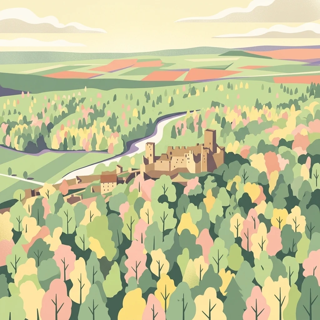
A flat-style digital illustration showing a medieval-style castle ruin set within a lush, colorful forest landscape under a pale sky.

Dinkelberg und Röttler Wald

Nature reserve

Park overview

Structured park overview, official facts, and landscape profile for Dinkelberg und Röttler Wald

Dinkelberg und Röttler Wald park facts, protected area profile, and essential visitor context

Review the core facts for Dinkelberg und Röttler Wald, including designation, size, terrain, visitor scale, habitats, and operating context in one park-focused overview.

About Dinkelberg und Röttler Wald

Dinkelberg und Röttler Wald is a substantial Natura 2000 protected area in southwestern Germany, straddling the counties of Lörrach and Waldshut in the state of Baden-Württemberg. The site connects three regional landscape units: the gentle, agricultural Markgräfler Hügelland along the Upper Rhine, the elevated Dinkelberg plateau, and the lower wooded slopes of the southern Black Forest. Together they form a varied mosaic of woodland, grassland, hedgerow, and small riverine features that has evolved over centuries of low-intensity land use.

The site was first proposed by the Freiburg Regional Council in 2005 and was formally designated as a Site of Community Importance under the EU Habitats Directive through a regulation issued by the same authority in October 2018, with legal effect from January 2019. Its designation is built on its combination of high-quality near-natural beech forest, extensive calcareous and mesophile grasslands, and distinctive karst features including caves and a temporary karst lake, as well as its importance for protected bat species.

Spanning roughly 46 square kilometers across 22 non-contiguous parcels, the area extends across parts of the municipalities of Kandern, Lörrach, Schopfheim, Zell im Wiesental, Hausen im Wiesental, Maulburg, Steinen, Wittlingen, and Kleines Wiesental. The watershed of the Kleine Wiese river, in its lower and middle course, also forms part of the protected area, linking the forest stands with riparian habitats. The majority of the land, around 88.8 percent, lies within Landkreis Lörrach, while the remaining 11.2 percent extends into Landkreis Waldshut.

Quick facts and research context for Dinkelberg und Röttler Wald

Dinkelberg und Röttler Wald is a 4646.9 hectare Fauna-Flora-Habitat site in the districts of Lörrach and Waldshut in Baden-Württemberg, Germany. It sits between 285 and 925 meters in elevation and includes parts of the Markgräfler Hügelland, the Dinkelberg plateau, and the southern Black Forest. The site carries the EU Natura 2000 identification DE8312311 and was designated by the Regierungspräsidium Freiburg on 25 October 2018, taking effect on 11 January 2019.

The landscape combines near-natural beech forests, hedgerows, calcareous dry grasslands, oat-grass meadows, karst caves, and temporary karst lakes, alongside the lower and middle reaches of the Kleine Wiese river. The area is notable for its mature beech stands and for hosting a rich community of bat species alongside other rare plants and animals typical of cultural landscapes with long continuity of low-intensity land use.

Protection and recognition

Examine official records, management scope, and verified protected area data.

Dinkelberg und Röttler Wald Protection Status and Mapped Designation Data

Dinkelberg und Röttler Wald protection status details bring together documented designation records and verified conservation registry entries. Official protected area data and regional management metrics provide clear insight into conservation frameworks.

Protection details

WDPA ID
555623537
Park context

Deeper park guide and search-rich context for Dinkelberg und Röttler Wald

Dinkelberg und Röttler Wald history, landscape, wildlife, and travel context

Explore Dinkelberg und Röttler Wald through its history, landscape character, ecosystems, wildlife, conservation priorities, cultural context, and seasonal travel timing in a structured park guide built for atlas discovery and search intent.

Why Dinkelberg und Röttler Wald stands out

The site is best known for its particularly well-developed stands of mature beech trees, which form the backbone of a near-natural forest landscape with scattered sessile oak and fir on sandstone soils of the southern Black Forest. Beyond the woodland, it encompasses a mosaic of calcareous grasslands, hedgerows, oat-grass meadows, karst caves, and a temporary karst lake, making it a textbook example of a traditional European cultural landscape that retains strong ecological value. Equally important to its identity is the significance of these habitats for European bat species, with the karst and forest features together providing shelter, foraging grounds, and key breeding conditions for protected fauna. The embedded Bannwald Röttler Wald further reinforces this profile, offering a strictly protected reference area where natural forest processes, including recovery from windthrow disturbance, are allowed to unfold.
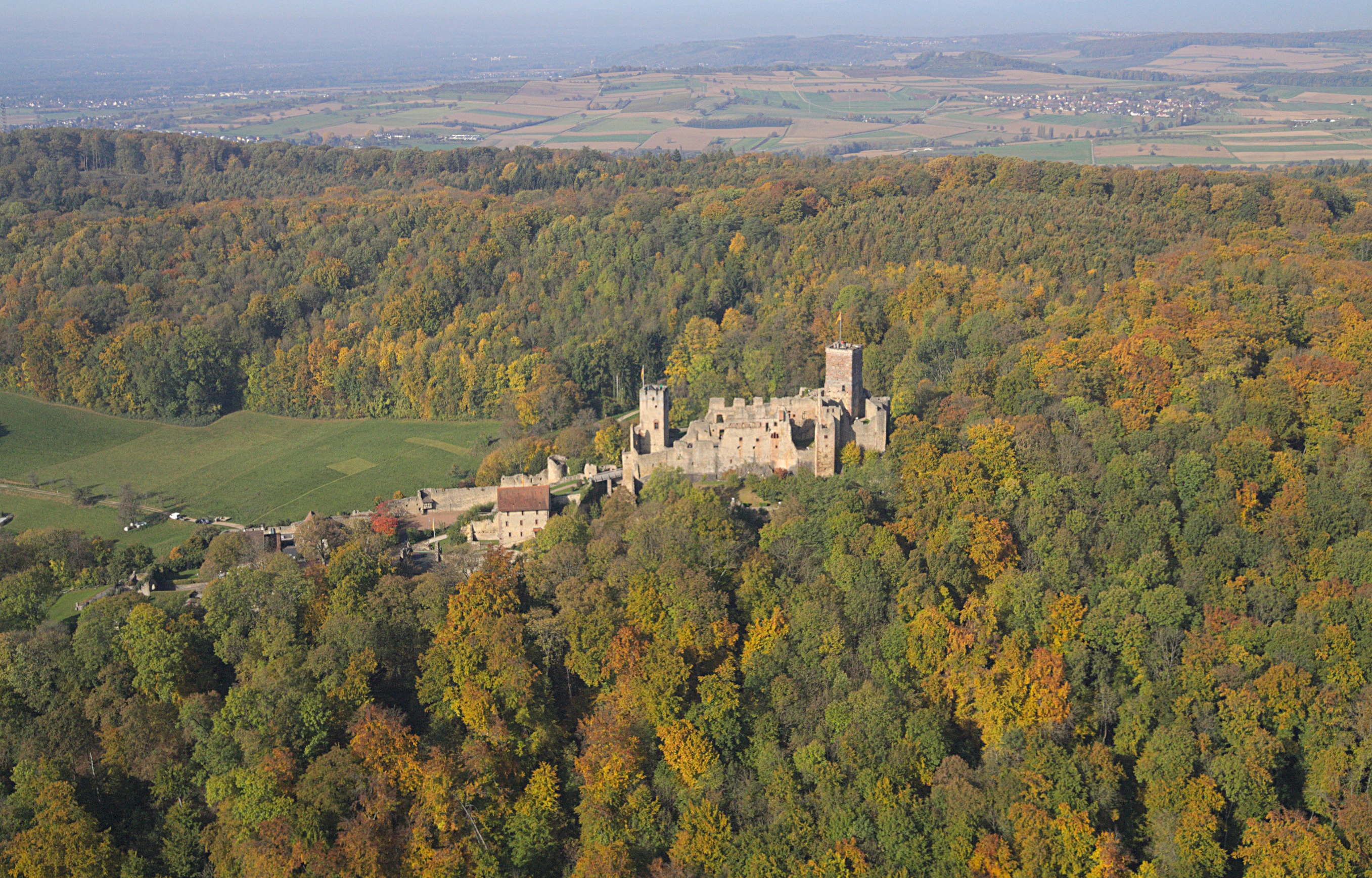
Aerial view of a medieval stone castle complex perched on a forested hill, surrounded by dense deciduous trees with autumn foliage.
Aerial view of Burg Rötteln surrounded by the dense autumn forests of the Röttler Wald.

Dinkelberg und Röttler Wald history and protected-area timeline

The history of Dinkelberg und Röttler Wald as a protected area begins in 2005, when the Regierungspräsidium Freiburg submitted the site for inclusion in the European Natura 2000 network as a Fauna-Flora-Habitat area. After more than a decade of assessment and planning, the Freiburg Regional Council issued a regulation on 25 October 2018 formally designating the site as a Site of Community Importance, with the designation taking legal effect on 11 January 2019.

Within the broader protected area, the Bannwald Röttler Wald has its own distinct protection history. It was designated as a Bannwald, a German category of strict forest reserve, in 2001, responding directly to the destructive effects of the December 1999 storm Orkan Lothar, which uprooted or damaged nearly half of the trees in the Röttlerwald. The storm damage effectively reset large portions of the forest, and the subsequent designation allowed the woodland to develop without forestry intervention, providing researchers with a rare opportunity to monitor natural regeneration in a formerly near-natural beech-oak forest.

Dinkelberg und Röttler Wald landscape and geographic character

The landscape of Dinkelberg und Röttler Wald is shaped by the transition between the Markgräfler Hügelland, the Dinkelberg plateau, and the edge of the Black Forest, producing a terrain that shifts between gentle agricultural hills, dissected plateau surfaces, and steeply incised forested valleys. Elevations within the site range from roughly 285 meters along the lower valleys up to about 925 meters on higher slopes, with an average elevation of around 605 meters. The result is a varied, mid-mountain terrain with strong contrasts in slope, exposure, and underlying geology.

Geologically, the southern Black Forest portion of the site rests primarily on Upper Buntsandstein (Lower Triassic sandstone), overlain in places by loess and developed into a mix of parabrown soils and transitional brown earths. The 166-hectare Bannwald Röttler Wald lies at the submontane elevation band between about 410 and 570 meters. Water features include the lower and middle reaches of the Kleine Wiese river and various smaller streams, alongside karst features such as caves and a temporary karst lake that reflect the soluble geology of parts of the area.

Dinkelberg und Röttler Wald ecosystems, habitats, and plant life

Ecologically, Dinkelberg und Röttler Wald is defined by its near-natural beech forests and its exceptionally well-developed mature beech stands, which dominate the higher and forested portions of the site. Within the Bannwald Röttler Wald, the forest composition is broadly characteristic of mixed deciduous woodland on acidic sandstone: beech and sessile oak are the dominant species, accompanied by scattered silver fir and other typical submontane trees. The natural recovery of these forests after storm damage has allowed their structure and dynamics to be studied as a reference for near-natural Central European woodland.

Beyond the closed forest, the site also includes a substantial component of open and semi-open habitats. Hedges line fields and forest margins, calcareous dry grasslands host specialized plant communities, and traditional oat-grass meadows reflect long continuity of low-intensity agricultural use. Karst caves and a temporary karst lake add a distinctive geological-hydrological element to the ecological mosaic. Climatically, the forests of the Röttler Wald experience mean annual temperatures around 10 degrees Celsius and annual precipitation totals between roughly 900 and 1080 millimeters, supporting the humid conditions favored by beech-dominated woodland.

Dinkelberg und Röttler Wald wildlife and species highlights

Wildlife is one of the defining conservation assets of Dinkelberg und Röttler Wald, with bats standing out as the most consistently emphasized group in site-level descriptions. The combination of extensive mature forest, karst caves, and a structurally rich cultural landscape provides roosting and foraging opportunities across seasons for multiple European bat species protected under the Habitats Directive.

Beyond bats, the woodland and meadow mosaic of the site supports a wide range of other rare and habitat-specialist animals associated with near-natural beech forest, calcareous grasslands, hedgerows, and small watercourses. These habitats sustain invertebrates, including saproxylic and grassland species tied to old trees and warm dry slopes, as well as breeding birds and small mammals typical of mixed low mountain forest and traditional agricultural land.

Dinkelberg und Röttler Wald conservation status and protection priorities

From a conservation perspective, Dinkelberg und Röttler Wald represents a high-value example of a European Habitats Directive site, designated to conserve both specific habitat types and individual protected species. Its primary conservation significance lies in the preservation of near-natural beech forests, including the especially well-developed mature beech stands, alongside calcareous grasslands, hedgerows, and karst features such as caves and a temporary karst lake. The site also plays a key role in protecting bat populations, with its forests and subterranean features together supporting the life-cycle requirements of multiple species of European concern.

Embedded within the broader site, the Bannwald Röttler Wald reinforces the conservation profile by providing a strictly protected reference area where forestry is excluded and natural dynamics can proceed unimpeded. Its designation in 2001, in the wake of the Orkan Lothar windthrow event, has turned the area into a long-term observatory for natural forest regeneration on sandstone soils in the southern Black Forest, adding a research and monitoring dimension to the site's broader habitat protection role.

Dinkelberg und Röttler Wald cultural meaning and human context

The cultural context of Dinkelberg und Röttler Wald is rooted in centuries of low-intensity agricultural and forestry use in the southern Black Forest region. The combination of woodland, hedges, meadows, and dry grasslands reflects a traditional cultural landscape shaped by small-scale farming, hay-making, and selective woodland management rather than industrial agriculture. The name Röttler Wald itself refers to the historical noble family Rötteln, illustrating how deeply the forested parts of the area are embedded in the regional feudal and settlement history, with medieval sites like Burg Rötteln overlooking the landscape.

The site spans multiple local communities, including Kandern, Lörrach, Schopfheim, Zell im Wiesental, Hausen im Wiesental, Maulburg, Steinen, Wittlingen, and Kleines Wiesental, reflecting a shared regional identity along the Kleine Wiese valley and surrounding hills. The persistence of traditional land use practices, alongside the late-twentieth-century recognition of the area's natural values, frames the contemporary management efforts that link local heritage with European nature conservation objectives.

Top sights and standout views in Dinkelberg und Röttler Wald

Dinkelberg und Röttler Wald's strongest points of distinction lie in the combination of well-developed mature beech forest, rich karst features including caves and a temporary karst lake, and a finely structured agricultural mosaic of dry grasslands and oat-grass meadows. The site's importance for European bats, supported by both forest and subterranean habitats, gives it a clear species-level identity within the Natura 2000 network.

The presence of the Bannwald Röttler Wald adds another highlight: a strictly protected, regenerating beech-oak forest on sandstone soils that became a refuge for natural processes after storm damage. Together, these features make the protected area both a working cultural landscape and a reference site for forest and grassland conservation in southwestern Germany.

Best time to visit Dinkelberg und Röttler Wald

Visits to Dinkelberg und Röttler Wald are most rewarding across the late spring and summer months, when the meadows and calcareous dry grasslands are in active growth and the hedgerow and woodland edges are rich with flowering plants and active insects. Late spring is also favorable for observing bat prey activity and breeding bird communities in the mixed forest and meadow mosaic.

For visitors interested primarily in the Bannwald Röttler Wald, the warmer months are also when the otherwise closed forest reserve is most accessible on foot, with established trailheads offering short loop walks and a dedicated Bannwaldpfad. Autumn brings color changes in the mixed beech and oak canopy, while winter visits emphasize the karst features and the structural character of the forest, though access may be more weather-dependent in the higher elevation zones.

Monthly climate preview

Long-term representative temperature ranges and monthly precipitation rhythm

Dinkelberg und Röttler Wald Climate Normals and Annual Weather Patterns

Historical climate data for Dinkelberg und Röttler Wald documents measured monthly temperature swings and precipitation levels across a representative coordinate. Reviewing the complete twelve-month profile provides detailed meteorological context for analyzing the local environment.
Annual mean9 °C
-1 °C18 °C
Jan-1°
Feb
Mar
Apr
May13°
Jun16°
Jul18°
Aug18°
Sep14°
Oct
Nov
Dec
Warmest month
July

18.2 °C

Coolest month
January

-0.6 °C

Wettest month
May

3.7 mm/day

Driest month
February

2.2 mm/day

Park location guide

Geography guide, regional context, and park location map for Dinkelberg und Röttler Wald

Dinkelberg und Röttler Wald park geography, regions, and map view in Germany

Understand where Dinkelberg und Röttler Wald sits in Germany through a broader geographic reading of the surrounding landscape, nearby location context, and its mapped position within the national park landscape.

How Dinkelberg und Röttler Wald fits into Germany

Germany is a federal republic in Western and Central Europe with a population of over 83 million across sixteen constituent states. It is Europe's largest economy by nominal GDP and a major global exporter and importer. The capital is Berlin, and the country borders Denmark, Poland, Czech Republic, Austria, Switzerland, France, Luxembourg, Belgium, and the Netherlands.

Wider geography shaping Dinkelberg und Röttler Wald in Germany

Germany is located in Western and Central Europe, spanning 357,022 km². It borders Denmark to the north, Poland and the Czech Republic to the east, Austria and Switzerland to the south, and France, Luxembourg, Belgium, and the Netherlands to the west. The country has coastlines on the Baltic Sea and North Sea to the north, with the Alps located in the southern region.

Map view of Dinkelberg und Röttler Wald

Use this park location map to pinpoint Dinkelberg und Röttler Wald in Germany, understand its exact geographic position, and read its mapped placement within the surrounding landscape more clearly.

Pigeon | © OpenStreetMap contributors

Location context for Dinkelberg und Röttler Wald

Baden-Württemberg

Photographic reference for mature beech stands, karst terrain, and woodland habitats

Visual Exploration of Dinkelberg und Röttler Wald Photos and Protected Landscapes

Visual records capture the varied terrain, mature beech forests, and calcareous grasslands defining Dinkelberg und Röttler Wald. Photographic documentation helps researchers examine habitat mosaics and protected landscape features across the southern Black Forest foothills.

Aerial view of a medieval stone castle complex perched on a forested hill, surrounded by dense deciduous trees with autumn foliage.

Park atlas

Compare regional park geography and surrounding protected terrain in southwestern Germany

Parks Near Dinkelberg und Röttler Wald and Adjacent Protected Landscapes

Browse other parks and protected areas situated near Dinkelberg und Röttler Wald across the southwestern foothills of Baden-Württemberg. Comparing these nearby natural landscapes provides broader regional context for mature beech forests, karst terrain, and traditional conservation areas.
Protected landscapeBaden-Württemberg
About 5.9 km away#1 closest

East

Südwestlicher Dinkelberg Protected Landscape and Dinkelberg Plateau Geography

Karst terrain and forest habitats in Baden-Württemberg

Located in the Lörrach district, Südwestlicher Dinkelberg protects a diverse mix of ravine forests, dry grasslands, and mires. The area preserves essential ecological corridors within the Lörrach-Basel region, showcasing complex geological features such as stream sinks and dry valleys that define the plateau edge.

Area
13.89 km²
Established
2013
IUCN
V
Relief
Upland
A watercolor painting showing a soft, impressionistic landscape with rolling green hills, forest patches, and pale distant mountains under a light sky.
Protected landscapeBaden-Württemberg
About 14 km away#2 closest

Southeast

Obersäckingen Protected Landscape: Regional Geography and Map Context in Baden-Württemberg

A preserved mosaic of southern Black Forest meadows and mixed woodland habitats

Located in the Waldshut district, the Obersäckingen protected landscape showcases a balanced environmental mosaic of oat-grass meadows, hedgerows, and field copses. This area serves as a key piece of the regional conservation network, closely overlapping with the Murg zum Hochrhein Natura 2000 site to maintain the visual and ecological character of the southern Black Forest countryside.

Area
0.415 km²
Established
2004
IUCN
V
A soft watercolor illustration of rolling hills, forested slopes, and meadow vegetation with a light, airy aesthetic.
Nature reserveBaden-Württemberg
About 18 km away#3 closest

North

Belchen Nature Reserve: Exploring the Mountain Geography of the High Black Forest

A diverse protected landscape in Baden-Württemberg

Belchen represents an essential protected area in the southern Black Forest, known for its compressed ecological profile ranging from lowland beech forests to exposed subalpine summits. The site maps a complex mosaic of scree slopes, mires, and rocky habitats that sustain specialized bat species and rare montane flora, offering a detailed perspective on central European highland ecosystems.

Area
29.072 km²
Established
2019
Relief
Mountain
Climate
Temperate
A horizontal watercolor illustration showing a winding river through a flat, green landscape with distant hills under a soft pink and yellow sky.
Nature reserveHaut-Rhin
About 20 km away#4 closest

West

Réserve naturelle nationale de la Petite Camargue alsacienne: Protected Rhine Floodplain Geography

A unique wetland and alluvial forest habitat in Haut-Rhin

Investigate the geographic significance of the Réserve naturelle nationale de la Petite Camargue alsacienne. This site acts as a protected reference for Upper Rhine floodplain ecology, showcasing a rare intersection of relict river meanders, marshy depressions, and diverse vegetation types near the French, Swiss, and German borders.

Area
9.04 km²
Established
1982
IUCN
IV
Relief
Lowland
A watercolor painting showing a panoramic view of green rolling hills and wooded ridges under a soft light.
Regional parkAargau
About 26 km away#5 closest

Southeast

Jurapark Aargau: Geographic Overview of a Swiss Regional Nature Park and Jura Landscapes

Protected Jura mountain terrain and regional landscape mapping

Located in northern Switzerland, Jurapark Aargau encompasses a vast, connected perimeter defined by the interaction of tabular limestone plateaus and dramatic folded mountain ridges. This regional nature park serves as an essential refugium for native flora, preserving ancient geological history through fossil-rich sediments, steep escarpments, and traditional rural land use that persists between the Aargau, Zurich, and Basel regions.

Area
299 km²
Established
2012
Relief
Mountain
Climate
Temperate
Watercolor painting of a pastoral landscape featuring soft, rolling green hills and a small group of evergreen trees, with light pastel mountains in the background.
Protected landscapeBaden-Württemberg
About 29 km away#6 closest

Northeast

St. Blasien Protected Landscape: Geographic Profile and Glacial Mapping

Southern Black Forest protected area in Baden-Württemberg.

The St. Blasien Protected Landscape represents a significant conservation zone in the southern Black Forest. Defined by its strong glacial influence, the area showcases a complex terrain of trough valleys, moraine ridges, and rocky crests alongside centuries-old alpine pastures. Its role in the regional conservation network makes it a key site for understanding the intersection of Pleistocene geography and traditional land management in Germany.

Area
35.754 km²
Established
2002
IUCN
V
Nature reserveAargau
About 31 km away#7 closest

East

Klingnauer Stausee Nature Reserve: Aargau Wetland and Aare River Floodplain Landscapes

Protected riparian habitat in the northern Swiss Jura

Klingnauer Stausee stands as a primary example of integrated hydropower and conservation. This artificial reservoir and its surrounding wetlands, located in the Aargau region, encompass a variety of protected habitats ranging from open still waters to alluvial forests. These landscapes provide essential refuge for migratory waterbirds and preserve unique remnants of the historical Aare River floodplain structure.

Area
1.16 km²
Established
1935
Relief
Lowland
Climate
Temperate
Watercolor painting of a river landscape with lush green riverbanks, patches of grass in the foreground, and gentle rolling hills in the background.
Protected landscapeAargau
About 32 km away#8 closest

East

Aarelandschaft bei Klingnau: A Protected Riverine Landscape in Northern Switzerland

Wetland geography, alluvial forests, and floodplain corridors

The Aarelandschaft bei Klingnau preserves a unique riverine mosaic where the Aare River meets the Rhine in northern Aargau. This protected landscape encompasses the Klingnauer Stausee reservoir, rich alluvial forests, and remnant oxbows. It serves as a vital migratory node for avian populations and provides a structured look at the interplay between human-engineered power infrastructure and protected natural river channels.

Area
3.6 km²
Established
1996
IUCN
V
Relief
Lowland

Common questions about visiting, size, designation, and location context for Dinkelberg und Röttler Wald

Dinkelberg und Röttler Wald FAQs for park facts, access, geography, and protected area context

Find quick answers about Dinkelberg und Röttler Wald, including protected-area facts, park geography, trail and visitor context, and how the park fits into its surrounding country and regional landscape.
MoriAtlas Explorer

Continue Your Protected Areas Search Across the Global Atlas

Deepen your exploration by continuing the structured search for national parks and protected areas worldwide. Utilize the comprehensive filtering capabilities to compare different conservation landscapes and refine your understanding of global park geography. Discover more about the distribution and characteristics of protected natural areas.

Global natural geography