
Mori Atlas logo
Nature reserveDöberitzer Heide

Understanding the ecological mosaic of a rewilded military legacy in Brandenburg

Döberitzer Heide: Mapping the Protected Heath and Glacial Landscapes of Havelland

(Sielmanns Naturlandschaft Döberitzer Heide)

Döberitzer Heide represents a significant protected area within the Havelland region, encompassing a diverse mosaic of dry heath, sandy open ground, and wet woodland. This nature reserve serves as an active rewilding landscape where large herbivores roam within a fenced core zone, preserving rare habitats that have remained largely undisturbed for nearly a century. The surrounding terrain reflects the glacial history of the Nauener Platte, offering a clear view of how dry grasslands and fens interlock across the landscape.

heathlandsand flatsdry grasslandwetlandfenlandrewilding
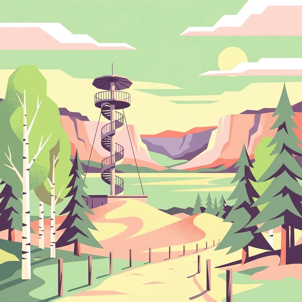
A flat-style digital illustration showing a spiral lookout tower on a sandy hill surrounded by birch and pine trees, with a distant canyon or ridge under a soft sun.

Döberitzer Heide

Nature reserve

Park overview

Structured park overview, official facts, and landscape profile for Döberitzer Heide

Döberitzer Heide park facts, protected area profile, and essential visitor context

Review the core facts for Döberitzer Heide, including designation, size, terrain, visitor scale, habitats, and operating context in one park-focused overview.

About Döberitzer Heide

Döberitzer Heide lies just west of the Berlin city boundary, in the Havelland on the southeastern edge of the Nauener Platte. The terrain is unusually varied for a flat, sandy region: glacial sand flats, dry heaths, dry grassland, low dunes, wet fens, and patches of woodland create a finely textured mosaic of open habitats over a very compact area. Because the ground was closed to the public and to ordinary land use for more than ninety years, the open-land character has been preserved in a way that would be extremely rare anywhere else in densely settled Brandenburg.

Today the landscape is shaped by two overlapping frameworks. The inner part of the reserve, the roughly 1,860-hectare core zone, is enclosed by a triple fence and run as a quasi-wilderness project: herds of European bison, Przewalski horses, and red deer live there year-round without supplementary feeding or veterinary intervention. They shape the open landscape by grazing, browsing, and trampling, exactly as large herbivores would in a self-sustaining ecosystem, and they prevent the gradual return of forest. The surrounding ring zone of about 1,800 hectares is managed in a softer way, with hardy domestic breeds including Galloway and Heck cattle, Konik horses, Skudden sheep, goats, water buffalo, and donkeys maintaining the open habitats under grazing leases with local land users.

The area is also a major biodiversity site. The two underlying nature reserves together are protected under the European Habitats Directive, and the species list is consistently impressive in breadth: nearly a thousand ferns and flowering plants, almost two thousand beetle species, more than 1,200 butterflies, and close to two hundred breeding or visiting bird species. Among the more charismatic fauna are white-tailed eagles and otters in the wetter parts, and a set of very rare dry-grassland plants including marsh orchid and lung gentian. A network of walking trails, viewpoints, a 15-meter observation tower on the Finkenberg (built on a former bunker), a visitor and education center near Elstal opened in 2024, and regular bat-night events turn the reserve into an active outdoor classroom on the edge of Germany's largest urban region.

Quick facts and research context for Döberitzer Heide

Döberitzer Heide covers about 5,000 hectares on the southeastern part of the Nauener Platte, in the Havelland just west of Berlin and reaching toward Potsdam. It encompasses two formal nature reserves: NSG Döberitzer Heide (established 1997, around 3,415 hectares) on the higher, drier ground, and NSG Ferbitzer Bruch (established 1996, around 1,155 hectares) in the lower, wetter ground. About 3,600 hectares of this mosaic are managed as Sielmanns Naturlandschaft Döberitzer Heide by the Heinz Sielmann Stiftung together with a local conservation association. The protected landscape is designated under the European Habitats Directive (FFH) and holds nearly 6,700 recorded species, including more than 190 bird species, around 130 European bison, two dozen Przewalski horses, and about 100 red deer living as wild, unmanaged herds.

Protection and recognition

Documented terrestrial protection history and Natura 2000 recognition sources

Döberitzer Heide Protection Status and International Recognition Data

Döberitzer Heide maintains a documented terrestrial protection status established in 1997 alongside official Natura 2000 designation records. Structured records outline the official protection history and recognized boundaries without inferring management outcomes.

International recognition

Protection details

Protection scope
Terrestrial
Designated year
1997
Transboundary protection
No
Core area
18.6 km²
Park context

Deeper park guide and search-rich context for Döberitzer Heide

Döberitzer Heide history, landscape, wildlife, and travel context

Explore Döberitzer Heide through its history, landscape character, ecosystems, wildlife, conservation priorities, cultural context, and seasonal travel timing in a structured park guide built for atlas discovery and search intent.

Why Döberitzer Heide stands out

Döberitzer Heide is best known as one of Central Europe's largest free-roaming large-herbivore projects, where European bison, Przewalski horses, and red deer live essentially wild inside a fenced core zone in the middle of a former military training ground. It is equally known for the unusual combination of dry heaths, sand flats, dry grassland, and wet fens that survived almost intact because the area was closed to the public for nearly a century. The result is a compact, easily accessible example of a near-natural open landscape that is unusual for an area immediately adjacent to a major capital city.
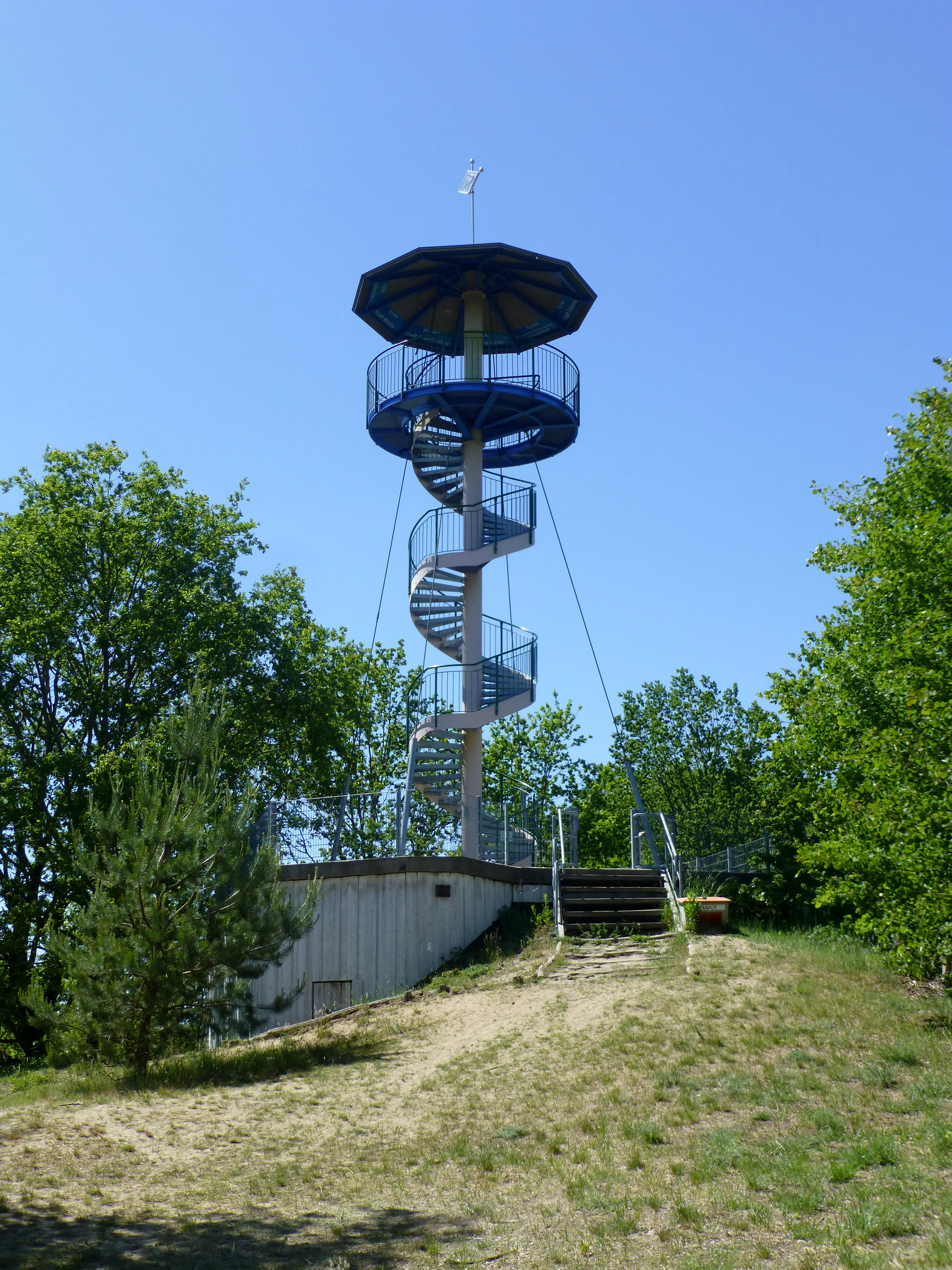
A modern steel spiral observation tower stands on a small sandy hill surrounded by green deciduous trees under a clear blue sky.
The Finkenberg observation tower offers an elevated vantage point over the Döberitzer Heide landscape.

Döberitzer Heide history and protected-area timeline

The military history of Döberitzer Heide stretches back more than three centuries. Troop maneuvers took place on the sandy ground already in 1713 under Friedrich Wilhelm I, and in 1753 Friedrich II staged one of the earliest large-scale maneuvers in Prussian military history with around 44,000 soldiers. The formal Truppenübungsplatz Döberitz was only established in 1892 under Kaiser Wilhelm II, in the years when the German Empire was rapidly expanding its army. Between 1903 and 1911 the Heerstraße was built as a formal military connection from the training ground to central Berlin, and in 1910 the Flugplatz Döberitz added an aviation dimension to the site. During the 1936 Olympic Games the area was used for equestrian and other military-style competitions.

After 1945 the Soviet occupation forces re-used the range and shaped it far more intensively than previous users had, blanketing the area with tank tracks and munitions handling. The withdrawal of Russian troops in 1991/1992 ended more than ninety-five years of continuous military use and left the area essentially closed off rather than transformed. Two local conservation scientists quickly founded a Schutzverein (support association) to prevent the land from being turned into conventional agriculture or forestry, and between 1996 and 1997 the two underlying nature reserves were formally designated under Brandenburg law. In 1998 the association received Brandenburg's environmental prize for the quality of its biotope and species work.

The decisive step came in 2004, when the Heinz Sielmann Stiftung purchased around 3,442 hectares for roughly 2.3 million euros. From 2007 onwards the foundation began staging Przewalski horses and European bison in an acclimation enclosure, and in May 2010 eleven bison and seven Przewalski horses were released into the fully fenced core zone. Since then the core population has grown to roughly 130 bison, twenty-four Przewalski horses, and about 100 red deer, all living under wild conditions. The Sielmann foundation's March 2024 Natur-Erlebniszentrum near Elstal marks the most recent step in converting the military landscape into a permanent educational and visitor site.

Döberitzer Heide landscape and geographic character

Döberitzer Heide sits on the gently undulating southeastern part of the Nauener Platte, a low sandy plateau shaped by the last ice age. The surface is dominated by glacial sand flats, low dunes, and broad sweeps of open heath, broken by small dry valleys and interrupted by patches of wetter fen and bog ground toward the western NSG Ferbitzer Bruch. The most visible result of this geology is the alternation, over very short distances, of dry, bleached sand, purplish-gray heather, golden dry-grassland, and darker wetland vegetation, with woodland confined to a few places along the edges.

The terrain is very gently rolling rather than dramatic in relief, but it is precisely this open, low-lying character that allows the visitor to see the entire mosaic at a glance from one of the observation points. The 15-meter viewing tower on the Finkenberg, deliberately built on top of a former bunker, gives an unusually clear panoramic view of how dry heath, dry grassland, and wetter ground interlock. The reserve also retains the linear scars of its military history: tank tracks, embankments, drill-ground clearings, and bunker foundations still mark the ground, and the network of sandy tracks and trails that connects the area often follows old military roads.
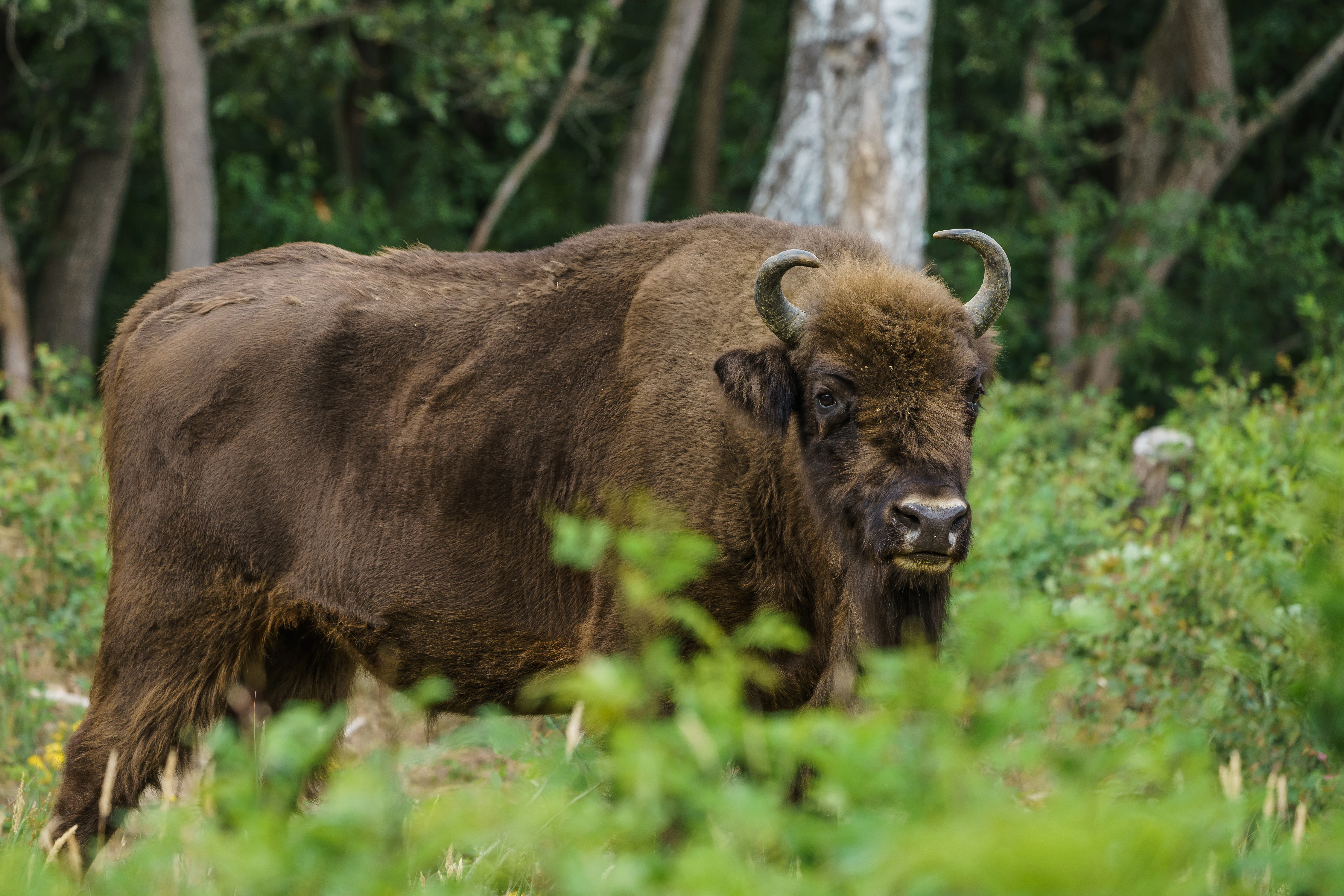
A brown European bison stands in a grassy clearing with trees in the background.
A European bison, or wisent, in the Döberitzer Heide nature reserve.

Döberitzer Heide ecosystems, habitats, and plant life

The ecological character of Döberitzer Heide is shaped above all by the contrast between dry open land and wet open land, both maintained by large herbivores rather than by mowing or mechanical management. The dry areas are dominated by heather communities on poor sandy soils, by drier sand flats of almost desert-like character, and by species-rich dry grasslands that harbor many of the site's rarest plants. The wetter NSG Ferbitzer Bruch complements this with reedbeds, sedge fens, open water, and bog woodland, providing the moisture gradient that turns the reserve into a complete habitat mosaic rather than a single uniform heathland.

Because almost all of the land has been free of plowing, fertilizer, and forestry for more than a century, and because it was never drained for farmland, the soil seed bank and the populations of slow-growing specialist plants are unusually intact. About 1,000 species of ferns and flowering plants have been recorded; among them are very rare dry-grassland specialists such as marsh orchid, lung gentian, and the leather-leaved rose, all of which are otherwise in strong retreat across the surrounding agricultural landscape of Brandenburg. The habitat complexity is increased by two small relict populations of primitive crustaceans, fairy shrimp and tadpole shrimp, which survive in temporary pools that appear only in some years.
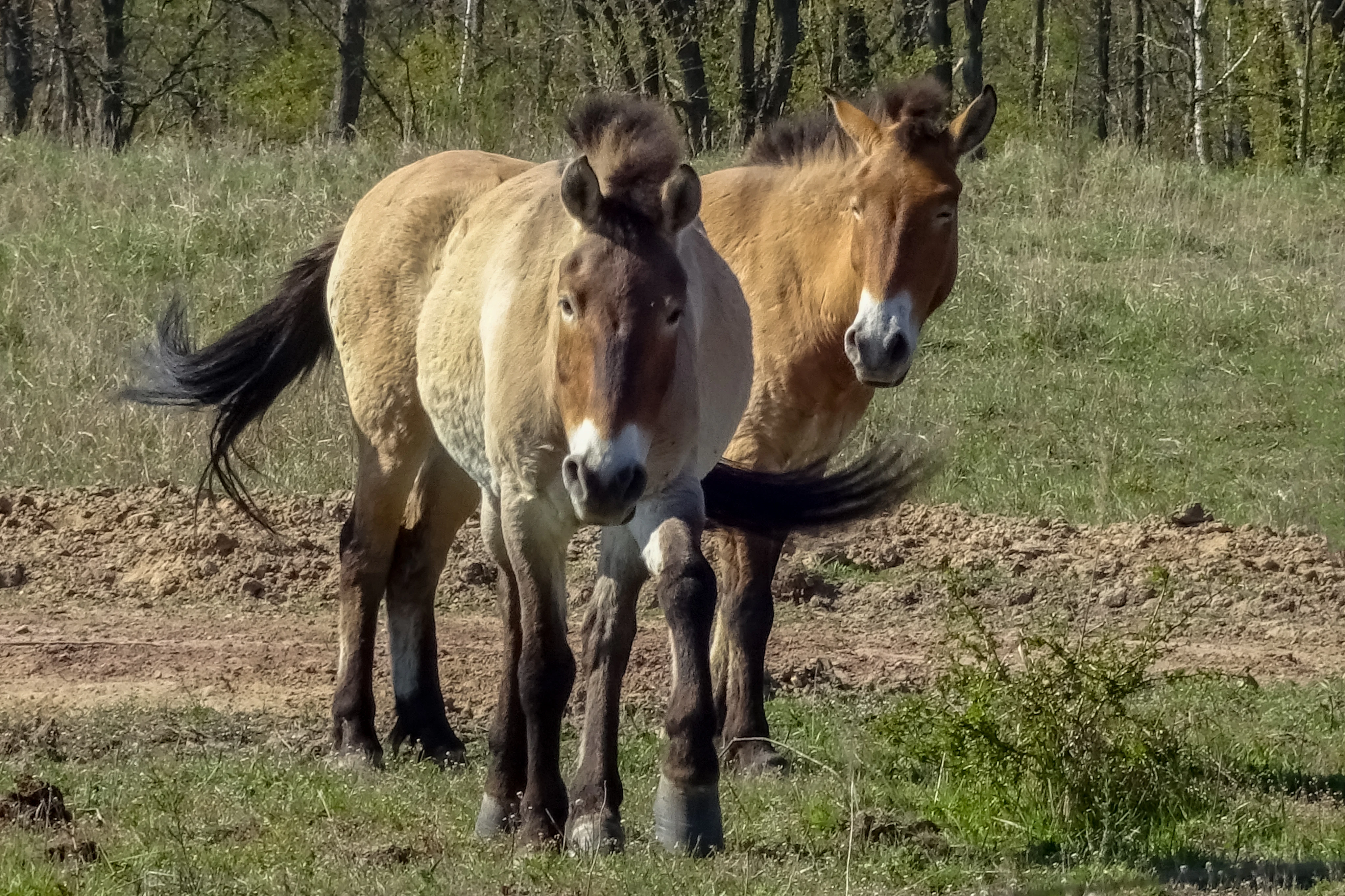
Two tan-colored Przewalski horses standing in an open field with a forest background.
Two Przewalski horses grazing in the Döberitzer Heide nature reserve.

Döberitzer Heide wildlife and species highlights

Döberitzer Heide is best described as a large-herbivore landscape: the animals themselves are the most visible wildlife. The fenced core zone holds free-roaming herds of European bison, Przewalski horses, and red deer, all living year-round without supplementary feeding, vaccination, or human contact beyond water access points. This is one of the very few places in Western Europe where all three species coexist in a genuinely wild setting, and the project is also an important contribution to the conservation breeding of Przewalski horses and European bison, both of which were once on the brink of extinction.

Outside the fences, the outer ring zone hosts a more traditional conservation-grazing menagerie: Galloway cattle, Heck cattle (a breed developed to approximate extinct aurochs), Konik horses (a hardy Polish breed that approximates the extinct tarpan), Skudden sheep, goats, water buffalo, and Sardinian donkeys. These animals perform the same ecological role as the larger wild herds but within a framework of lease-grazing with local farmers. Smaller wildlife is also abundant: the species inventory includes around 1,762 beetle species, more than 1,200 butterflies, nearly 200 bird species, several hundred spider species, and around 52 mammal species. Among the most charismatic are white-tailed eagles and otters in the wetter zones, while bat evenings around the visitor center have become a regular educational highlight.
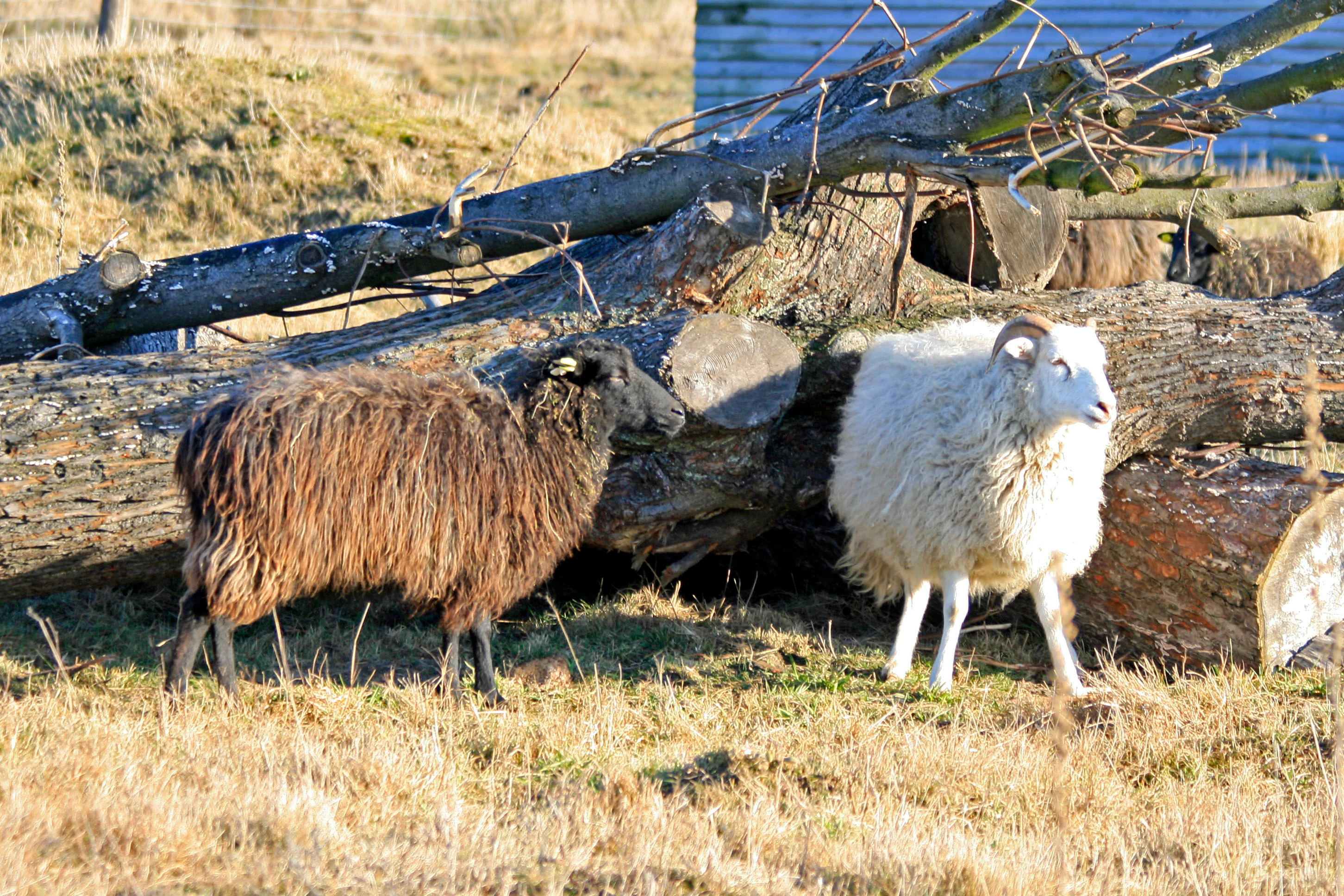
A brown and a white sheep standing in a dry, grassy field next to a pile of fallen logs.
Heidschnucken sheep grazing in the Döberitzer Heide landscape.

Döberitzer Heide conservation status and protection priorities

Döberitzer Heide is one of the most ambitious habitat-restoration projects in Germany. Its conservation logic rests on the unusual historical fact that the area was removed from productive land use for more than a century by military closure, so an unusually complete set of dry-heath, sand-flat, dry-grassland, and wet-fen habitats survived to be inherited by conservation managers in the 1990s. The site's legal backbone is the formal designation of NSG Ferbitzer Bruch in 1996 and NSG Döberitzer Heide in 1997, both now part of the European Natura 2000 network under the Habitats Directive.

The site's distinctive contribution to conservation is its reliance on large herbivores as the primary management tool. The Przewalski horses, European bison, and red deer in the fenced core zone, and the hardy domestic breeds in the outer ring zone, are not simply symbolic animals: their grazing, browsing, and trampling are the mechanism by which the open landscape is kept open and the gradual return of forest is prevented. The project also functions as a working gene pool for two rare species, the Przewalski horse and the European bison, both of which were saved from extinction through captive breeding and are now represented here by stable, naturally reproducing populations.

Döberitzer Heide cultural meaning and human context

The cultural meaning of Döberitzer Heide is inseparable from its military past. For a century the area was off-limits to civilians, and the social memory of the surrounding communities, especially in Spandau, Elstal, Dallgow, and the southern outskirts of Potsdam, is heavily shaped by the training ground's presence: the sound of artillery, the visual cutoff west of the city, the Heerstraße built to move troops between Döberitz and central Berlin, the 1936 Olympic equestrian events, and finally the long Soviet presence. The bunker on the Finkenberg, now used as the base for the viewing tower, is the most concrete reminder of that layered history.

After 1991 the area also became a symbol of post-reunification landscape recovery, showing how a former military zone in the new eastern German states could be transformed rather than redeveloped. The cooperation between local conservation scientists, a national foundation (the Heinz Sielmann Stiftung), and Brandenburg state authorities has itself become a small reference point in German conservation practice. Today the area carries a different kind of cultural weight as a freely accessible nature reserve in one of Germany's most densely populated regions, with educational programs aimed at school classes, families, and corporate groups.
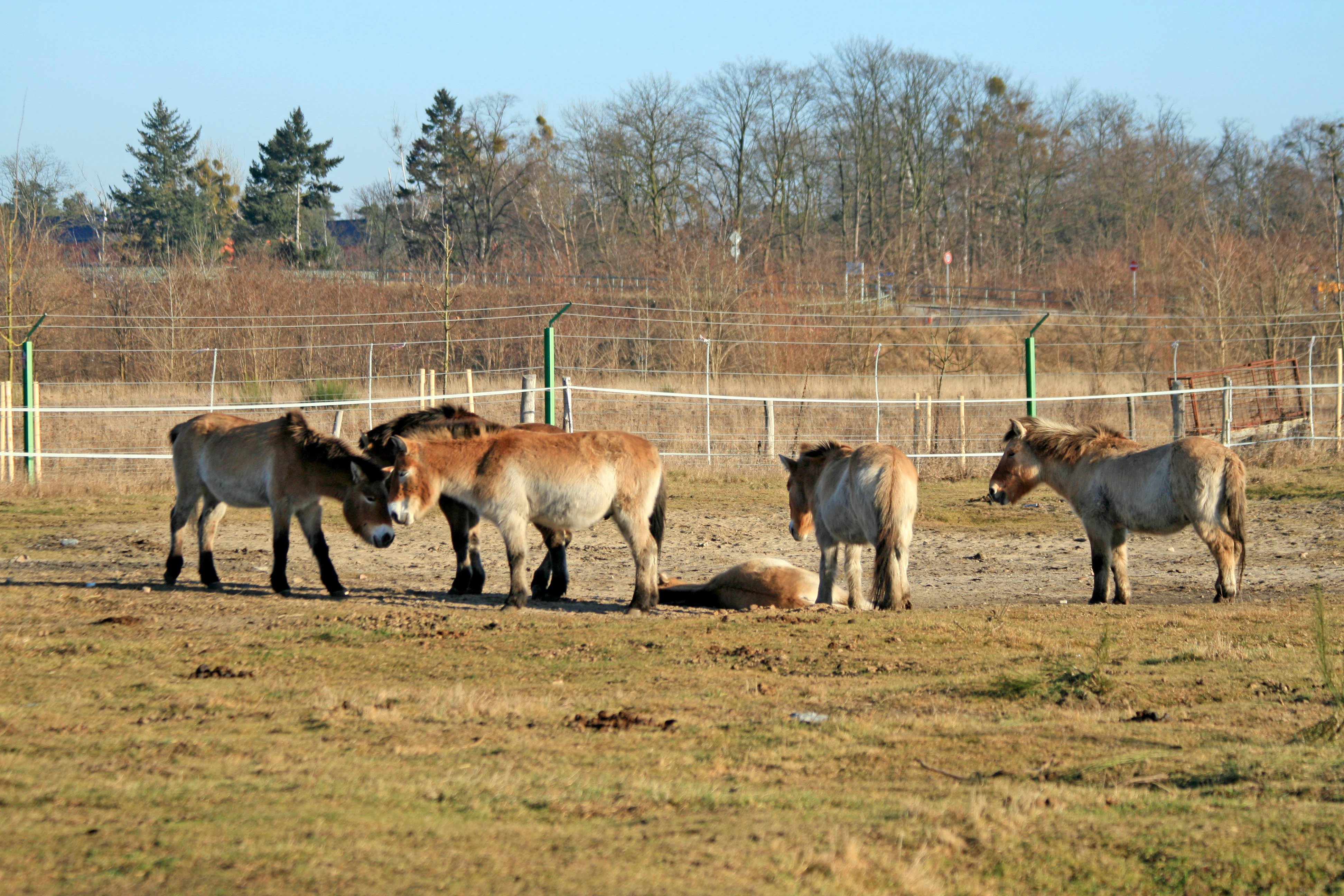
A group of light brown Przewalski horses grazing and standing in a dry, open field enclosed by a wire fence, with trees in the background.
A small herd of Przewalski horses within the fenced enclosure at Döberitzer Heide.

Top sights and standout views in Döberitzer Heide

The standout features of Döberitzer Heide are its unusually complete open-landscape mosaic, its free-roaming herds of European bison, Przewalski horses, and red deer in the fenced core zone, and its role as a working example of large-herbivore-driven rewilding in the middle of a metropolitan region. The site combines rare dry heaths and sand flats with rich wet fens in a compact area, hosts white-tailed eagles and otters alongside beetles, butterflies, and primitive crustaceans, and offers easy public access via a network of trails, the Finkenberg viewing tower on a former bunker, and a modern visitor and education center near Elstal.
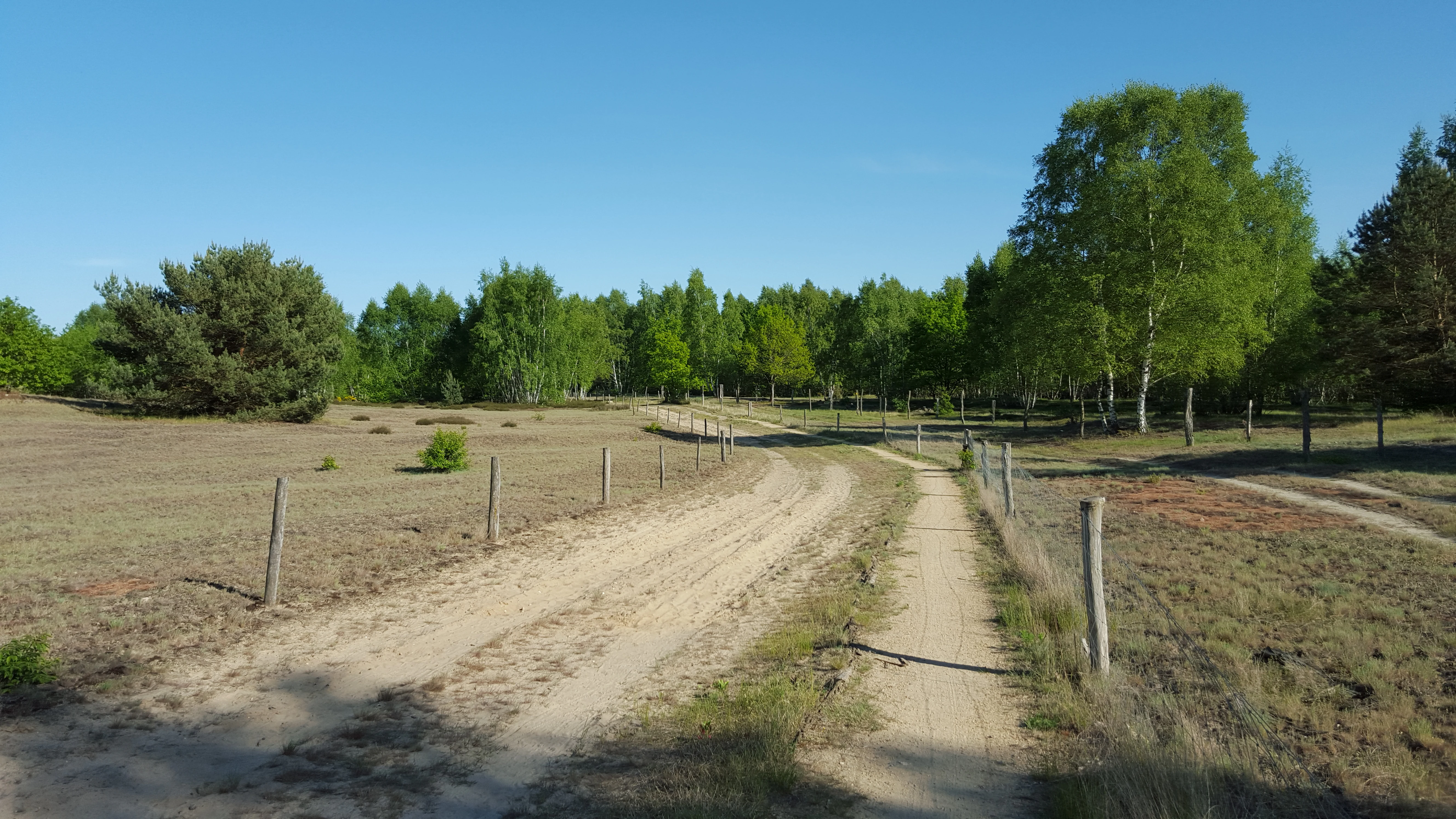
A sandy, unpaved track winds through an open, grassy landscape bordered by a fence and a line of birch and pine trees under a clear blue sky.
A dirt path winding through the open heathland of Döberitzer Heide.

Best time to visit Döberitzer Heide

Spring and early summer are the most rewarding seasons, when dry grasslands are in flower, woodland birds are active, and bat evenings around the visitor center are scheduled. Late summer and early autumn bring the heather into bloom and give the open landscape its most distinctive purple-gold coloration, while the autumn rut of the red deer in and around the core zone adds a further wildlife dimension. Winter has its own appeal: with the heather still structurally visible, sand flats and frost-rimed dry grassland create an unusually open and quiet atmosphere, and the large herbivores are easier to spot against bare vegetation.

Monthly climate preview

Long-term monthly temperature and precipitation patterns across Havelland

Döberitzer Heide Climate Normals and Annual Temperature Rhythm

Recorded coordinates capture measured monthly air temperatures ranging from negative averages to over thirty degrees alongside consistent daily precipitation. Exploring the full twelve-month profile reveals detailed baseline rhythms across the entire protected terrain.
Annual mean9 °C
-1 °C20 °C
Jan-1°
Feb
Mar
Apr
May14°
Jun18°
Jul20°
Aug20°
Sep15°
Oct
Nov
Dec
Warmest month
July

20.3 °C

Coolest month
January

-0.7 °C

Wettest month
July

2.4 mm/day

Driest month
April

1 mm/day

Park location guide

Geography guide, regional context, and park location map for Döberitzer Heide

Döberitzer Heide park geography, regions, and map view in Germany

Understand where Döberitzer Heide sits in Germany through a broader geographic reading of the surrounding landscape, nearby location context, and its mapped position within the national park landscape.

How Döberitzer Heide fits into Germany

Germany is a federal republic in Western and Central Europe with a population of over 83 million across sixteen constituent states. It is Europe's largest economy by nominal GDP and a major global exporter and importer. The capital is Berlin, and the country borders Denmark, Poland, Czech Republic, Austria, Switzerland, France, Luxembourg, Belgium, and the Netherlands.

Wider geography shaping Döberitzer Heide in Germany

Germany is located in Western and Central Europe, spanning 357,022 km². It borders Denmark to the north, Poland and the Czech Republic to the east, Austria and Switzerland to the south, and France, Luxembourg, Belgium, and the Netherlands to the west. The country has coastlines on the Baltic Sea and North Sea to the north, with the Alps located in the southern region.

Map view of Döberitzer Heide

Use this park location map to pinpoint Döberitzer Heide in Germany, understand its exact geographic position, and read its mapped placement within the surrounding landscape more clearly.

Pigeon | © OpenStreetMap contributors

Location context for Döberitzer Heide

Havelland

Visual exploration of sand flats, dry heaths, and wildlife habitats

Döberitzer Heide Photos and Protected Landscape Scenery

Visual records capture the open mosaic of dry heath, sandy ground, and wet fens across the protected area. Examining terrain photographs helps observers understand habitat restoration and large herbivore grazing dynamics in the region.

A modern steel spiral observation tower stands on a small sandy hill surrounded by green deciduous trees under a clear blue sky.

A small herd of brown European bison grazing in a meadow adjacent to a dense forest.

A brown European bison stands in a grassy clearing with trees in the background.

Two tan-colored Przewalski horses standing in an open field with a forest background.

A brown and a white sheep standing in a dry, grassy field next to a pile of fallen logs.

A group of red deer, including a large stag with antlers, grazing in a dry grassy field with a wooden fence in the background.

A group of light brown Przewalski horses grazing and standing in a dry, open field enclosed by a wire fence, with trees in the background.

A sandy, unpaved track winds through an open, grassy landscape bordered by a fence and a line of birch and pine trees under a clear blue sky.

Four Konik horses graze in a dry, grassy field with a backdrop of a dense forest and leafless birch trees under an overcast sky.

Wide shot of a field covered in vibrant yellow broom blossoms under a bright blue sky, with a line of green trees in the background.

Park atlas

Compare surrounding regional landscapes and connected wildlife habitats

Parks Near Döberitzer Heide and Related Protected Areas in the Region

Browse other parks near Döberitzer Heide to compare similar protected landscapes and regional habitats across the surrounding territory. Expanding your search provides broader geographic context for Central European rewilding projects and sandy heath reserves.
A soft watercolor illustration of a rolling green landscape with a small cluster of trees and birch trees in the foreground, against a pale background.
Nature reserveBrandenburg
Park boundaries overlap#1 closest

West

Ferbitzer Bruch Nature Reserve: Exploring Brandenburg Protected Landscape Boundaries

A lowland mosaic of sandy habitat in the Havelland region

Ferbitzer Bruch provides a focused look at the sandy lowland ecosystems characteristic of western Brandenburg. This nature reserve, anchored between the Havel Canal and the Döberitzer Heide, preserves a distinct mosaic of open heath, scrub, and woodland habitats that define this segment of the German landscape.

Area
11.564 km²
Established
1996
IUCN
IV
A soft, artistic watercolor painting of a river landscape with trees, grassy banks, and rolling hills in the background.
Nature reserveBrandenburg
About 2.6 km away#2 closest

West

Falkenrehder Wublitz Nature Reserve: Brandenburg Wetland Geography and Protected Landscape Atlas

A mapped riparian wetland reserve within the Havel valley floodplain.

Falkenrehder Wublitz is a nature reserve in Brandenburg, Germany, established to safeguard a representative slice of the Havel lowland wetlands. Centered on the Wublitz side arm of the Havel river, this protected area features diverse aquatic habitats, wet meadows, and swamp forests. The reserve plays a functional role in regional conservation by linking smaller wetland pockets into a broader, connected riparian landscape near the Havel Canal.

Area
0.976 km²
Established
2002
IUCN
IV
Nature reserveBerlin
About 5.5 km away#3 closest

East

Windmühlenberg Nature Reserve: Glacial Terrain and Steppe Flora in Berlin

Protected sand-dry grasslands on the Nauen Plateau edge

Windmühlenberg preserves a rare ecological landscape in western Berlin. This glacial hill and nature reserve functions as a protected habitat for steppe-relict flora and specialized insects, serving as a critical point of interest for understanding the geomorphology and sand-based grassland environments of the Havel river valley.

Area
0.051 km²
Established
2002
Relief
Upland
Climate
Temperate
A horizontal watercolor illustration depicting a calm lake surrounded by soft green forest and distant hazy hills.
Protected areaBerlin
About 6.6 km away#4 closest

Southeast

EU-Vogelschutzgebiet Westlicher Düppeler Forst: Protected Area and Regional Geography

Ecological sanctuary and Havel lakeshore landscape in Berlin

Located in the Steglitz-Zehlendorf district, this protected area spans nearly 10 square kilometres of diverse woodland and aquatic terrain. The site combines historical cultural landmarks with essential breeding grounds for migratory birds, including significant woodpecker populations and varied riparian corridors throughout the southwestern Berlin borderlands.

Area
9.44 km²
Established
2003
Protected landscapeBerlin
About 7.2 km away#5 closest

East

Tiefwerder-Wiesen Protected Landscape: Berlin Riverine Geography and Floodplain Map

Mapping the historic Havel river floodplains and wetland habitats.

Tiefwerder-Wiesen serves as an important ecological corridor in Berlin, safeguarding the last functional pike spawning grounds within the city. This protected landscape contains a dense network of river arms, ditches, and sedge meadows that illustrate the historical and ongoing geomorphological processes of the Havel river valley.

Area
0.667 km²
Established
1960
Relief
Lowland
Climate
Temperate
Watercolor painting of a green wetland area with soft, blurred rolling hills in the background.
Nature reserveBerlin
About 8.6 km away#6 closest

Southeast

Großes Fenn Nature Reserve: Protected Peatland and Kettle Bog Geography in Berlin

A study of post-glacial landforms and mire environments.

Großes Fenn represents a rare urban kettle bog formed during the last glacial period, now protected within the Berlin region. This reserve showcases the historical peat-forming processes and the fragile ecological balance of small depressions in the Düppeler Forest, offering a compact site for understanding glacial landscape legacies.

Area
0.064 km²
Established
1986
IUCN
IV
Nature reserveBerlin
8.8 km away#7 closest

East

Fließwiese Ruhleben: A Glacial Nature Reserve and Wetland Mosaic in Berlin

Mapping a unique urban protected area and its peat marsh topography

Fließwiese Ruhleben is a protected nature reserve in western Berlin that preserves a distinct relic of Weichselian glaciation. The site features a narrow, basin-like depression carved by glacial meltwater, supporting a rich diversity of peat-forming marshland and alder swamp forests. This protected area remains a vital node for regional biodiversity, contrasting sharply with the surrounding urban landscape of the Teltow plateau.

Area
0.118 km²
Established
1959
Relief
Lowland
Climate
Temperate
Watercolor illustration of a serene wetland scene with soft green hills and a light pink sky.
Nature reserveBerlin
About 9.5 km away#8 closest

East

Sandgrube im Jagen 86 Nature Reserve: Mapped Geography and Protected Area Context

A unique habitat mosaic within the Berlin forest region

Sandgrube im Jagen 86 functions as a protected nature reserve in Berlin, characterized by a bowl-shaped terrain of glacial sands. The area provides a critical habitat for specialized wildlife by balancing nutrient-poor grasslands with open water bodies and sun-exposed slopes, illustrating an effective example of managed conservation within an urban forest.

Area
0.135 km²
Established
1992
IUCN
IV
Relief
Lowland

Common questions about visiting, size, designation, and location context for Döberitzer Heide

Döberitzer Heide FAQs for park facts, access, geography, and protected area context

Find quick answers about Döberitzer Heide, including protected-area facts, park geography, trail and visitor context, and how the park fits into its surrounding country and regional landscape.
MoriAtlas Explorer

Continue Your Protected Areas Search Across the Global Atlas

Deepen your exploration by continuing the structured search for national parks and protected areas worldwide. Utilize the comprehensive filtering capabilities to compare different conservation landscapes and refine your understanding of global park geography. Discover more about the distribution and characteristics of protected natural areas.

Global natural geography