
Mori Atlas logo
Nature reserveRezerwat przyrody Dolina Kulawy

A detailed geographic overview of protected wetland ecosystems and post-glacial terrain in northern Poland.

Rezerwat przyrody Dolina Kulawy: Mapping the Soligenous Peatlands and River Valley Landscapes

Rezerwat przyrody Dolina Kulawy represents a complex of soligenous peatlands and spring-fed wetland systems within the Pomeranian Voivodeship. This protected area, nestled within the broader Zaborski Landscape Park, showcases a varied mosaic of alder-ash floodplain forests, mesotrophic lakes, and open heaths shaped by post-glacial processes. Through this atlas perspective, gain insight into the ecological boundaries and the riverine topography that define this significant wetland habitat.

peatland reservesoligenous peatlandsspring habitatsmesotrophic lakesKulawa River valleyfloodplain forest
A graphic illustration of a winding stream flowing through a wetland environment with tall grasses, fallen logs, and trees on the banks.

Rezerwat przyrody Dolina Kulawy

Nature reserve

Park overview

Structured park overview, official facts, and landscape profile for Dolina Kulawy Nature Reserve

Dolina Kulawy Nature Reserve park facts, protected area profile, and essential visitor context

Review the core facts for Dolina Kulawy Nature Reserve, including designation, size, terrain, visitor scale, habitats, and operating context in one park-focused overview.

About Dolina Kulawy Nature Reserve

Dolina Kulawy Nature Reserve is a peatland-type nature reserve established on 8 July 2009 by Order No. 14/2009 of the Regional Director of Environmental Protection in Gdańsk, in the Polish Journal of the Pomeranian Voivodeship (Dz.U.Pomor.09.106.2091). The reserve was created to preserve the natural peatlands, springs, mesotrophic lakes, and forest and non-forest terrestrial ecosystems characteristic of this part of northern Poland, along with the biocenoses associated with them.

The reserve falls within the Równina Charzykowska mesoregion, a lowland area shaped by glacial processes and today dominated by forests, peatlands, and lakes typical of the broader Bory Tucholskie region. Administratively, the reserve lies across two communes, Studzienice in Bytów County and Brusy in Chojnice County, in the Pomeranian Voivodeship, and is managed by the Osusznica and Przymuszewo Forest Districts under the Regional Directorates of State Forests in Szczecinek and Toruń respectively.

Ecologically, the protected area represents one of the clearer examples of peatland and spring-complex conservation in the Zaborski Landscape Park. The reserve consists of two parts with a combined area of 154.55 hectares, although the founding document originally described the extent as 155.41 hectares. Surrounding the core area, a 350.40-hectare protective buffer zone has been established to provide additional spatial safeguards against external pressures.

From a landscape and habitat perspective, the reserve gathers several characteristic post-glacial features into a single protected unit: gently sloping peat-forming mires, springs feeding the Kulawa River, small lakes such as Małe Głuche, Duże Głuche, and Szczeczonek, riverine forests, birch stands, heaths, and open non-forest communities. Together these elements form a coherent ecological mosaic typical of the transitional zones between glacial lakes and peat basins in northern Poland.

Protection and recognition

Terrestrial conservation framework and verified protection metrics

Rezerwat przyrody Dolina Kulawy Protection Status and Designated Area Record

Rezerwat przyrody Dolina Kulawy maintains a documented terrestrial protection scope within the national conservation network. Official records compile the core designation history and verified administrative boundaries for regional environmental analysis.

Protection details

Protection scope
Terrestrial
Transboundary protection
No
Buffer area
3.5 km²
Park context

Deeper park guide and search-rich context for Dolina Kulawy Nature Reserve

Dolina Kulawy Nature Reserve history, landscape, wildlife, and travel context

Explore Dolina Kulawy Nature Reserve through its history, landscape character, ecosystems, wildlife, conservation priorities, cultural context, and seasonal travel timing in a structured park guide built for atlas discovery and search intent.

Why Dolina Kulawy Nature Reserve stands out

The reserve is best known for its soligenous peatlands and spring-fed wetland system along the Kulawa River, combined with mesotrophic lakes, alder-ash floodplain forest, heaths, and adjacent terrestrial habitats. This combination of peatland, spring areas, and post-glacial lakes within a single protected valley is a defining feature of the reserve's identity.
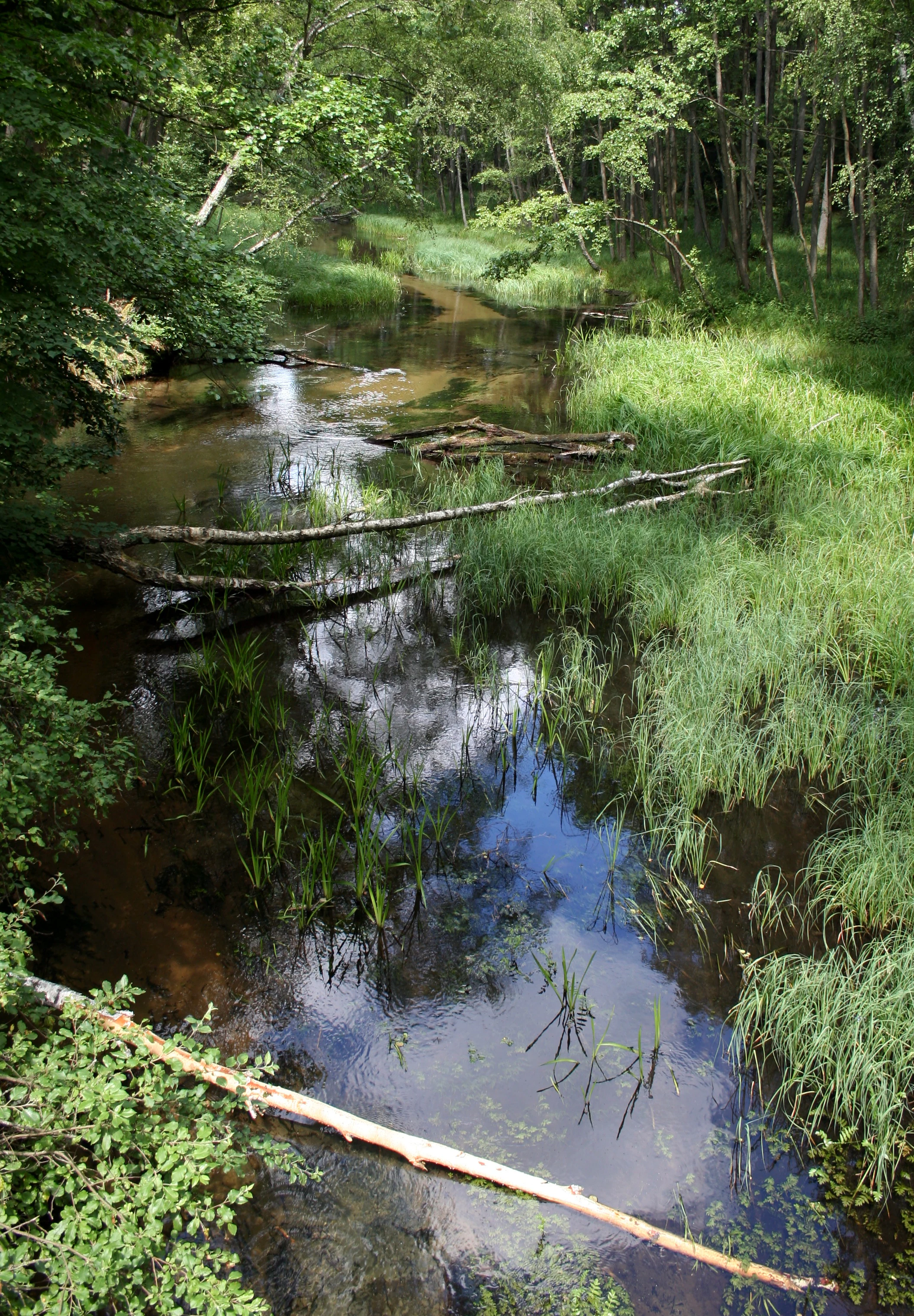
A slow-moving river flows through a dense, green forest with tall grasses and fallen tree branches visible in the shallow water.
The Kulawa River meandering through a forested wetland area.

Dolina Kulawy Nature Reserve history and protected-area timeline

Dolina Kulawy Nature Reserve was officially established on 8 July 2009 through administrative order No. 14/2009 of the Regional Director of Environmental Protection in Gdańsk, published in the official journal of the Pomeranian Voivodeship. The creation of the reserve reflected an explicit intent to maintain the integrity of soligenous peatlands, spring systems, mesotrophic lakes, and the surrounding terrestrial habitats already present in this part of the Zaborski Landscape Park.

Although the founding legal instrument initially reported the area as 155.41 hectares, the current documented extent of the reserve is 154.55 hectares, distributed across two distinct parts. Alongside the core reserve, a surrounding buffer zone covering 350.40 hectares was designated to reinforce the long-term protection of the reserve's ecological values.

The reserve's history is also tied to the broader framework of landscape-level conservation in the Zaborski region, where peatland, lake, and forest protection has long been a regional priority, and to the management responsibilities of two State Forests districts, Osusznica and Przymuszewo, which jointly oversee the forested areas within and around the reserve.

Dolina Kulawy Nature Reserve landscape and geographic character

The landscape of Dolina Kulawy reflects the classic character of the post-glacial lowlands of northern Poland, particularly the Równina Charzykowska mesoregion. The terrain is shaped by glacial processes that produced an alternating pattern of lakes, peat-forming depressions, forested uplands, and gently sloping river valleys, of which the Kulawa River valley is the central defining feature.

Within the reserve, the valley bottom is occupied by peatlands fed by groundwater seepage, giving the landscape its soligenous, spring-influenced character. These mires are bordered by floodplain forests and, in slightly higher areas, by birch stands and open heaths, creating a varied mosaic of wetland and dry-ground communities in close proximity.

The reserve also contains a cluster of small lakes, including Małe Głuche, Duże Głuche, and Szczeczonek, which are integral to the visual and ecological character of the area. The combination of mires, riverine forest, heath, and lakes gives the reserve a distinctive wetland-dominated scenery that is closely associated with the wider Bory Tucholskie landscape.

Dolina Kulawy Nature Reserve ecosystems, habitats, and plant life

The nature of Dolina Kulawy is defined by the ecological richness of its peatland and spring complex. The reserve protects soligenous peatlands, dependent on groundwater outflow rather than rainfall alone, along with associated springs and mesotrophic lake ecosystems that together sustain moisture-loving plant communities and the animals they support.

The forested component of the reserve is dominated by alder and ash floodplain forest along the river and its side channels, with birch stands occupying transitional zones. Beyond the wetland and forest habitats, the reserve also includes non-forest communities, including heaths and meadows, which broaden the ecological spectrum and contribute to overall biotope diversity.

Because the reserve lies within the Zaborski Landscape Park, its ecological profile sits within a broader network of protected forest, peat, and lake habitats. The protected area thus represents not just an isolated wetland but a well-defined ecological unit where spring activity, peat formation, and post-glacial lake ecology interact across a relatively compact territory.

Dolina Kulawy Nature Reserve conservation status and protection priorities

The conservation significance of Dolina Kulawy lies in its role as a protected refuge for soligenous peatlands, spring habitats, and mesotrophic lakes within the larger Zaborski Landscape Park, one of the key landscape protection areas of the Pomeranian Voivodeship. By formalizing the protection of these habitats, the reserve safeguards ecological processes that are sensitive to hydrological change and external land-use pressures.

The additional 350.40-hectare buffer zone around the core reserve strengthens the conservation value of the area, providing spatial protection against disturbance and helping maintain the hydrological conditions on which the peatlands and springs depend. The reserve is also notable for holding rare and endangered plant species covered by species protection, which are listed as part of its educational trail.

Through its peatland, spring, and lake habitats, the reserve contributes to conservation efforts aimed at preserving representative examples of northern Polish wetland ecosystems, including species and ecological communities that have become rare or threatened elsewhere in the region.

Dolina Kulawy Nature Reserve cultural meaning and human context

The Dolina Kulawy reserve is situated within the Zaborski Landscape Park, an area with a strong regional identity associated with the Bory Tucholskie forest and lake region. The landscape carries a long-standing tradition of rural land use, including traditional meadow, heath, and small-scale forestry practices, which have shaped the mosaic of habitats protected by the reserve.

The inclusion of a traditional building described as a 'stodoła' (barn) among the educational stops along the nature trail indicates a low-key but visible connection between the reserve's ecological functions and the agricultural heritage of the surrounding area. The presence of this structure, noted for having a wall colonized by rare lichens, reflects how natural and cultural elements interact in this part of the Polish countryside.

Top sights and standout views in Dolina Kulawy Nature Reserve

Dolina Kulawy stands out as a peatland-focused reserve whose strength lies in the concentration of soligenous mires, springs, and mesotrophic lakes within a single protected valley along the Kulawa River. Its position within the Zaborski Landscape Park places it at the heart of one of the most important protected landscape complexes in the Pomeranian Voivodeship.

The combination of alder-ash floodplain forest, birch stands, heaths, meadows, and small post-glacial lakes creates a varied habitat mosaic unusually compact for a reserve of its size. A 13-stop nature trail further enhances the reserve's role as an accessible place to encounter the diversity of northern Polish wetland and forest ecosystems.

Best time to visit Dolina Kulawy Nature Reserve

Late spring through early autumn is generally the most rewarding time to experience the landscapes of Dolina Kulawy, when forest and meadow habitats are fully active, peatland vegetation is visible, and trail conditions are favorable. Summer months highlight the green character of the floodplain forests and open heaths, while early autumn brings muted colors that emphasize the wetland and lake scenery of the reserve.
Monthly climate preview

Long-term temperature and precipitation baselines across twelve measured intervals

Rezerwat przyrody Dolina Kulawy Climate Normals and Temperature Rhythms

Representative coordinate records show average monthly temperatures ranging from sub-zero winter minimums to warm summer maximums alongside consistent precipitation baselines. Examining the complete twelve-month climatology profile provides deeper insight into measured long-term environmental patterns.
Annual mean8 °C
-3 °C18 °C
Jan-3°
Feb-2°
Mar
Apr
May12°
Jun16°
Jul18°
Aug18°
Sep14°
Oct
Nov
Dec-1°
Warmest month
July

18.3 °C

Coolest month
January

-2.7 °C

Wettest month
July

2.8 mm/day

Driest month
April

1.3 mm/day

Park location guide

Geography guide, regional context, and park location map for Dolina Kulawy Nature Reserve

Dolina Kulawy Nature Reserve park geography, regions, and map view in Poland

Understand where Dolina Kulawy Nature Reserve sits in Poland through a broader geographic reading of the surrounding landscape, nearby location context, and its mapped position within the national park landscape.

How Dolina Kulawy Nature Reserve fits into Poland

Poland, officially the Republic of Poland, is a Central European country spanning from the Baltic Sea in the north to the Carpathian Mountains in the south. It borders Germany, Czech Republic, Slovakia, Ukraine, Belarus, Lithuania, and Kaliningrad Oblast. The country has a temperate climate, diverse landscapes, and is known for its rich history, cultural heritage, and strong economic position within the EU.

Wider geography shaping Dolina Kulawy Nature Reserve in Poland

Poland occupies 312,696 km2 in Central Europe, extending from the Baltic Sea coast in the north to the Sudetes and Carpathian Mountains in the south. It borders Germany to the west, Czech Republic and Slovakia to the south, Ukraine and Belarus to the east, and Lithuania and Kaliningrad Oblast to the northeast. The landscape includes lowland plains, uplands, and mountain ranges.

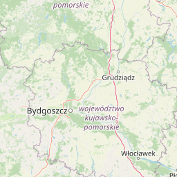
Map view of Dolina Kulawy Nature Reserve

Use this park location map to pinpoint Dolina Kulawy Nature Reserve in Poland, understand its exact geographic position, and read its mapped placement within the surrounding landscape more clearly.

Pigeon | © OpenStreetMap contributors

Location context for Dolina Kulawy Nature Reserve

Pomeranian Voivodeship

Visualizing the peatlands, spring-fed lakes, and floodplain forests of northern Poland

Rezerwat przyrody Dolina Kulawy Landscape Photos and Wetland Scenery

Examine detailed visual documentation of Rezerwat przyrody Dolina Kulawy to observe the complex terrain of soligenous mires and mesotrophic lakes. Photographic records illustrate the distinct character of the Kulawa River valley and surrounding forest habitats.

A slow-moving river flows through a dense, green forest with tall grasses and fallen tree branches visible in the shallow water.

Park atlas

Compare nearby wetland reserves and regional protected landscapes across northern Poland

Other Parks Near Rezerwat Przyrody Dolina Kulawy And Protected Areas In The Surrounding Region

Browse protected areas and wetland reserves located near Rezerwat przyrody Dolina Kulawy to compare post-glacial terrain across the broader Bory Tucholskie region. Expanding the geographic scope reveals connected wetland habitats and forested river valleys throughout the surrounding Pomeranian landscape.
Protected areaPomeranian Voivodeship
Mapped location lies within the park boundary#1 closest

South

Sandr Brdy: Protected Glacial Landscapes and Hydrological Networks in Pomeranian Voivodeship

A vital reference site for lowland habitat conservation and post-glacial terrain.

Sandr Brdy spans 7,492 hectares of outwash plains in northern Poland. Its terrain hosts a complex mosaic of calcareous fens, acid oak forests, and lobelia lakes, established to preserve fragile aquatic and terrestrial species like the gray wolf and lady's slipper orchid within a unique glacial framework.

Area
74.926 km²
Scope
Terrestrial
Water
Major water bodies
Protected landscapePomeranian Voivodeship
Mapped location lies within the park boundary#2 closest

South

Zaborski Park Krajobrazowy: Geographic Profile of a Polish Protected Landscape Area

Tuchola Forest region, Pomeranian Voivodeship

Investigate the unique terrain of Zaborski Park Krajobrazowy, a protected landscape defined by its dense network of glacial lakes and sandy outwash plains. This territory provides a comprehensive view of northern Polish lowland geography, highlighting the ecological significance of its river valleys and relic forest habitats within the broader Tuchola Forest ecosystem.

Area
340.3 km²
Established
1990
Relief
Lowland
Climate
Temperate
A soft watercolor illustration depicting a flat wetland landscape with low hills in the background and clusters of green trees and shrubs in the foreground.
Nature reservePomeranian Voivodeship
About 5.9 km away#3 closest

Northwest

Mechowisko Radość Nature Reserve: Atlas of Protected Alkaline Fen Landscapes in Pomeranian Voivodeship

A rare calcareous mire ecosystem within the Bory Tucholskie post-glacial terrain

Mechowisko Radość Nature Reserve protects a specialized alkaline peatland ecosystem that developed in a formerly mesotrophic lakeside bay. This site highlights the complex hydrological and ecological processes of the Bory Tucholskie region, where flat, post-glacial landscapes sustain rare orchid and bryophyte assemblages through dedicated active conservation management.

Area
0.096 km²
Established
2013
Relief
Lowland
Scope
Terrestrial
Nature reservePomeranian Voivodeship
About 13 km away#4 closest

North

Studzienickie Torfowiska Nature Reserve: Geographic Atlas and Wetland Habitat Context

Protected peatland terrain in Pomeranian Voivodeship

Studzienickie Torfowiska represents a vital protected peatland system characterized by its mosaic of transitional mires, dystrophic lakes, and regenerating bog forests. The landscape focus lies on the interplay between saturated ground and peat accumulation, offering a clear regional perspective on wetland conservation within northern Poland's lowland geography.

Area
1.75 km²
Relief
Lowland
Climate
Temperate
Access
Access unknown
A pale, soft-toned watercolor painting of a calm lake shore with marshy grasses in the foreground and a line of green trees and rolling hills in the background.
National parkPomeranian Voivodeship
About 14 km away#5 closest

South

Park Narodowy „Bory Tucholskie”: Geography of a Polish National Park and Protected Forest

Lowland pine ecosystems and glacial water networks

Located in the Pomeranian Voivodeship, Park Narodowy „Bory Tucholskie” protects a significant remnant of the Tuchola Forest. The terrain, characterized by postglacial sandy plains, inland dunes, and acidic lobelia lakes, provides a critical reference site for studying forest ecology and glacial geomorphology within the Polish national park system.

Area
46.13 km²
Established
1996
Visitors
33K annual
Relief
Lowland
Watercolor painting of a river flowing through a forested area with colorful fields
National parkPomeranian Voivodeship
About 14 km away#6 closest

South

Tuchola Forest National Park: Explore Poland's Largest Protected Woodland and Glacial Lakes

Detailed maps and geographic context of unique forest ecosystems and terrain.

MoriAtlas offers a comprehensive geographic overview of Tuchola Forest National Park, a vital protected area in Pomeranian Voivodeship, Poland. This page delves into the park's identity as Poland's largest contiguous forest, distinguished by its post-glacial landscape. Users can explore the mapped boundaries of its extensive coniferous forests, numerous interconnected glacial lakes, dynamic dunes, and ecologically rich peatlands. It serves as a key entry point for understanding the park's unique terrain and its significant place within the broader regional geography and protected lands atlas.

Area
46.13 km²
Established
1996
IUCN
II
Visitors
33K annual
Nature reservePomeranian Voivodeship
About 19 km away#7 closest

South

Rezerwat przyrody Moczadło: Protected Nature Reserve and Lobelia Lake in Pomeranian Voivodeship

Mapped ecological zone within the Bory Tucholskie lake region

Gain insight into the protected landscape of Rezerwat przyrody Moczadło, a nature reserve in Pomeranian Voivodeship defined by its exceptionally clear oligotrophic waters. This site offers valuable data for those studying post-glacial lake ecosystems, rare aquatic flora, and the sensitive transition zones between open water and peat-forming pine forest landscapes.

Area
0.262 km²
Established
2011
Water
Major water bodies
A soft watercolor painting of gentle, rolling hills and scattered trees under a light sky.
Protected areaPomeranian Voivodeship
About 20 km away#8 closest

Northwest

Ostoja Masłowiczki: Protected Landscape and Post-Glacial Terrain in Pomeranian Voivodeship

Exploring the glacial basins, bogs, and forests of northern Poland.

Ostoja Masłowiczki is a protected area in the Bytów Lake District defined by its glacial heritage. The site provides a unique look at how moraine landscapes support a varied mosaic of habitats, ranging from acidic dystrophic lakes and active raised bogs to lush oak-hornbeam and beech forests within the Pomeranian region.

Area
16.8 km²
Established
2011
Relief
Lowland
Climate
Temperate

Common questions about visiting, size, designation, and location context for Dolina Kulawy Nature Reserve

Dolina Kulawy Nature Reserve FAQs for park facts, access, geography, and protected area context

Find quick answers about Dolina Kulawy Nature Reserve, including protected-area facts, park geography, trail and visitor context, and how the park fits into its surrounding country and regional landscape.
MoriAtlas Explorer

Continue Your Protected Areas Search Across the Global Atlas

Deepen your exploration by continuing the structured search for national parks and protected areas worldwide. Utilize the comprehensive filtering capabilities to compare different conservation landscapes and refine your understanding of global park geography. Discover more about the distribution and characteristics of protected natural areas.

Global natural geography