
Mori Atlas logo
Wildlife reserveDome Wilderness

Tracing the dramatic volcanic domes and fire-altered terrain within the Jemez Mountains

Dome Wilderness: Volcanic Geology and Protected Forest Landscapes in Sandoval County, New Mexico

Dome Wilderness is a federally protected area in Sandoval County, New Mexico, renowned for its distinct volcanic topography and recovering forest landscapes. Established within the Jemez Mountains, the area features prominent volcanic domes such as St. Peter's Dome alongside terrain shaped by significant fire-adapted ecological shifts. This protected landscape offers a unique vantage point to study geologic formations and prehistoric archaeological sites adjacent to Bandelier National Monument.

wilderness areavolcanic landscapemountainsconiferous forestfire ecologyprehistoric sites
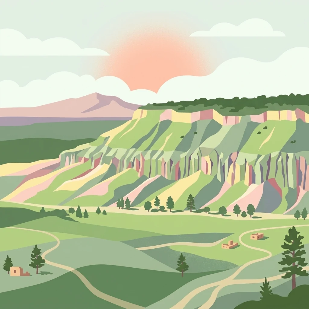
A digital illustration of a southwestern landscape with a prominent mesa, winding dirt paths, scattered trees, and small adobe structures under a soft sun.

Dome Wilderness

Wildlife reserve

Park overview

Structured park overview, official facts, and landscape profile for Dome Wilderness

Dome Wilderness park facts, protected area profile, and essential visitor context

Review the core facts for Dome Wilderness, including designation, size, terrain, visitor scale, habitats, and operating context in one park-focused overview.

About Dome Wilderness

Dome Wilderness is one of the smaller designated wilderness areas of northern New Mexico, yet it concentrates a remarkable variety of features into a compact footprint in the Jemez Mountains. The wilderness occupies part of the Jemez Ranger District of the Santa Fe National Forest and is bordered directly by Bandelier National Monument and the Bandelier Wilderness. Its proximity to Los Alamos makes it unusually accessible for a congressionally designated wilderness, with paved roads and gravel forest roads leading visitors to a network of trailheads on the surrounding national forest. Several of these trails extend into Bandelier National Monument, allowing for long loop hikes that link the two protected landscapes together.

The defining physical character of the wilderness comes from its volcanic past. The area is named for prominent volcanic domes that rise from the forested terrain, including St. Peter's Dome, which marks the highest point within the wilderness boundary. This landscape reflects the broader geological story of the Jemez Mountains, a large volcanic complex associated with the Valles Caldera system. Erosion of these volcanic deposits has produced a terrain of cliffs, canyons, slickrock exposures, forested slopes, and surprising open vistas, especially where fires have thinned or removed the tree cover.

Perhaps no single event has shaped the modern identity of the Dome Wilderness more than the Dome Fire of 1996, which burned large portions of the area. The fire dramatically altered the forest cover, leaving behind a stark, regenerating landscape that differs visibly from the deeper coniferous forests around it. In the decades since the fire, fire-adapted vegetation has returned, but the open character of the terrain and the exposed geology remain signature features. This makes the Dome Wilderness particularly compelling for visitors interested in ecological recovery, fire history, and the dynamics of Southwestern mountain forests.

Beyond its natural character, the wilderness carries strong cultural significance. As part of the Santa Fe National Forest landscape, it contains numerous prehistoric archaeological sites that reflect generations, even millennia, of human presence in the Jemez region. Combined with its geological identity and its ties to Bandelier National Monument, the Dome Wilderness stands as a layered landscape where volcanic geology, fire history, and deep human heritage all converge within a relatively small and easily explored footprint.

Quick facts and research context for Dome Wilderness

Dome Wilderness is a roughly 5,200-acre congressionally designated wilderness area in Sandoval County, New Mexico. It is administered by the U.S. Forest Service as part of the Santa Fe National Forest's Jemez Ranger District. The area sits immediately adjacent to Bandelier National Monument and the Bandelier Wilderness, near the town of Los Alamos. Its terrain is characterized by volcanic domes, forested canyons, fire-affected slopes, and numerous prehistoric archaeological sites.

Protection and recognition

Review the recorded terrestrial designation and management framework for Dome Wilderness.

Dome Wilderness Protection Status and Documented Conservation Scope

Dome Wilderness maintains a documented terrestrial protection scope within the global conservation registry. Review the official designation details, administrative boundaries, and recorded recognition parameters associated with this protected landscape.

Protection details

Protection scope
Terrestrial
Transboundary protection
No
Park context

Deeper park guide and search-rich context for Dome Wilderness

Dome Wilderness history, landscape, wildlife, and travel context

Explore Dome Wilderness through its history, landscape character, ecosystems, wildlife, conservation priorities, cultural context, and seasonal travel timing in a structured park guide built for atlas discovery and search intent.

Why Dome Wilderness stands out

The Dome Wilderness is best known for its volcanic dome geology, especially St. Peter's Dome, and for the dramatic post-fire landscape left by the 1996 Dome Fire. The contrast between recovering burned slopes and older surviving forest stands makes it visually distinctive within the broader Santa Fe National Forest. Its close connection to Bandelier National Monument and its wealth of prehistoric cultural sites further define its identity.
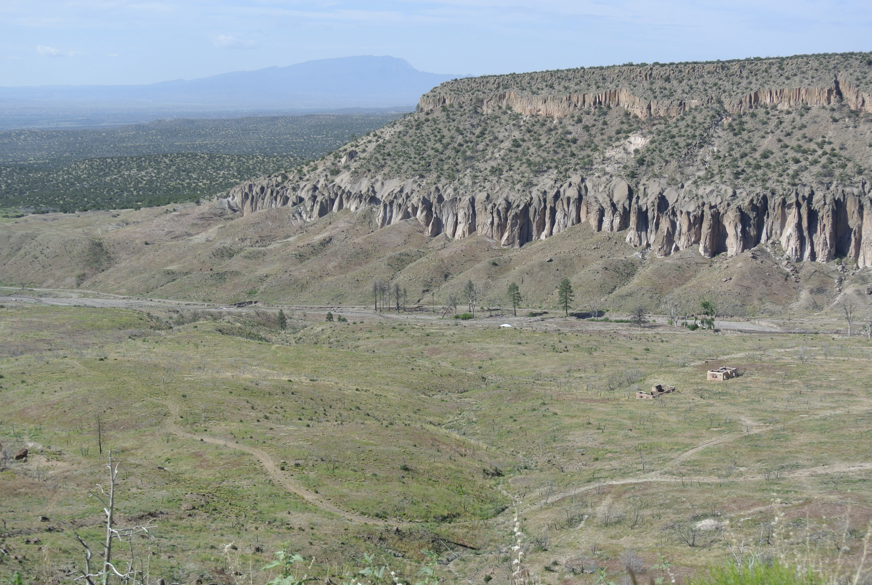
A wide landscape view of the Dome Wilderness in New Mexico, featuring a high, jagged cliff face rising above a wide, open valley floor with sparse desert vegetation.
A wide view of the rugged terrain and cliffs within the Dome Wilderness.

Dome Wilderness history and protected-area timeline

The Dome Wilderness was created by an act of the United States Congress in 1980, when it was formally designated as a wilderness area. Its establishment recognized the relatively undisturbed character of the volcanic dome landscape on the Jemez Ranger District of the Santa Fe National Forest, as well as the area's proximity and natural connection to Bandelier National Monument. By placing the land under federal wilderness protections, Congress reinforced long-standing patterns of public forest management in northern New Mexico while also safeguarding the area's ecological and scenic values.

Management of the wilderness has been carried out by the United States Forest Service under broader policies governing the Santa Fe National Forest. Like the surrounding national forest lands, the Dome Wilderness was already known to harbor numerous prehistoric archaeological sites, reflecting its long history of human use long before designation.

The most transformative event in the modern history of the wilderness was the Dome Fire of 1996, which burned much of the area and dramatically reshaped its vegetation. In the years since the fire, the landscape has been gradually recovering, but the burn footprint remains a defining element of the wilderness experience and continues to shape how visitors, managers, and researchers understand the area.

Dome Wilderness landscape and geographic character

The landscape of the Dome Wilderness is defined by a volcanic topography embedded within the forested Jemez Mountains of north-central New Mexico. The area's namesake features are exposed volcanic domes that rise prominently above the surrounding terrain, with St. Peter's Dome representing the highest point within the wilderness boundary. These domes are part of the larger volcanic geological story of the Jemez region, which is associated with the massive Valles Caldera volcanic system.

Erosion of the volcanic deposits has produced a varied terrain that includes rocky slopes, canyon systems, exposed slickrock, and open ridges, alongside surviving mixed coniferous forest cover. The 1996 Dome Fire opened large portions of this terrain, exposing rock, soil, and panoramic views that were once concealed beneath dense forest. As a result, the wilderness today offers an unusually open and visually layered landscape for its size, alternating between recovering burned slopes and stands of older surviving trees.

Because the wilderness borders Bandelier National Monument directly, its landforms blend almost seamlessly with the protected scenery of the surrounding monument, creating a continuous landscape of volcanic mesas, forested canyons, and steep canyon walls that shape both visual character and ecological patterns within the area.

Dome Wilderness ecosystems, habitats, and plant life

The Dome Wilderness sits within the high-elevation temperate forests of northern New Mexico's Jemez Mountains, where montane and mixed coniferous vegetation is the dominant ecological character. The area's plant communities include conifers typical of the broader Santa Fe National Forest, ranging from denser stands on more sheltered slopes to sparser, more open cover across the fire-affected terrain.

The 1996 Dome Fire was a defining ecological disturbance for the wilderness. It removed large sections of forest canopy, altered understory composition, and initiated a long process of post-fire recovery. Today, the wilderness represents a particularly dynamic stage of Southwestern mountain forest regeneration, with fire-adapted vegetation, reseeded grasses, shrub recovery, and ongoing canopy return across the burn footprint. Older, unburned forest stands remain in pockets and along canyon margins, providing valuable contrast.

Wildlife habitat in the area reflects this mixture of recovering and mature forest, along with rocky terrain, water sources, and adjacent protected lands. The interconnected mosaic of Dome Wilderness, Bandelier Wilderness, and Bandelier National Monument supports broader ecological processes across the Jemez Mountains and increases the ecological value of the smaller wilderness footprint.

Dome Wilderness wildlife and species highlights

Although smaller than many Southwestern wilderness areas, the Dome Wilderness supports wildlife communities typical of the mixed coniferous forests and montane canyons of the Jemez Mountains. The combination of recovering post-fire habitats, mature surviving forest stands, rocky outcrops, and water resources creates varied habitat conditions for a range of native species.

Because the wilderness connects ecologically with Bandelier National Monument and the Bandelier Wilderness, animals are not confined strictly to the Dome Wilderness boundary. This connectivity supports wide-ranging mammal species, a variety of bird communities adapted to both forested and open terrain, and the broader ecological function of the Jemez Mountains landscape. Together with its fire-affected vegetation pattern, the area offers interesting habitat diversity for species adapted to early and mid-successional forest conditions as well as those tied to older, denser stands.

Dome Wilderness conservation status and protection priorities

The Dome Wilderness derives its principal conservation significance from its congressional designation as a federal wilderness area in 1980, placing it under the highest level of protection for U.S. Forest Service lands. This designation restricts development, mechanized use, and other activities that could alter its wilderness character, while preserving its natural processes and scenery.

Its conservation value is closely tied to its position within the broader Jemez Mountains landscape. By bordering Bandelier National Monument and lying within the Santa Fe National Forest, the dome area contributes to a much larger network of protected, semi-protected, and ecologically connected lands. This interconnected setting amplifies the importance of even a relatively small wilderness, allowing wildlife movement, plant dispersal, and natural processes to function across institutional boundaries.

The 1996 Dome Fire also gave the wilderness an important role in understanding post-fire ecological recovery in Southwestern mountain forests. Its recovering slopes provide ongoing insight into how vegetation, soils, and habitat conditions re-establish after major wildfire, contributing practical value to regional conservation and land management knowledge beyond the wilderness itself.

Dome Wilderness cultural meaning and human context

The Dome Wilderness sits within a landscape of long human history, embedded in the Jemez Mountains of northern New Mexico along with Bandelier National Monument. As part of the surrounding Santa Fe National Forest, the area contains numerous prehistoric archaeological sites reflecting generations of human presence tied to canyon habitats, water sources, and the broader subsistence and cultural movements of the region.

The proximity of the wilderness to Bandelier National Monument further embeds the Dome Wilderness in a cultural landscape shaped for centuries by Indigenous peoples and later by Spanish colonial, Mexican, and American periods of settlement. Today, the area's prehistoric sites and adjacent archaeological resources connect visitors to one of the most culturally rich highland regions in the American Southwest.

Top sights and standout views in Dome Wilderness

Standout features of the Dome Wilderness include its namesake volcanic domes crowned by St. Peter's Dome, the still-visible landscape of the 1996 Dome Fire, and its direct connection to Bandelier National Monument through adjoining trail systems. The wilderness also stands out for its prehistoric archaeological sites, its unusually easy access from Los Alamos, and the rare opportunity it offers to observe fire recovery within a federally protected wilderness setting.

Best time to visit Dome Wilderness

The character of the Dome Wilderness changes meaningfully with the seasons, in keeping with its high-elevation Southwestern mountain setting. Spring and early summer bring mild temperatures and active ecological recovery on the fire-affected slopes, while monsoonal summer rains can refresh vegetation and create dramatic skies over the domes. Autumn tends to highlight the contrast between recovering fire areas and surviving forest stands. Winters in the Jemez Mountains can be cold and snowy, and visitors should be prepared for high-elevation mountain conditions at any time of year.

Monthly climate preview

Track monthly temperature variations and precipitation averages at a representative elevation point

Dome Wilderness Climate Normals and Long Term Temperature Patterns

Representative coordinates record long term temperature averages alongside monthly precipitation variations across the year. Reviewing the complete twelve month profile provides detailed climate data for research and comparison.
Annual mean11 °C
0 °C24 °C
Jan
Feb
Mar
Apr10°
May16°
Jun22°
Jul24°
Aug22°
Sep18°
Oct11°
Nov
Dec
Warmest month
July

23.6 °C

Coolest month
January

-0.4 °C

Wettest month
July

2 mm/day

Driest month
February

0.6 mm/day

Park location guide

Geography guide, regional context, and park location map for Dome Wilderness

Dome Wilderness park geography, regions, and map view in United States of America

Understand where Dome Wilderness sits in United States of America through a broader geographic reading of the surrounding landscape, nearby location context, and its mapped position within the national park landscape.

How Dome Wilderness fits into United States of America

The United States of America is a federal presidential republic and one of the world's largest countries by area and population. It consists of 50 states across a vast territory spanning multiple time zones, with its capital in Washington, D.C. and largest city in New York City. The nation has a diverse economy, influential political system, and significant cultural and military presence globally.

Wider geography shaping Dome Wilderness in United States of America

The United States occupies a vast territory in North America, bordered by Canada to the north and Mexico to the south. The 48 contiguous states stretch from the Atlantic to the Pacific Ocean, while Alaska occupies the northwestern region and Hawaii is an archipelago in the Pacific. The country encompasses diverse terrain including the Rocky Mountains, Appalachian Mountains, Great Plains, and extensive river systems.

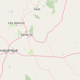
Map view of Dome Wilderness

Use this park location map to pinpoint Dome Wilderness in United States of America, understand its exact geographic position, and read its mapped placement within the surrounding landscape more clearly.

Pigeon | © OpenStreetMap contributors

Location context for Dome Wilderness

New MexicoSandoval County
Recorded earthquake history

Review the Historical Earthquake Catalogue for Dome Wilderness

Explore documented seismic events mapped to the surroundings of Dome Wilderness. This catalogue provides a clear, data-driven look at historical earthquake records to support geographic study of the Jemez Mountains region.

Dome Wilderness Earthquake Records

Catalogued events

6 events

Strongest magnitude

Magnitude 4.5

Most recent event

Jan 30, 2026

This history includes earthquakes recorded inside the park or within 50 km of its borders

Explore protected area views, recovering forest stands, and rugged volcanic terrain.

Dome Wilderness Photos and Scenery: Visualizing the Volcanic Landscapes

Visual documentation captures the exposed volcanic domes, rugged canyons, and fire-scarred forest regrowth defining the terrain of Dome Wilderness. Photographic records provide clear insight into the protected landscape, revealing geologic formations and vegetation patterns across the region.

A wide landscape view of the Dome Wilderness in New Mexico, featuring a high, jagged cliff face rising above a wide, open valley floor with sparse desert vegetation.

Park atlas

Compare regional volcanic terrain, neighboring monuments, and protected mountain areas

Explore Other Parks Near Dome Wilderness and Protected Landscapes

Browse protected areas adjacent to Dome Wilderness to examine connected volcanic topography and regional forest ecosystems. Extending the geographic review helps map broader conservation patterns across the Jemez Mountains.
Watercolor painting of a gentle, rolling landscape with a small stream, a small waterfall, and scattered trees under a soft, light sky.
Protected landscapeNew Mexico
Park boundaries overlap#1 closest

East

Santa Fe National Forest: Geographic Atlas and Protected Landscape Overview

New Mexico mountain geography and wilderness mapping

Santa Fe National Forest spans more than 1.5 million acres of Northern New Mexico, featuring a dramatic transition from canyon river systems to the high elevations of the Pecos Wilderness. This protected landscape contains a complex network of forest districts across the Jemez and Sangre de Cristo Mountains, defined by volcanic plateaus, alpine basins, and seasonal aspen forests. Use this resource to understand the park boundaries, regional mountain geography, and the interconnected nature of these protected lands.

Area
6,306.83 km²
Established
1915
Relief
Mountain
Access
Easy access
Protected landscapeSandoval County
About 26 km away#2 closest

West

Jemez National Recreation Area: Geography and Protected Land Map Overview

Exploring volcanic plateaus and river canyons in northern New Mexico

Jemez National Recreation Area represents a key protected landscape in Sandoval County, encompassing diverse forested uplands and steep volcanic canyons. The area serves as a focal point for understanding the geological legacy of the Jemez Mountains, providing a clear window into how river incision and ancient volcanic activity have shaped the regional terrain. Its proximity to national forest lands and the Valles Caldera system makes it a vital unit for geographic study and mapped landscape exploration.

Area
233.3 km²
Established
1993
Visitors
1.6M annual
Relief
Mountain
A minimalist watercolor painting depicting soft green rolling hills in the foreground and faded pink mountain ridges in the background on a white paper background.
Protected areaNew Mexico
99 km away#3 closest

South

Manzano Mountain Wilderness: Rugged Protected Landscapes in Central New Mexico

Canyon-scarred mountain geography and forest ecosystems.

Manzano Mountain Wilderness is a significant protected area defined by its deep, radiating canyons and compressed elevational ranges. From pinyon-juniper foothills to the spruce-fir heights of the crest, this landscape offers a detailed look at the varied natural terrain found within the Cibola National Forest in New Mexico.

Area
149.23 km²
Established
1978
IUCN
Ib
Relief
Mountain
Watercolor painting of a green forest, calm water, and distant mountain silhouettes against a light sky.
Wildlife reserveNew Mexico
128 km away#4 closest

Northeast

Latir Peak Wilderness: Mapped Geography of the Sangre de Cristo Mountains

High-elevation wilderness reserves in northern New Mexico

Latir Peak Wilderness presents a distinct vertical landscape within the northern Sangre de Cristo Mountains. This protected area features a unique combination of high-altitude summits, rounded alpine mesas, and cold-water trout habitats. Mapped terrain includes the significant Lake Fork of Cabresto Creek drainage and dense conifer forests that define this 20,506-acre wilderness unit.

Area
82.98 km²
Established
1980
IUCN
Ib
Relief
Mountain
Watercolor painting of soft, layered mountain ranges behind green hills and patches of evergreen trees on a white background.
Protected landscapeColorado
135 km away#5 closest

North

Rio Grande National Forest: Atlas and Geographic Profile of a Southern Colorado Landscape

Watershed geography and Continental Divide terrain analysis.

Rio Grande National Forest represents an immense protected landscape encompassing diverse terrain from high desert steppe to rugged alpine peaks. This profile details the forest's hydrological significance as the source of the Rio Grande and its role as a massive ecological transition zone in the Mountain West. Examine the boundaries and mountain geography that define this critical protected area.

Area
7,500 km²
Established
1908
Relief
Mountain
Climate
Boreal
Protected landscapeColorado
144 km away#6 closest

Northwest

San Juan National Forest: Geographic Overview of a Major Southern Colorado Protected Landscape

Mapped terrain across the Southern San Juan Mountains

San Juan National Forest represents a massive protected landscape in western Colorado, defined by its rugged alpine peaks, dense conifer forests, and glacial valleys. This atlas entry details the forest boundary, its position along the Continental Divide, and the surrounding transition into the Colorado Plateau. It provides a structured look at the terrain that connects diverse ecosystems, from high-altitude tundra to expansive mesa country, within one of the largest national forests in the American West.

Area
7,603.42 km²
Established
1905
Relief
Mountain
Climate
Alpine
A horizontal watercolor illustration of a wide, open prairie landscape featuring soft green hills, sparse shrubs, and grasses against a pale background.
Protected landscapeNew Mexico
179 km away#7 closest

East

Kiowa National Grassland: Protected Landscapes, Canyon Terrain, and Prairie Geography

Northeastern New Mexico shortgrass prairie and river canyon systems.

Kiowa National Grassland represents a distinctive protected landscape within the southwestern Great Plains, featuring a mix of rolling steppe, pinyon-juniper woodland, and the deep gorges of the Canadian River Canyon. This area offers significant insight into the regional geography of New Mexico, where historic Santa Fe Trail corridors and seasonal playa lakes define the local terrain and ecosystem.

Area
554.95 km²
Established
1960
Relief
Upland
Climate
Temperate
Watercolor painting of a serene mountain landscape featuring rolling hills, coniferous trees, and a lake in the foreground, rendered in light pastel tones.
Protected landscapeColorado
196 km away#8 closest

Northeast

San Isabel National Forest: Geographic Overview and Protected Mountain Landscape Atlas

Central Colorado alpine terrain and designated wilderness areas

Spanning eleven counties in central Colorado, San Isabel National Forest serves as a cornerstone of the Southern Rocky Mountains. The forest landscape is dominated by the Sawatch and Sangre de Cristo ranges, offering a unique atlas of alpine tundra, dense coniferous forests, and high-altitude peaks that define the character of the region. This protected area provides a vital habitat and a vast, rugged environment characterized by volcanic formations like the Spanish Peaks and glacial geological features.

Area
4,533.42 km²
Established
1902
Relief
Mountain
Climate
Alpine

Common questions about visiting, size, designation, and location context for Dome Wilderness

Dome Wilderness FAQs for park facts, access, geography, and protected area context

Find quick answers about Dome Wilderness, including protected-area facts, park geography, trail and visitor context, and how the park fits into its surrounding country and regional landscape.
MoriAtlas Explorer

Continue Your Protected Areas Search Across the Global Atlas

Deepen your exploration by continuing the structured search for national parks and protected areas worldwide. Utilize the comprehensive filtering capabilities to compare different conservation landscapes and refine your understanding of global park geography. Discover more about the distribution and characteristics of protected natural areas.

Global natural geography