
Mori Atlas logo
Protected areaDonnersberg

Mapping the geological cryptodome, forested plateau, and historical Celtic landscape boundaries.

Donnersberg: A Detailed Geographic Survey of the Highest Massif in the Palatinate Region

The Donnersberg stands as the dominant mountain massif of the Palatinate region, rising prominently above the surrounding Nordpfälzer Bergland. This protected landscape is defined by its unique Permian rhyolite cryptodome, recognized as a nationally significant geotope, and an expansive forested plateau that contains evidence of one of the largest Celtic oppida north of the Alps. The terrain transitions from high, flat summits to deeply cut valleys and exposed rocky flanks, creating a distinct environmental structure within Rhineland-Palatinate.

mountain massifPalatinateRhineland-PalatinateNordpfälzer BerglandSaar-Nahe-Berglandrhyolite
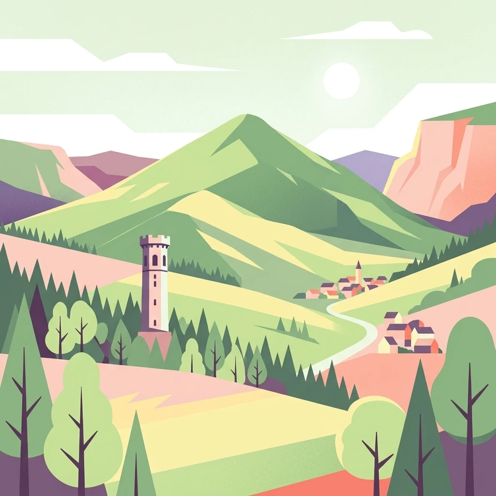
A stylized flat vector landscape illustration showing a green mountain peak, a stone tower, a small village with a church, and surrounding forests.

Donnersberg

Protected area

Park overview

Structured park overview, official facts, and landscape profile for Donnersberg

Donnersberg park facts, protected area profile, and essential visitor context

Review the core facts for Donnersberg, including designation, size, terrain, visitor scale, habitats, and operating context in one park-focused overview.

About Donnersberg

The Donnersberg is the defining natural landmark of the northern Palatinate, an isolated, dome-shaped massif that rises sharply from the surrounding rolling country between Rockenhausen, Kirchheimbolanden, and Dannenfels. Its broad summit plateau covers roughly 300 hectares and is surrounded by steep flanks, especially along its northern and western edges, while the southwestern part of the massif, the Falkensteiner Berge, breaks into a cluster of separate hills separated by deeply incised valleys.

The mountain sits within the Saar-Nahe-Bergland, the natural region that links the Saarland and the Nahe river valley. To the north and east the land drops toward the Rheinhessische Tafel- und Hügelland, producing a clear elevation contrast that makes the massif visible from far across the surrounding plains. Several streams rise on the slopes, including the Königsbach, the Wildensteiner Bach, and the Eschbach, feeding tributaries of both the Nahe and the Pfrimm and ultimately the Rhine.

Ecologically the Donnersberg is fully forested, with a mix dominated by deciduous species, roughly half beech and a quarter birch, alongside coniferous stands of spruce and pine. A particularly notable feature is a substantial grove of sweet chestnut on the eastern edge, a tree widely held to have been introduced to the Palatinate during the Roman period. Mammal fauna includes wild boar, roe deer, fox, hare, and European mouflon.

The protected status of the Donnersberg reflects both its landscape and its ecological value. Most of the massif lies within the Donnersberg landscape protection area, overlaid by a sizable Fauna-Flora-Habitat zone, with smaller nature reserves (Spendel-Wildenstein, Eschdell, Beutelfels, and Schelmenkopf-Falkenstein) clustered along the flanks. The Donnersberg is additionally one of the official national geotopes of Germany, an unusual distinction that ties its identity directly to its rare volcanic geology.

For visitors and researchers the Donnersberg functions simultaneously as a panoramic viewpoint, a hiking destination, and an open-air archaeological site. The Ludwigsturm observation tower offers long-distance views toward Rheinhessen, the Hunsrück, the Odenwald, the Black Forest, and even the skyline of Frankfurt am Main. Long-distance footpaths cross the summit, while trails such as the Keltenweg follow segments of the ancient Celtic ramparts.

Quick facts and research context for Donnersberg

The Donnersberg is a roughly 24 square kilometer massif in the Nordpfälzer Bergland, with its summit on the Königstuhl rock formation at 686.5 meters. It belongs to the Saar-Nahe-Bergland natural region and is built from Permian (Rotliegend) rhyolite, classifying it as a cryptodome rather than a true volcanic edifice. A large portion of the mountain is protected as the Donnersberg landscape protection area, established in 1978 and covering more than 50 square kilometers, while an overlapping Fauna-Flora-Habitat site covers about 81 square kilometers. The summit plateau carries the remains of a major La Tène Celtic oppidum, and five medieval castle ruins stand at the edges of the massif.

Protection and recognition

Documented terrestrial designation history and Natura 2000 records for Donnersberg

Donnersberg Protection Status and International Recognition Facts

Donnersberg holds a documented terrestrial protection status established in 1978, incorporating official Natura 2000 recognition records within its management scope. Comprehensive protection facts outline the historical designation details and international framework sources associated with the protected area.

International recognition

Protection details

Protection scope
Terrestrial
Designated year
1978
Transboundary protection
No
Park context

Deeper park guide and search-rich context for Donnersberg

Donnersberg history, landscape, wildlife, and travel context

Explore Donnersberg through its history, landscape character, ecosystems, wildlife, conservation priorities, cultural context, and seasonal travel timing in a structured park guide built for atlas discovery and search intent.

Why Donnersberg stands out

The Donnersberg is best known for combining geological, ecological, and archaeological significance in a single massif. Its identity rests on three pillars: the Permian rhyolite cryptodome that earned it national geotope status, the broad forested plateau and surrounding protected habitats, and the 240-hectare La Tène oppidum that ranks among the largest Celtic fortified settlements north of the Alps. The mountain also functions as a landmark for the entire Palatinate region, dominating the surrounding lowlands and visible from distant vantage points such as the Taunus. Its blend of dense woodland, exposed rock formations like the Königstuhl, and a sequence of medieval castle ruins gives the massif a distinctive layered character.
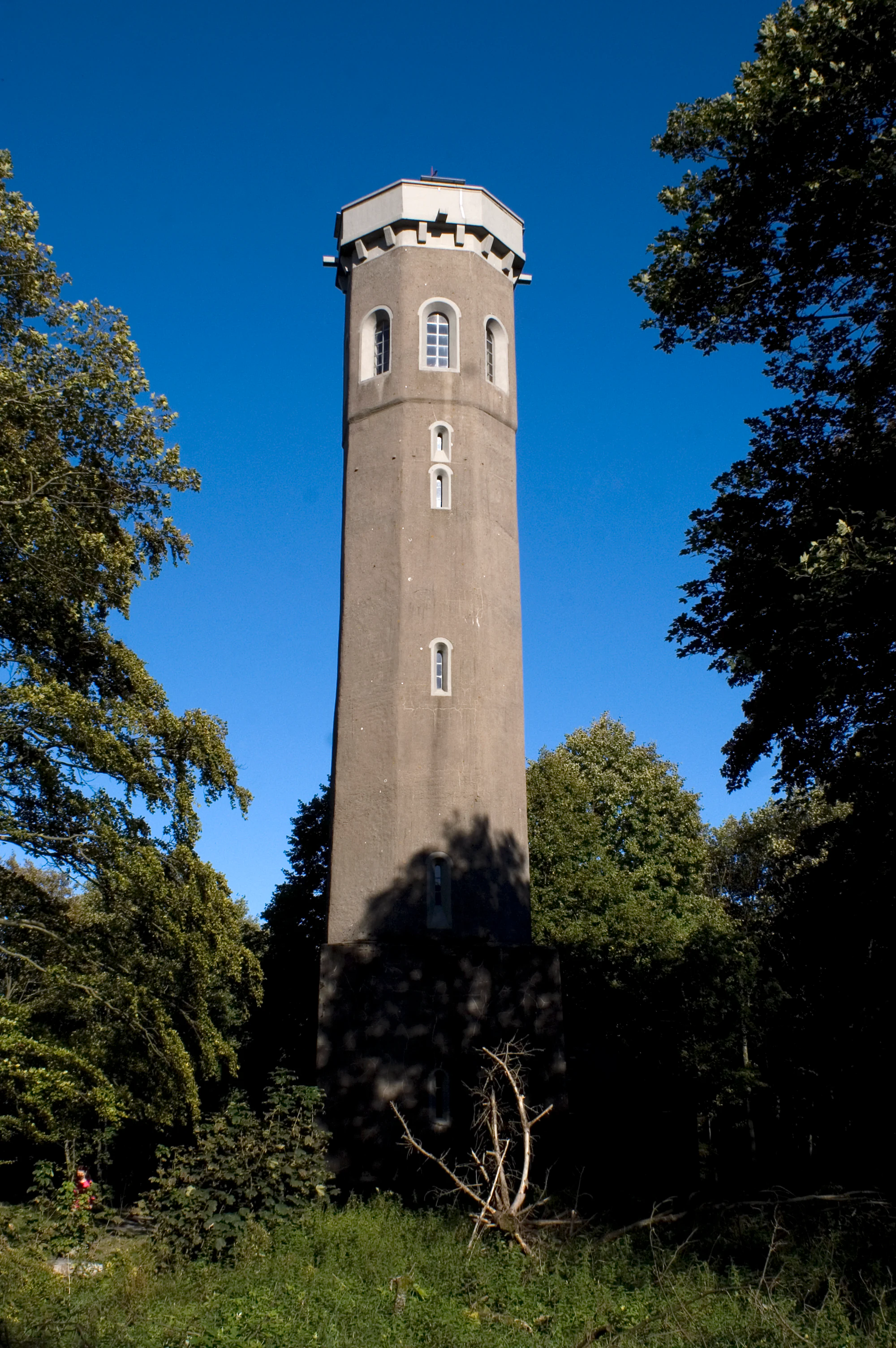
A tall, octagonal grey stone observation tower standing amidst green trees under a clear blue sky.
The Ludwigsturm, an octagonal observation tower situated on the Donnersberg plateau.

Donnersberg history and protected-area timeline

The earliest documented phase of the Donnersberg's human history belongs to the Celts. Around 150 BCE, during the La Tène period, a sizeable fortified settlement was constructed on the high plateau, enclosed by a ring wall stretching roughly 8.5 kilometers and enclosing about 240 hectares. Reconstructed sections of this wall still stand on the plateau today. The oppidum was abandoned peacefully around 50 BCE.

After the Celtic era, Germanic-speaking peoples began to settle in the foothills from the fifth century onward and more permanently from around the seventh century, though they left little visible trace on the summit itself. The mountain's strategic value became more visible in the Middle Ages, when five castles, Falkenstein, Hohenfels, Ruppertsecken, Tannenfels, and Wildenstein, were positioned on its flanks and surrounding ridges. All survive today as ruins.

In 1370, Heinrich II of Sponheim-Bolanden handed a hermit's chapel dedicated to Saint James the Elder, standing on the summit, to the Pauline Hermits, establishing the Monastery of St. Jakob. The monks cleared land within the old Celtic ramparts and farmed the area for self-sufficiency. Following the Reformation, the monastery was secularized around 1554 into a farm estate with around 70 hectares of fields and meadows, which operated until 1854. After that, the Kingdom of Bavaria acquired the area and reforested it, creating the wooded summit landscape seen today.

The mountain's name in turn shaped administrative geography: after 1797/98 it gave its name to the French Département du Mont-Tonnerre, and in 1969 it lent its name to the modern Donnersbergkreis district of Rhineland-Palatinate.

Donnersberg landscape and geographic character

The Donnersberg massif spans roughly 24 square kilometers, stretching about 7 kilometers from Bastenhaus in the northeast to Imsbach in the southwest and about 4.5 kilometers from the Marienthaler Mordkammerhof in the northwest to the Steinbach settlement of Haus Kaiserbusch in the southeast. Its summit, the Königstuhl, stands prominently at the southwestern edge of the plateau.

The high plateau itself is a relatively flat area of some 300 hectares at the top of the Hohen Donnersberg, bordered by steep slopes that fall sharply on the northern and western flanks. From the summit the land drops 344 meters to the church at Marienthal and more than 410 meters down to Steinbach. The southwestern part of the massif, the Falkensteiner Berge, is more dissected, with individual summits including the Gebrannter Berg (651.5 meters), the Bickberg, the Dorntreiber Kopf, the Kübelberg, the Hühnerberg, the Katharinenberg, and the Schartenrück separated by deeply cut valleys.

Sprinkled across the rocky flanks are a number of named rock formations, among them the Beutelfels, the Falkenstein rock, the Hahnweiler Beutelfels, the Dampfnudelfelsen, the Hirtenfels, the Hohenfels, the Kanzel, the Langenfels, the Moltkefelsen, the Rehbockfelsen, the Reißender Fels, and the Tannenfels. Many of these serve as viewpoints. From the massif, water flows radiate outward to the moraine and forest country of the northern Palatinate and onward via the Appelbach and Nahe to the Rhine, while southern streams descend toward the Pfrimm and ultimately the same great river.
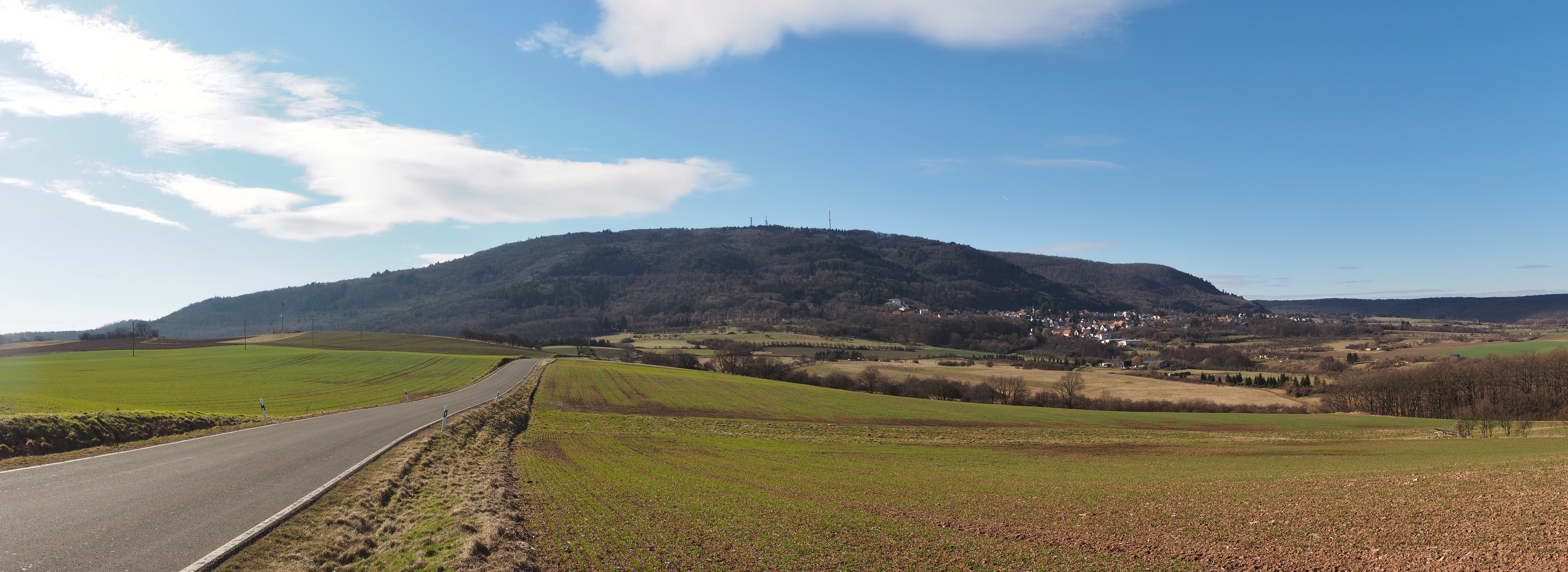
A wide, scenic view of the Donnersberg mountain range from the east, featuring a paved road in the foreground and rolling agricultural fields leading to the forested mountain slope.
A view of the Donnersberg massif from the east, showing the mountain's prominence above the surrounding farmland.

Donnersberg ecosystems, habitats, and plant life

The Donnersberg's ecological character is shaped by its status as a fully forested mid-elevation massif embedded in the agricultural matrix of the northern Palatinate. Its plateau and slopes support a balanced mix of broadleaf and coniferous forest that gives the mountain a notably green, almost unbroken canopy when viewed from below.

Deciduous woodland dominates, with beech making up roughly half of the broadleaf cover and birch about a quarter. Among conifers, spruce and pine are the most common species, filling the more siliceous, rocky parts of the slopes. A particularly distinctive feature is a substantial stand of sweet chestnut along the eastern edge of the massif, a tree widely associated with Roman-era introduction to the Palatinate and now a recognizable component of the mountain's forest profile.

The protected-area framework reinforces the Donnersberg's ecological value. The Donnersberg landscape protection area, designated in 1978, covers more than 50 square kilometers, while the overlapping Donnersberg Fauna-Flora-Habitat site covers about 81 square kilometers. Smaller nature reserves, including Spendel-Wildenstein along the Wildensteiner Bach, Eschdell on the northern flank, and Beutelfels and Schelmenkopf-Falkenstein on the southwestern margins, protect particularly sensitive rocky and forest communities.

As one of the larger forested elevations in an otherwise open region, the Donnersberg provides a continuous wildlife corridor and habitat refuge within the Nordpfälzer Bergland, allowing forest-dwelling mammals and birds to maintain populations in an otherwise densely cultivated landscape.
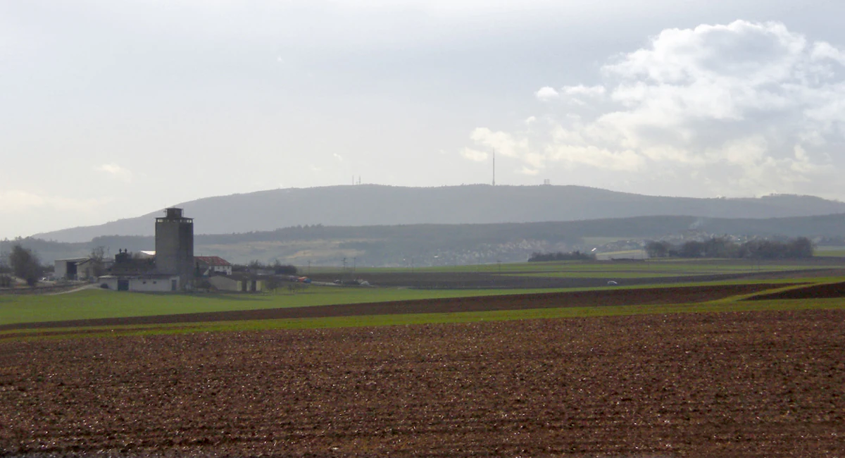
A wide landscape view of the Donnersberg mountain massif in Germany, seen from the east across open agricultural fields, with a farm building visible in the foreground left.
A wide view of the Donnersberg mountain massif seen from the east, overlooking agricultural fields.

Donnersberg wildlife and species highlights

The forested slopes and plateau of the Donnersberg support a community of typical central European forest fauna. Wild boar and roe deer are regular inhabitants, alongside foxes and hares, all of which are well adapted to mixed broadleaf and coniferous woodland with open clearings.

A particularly interesting presence is the European mouflon, a wild sheep species introduced in various German uplands, which finds refuge here in the rougher, more rocky terrain of the massif. The combination of closed forest, edge habitats along field boundaries, and harsh rocky outcrops creates a varied setting that supports both small ground-dwelling mammals and larger ungulates.

The protected-area network around the Donnersberg, including the extensive landscape protection area, the Fauna-Flora-Habitat zone, and smaller nature reserves, helps maintain these populations by limiting intensive land use and preserving forest continuity across the massif.
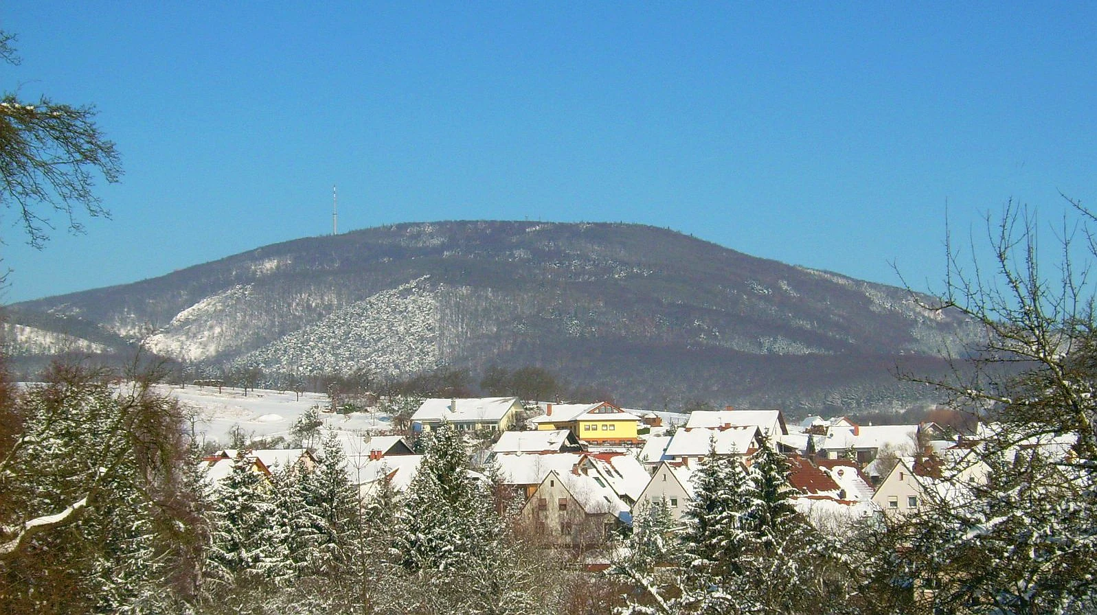
A wide view of a large, snow-covered mountain massif rising behind a small village, under a clear blue sky in winter.
The Donnersberg massif viewed from the village of Steinbach in winter.

Donnersberg conservation status and protection priorities

The Donnersberg holds a distinctive position in German conservation through the unusual combination of its recognized geological value and its extensive protected-area coverage. In 2019 it was officially listed among Germany's nationally significant geotopes (Nationaler Geotop), reflecting the geological importance of its Permian rhyolite cryptodome.

Beyond its geological status, the mountain is protected across multiple administrative layers. The Donnersberg landscape protection area, established on 29 September 1978 and covering more than 50 square kilometers, forms the broad protective envelope. An overlapping Fauna-Flora-Habitat site covers about 81 square kilometers under the European Habitats Directive. Within this framework, the smaller nature reserves of Spendel-Wildenstein, Eschdell, Beutelfels, and Schelmenkopf-Falkenstein protect specific forest and rock habitats, including the chestnut groves on the eastern edge and the cliff communities of the southwestern ridges.

Together these designations make the Donnersberg a key conservation node within the Nordpfälzer Bergland, preserving both relict forest communities and a nationally important geological exposure that would otherwise be vulnerable to quarrying and forestry pressure.

Donnersberg cultural meaning and human context

The Donnersberg carries a deep and layered cultural identity that reaches back more than two millennia. Its dominant feature is the La Tène oppidum, one of the largest known Celtic fortified settlements north of the Alps, whose 8.5-kilometer ring wall remains partially visible on the summit plateau. This archaeological landscape is actively explored through the Keltenweg trail and various local heritage associations.

In the Middle Ages, the strategic value of the massif led to the construction of five castles on its flanks and ridges: Falkenstein, Hohenfels, Ruppertsecken, Tannenfels, and Wildenstein. All survive as ruins and are integrated into modern hiking routes. The summit itself became a religious site with the 1370 foundation of the Monastery of St. Jakob by the Pauline Hermits, a community that shaped agriculture on the plateau until secularization after the Reformation.

The mountain's prominence in regional identity is reflected in its repeated use as an administrative toponym. After the French revolutionary period it gave its name to the Département du Mont-Tonnerre, and in 1969 the modern German district of Donnersbergkreis inherited the same regional anchor. Today the Ludwigsturm observation tower continues the long tradition of celebrating the Donnersberg as a viewing point over the Palatinate and beyond.
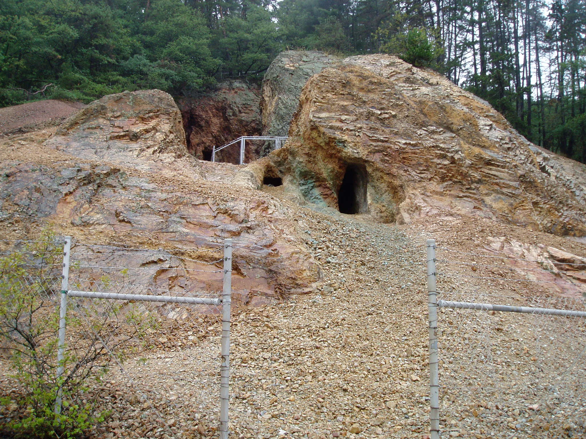
A view of the entrance to an old, small copper mine carved into a rocky, reddish-brown rhyolite hillside, secured with a chain-link fence in the foreground.
The entrance to the historic Katharina I copper mine located within the Donnersberg massif, showcasing its distinctive rhyolite rock formations.

Top sights and standout views in Donnersberg

The Donnersberg combines three defining layers: a nationally recognized Permian rhyolite cryptodome, one of the largest La Tène Celtic oppida north of the Alps, and a network of medieval castle ruins encircling its flanks. The summit plateau preserves sections of the Celtic ring wall, the late medieval monastery site now used as a forested recreation area, and the 1864/65 Ludwigsturm observation tower with views toward the Hunsrück, Odenwald, Black Forest, and Frankfurt.

Ecologically the mountain stands out for its fully forested massif, beech-dominated broadleaf woodland with notable sweet chestnut stands along the eastern slope, and an unusually extensive protected-area framework that includes a landscape protection area, a Fauna-Flora-Habitat zone, and several smaller nature reserves. The mountain's role as the highest peak of the Palatinate makes it both a regional landmark and a national geotope, linking geology, archaeology, and ecology in a single accessible site.
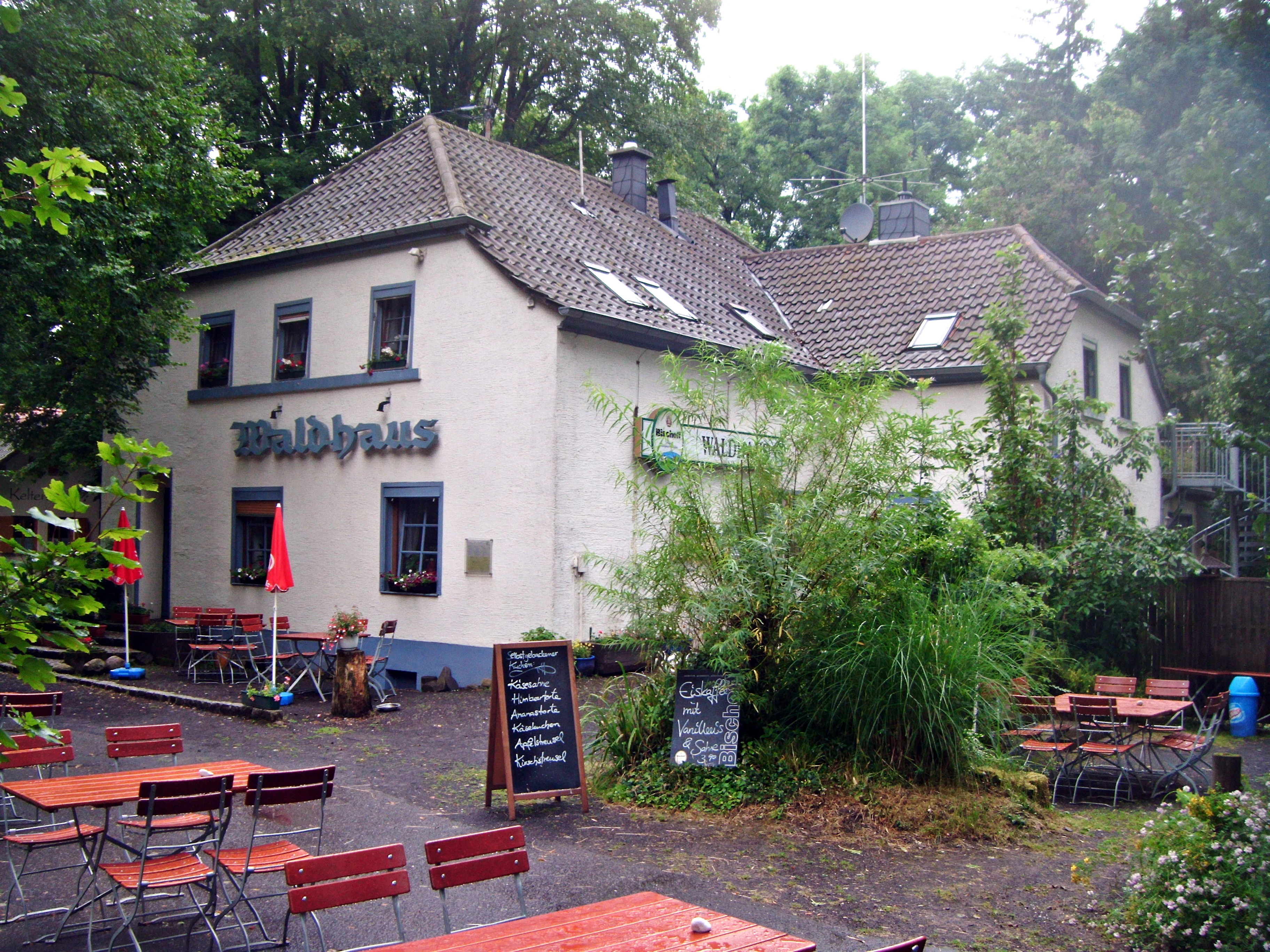
A two-story building named Waldhaus with outdoor seating, red tables, and chairs in a forest setting on Donnersberg mountain.
The Waldhaus restaurant located on Donnersberg mountain.

Best time to visit Donnersberg

The Donnersberg can be visited throughout the year, with each season offering different experiences. Late spring through early autumn is generally the most rewarding period for hiking, when the forests are fully leafed out, the long-distance trails are clearly marked, and the Ludwigsturm observation tower offers wide views over Rheinhessen, the Hunsrück, the Odenwald, and on clear days even toward the Black Forest and Frankfurt.

Winter brings a quieter atmosphere and the chance to use the cross-country ski trails groomed at around 550 meters elevation, while summer offers longer daylight for combining the Celtic ramparts, the castle ruins, and the geological sites near Imsbach into a single visit. The Keltenhütte near the Ludwigsturm is typically open on weekends and public holidays, and the mountain's panoramic viewpoint works especially well in stable, clear weather when haze over the Rhine lowlands is reduced.

Monthly climate preview

Long-term monthly temperature swings and precipitation patterns across representative terrain

Donnersberg Climate Normals: Annual Temperature and Precipitation Rhythm

Representative coordinate records show mean monthly temperatures ranging from near freezing to warm summer peaks alongside steady precipitation throughout the year. Reviewing the complete twelve-month profile provides deeper insight into measured climate normals across the terrain.
Annual mean10 °C
0 °C20 °C
Jan
Feb
Mar
Apr
May14°
Jun18°
Jul20°
Aug20°
Sep15°
Oct10°
Nov
Dec
Warmest month
July

20.4 °C

Coolest month
January

0.3 °C

Wettest month
July

2.2 mm/day

Driest month
April

1.4 mm/day

Park location guide

Geography guide, regional context, and park location map for Donnersberg

Donnersberg park geography, regions, and map view in Germany

Understand where Donnersberg sits in Germany through a broader geographic reading of the surrounding landscape, nearby location context, and its mapped position within the national park landscape.

How Donnersberg fits into Germany

Germany is a federal republic in Western and Central Europe with a population of over 83 million across sixteen constituent states. It is Europe's largest economy by nominal GDP and a major global exporter and importer. The capital is Berlin, and the country borders Denmark, Poland, Czech Republic, Austria, Switzerland, France, Luxembourg, Belgium, and the Netherlands.

Wider geography shaping Donnersberg in Germany

Germany is located in Western and Central Europe, spanning 357,022 km². It borders Denmark to the north, Poland and the Czech Republic to the east, Austria and Switzerland to the south, and France, Luxembourg, Belgium, and the Netherlands to the west. The country has coastlines on the Baltic Sea and North Sea to the north, with the Alps located in the southern region.

Map view of Donnersberg

Use this park location map to pinpoint Donnersberg in Germany, understand its exact geographic position, and read its mapped placement within the surrounding landscape more clearly.

Pigeon | © OpenStreetMap contributors

Location context for Donnersberg

Rhineland-Palatinate
Recorded earthquake history

Examine the Recorded Earthquake History of the Donnersberg Massif

Browse the historical catalogue of seismic events identified within the vicinity of the Donnersberg massif. MoriAtlas organizes these records by proximity to provide a factual, location-based overview of documented regional activity.

Donnersberg Earthquake History

Catalogued events

25 events

Strongest magnitude

Magnitude 3.8

Most recent event

May 17, 2014

This history includes earthquakes recorded inside the park or within 50 km of its borders

Explore photographic records of the forested plateau, rocky outcrops, and protected habitats.

Donnersberg Photos and Landscape Scenery: Visualizing the Palatinate Massif

Visual documentation captures the rugged topography, beech woodland, and exposed rhyolite formations that define the terrain of Donnersberg. Examining these protected habitats and regional viewpoints provides a clearer understanding of the ecological and geological character of the massif.

A tall, octagonal grey stone observation tower standing amidst green trees under a clear blue sky.

A wide shot of a green, rowed agricultural field in the foreground leading to the Donnersberg mountain massif in the distance under a clear blue sky.

A wide, scenic view of the Donnersberg mountain range from the east, featuring a paved road in the foreground and rolling agricultural fields leading to the forested mountain slope.

A wide landscape view of the Donnersberg mountain massif in Germany, seen from the east across open agricultural fields, with a farm building visible in the foreground left.

A wide view of a large, snow-covered mountain massif rising behind a small village, under a clear blue sky in winter.

A one story alpine style building with a red tiled roof and light colored walls surrounded by bare trees in early spring.

A view of the entrance to an old, small copper mine carved into a rocky, reddish-brown rhyolite hillside, secured with a chain-link fence in the foreground.

A two-story building named Waldhaus with outdoor seating, red tables, and chairs in a forest setting on Donnersberg mountain.

Park atlas

Compare surrounding regional geography and adjacent protected areas

Exploring Parks Near Donnersberg and Related Protected Landscapes

Browsing other protected areas near Donnersberg reveals the broader upland terrain and forested reserves of the surrounding Palatinate region. Comparing these adjacent natural spaces provides valuable context for understanding regional park geography and upland conservation networks.
Nature reserveDonnersbergkreis
Mapped location lies within the park boundary#1 closest

Southwest

Beutelfels Nature Reserve: Geographic Insights and Protected Landscape Mapping

A diverse forested landmark in the Donnersbergkreis district

Located in the Falkensteiner Berge range, Beutelfels represents a significant protected area within the German landscape. The reserve showcases a dense integration of maple-linden forests and open rocky outcrops, preserved as a dedicated forest reference plot. Discover the unique topography and ecological zoning that define this essential 59-hectare segment of the Nordpfälzer Bergland.

Area
0.59 km²
Established
1981
Relief
Mountain
Climate
Temperate
Nature reserveRheinland-Pfalz
Mapped location lies within the park boundary#2 closest

South

Spendel-Wildenstein Nature Reserve: Protected Forest Boundaries and Regional Geography

Deciduous forest reference area in the Donnersbergkreis district

Discover the geographic and ecological structure of Spendel-Wildenstein, a 145-hectare protected forest area in Germany. This nature reserve serves as a crucial natural forest reference site, known for its layered woodland communities, including rare Montpellier maple-oak and maple-ash stands situated along the Wildensteiner Bach stream valley.

Area
1.45 km²
Established
1981
Nature reserveDonnersbergkreis
Mapped location lies within the park boundary#3 closest

Northeast

Steinbühl-Schäfergraben: A Protected Porphyry Quarry Landscape in Donnersbergkreis

Managed conservation grazing for open habitat biodiversity

Steinbühl-Schäfergraben represents a rare convergence of industrial history and conservation science, where an abandoned porphyry quarry has been transformed into a species-rich protected landscape. By employing year-round grazing with hardy livestock, the site retains its open, rocky character, contrasting with the surrounding woodlands of the Donnersbergkreis. This location provides essential insight into land reclamation and the development of open-terrain ecosystems on post-industrial ground.

Area
0.67 km²
Established
1998
Nature reserveDonnersbergkreis
About 4.3 km away#4 closest

Northwest

Langhöll-Falkenberg Nature Reserve and Protected Landscape in Donnersbergkreis

Mapping the ecological gradient of this North Palatine valley reserve.

Langhöll-Falkenberg represents a distinct protected zone where dry upland slopes meet moist valley floor environments. The reserve functions as an essential habitat mosaic, combining semi-dry grasslands with alder carr and spring-fed mires. This structured view examines the site topography and its role in regional conservation across the North Palatine uplands of Rhineland-Palatinate.

Area
1 km²
Established
1999
IUCN
IV
Protected landscapeRhineland-Palatinate
About 6.1 km away#5 closest

North

Rheinhessische Schweiz: Protected Landscape and Regional Geography in Rhineland-Palatinate

Forested ridges and dry heathland terrain

Rheinhessische Schweiz represents a significant protected area defined by its dense deciduous forests, narrow valleys, and nutrient-poor porphyry soils. This atlas entry details the geographic composition of the Wiesener Randhöhen and the Neubamberger Riegel, highlighting the unique dry grassland ecosystems preserved within these North Palatine Uplands boundaries.

Area
67.66 km²
Established
1961
Relief
Upland
Climate
Temperate
Watercolor painting of a heathland landscape with rolling hills, purple heather, and scattered pine trees.
Nature reserveRhineland-Palatinate
8.5 km away#6 closest

South

Mehlinger Heide Nature Reserve: Geography and Protected Heathland Atlas of Rhineland-Palatinate

A rare mosaic of inland sandy heath and dry grassland habitats

Spanning over 400 hectares in Rhineland-Palatinate, Mehlinger Heide offers a distinctive protected area featuring inland dunes and dwarf-shrub heath. This nature reserve presents an unusual ecological environment within Germany, supporting specialised insect and bird populations through its open pioneer habitats and remnants of historic military training grounds. Explore the mapped terrain and natural boundaries of this significant conservation site.

Area
3.99 km²
Established
2001
IUCN
IV
Relief
Upland
A soft, light watercolor painting of a rolling rural landscape featuring rows of vineyards in the foreground and tree-covered hills in the distance.
Nature reserveRheinland-Pfalz
11 km away#7 closest

Southeast

Haardtrand Nature Reserve: Geographic Overview and Protected Landscape Mapping

Bird protection area within the Rheinland-Pfalz region.

Spanning roughly 14,700 hectares, Haardtrand serves as a critical link between the Palatinate Forest and the Rhine valley. This nature reserve is composed of a distinctive mosaic of habitat types, including mature broadleaf woodlands, traditional orchard meadows, and sandy terraces, which together create a highly structured environment for diverse raptors and forest-dwelling bird species.

Area
147.28 km²
Established
2004
A horizontal watercolor painting of rolling green hills, a small stream, and forested slopes against a pale sky.
Protected areaRheinland-Pfalz
12 km away#8 closest

West

Königsberg Protected Area: Geography, Forest Habitats, and Regional Landscape Identity

Examining the mountain ridges of the Nordpfälzer Bergland

Königsberg stands as a prominent mountain massif in the German state of Rheinland-Pfalz. This protected landscape is characterized by deep mixed beech-oak forests, significant geological scree formations, and an intricate history of mining. Its ridge-line terrain provides a critical study of upland geography, separating regional valleys while hosting a diverse array of protected natural habitats and medieval heritage sites.

Area
10.47 km²
Relief
Mountain
Climate
Temperate
Access
Moderate access

Common questions about visiting, size, designation, and location context for Donnersberg

Donnersberg FAQs for park facts, access, geography, and protected area context

Find quick answers about Donnersberg, including protected-area facts, park geography, trail and visitor context, and how the park fits into its surrounding country and regional landscape.
MoriAtlas Explorer

Continue Your Protected Areas Search Across the Global Atlas

Deepen your exploration by continuing the structured search for national parks and protected areas worldwide. Utilize the comprehensive filtering capabilities to compare different conservation landscapes and refine your understanding of global park geography. Discover more about the distribution and characteristics of protected natural areas.

Global natural geography