
Mori Atlas logo
Wildlife reserveDugger Mountain Wilderness

A protected wilderness reserve featuring steep forested ridges and unbroken topographic corridors

Dugger Mountain Wilderness: Analyzing Alabama's Rugged Appalachian Mountain Landscape

Dugger Mountain Wilderness stands as a significant protected landscape within the Talladega National Forest in northeastern Alabama. Covering nearly 9,200 acres, this roadless terrain encompasses the state's second-highest peak and provides essential habitat for rare plant communities. The area serves as a vital component of the Appalachian fringe, offering an isolated, mountainous environment that remains largely free from fragmentation and developmental impact.

wilderness areaupland forestAppalachian foothillsrare plant communitiesroadless areaTalladega National Forest
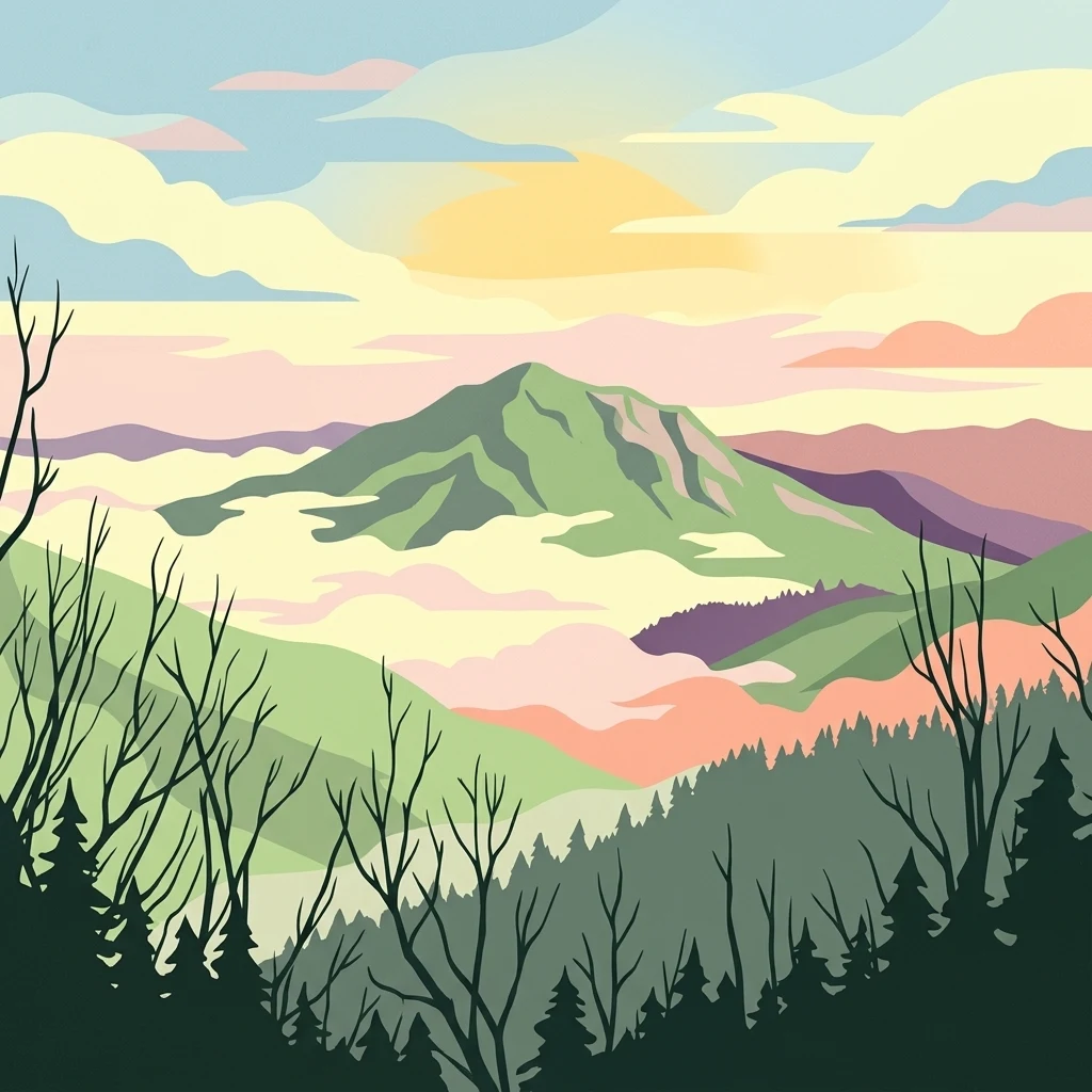
A stylized illustration showing a green mountain peak rising above a misty, layered valley with dark silhouetted trees in the foreground and a soft, pastel-colored sunset sky above.

Dugger Mountain Wilderness

Wildlife reserve

Park overview

Structured park overview, official facts, and landscape profile for Dugger Mountain Wilderness

Dugger Mountain Wilderness park facts, protected area profile, and essential visitor context

Review the core facts for Dugger Mountain Wilderness, including designation, size, terrain, visitor scale, habitats, and operating context in one park-focused overview.

About Dugger Mountain Wilderness

Dugger Mountain Wilderness occupies a distinctive place in Alabama's protected landscape system as the state's newest and third designated wilderness area. It lies within the Talladega National Forest, unfolding across the steep, forested ridges of northeastern Alabama between Anniston and Piedmont. The wilderness takes its name from Dugger Mountain, which at about 2,140 feet is the second-highest peak in the state and rises prominently above the surrounding Appalachian foothills.

The area's protected status reflects both its scenic value and its ecological importance. Of the mountain's roughly 16,000 acres, most were too steep for profitable timber harvesting, which helped preserve extensive stands of older forest and unusual plant communities. When these lands were formally designated as wilderness in April 2000, they became not only a refuge for native vegetation but also one of the last large roadless tracts remaining in Alabama's national forests.

Beyond conservation, the wilderness plays a meaningful role in regional outdoor recreation. The Pinhoti National Recreation Trail winds through the area, providing a rugged backcountry experience and connecting Dugger Mountain to a broader hiking network that links the southern Appalachians to longer-distance routes. Today the wilderness is valued as a quiet, forested refuge where steep ridges, uncommon plant communities, and a classic Appalachian-style landscape converge within easy reach of small Alabama communities.

Quick facts and research context for Dugger Mountain Wilderness

Dugger Mountain Wilderness sits within the Talladega National Forest in Calhoun and Cleburne counties of northeastern Alabama, with the nearby city of Piedmont serving as the most accessible gateway community. Designated in April 2000, the wilderness covers about 9,200 acres and is managed by the U.S. Forest Service under an IUCN Category Ib designation. It protects the slopes around Dugger Mountain, the second-highest peak in Alabama at approximately 2,140 feet, and remains one of the last intact roadless landscapes in Alabama's national forest system. The Pinhoti National Recreation Trail passes through the wilderness, reinforcing its role as both a conservation area and a long-distance hiking corridor.

Protection and recognition

Terrestrial conservation framework, management scope, and recognition records

Dugger Mountain Wilderness Protection Status and Official Designation Facts

Dugger Mountain Wilderness maintains a defined terrestrial protection scope within the global conservation network. Official administrative records document the baseline management status and designated geographical boundaries.

Protection details

Protection scope
Terrestrial
Park context

Deeper park guide and search-rich context for Dugger Mountain Wilderness

Dugger Mountain Wilderness history, landscape, wildlife, and travel context

Explore Dugger Mountain Wilderness through its history, landscape character, ecosystems, wildlife, conservation priorities, cultural context, and seasonal travel timing in a structured park guide built for atlas discovery and search intent.

Why Dugger Mountain Wilderness stands out

Dugger Mountain Wilderness is best known for preserving one of the last intact roadless areas in Alabama's national forests and for protecting rare and threatened plant communities on the steep slopes around Dugger Mountain, Alabama's second-highest peak. The wilderness is also recognized for the segment of the Pinhoti National Recreation Trail that crosses its rugged ridges, linking it to one of the Southeast's most significant long-distance footpaths.
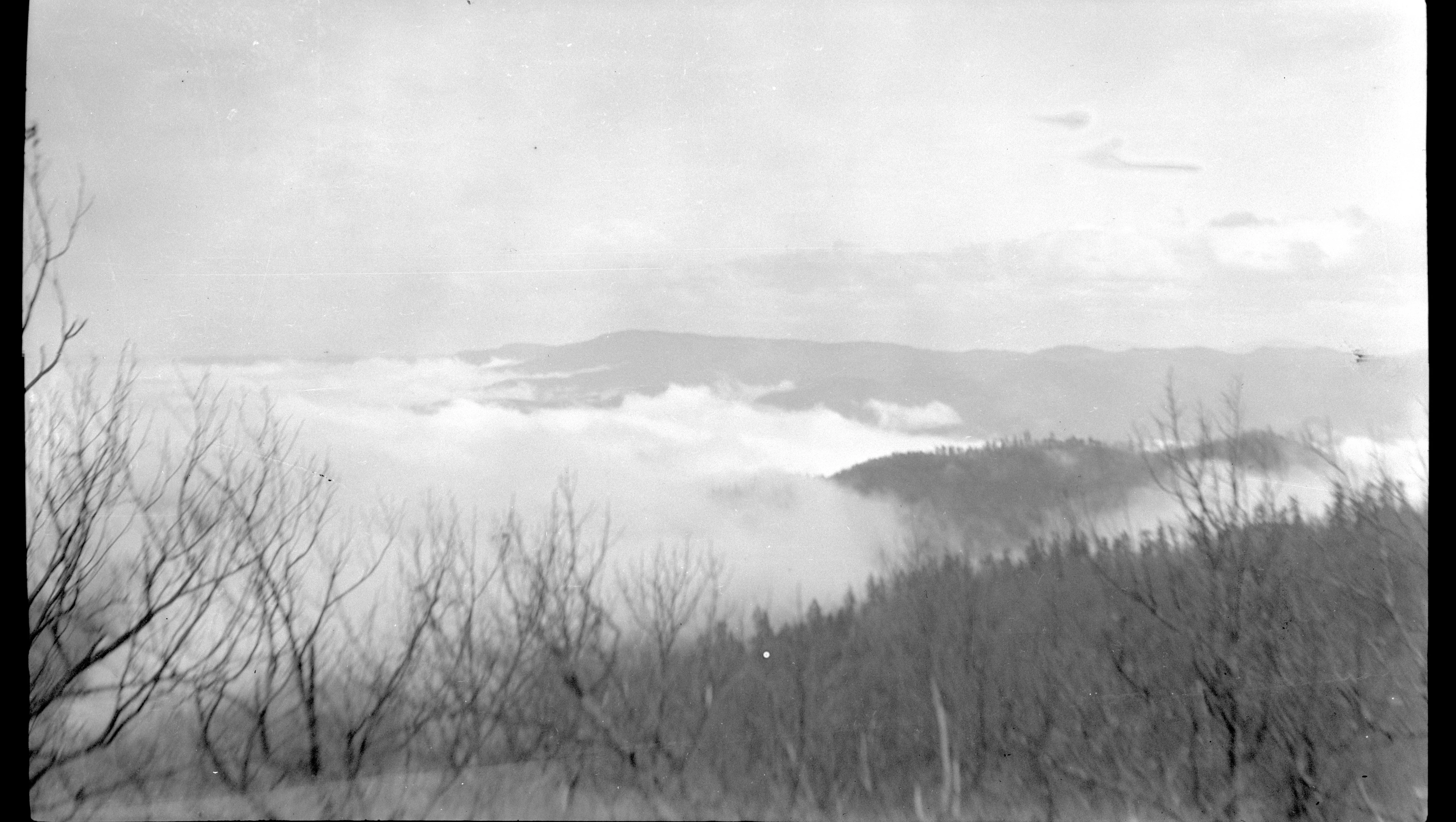
A black and white landscape photograph showing rolling mountain ridges partially obscured by a thick blanket of fog, viewed through bare trees in the foreground.
A view of low-lying fog filling the valleys south of Dugger Mountain.

Dugger Mountain Wilderness history and protected-area timeline

Dugger Mountain Wilderness has a relatively recent administrative history, with its formal designation coming in modern times rather than through the early-twentieth-century movement that established many of America's first wilderness areas.

The land that would eventually become the wilderness was part of the Talladega National Forest in northeastern Alabama, where steep terrain along Dugger Mountain limited the feasibility of commercial timber harvesting. Because much of the mountain's roughly 16,000 acres were too rugged to log profitably, large stands of older forest and unusual plant communities were able to persist with relatively limited industrial disturbance. This de facto protection created one of the last substantial roadless areas in Alabama's national forest system.

In April 2000, this landscape received formal recognition when Dugger Mountain was designated as Alabama's third and newest wilderness area, covering approximately 9,200 acres across Calhoun and Cleburne counties. Since then it has been managed by the U.S. Forest Service as a congressionally designated wilderness under the protections that come with that status, including restrictions on road-building, motorized use, and other forms of development.

Dugger Mountain Wilderness landscape and geographic character

Dugger Mountain Wilderness is defined by the rugged, mountainous terrain at the southern edge of the Appalachian system. The wilderness surrounds Dugger Mountain, the second-highest peak in Alabama, which rises to roughly 2,140 feet above the surrounding foothills between Anniston and Piedmont. Rather than dramatic alpine forms, the landscape offers steep, forested ridges, narrow hollows, and long, uninterrupted slopes that are characteristic of inland Alabama's hill country.

The terrain is widely described as among the most rugged in the state. Many of the slopes are too steep for past timber harvesting practices, which has left large tracts forested and unusually free from fragmentation by roads or clearings. As a result, the wilderness retains a continuous, roadless ridgeline and a sense of topographic isolation that is uncommon elsewhere in Alabama's national forests.

Views from upper elevations open out across the surrounding valleys and neighboring ridges of the Talladega National Forest, providing a sense of the broader Appalachian landscape stretching into northeastern Alabama. Fog is a recurring feature of the higher ground, frequently softening the contours of the ridges and contributing to the atmospheric character of the wilderness.

Dugger Mountain Wilderness ecosystems, habitats, and plant life

The ecological character of Dugger Mountain Wilderness reflects the intersection of southern Appalachian influences and the distinctive conditions of Alabama's Ridge and Valley country. The wilderness preserves large, contiguous blocks of upland forest that have been shaped by steep topography, shallow soils, and a long history of limited industrial disturbance. These conditions have allowed unusual and unusually intact plant communities to persist across the slopes.

The area is known for harboring several rare, endangered, or otherwise threatened plant communities, a feature that distinguishes Dugger Mountain from much of the surrounding, more heavily managed national forest land. The combination of high ridge environments, shaded north-facing slopes, and sheltered coves creates a mosaic of habitat types within a relatively compact area.

Because the wilderness includes both upper-elevation terrain and lower creek bottoms and hollows, it supports a layered forest cover ranging from drier ridge-top communities to more mesic forests along the drainages. This internal diversity gives the wilderness sustained ecological value well beyond its relatively modest size, reinforcing its importance as a refuge for native vegetation in a region where most forestland has been altered by past land use.

Dugger Mountain Wilderness conservation status and protection priorities

Dugger Mountain Wilderness represents one of the most significant conservation achievements in Alabama's national forest system in recent decades. Its designation in 2000 closed a long-standing gap by formally protecting a large, intact roadless landscape that had previously existed largely by accident of difficult terrain rather than by deliberate conservation policy.

The wilderness shelters several rare, endangered, and threatened plant communities, giving it an outsized importance for plant conservation in the region. Its roadless character also benefits broader forest health by maintaining watershed function, protecting soils on steep slopes, and providing habitat conditions for wildlife species sensitive to fragmentation.

Administered by the U.S. Forest Service under the protections afforded by the Wilderness Act, Dugger Mountain Wilderness is shielded from road construction, motorized vehicle use, commercial development, and other activities that would alter its wild character. This legal and administrative framework ensures that the ecological values of the area can be maintained over the long term, even as surrounding lands continue to face pressures from logging, development, and other uses.

Top sights and standout views in Dugger Mountain Wilderness

Dugger Mountain Wilderness stands out as Alabama's newest wilderness area and one of the state's last intact roadless landscapes, wrapped around the second-highest peak in Alabama. Its defining qualities include exceptionally rugged ridge terrain, rare and threatened plant communities, and a long, undeveloped corridor of the Pinhoti National Recreation Trail that links it to the broader Appalachian hiking network.

The wilderness is managed by the U.S. Forest Service within the Talladega National Forest and reflects the type of Appalachian-margin landscape that has become increasingly rare in the Southeast: contiguous forest, protected watersheds, and a sense of quiet isolation despite being close to small Alabama communities like Piedmont and Anniston.

Best time to visit Dugger Mountain Wilderness

Dugger Mountain Wilderness is broadly accessible year-round, but spring and fall are often the most rewarding seasons to experience the landscape. Spring brings fresh green foliage, mild temperatures for hiking the Pinhoti National Recreation Trail, and active wildlife and plant communities across the slopes. Fall is notable for cooler air, colorful leaf change along the ridges, and the recurring fog and low clouds that drift across Dugger Mountain.

Summer can be hot and humid at lower elevations, though the forested cover and elevation of the ridgelines offer some relief; winter brings cooler temperatures, occasional frost, and a stark, open view of the surrounding valleys. Because the wilderness is roadless, rugged, and remote in character, visitors should plan for conditions on actual mountain terrain rather than the gentler foothills common elsewhere in the Talladega National Forest.

Monthly climate preview

Long-term representative point measurements and monthly climate patterns across the protected terrain

Dugger Mountain Wilderness Climate Normals, Annual Temperature and Precipitation Rhythm

Historical climate data for Dugger Mountain Wilderness reveals measured shifts in monthly average temperatures and daily precipitation rates based on long-term representative coordinate sampling. Reviewing the complete twelve-month profile provides deeper analytical context on annual atmospheric cycles within the protected area.
Annual mean16 °C
5 °C27 °C
Jan
Feb
Mar11°
Apr16°
May21°
Jun25°
Jul27°
Aug26°
Sep23°
Oct17°
Nov10°
Dec
Warmest month
July

26.7 °C

Coolest month
January

4.8 °C

Wettest month
February

4.4 mm/day

Driest month
October

2.7 mm/day

Park location guide

Geography guide, regional context, and park location map for Dugger Mountain Wilderness

Dugger Mountain Wilderness park geography, regions, and map view in United States of America

Understand where Dugger Mountain Wilderness sits in United States of America through a broader geographic reading of the surrounding landscape, nearby location context, and its mapped position within the national park landscape.

How Dugger Mountain Wilderness fits into United States of America

The United States of America is a federal presidential republic and one of the world's largest countries by area and population. It consists of 50 states across a vast territory spanning multiple time zones, with its capital in Washington, D.C. and largest city in New York City. The nation has a diverse economy, influential political system, and significant cultural and military presence globally.

Wider geography shaping Dugger Mountain Wilderness in United States of America

The United States occupies a vast territory in North America, bordered by Canada to the north and Mexico to the south. The 48 contiguous states stretch from the Atlantic to the Pacific Ocean, while Alaska occupies the northwestern region and Hawaii is an archipelago in the Pacific. The country encompasses diverse terrain including the Rocky Mountains, Appalachian Mountains, Great Plains, and extensive river systems.

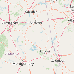
Map view of Dugger Mountain Wilderness

Use this park location map to pinpoint Dugger Mountain Wilderness in United States of America, understand its exact geographic position, and read its mapped placement within the surrounding landscape more clearly.

Pigeon | © OpenStreetMap contributors

Location context for Dugger Mountain Wilderness

Alabama
Recorded earthquake history

Explore Historical Earthquake Records Near Dugger Mountain Wilderness

Review documented seismic events that have occurred in the vicinity of Dugger Mountain Wilderness. This MoriAtlas catalogue provides a structured look at past epicenter data within the Talladega National Forest, enabling a clear perspective on regional geological history without predictive modeling.

Dugger Mountain Wilderness Earthquake History

Catalogued events

1 event

Strongest magnitude

Magnitude 3.2

Most recent event

May 6, 2010

This history includes earthquakes recorded inside the park or within 50 km of its borders

Explore protected ridge terrain, upland forest habitats, and Appalachian hill country views.

Dugger Mountain Wilderness Photos and Landscape Scenery Visual Guide

Visual documentation captures the steep forested ridges, roadless valleys, and rugged terrain defining Dugger Mountain Wilderness. Detailed photography reveals the unique upland habitats and atmospheric mountain conditions shaping this protected Alabama landscape.

A black and white landscape photograph showing rolling mountain ridges partially obscured by a thick blanket of fog, viewed through bare trees in the foreground.

Park atlas

Compare regional park geography and connected Appalachian forest landscapes

Explore Parks Near Dugger Mountain Wilderness and Surrounding Protected Areas

Visitors can browse other protected areas near Dugger Mountain Wilderness to examine neighboring ridge terrain and forest reserves across the region. Reviewing adjacent conservation landscapes provides valuable geographic context for understanding the broader Appalachian mountain system.
A pale, soft-focus watercolor painting showing a river with gentle banks and distant hills, with tree branches hanging in the top right corner.
Protected landscapeGeorgia
101 km away#1 closest

East

Chattahoochee River National Recreation Area: Protected Landscape Map and Regional Geography

River corridors, Piedmont forest, and historic tributary gorges

This protected landscape in northern Georgia preserves a vital 48-mile corridor along the Chattahoochee River. The terrain shifts from vertical palisade cliffs to wide shoals and forested tributary gorges, weaving through the metropolitan landscape of Atlanta. The area serves as a significant regional anchor for natural river ecosystems and historic industrial remnants.

Area
42.69 km²
Established
1978
IUCN
V
Visitors
3.5M annual
Protected landscapeAlabama
About 104 km away#2 closest

Southwest

Talladega National Forest: Geography and Protected Appalachian Forest Maps

Mapping Alabama high country and southern Appalachian forest recovery

Talladega National Forest is a primary protected landscape in Alabama, offering a detailed look at the transition from central pine-oak ridges to northeastern mixed mesophytic hardwood slopes. This forest manages a diverse range of terrain, including the highest peaks in the state, and represents a major achievement in regional ecological restoration across hundreds of thousands of acres of federally protected land.

Area
1,588.66 km²
Established
1936
Relief
Mixed relief
Climate
Temperate
Protected landscapeAlabama
136 km away#3 closest

West

William B. Bankhead National Forest: Cumberland Plateau Landscapes and Geography

Protected river gorges and forested ridges in northwestern Alabama

Covering extensive tracts across Lawrence, Winston, and Franklin counties, William B. Bankhead National Forest anchors the regional geography of the Cumberland Plateau. This atlas entry provides a detailed look at the forest's stream-carved terrain, limestone geology, and its central role in preserving the riparian corridors of the Sipsey Fork and its surrounding protected wilderness.

Area
733.4 km²
Established
1918
Relief
Upland
Scope
Terrestrial
A wide watercolor painting showing a landscape of green rolling hills with trees in the foreground and layers of purple mountains in the background against a white background.
Protected areaGilmer County
139 km away#4 closest

Northeast

Rich Mountain Wilderness: Mapping Appalachian Ridges and Protected Terrain in Georgia

Explore the high-elevation forests of Gilmer County.

Rich Mountain Wilderness encompasses nearly 9,500 acres of undisturbed Appalachian mountain landscape. Characterized by its signature 4,050-foot peak and unique porter's loam soils, the area supports a diverse forest ecosystem shielded under federal wilderness protection within the Chattahoochee National Forest.

Area
38.35 km²
Established
1986
IUCN
Ib
Relief
Mountain
A soft watercolor illustration depicting a landscape of rolling hills and mountain silhouettes in shades of green, yellow, and faint red against a white background.
Protected landscapeGeorgia
About 149 km away#5 closest

Northeast

Ed Jenkins National Recreation Area and Southern Appalachian Mountain Geography

Protected forested ridges and trail gateway in northern Georgia

Covering over 23,000 acres, this protected area features the iconic southern terminus of the Appalachian Trail at Springer Mountain. The unit preserves a dense tapestry of hardwood forests, rolling ridges, and spring-fed stream valleys, representing a core portion of the Blue Ridge mountain range's continuous landscape in northern Georgia.

Area
94.4 km²
Established
1991
Relief
Mountain
Climate
Temperate
Protected landscapeMacon County
About 150 km away#6 closest

South

Tuskegee National Forest: A Protected Landscape in Macon County, Alabama

Mapped geography and forest terrain in the American South

Tuskegee National Forest represents a concentrated pocket of protected land in Macon County, Alabama. As the smallest national forest in the country, it provides a dense network of trails and stream terraces that demonstrate how compact forests sustain regional biodiversity and outdoor recreation.

Area
45.54 km²
Established
1959
Relief
Upland
Climate
Subtropical
Wildlife reserveTennessee
176 km away#7 closest

Northeast

Gee Creek Wilderness: Geographic Atlas of an Appalachian Forested Wildlife Reserve

Protected mountain terrain in the Tennessee foothills

Gee Creek Wilderness is a federally protected area in southeastern Tennessee characterized by its small, roadless footprint and rich Appalachian forest composition. The reserve showcases the dramatic intersection of forested ridgelines and stream-carved valleys, providing a concentrated look at the ecological character of the Cherokee National Forest's lower Appalachian zone.

Area
10.09 km²
Established
1975
IUCN
Ib
Relief
Upland
A pale, minimalist watercolor painting showing layers of soft green hills and a gentle stream against a white background.
Wildlife reserveGeorgia
176 km away#8 closest

Northeast

Raven Cliffs Wilderness: Exploring the Appalachian Ridges and Protected Forest Landscapes

High-elevation wilderness area in northern Georgia.

Spanning steep ridges and narrow valleys, Raven Cliffs Wilderness represents a significant protected area within the Chattahoochee National Forest. The landscape transitions from high, exposed ridgelines to dense hardwood forest, offering a compact yet varied study in Appalachian mountain geography.

Area
36.89 km²
Established
1986
IUCN
Ib
Relief
Mountain

Common questions about visiting, size, designation, and location context for Dugger Mountain Wilderness

Dugger Mountain Wilderness FAQs for park facts, access, geography, and protected area context

Find quick answers about Dugger Mountain Wilderness, including protected-area facts, park geography, trail and visitor context, and how the park fits into its surrounding country and regional landscape.
MoriAtlas Explorer

Continue Your Protected Areas Search Across the Global Atlas

Deepen your exploration by continuing the structured search for national parks and protected areas worldwide. Utilize the comprehensive filtering capabilities to compare different conservation landscapes and refine your understanding of global park geography. Discover more about the distribution and characteristics of protected natural areas.

Global natural geography