
Mori Atlas logo
Wildlife reserveEagletail Mountains Wilderness

Tracking the rugged ridgelines, arid bajadas, and desert basins of this protected wilderness.

Eagletail Mountains Wilderness: A Mapped Analysis of Arizona Desert Protected Landscapes

The Eagletail Mountains Wilderness spans a vast and remote stretch of central-western Arizona, preserving the iconic Sonoran Desert environment. This protected landscape is defined by the prominent Eagletail Mountains ridge, the secondary Cemetery Ridge, and the expansive bajadas that drain into the Bouse Wash basin. The area serves as a critical geographic transition zone between the Ranegras Plain and the Gila Bend Mountains, offering significant insight into the arid terrain and isolated wilderness character of the region.

Sonoran Desertmountain wildernessarid landscapedesert mountainsbajadasdesert plains
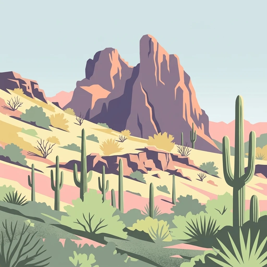
A flat-style digital illustration of a desert mountain landscape with prominent rock peaks in the background and saguaro cacti, shrubs, and succulents in the foreground.

Eagletail Mountains Wilderness

Wildlife reserve

Park overview

Structured park overview, official facts, and landscape profile for Eagletail Mountains Wilderness

Eagletail Mountains Wilderness park facts, protected area profile, and essential visitor context

Review the core facts for Eagletail Mountains Wilderness, including designation, size, terrain, visitor scale, habitats, and operating context in one park-focused overview.

About Eagletail Mountains Wilderness

The Eagletail Mountains Wilderness is one of the larger designated wilderness areas in Arizona's Sonoran Desert region. Located in central-western Arizona, about 65 miles west of Phoenix, it protects a substantial slice of arid landscape defined by the Eagletail Mountains along its northeast side, the shorter Cemetery Ridge on its southwest side, and the desert plains that connect the two.

Geographically, the wilderness stretches across the southeast corner of La Paz County and reaches into the intersection with Maricopa County to the east and Yuma County to the southwest. It sits at the southeast margin of the Ranegras Plain, in the headwater region of Bouse Wash, and lies directly adjacent to the northwest boundary of the Gila Bend Mountains, the range responsible for the dramatic bend in the Gila River further downstream.

The terrain represents a classic Sonoran Desert profile, with rocky desert mountains, alluvial fans, and flatter basins that gradually transition between the higher ridges and the broader desert plain. The wilderness is bordered to the north by a southeast-trending section of Interstate 10, with the nearest exit at Centennial roughly five miles away and the small community of Tonopah around twenty miles further east. From the south, the area is reachable only by unimproved roads leading out from Hyder, about twenty-five miles away, reinforcing its sense of isolation.

Designated as wilderness in the 1990s and classified under IUCN Category Ib, the area continues to function as a protected block of Sonoran Desert landscape, preserving both the mountain landforms of the Eagletail range and the open desert ecosystems that surround them.

Quick facts and research context for Eagletail Mountains Wilderness

The Eagletail Mountains Wilderness encompasses about 100,600 acres of federal wilderness in central-western Arizona, set within the Sonoran Desert. It lies at the southeast end of the Ranegras Plain and adjacent to the northwest flank of the Gila Bend Mountains, near the headwaters of Bouse Wash. The protected area covers nearly all of the Eagletail Mountains range as well as the lower Cemetery Ridge section and surrounding desert plains.

Protection and recognition

Terrestrial conservation framework and official designation history

Eagletail Mountains Wilderness Protection Status and Recognition Data

Eagletail Mountains Wilderness maintains a documented terrestrial protection scope within the regional conservation network. Structured facts outline the recorded designation framework and associated administrative details for this protected area.

Protection details

Protection scope
Terrestrial
Transboundary protection
No
Park context

Deeper park guide and search-rich context for Eagletail Mountains Wilderness

Eagletail Mountains Wilderness history, landscape, wildlife, and travel context

Explore Eagletail Mountains Wilderness through its history, landscape character, ecosystems, wildlife, conservation priorities, cultural context, and seasonal travel timing in a structured park guide built for atlas discovery and search intent.

Why Eagletail Mountains Wilderness stands out

The Eagletail Mountains Wilderness is best known for preserving a large, rugged section of the Sonoran Desert anchored by the Eagletail Mountains themselves, an isolated desert range characterized by sharp ridgelines, rocky bajadas, and broad surrounding desert plains. Its remote character, set away from major population centers and crossed only by nearby Interstate 10, gives it a strong identity as a quiet, arid wilderness in a region otherwise shaped by ranching, desert highways, and small settlements.
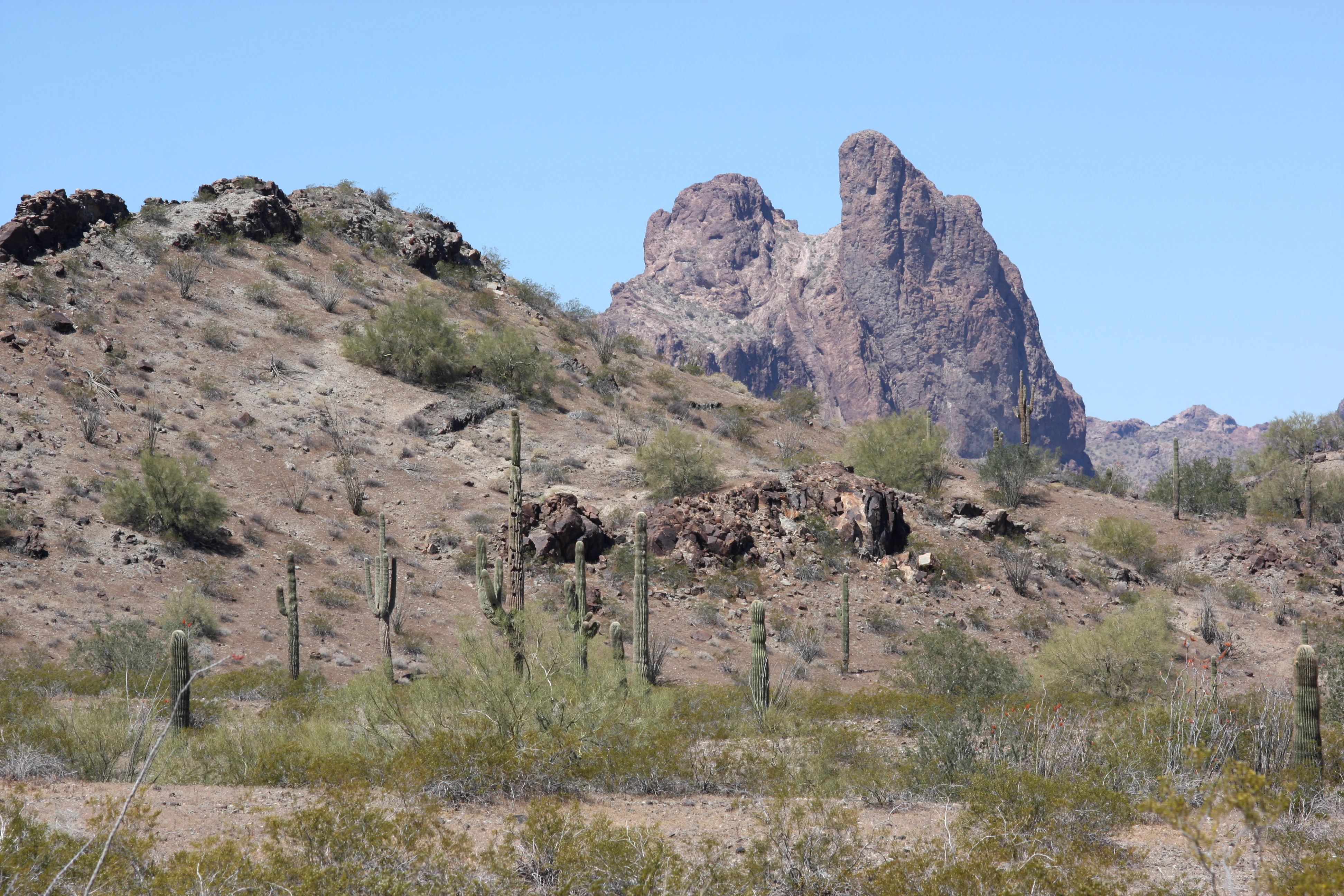
A desert landscape in the Eagletail Mountains featuring the prominent Courthouse Rock formation surrounded by saguaro cacti and arid vegetation.
Courthouse Rock in the Eagletail Mountains Wilderness.

Eagletail Mountains Wilderness history and protected-area timeline

The Eagletail Mountains Wilderness was formally designated as a federally protected wilderness area in the 1990s, under the broader system of U.S. wilderness preservation. Its establishment brought a large portion of the Eagletail Mountains, along with adjacent Cemetery Ridge and the surrounding Sonoran Desert plains, under formal wilderness protection, restricting development and preserving the area's remote character.

The geographic context of the wilderness, set between the Ranegras Plain and the Gila Bend Mountains near the headwaters of Bouse Wash, has long defined this part of central-western Arizona as a transition landscape between desert basins and mountain ranges. The nearby routes, including Interstate 10 and older access roads from settlements such as Tonopah, Centennial, and Hyder, reflect the region's gradual integration with the broader transportation network of western Arizona, while the wilderness itself remained a protected exception to that development.

Eagletail Mountains Wilderness landscape and geographic character

The landscape of the Eagletail Mountains Wilderness is defined by the contrast between its long, northeast-trending Eagletail mountain ridge and the much shorter Cemetery Ridge along the southwest edge. Between and around these two ridges lie broad desert plains, bajadas, and washes typical of the Sonoran Desert.

The Eagletail Mountains themselves form the most prominent feature of the area, rising above the surrounding basins to create jagged ridgelines, steep rocky slopes, and isolated desert peaks. To the southwest, Cemetery Ridge provides a lower secondary ridge line, while the intervening terrain consists of gently sloping desert flats that drain toward the headwaters of Bouse Wash.

The wilderness sits at the southeast corner of the Ranegras Plain and is bordered on the southeast by the Gila Bend Mountains, a larger range associated with the famous Gila Bend of the Gila River. The overall setting is a wide, open desert landscape segmented by parallel mountain ranges and dry washes, characteristic of the central-western Arizona portion of the Sonoran Desert.

Eagletail Mountains Wilderness ecosystems, habitats, and plant life

The natural environment of the Eagletail Mountains Wilderness is shaped almost entirely by the Sonoran Desert. The combination of rocky mountain slopes, desert bajadas, and open plains supports the arid-land vegetation and habitat patterns typical of this region of Arizona.

The transition from upper mountain terrain down to basin flats produces a layered ecological setting, where higher, rockier slopes contrast with lower, sandier desert flats and dry wash systems. The headwater area of Bouse Wash, which runs through or near the wilderness, adds a riparian-influenced thread to an otherwise arid landscape, supporting slightly different vegetation along its drainage.

Positioned between the Ranegras Plain and the Gila Bend Mountains, the wilderness functions as a large, undisturbed block of Sonoran Desert habitat, helping maintain ecological continuity across a landscape otherwise broken up by roads, ranching, and small communities.

Eagletail Mountains Wilderness conservation status and protection priorities

As a designated federal wilderness area classified under IUCN Category Ib, the Eagletail Mountains Wilderness represents a significant conservation holding within Arizona's Sonoran Desert. Its designation in the 1990s placed long-term protection on roughly 100,600 acres of desert mountain and plain, limiting development and motorized access.

The wilderness protects not only the Eagletail Mountains themselves but also the surrounding desert ecosystems, including the upper drainage of Bouse Wash and the transition zone between the Ranegras Plain and the Gila Bend Mountains. By preserving this broad, contiguous block of desert habitat in a region otherwise influenced by ranching, highways, and energy infrastructure, the area supports the long-term integrity of Sonoran Desert landscapes and the ecological processes they depend on.

Top sights and standout views in Eagletail Mountains Wilderness

The defining highlights of the Eagletail Mountains Wilderness are its long Eagletail mountain ridge and the open Sonoran Desert plains that surround it. The shorter Cemetery Ridge adds a second ridgeline that frames the southwestern edge of the protected area.

The wilderness also stands out for its geographic position, anchored between the Ranegras Plain and the Gila Bend Mountains near the headwaters of Bouse Wash, and for its relative isolation. Although Interstate 10 runs along its northern edge, the area remains remote, with only a few small settlements such as Centennial, Tonopah, and Hyder nearby and minimal road access from the south.

Best time to visit Eagletail Mountains Wilderness

The Eagletail Mountains Wilderness, like much of the Sonoran Desert, is best experienced during the cooler months of late fall, winter, and early spring, when daytime temperatures are milder and desert wildlife is more active. Summer heat in this part of Arizona can be extreme, making the higher ridges and exposed desert flats far less hospitable for exploration.

Winter and spring visits also bring cooler nights and the possibility of seasonal wildflower blooms in favorable years, while the long views across the desert plains toward the Gila Bend Mountains become especially clear under the dry, stable air of the cooler season.
Monthly climate preview

Long-term representative monthly temperature averages and precipitation statistics for Arizona protected terrain

Eagletail Mountains Wilderness Climate Normals, Annual Temperature and Precipitation Patterns

Historical NASA climate data records long-term monthly temperature fluctuations and precipitation averages across representative coordinates in Eagletail Mountains Wilderness. Examining the complete twelve-month profile provides detailed meteorological context for regional conservation terrain.
Annual mean22 °C
11 °C34 °C
Jan12°
Feb13°
Mar17°
Apr20°
May26°
Jun31°
Jul34°
Aug33°
Sep30°
Oct23°
Nov16°
Dec11°
Warmest month
July

33.8 °C

Coolest month
December

11 °C

Wettest month
February

0.8 mm/day

Driest month
June

0 mm/day

Park location guide

Geography guide, regional context, and park location map for Eagletail Mountains Wilderness

Eagletail Mountains Wilderness park geography, regions, and map view in United States of America

Understand where Eagletail Mountains Wilderness sits in United States of America through a broader geographic reading of the surrounding landscape, nearby location context, and its mapped position within the national park landscape.

How Eagletail Mountains Wilderness fits into United States of America

The United States of America is a federal presidential republic and one of the world's largest countries by area and population. It consists of 50 states across a vast territory spanning multiple time zones, with its capital in Washington, D.C. and largest city in New York City. The nation has a diverse economy, influential political system, and significant cultural and military presence globally.

Wider geography shaping Eagletail Mountains Wilderness in United States of America

The United States occupies a vast territory in North America, bordered by Canada to the north and Mexico to the south. The 48 contiguous states stretch from the Atlantic to the Pacific Ocean, while Alaska occupies the northwestern region and Hawaii is an archipelago in the Pacific. The country encompasses diverse terrain including the Rocky Mountains, Appalachian Mountains, Great Plains, and extensive river systems.

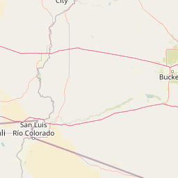
Map view of Eagletail Mountains Wilderness

Use this park location map to pinpoint Eagletail Mountains Wilderness in United States of America, understand its exact geographic position, and read its mapped placement within the surrounding landscape more clearly.

Pigeon | © OpenStreetMap contributors

Location context for Eagletail Mountains Wilderness

ArizonaLa Paz CountyMaricopa CountyYuma County
Recorded earthquake history

Review Recorded Seismic Activity near Eagletail Mountains Wilderness

Access a structured historical database of seismic events documented around Eagletail Mountains Wilderness. MoriAtlas enables precise filtering of recorded earthquakes by magnitude and date, helping you examine the seismic history of this desert landscape with clear, source-linked data points.

Eagletail Mountains Wilderness Earthquake History

Catalogued events

2 events

Strongest magnitude

Magnitude 3.8

Most recent event

Nov 10, 1976

This history includes earthquakes recorded inside the park or within 50 km of its borders

Visual reference collection showcasing arid terrain, rocky ridges, and desert habitats.

Eagletail Mountains Wilderness Photos, Scenery, and Desert Landscape Views

Visual documentation captures the rugged mountain ridgelines, wide bajadas, and open desert plains defining the remote Arizona protected area. Photographic records reveal the stark Sonoran Desert environment and the arid character of the surrounding basin.

A desert landscape in the Eagletail Mountains featuring the prominent Courthouse Rock formation surrounded by saguaro cacti and arid vegetation.

Park atlas

Compare adjacent protected landscapes and arid mountain terrain across central Arizona

Explore Other Parks Near Eagletail Mountains Wilderness And Surrounding Desert Regions

Continue browsing other parks near Eagletail Mountains Wilderness to compare related desert ecosystems and mountain ranges across the surrounding region. Expanding your search reveals adjacent protected landscapes, arid terrain patterns, and remote wilderness areas throughout the Sonoran Desert.
Watercolor painting of a desert scene with rolling hills in the background and saguaro cacti in the foreground.
Wildlife reserveMaricopa County
24 km away#1 closest

Northeast

Hummingbird Springs Wilderness: A Protected Sonoran Desert Landscape in Maricopa County

Rugged mountain terrain and desert wash networks

Spanning more than 31,000 acres, Hummingbird Springs Wilderness serves as a core protected area in the Sonoran Desert. The geography encompasses the Belmont Mountains, providing a stark contrast of arid peaks and sandy basins that extend through western Maricopa County. This roadless wilderness represents an essential connection between adjacent protected lands, maintaining a vast and isolated desert environment shaped by centuries of geological forces.

Area
126.26 km²
Established
1990
IUCN
Ib
Relief
Mountain
Wildlife reserveCalifornia
103 km away#2 closest

Southwest

Little Picacho Wilderness: Exploring the Protected Volcanic Terrain and Desert Geography

A rugged wilderness reserve in southeastern California

Little Picacho Wilderness is a protected desert landscape located along the lower Colorado River corridor. The area is defined by dramatic volcanic ridges, Picacho Peak, and extensive arid desert washes. This wildlife reserve serves as an important refuge for desert bighorn sheep, desert tortoises, and free-roaming wild horse herds, offering a clear window into the rugged geography of the Sonoran Desert.

Area
154.65 km²
Established
1994
IUCN
Ib
Relief
Mountain
Watercolor painting of a calm lake surrounded by green forests and distant mountain ridges.
Protected areaArizona
104 km away#3 closest

Northeast

Prescott National Forest: Geographic Overview of Arizona Protected Landscapes and Wilderness

Regional geography and protected terrain map of the Bradshaw Mountains

Spanning over one million acres, Prescott National Forest represents a defining outdoor landscape in Arizona. The terrain transitions from high desert chaparral to dense ponderosa pine forests, featuring eight distinct wilderness areas, rugged canyon systems, and essential watershed corridors that shape the regional ecology near Prescott.

Area
5,100 km²
Established
1908
Relief
Mountain
Climate
Temperate
Watercolor painting showing a soft landscape with rolling hills in the background and a grassy plain with sparse trees and water in the foreground.
Wildlife reserveUnited States of America
About 112 km away#4 closest

Northwest

Riverside Mountains Wilderness: Mapping the Desert Peaks and Protected Landscapes of California

A rugged desert wildlife reserve within the Lower Colorado River Valley

Riverside Mountains Wilderness features a tightly woven mosaic of dry drainages, rocky slopes, and sheltered canyon pockets. Situated in Riverside County, California, this protected area showcases a striking transition between steep mountain crags and open desert flats, providing a meaningful look at the Sonoran and Colorado Desert ecosystems along the Colorado River corridor.

Area
97.14 km²
Established
1994
Relief
Mountain
Climate
Arid
Protected landscapeArizona
121 km away#5 closest

East

Tonto National Forest: Understanding the Geography of an Expansive Protected Landscape

Exploring the vertical ecosystem gradients in Central Arizona

Spanning from arid Sonoran basins to the towering Mogollon Rim, Tonto National Forest offers a unique study in vertical geography and protected land management. This expansive territory provides a vital map of Southwest life zones, encompassing reservoir systems, rugged river canyons, and critical wilderness habitat that define the environmental identity of the region.

Area
11,627 km²
Established
1905
Visitors
5.9M annual
Relief
Mountain
Wildlife reserveCalifornia
About 123 km away#6 closest

West

Indian Pass Wilderness: Protected Sonoran Desert Geography and Terrain Mapping

Analyzing desert mountain slopes and riparian corridors in California

Indian Pass Wilderness represents a key protected-area unit where the arid Chocolate Mountains descend into the Lower Colorado River Valley. The area is defined by its dramatic drainage patterns, including Julian Wash, and its role as a transition zone between desert upland and riparian edge, serving as a critical study for understanding southwestern desert geography and protected landscape boundaries.

Area
131.19 km²
Established
1994
IUCN
Ib
Relief
Mountain
Wildlife reserveArizona
158 km away#7 closest

Northeast

Mazatzal Wilderness: Geographic Overview of Arizona's Expansive Protected Mountain Terrain

Mapping the ecological transition from desert canyon to forest ridge

Mazatzal Wilderness stands as an essential protected area in central Arizona, covering vast tracts of the Tonto and Coconino National Forests. The landscape is defined by the stark vertical contrast between the low-lying Verde River corridor and the high-elevation forests of the Mazatzal Mountains. This expansive wilderness remains a key study in regional topography and ecological zonation for those exploring the rugged backcountry of the southwestern United States.

Area
1,021.4 km²
Established
1964
IUCN
Ib
Relief
Mountain
Wildlife reserveYavapai County
About 165 km away#8 closest

North

Juniper Mesa Wilderness: Geological Landscape and Protected Area Mapping

Essential protected land data in Yavapai County

Juniper Mesa Wilderness protects a rare sedimentary mesa capped by Tapeats sandstone, rising above a vast granite landscape in Yavapai County. This geographic survey highlights the canyon-cut topography and the shifting vegetation zones that characterize the Transition Zone ecology within the Prescott National Forest.

Area
29.97 km²
Established
1984
IUCN
Ib
Relief
Mountain

Common questions about visiting, size, designation, and location context for Eagletail Mountains Wilderness

Eagletail Mountains Wilderness FAQs for park facts, access, geography, and protected area context

Find quick answers about Eagletail Mountains Wilderness, including protected-area facts, park geography, trail and visitor context, and how the park fits into its surrounding country and regional landscape.
MoriAtlas Explorer

Continue Your Protected Areas Search Across the Global Atlas

Deepen your exploration by continuing the structured search for national parks and protected areas worldwide. Utilize the comprehensive filtering capabilities to compare different conservation landscapes and refine your understanding of global park geography. Discover more about the distribution and characteristics of protected natural areas.

Global natural geography