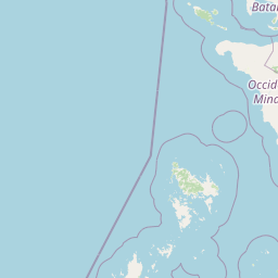

Why El Nido-Taytay Managed Resource Protected Area stands out
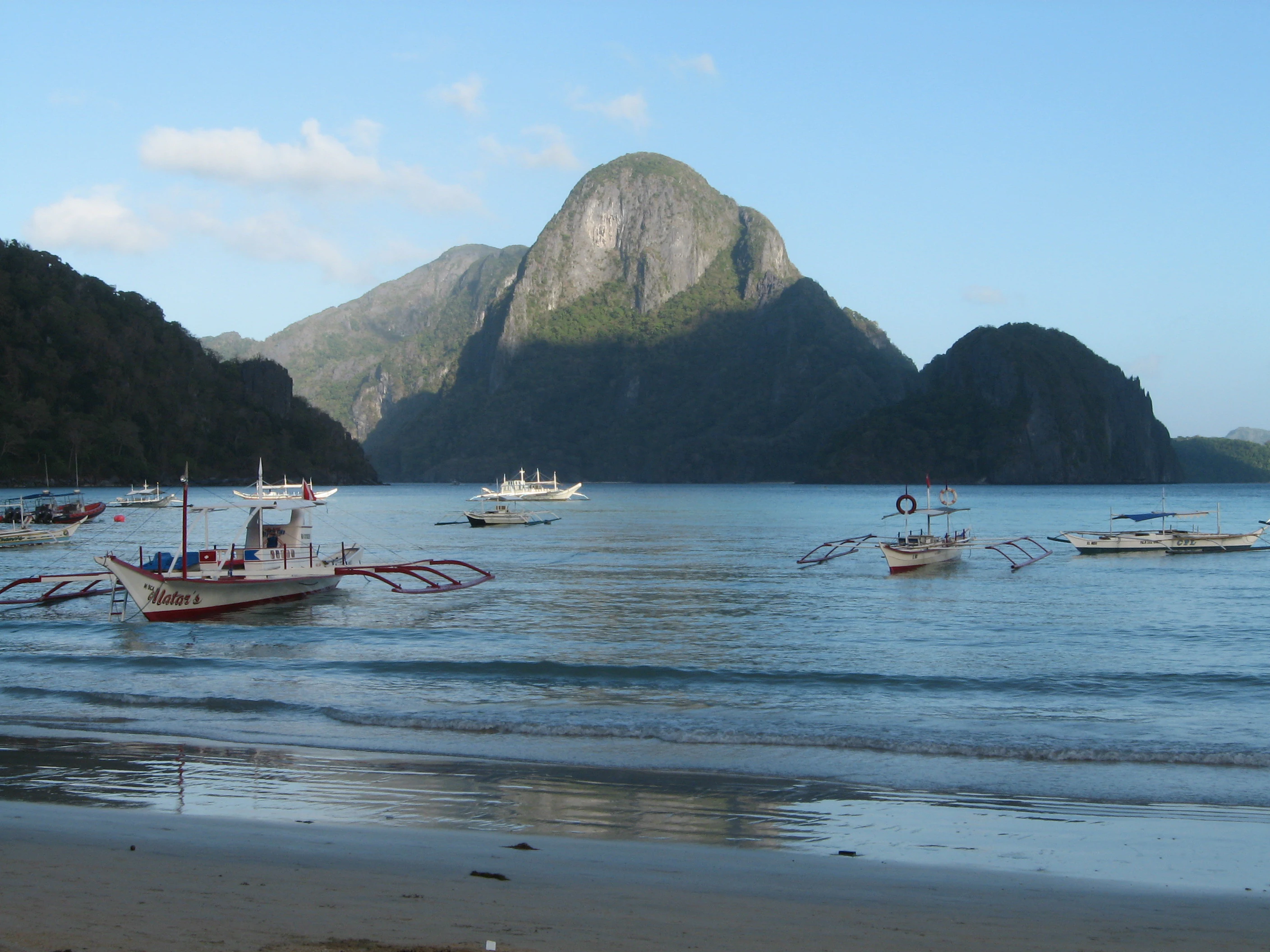
El Nido-Taytay is best known for the karst scenery of the Bacuit Archipelago, a cluster of steep, jagged limestone islands rising from clear tropical waters. The combination of towering cliffs, narrow inlets, white-sand beaches, and offshore coral reefs has made this area a globally recognized symbol of Philippine coastal beauty. Beyond its visual drama, the reserve is equally notable for its ecological diversity. Its mixed land-and-sea character brings together karst forests, mangrove fringes, river estuaries, tidal flats, and rich coral reef systems within a single protected framework, giving El Nido-Taytay both scenic and biological significance.
El Nido-Taytay Managed Resource Protected Area history and protected-area timeline
El Nido-Taytay Managed Resource Protected Area was formally established on 8 October 1998 through Presidential Proclamation 32, which set aside its land and sea territory as a protected area under the Philippine system of conservation.
The proclamation recognized both the ecological importance of the area and its relationship with the local population. Rather than being designated purely as a strict nature reserve, the area was framed as a managed resource protected area, meaning that conservation objectives were paired with the protection and development of the livelihoods of coastal residents and with regional tourism growth.
Since then, the reserve has continued to function within the broader MIMAROPA network of protected areas, which includes major Philippine sites such as Apo Reef, the Malampaya Sound Protected Landscape and Seascape, and Mount Guiting-guiting Natural Park.
El Nido-Taytay Managed Resource Protected Area landscape and geographic character
The landscape of El Nido-Taytay is defined by the contrast between dramatic karst islands and the gentler features of the Palawan mainland coast. The Bacuit Archipelago forms the scenic centerpiece, with towering limestone islands and cliffs rising directly from the sea.
Geologically, both the islands of the Bacuit Archipelago and the coastal cliffs near El Nido are formed from karstified limestone. Over long stretches of geological time, weathering and erosion have sculpted this rock into sharp ridgelines, deep fissures, sea-level caves, and narrow straits. The result is a deeply indented coastline where cliffs, beaches, and small bays alternate rapidly.
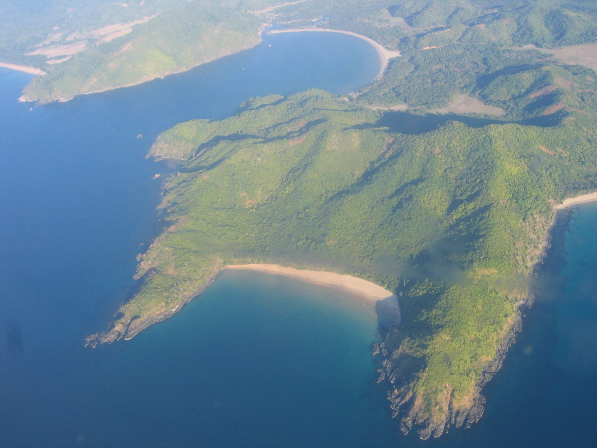
Along the mainland-facing side of the reserve, the terrain softens into mangrove-lined shores, river estuaries, and broad tidal flats. Numerous small streams and rivers from the Palawan interior reach the sea within the protected area. The highest point in the reserve is the summit of Cadlao Island, which reaches about 640 meters above sea level. To the south, the protected area adjoins the Malampaya Sound Protected Landscape and Seascape, continuing the chain of protected coastal and marine terrain along northern Palawan.
El Nido-Taytay Managed Resource Protected Area ecosystems, habitats, and plant life
Ecologically, El Nido-Taytay stands out for the close integration of terrestrial and marine habitats within a single management boundary. The reserve includes karst forests on the islands and the coastal mainland, mangrove forests along sheltered shorelines, river estuaries where freshwater meets the sea, and tidal flats that are alternately submerged and exposed. Together these habitats support a varied and interconnected coastal ecosystem.
The marine portion of the reserve is equally important. Coral reefs lie offshore from both the islands and parts of the mainland coast, providing habitat structure for marine flora and fauna. The combination of clear tropical waters, reef ecosystems, and sheltered bays makes the area ecologically rich as well as scenic.
On land, the karst terrain supports distinctive dry and semi-dry forest vegetation adapted to limestone soils, while lowland areas carry mangrove communities and riparian forest along rivers. This habitat mosaic is at the core of what makes El Nido-Taytay ecologically significant, since forest, mangrove, estuarine, reef, and tidal flat environments all coexist within a relatively compact area.
El Nido-Taytay Managed Resource Protected Area wildlife and species highlights
The wildlife profile of El Nido-Taytay reflects its position at the meeting point of terrestrial, coastal, and marine habitats. Coral reefs and associated marine ecosystems support a diverse community of reef fish and other marine species, while mangrove forests and tidal flats provide feeding and roosting habitat for coastal and migratory birds.
The karst forests of the islands and the coastal mainland host terrestrial species adapted to limestone terrain, including forest-dependent birds and other animals that benefit from the protection the reserve provides. River systems emptying into the sea create transitional habitats that further increase the variety of wildlife supported by the area.
While hunting pressure and habitat disturbance are ongoing concerns in many parts of the Philippines, the protected status of El Nido-Taytay helps safeguard its populations of reef-associated marine life, mangrove-dependent species, and coastal birds. The reserve's combination of intact reef, mangrove, and forest habitats gives it a particularly rich and layered wildlife character.
El Nido-Taytay Managed Resource Protected Area conservation status and protection priorities
El Nido-Taytay occupies an important place in the Philippine system of protected areas. Its combined landscape-and-seascape designation reflects a recognition that terrestrial and marine ecosystems in this part of Palawan are ecologically linked and must be managed together.
The reserve protects representative examples of several habitat types that are increasingly threatened elsewhere in the Philippines and Southeast Asia, including karst forests, mangrove systems, coral reefs, and tidal flats. By safeguarding these habitats within a single protected boundary, El Nido-Taytay contributes to the long-term preservation of biodiversity in northern Palawan and supports the ecological connectivity of the broader MIMAROPA protected-area network.
Its management approach also reflects the human dimension of conservation in the Philippines. By integrating biodiversity protection with the livelihoods of local communities and sustainable tourism development, the reserve illustrates the dual mandate of many Philippine protected areas: protecting natural values while supporting the people who live alongside them.
El Nido-Taytay Managed Resource Protected Area cultural meaning and human context
El Nido-Taytay is a conservation area shaped as much by its human geography as by its natural features. Twenty-one barangays lie within its boundaries, eighteen in the municipality of El Nido and three in the municipality of Taytay, meaning that local fishing communities and coastal settlements are closely tied to the protected area.
The municipal name El Nido has become widely known internationally, partly because of the scenic reputation of the Bacuit Archipelago and partly because of the tourism economy that has grown around it. The protected area framework was designed to acknowledge this relationship, balancing biodiversity conservation with the economic dependence of local residents on marine resources and on tourism.
This fusion of conservation and community gives El Nido-Taytay a distinct regional identity: it is simultaneously one of the most photographed natural landscapes in the Philippines and a working landscape for the people of northern Palawan.
Top sights and standout views in El Nido-Taytay Managed Resource Protected Area
The defining highlight of El Nido-Taytay is the Bacuit Archipelago, whose jagged limestone karst islands, hidden lagoons, and beach-lined bays create one of the most recognizable coastal landscapes in Southeast Asia.
Equally important are the reserve's offshore coral reefs, its mangrove-fringed mainland coast, and the river estuaries and tidal flats that line Palawan's northwestern shore. Together with the karst forests of Cadloa Island and the surrounding seascape, these features give El Nido-Taytay a layered identity that combines scenery, ecological diversity, and community relevance.
Best time to visit El Nido-Taytay Managed Resource Protected Area
The climate of northern Palawan follows the general tropical pattern of the Philippines, with a drier period and a wetter period through the year. The drier months generally offer calmer seas, clearer skies, and better visibility for experiencing the Bacuit Archipelago's islands, beaches, and reefs, while the wetter months bring heavier rain and rougher sea conditions.
For visitors interested in the area's marine scenery, the clearer, calmer months also tend to provide better conditions for reef-related activities. For those interested in coastal wildlife, tidal flats and mangrove areas can be observed throughout much of the year, though access can vary with seasonal weather and sea conditions.