
Mori Atlas logo
Wildlife reserveEl Paso Mountains Wilderness

Mapping the volcanic badlands, deep canyons, and archaeological heritage of Kern County

El Paso Mountains Wilderness: A Detailed Geographic Atlas of Mojave Desert Protected Landscapes

The El Paso Mountains Wilderness encompasses approximately 24,000 acres of arid Mojave Desert terrain in eastern Kern County. This protected landscape is defined by the stark volcanic geology of Black Mountain, where eroded red buttes and dark mesas create a complex network of canyons and ridges. Beyond its dramatic volcanic topography, the area contains a high density of prehistoric cultural sites that anchor this region as a significant corridor of desert history and natural biodiversity.

wilderness areaMojave Desertvolcanic landscapebadlandsdesert ecosystemcreosote bush scrub
A flat-style digital illustration of a desert scene with a winding river in the foreground, leading toward a waterfall cascading from rocky, multi-colored cliffs and mountains under a soft sky.

El Paso Mountains Wilderness

Wildlife reserve

Park overview

Structured park overview, official facts, and landscape profile for El Paso Mountains Wilderness

El Paso Mountains Wilderness park facts, protected area profile, and essential visitor context

Review the core facts for El Paso Mountains Wilderness, including designation, size, terrain, visitor scale, habitats, and operating context in one park-focused overview.

About El Paso Mountains Wilderness

El Paso Mountains Wilderness is a Bureau of Land Management wilderness area in the northern Mojave Desert, situated in eastern Kern County, California, just south of the high desert community of Ridgecrest. Established in 1994, the wilderness protects about 23,780 acres of arid, rugged terrain that captures the characteristic scenery of the western Mojave: weathered volcanic uplifts, deep erosional canyons, and expanses of creosote bush scrub interspersed with stands of Joshua trees.

The geography of the wilderness is shaped around Black Mountain, an extinct volcano that rises to 5,244 feet and forms the central spine of the area. Around this peak, dark volcanic mesas and reddish buttes have been carved by erosion into a badlands topography of steep slopes, washes, and narrow canyons. The desert vegetation reflects this elevation and exposure gradient, with creosote bush dominating much of the lower terrain and Joshua trees appearing in the western portion of the range. Wildlife typical of the northern Mojave is present, including raptors, the Mohave ground squirrel, and the desert tortoise, a species of conservation concern across the region.

What truly sets the El Paso Mountains apart from many other desert wildernesses is its cultural dimension. The southern portion of the area lies within the Last Chance Archaeological District, which is listed on the National Register of Historic Places. This district preserves a remarkable concentration of prehistoric cultural sites, including rock art, habitation areas, and artifact scatters that document long-term human use of the desert canyons. The wilderness is therefore valued not only as a place of scenic and ecological protection but also as a protected landscape where desert geology, desert ecology, and a deep human history in the arid West intersect.

Quick facts and research context for El Paso Mountains Wilderness

El Paso Mountains Wilderness is a 23,780 acre BLM wilderness in eastern Kern County, California, in the northern Mojave Desert south of Ridgecrest. Designated in 1994, it encompasses a rugged landscape of red buttes, dark volcanic mesas, and badlands centered on the extinct volcanic peak of Black Mountain. The southern portion of the wilderness falls within the Last Chance Archaeological District, listed on the National Register of Historic Places, making the area unusually rich in prehistoric cultural sites as well as desert wildlife such as raptors, Mohave ground squirrel, and desert tortoise.

Protection and recognition

Terrestrial conservation scope and official protected area data

El Paso Mountains Wilderness Protection Status and Recognition

El Paso Mountains Wilderness maintains a documented terrestrial protection scope within the regional conservation network. Structured environmental records outline the established designation framework and administrative management criteria.

Protection details

Protection scope
Terrestrial
Transboundary protection
No
Park context

Deeper park guide and search-rich context for El Paso Mountains Wilderness

El Paso Mountains Wilderness history, landscape, wildlife, and travel context

Explore El Paso Mountains Wilderness through its history, landscape character, ecosystems, wildlife, conservation priorities, cultural context, and seasonal travel timing in a structured park guide built for atlas discovery and search intent.

Why El Paso Mountains Wilderness stands out

The wilderness is best known for its eroded badlands of reddish buttes and dark volcanic mesas, set around the central volcanic peak of Black Mountain. It is equally recognized for the exceptional density of prehistoric cultural sites in the Last Chance Archaeological District, where pictographs, habitation sites, and other archaeological traces are scattered across the canyon landscape of the southern wilderness. Its combination of vivid Mojave Desert scenery and concentrated archaeological heritage distinguishes it from many other small desert wildernesses in the region. Visitors and researchers value it as a place where stark volcanic geology and a long human history in the desert meet within a single protected landscape.
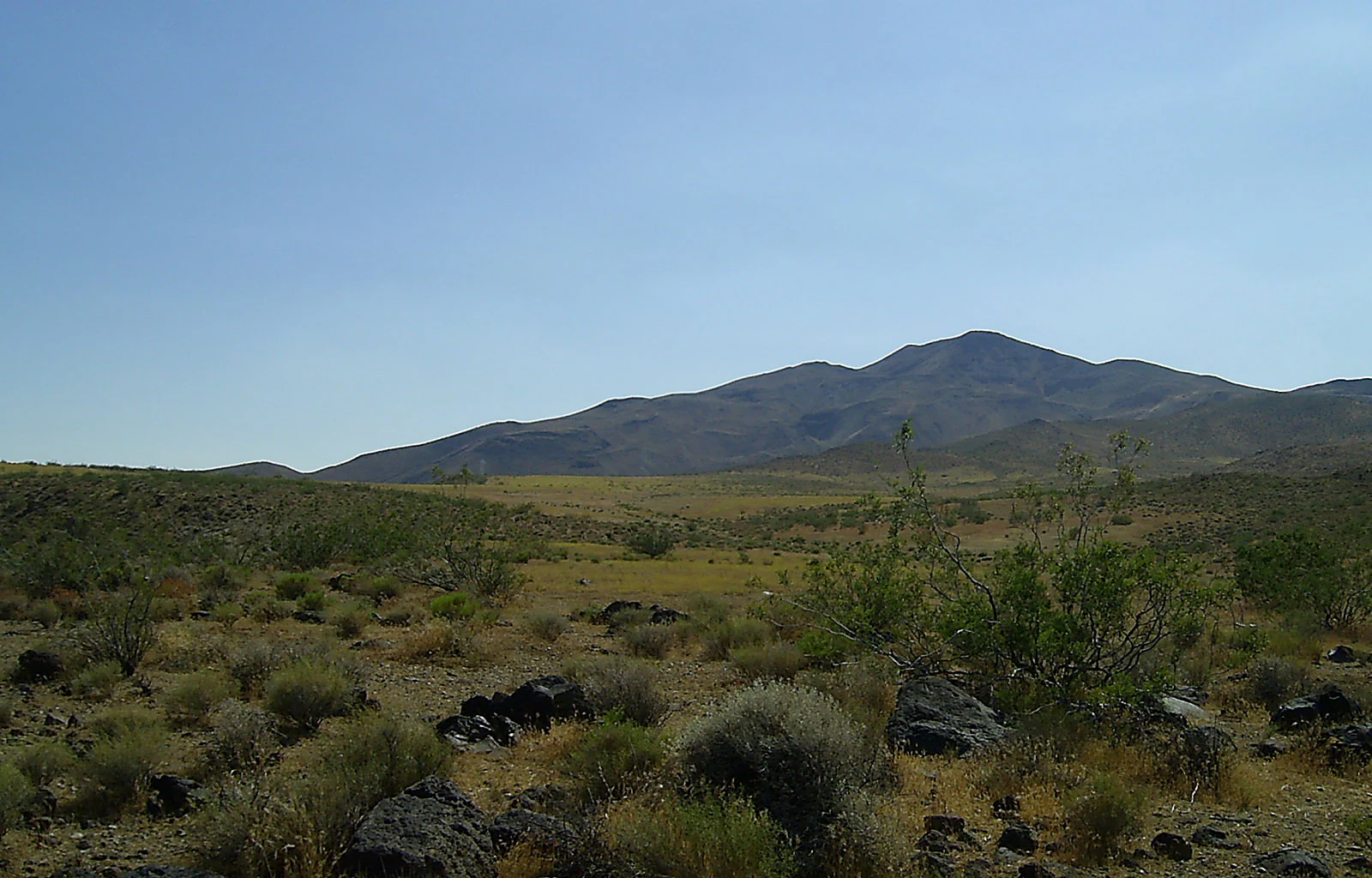
A wide desert landscape featuring arid shrubland in the foreground leading to a large, rounded mountain peak under a clear blue sky.
A view of Black Mountain in the El Paso Mountains Wilderness.

El Paso Mountains Wilderness history and protected-area timeline

El Paso Mountains Wilderness was formally designated by Congress as part of the 1994 California Desert Protection Act process, establishing roughly 23,780 acres of protected wilderness south of Ridgecrest in eastern Kern County. The area had long been recognized at the local and federal levels for its unusual combination of volcanic badlands scenery and its exceptional archaeological richness, which influenced the decision to place it under permanent wilderness management by the Bureau of Land Management.

The human history recorded in the landscape stretches back far beyond the formal designation. The southern portion of the wilderness falls within the Last Chance Archaeological District, recorded on the National Register of Historic Places for its high density of prehistoric sites. Petroglyphs, pictographs, habitation sites, lithic scatters, and other cultural features document sustained Indigenous and later human use of the canyons and mesas over many centuries. The wilderness designation was seen as a way to safeguard these resources alongside the area's natural values, ensuring that future land management would continue to protect both the fragile desert ecosystem and the irreplaceable archaeological record.

El Paso Mountains Wilderness landscape and geographic character

The El Paso Mountains present a classic example of eroded Mojave Desert badlands. The defining landform is Black Mountain, an extinct volcano that rises to 5,244 feet and serves as the central anchor of the wilderness. Around it, erosion has sliced dark volcanic mesas into steep-sided ridges and carved narrow canyons between them, producing a terrain that alternates between broad, sloping uplands and tightly confined washes.

Color and contrast are central to the visual character of the area. Many of the buttes and lower slopes display reddish hues that stand out against the darker basaltic rock of the volcanic uplifts. The result is a patchwork of red, brown, and black landforms framed by pale desert sky, with creosote bush scrub and scattered Joshua trees softening the transitions between rock and sand. The badlands topography, with its combination of isolated buttes, dissected mesas, and twisting canyons, gives the wilderness a strongly three-dimensional feel compared to the flatter alluvial basins that surround it.

El Paso Mountains Wilderness ecosystems, habitats, and plant life

Ecologically, El Paso Mountains Wilderness falls within the northern Mojave Desert and supports the vegetation communities typical of that region. The dominant plant cover is creosote bush scrub, with its widely spaced shrubs adapted to low rainfall, high summer temperatures, and coarse desert soils. On the western side of the mountains, where elevation, slope, and soils shift, stands of Joshua trees become an important part of the vegetation, adding a distinct vertical element to the otherwise low shrubland.

The varied topography of buttes, mesas, canyons, and washes creates a mosaic of microhabitats across a relatively small area. Rockier slopes host different plant and animal communities than the sandy flats and washes below, and the shaded canyon walls retain moisture and shelter longer than exposed surfaces. This diversity of terrain supports the range of desert wildlife associated with the northern Mojave, including raptors that use the cliffs and ridges for nesting and hunting, small mammals such as the Mohave ground squirrel that depend on the creosote bush understory, and the desert tortoise, a wider-ranging species of significant conservation concern that occurs in suitable habitat throughout the area.

El Paso Mountains Wilderness wildlife and species highlights

Wildlife in El Paso Mountains Wilderness reflects the broader northern Mojave Desert fauna, with species adapted to arid conditions, sparse vegetation, and the temperature extremes of the region. Raptors are among the most visible groups, using the cliffs, ridges, and isolated buttes as perches and nesting sites, and preying on the smaller desert animals that occupy the washes and flats below.

Among small mammals, the Mohave ground squirrel is a distinctive resident, closely tied to creosote bush scrub habitats of this part of the Mojave. The desert tortoise is also present, moving through suitable terrain across the wilderness and representing an important conservation focus for the region. Lizards, smaller rodents, and various passerine birds typical of creosote scrub and Joshua tree woodland round out the regular fauna, with overall wildlife patterns shaped by elevation, exposure, and the distribution of vegetation across the badlands landscape.

El Paso Mountains Wilderness conservation status and protection priorities

El Paso Mountains Wilderness is protected primarily for its combination of scenic, ecological, and archaeological values. Wilderness designation under the Bureau of Land Management framework limits road building, motorized access, and other forms of development, preserving the area's largely unmodified character. This protection is particularly important given the fragility of desert soils and vegetation, which recover slowly once disturbed.

The presence of the desert tortoise within the wilderness adds a regional conservation dimension, since the species has suffered significant declines across much of its range due to habitat loss, fragmentation, and other pressures. By safeguarding continuous blocks of suitable habitat and protecting key physical features such as rocky outcrops and washes, the wilderness contributes to broader efforts to maintain viable tortoise populations in the northern Mojave. At the same time, the protection of the Last Chance Archaeological District within the southern portion of the wilderness recognizes that conservation in this landscape must address cultural resources as well as natural ones, preserving a record of prehistoric human presence in the Mojave for future research and interpretation.

El Paso Mountains Wilderness cultural meaning and human context

The cultural significance of El Paso Mountains Wilderness is unusually concentrated for an area of its size. The southern wilderness overlaps with the Last Chance Archaeological District, a landscape recognized on the National Register of Historic Places for the density and variety of its prehistoric cultural sites. Across the canyons and around the bases of the mesas, archaeological evidence documents long-term human use of the desert environment, including habitation sites, tool-making areas, rock art, and other features typical of Indigenous occupation in the Mojave.

This rich archaeological record gives the wilderness a layered human dimension, in which today's protected desert landscape sits above and among evidence of much older desert lifeways. The district's listing reflects both the scientific value of the sites and the recognition that they form a defining feature of the El Paso Mountains, complementing the area's scenic and ecological importance.

Top sights and standout views in El Paso Mountains Wilderness

El Paso Mountains Wilderness stands out for the way it compresses three distinct qualities into a relatively small area. The volcanic badlands scenery around Black Mountain, with their red buttes, dark mesas, and intricate canyon networks, gives the wilderness an unusually dramatic Mojave character. The northern Mojave flora, anchored by creosote bush scrub and supplemented by Joshua tree stands, completes a recognizable desert ecological setting.

Best time to visit El Paso Mountains Wilderness

The El Paso Mountains, like most of the northern Mojave, are best experienced in the cooler months, when daytime temperatures are more moderate and the desert landscape is at its most comfortable for hiking and exploration. Spring can bring wildflower displays in favorable years, while fall and winter typically offer clearer skies and milder conditions across the buttes and canyons. Summer in this part of the Mojave is extremely hot, and travel into the canyons and exposed badlands during that season is generally difficult and demanding.

Monthly climate preview

Explore long-term temperature averages and monthly precipitation records for this protected landscape

El Paso Mountains Wilderness Climate Normals and Annual Weather Patterns

El Paso Mountains Wilderness exhibits a measured annual cycle of temperature and precipitation based on representative coordinate data from 1991 to 2000. Reviewing the complete twelve-month statistical profile clarifies long-term thermal fluctuations and moisture patterns across the terrain.
Annual mean14 °C
5 °C26 °C
Jan
Feb
Mar
Apr12°
May16°
Jun22°
Jul26°
Aug25°
Sep22°
Oct15°
Nov
Dec
Warmest month
July

26 °C

Coolest month
December

4.9 °C

Wettest month
February

1.6 mm/day

Driest month
June

0.1 mm/day

Park location guide

Geography guide, regional context, and park location map for El Paso Mountains Wilderness

El Paso Mountains Wilderness park geography, regions, and map view in United States of America

Understand where El Paso Mountains Wilderness sits in United States of America through a broader geographic reading of the surrounding landscape, nearby location context, and its mapped position within the national park landscape.

How El Paso Mountains Wilderness fits into United States of America

The United States of America is a federal presidential republic and one of the world's largest countries by area and population. It consists of 50 states across a vast territory spanning multiple time zones, with its capital in Washington, D.C. and largest city in New York City. The nation has a diverse economy, influential political system, and significant cultural and military presence globally.

Wider geography shaping El Paso Mountains Wilderness in United States of America

The United States occupies a vast territory in North America, bordered by Canada to the north and Mexico to the south. The 48 contiguous states stretch from the Atlantic to the Pacific Ocean, while Alaska occupies the northwestern region and Hawaii is an archipelago in the Pacific. The country encompasses diverse terrain including the Rocky Mountains, Appalachian Mountains, Great Plains, and extensive river systems.

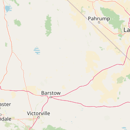
Map view of El Paso Mountains Wilderness

Use this park location map to pinpoint El Paso Mountains Wilderness in United States of America, understand its exact geographic position, and read its mapped placement within the surrounding landscape more clearly.

Pigeon | © OpenStreetMap contributors

Location context for El Paso Mountains Wilderness

CaliforniaKern County
Recorded earthquake history

Examine Recorded Earthquake History Near El Paso Mountains Wilderness

Review documented seismic events associated with the topography of El Paso Mountains Wilderness through our historical catalogue. This collection offers a structured look at past earthquake records, including magnitude and distance data, to provide better geographic context for this Mojave Desert wilderness area.

El Paso Mountains Wilderness Earthquake History

Catalogued events

1,708 events

Strongest magnitude

Magnitude 7.1

Most recent event

Jul 13, 2026

This history includes earthquakes recorded inside the park or within 50 km of its borders

Visualizing the badlands terrain, dark basalt mesas, and desert habitats of California

El Paso Mountains Wilderness Landscape Photos and Volcanic Scenery

Examinations of El Paso Mountains Wilderness imagery reveal the eroded badlands, reddish buttes, and volcanic formations defining the protected area. Visual documentation captures the stark Mojave Desert terrain and native vegetation surrounding Black Mountain.

A wide desert landscape featuring arid shrubland in the foreground leading to a large, rounded mountain peak under a clear blue sky.

A brown Bureau of Land Management sign reading El Paso Mountains Wilderness Area stands in a sandy, shrub-filled desert landscape under a clear blue sky.

Park atlas

Compare regional protected areas and connected desert wilderness terrains

Explore Other Parks Near El Paso Mountains Wilderness and Surrounding Desert Landscapes

Expand your geographic search by comparing El Paso Mountains Wilderness with adjacent desert protected areas and volcanic badlands. Examining nearby regional terrain provides deeper context on northern Mojave ecosystems and surrounding wilderness conservation.
Wildlife reserveKern County
8 km away#1 closest

Northwest

Kiavah Wilderness: Geographic Overview of the Scodie Mountains Plateau

Protected desert wilderness in Kern County, California

Kiavah Wilderness provides a vital protected landscape in Kern County, defined by the Scodie Mountains and a dramatic escarpment above the Mojave Desert floor. Known for its rare pinyon-juniper woodlands and seasonal springs, this wilderness area preserves the complex geography linking the southern Sierra Nevada to the broader Mojave basin.

Area
357.3 km²
Established
1994
IUCN
Ib
Relief
Mountain
Watercolor painting of a panoramic mountain landscape with stylized pine trees and soft green meadows.
Protected landscapeCalifornia
13 km away#2 closest

Northwest

Sequoia National Forest: Protected Sierra Nevada Geography and Mountain Terrain

A vast protected landscape spanning 1.1 million acres in California

Spanning Tulare, Kern, and Fresno counties, Sequoia National Forest preserves iconic giant sequoia groves across multiple river watersheds. The terrain features vertical relief exceeding 11,000 feet, showcasing a range of ecosystems from chaparral slopes and coniferous forests to glacial cirques and granite spires located within the southern Sierra Nevada range.

Area
4,829.17 km²
Established
1908
Relief
Mountain
Climate
Mediterranean
A soft watercolor painting of rolling hills and mountain ridges, featuring shades of green, yellow, and faint pink on a white background.
Wildlife reserveCalifornia
29 km away#3 closest

Northwest

Domeland Wilderness: Granite Spires and Kern Plateau Geography in the Southern Sierra Nevada

A protected wilderness landscape on the California high plateau

Spanning over 130,000 acres, Domeland Wilderness offers a deep look into the geological transition zone of the southern Sierra Nevada. The protected landscape is characterized by its iconic granite domes and spires, vast summer range meadows for deer, and the winding course of the Wild and Scenic South Fork Kern River. This atlas entry details the rugged terrain, ridge boundaries, and ecological diversity found across this lightly visited high-altitude wilderness.

Area
526.42 km²
Established
1964
IUCN
Ib
Relief
Mountain
A horizontal watercolor painting depicting a mountain range in the background with rolling hills and a winding river or stream in the foreground.
Protected landscapeCalifornia
56 km away#4 closest

North

Inyo National Forest: An Atlas of Protected Landscapes and Sierra Nevada Geography

High altitude wilderness and volcanic terrain in Eastern California

Spanning from the arid Owens Valley floor to the 14,000 foot crest of the Sierra Nevada, Inyo National Forest remains a cornerstone of the American West. This protected landscape contains the Ancient Bristlecone Pine Forest, Mount Whitney, and the Mono Inyo volcanic chain, providing a dense geographic record of glacial, tectonic, and ecological diversity across a vast managed corridor.

Area
7,702.71 km²
Established
1907
IUCN
Ib
Relief
Mountain
Watercolor painting of a mountain landscape with trees in the midground and a simple river or valley floor in the foreground, executed in a soft, light-toned palette.
Protected areaUnited States of America
About 68 km away#5 closest

North

Inyo Mountains Wilderness: Protected Landscapes and Geographic Features in California

A study of fault block terrain and desert mountain ecosystems.

The Inyo Mountains Wilderness serves as a dramatic ecological bridge between the Owens Valley and Saline Valley. This expansive protected area offers a look into late Proterozoic to Cambrian geology and distinct vertical plant zonation. Mapping the range reveals a network of canyons, ridges, and slopes that sustain endemic biodiversity and ancient bristlecone pine stands within the Great Basin periphery.

Area
806.17 km²
Relief
Mountain
Climate
Arid
Access
Remote access
National parkCalifornia
68 km away#6 closest

Northeast

Death Valley National Park: Exploring California's Mapped Protected Landscape

View the geographic boundaries and desert terrain.

Access a detailed atlas perspective of Death Valley National Park, a protected national park situated in California. Understand the park's distinct mapped boundaries and its role within the regional geography. This resource highlights the unique desert landscape, offering focused insights into its protected-area identity and natural terrain for geographic discovery.

Area
13,848.4 km²
Established
1994
IUCN
II
Visitors
1.1M annual
A soft, painterly watercolor illustration depicting layered green mountain ridges and rolling foothills under a bright, open sky.
Protected landscapeCalifornia
97 km away#7 closest

South

Angeles National Forest: Mapped Protected Landscapes and Geographic Terrain in California

Mountain wilderness and Mediterranean watershed geography

Spanning the San Gabriel and Sierra Pelona ranges, Angeles National Forest serves as a dramatic ecological transition zone. This analysis of its protected landscape focuses on the interaction between steep canyons, high peaks, and the distinct chaparral and conifer zones that shape California geography.

Area
2,652.26 km²
Established
1908
Relief
Mountain
Climate
Mediterranean
National parkCalifornia
98 km away#8 closest

Northwest

Sequoia National Park National Park: Geographic Identity and Protected Landscape Atlas

Explore mapped boundaries and the terrain of this California protected area.

Gain a structured understanding of Sequoia National Park as a protected landscape, focusing on its mapped geographic boundaries and its context within California. This entry provides foundational data for exploring the park's natural terrain and its role in a broader atlas of conservation lands, ideal for users seeking detailed geographic information.

Area
1,635.19 km²
Established
1890
IUCN
II
Visitors
1.2M annual

Common questions about visiting, size, designation, and location context for El Paso Mountains Wilderness

El Paso Mountains Wilderness FAQs for park facts, access, geography, and protected area context

Find quick answers about El Paso Mountains Wilderness, including protected-area facts, park geography, trail and visitor context, and how the park fits into its surrounding country and regional landscape.
MoriAtlas Explorer

Continue Your Protected Areas Search Across the Global Atlas

Deepen your exploration by continuing the structured search for national parks and protected areas worldwide. Utilize the comprehensive filtering capabilities to compare different conservation landscapes and refine your understanding of global park geography. Discover more about the distribution and characteristics of protected natural areas.

Global natural geography