Mori Atlas logo
Nature reserveEspace naturel sensible de la Vauvre

Analyzing the reclaimed marshland geography and avian habitats of this unique nature reserve

Espace naturel sensible de la Vauvre: A Mapped Wetland Protected Area in Central France

The Espace naturel sensible de la Vauvre sits as a distinct protected landscape within the Cher valley, showcasing a transformation from industrial excavation into a vital wetland mosaic. This nature reserve, located in the Allier department, serves as a crucial habitat for migratory birds and supports diverse dragonfly populations within its open water, reedbeds, and alluvial meadows. Understanding its geography reveals how historical infrastructure projects were repurposed to support significant regional biodiversity.

wetland reserveregional nature reserveEspace Naturel Sensiblebirdwatchingkingfisher habitatmigratory birds

Espace naturel sensible de la Vauvre

Nature reserve

Park overview

Structured park overview, official facts, and landscape profile for Espace naturel sensible de la Vauvre

Espace naturel sensible de la Vauvre park facts, protected area profile, and essential visitor context

Review the core facts for Espace naturel sensible de la Vauvre, including designation, size, terrain, visitor scale, habitats, and operating context in one park-focused overview.

About Espace naturel sensible de la Vauvre

L'Espace naturel sensible de la Vauvre sits in a quiet stretch of the Cher valley in the commune of Nassigny, in the Allier department of central France. Although small in size, the reserve is widely recognized within the region for its ecological richness, and it has become a reference site for wetland conservation in the Bourbonnais countryside. Its setting combines a sizeable open-water basin, a fringe of emergent marsh vegetation, damp meadows, and adjacent woodlands that together create a varied mosaic of habitats unusually concentrated for so modest an area.

The reserve grew out of what was originally a piece of industrial infrastructure. The plan d'eau at its heart was created between 1987 and 1989 when sand and gravel were extracted for the construction of the A71 motorway between Clermont-Ferrand, Bourges, and Vierzon. The new lake, surrounded by embankments, rip-rap, and the new highway bridge, would have remained a largely forgotten quarry had local naturalists not quickly realized its interest for waterbirds. Their observations underpinned the creation, in 1996, of a voluntary nature reserve managed by the local Centre permanent d'initiatives pour l'environnement (CPIE) of Tronçais.

After a difficult period in the early 2000s, the site was revitalized through a partnership between the commune of Nassigny, the communauté de communes du Val de Cher, and the LPO Auvergne. The commune transferred most of its land for a symbolic euro, and in 2011 the area was officially labeled as an Espace Naturel Sensible by the conseil départemental de l'Allier. A first five-year management plan introduced systematic habitat restoration, public engagement, and ecological monitoring, which have shaped the site's character ever since.

Today the reserve functions as a multi-purpose conservation site: a refuge for wetland birds, a feeding and resting place for mammals such as beavers and otters that have returned to the Cher, a study area for bats, dragonflies, and amphibians, and a local outdoor classroom. Two marked trails and several birdwatching hides allow visitors to experience the site without disturbing the wildlife, and each year the LPO organizes events such as the Fête de la Nature in late May alongside school programs and guided outings.

Quick facts and research context for Espace naturel sensible de la Vauvre

The Espace naturel sensible de la Vauvre is located in Nassigny, in the Allier department of the Auvergne-Rhône-Alpes region, within the historical Bourbonnais area of central France. It is part of the network of departmental "Espaces Naturels Sensibles" of the Allier and also carries a regional nature reserve designation. Administrative responsibility lies with the communauté de communes du Val de Cher, while day-to-day wildlife management is largely carried out by the local branch of the Ligue pour la protection des oiseaux (LPO Auvergne).

The protected area spans roughly 46 hectares, with a central plan d'eau, marshy fringes, and adjacent meadows along the Cher river. It is classified as a UICN Category IV protected area and was created as a voluntary nature reserve in 1996 before being officially labeled as an Espace Naturel Sensible in 2011. The site is open to the public, with marked trails, birdwatching hides, and seasonal educational events, while remaining primarily oriented toward conservation, ecological restoration, and ornithological monitoring.

Protection and recognition

Terrestrial conservation framing, designation history, and documented management scope

Espace naturel sensible de la Vauvre Protection Status and Designated Area Record

Espace naturel sensible de la Vauvre holds a registered terrestrial protection status established in 2011 with verified database tracking. This structured record details the designated conservation scope and official recognition metrics for the protected landscape.

Protection details

Protection scope
Terrestrial
Designated year
2011
Transboundary protection
No
WDPA ID
147275
Park context

Deeper park guide and search-rich context for Espace naturel sensible de la Vauvre

Espace naturel sensible de la Vauvre history, landscape, wildlife, and travel context

Explore Espace naturel sensible de la Vauvre through its history, landscape character, ecosystems, wildlife, conservation priorities, cultural context, and seasonal travel timing in a structured park guide built for atlas discovery and search intent.

Why Espace naturel sensible de la Vauvre stands out

The reserve is best known for its birdlife. Its combination of open water, reedy edges, and wet meadows makes it a productive habitat for breeding, wintering, and migratory birds, and it regularly hosts species such as the European kingfisher, the osprey, the little egret, the black kite, and the migratory ducks that shelter here in winter. Equally distinctive is the site's unusual origin story. The main lake is essentially a former motorway borrow pit, dug during the construction of the A71 Clermont-Bourges-Vierzon highway and left behind when the road was completed in 1989. Local ornithologists quickly recognized its ornithological potential, and over the following decades the accidental quarry has been deliberately reshaped into one of the Allier department's most valued wetland reserves.

Espace naturel sensible de la Vauvre history and protected-area timeline

The history of the Vauvre reserve is essentially the history of an accidental landscape that was gradually transformed into a deliberately protected one. Between 1987 and 1989, the construction of the A71 motorway between Clermont-Ferrand, Bourges, and Vierzon reshaped this stretch of the Cher valley: the river itself was embanked and channelized with dikes and rip-rap, a highway bridge was built, and large quantities of sand and gravel were extracted to supply the construction works, leaving behind the substantial basin that is now the reserve's central lake. The motorway opened in December 1989, and from the very first years local ornithologists began visiting the new waterbody, recognizing its strong potential for waterbirds.

In 1996, the prefect of the Allier formally created the Réserve naturelle volontaire de la Vauvre, placing its management in the hands of the CPIE of Tronçais. The site was managed in this way until 2002. After a period during which the reserve was somewhat neglected, the Ligue pour la protection des oiseaux (LPO) Auvergne met with local elected representatives in 2004 to relaunch conservation work. In 2008, the commune of Nassigny, which owned most of the land, transferred it for a symbolic euro to the communauté de communes du Val de Cher, giving the site a stable institutional base.

In 2010, the conseil départemental de l'Allier, the commune, and the communauté de communes jointly labeled the Vauvre as an Espace Naturel Sensible, and the label was formally applied from 2011. A five-year management plan drawn up under the leadership of the communauté de communes and the LPO Auvergne followed shortly afterwards, launching a sustained program of habitat restoration, public awareness activities, and naturalist inventories that continues to define the reserve today.

Espace naturel sensible de la Vauvre landscape and geographic character

The landscape of the Vauvre reserve is dominated by the large open water of the central plan d'eau, edged by reedbeds and other emergent wetland vegetation that colonize the gently sloping banks. Around the lake, the terrain transitions into alluvial meadows and damp grasslands, with willows and other riparian trees lining parts of the shoreline. Together, these elements create the sort of layered wetland mosaic that is increasingly rare in the heavily cultivated plains of central France.

Beyond the wetland core, the reserve is framed by the modified valley of the Cher itself. The river was straightened and embanked during the motorway works, producing the channels, dikes, and embankments that still mark the wider landscape. The historic Tronçais forest lies not far to the north, and the broader scenery of the Bourbonnais alternates between bocage, arable fields, scattered woodland patches, and small valley wetlands like the Vauvre.

Espace naturel sensible de la Vauvre ecosystems, habitats, and plant life

Ecologically, the Vauvre reserve is primarily a wetland ecosystem, with a clear gradient from open water through reedbed and marsh to wet meadow. The southern part of the lake is densely colonized by flowering rush (Butomus umbellatus), a species considered rare in Auvergne, illustrating the botanical interest of even the most aquatic parts of the site. The diversity of habitats supports an unusually rich community of dragonflies for so small an area: roughly thirty-five species were recorded in 2011, representing about half of all species known from the Auvergne region.

The mosaic of dry meadows, shrubby edges, and wetlands also supports insects such as the Gazé, a butterfly that has become scarce on the French plains. Combined with the waterbodies, these habitats create conditions favorable for amphibians, even though the yellow-bellied toad, once present here, was last recorded in 1988. Overall, the site's ecological value lies less in rarity than in the density and diversity of wetland habitats packed into a small footprint within an otherwise intensively managed countryside.

Espace naturel sensible de la Vauvre wildlife and species highlights

The reserve's wildlife profile is built around birds. The lake and its fringes form an important ecological corridor for breeding, wintering, and migratory species, and the site is well known among local birders for sightings of the black kite, the osprey, and the little egret fishing in the shallows. The European kingfisher finds particularly favorable conditions here for both reproduction and feeding, while ducks such as the mallard breed on site and a variety of wintering species, including wigeon and other migratory ducks, use the basin as a refuge in the colder months. Restoration work has also encouraged the return of breeding pairs of red-backed shrike.

Mammal interest is focused along the Cher and the wetland fringes. Eleven bat species were recorded in a 2013 inventory, although no breeding roosts were identified; the bats appear to use the reserve mainly as hunting habitat, especially during migration. Eurasian beavers have been observed on the site since 2011, and the European otter has been recorded here since 1995, both signs of improving water quality and habitat connectivity in the valley.

Among invertebrates, the dragonfly fauna is particularly notable, with roughly half of Auvergnat species recorded on the site. Invasive Louisiana crawfish are also present and are the subject of an active management program because of their impact on native crayfish and bank stability.

Espace naturel sensible de la Vauvre conservation status and protection priorities

As a labeled Espace Naturel Sensible and a regional nature reserve, the Vauvre site carries significant conservation weight within the Allier department, despite its modest size. It contributes to a network of seventeen departmental sensitive natural areas and provides one of the few reliable wetland refuges for waterbirds in an otherwise heavily cultivated landscape. The protection status is anchored both in the 1996 voluntary reserve designation and in the 2011 departmental ENS label, and it is reinforced by a dedicated five-year management plan coordinated by the communauté de communes du Val de Cher and the LPO Auvergne.

Active conservation at the Vauvre focuses on habitat restoration, biodiversity monitoring, and control of invasive species. Habitat reopening work has clearly benefited birds such as the red-backed shrike, while a multi-year program (2016 to 2020) led by the LPO specifically targets the Louisiana crawfish population to limit its damage to native crayfish and to bank stability. The reserve also functions as an open-air laboratory for bat, dragonfly, and plant inventories, helping to track the recovery of wetland biodiversity in the Cher valley.

Espace naturel sensible de la Vauvre cultural meaning and human context

The Vauvre reserve is rooted in the rural culture of the Bourbonnais, and although it has no deep historical heritage attached to the site itself, it sits in a landscape long shaped by agriculture, small river valleys, and forestry, including the famous Tronçais forest nearby. The recent history of the site is in fact a cultural story in its own right: the accidental creation of the lake during motorway construction in the late 1980s, followed by a community-led effort to give it conservation value, reflects the strong involvement of local ornithologists, the commune of Nassigny, and the communauté de communes du Val de Cher.

Annual events such as the Fête de la Nature in late May, school programs, and guided outings run by the LPO have made the reserve an established part of local environmental culture, where nature-based education and community engagement are as central as habitat protection.

Top sights and standout views in Espace naturel sensible de la Vauvre

One of the standout features of the Vauvre reserve is how a former motorway borrow pit has been deliberately reshaped into a functioning wetland sanctuary, with a particularly strong birdwatching identity. The combination of open water, reedbed, and meadow within a compact 46-hectare footprint supports a dense and varied bird fauna as well as an unusually rich dragonfly community, and the site's proximity to the Tronçais forest adds a wider Bourbonnais context to any visit.

Equally distinctive is the long-running partnership between the commune of Nassigny, the communauté de communes du Val de Cher, and the LPO Auvergne, which has turned what was once a neglected industrial accident into a model of small-scale community-led wetland conservation in central France.

Best time to visit Espace naturel sensible de la Vauvre

The reserve's character changes meaningfully through the seasons, and visiting at different times of year offers very different experiences. Spring and early summer are the most dynamic periods ornithologically, with breeding birds such as kingfishers, red-backed shrikes, and a wide range of wetland species active around the lake and its fringes, and the late-May Fête de la Nature offers a particularly lively window into the site.

Autumn and winter bring their own interest, when migratory and wintering waterfowl, including various duck species, use the open water as a refuge, and the bare vegetation makes it easier to observe birds from the site's hides and observation cabins. Summer visits are generally warm and pleasant, with dragonflies abundant around the reedbeds, while any visit benefits from the two marked trails and several hides that allow quiet, low-impact observation of the wildlife.
Monthly climate preview

Long-term representative monthly temperature and precipitation data for Espace naturel sensible de la Vauvre

Espace naturel sensible de la Vauvre Climate Normals and Annual Weather Patterns

Representative coordinates record long-term monthly temperature averages ranging from negative lows to warm summer peaks alongside steady precipitation levels. Examining the complete twelve-month record reveals detailed annual climate normals across the protected landscape.
Annual mean11 °C
3 °C20 °C
Jan
Feb
Mar
Apr10°
May14°
Jun18°
Jul20°
Aug20°
Sep16°
Oct12°
Nov
Dec
Warmest month
August

20.3 °C

Coolest month
January

2.7 °C

Wettest month
May

2.6 mm/day

Driest month
March

1.6 mm/day

Park location guide

Geography guide, regional context, and park location map for Espace naturel sensible de la Vauvre

Espace naturel sensible de la Vauvre park geography, regions, and map view in France

Understand where Espace naturel sensible de la Vauvre sits in France through a broader geographic reading of the surrounding landscape, nearby location context, and its mapped position within the national park landscape.

How Espace naturel sensible de la Vauvre fits into France

France is a unitary semi-presidential republic and one of the world's largest economies. It borders Belgium, Luxembourg, Germany, Switzerland, Italy, Monaco, Andorra, and Spain, with a maritime border to the United Kingdom. The country is known for its cultural influence, art, cuisine, and political history spanning centuries.

Wider geography shaping Espace naturel sensible de la Vauvre in France

France is located in Western Europe. Metropolitan France extends from the Rhine to the Atlantic Ocean and from the Mediterranean Sea to the English Channel and North Sea. The country borders Belgium, Luxembourg, Germany, Switzerland, Italy, Monaco, Andorra, Spain, and has a maritime border with the United Kingdom.

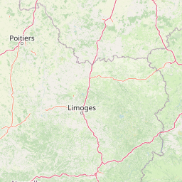
Map view of Espace naturel sensible de la Vauvre

Use this park location map to pinpoint Espace naturel sensible de la Vauvre in France, understand its exact geographic position, and read its mapped placement within the surrounding landscape more clearly.

Pigeon | © OpenStreetMap contributors

Location context for Espace naturel sensible de la Vauvre

Auvergne-Rhône-Alpes
Park atlas

Compare nearby wetland reserves, valley landscapes, and regional conservation areas.

Parks Near Espace naturel sensible de la Vauvre and Surrounding Protected Areas

Browsing other protected areas near Espace naturel sensible de la Vauvre reveals how central France preserves fragmented wetland habitats and river valleys. Comparing adjacent regional nature reserves expands your understanding of local wildlife corridors and Bourbonnais geography.
A soft, horizontal watercolor painting showing a meandering river winding through lush green riverbanks, with distant rolling hills against a white background.
Nature reserveAllier
About 54 km away#1 closest

East

Réserve naturelle nationale du val d'Allier Protected Area and River Corridor Map

Alluvial landscape and floodplain geography in central France

The Réserve naturelle nationale du val d'Allier encompasses a mosaic of gravel bars, islands, and side channels shaped by natural river dynamism. This protected expanse showcases a complete riparian forest sequence, providing a rare example of a largely untamed river floodplain preserved for its ongoing geomorphic activity.

Area
14.5 km²
Established
1994
IUCN
IV
Relief
Lowland
A soft watercolor painting of a wide, rolling landscape with green hills, pale mountain silhouettes in the background, and a faint reddish-brown foreground, presented on a white background.
Natural monumentAuvergne-Rhône-Alpes
About 72 km away#2 closest

South

Chaîne des Puys - faille de Limagne: Mapping Volcanic and Tectonic Protected Landscapes

Geological exploration of the Auvergne-Rhône-Alpes volcanic chain

Spanning a rhythmic skyline of roughly eighty volcanoes, the Chaîne des Puys - faille de Limagne represents a premier site for studying continental rifting and volcanic landforms. This protected monument offers a clear view into the interplay between the ancient mountain basement, the massive Limagne fault, and the resulting volcanic edifices that define the regional identity of the Auvergne-Rhône-Alpes area.

Area
242.23 km²
Established
2018
Relief
Mountain
Climate
Temperate
Nature reservePuy-de-Dôme
About 77 km away#3 closest

Southeast

Réserve naturelle régionale des cheires et grottes de Volvic: Volcanic Landscapes and Bat Habitats

A regional nature reserve within the Puy-de-Dôme volcanic terrain

This protected area captures the geological signature of the Puy de la Nugère, where trachy-andésite lava flows form a stark surface landscape known as cheires. Beneath these flows, an extensive network of abandoned quarries provides stable cavities for diverse bat species, creating a dual-layered ecological site within the Chaîne des Puys.

Area
0.613 km²
Established
2014
IUCN
IV
Visitors
100K annual
Watercolor painting of the Loire river showing trees along the banks and soft pink clouds in the background.
Nature reserveBourgogne-Franche-Comté
About 78 km away#4 closest

Northeast

Réserve naturelle régionale de la Loire bourguignonne: Regional Nature Reserve Map

Protected fluvial geography in Bourgogne-Franche-Comté

Located in the Nièvre department, this reserve protects an essential section of the Loire river. The landscape offers a rich mosaic of 31 natural habitats, featuring exposed gravel banks and riparian woodlands that support rare endemic flora and diverse ground-nesting bird populations.

Area
7.397 km²
Established
2015
IUCN
IV
Relief
Lowland
Nature reserveAuvergne-Rhône-Alpes
About 83 km away#5 closest

East

Réserve naturelle régionale du val de Loire Bourbonnais Protected Area and Atlas View

Riverine geography and floodplain landscapes in Allier, France

Examine the geographic profile of the Réserve naturelle régionale du val de Loire Bourbonnais. This site protects a significant stretch of the Loire River characterized by active meanders and alluvial deposits, representing a key example of riverine conservation in the Bourbonnais region of central France.

Area
3.08 km²
Established
2015
IUCN
IV
A horizontal watercolor painting depicting a wide river valley with grassy banks and distant hills in soft pastel shades of green, yellow, and muted pink.
Nature reserveBourgogne-Franche-Comté
About 86 km away#6 closest

North

Réserve naturelle nationale du val de Loire: Protected River Geography and Map

An active alluvial landscape in the French river corridor

The Réserve naturelle nationale du val de Loire preserves one of the most representative segments of a free-flowing river system in Europe. This protected corridor showcases an exceptionally active dynamic, featuring shifting sandbanks, calm backwaters, and diverse alluvial forests that define the valley floor. Learn about the geographic boundaries and the natural terrain that characterize this essential French nature reserve.

Area
14.54 km²
Established
1995
IUCN
IV
Relief
Lowland
A horizontal watercolor painting showing a green landscape with a winding stream, patches of marshy water, and distant hills, with soft light and green trees on the sides.
Nature reserveBourgogne-Franche-Comté
About 92 km away#7 closest

Northeast

Réserve naturelle régionale des Mardelles de Prémery: Protected Wetland and Forest Geography

Mapping the peatland depressions of the Prémery forest

This nature reserve protects a rare assemblage of mardelles, shallow forest pools set within the Prémery state forest. The landscape serves as a vital ecological archive, with peat deposits documenting environmental changes over 15 millennia. Explore the unique hydrological and botanical features of this protected lowland habitat nestled in the heart of the Nièvre department.

Area
2.525 km²
Established
2015
IUCN
IV
Nature reserveAuvergne-Rhône-Alpes
About 102 km away#8 closest

Southeast

Réserve naturelle régionale du Puy de Marmant: Volcanic Geography and Protected Terrain

Regional nature reserve in the Auvergne-Rhône-Alpes landscape.

This protected site preserves a prominent volcanic hill and its surrounding dry grasslands within the Limagne basin. The reserve serves as an ecologically significant island, maintaining specialized thermophilous plants and rare geological formations composed of basalt and peperite. It remains an essential reference for understanding the volcanic heritage and unique botanical diversity of the Puy-de-Dôme department.

Area
0.203 km²
Established
1985
IUCN
IV
Relief
Upland

Common questions about visiting, size, designation, and location context for Espace naturel sensible de la Vauvre

Espace naturel sensible de la Vauvre FAQs for park facts, access, geography, and protected area context

Find quick answers about Espace naturel sensible de la Vauvre, including protected-area facts, park geography, trail and visitor context, and how the park fits into its surrounding country and regional landscape.
MoriAtlas Explorer

Continue Your Protected Areas Search Across the Global Atlas

Deepen your exploration by continuing the structured search for national parks and protected areas worldwide. Utilize the comprehensive filtering capabilities to compare different conservation landscapes and refine your understanding of global park geography. Discover more about the distribution and characteristics of protected natural areas.

Global natural geography