
Mori Atlas logo
Nature reserveFauler See/Markendorfer Wald

Explore the integrated woodland and lake geography within this protected nature reserve corridor.

Fauler See/Markendorfer Wald: A Protected Nature Reserve Landscape in Brandenburg, Germany

(Naturschutzgebiet Fauler See/Markendorfer Wald)

Fauler See/Markendorfer Wald stands as a strictly designated nature reserve within the Brandenburg region, located near the city of Frankfurt Oder. This protected area preserves a distinct landscape where open water lake habitats merge with mature forest ecosystems. The reserve acts as a critical natural enclave nestled among major regional transport corridors, offering a preserved look at the lowland terrain and ecological connectivity characteristic of eastern Germany.

nature reserveBrandenburglake habitatwoodlandmixed forestperi-urban nature
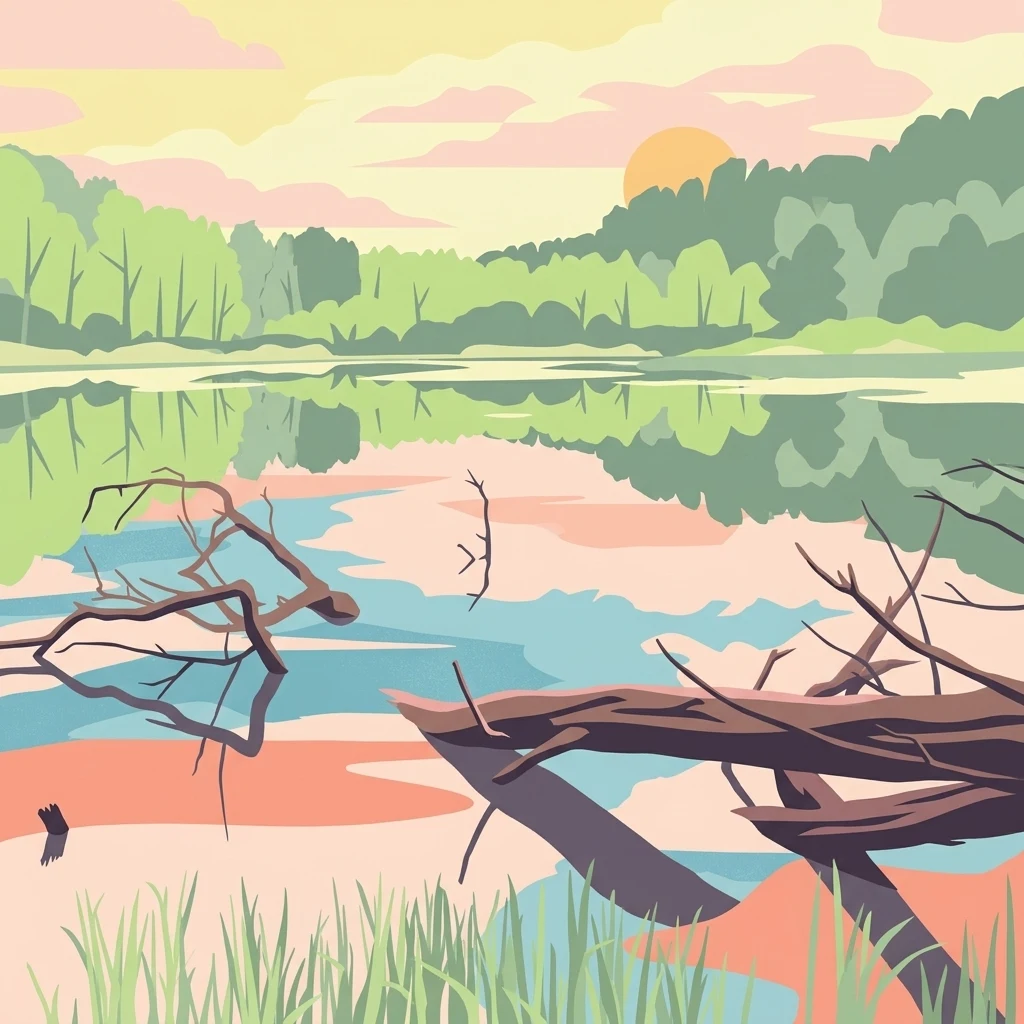
A flat-style digital illustration depicting a calm lake surrounded by forest at sunset. In the foreground, fallen tree trunks extend into the water, and reeds grow along the shore. The scene features soft pastel colors and a reflective water surface.

Fauler See/Markendorfer Wald

Nature reserve

Park overview

Structured park overview, official facts, and landscape profile for Fauler See/Markendorfer Wald

Fauler See/Markendorfer Wald park facts, protected area profile, and essential visitor context

Review the core facts for Fauler See/Markendorfer Wald, including designation, size, terrain, visitor scale, habitats, and operating context in one park-focused overview.

About Fauler See/Markendorfer Wald

Fauler See/Markendorfer Wald is a small but clearly defined nature reserve in eastern Germany, situated within the territory of the independent city of Frankfurt (Oder) in the state of Brandenburg. Officially established in early 2003 under a Brandenburg state safeguarding order, the reserve exists to protect a localized landscape where a lake ecosystem and a forested area occur in close proximity, an arrangement that is more characteristic of rural settings than of areas immediately adjacent to a city center.

The reserve takes its dual name from its two principal components: the Fauler See, the small lake at its heart, and the Markendorfer Wald, the surrounding woodland that gives the protected area its forested character. Together these features form a continuous stretch of semi-natural landscape that has been shielded from more intensive land uses, allowing local habitats to persist in a region otherwise shaped by urban development, transport corridors, and agriculture.

The site's location is one of its defining traits from a conservation perspective. Although the reserve is only about 171 hectares in area, it lies immediately southwest of Frankfurt (Oder)'s central city area, near the Markendorf district. Major transport routes bound the area on multiple sides, including the A 12 motorway to the north and the federal roads B 87 and B 112 to the west and east. This positioning makes the reserve a notable example of how even relatively small protected areas can play an important ecological role in peri-urban landscapes, functioning simultaneously as a habitat refuge and as a green buffer within the city's territory.

Within Brandenburg's broader network of protected sites, Fauler See/Markendorfer Wald is part of a cluster of Naturschutzgebiete that the city of Frankfurt (Oder) maintains, alongside reserves such as Booßener Teichgebiet, Eichwald und Buschmühle, and Oderwiesen nördlich Frankfurt. Its status as an IUCN Category IV area underlines its explicit orientation toward habitat and species management, rather than purely passive protection.

Quick facts and research context for Fauler See/Markendorfer Wald

Fauler See/Markendorfer Wald is a registered nature reserve (Naturschutzgebiet) with official code 1526 and a total area of approximately 171 hectares. It is located in the independent city of Frankfurt (Oder) within the state of Brandenburg, in eastern Germany, and is positioned southwest of the inner city at the edge of the Markendorf district.

The reserve is administered under a safeguarding order issued on 20 December 2002, with the formal establishment date of 4 April 2003. It is classified as an IUCN Category IV protected area, indicating habitat and species management. Major road corridors including the A 12 motorway to the north and federal highways B 87 and B 112 to the west and east define its broader geographic setting, while the protected landscape itself is dominated by the Fauler See lake and the surrounding Markendorfer Wald woodland.

Protection and recognition

Documented conservation status and international Natura 2000 recognition records

Fauler See and Markendorfer Wald Protection Status and Recognition Data

Fauler See/Markendorfer Wald incorporates official Natura 2000 designations and recorded conservation boundaries into a structured geographic index. Conservation researchers and park planners utilize these verified records to analyze international protection frameworks across the landscape.
Park context

Deeper park guide and search-rich context for Fauler See/Markendorfer Wald

Fauler See/Markendorfer Wald history, landscape, wildlife, and travel context

Explore Fauler See/Markendorfer Wald through its history, landscape character, ecosystems, wildlife, conservation priorities, cultural context, and seasonal travel timing in a structured park guide built for atlas discovery and search intent.

Why Fauler See/Markendorfer Wald stands out

Fauler See/Markendorfer Wald is best known for combining a small forest lake with an adjacent named woodland, the Markendorfer Wald, within a single strictly protected area. It represents a compact, urban-adjacent refuge where wetland and forest habitats meet, and is recognized as part of the regional protected-area system of Frankfurt (Oder).
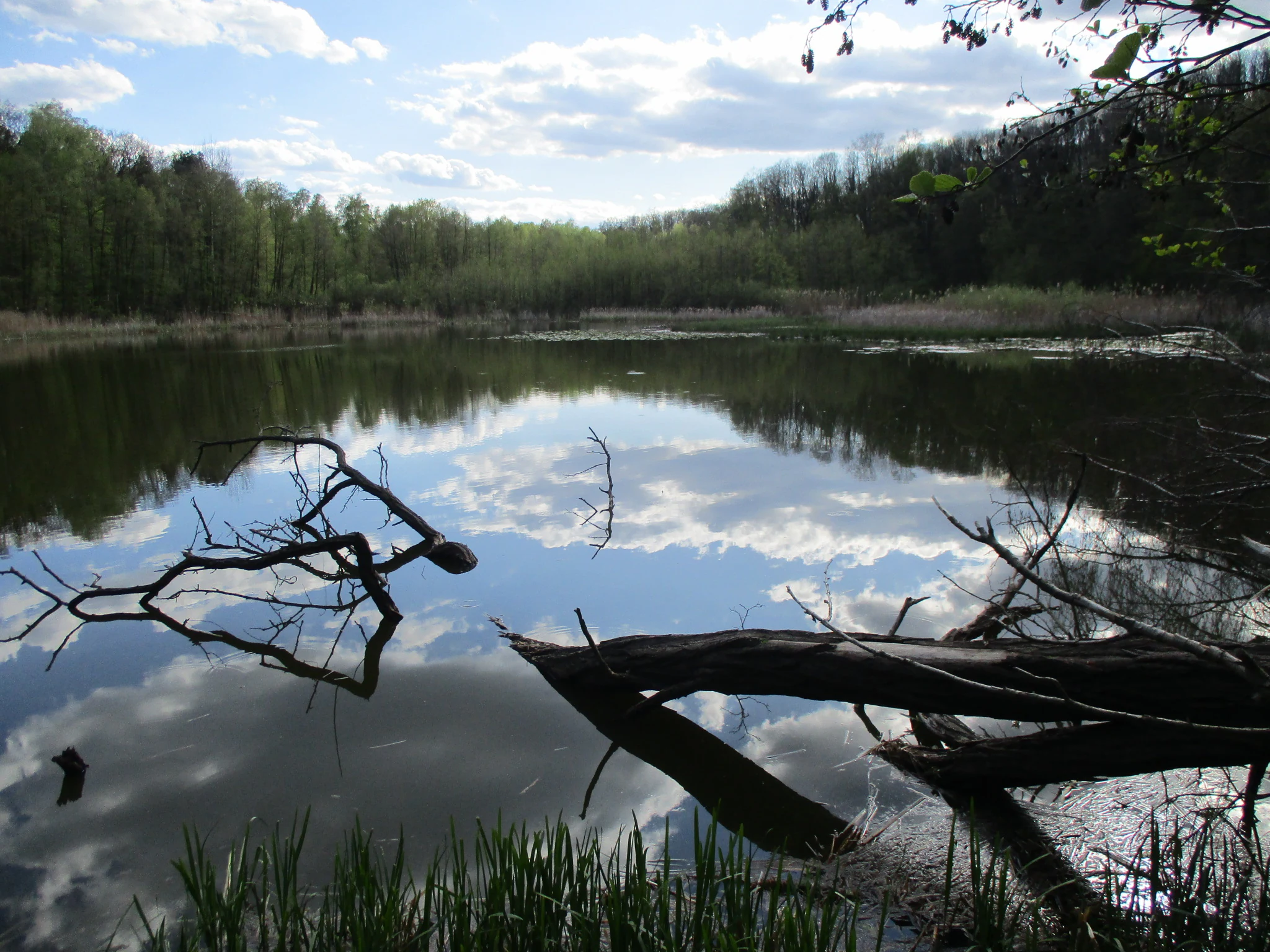
A calm lake reflection showing blue sky and white clouds, with dark tree branches and a fallen log in the foreground and a lush green forest bank in the distance.
A serene view of Fauler See surrounded by forest in spring.

Fauler See/Markendorfer Wald history and protected-area timeline

The history of Fauler See/Markendorfer Wald as a formal protected area dates to the early 2000s. A safeguarding order for the reserve was issued on 20 December 2002, and the area was officially established as a Naturschutzgebiet on 4 April 2003. Since that time, the site has been maintained as part of Brandenburg's network of strictly protected nature reserves (

) and is listed internationally in the World Database on Protected Areas under the WDPA ID 318386. Subsequent planning and management work has been undertaken as part of the Natura 2000 framework, reflecting the area's integration into the wider European protected-area context.

Beyond the formal designation, the local press has described the area as a natural environment at the edge of the city, highlighting how the reserve functions as a small but valued natural area embedded within the urban territory of Frankfurt (Oder).

Fauler See/Markendorfer Wald landscape and geographic character

The landscape of Fauler See/Markendorfer Wald is shaped by the combination of a small lake and surrounding woodland. The Fauler See itself is the central hydrological feature of the reserve, and its margins merge into the wooded terrain of the Markendorfer Wald. The result is a compact zone where open water, shoreline, and forest habitats blend directly into one another, without extensive zones of agricultural or developed land separating them.

Geographically, the reserve lies in the lowlands of eastern Brandenburg, southwest of the inner city of Frankfurt (Oder) and adjacent to the Markendorf district. The terrain is largely flat, in keeping with the broader glacially influenced landscape of the region, and the protected area is hemmed in by major transport infrastructure. The A 12 motorway runs to the north, while the B 87 to the west and the B 112 to the east channel significant traffic past, rather than through, the reserve, leaving the woodland and lake as a quieter pocket within a generally busy transport corridor.

Fauler See/Markendorfer Wald ecosystems, habitats, and plant life

Ecologically, the reserve is defined by the meeting point of two complementary habitat types. The Fauler See provides standing freshwater habitat, supporting shoreline vegetation and the wetland-associated communities typical of small lowland lakes in Brandenburg. The surrounding Markendorfer Wald extends a wooded environment up to and beyond the lake margins, providing terrestrial habitat continuity across the protected area and connecting the open water to a forested buffer.

This lake-and-woodland mosaic is the central ecological signature of the reserve. Such mosaics are recognized for their value in maintaining habitat diversity in relatively small areas, particularly when water-based and forest-based habitats are closely interwoven. Within Brandenburg's broader ecological context, the reserve represents an urban-adjacent enclave where both forest and aquatic habitats can coexist with minimal fragmentation or external disturbance.

Fauler See/Markendorfer Wald conservation status and protection priorities

Fauler See/Markendorfer Wald is significant from a conservation perspective because it secures and manages a combination of forested and freshwater habitats in a location where such habitats compete with significant human pressures. Classified as a Naturschutzgebiet, Germany's strictest category of nature protection, and as an IUCN Category IV habitat and species management area, the reserve is explicitly oriented toward the active safeguarding of its ecological values.

The reserve is part of the Natura 2000 management planning framework for Brandenburg, integrating the site into the wider European network that coordinates protection of threatened habitats and species. By maintaining a forest and lake complex immediately adjacent to a sizeable city and along major transport routes, the reserve plays a meaningful role in preserving ecological continuity within a heavily used peri-urban landscape.

Top sights and standout views in Fauler See/Markendorfer Wald

The defining highlights of Fauler See/Markendorfer Wald are its integration of a named small lake, the Fauler See, with an adjacent woodland, the Markendorfer Wald, inside a single strictly protected nature reserve. Its peri-urban location on the edge of Frankfurt (Oder), nested between major federal highways, and its inclusion in both national and European conservation frameworks give the site a clear identity as a compact yet ecologically purposeful protected landscape.

Monthly climate preview

Long-term representative monthly temperature and precipitation data for Brandenburg

Fauler See/Markendorfer Wald Climate Normals and Annual Temperature Rhythm

Representative coordinate measurements reveal the annual cycle of average temperatures and precipitation totals across Fauler See/Markendorfer Wald. Detailed monthly climate normals provide deeper context into long-term meteorological patterns at this location.
Annual mean9 °C
-1 °C20 °C
Jan-1°
Feb
Mar
Apr
May14°
Jun18°
Jul20°
Aug20°
Sep15°
Oct
Nov
Dec
Warmest month
July

20.3 °C

Coolest month
January

-1.1 °C

Wettest month
July

2.5 mm/day

Driest month
April

1.1 mm/day

Park location guide

Geography guide, regional context, and park location map for Fauler See/Markendorfer Wald

Fauler See/Markendorfer Wald park geography, regions, and map view in Germany

Understand where Fauler See/Markendorfer Wald sits in Germany through a broader geographic reading of the surrounding landscape, nearby location context, and its mapped position within the national park landscape.

How Fauler See/Markendorfer Wald fits into Germany

Germany is a federal republic in Western and Central Europe with a population of over 83 million across sixteen constituent states. It is Europe's largest economy by nominal GDP and a major global exporter and importer. The capital is Berlin, and the country borders Denmark, Poland, Czech Republic, Austria, Switzerland, France, Luxembourg, Belgium, and the Netherlands.

Wider geography shaping Fauler See/Markendorfer Wald in Germany

Germany is located in Western and Central Europe, spanning 357,022 km². It borders Denmark to the north, Poland and the Czech Republic to the east, Austria and Switzerland to the south, and France, Luxembourg, Belgium, and the Netherlands to the west. The country has coastlines on the Baltic Sea and North Sea to the north, with the Alps located in the southern region.

Map view of Fauler See/Markendorfer Wald

Use this park location map to pinpoint Fauler See/Markendorfer Wald in Germany, understand its exact geographic position, and read its mapped placement within the surrounding landscape more clearly.

Pigeon | © OpenStreetMap contributors

Location context for Fauler See/Markendorfer Wald

Brandenburg

Visual exploration of lake habitats, woodland terrain, and conservation boundaries

Fauler See and Markendorfer Wald Photos, Scenery, and Protected Landscape Views

Visual records document the forested shores, open waters, and wetland margins defining Fauler See and Markendorfer Wald. Detailed photography captures the protected lowland character, offering clear insight into regional conservation habitats.

A calm lake reflection showing blue sky and white clouds, with dark tree branches and a fallen log in the foreground and a lush green forest bank in the distance.

Park atlas

Compare surrounding lowland reserves and connected protected landscapes in Brandenburg

Explore Other Parks Near Fauler See and Markendorfer Wald for Regional Comparison

Visitors exploring Fauler See and Markendorfer Wald can browse nearby protected areas to examine similar lake and woodland ecosystems across eastern Brandenburg. Extending the regional comparison reveals how small urban fringe reserves fit into broader lowland conservation networks.
Nature reserveBrandenburg
3.5 km away#1 closest

Northeast

Fledermausquartier Brauereikeller Frankfurt (Oder) Nature Reserve and Protected Landscape

Urban bat conservation site in Brandenburg, Germany

The Fledermausquartier Brauereikeller Frankfurt (Oder) encompasses 1.34 hectares of protected land, centered on a historic brewery ruin that has become a vital habitat for hibernating bats. By leveraging specialized microclimates within brick cellars and maintaining a protective green buffer, the reserve functions as a landmark for urban wildlife preservation and transboundary conservation efforts in Brandenburg.

Area
0.013 km²
Established
2006
IUCN
IV
Relief
Lowland
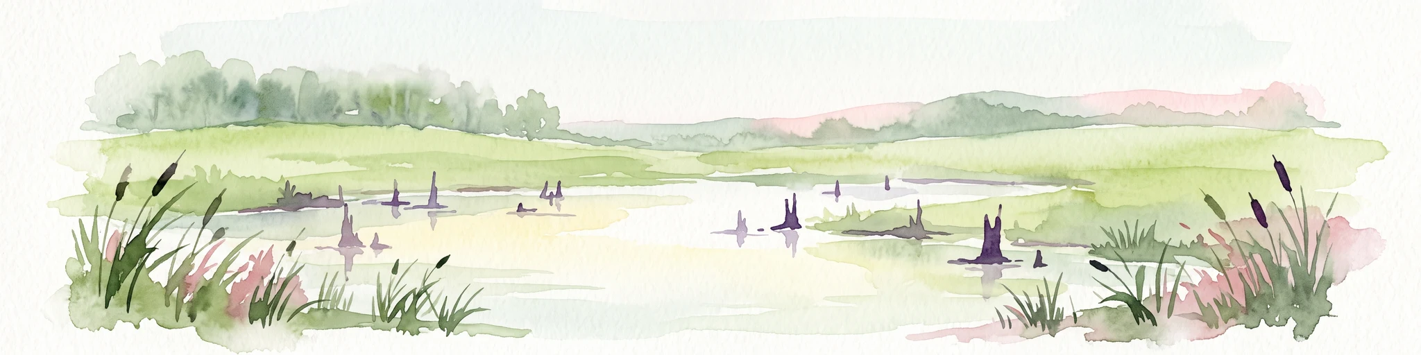
A watercolor painting showing a quiet wetland with calm water, scattered dark tree stumps, reeds in the foreground, and rolling green hills in the distance under a pale sky.
Nature reserveBrandenburg
6.5 km away#2 closest

North

Booßener Teichgebiet Nature Reserve: Regional Geography and Protected Landscape Analysis

Glacial meltwater valleys and pond ecosystems in eastern Brandenburg

Discover the geographic footprint of Booßener Teichgebiet, a 104-hectare nature reserve in Brandenburg. This protected area features a unique combination of managed stream corridors, impoundment ponds, and xerothermic biotopes nestled within a glacial meltwater valley near the German-Polish border.

Area
1.04 km²
Established
2008
IUCN
IV
Relief
Lowland
Watercolor painting showing a winding river through a wetland with trees and hills in the background.
Nature reserveLubusz Voivodeship
About 15 km away#3 closest

Northeast

Mokradła Sułowskie Nature Reserve: Mapping Wetland Protected Areas in Lubusz Voivodeship

A comprehensive geographic atlas of Polish peatland and forest marsh habitats

The Mokradła Sułowskie nature reserve protects a vital cluster of eutrophic lakes and waterlogged mires in western Poland. This atlas entry provides a detailed look at its unique landscape, where divided northern and southern sections showcase diverse stages of marshland succession and regional biodiversity within the broader Lubusz Voivodeship.

Area
0.451 km²
Established
1990
Water
Water-dominated
Protected landscapePoland
16 km away#4 closest

North

Park Krajobrazowy Ujście Warty: Protected Landscape and River Valley Atlas

Mapping wetland ecosystems and floodplain geography in western Poland

Park Krajobrazowy Ujście Warty preserves a significant lowland river valley landscape characterized by vast open pastures, marshes, and rare riparian oak forests. Located primarily within the Lubuskie region, this protected area offers a clear view into the floodplain processes of the Warta river basin, providing a distinct geographic context for wetland conservation and waterbird habitat mapping in Poland.

Area
194.96 km²
Established
1996
Relief
Lowland
Climate
Temperate
A horizontal watercolor illustration showing soft, pastel-colored rolling hills and a calm lake or pond in the foreground, surrounded by grassy banks.
Nature reserveBrandenburg
About 26 km away#5 closest

West

Beerenbusch Nature Reserve: Geographic Profile and Protected Woodland Landscapes of Brandenburg

Mapping forest boundaries in the German lowlands

Located in the Oder-Spree district, Beerenbusch protects rare oak-hornbeam and alder swamp forest ecosystems. This profile details the reserve landscape, cultural landmarks like the Königskiefer, and its importance as a surviving woodland refuge within the Brandenburg forest belt.

Area
0.7 km²
Established
1967
IUCN
IV
Relief
Lowland
Nature reserveLubusz Voivodeship
About 27 km away#6 closest

Southeast

Młodno Nature Reserve: Mapped Protected Peatland and Wetland Landscapes in Lubusz Voivodeship

Geographic analysis of lowland mire and pine forest mosaic

Examine the territorial footprint of Młodno Nature Reserve in western Poland. This site offers insight into deep-sediment organic basins and the ecological transition zones between marshland and pine-dominated woodlands within the Torzym Plain.

Area
0.929 km²
Established
1988
Relief
Lowland
Scope
Terrestrial
Nature reserveBrandenburg
About 28 km away#7 closest

Southwest

Dammühlenfließniederung Nature Reserve: Brandenburg Protected Land and Geography Atlas

Floodplain and riparian habitats in the Niederlausitz region

Explore the geographic framework of Dammühlenfließniederung, an essential nature reserve in eastern Brandenburg. This area safeguards the Dammühlenfließ stream valley and a segment of the Schwielochsee lakeshore, representing the unique glacial lowlands of the region through a focused wetland and floodplain corridor.

Area
0.79 km²
Established
1998
IUCN
IV
National parkLubusz Voivodeship
29 km away#8 closest

Northeast

Park Narodowy „Ujście Warty” National Park: Regional Geography and Wetland Landscapes

A major protected riparian and floodplain zone in western Poland

Located in the Lubusz Voivodeship, Park Narodowy „Ujście Warty” features an extensive network of wetlands, marshes, and meadows at the Warta and Oder confluence. This atlas entry provides essential geographic context for the park's lowland terrain and riverine ecosystems, which are defined by constant shifts in water levels and seasonal flooding patterns that sustain dense bird populations.

Area
80.74 km²
Established
2001
Visitors
52K annual
Relief
Lowland

Common questions about visiting, size, designation, and location context for Fauler See/Markendorfer Wald

Fauler See/Markendorfer Wald FAQs for park facts, access, geography, and protected area context

Find quick answers about Fauler See/Markendorfer Wald, including protected-area facts, park geography, trail and visitor context, and how the park fits into its surrounding country and regional landscape.
MoriAtlas Explorer

Continue Your Protected Areas Search Across the Global Atlas

Deepen your exploration by continuing the structured search for national parks and protected areas worldwide. Utilize the comprehensive filtering capabilities to compare different conservation landscapes and refine your understanding of global park geography. Discover more about the distribution and characteristics of protected natural areas.

Global natural geography