Why Middle Niger Wetland II stands out
Middle Niger Wetland II is best known for being a seasonally flooded Niger River floodplain that supports a varied community of wading birds, waterfowl, and floodplain mammals. Its annual inundation pattern, floodplain ponds, and riverine forests make it a textbook example of West African inland wetland ecology. The site is also notable as part of a paired Ramsar designation along the middle Niger. Together with the earlier Middle Niger Wetland to the north, it preserves an extended stretch of riverine floodplain at a point where the Niger forms an international boundary, giving the site added significance for transboundary watershed conservation.
Middle Niger Wetland II history and protected-area timeline
The site entered the international conservation framework on 26 April 2004, when it was formally designated under the Ramsar Convention as a Wetland of International Importance. The designation recognized the value of the seasonal floodplain on the Niger's left bank for waterbirds, floodplain mammals, and native fish communities.
The wetland's protection builds on an earlier Ramsar listing to the north, the original Middle Niger Wetland, creating a paired set of protected floodplain tracts along the middle reaches of the Niger River. Together these sites reflect a deliberate approach of extending protected status along the river corridor rather than relying on a single isolated reserve. Subsequent academic and institutional engagement, including regional studies of the ecosystem services provided by the site, has helped document the wetland's ecological and socioeconomic importance to local communes such as Gatawani Kaina and Gatawani Béri in the commune of Tounouga.
Middle Niger Wetland II landscape and geographic character
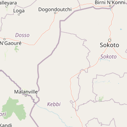
The landscape of Middle Niger Wetland II is defined by the Niger River and the broad floodplain that unfurls along its left bank. The river here marks the international border with Benin, and the protected area runs for about 25 kilometers along this stretch. Outside of the flood season, the terrain consists of gently sloping lowlands dotted with ponds and channels left behind by past floods and river shifts.
During the wet season, the floodplain transforms. Rising waters spread across the low-lying ground, submerging grasslands, reconnecting isolated depressions into a continuous flooded surface, and turning the area into a shallow inland sea for several months. This recurring inundation is the central organizing feature of the landscape, shaping soils, vegetation patterns, and the distribution of wildlife across the protected area.
The riverbanks and slightly elevated ground within and around the floodplain carry characteristic vegetation, including stands of African baobab, palmyra palms, and shea trees. The combination of open water, seasonally flooded grassland, and patches of taller woody vegetation gives the wetland its distinctive mosaic character and provides a wide range of habitats across a relatively compact geographic footprint.
Middle Niger Wetland II ecosystems, habitats, and plant life
The wetland's ecology is built around its seasonal flooding cycle. When the rains begin in August and the Niger rises, the floodplain becomes a dynamic aquatic environment supporting submerged and emergent grasses, floating plants, and dense aquatic vegetation in slow-moving channels. Among the aquatic plants are species such as the thick-stemmed water hyacinth, cattail-type rushes, and native grasses more generally associated with African floodplains.
Outside the flooded season, the same ground retains moisture in ponds and saturated soils, sustaining grasses and riverine woodland. Baobab trees dominate parts of the skyline, while palmyra palms, shea trees, and shrubs such as Neocarya macrophylla contribute to the woody cover. This mixture of trees, shrubs, and seasonal grassland gives the protected area a layered vegetation structure and supports a wide range of ecological niches within a relatively small area.
The wetland habitat also includes standing pools and slow-flowing stretches that are particularly important for native fish. Species documented in the waters include Hippopotamyrus pictus and Nannocharax occidentalis, alongside other floodplain-dependent fish that use the inundated grasslands as feeding and breeding grounds during the high-water period.
Middle Niger Wetland II wildlife and species highlights
Middle Niger Wetland II is primarily recognized as a refuge for waterbirds and other wetland-dependent species. The combination of open water, flooded grassland, and fringing trees supports a varied bird community, including taller wading species and flocks of waterfowl that use the floodplain during the wet season.
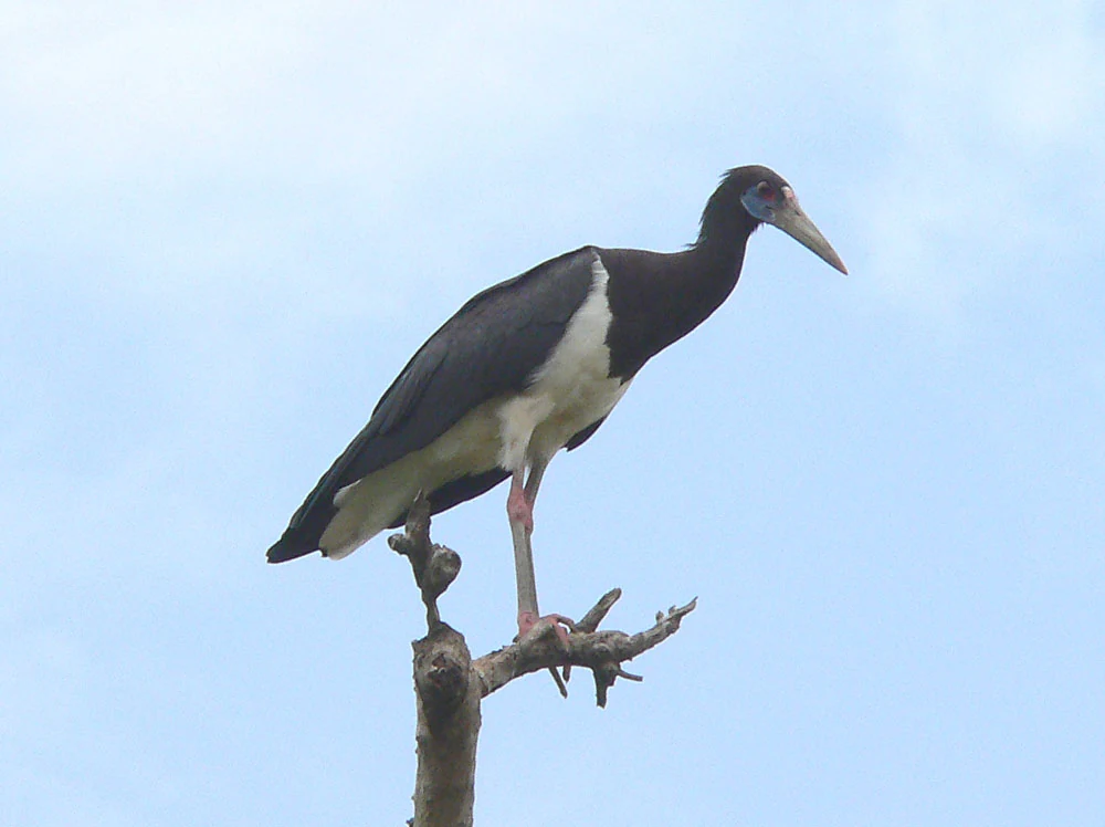
Documented birdlife includes the black-headed heron, purple heron, cattle egret, white-winged tern, white-faced whistling duck, little egret, black-winged stilt, ruff, glossy ibis, sacred ibis, wood sandpiper, and green sandpiper. The seasonal abundance of these species reflects the site's role as a feeding and resting area within broader migratory and regional movement patterns in West Africa.
The wetland is not only about birds. Its floodplain ponds and riverine forest support a wider community of mammals, including patas monkeys, large grey mongooses, hippopotamuses, and pale foxes. Beneath the water, native fish species such as Hippopotamyrus pictus and Nannocharax occidentalis inhabit the channels and flooded zones, completing a food web that depends on the annual flood pulse.
Middle Niger Wetland II conservation status and protection priorities
Conservation value at Middle Niger Wetland II is anchored in its Ramsar designation, which was granted on 26 April 2004 in recognition of the site's importance for wetlands, waterbirds, and floodplain biodiversity. The designation places the wetland within an international framework for the wise use of wetlands and obliges reporting on the site's ecological character.
The protected area functions as a crucial corridor of habitat along the middle Niger, complementing the earlier Middle Niger Wetland to the north. Together, the two sites preserve a longer stretch of the riverine floodplain, a feature that is increasingly rare in West Africa as wetlands face pressure from water management, agriculture, and settlement.
Because the Niger here also forms the border with Benin, the site carries transboundary conservation significance. Protecting the floodplain on the Niger's banks helps maintain ecological connectivity across the border and supports species that depend on long stretches of riverine habitat rather than isolated patches. Continued monitoring and local engagement in communes such as Tounouga, where ecosystem service studies have been carried out, are important for sustaining the site's ecological character over time.
Middle Niger Wetland II cultural meaning and human context
The wetland sits within the Dendi landscape of southwestern Niger, a region shaped by longstanding interaction between riverine communities and the seasonal dynamics of the Niger. Local populations, including the town of Gaya and surrounding villages such as Tanda, Tounouga, Dolé, Gatawani Béri, Gatawani Kaina, and Koma, have long relied on the floodplain for fishing, riverside agriculture, and seasonal grazing.
This human presence gives the protected area a working cultural dimension. Communities have traditional knowledge of the flood cycle, of fish movements, and of the changing productivity of floodplain soils. Studies of ecosystem services, such as those focused on the Gatawani Kaina and Gatawani Béri areas in the commune of Tounouga, reflect an effort to link conservation planning with the livelihoods and priorities of the people who share the wetland with its wildlife.
Top sights and standout views in Middle Niger Wetland II
Middle Niger Wetland II stands out for its strong flood-pulse ecology, a Ramsar designation earned in 2004, and its position along a transboundary stretch of the Niger River. Its mosaic of seasonally flooded grassland, ponds, riverine woodland, and baobab-studded banks supports a diverse bird community and a meaningful mammal and fish fauna. Together with the neighboring Middle Niger Wetland, it forms one of the more coherent protected riverine corridors in this part of West Africa.
Best time to visit Middle Niger Wetland II
The character of a visit to Middle Niger Wetland II is shaped by the flood cycle. From around August onward, rains swell the Niger and the floodplain begins to inundate, with peak flooding typically lasting four to five months. During this high-water period, the wetland is at its most dynamic, attracting large concentrations of waterbirds, with shallow open water and flooded grassland dominating the scene.
In the dry months, when floodwaters have receded, the area offers a different perspective: exposed floodplain soils, shrinking ponds, and easier access along the banks for observing terrestrial wildlife, baobab stands, and riparian woodland. Bird activity remains notable year-round, but the most dramatic concentrations of waterfowl and waders coincide with the flooded season, making the August-through-December window especially rewarding for viewers of wetland ecosystems.