

Mori Atlas logo
State or regional parkFinlay-Russel Provincial Park and Protected Area

Tracing the 85-kilometre protected river corridor within British Columbia's Muskwa-Kechika landscape.

Finlay-Russel Provincial Park and Protected Area: Mapped Wilderness and River Corridor Geography

Finlay-Russel Provincial Park and Protected Area functions as a vital wilderness corridor tracking the Finlay River through northern British Columbia. Extending from the Fox River confluence to the Toodoggone River confluence, this 85-kilometre protected zone serves as a foundational element of the broader Muskwa-Kechika Management Area. The landscape highlights include intact boreal forest, riverine terrain, and rugged northern topography that remains remote and free from permanent road infrastructure.

provincial parkwilderness corridorFinlay RiverMuskwa-Kechika Management Arearemote backcountrynorthern British Columbia

Finlay-Russel Provincial Park and Protected Area

State or regional park

Park overview

Structured park overview, official facts, and landscape profile for Finlay-Russel Provincial Park and Protected Area

Finlay-Russel Provincial Park and Protected Area park facts, protected area profile, and essential visitor context

Review the core facts for Finlay-Russel Provincial Park and Protected Area, including designation, size, terrain, visitor scale, habitats, and operating context in one park-focused overview.

About Finlay-Russel Provincial Park and Protected Area

Finlay-Russel Provincial Park and Protected Area is one of the more remote and least developed protected areas in British Columbia. It sits in the Peace River Regional District in the northeastern part of the province, embedded within the Muskwa-Kechika Management Area, a vast management zone recognized for preserving one of the largest intact natural landscapes in the province. The park itself takes the form of a long linear corridor, strung out along the Finlay River, which is one of the major rivers of northern British Columbia and a key tributary in the broader Peace-Mackenzie river system.

The corridor begins near the Fox River confluence in the south and runs roughly 85 kilometres north to the Toodoggone River confluence. This shape means that the park's character is dictated primarily by the river valley it tracks, with the surrounding ridges, forests, and tributary drainages shaping the wider ecological context. Despite its size, Finlay-Russel has limited road access, and its remoteness is one of its most defining traits. The nearest community, Mackenzie, is still approximately a day's drive away, and neighboring Stone Mountain Provincial Park is considered slightly easier to reach.

The park combines two designations at once: a provincial park and a protected area. This allows for a more flexible approach to land use than a purely strict park zoning would permit, accommodating activities such as wilderness camping, cycling, and hunting within the protected area portion. E-bike use is restricted except on designated roads and for authorized trail maintenance purposes. Hiking and day-to-day trail use is limited by the fact that trails within the park are not reliably maintained, meaning that visitors should expect genuine wilderness conditions rather than developed infrastructure.

Finlay-Russel thus occupies a particular niche within British Columbia's conservation system. It is not designed as a primary tourist destination like some of the province's more accessible parks, but rather as a long-term safeguard of a major northern river valley and the wilderness landscape that surrounds it, sitting alongside other protected zones within the greater Muskwa-Kechika Management Area.

Quick facts and research context for Finlay-Russel Provincial Park and Protected Area

Finlay-Russel Provincial Park and Protected Area is situated in the Peace River Regional District of northeastern British Columbia, within the much larger Muskwa-Kechika Management Area. It covers more than 100,000 hectares and is classified as an IUCN Category II protected area, the same category used for national parks worldwide.

The park was formally established on April 4, 2001, and is administered by BC Parks. It functions simultaneously as a provincial park and a protected area, combining stricter conservation zoning with a corridor of land that allows activities such as wilderness camping, cycling, and regulated hunting.

Protection and recognition

Examine the documented terrestrial protection scope and official recognition framework

Finlay-Russel Provincial Park and Protected Area Protection Status and International Recognition

Finlay-Russel Provincial Park and Protected Area maintains a documented terrestrial protection scope without imported international recognition sources. Review the structured administrative records and formal designation details associated with this protected landscape.

Protection details

Protection scope
Terrestrial
Transboundary protection
No
Park context

Deeper park guide and search-rich context for Finlay-Russel Provincial Park and Protected Area

Finlay-Russel Provincial Park and Protected Area history, landscape, wildlife, and travel context

Explore Finlay-Russel Provincial Park and Protected Area through its history, landscape character, ecosystems, wildlife, conservation priorities, cultural context, and seasonal travel timing in a structured park guide built for atlas discovery and search intent.

Why Finlay-Russel Provincial Park and Protected Area stands out

Finlay-Russel is best known for protecting an 85-kilometre corridor along the Finlay River within the Muskwa-Kechika Management Area, one of the most significant large-scale wilderness regions remaining in British Columbia. The park's profile is defined more by the scale and remoteness of the landscape it conserves than by any single landmark feature, and it represents the type of expansive, lightly developed northern wilderness that the Muskwa-Kechika framework was designed to safeguard. The Finlay River corridor itself is the park's central identity. Stretching from the Fox River confluence to the Toodoggone River confluence, this long ribbon of protected land helps preserve a continuous stretch of intact northern river valley habitat in a region where industrial activity, including resource extraction, surrounds the protected zone.

Finlay-Russel Provincial Park and Protected Area history and protected-area timeline

Finlay-Russel Provincial Park and Protected Area was formally established on April 4, 2001, as part of British Columbia's broader effort to protect representative landscapes within the Muskwa-Kechika Management Area. Its creation reflected a recognition of the ecological value of the Finlay River corridor and the importance of preserving long stretches of intact northern wilderness in the province.

The park was not created in isolation. It is part of a larger regional conservation framework in northeastern British Columbia, where the Muskwa-Kechika Management Area was established to balance the preservation of wilderness with resource use in surrounding lands. Finlay-Russel functions as one of the protected cornerstones within that wider mosaic.

Finlay-Russel Provincial Park and Protected Area landscape and geographic character

The landscape of Finlay-Russel is shaped by the Finlay River valley, which the park follows as a long narrow corridor through northeastern British Columbia. Between the Fox River confluence in the south and the Toodoggone River confluence in the north, the park tracks the path of the river for roughly 85 kilometres, capturing a continuous stretch of northern riverine terrain.

The surrounding terrain is typical of the Muskwa-Kechika region: boreal forest, rugged ridges, and broad valleys, with the river system serving as the dominant organizing feature of the protected area. Because the park is essentially a corridor straddling a major river, its elevation, slope, and habitat transitions follow the natural gradient of the Finlay watershed. The result is a wilderness landscape with few if any roads and limited human modification, where the river itself defines the spine of the protected zone.

Finlay-Russel Provincial Park and Protected Area ecosystems, habitats, and plant life

The park's ecological character is closely tied to the Finlay River and the larger Muskwa-Kechika ecosystem. The river corridor supports riparian habitat typical of large northern rivers, and the surrounding land transitions into boreal and sub-boreal forest typical of northeastern British Columbia. As a protected area embedded in the broader Muskwa-Kechika Management Area, Finlay-Russel helps maintain habitat continuity across a region where intact wilderness still dominates large tracts of land.

Because the park's footprint follows the river valley rather than a single habitat type, it preserves a wide cross-section of ecological transitions: the active river corridor, the adjacent floodplain and riparian zones, and the forest communities that rise away from the water. This continuous river valley habitat is one of the park's principal ecological assets.

Finlay-Russel Provincial Park and Protected Area wildlife and species highlights

Finlay-Russel lies within a region known for supporting populations of large northern mammals and a wide range of boreal wildlife typical of the Muskwa-Kechika landscape. The park's protected status and its long, unroaded river corridor allow it to function as a refuge within a broader working landscape, helping sustain wildlife populations in an area where industrial activity occurs in surrounding lands.

The Finlay River and its tributaries support fish populations characteristic of large northern river systems, and the surrounding forests and wetlands provide habitat for species typical of the sub-boreal north, including caribou, moose, elk, predator species, and a variety of boreal and northern-breeding birds. The combination of intact habitat, limited access, and the park's role as a corridor make Finlay-Russel a meaningful contributor to regional wildlife conservation, even though it is not managed as a high-profile wildlife-viewing destination.

Finlay-Russel Provincial Park and Protected Area conservation status and protection priorities

Finlay-Russel plays an important role in conservation by protecting a long stretch of the Finlay River corridor within the larger Muskwa-Kechika Management Area. The Muskwa-Kechika region is one of the most significant intact wilderness areas in British Columbia, and Finlay-Russel's protected corridor adds an important element of habitat security within it.

By combining a provincial park designation with protected area status, the park allows for a mix of conservation and limited compatible use, including wilderness camping, regulated hunting, and non-motorized cycling. This structure is designed to maintain wilderness integrity while acknowledging traditional and regional land uses in the surrounding area, and it positions the park as a long-term contributor to preserving ecological connectivity in northeastern British Columbia.

Finlay-Russel Provincial Park and Protected Area cultural meaning and human context

Finlay-Russel Provincial Park and Protected Area lies in a part of British Columbia historically associated with First Nations presence along the Finlay River and the broader Peace-Mackenzie watershed, and with later exploration and resource development that tied the region's river valleys into the wider northern economy. The park does not feature prominent cultural landmarks in the sense of constructed heritage sites, and its cultural meaning is largely tied to the wilderness it protects rather than to specific built features within its boundaries.

Top sights and standout views in Finlay-Russel Provincial Park and Protected Area

Finlay-Russel's defining highlight is its 85-kilometre corridor along the Finlay River, which links the Fox River and Toodoggone River confluences through an unbroken stretch of northern wilderness. This corridor, combined with the park's location inside the Muskwa-Kechika Management Area, makes Finlay-Russel an unusually long and narrow protected landscape, ideally suited to conserving the ecological continuity of a major northern river.

Its scale, its remoteness, and the way it pairs provincial park and protected area zoning together also set the park apart. Together, these qualities make Finlay-Russel one of the more distinctive large-scale wilderness parks in British Columbia's protected-area system.

Best time to visit Finlay-Russel Provincial Park and Protected Area

Because Finlay-Russel is a remote backcountry park with limited road access, a visit depends heavily on weather and seasonal ground conditions. Summer is generally the most practical window, when river crossings, access routes, and conditions along the corridor are most likely to be workable for experienced visitors prepared for true wilderness travel. Winters bring harsh northern conditions and effectively close the area to most non-industrial users.

Given the park's remoteness and the fact that trails are not reliably maintained, any visit should be treated as a serious backcountry undertaking rather than a casual outing, and timing should be planned around practical access rather than around visitor infrastructure.
Monthly climate preview

Long-term representative temperature and precipitation normals across the year

Finlay-Russel Provincial Park and Protected Area Climate and Weather by Month

Finlay-Russel Provincial Park and Protected Area records a measured annual rhythm of low winter temperatures and moderate summer precipitation based on representative coordinates. Detailed monthly normals provide a complete statistical record of long-term temperature ranges and precipitation patterns.
Annual mean-4 °C
-17 °C10 °C
Jan-17°
Feb-15°
Mar-11°
Apr-5°
May
Jun
Jul10°
Aug
Sep
Oct-4°
Nov-13°
Dec-17°
Warmest month
July

10 °C

Coolest month
December

-16.8 °C

Wettest month
June

3.2 mm/day

Driest month
February

1.1 mm/day

Park location guide

Geography guide, regional context, and park location map for Finlay-Russel Provincial Park and Protected Area

Finlay-Russel Provincial Park and Protected Area park geography, regions, and map view in Canada

Understand where Finlay-Russel Provincial Park and Protected Area sits in Canada through a broader geographic reading of the surrounding landscape, nearby location context, and its mapped position within the national park landscape.

How Finlay-Russel Provincial Park and Protected Area fits into Canada

Canada is a federal parliamentary constitutional monarchy spanning North America from the Atlantic to the Pacific and Arctic Oceans. With a population of over 41 million, it is officially bilingual in English and French at the federal level. The country gained independence from the United Kingdom through a gradual process culminating in 1982.

Wider geography shaping Finlay-Russel Provincial Park and Protected Area in Canada

Canada occupies the northern portion of North America, sharing its longest international border with the United States. The country extends from the Atlantic Ocean to the Pacific Ocean and northward into the Arctic Ocean, giving it the longest coastline of any nation.

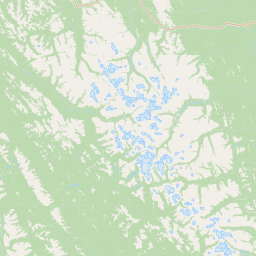
Map view of Finlay-Russel Provincial Park and Protected Area

Use this park location map to pinpoint Finlay-Russel Provincial Park and Protected Area in Canada, understand its exact geographic position, and read its mapped placement within the surrounding landscape more clearly.

Pigeon | © OpenStreetMap contributors

Location context for Finlay-Russel Provincial Park and Protected Area

British Columbia
Park atlas

Compare adjacent northern wilderness corridors and surrounding regional protected areas

Parks Near Finlay-Russel Provincial Park and Protected Area

Browse other remote parks and protected landscapes located across the surrounding northern British Columbia wilderness. Continuing into adjacent regional reserves helps reveal broader ecological patterns across the broader watershed.
State or regional parkBritish Columbia
About 50 km away#1 closest

Northeast

Kwadacha Wilderness Provincial Park: Geographic Boundaries and Regional Protected Area Context

Untouched mountain wilderness in northern British Columbia

Kwadacha Wilderness Provincial Park provides a rare, roadless mountain experience within the northeastern interior of British Columbia. Characterized by high-relief alpine ridges, dense boreal forests, and challenging river systems, the park represents an essential wilderness corridor that remains free from human infrastructure and standard road access, prioritizing ecological integrity over recreation.

Area
1,302.79 km²
Established
1973
IUCN
Ib
Relief
Mountain
State or regional parkBritish Columbia
About 95 km away#2 closest

North

Dune Za Keyih Provincial Park and Protected Area: Watershed and Terrain Geography

Remote wilderness landscape in northern British Columbia

Dune Za Keyih Provincial Park and Protected Area protects the largest unlogged watershed in British Columbia. Situated within the Muskwa-Kechika Management Area, this remote wilderness is defined by the geological structures of the Rocky Mountain Trench, providing a continuous corridor of undisturbed mountain forest, riparian zones, and highland terrain.

Area
3,468.33 km²
Established
2001
IUCN
Ib
Relief
Mountain
State or regional parkBritish Columbia
About 112 km away#3 closest

Northwest

Denetiah Provincial Park and Protected Area: Regional Geography and Wilderness Mapping

An undisturbed boreal reserve in the Stikine Region

Discover the geographic structure of Denetiah Provincial Park and Protected Area, a vast roadless landscape in northern British Columbia. This park protects pristine boreal forests, elongated glacial lake basins, and critical river headwaters that serve as a benchmark for northern conservation within the Muskwa-Kechika Management Area.

Area
1,053.49 km²
Established
1999
IUCN
II
Relief
Upland
State or regional parkBritish Columbia
About 119 km away#4 closest

East

Redfern-Keily Provincial Park: A Deep Dive into Muskwa Ranges Protected Geography

Remote Glacial Landscapes and Northern Wilderness Terrain

Redfern-Keily Provincial Park encompasses a significant stretch of remote wilderness in the Muskwa Ranges of northeastern British Columbia. Anchored by the eight-kilometer Redfern Lake and surrounding glaciers like the Ithaca and Achaean, the area serves as a primary example of intact boreal and subalpine geography. The terrain offers a rugged look at high-elevation ecosystems and glacial history within the Muskwa-Kechika Management Area.

Area
807.12 km²
Established
1999
IUCN
II
Relief
Mountain
State or regional parkBritish Columbia
About 130 km away#5 closest

East

Prophet River Hot Springs Provincial Park: Protected Landscape and Geothermal Geography

Remote backcountry wilderness in northeastern British Columbia

Prophet River Hot Springs Provincial Park is a specialized protected area known for its unique tufa mounds and geothermal features. Set against the mountainous backdrop of the Muskwa Ranges, this backcountry destination offers a compelling study of boreal and subalpine geography, accessible only by hiking or horseback through undisturbed wilderness corridors.

Area
1.84 km²
Established
1999
IUCN
II
Relief
Mountain
Nature reserveBritish Columbia
About 159 km away#6 closest

West

Gladys Lake Ecological Reserve: Remote Wilderness and Alpine Geography in British Columbia

Scientific reference area on the Spatsizi Plateau

Explore the expansive geography of Gladys Lake Ecological Reserve, a major protected area located in the remote interior of British Columbia. This reserve provides a strictly preserved natural landscape defined by high-elevation ridges, subalpine transitions, and the pristine wilderness of the Eaglenest Range, serving as a benchmark for ecological research in Canada.

Area
440.98 km²
Established
1975
IUCN
Ia
Relief
Mountain
State or regional parkBritish Columbia
About 167 km away#7 closest

Southeast

Graham-Laurier Provincial Park: Protected Boreal Landscape and Geographic Context

Remote wilderness exploration in the Peace River region

Graham-Laurier Provincial Park represents a massive, intact wilderness area in northeastern British Columbia. Defined by boreal forests, undulating ridges, and the cascading waters of Christina Falls, this region serves as a crucial natural refuge within the Muskwa-Kechika Management Area. Access is centered on rugged forest service roads and backcountry trails, making the area a primary destination for self-reliant exploration and terrain study.

Area
999.82 km²
Established
1999
IUCN
II
Relief
Mountain
State or regional parkBritish Columbia
About 174 km away#8 closest

North

Horneline Creek Provincial Park: Protected Canyon Landscapes and Rocky Mountain Trench Geography

Remote glacial-terrace wilderness in northern British Columbia

Located deep in the Rocky Mountain Trench, Horneline Creek Provincial Park is defined by its deep-cut canyon and ancient glacial terraces. This protected area offers an intimate view of sub-boreal terrain where mineral-stained walls and aspen-dotted grasslands create a concentrated, ecologically significant landscape within a remote corner of northern British Columbia.

Area
2.98 km²
Established
1999
IUCN
II
Relief
Upland

Common questions about visiting, size, designation, and location context for Finlay-Russel Provincial Park and Protected Area

Finlay-Russel Provincial Park and Protected Area FAQs for park facts, access, geography, and protected area context

Find quick answers about Finlay-Russel Provincial Park and Protected Area, including protected-area facts, park geography, trail and visitor context, and how the park fits into its surrounding country and regional landscape.
MoriAtlas Explorer

Continue Your Protected Areas Search Across the Global Atlas

Deepen your exploration by continuing the structured search for national parks and protected areas worldwide. Utilize the comprehensive filtering capabilities to compare different conservation landscapes and refine your understanding of global park geography. Discover more about the distribution and characteristics of protected natural areas.

Global natural geography