
Mori Atlas logo
Protected areaFiordland Conservancy

A remote wilderness system defined by deep marine inlets, forest-covered mountain ridges, and steep coastal terrain

Fiordland Conservancy Protected Area: Mapping the Glacial Fjord Landscape of Coastal British Columbia

Fiordland Conservancy preserves a significant segment of British Columbia's coastal geography within the Kitimat Ranges of the Coast Mountains. This protected area features deeply carved glacial inlets, including Mussel Inlet and Kynoch Inlet, where high mountain walls plunge directly into the narrow channels of the Pacific. As a roadless maritime landscape, it stands as an intact wilderness system that highlights the geological interaction between rugged alpine terrain and quiet, sheltered marine waters.

fjord coastcoastal mountainsKitimat RangesCoast Mountainsglacial landscapeBritish Columbia conservancy
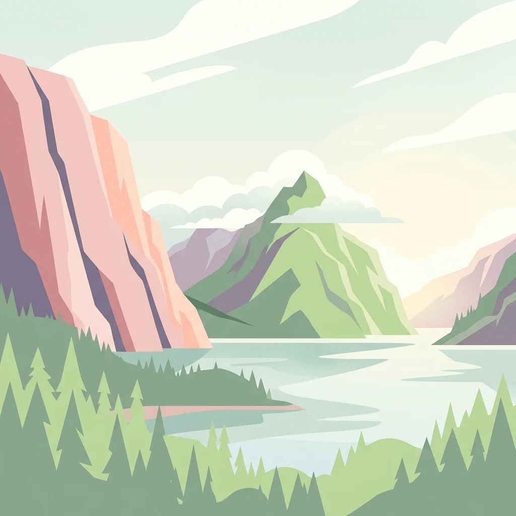
A flat-style vector illustration of a dramatic mountain fjord with steep cliffs, surrounding coniferous forest, and calm water under a light sky.

Fiordland Conservancy

Protected area

Park overview

Structured park overview, official facts, and landscape profile for Fiordland Conservancy

Fiordland Conservancy park facts, protected area profile, and essential visitor context

Review the core facts for Fiordland Conservancy, including designation, size, terrain, visitor scale, habitats, and operating context in one park-focused overview.

About Fiordland Conservancy

Fiordland Conservancy is a large protected area on the central coast of British Columbia, situated in the Kitimat-Stikine Regional District and lying north of the community of Bella Coola. The conservancy encompasses a remote and rugged section of coastline where the Coast Mountains meet the Pacific Ocean through a series of deeply carved inlets. The landscape is shaped by glacial action, which has produced the long, narrow fjords that define the area and give the conservancy both its name and its ecological identity.

The protected area was established in 1987 under the management of BC Parks and was, at the time of its creation, a pioneering designation in the provincial system because it focused on a fjord environment that previously had no formal protection. Its boundaries include both terrestrial habitat within the Kitimat Ranges and an extensive foreshore component along the inlets, reflecting the interconnected nature of marine and terrestrial systems along this part of the coast. The combination of steep forested slopes, narrow inlet channels, and open tidal waters creates a landscape that blends mountain wilderness with strongly marine character.

Access to Fiordland Conservancy is limited, as there are no roads leading into the area. As a result, the conservancy is mainly visited by people traveling by sea, including kayakers undertaking multi-day expeditions along the inlets and sailors navigating the protected channels. The nearest communities are the Heiltsuk-connected villages to the south, including Bella Bella and Klemtu, while Bella Coola lies roughly 100 kilometers to the southeast. This isolation has helped preserve the area's wilderness character and contributes to its appeal for visitors seeking an undisturbed coastal landscape.

The conservancy's ecological and cultural setting reaches beyond natural scenery. The inlets and their shores are part of the traditional territory of the Heiltsuk people, who historically maintained villages along the surrounding coast. Today, the area continues to represent an important intersection of coastal mountain ecosystems, marine habitats, and the broader cultural landscape of British Columbia's central coast.

Quick facts and research context for Fiordland Conservancy

Fiordland Conservancy is a British Columbia conservancy located in the Kitimat-Stikine Regional District on the central coast, roughly 100 kilometers north of Bella Coola. Established in 1987, it covers a substantial area of land within the Kitimat Ranges of the Coast Mountains and includes a significant foreshore component along its inlet coasts.

Its defining feature is the presence of glacial fjords, an environmental zone that, at the time of designation, had no other comparable protection within the provincial park system. The conservancy is also notable for its lack of road access, making it primarily a destination reached by boat. Its history is closely tied to Heiltsuk presence along the inlets and to the broader provincial effort to protect representative coastal ecosystems in British Columbia.

Protection and recognition

Examine documented protection scope, management assignments, and designation records.

Fiordland Conservancy Protection Status and International Recognition Data

Fiordland Conservancy maintains a mixed protection scope backed by structured administrative records and conservation management frameworks. Official designations outline the established legal boundaries and administrative oversight governing this protected landscape.

Protection details

Protection scope
Mixed
Transboundary protection
No
Park context

Deeper park guide and search-rich context for Fiordland Conservancy

Fiordland Conservancy history, landscape, wildlife, and travel context

Explore Fiordland Conservancy through its history, landscape character, ecosystems, wildlife, conservation priorities, cultural context, and seasonal travel timing in a structured park guide built for atlas discovery and search intent.

Why Fiordland Conservancy stands out

Fiordland Conservancy is best known for protecting a section of British Columbia's glacial fjord coastline within the Kitimat Ranges of the Coast Mountains. The deep, steep-walled inlets, including Mussel Inlet and Kynoch Inlet, form the park's most recognizable landscape signature. The conservancy is also distinguished by its remoteness and the fact that it preserves a coastal wilderness that is typically only accessible by sea. Its combination of steep coastal mountains, deeply penetrating marine inlets, and undeveloped shoreline gives it a character shared with other Pacific fjord regions elsewhere in the world, while remaining firmly rooted in the geography of British Columbia's central coast.
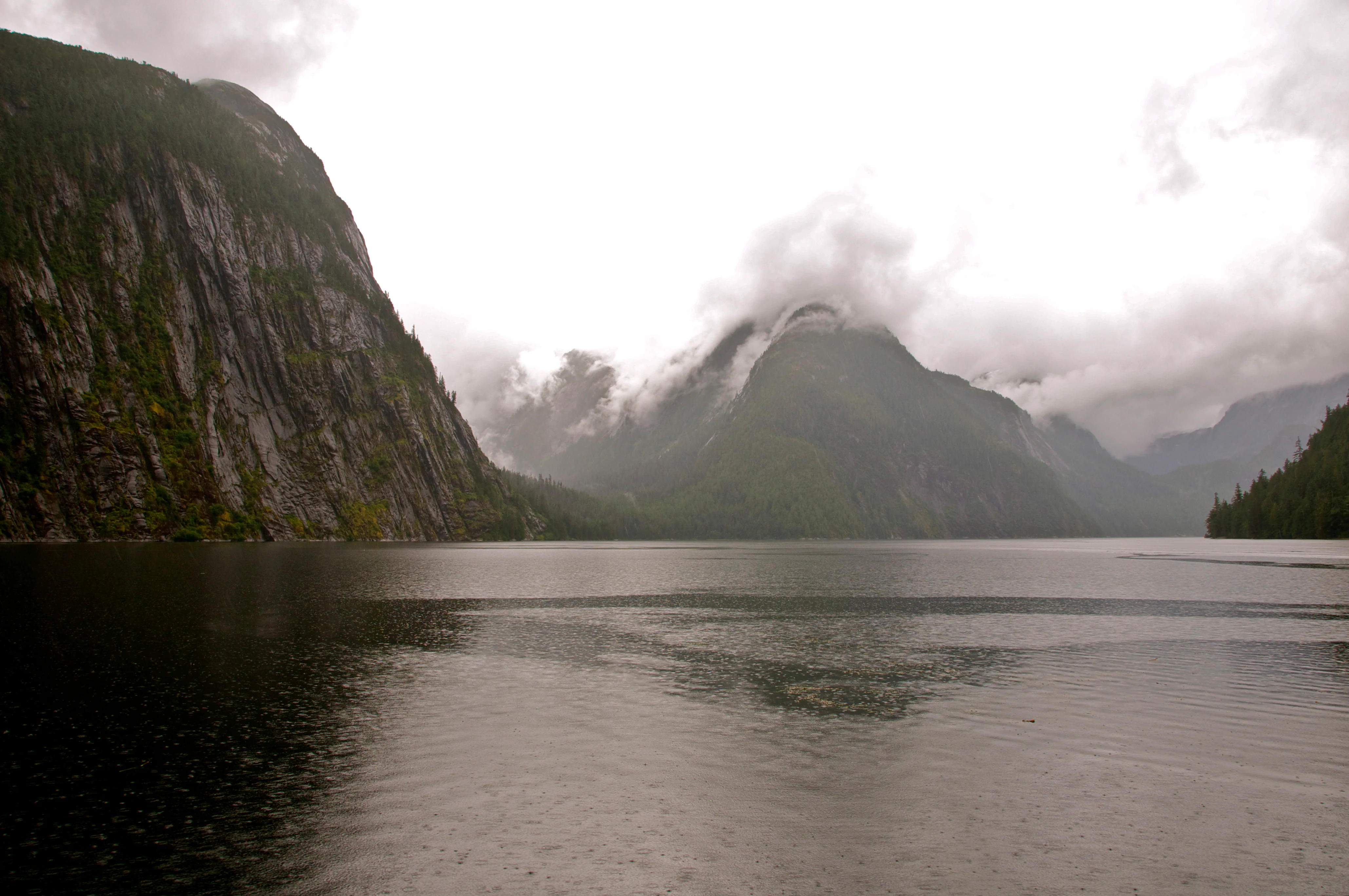
A wide, eye-level shot looking out over a calm, dark body of water surrounded by steep, mist-covered mountain slopes and dense forest under an overcast sky.
A view of the misty landscape of Kynoch Inlet within Fiordland Conservancy.

Fiordland Conservancy history and protected-area timeline

Fiordland Conservancy was formally established in 1987 as a provincial conservancy managed by BC Parks. Its creation marked an important moment in the development of British Columbia's protected-area system, because it was the first designation in the provincial network to focus specifically on the protection of a fjord environment. Until then, this distinctive type of coastal landscape had remained unrepresented in the province's formal conservation framework.

The area's history also extends well beyond its formal designation. The inlets and surrounding coastline have long been part of the traditional territory of the Heiltsuk people, who in the past maintained villages along the shores of these waters. The relationship between the human history of the region and the natural environment has left a cultural layer that still informs how the area is understood today, even though there are no modern settlements within the conservancy boundaries.

Over time, the area has also been referenced under additional names. Beyond its current designation as the Fiordland Conservancy, the lands have previously been known as the Fiordland Recreation Area and more recently as the Fiordland Conservation Area, reflecting different administrative framings within BC Parks. Throughout these shifts in nomenclature, the underlying intent of protecting the fjord landscape has remained consistent.

Fiordland Conservancy landscape and geographic character

The landscape of Fiordland Conservancy is defined by the dramatic interaction between the Kitimat Ranges and the sea. As part of the broader Coast Mountains, the terrain rises sharply from the waterline, with steep, forested slopes descending directly into narrow, deep inlets. The glacially carved character of these inlets gives the coastline its distinctive fjord profile, with high walls, narrow channels, and quiet, sheltered waters that penetrate far inland.

Two major inlets anchor the geography of the conservancy: Mussel Inlet and Kynoch Inlet. Both feature the classic fjord morphology of long, narrow basins flanked by mountain ridges, often with cascading streams along their flanks and small pocket beaches at their upper reaches. Beyond the inlets themselves, the topography includes the broader ridges, valleys, and peaks of the Kitimat Range, providing an extensive upland backdrop to the marine scenery.

Because the area has never been crossed by roads and has seen little modern development, the shoreline retains a largely unbroken and undeveloped quality. The combination of mountain terrain, marine inlets, and continuous coastal forest creates a landscape that reads as a single, integrated wilderness system, rather than a patchwork of separated habitats. The result is a coastal mountain environment that feels both vast and intimately shaped by water.

Fiordland Conservancy ecosystems, habitats, and plant life

Fiordland Conservancy supports a range of ecosystems that reflect its position at the boundary between the Coast Mountains and the Pacific Ocean. On land, the steep valley walls and coastal slopes are dominated by temperate rainforest vegetation characteristic of the central British Columbia coast, including coniferous forest communities that thrive in the wet, mild maritime climate. The dense canopy and moss-rich understory typical of the region extend down toward the tideline in many places, blending directly with the marine environment.

The foreshore component adds an important habitat layer. The inlets host sheltered tidal waters, rocky intertidal zones, estuarine pockets, and stream outflows that support rich productivity. This interface between terrestrial runoff and marine conditions creates nutrient-rich areas that sustain both resident species and seasonal visitors. The interplay between freshwater systems flowing off the Kitimat Range and the saline waters of the inlets is a defining ecological feature of the area.

Because the area is remote and has been subject to relatively little direct human modification, ecological processes within the conservancy can operate across relatively intact gradients, from alpine and subalpine settings in the mountains down to deep-water marine environments at the bottom of the inlets. This continuity of habitat is a defining characteristic of the conservancy and contributes to its scientific and conservation value.

Fiordland Conservancy wildlife and species highlights

The wildlife profile of Fiordland Conservancy reflects the overlapping richness of coastal mountain and marine environments along British Columbia's central coast. The forested slopes and valleys provide habitat for species typical of the Pacific Northwest temperate rainforest, including black bears, mountain goats along higher rocky terrain, and populations of deer that move between coastal and upland habitats. The waterways and shoreline attract both resident and migratory waterfowl, and the inlets serve as important habitat for a range of seabirds and shorebirds.

Marine wildlife is a particularly important component of the area. The inlets support populations of fish that use both the open marine waters and the freshwater systems feeding from the surrounding mountains, and the tidal shorelines are visited by a variety of marine mammals, including seals and, in some areas, larger cetaceans moving along the coast. Raptors and bald eagles are frequently observed along the inlets, taking advantage of the productive shoreline.

Because the area remains relatively undisturbed and lacks road infrastructure, wildlife in Fiordland Conservancy often experiences limited direct human pressure. This makes the area valuable both for resident species and for visitors interested in observing coastal wildlife in a setting where natural behavior patterns are less disrupted by development.

Fiordland Conservancy conservation status and protection priorities

Fiordland Conservancy plays a distinctive role in British Columbia's conservation framework because it protects an environmental zone that is otherwise poorly represented in the provincial system. At the time of its establishment in 1987, it was the first and only protected area in the province dedicated explicitly to the preservation of a fjord landscape. This makes it historically important as a benchmark for coastal conservation in British Columbia.

The conservancy's protected status safeguards not only the terrestrial ecosystems of the Kitimat Range but also a substantial foreshore area, recognizing that the value of the fjord environment lies in the relationship between land and sea. Protecting both the steep forested slopes and the tidal waters allows ecological processes to function across the full gradient of the fjord system, rather than fragmenting it into smaller pieces.

As a designated conservancy under BC Parks, the area is managed to balance ecological protection with low-impact recreation and cultural recognition. Its remoteness, combined with its formal designation, helps ensure that this stretch of British Columbia's fjord coast remains available as habitat for wildlife, as a reference for scientific study, and as a place where the integrity of one of the province's most distinctive coastal landscapes can be preserved over the long term.

Fiordland Conservancy cultural meaning and human context

The cultural identity of Fiordland Conservancy is closely tied to the Heiltsuk people, whose traditional territory includes the inlets and shores that make up the protected area. Although there are no permanent settlements within the conservancy today, the Heiltsuk historically maintained villages along these waters, particularly around Mussel Inlet. The names of the inlets and surrounding features reflect this long-standing human relationship with the coast.

The cultural layer adds depth to what is otherwise a deeply physical landscape. The inlets were not only ecological resources but also centers of community life, providing access to marine resources, travel corridors, and gathering places. Understanding the area's history means recognizing that the wilderness character of today's conservancy is, in part, the result of long histories of human presence and stewardship along the coast.

Today, Fiordland Conservancy sits within a broader cultural landscape that includes Heiltsuk communities such as Bella Bella and Klemtu, both of which remain important reference points for understanding the regional identity of British Columbia's central coast. The conservancy thus represents a meeting point between natural and cultural heritage, where protected wilderness and continuing Indigenous connection to place intersect.

Top sights and standout views in Fiordland Conservancy

Fiordland Conservancy's most prominent highlight is its protection of major glacial fjords on the central British Columbia coast, anchored by Mussel Inlet and Kynoch Inlet. These inlets define the visual and ecological identity of the area, offering a striking example of how the Kitimat Ranges of the Coast Mountains meet the sea.

Equally important is the area's status as the first protected-area designation in British Columbia to focus specifically on the fjord environment, a fact that gives it lasting significance in the history of coastal conservation in the province. Combined with its roadless access, its intact forested shorelines, and the cultural heritage of the Heiltsuk people, the conservancy stands out as a rare convergence of ecological, geological, and cultural values in a single protected coastal landscape.

Best time to visit Fiordland Conservancy

The character of a visit to Fiordland Conservancy varies meaningfully with the seasons, though at all times the area demands preparation for variable coastal weather. Summer is generally the most favorable period for kayaking and sailing expeditions, when longer daylight hours, calmer sea conditions, and milder temperatures make multi-day journeys along the inlets more manageable. Wildlife viewing along the shoreline, particularly for seabirds and marine mammals, can also be productive during this season.

Shoulder seasons can bring quieter conditions and a stronger sense of wilderness, but they also bring more unpredictable weather, shorter days, and increased exposure to Pacific storm systems moving along the coast. Winter visits are uncommon and typically reserved for experienced boaters, as conditions along the fjords become significantly more challenging. For most visitors, late spring through early fall represents the most realistic window for exploring the conservancy's coastal landscape in relative safety and comfort.
Monthly climate preview

Long-term representative averages tracking monthly temperature ranges and precipitation patterns

Fiordland Conservancy Climate Normals, Annual Temperature and Precipitation Rhythm

Fiordland Conservancy experiences a measured annual climate rhythm spanning sub-zero winter lows and warmer summer maximums alongside varying daily precipitation levels. Reviewing the complete twelve-month temperature and precipitation dataset provides deeper context for long-term regional environmental conditions.
Annual mean4 °C
-3 °C13 °C
Jan-3°
Feb-3°
Mar-1°
Apr
May
Jun10°
Jul13°
Aug13°
Sep10°
Oct
Nov
Dec-3°
Warmest month
July

13 °C

Coolest month
January

-3.5 °C

Wettest month
November

13 mm/day

Driest month
May

4.7 mm/day

Park location guide

Geography guide, regional context, and park location map for Fiordland Conservancy

Fiordland Conservancy park geography, regions, and map view in Canada

Understand where Fiordland Conservancy sits in Canada through a broader geographic reading of the surrounding landscape, nearby location context, and its mapped position within the national park landscape.

How Fiordland Conservancy fits into Canada

Canada is a federal parliamentary constitutional monarchy spanning North America from the Atlantic to the Pacific and Arctic Oceans. With a population of over 41 million, it is officially bilingual in English and French at the federal level. The country gained independence from the United Kingdom through a gradual process culminating in 1982.

Wider geography shaping Fiordland Conservancy in Canada

Canada occupies the northern portion of North America, sharing its longest international border with the United States. The country extends from the Atlantic Ocean to the Pacific Ocean and northward into the Arctic Ocean, giving it the longest coastline of any nation.

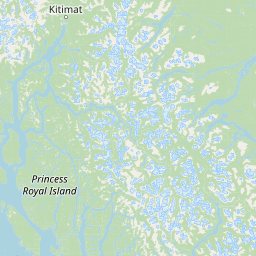
Map view of Fiordland Conservancy

Use this park location map to pinpoint Fiordland Conservancy in Canada, understand its exact geographic position, and read its mapped placement within the surrounding landscape more clearly.

Pigeon | © OpenStreetMap contributors

Location context for Fiordland Conservancy

British ColumbiaKitimat-Stikine

Visual reference guide to protected coastal terrain, steep mountain walls, and deep marine inlets

Fiordland Conservancy Photos, Scenery, and Glacial Fjord Landscape Views

Examine detailed imagery showcasing the dramatic meeting of the Kitimat Ranges and the Pacific tide across Fiordland Conservancy. Visualizing these remote glacial inlets and forested shorelines helps researchers understand the rare geography of protected coastal wilderness.

A wide, eye-level shot looking out over a calm, dark body of water surrounded by steep, mist-covered mountain slopes and dense forest under an overcast sky.

Park atlas

Compare adjacent protected landscapes and marine reserves along the Pacific coast

Explore Other Parks Near Fiordland Conservancy and Surrounding Coastal Wilderness

Continue browsing related protected areas and coastal wilderness zones extending across the surrounding region. Comparing adjacent marine reserves and mountain habitats reveals the broader continuity of Pacific fjord ecosystems.
A soft, light watercolor painting of a winding river flowing through a forested valley with distant, muted mountain ranges under a pale sky.
Protected areaBritish Columbia
About 7.4 km away#1 closest

Northeast

Kitlope Heritage Conservancy: Coastal Temperate Rainforest and Mountain Watersheds

A vast protected area in the Kitimat-Stikine region of British Columbia

Spanning from the Gardner Canal to glaciated inland summits, the Kitlope Heritage Conservancy protects an entire, undisturbed watershed. It is defined by its transition from saltwater fjords through ancient, salmon-bearing river valleys to high granite peaks, acting as a vital benchmark for coastal ecosystem integrity in the Pacific Northwest.

Area
3,220.2 km²
Established
1996
IUCN
Ib
Relief
Mountain
Protected areaBritish Columbia
About 115 km away#2 closest

South

Hakai Lúxvbálís Conservancy: Protected Coastal Landscapes and Geography in British Columbia

Coastal wilderness, island terrain, and marine foreshore habitats

Spanning over 51,000 hectares of upland, Hakai Lúxvbálís Conservancy is defined by its connection between forested island ridges and the Pacific marine environment. This protected area on the British Columbia Central Coast offers a deep look into temperate rainforest geography and indigenous-led conservation frameworks that prioritize ecosystem integrity across island and sea.

Area
1,229.98 km²
Established
2008
IUCN
II
Relief
Lowland
A horizontal watercolor painting showing a calm inlet surrounded by forested hills and distant mountains.
State or regional parkBritish Columbia
About 147 km away#3 closest

Northwest

Klewnuggit Inlet Marine Provincial Park: Regional Geography and Protected Area Mapping

Coastal inlet, freshwater lakes, and northern forest ecosystems.

Klewnuggit Inlet Marine Provincial Park showcases the dramatic meeting of mountain, forest, and sea. Spanning from the sheltered waters of the Grenville Channel to inland freshwater systems, the park offers a detailed study of northern coastal geography, fjord-like marine channels, and diverse bird and marine wildlife habitats.

Area
18 km²
Established
1993
IUCN
II
Relief
Mixed relief
A soft watercolor illustration depicting a calm river scene with evergreen trees, a grassy riverbank, and distant rolling hills in pale green and pink tones.
State or regional parkBritish Columbia
About 186 km away#4 closest

Northwest

Exchamsiks River Provincial Park: Protected Old-Growth Forest Geography in British Columbia

A rare maritime Sitka spruce landscape in the Skeena River estuary

Situated at the meeting of the Exchamsiks and Skeena rivers, this provincial park protects a significant stand of unlogged old-growth coastal rainforest. The terrain provides a compact, ecologically essential example of the temperate habitat characteristic of British Columbia's north coast, featuring moisture-loving spruce and salmonberry understory landscapes.

Area
0.182 km²
Established
1956
Relief
Lowland
Climate
Temperate
A soft watercolor illustration depicting a winding creek bordered by pine forests, with rolling mountains in the background, set against a plain white background.
State or regional parkBritish Columbia
About 196 km away#5 closest

North

Kleanza Creek Provincial Park: Coast Mountains Canyon and Salmon Protected Landscape

Regional protected geography in northwestern British Columbia

Kleanza Creek Provincial Park offers an intimate look at a rugged Coast Mountains landscape. The area is defined by its deep, forested rock canyons and the cascading waters of Kleanza Creek, which serve as essential habitat for spawning pink salmon. This protected site retains historical significance from nineteenth-century placer mining and provides a compact example of the complex terrain found in this part of British Columbia.

Area
2.69 km²
Established
1956
Relief
Mountain
Climate
Temperate
A soft watercolor painting of a winding river flowing through a lush, green landscape with forested hills in the background.
Nature reserveBritish Columbia
About 202 km away#6 closest

Northwest

Gamble Creek Ecological Reserve: Protected Nature Reserve Geography and Forest Map

British Columbia North Coast forest and peatland research landscape.

Situated on the North Coast of British Columbia, Gamble Creek Ecological Reserve is a designated nature reserve comprising forest and bog ecosystems. The protected area serves as an important site for studying plant communities, including sphagnum moss and coastal bog species, within a unique altitudinal transition between coastal hemlock and subalpine zones.

Area
10.26 km²
Established
1991
IUCN
Ia
Relief
Mixed relief
A watercolor painting showing a lake, a forested shoreline, and distant mountains in a soft palette.
State or regional parkBritish Columbia
About 210 km away#7 closest

Northwest

Diana Lake Provincial Park: Mapping Coastal Rainforest and Wetland Geography in British Columbia

An examination of North Coast forest and freshwater ecosystems

Diana Lake Provincial Park represents a significant protected area in British Columbia, showcasing the diverse ecological character of the North Coast. The park boundary encompasses a mosaic of old-growth rainforest, open blanket bogs, and freshwater aquatic systems. By protecting these varied terrains, the region maintains vital habitats for Pacific salmon species while providing a structured landscape for understanding the wet maritime environment of the Pacific Northwest.

Area
2.33 km²
Established
1980
IUCN
II
Relief
Upland
Watercolor painting of a coastal scene with green islands, coniferous trees, and soft, hazy mountains in the background, set against a white background.
Marine protected areaBritish Columbia
About 213 km away#8 closest

Northwest

Kitson Island Marine Provincial Park Map and Coastal Protected Area Atlas

Protected island and estuarine landscape in British Columbia

Kitson Island Marine Provincial Park encompasses a vital coastal island and the adjacent Flora Bank at the mouth of the Skeena River. This protected marine environment provides a rare example of accessible sandy beach terrain on the North Coast. Use this atlas resource to understand the park boundaries, island geography, and estuarine interface within the broader Inside Passage conservation network.

Area
0.45 km²
Established
1993
IUCN
II
Relief
Lowland

Common questions about visiting, size, designation, and location context for Fiordland Conservancy

Fiordland Conservancy FAQs for park facts, access, geography, and protected area context

Find quick answers about Fiordland Conservancy, including protected-area facts, park geography, trail and visitor context, and how the park fits into its surrounding country and regional landscape.
MoriAtlas Explorer

Continue Your Protected Areas Search Across the Global Atlas

Deepen your exploration by continuing the structured search for national parks and protected areas worldwide. Utilize the comprehensive filtering capabilities to compare different conservation landscapes and refine your understanding of global park geography. Discover more about the distribution and characteristics of protected natural areas.

Global natural geography