

Mori Atlas logo
National parkFish River Station

Analyzing the diverse terrain from Daly River floodplains to the rugged Wingate Mountains

Fish River Station National Park: Mapped Geography and Protected Landscapes of the Northern Territory

Fish River Station represents a significant conservation estate in the Northern Territory, characterized by a complex mosaic of wet-dry tropical habitats. The property encompasses expansive Daly River floodplains, seasonal billabongs, and pockets of monsoon rainforest, all framed by the rising escarpments of the Wingate Mountains. This protected area stands as a model of landscape-scale conservation, offering deep insights into the ecological connectivity of northern Australian environments.

Northern TerritoryDaly River floodplainbillabongsmonsoon rainforestsavannah woodlandWingate Mountains

Fish River Station

National park

Park overview

Structured park overview, official facts, and landscape profile for Fish River Station

Fish River Station park facts, protected area profile, and essential visitor context

Review the core facts for Fish River Station, including designation, size, terrain, visitor scale, habitats, and operating context in one park-focused overview.

About Fish River Station

Fish River Station is one of the most significant conservation properties in the wet-dry tropics of Australia's Northern Territory. Situated roughly 150 kilometres south of Darwin and 50 kilometres south of the small community of Daly River, the station occupies a vast, ecologically varied landscape that has been removed from pastoral use and placed under long-term conservation management. The protected area covers about 1,781 square kilometres, making it a major block of relatively intact tropical habitat in a region where land clearing and fragmentation have steadily reduced the extent of native vegetation.

The defining feature of the property is its long frontage onto the Daly River, which forms much of its northern and eastern boundary. Along this corridor lie extensive floodplains, seasonal billabongs, and monsoon rainforest patches that thrive on the moisture provided by the wet season flows. Away from the river, the land transitions into open savannah woodland typical of the Top End, while the western edge rises into the rugged foothills and ridges of the Wingate Mountains. This juxtaposition of wetlands, rainforest refuges, savannahs, and rocky uplands within a single managed property gives the reserve an unusually rich habitat mosaic.

The conservation history of the station is closely tied to a landmark acquisition completed in 2011, when the property was purchased for A$13 million through a partnership between the Indigenous Land Corporation, the Nature Conservancy, Pew Environmental Group, and the Australian Government's National Reserve System. Following the purchase, management responsibility was handed back to the Wagiman, Labarganyan, Malak Malak, and Kamu peoples, the recognized traditional owners of the area. This blend of large-scale conservation investment and Indigenous land management makes Fish River Station both an ecological and cultural touchstone in the Northern Territory's protected-area network.

Quick facts and research context for Fish River Station

Fish River Station is a privately managed conservation reserve located in the Northern Territory of Australia, about 150 kilometres south of Darwin and approximately 50 kilometres south of Daly River. The property covers around 1,781 square kilometres and is bounded by the Daly River system, the Wingate Mountains to the west, and neighboring pastoral properties to the south. It is classified as an IUCN Category II protected area, equivalent in status to a national park.

The reserve is managed following the 2011 acquisition by a partnership that included the Indigenous Land Corporation, the Nature Conservancy, and Pew Environmental Group, with ongoing involvement of the Australian Government's National Reserve System. After its acquisition, management responsibility was returned to the Wagiman, Labarganyan, Malak Malak, and Kamu peoples, the recognized traditional owners of the area.

Protection and recognition

Documented terrestrial conservation scope and official designation records

Fish River Station Protection Status and International Recognition Data

Fish River Station maintains a registered terrestrial protection scope within the global conservation network. Review structured records detailing management parameters and official designation criteria without external speculation.

Protection details

Protection scope
Terrestrial
Transboundary protection
No
Park context

Deeper park guide and search-rich context for Fish River Station

Fish River Station history, landscape, wildlife, and travel context

Explore Fish River Station through its history, landscape character, ecosystems, wildlife, conservation priorities, cultural context, and seasonal travel timing in a structured park guide built for atlas discovery and search intent.

Why Fish River Station stands out

Fish River Station is best known for its expansive stretch of Daly River floodplain, threaded with billabongs and edged by patches of monsoon rainforest, which sits in striking contrast to the surrounding tropical savannah woodland and the rugged Wingate Mountains to the west. The reserve's defining character comes from this combination of lowland wetland systems and drier upland habitats, supported by a large, connected landscape block only a few hours south of Darwin. The property is also notable as a landmark example of Indigenous-led conservation in northern Australia. Its 2011 acquisition by a partnership including the Indigenous Land Corporation, followed by the return of management to traditional owners, has given the reserve a distinctive cultural and institutional profile alongside its natural values.

Fish River Station history and protected-area timeline

Fish River Station was originally operated as a pastoral lease in the Daly River region of the Northern Territory. By the early 2010s, the property had become a focal point for a major conservation acquisition, reflecting growing interest in protecting large tracts of the Daly floodplain and surrounding savannah from further fragmentation and land-use change.

In 2011, the station was purchased from prominent Melbourne barrister Alan Myers for A$13 million. The acquisition was led by a consortium that combined Indigenous land interests with international and national conservation funding: the Indigenous Land Corporation, the Nature Conservancy, Pew Environmental Group, and the Australian Government's National Reserve System. This partnership model was significant because it brought Indigenous ownership and mainstream conservation groups together in a single transaction.

Following the acquisition, management of the property was returned to its traditional owners, the Wagiman, Labarganyan, Malak Malak, and Kamu peoples. The transfer of management responsibility marked a turning point for the station, repositioning it from a former pastoral holding into an Indigenous-led conservation reserve. The property has since functioned as an IUCN Category II protected area managed for long-term landscape conservation.

Fish River Station landscape and geographic character

The landscape of Fish River Station is defined by a sharp contrast between lowland river country and drier upland terrain. Much of the northern and eastern boundary follows the Daly River, one of the major river systems of the Northern Territory. Along the river, the terrain flattens out into broad floodplains that swell and reshape with the annual wet season, holding billabongs, swamps, and low-lying channels for much of the year.

Away from the river corridor, the land rises gently into open savannah woodland, with characteristic eucalypts and other tropical dry-country species forming a continuous canopy across the broader property. In the western part of the reserve, the landscape shifts again as the foothills and ridges of the Wingate Mountains begin to assert themselves, producing rugged sandstone and escarpment country that overlooks the floodplain below. These ranges provide a striking backdrop and a very different habitat type from the lowland areas.

Between these broad zones, narrow fringes of monsoon rainforest cling to the moister parts of the property, particularly along the river and where drainage lines concentrate seasonal water. The combined effect is a landscape of layered textures: wet-season floodwaters, reflective billabongs, dense green riparian patches, wide golden savannahs, and weathered rocky ranges all within the same conservation estate.

Fish River Station ecosystems, habitats, and plant life

The ecological character of Fish River Station rests on the coexistence of several distinct habitat systems within a large unfragmented block. At its base is the Daly River floodplain, where seasonal flooding drives a dynamic wetland system of billabongs, waterholes, and shallowly inundated grasslands. These wet-season environments support prolific aquatic and semi-aquatic life and act as seasonal feeding grounds for many of the region's larger animal species.

Fringing the floodplain and tucked along drainage lines, patches of monsoon rainforest provide a denser, moister habitat type that contrasts strongly with the surrounding open country. These rainforest pockets act as refuges during the dry season and contribute to the botanical diversity of the reserve, hosting plant species that cannot survive in the drier savannah further from the river.

Beyond the river corridor, the property extends into tropical savannah woodland, one of the most extensive habitat types in northern Australia. This woodland carries a grassy understory and a fire-maintained structure that supports a wide range of birds, mammals, and reptiles adapted to seasonal tropical conditions. Together, the floodplain, rainforest refuges, savannah woodland, and rocky uplands of the Wingate Mountains combine to give the reserve a layered ecological identity more complex than its remote location might suggest.

Fish River Station wildlife and species highlights

The wildlife of Fish River Station reflects the diversity of habitats described across the property, ranging from water-dependent floodplain species to savannah woodland fauna more typical of the broader Top End. The billabongs and seasonal wetlands of the Daly River frontage support healthy populations of fish, freshwater crocodiles, waterbirds, and other wetland-associated species, and these aquatic habitats underpin much of the reserve's ecological productivity.

The open savannah woodland that dominates much of the property provides habitat for many of the birds and mammals characteristic of tropical northern Australia. Seasonal grass cover, scattered trees, and patchy burns create the structural mosaic that these species depend on, and the reserve's large unfragmented extent makes it valuable for animals that need extensive home ranges.

The edges where rainforest meets savannah, and where the foothills of the Wingate Mountains meet the flatter country, offer transitional habitat for species that use both wetter and drier environments. While many of the detailed species inventories remain subject to ongoing survey work, the combination of river, woodland, and rugged ranges gives the property the ecological richness expected of a major Top End conservation block.

Fish River Station conservation status and protection priorities

Fish River Station is significant as one of the largest single conservation acquisitions in recent Northern Territory history, with much of its importance tied to the protection of an intact Daly River floodplain and its surrounding catchments. Floodplains of this scale are increasingly rare in northern Australia, and the station's substantial area, roughly 1,781 square kilometres, gives it real weight as a refuge for water-dependent and savannah woodland species.

The reserve's protected status under IUCN Category II reflects a management intent broadly comparable to a national park, focused on long-term landscape conservation rather than commercial land use. Its classification within the Australian National Reserve System adds a further layer of national recognition and helps integrate it into broader continental conservation planning.

Perhaps unusually for a property of this size, the conservation outcome is closely tied to Indigenous land ownership and management. The involvement of the Indigenous Land Corporation and the transfer of management to the Wagiman, Labarganyan, Malak Malak, and Kamu peoples place traditional knowledge and Aboriginal land interests at the center of the reserve's ongoing stewardship, reinforcing both its cultural and ecological value.

Fish River Station cultural meaning and human context

Fish River Station lies within the traditional Country of several Aboriginal language and clan groups whose connections to this landscape are long-standing and clearly documented. The Wagiman, Labarganyan, Malak Malak, and Kamu peoples are recognized as the traditional owners of the area, each with distinct language, territory, and cultural identity within the broader Daly River region.

The 2011 acquisition of the property by a partnership involving the Indigenous Land Corporation, and the subsequent return of management to traditional owners, represent a deliberate effort to bring conservation outcomes in the Northern Territory into closer alignment with Indigenous land aspirations. The transaction reflects a wider national movement toward recognizing Aboriginal peoples' roles as custodians of large tracts of the Australian landscape.

In practical terms, this means the reserve is more than a purely ecological entity. It also functions as a place of ongoing cultural connection for traditional owner groups, whose stewardship of the land, rivers, billabongs, and ranges carries layered ecological and cultural meaning that predates and extends well beyond the pastoral and conservation phases of the property's history.

Top sights and standout views in Fish River Station

Fish River Station combines the scale of a major conservation estate with the ecological complexity of the wet-dry tropics, all within relatively easy reach of Darwin. Its frontage onto the Daly River and its mosaic of floodplain, billabongs, monsoon rainforest, savannah woodland, and the Wingate Mountains make it a textbook example of layered Top End habitat.

Equally important is the model's the reserve represents: a high-value pastoral property converted into a large-scale Indigenous-led conservation reserve, supported by national and international partners and placed within the National Reserve System. This blend of ecological protection, cultural reconnection, and institutional partnership gives Fish River Station a distinctive identity within Australia's network of protected areas.

Best time to visit Fish River Station

As a tropical property in the Northern Territory's wet-dry zone, Fish River Station's character shifts strongly with the seasons. The wet season, roughly from November through to April, transforms the Daly River floodplain, raising water levels, filling billabongs, and saturating the floodplain grasslands. This is when the rivers and wetlands look most dramatic and when waterbirds and other water-dependent species are concentrated on the floodplain, but access across much of the surrounding country is typically restricted by flooding and remote conditions.

The dry season, from around May through to September, brings lower river levels, drier savannah, and more stable ground across the station and its access roads. Wildlife tends to concentrate around remaining water sources during this period, and the cooler, drier months are generally considered the more practical window for experiencing the reserve's landscapes. As always, travelers interested in visiting should check current conditions and access arrangements, since this is a working conservation property rather than a routinely staffed tourist destination.
Monthly climate preview

Long term temperature and precipitation records measured at representative coordinates

Fish River Station Climate Normals and Monthly Temperature Patterns

Historical climate data from 1991 to 2020 outlines the measured annual temperature and precipitation rhythm across representative coordinates in Fish River Station. Reviewing the complete monthly profile provides deeper insight into long term averages for temperature variations and precipitation totals.
Annual mean27 °C
24 °C31 °C
Jan28°
Feb27°
Mar27°
Apr26°
May25°
Jun24°
Jul24°
Aug26°
Sep30°
Oct31°
Nov31°
Dec29°
Warmest month
October

31.4 °C

Coolest month
June

23.9 °C

Wettest month
January

10.8 mm/day

Driest month
July

0 mm/day

Park location guide

Geography guide, regional context, and park location map for Fish River Station

Fish River Station park geography, regions, and map view in Australia

Understand where Fish River Station sits in Australia through a broader geographic reading of the surrounding landscape, nearby location context, and its mapped position within the national park landscape.

How Fish River Station fits into Australia

Australia is a constitutional monarchy and federal parliamentary democracy comprising six states and ten territories. With a population of nearly 28 million, it is one of the world's most urbanised countries, with most people concentrated on the eastern seaboard. The country has a high Human Development Index and is known for its cultural diversity, ancient Aboriginal heritage, and unique wildlife.

Wider geography shaping Fish River Station in Australia

Australia occupies the entire Australian continent, the island of Tasmania, and numerous smaller islands. It is the world's flattest and driest inhabited continent, featuring vast deserts in the interior (the Outback), tropical rainforests along the eastern coast, and a coastline bordering the Indian and Pacific Oceans.

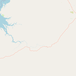
Map view of Fish River Station

Use this park location map to pinpoint Fish River Station in Australia, understand its exact geographic position, and read its mapped placement within the surrounding landscape more clearly.

Pigeon | © OpenStreetMap contributors

Location context for Fish River Station

Northern Territory
Park atlas

Compare adjacent protected landscapes, tropical savannahs, and regional wetland habitats

Exploring Other Parks Near Fish River Station and Surrounding Northern Territory Reserves

Continue browsing national parks and protected areas near Fish River Station to examine connected regional geography and tropical wetland habitats. Comparing adjacent conservation estates reveals broader ecological patterns across the Northern Territory landscape.
National parkNorthern Territory
About 72 km away#1 closest

North

Litchfield National Park: Northern Territory National Park Protected Landscape Atlas

Explore regional geography and mapped park boundaries.

Litchfield National Park is a protected natural area located in Australia's Northern Territory, designated as a national park. This page offers detailed geographic context and explores the park's mapped boundaries, providing a foundational understanding of its protected landscape identity. Discover how Litchfield National Park fits within the broader atlas of Australian conservation lands, highlighting its regional geographic significance and mapped terrain.

Area
1,458.47 km²
Established
1991
IUCN
II
Visitors
329.6K annual
Nature reserveNorthern Territory
About 99 km away#2 closest

Southeast

Giwining / Flora River Nature Park: Protected Limestone Landscapes of Northern Territory

Geological spring systems and tropical riverine corridors.

The landscape of Giwining / Flora River Nature Park is defined by a network of calcium-rich springs emerging from Tindall Limestone. These waters have sculpted tufa dams and cascading waterfalls along the Flora River, creating a unique geological environment within the savanna woodlands of the Northern Territory.

Area
78.24 km²
Established
1993
IUCN
V
Relief
Lowland
Watercolor illustration showing rolling green hills, a red rock formation, and scattered trees
National parkNorthern Territory
About 130 km away#3 closest

South

Judbarra National Park: Northern Territory National Park Protected Landscape and Geography

Discover its mapped terrain and ancient Indigenous rock art.

Judbarra National Park is a major national park in Australia's Northern Territory, recognized for its extensive Indigenous rock art, which constitutes a significant artistic province. Spanning a vast area with two distinct geographic sections, the park showcases a transition between tropical and semi-arid ecosystems. Users can explore its rugged terrain, sandstone escarpments, and mapped park boundaries to understand its unique regional geographic context and rich cultural heritage.

Area
13,004.1 km²
Established
1990
IUCN
II
Relief
Mixed relief
National parkNorthern Territory
About 136 km away#4 closest

Northeast

Mary River National Park: National Park in Northern Territory, Australia

Mapped protected landscape and regional geographic context.

Mary River National Park is an officially designated national park located in the vast Northern Territory of Australia. This protected area offers rich opportunities for geographic discovery, allowing users to explore its mapped boundaries and understand its significance within the regional landscape. Discover the natural context and atlas positioning of Mary River National Park, contributing to a broader understanding of protected lands in Northern Australia.

Area
1,215.25 km²
Established
1966
IUCN
II
Visitors
336.4K annual
National parkNorthern Territory
About 138 km away#5 closest

East

Nitmiluk National Park: Detailed Protected Landscape and Geographic Context

Explore mapped park boundaries and regional terrain.

Delve into the specifics of Nitmiluk National Park, a designated national park within the Northern Territory of Australia. This section focuses on its protected-area status and how its geography contributes to the regional landscape. Users can explore the park's mapped extent and understand its placement within the broader geographical atlas, highlighting its importance as a distinct protected natural area.

Area
2,946.64 km²
Established
1977
IUCN
II
Visitors
309.8K annual
Protected landscapeNorthern Territory
About 140 km away#6 closest

Northwest

Channel Point Coastal Reserve: Mapped Geography and Protected Coastal Landscape

Northern Territory coastal wetlands and river-mouth geography.

Spanning the mouth of the Daly River, Channel Point Coastal Reserve offers a study in tropical estuarine geography. Its protected boundaries encompass diverse tidal flats and mangrove ecosystems, providing crucial habitat within the Northern Territory. The landscape remains a quiet node of ecological significance, characterized by its interaction with the Peron Islands and open bay waters.

Area
2.5 km²
Established
2005
IUCN
V
Relief
Lowland
Protected landscapeNorthern Territory
About 141 km away#7 closest

East

Kintore Caves Conservation Reserve: Karst Geography and Protected Landscape Analysis

Mapping subterranean terrain and cultural heritage in Australia's Northern Territory.

Kintore Caves Conservation Reserve in the Northern Territory is a vital protected area defined by its rare limestone karst geology and extensive cave networks. This site provides a concentrated look at subterranean biodiversity and archaeological history within a transitional rural setting near Katherine, showcasing the importance of focused conservation boundaries in safeguarding geological and human-linked landscapes.

Area
4.23 km²
Established
1965
IUCN
V
Access
Access unknown
National parkAustralia
About 145 km away#8 closest

Northeast

Kakadu National Park: Australia's Protected Landscape and Regional Geography

Explore Kakadu National Park's mapped boundaries and natural terrain.

Kakadu National Park stands as a significant national park entity within Australia, providing rich geographic context for atlas discovery. This page details the park's protected area identity, its mapped natural landscapes, and its place within the broader Australian continent's geography. Understand the unique regional setting and the specific topographic features that define Kakadu National Park for detailed exploration and comparative geographic analysis.

Area
19,804 km²
Established
1979
IUCN
II
Visitors
250K annual

Common questions about visiting, size, designation, and location context for Fish River Station

Fish River Station FAQs for park facts, access, geography, and protected area context

Find quick answers about Fish River Station, including protected-area facts, park geography, trail and visitor context, and how the park fits into its surrounding country and regional landscape.
MoriAtlas Explorer

Continue Your Protected Areas Search Across the Global Atlas

Deepen your exploration by continuing the structured search for national parks and protected areas worldwide. Utilize the comprehensive filtering capabilities to compare different conservation landscapes and refine your understanding of global park geography. Discover more about the distribution and characteristics of protected natural areas.

Global natural geography