Why Flotzgrün stands out
Flotzgrün is best known for being a textbook example of how 19th-century Rhine straightening reshaped the Upper Rhine landscape, producing a new island that now carries multiple modern functions. It combines a major industrial landfill operated by BASF, an active agricultural floodwater polder that can store up to five million cubic meters of floodwater, and formally protected floodplain nature reserves. The island is also notable for its layered cultural and environmental value: it lies within the broader Pfälzische Rheinauen landscape protection area, while the old river channels around its southern and western edges are designated as the Flotzgrün nature reserve, with the small Elslache meadow serving as a designated natural monument.
Flotzgrün history and protected-area timeline
Flotzgrün did not exist before the mid-19th century. Its origin is directly tied to the large-scale Rhine correction project led by Johann Gottfried Tulla, which sought to straighten and shorten the Upper Rhine in order to improve navigability and reduce flooding. In 1842, work began on a guiding ditch for the Oberhausen Durchstich, and by 1844 that channel had cut off a section of the original Rhine course near Oberhausen, isolating the land that would become Flotzgrün as a new island between the newly corrected main channel and the surviving old river arm.
For more than a century, the island developed without major additional engineering intervention, used primarily for agriculture while the surrounding floodplains gradually lost much of their natural flood retention capacity due to straightening and dam construction downstream. In the late twentieth century, that loss became a policy problem: the protection against very high, statistically rare floods had decreased along the southern Upper Rhine, motivating the Integrated Rhine Programme, of which Flotzgrün's southern polder is now a key element.
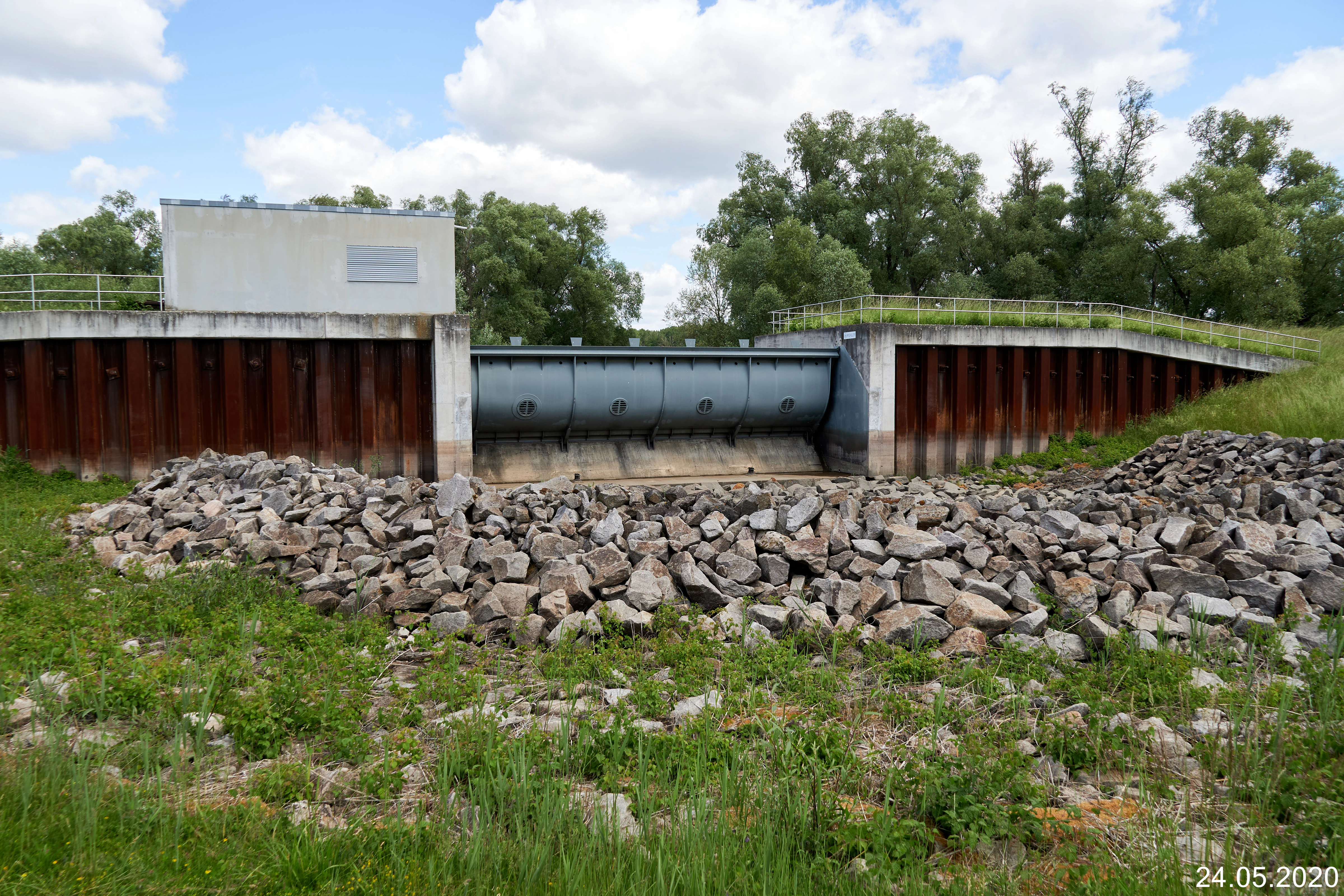
The modern phase of the island's history began in 1998, when the planning approval procedure for the Flotzgrün polder was completed. Construction of dikes, inlet and outlet structures, and associated infrastructure followed, and the polder was formally placed in operation in 2002 after roughly eight million euros of investment. The historical and present-day BASF landfill complex in the northwest, with its documented concerns around legacy industrial waste and groundwater contamination, adds an additional, ongoing layer to the island's management history.
Flotzgrün landscape and geographic character
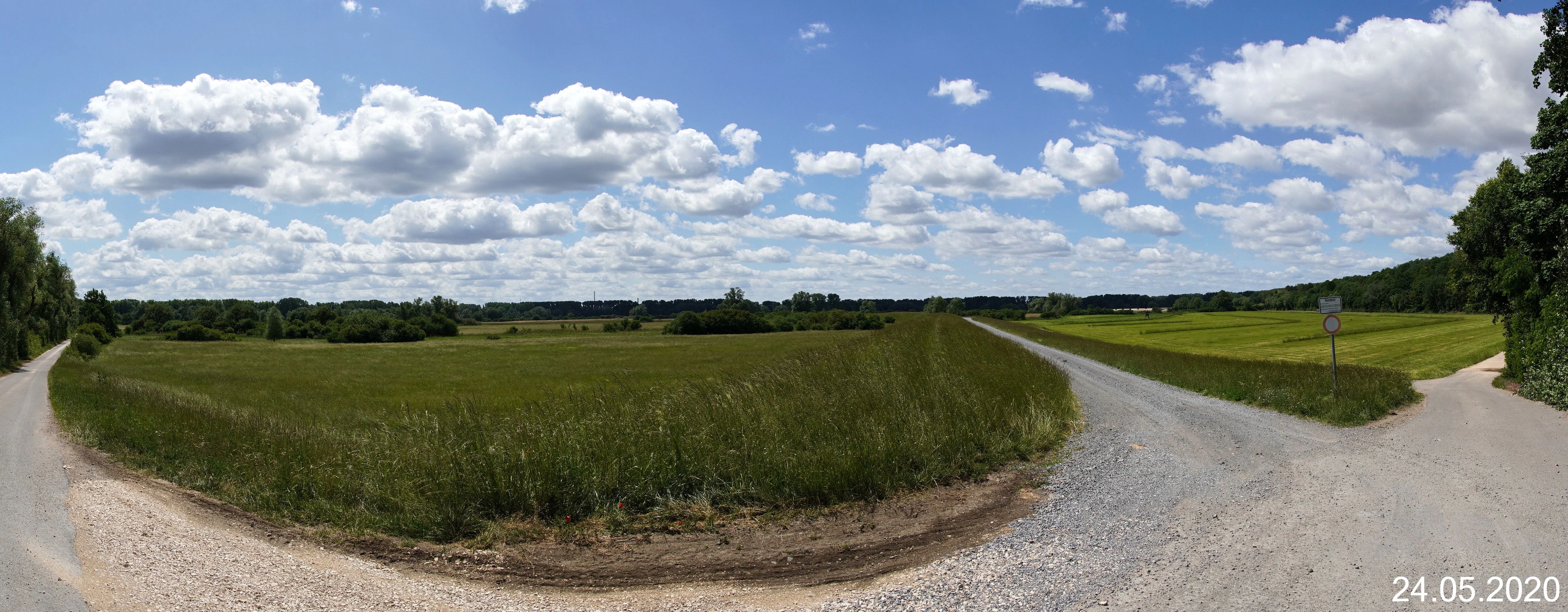
The physical landscape of Flotzgrün is defined by a striking contrast between engineered geometry and surviving natural river forms. The island itself is flat, low-lying, and fully enclosed by dikes, with an overall footprint of roughly 2.1 kilometers long and 1.8 kilometers wide, giving it an approximately 340-hectare footprint that extends right up to the edges of both the modern Rhine and the Berghäuser Altrhein.
To the south and west, the old river arm retains a much more natural morphology. Its banks are lined with riparian woodland, and the curvilinear shoreline stands in visible contrast to the straightened geometry of the corrected Rhine on the eastern side. Together, these old water bodies form the core of the Flotzgrün nature reserve. Inside the diked island, the landscape is overwhelmingly agricultural, with fields occupying the southern polder area, while the northwestern quarter has a strongly industrial character dominated by landfill operations and associated infrastructure. Within this largely managed interior, the small Elslache depression forms a notable natural feature: a periodically wet, species-rich meadow whose alternating hydrology makes it a local ecological highlight.
Flotzgrün ecosystems, habitats, and plant life
Ecologically, Flotzgrün sits at the interface between a heavily engineered river landscape and the surviving remnants of the original Upper Rhine floodplain system. The island and its surrounding old river arm fall within the broader Pfälzische Rheinauen landscape protection area, which links a chain of protected floodplain sites along this stretch of the Rhine.
The most ecologically important habitats lie outside the diked farmland. The old river channels and their accompanying riparian forests along the southern and western edges of the island are designated as the Flotzgrün nature reserve, providing sheltered aquatic and woodland habitat that contrasts sharply with the regulated main river channel nearby. On the island itself, the Elslache is a small but ecologically significant wet meadow protected as a natural monument; as a so-called Pfeifengraswiese, a moist grassland type tied to fluctuating water levels, it hosts a community of plants and animals that depend on alternation between flooded and drier conditions and is considered regionally uncommon.
The polder itself adds a dynamic ecological layer. Although primarily an agricultural flood basin, it can be deliberately flooded during high-water events, reintroducing at least an episodic hydrological disturbance into a landscape that had lost much of its natural flood regime. Adjacent polders at Mechtersheim and on the Rheinschanzinsel extend this managed floodplain ecology across the river.
Flotzgrün wildlife and species highlights
The wildlife significance of Flotzgrün is concentrated in its old water bodies and the small Elslache meadow rather than in its cultivated interior. The old river channels around the island, protected as the Flotzgrün nature reserve, provide habitat for aquatic and riparian species tied to slow-moving, structurally diverse riverine environments, while their fringing riparian woodlands offer nesting and shelter for birdlife associated with the Rhine floodplain system.
The Elslache, as a designated natural monument, is recognized specifically for hosting rare plants and animals adapted to its alternating wet and dry conditions. Its designation as a Pfeifengraswiese emphasizes the importance of such moisture-fluctuating grasslands in a region where most similar habitats have been lost to drainage and agricultural intensification. Together, the nature reserve and the Elslache make the island a locally significant refuge within the larger Palatinate Rhine floodplain ecosystem, even though the central farmland portion of the island is dominated by agricultural rather than wildlife-supporting land use.
Flotzgrün conservation status and protection priorities
The conservation profile of Flotzgrün is unusual because it combines active industrial use with multiple layers of formal protection. The island and its surrounding old river arm are embedded in the Pfälzische Rheinauen, a wide landscape protection area covering a substantial portion of the Palatinate Rhine floodplain, which provides a baseline level of landscape-scale protection across the broader river corridor.
Within that framework, the Flotzgrün nature reserve gives stricter protection to the ecologically most valuable area: the surviving old river channels and their fringing riparian woodlands along the southern and western edges of the island. The Elslache adds a third layer of protection through its designation as a natural monument, sheltering a rare wet-meadow community that depends on continued natural hydrological fluctuation.
Conservation interest is not limited to natural heritage. The Integrated Rhine Programme treats managed flooding of the Flotzgrün polder as an environmental measure in its own right, intended to restore a degree of the floodplain dynamics lost since the 19th-century Rhine correction and to rebuild protection against extreme flood events along the southern Upper Rhine. Even the BASF landfill area carries conservation significance, but in a precautionary sense: documented groundwater contamination and the presence of legacy industrial waste mean the site is the subject of extensive water-pumping and monitoring operations that are critical to protecting the drinking water supply of Speyer.
Flotzgrün cultural meaning and human context
Flotzgrün's cultural context is closely tied to one of the most consequential landscape transformations in modern European river management. The Rhine correction led by Johann Gottfried Tulla was both a technical and a cultural milestone, reshaping centuries of settlement, agriculture, and flood experience along the Upper Rhine. The creation of Flotzgrün as a byproduct of the 1842 Oberhausen Durchstich gives the island a place in this longer story, even if it was never a traditional settlement.
Today the island embodies the modern entanglement of regional industry, agriculture, and environmental management in the Palatinate. Its role as a BASF waste-management site, its integration into the Integrated Rhine Programme's flood defense strategy, and its embedding in regional nature conservation frameworks together reflect how the Upper Rhine has become a working landscape in which heritage and contemporary infrastructure are tightly interwoven.
Top sights and standout views in Flotzgrün
Flotzgrün illustrates how a single Rhine island can carry industrial, agricultural, hydrological, and ecological functions simultaneously. The combination of the BASF landfill in the north, the agricultural polder in the south, the surrounding Flotzgrün nature reserve, and the Elslache natural monument gives the site a remarkably layered profile within a relatively small area.
The Flotzgrün polder is itself a standout feature: able to absorb up to five million cubic meters of floodwater via two fish-belly flap-controlled inlet and outlet structures, it is a showcase of modern flood management along the southern Upper Rhine and a tangible expression of the Integrated Rhine Programme's ambition to undo some of the hydrological consequences of 19th-century river straightening.