
Mori Atlas logo
Nature reserveForstberg von Ueberau

Tracing the volcanic terrain, dry grassland mosaic, and ecological boundaries of a unique Hessian nature reserve.

Forstberg von Ueberau Nature Reserve: Geological Landscapes and Protected Habitat Geography in Hesse, Germany

(Naturschutzgebiet Forstberg von Ueberau)

Forstberg von Ueberau represents a distinct protected landscape situated within the Reinheimer Hügelland of southern Hesse. This nature reserve, formed around the remains of an extinct volcano, encompasses a compact but biologically vital area of basaltic ridges, historical quarry craters, and traditional orchard meadows. By maintaining a delicate balance between active conservation and traditional land management, the reserve provides a critical refuge for dry-grassland flora and insect populations within an intensively farmed regional setting.

extinct volcanonature reservedry grasslandbutterfly habitattraditional orchardhedgerow landscape
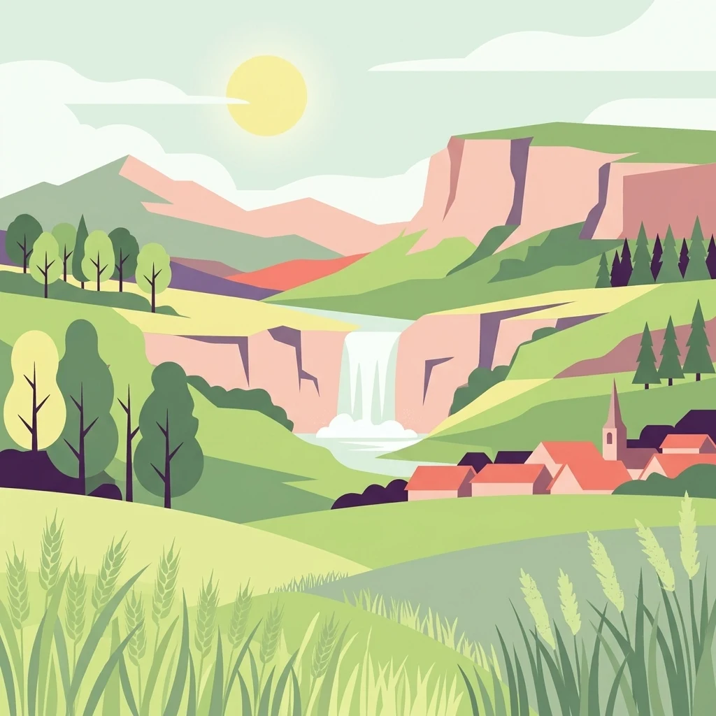
A flat style digital illustration showing a sunny valley with rolling green meadows in the foreground, a small village with a church spire to the right, a waterfall cascading over rocky cliffs in the midground, and volcanic mountains in the background.

Forstberg von Ueberau

Nature reserve

Park overview

Structured park overview, official facts, and landscape profile for Forstberg von Ueberau

Forstberg von Ueberau park facts, protected area profile, and essential visitor context

Review the core facts for Forstberg von Ueberau, including designation, size, terrain, visitor scale, habitats, and operating context in one park-focused overview.

About Forstberg von Ueberau

Forstberg von Ueberau is a nature reserve in southern Hesse that gains much of its identity from being a small island of seminatural habitat embedded in a working agrarian landscape. Its territory lies in the Reinheimer Hügelland, the gently undulating agricultural belt between the Odenwald uplands to the east and the Upper Rhine Plain to the west. Administratively, the reserve spans parts of the city of Reinheim (specifically the Ueberau district) and the town of Groß-Bieberau, both within the Darmstadt-Dieburg district.

The reserve takes its name from the Forstberg itself, a small isolated hill that is in fact the deeply eroded remnant of a long-extinct volcano. The volcano formed approximately 45 million years ago during the tectonic activity that produced the Upper Rhine Graben, when magma rose through fissures and cooled into the basalt and olivine-nephelinite that still define the hill today. The Forstberg belongs to the same family of small volcanic summits that includes the nearby Otzberg and Roßberg, both visible landmarks in this part of Hesse. Although modest in height, rising from a base around 160 meters to a summit of 235.4 meters, the hill stands out because its dark volcanic rocks contrast with the lighter sedimentary rocks that dominate the rest of the Reinheimer Hügelland.

The summit of the Forstberg carries a striking manmade feature: a broad crater-shaped depression left behind by historical basalt quarrying. The old quarry pit now provides warm bare rock faces, exposed mineral substrate, and sheltered microclimates that many specialized plants and insects depend on, and it has become an integral component of the protected area. Around the volcanic core, the slopes blend into a layered mosaic of Magerwiesen, traditional orchards, hedgerows, terraced edges, and field margins. Because most of the reserve remains open, light-dependent dry grassland flora and fauna continue to thrive on a hill that in many other parts of central Germany might have been swallowed by closed forest.

In formal terms, the reserve was established on 17 October 1990 under Hessian nature protection law and is listed internationally with the WDPA. It is classified under IUCN Category IV, recognizing that its conservation value rests on the active management of specific habitats and species rather than on wilderness preservation. This combination of volcanic geology, exposed quarry rock, seminatural dry grasslands, hedges, and orchards makes Forstberg von Ueberau a compact but unusually rich example of how cultural landscape and protected status can reinforce each other.

Quick facts and research context for Forstberg von Ueberau

The reserve lies in the Reinheimer Hügelland of southern Hesse, within the Landkreis Darmstadt-Dieburg, about 1.2 kilometers northeast of Groß-Bieberau and 1.7 kilometers southwest of Reinheim-Ueberau.

Designated as a Naturschutzgebiet on 17 October 1990, it covers 30.47 hectares and is classified as an IUCN Category IV Habitat/Species Management Area. Its foundation is the Forstberg, a 235.4 meter high extinct volcano that formed roughly 45 million years ago; the summit hosts a former basalt quarry whose crater is now part of the protected landscape. The reserve protects seminatural dry grasslands, hedgerows, terraces, and traditional orchards supporting 33 breeding bird species, more than 250 butterfly species, and a notable set of Red List plants and moths.

Protection and recognition

Track documented conservation frameworks and international recognition standards

Forstberg von Ueberau Protection Status and Official Designation Records

Analysis of Forstberg von Ueberau incorporates verified protection status records and associated designation data from the World Database on Protected Areas. Structured administrative tracking indexes official management metrics and documented conservation scope without speculative claims.

Protection details

WDPA ID
163129
Park context

Deeper park guide and search-rich context for Forstberg von Ueberau

Forstberg von Ueberau history, landscape, wildlife, and travel context

Explore Forstberg von Ueberau through its history, landscape character, ecosystems, wildlife, conservation priorities, cultural context, and seasonal travel timing in a structured park guide built for atlas discovery and search intent.

Why Forstberg von Ueberau stands out

The Forstberg von Ueberau is best known for being one of the smallest but most biologically rich dry grassland reserves in Hesse, set on the slopes of an extinct volcano. Its combination of warm basaltic substrate, abandoned quarry walls, hedge networks, traditional orchards, and seminatural meadows has produced an exceptional concentration of dry grassland specialists in a very compact area. The site is also celebrated for its butterfly fauna, with over 250 recorded species including declining dry meadow specialists such as the wall brown, the marbled white, the dry meadow fritillary, and the comma butterfly. Among ecologists, the reserve is recognized as a textbook example of how light traditional land management and formal habitat protection can coexist on a single hill, sustaining Red List species that have largely vanished from the surrounding farmland.
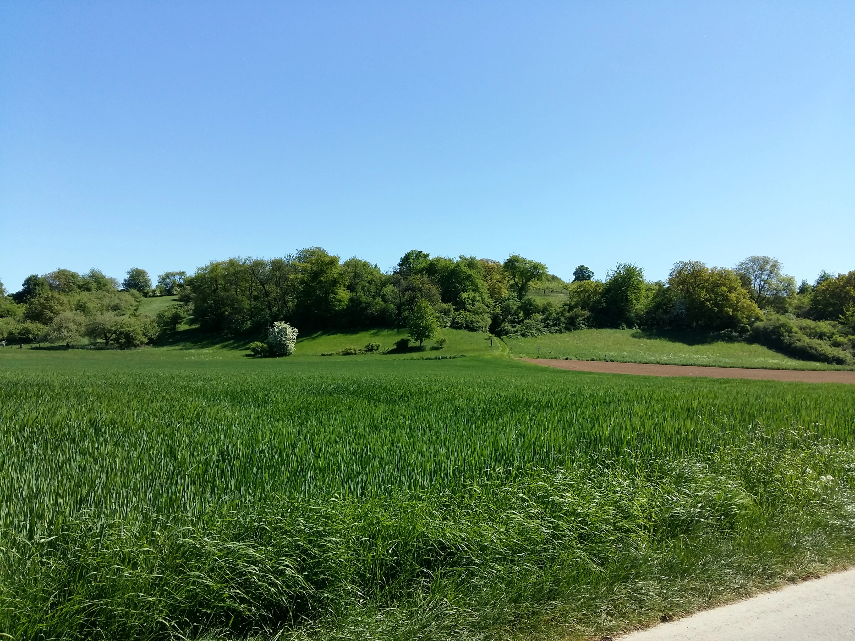
A wide view of a bright green meadow and agricultural field in the foreground, leading up to a low, wooded volcanic hill under a clear blue sky.
A view of the Forstberg von Ueberau nature reserve from Ackerauer Weg.

Forstberg von Ueberau history and protected-area timeline

Forstberg von Ueberau gained formal protection as a Hessian nature reserve on 17 October 1990, when regional authorities issued a designation ordinance bringing the hill's existing seminatural land use under conservation management. The timing reflected a broader recognition in Hesse of the ecological value of small preserves made up of Magerwiesen, hedges, and traditional orchards, all of which had been steadily lost to agricultural intensification elsewhere in the region.

Long before the area received conservation status, the Forstberg already had a place in regional imagination. A publication dating from 1869 records a local tradition suggesting that a ring wall once stood on the hill, placing the Forstberg within the broader Hessian pattern of fortified hilltop sites referenced in historical and folkloric sources. No confirmed archaeological remains from such a fortification have been documented in modern conservation literature, but the reference is part of how the hill has been understood locally for well over a century.

The most ancient history of the site is geological rather than human. The Forstberg was shaped roughly 45 million years ago as one of several small volcanoes that formed along fissures connected to the subsidence of the Upper Rhine Graben; the Otzberg and Roßberg are its closest relatives in this family. In more recent centuries, the hill's basalt was quarried for building and road materials, leaving the crater-like depression on the summit. That former quarry has since become part of the reserve's identity, transforming industrial scars into habitat.

Forstberg von Ueberau landscape and geographic character

The landscape of Forstberg von Ueberau is defined above all by the contrast between an isolated volcanic hill and the gentle agricultural countryside that surrounds it. The hill rises about 75 meters above its surroundings, climbing from a base of roughly 160 meters to a summit elevation of 235.4 meters. Throughout most of the Reinheimer Hügelland, geology is dominated by sedimentary rocks, so the dark basaltic and olivine-nephelinite stones of the Forstberg stand out as a visible anomaly that shapes both terrain and soil.

The most striking landform on the hill is the quarry crater on the summit. Created by historical basalt extraction, the pit forms an irregular bowl surrounded by rocky edges and exposed mineral ground. This single feature gives the upper part of the reserve a varied microtopography of warm south-facing rock, cooler shaded hollows, and bare substrate that contrasts with the surrounding grassy slopes. Looking outward from the higher slopes, the view extends across a patchwork of fields between Groß-Bieberau and Reinheim-Ueberau, both close enough that the reserve feels embedded in the daily landscape rather than detached from it.

Around the volcanic core, the terrain feels thoroughly cultural. Hedges, terraces, field margins, and traditional orchard trees line the slopes, dividing the hill into a structured pattern of small habitats rather than continuous meadow or woodland. The absence of closed forest across most of the reserve is itself a defining landscape feature, keeping the slopes open and the long views intact. This combination of rocky summit, dry slopes, terrace patterns, and orchard meadows is what gives Forstberg von Ueberau its particular sense of place within the broader Reinheimer Hügelland.

Forstberg von Ueberau ecosystems, habitats, and plant life

Ecologically, Forstberg von Ueberau is built around its Magerwiesen, the species-rich nutrient-poor dry grasslands that have become scarce across central Europe. Developed on thin volcanic soils under warm, well-drained conditions, these meadows support a remarkable plant diversity for so small an area, including meadow bellflower, clustered bellflower, meadow sage, hairy violet, and rampion bellflower. Where management allows, additional specialists such as French rose, centaury, and bulbous saxifrage thrive alongside native grasses and herbs typical of the Reinheimer Hügelland.

Hedgerows and field margins (Saumbiotope) are central to the reserve's ecological structure. These linear habitats provide shelter, food, and movement corridors for the species that would otherwise struggle in the intensively farmed fields surrounding the reserve. Traditional orchards (Streuobstbestände) layer scattered old fruit trees over parts of the grassland, creating a three-dimensional mosaic that supports nesting birds, pollinators, and invertebrates needing both open ground and tree cover within the same area.

The reserve's protected status ordinance explicitly aims to expand the Magerwiesen, preserve the species-rich hedges, and maintain the network of edge habitats that ties these features together. This active habitat management is fundamental: dry grassland and orchard habitats do not sustain themselves once traditional management is abandoned or intensified, so the reserve operates as a maintained cultural landscape where biodiversity depends on ongoing light human use. The combination of warm, rocky substrate, hedge connectivity, orchard structure, and seminatural meadows is what allows Forstberg von Ueberau to support so much life within only 30 hectares.

Forstberg von Ueberau wildlife and species highlights

Forstberg von Ueberau supports an unusually rich fauna for a reserve of its size. Documented breeding birds number around 33 species, taking advantage of the open grassland, hedge network, and orchard trees. Characteristic species include grey partridge, common nightingale, red-backed shrike, several warbler species, and European turtle dove, the last being a farmland bird of significant conservation concern across much of Europe. The reserve's hedges and scattered trees provide nesting and song perches that have largely disappeared from the surrounding intensified farmland.

The site's insect fauna is especially notable. Numerous beetle, grasshopper, and hymenopteran species occupy the warm, structurally varied habitats, and the reserve has been documented as the home of more than 250 butterfly species. This figure includes iconic dry-grassland specialists such as Old World swallowtail, wall brown, marbled white, dry meadow fritillary, and comma butterfly, all of which depend on the kind of seminatural habitat mosaic that the reserve preserves. Twenty-two moth species on national Red Lists have also been recorded, adding a nocturnal component to the reserve's insect diversity.

Together, the bird and insect communities make the reserve an important local site for monitoring farmland biodiversity decline. Many of the species present here have contracted sharply elsewhere in the Rhine-Main region, so Forstberg von Ueberau acts as a refuge where traditional hedgerow, orchard, and dry grassland habitats continue to function at a meaningful scale. For naturalists, the hill offers a compact but unusually representative sample of species associated with seminatural agricultural countryside.

Forstberg von Ueberau conservation status and protection priorities

Forstberg von Ueberau is recognized internationally as an IUCN Category IV Habitat/Species Management Area, placing it within the global protected-area framework while signaling that its value rests on targeted habitat and species management rather than on wilderness preservation. Designated under Hessian nature protection law in October 1990, the reserve addresses what is now widely acknowledged as one of the most pressing conservation challenges in the Rhine-Main region: the loss of Magerwiesen, hedges, traditional orchards, and the specialized species they support.

The reserve's conservation strategy explicitly combines habitat protection with active management. Designated goals include expanding species-rich dry grasslands, maintaining species-rich hedges, and preserving the network of edge habitats that ties the cultural landscape together. Such measures are necessary because dry grassland and orchard habitats do not survive passively; without continued light traditional management, they are quickly lost to either succession into scrub and forest or to intensification.

Beyond its local role, the reserve has broader conservation significance as a habitat island inside a heavily farmed region. As surrounding fields have become more uniform, the Forstberg provides an increasingly vital refuge for dry-grassland plants, declining butterfly species, and farmland birds whose long-term survival depends exactly on the kind of small structured habitats the reserve preserves. Its combination of geological distinctiveness, cultural landscape structure, and documented species richness makes it an important reference site for conservation planning in southern Hesse.

Forstberg von Ueberau cultural meaning and human context

The cultural layers of Forstberg von Ueberau are modest but distinct. The most evocative reference is a local tradition recorded in 1869 suggesting that a ring wall once stood on the hill. While no confirmed archaeological remains have been tied to this tradition, the Forstberg fits the broader Hessian pattern of fortified hilltop sites and reflects the long role of the landmark in regional identity and folklore.

More tangibly, the cultural identity of the reserve today rests on generations of traditional land management. The Magerwiesen, orchard meadows, hedgerows, and terraced slopes are all products of low-intensity farming practices that have shaped the Reinheimer Hügelland for centuries. Maintaining these features is as much an act of cultural preservation as it is of ecological management: old fruit trees and field margins preserve a recognizable rural character that connects the reserve to the agrarian past of the Darmstadt-Dieburg district.

Top sights and standout views in Forstberg von Ueberau

Forstberg von Ueberau packs extraordinary ecological value into a very small reserve built around an extinct volcano. Its combination of basalt rock, abandoned quarry crater, warm slopes, hedges, traditional orchards, and seminatural Magerwiesen supports more than 250 butterfly species, 33 breeding bird species, and a meaningful set of Red List plants and moths within a single protected site of just over 30 hectares.

What makes the reserve especially valuable is that it remains a working agrarian landscape rather than a closed nature reserve. Light management, traditional orchards, and open dry grasslands coexist with formal protection, offering a rare and effective model of habitat conservation inside an active agricultural region of southern Hesse.

Best time to visit Forstberg von Ueberau

The reserve shows its character most fully from late spring through early summer, when the Magerwiesen come into bloom and dry grassland flora is at its most expressive. This period also coincides with peak butterfly activity, when species such as wall brown, marbled white, and various fritillaries are most reliably seen along the warm slopes and quarry edges. Late spring and early summer are likewise the most rewarding time for bird observation, with breeding species singing across the hedgerows and orchards.

In high summer, the dry slopes continue to host thermophilic insects and the traditional orchards form a quieter but visually distinct layer in the landscape; however, vegetation can become parched and views across the reserve more uniform. Autumn tends to be calmer, with late-flowering plants and migrating activity around the hedgerows, while winter reveals the reserve's agricultural setting more starkly but provides the clearest views of the volcanic terrain and the quarry crater.

Monthly climate preview

Long-term representative monthly averages for temperature and precipitation

Forstberg von Ueberau Climate Normals and Annual Temperature Patterns

Representative coordinates track measured monthly temperature swings from sub-zero winter lows to warm summer maximums alongside steady precipitation rates. Detailed twelve-month records provide complete monthly climate normals for analyzing long-term environmental patterns across the protected landscape.
Annual mean10 °C
0 °C21 °C
Jan
Feb
Mar
Apr10°
May14°
Jun18°
Jul21°
Aug20°
Sep15°
Oct10°
Nov
Dec
Warmest month
July

20.6 °C

Coolest month
January

0.2 °C

Wettest month
July

2.2 mm/day

Driest month
April

1.4 mm/day

Park location guide

Geography guide, regional context, and park location map for Forstberg von Ueberau

Forstberg von Ueberau park geography, regions, and map view in Germany

Understand where Forstberg von Ueberau sits in Germany through a broader geographic reading of the surrounding landscape, nearby location context, and its mapped position within the national park landscape.

How Forstberg von Ueberau fits into Germany

Germany is a federal republic in Western and Central Europe with a population of over 83 million across sixteen constituent states. It is Europe's largest economy by nominal GDP and a major global exporter and importer. The capital is Berlin, and the country borders Denmark, Poland, Czech Republic, Austria, Switzerland, France, Luxembourg, Belgium, and the Netherlands.

Wider geography shaping Forstberg von Ueberau in Germany

Germany is located in Western and Central Europe, spanning 357,022 km². It borders Denmark to the north, Poland and the Czech Republic to the east, Austria and Switzerland to the south, and France, Luxembourg, Belgium, and the Netherlands to the west. The country has coastlines on the Baltic Sea and North Sea to the north, with the Alps located in the southern region.

Map view of Forstberg von Ueberau

Use this park location map to pinpoint Forstberg von Ueberau in Germany, understand its exact geographic position, and read its mapped placement within the surrounding landscape more clearly.

Pigeon | © OpenStreetMap contributors

Location context for Forstberg von Ueberau

Hesse

Explore protected area imagery, basalt formations, and habitat mosaics across the reserve hill.

Forstberg von Ueberau Photos and Landscape Scenery: Visualizing Volcanic Terrain and Dry Grasslands

Visual documentation captures the distinct volcanic topography, rocky summit craters, and open dry grasslands of Forstberg von Ueberau. Examining these protected area photographs reveals the intricate mosaic of traditional orchards, hedgerows, and agrarian habitats that define the reserve environment.

A wide view of a bright green meadow and agricultural field in the foreground, leading up to a low, wooded volcanic hill under a clear blue sky.

A wide view of a small town with red-tiled roofs nestled at the base of rolling green hills, with flowering trees and agricultural fields visible in early spring.

Park atlas

Compare surrounding regional nature reserves and connected volcanic terrain in southern Hesse

Parks Near Forstberg von Ueberau and Related Protected Landscapes to Explore

Visitors exploring Forstberg von Ueberau can continue discovering nearby protected areas and volcanic terrain across the Reinheimer Hügelland. Examining adjacent nature reserves provides deeper geographic context into the regional spread of dry grassland habitats and agricultural refuges.
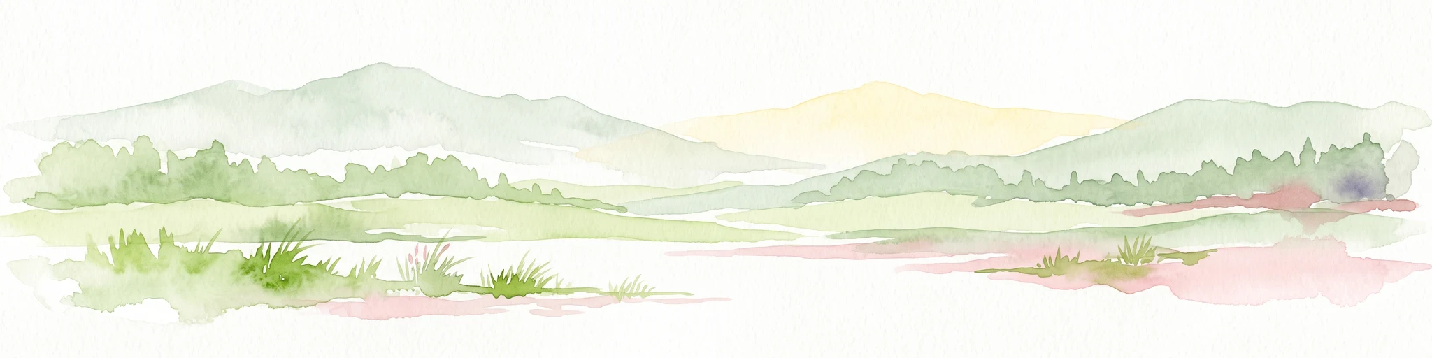
Watercolor painting of a tranquil pond landscape with soft green reeds, grasses, and low trees under a pale, muted sky.
Nature reserveHesse
About 4.6 km away#1 closest

North

Reinheimer Teich Nature Reserve: Mapped Wetlands and Biodiversity in Hesse, Germany

A lowland wetland refuge in the Reinheimer Becken

Reinheimer Teich represents a significant nature reserve in the Darmstadt-Dieburg district of Hesse. This protected area features a mosaic of reed beds, wet meadows, and open water channels. It is recognized as one of the final strongholds for the European pond turtle and remains a key node within the Untere Gersprenz river system, demonstrating the vital role of floodplain restoration in local landscape conservation.

Area
0.75 km²
Established
1975
IUCN
IV
Relief
Lowland
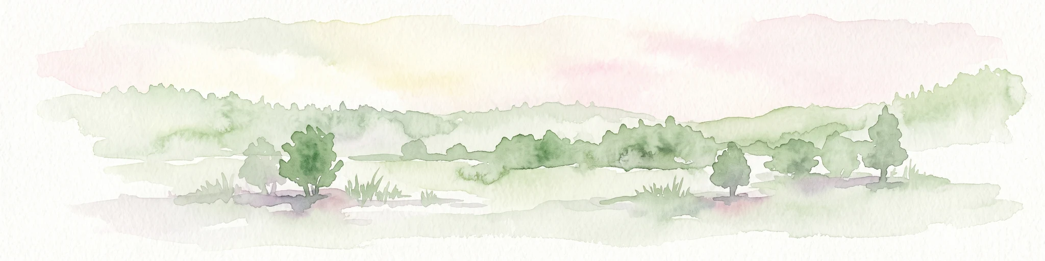
A watercolor illustration of a soft, pastel-colored wetland landscape with trees, grassy banks, and distant hills.
Nature reserveHesse
About 5.7 km away#2 closest

Southeast

Bruch von Brensbach: Mapping the Nature Reserve and Wetland Mosaic in Hesse, Germany

Protected carr woodland and Gersprenz valley stream corridors

Located in the Odenwaldkreis district of Hesse, Bruch von Brensbach acts as a crucial protected wetland corridor. The reserve preserves a rare concentration of alder carr forest and reed beds along the Kilsbach stream, offering a stark geographic contrast to the agricultural fields that characterize the broader Gersprenz valley landscape.

Area
0.055 km²
Established
1983
IUCN
IV
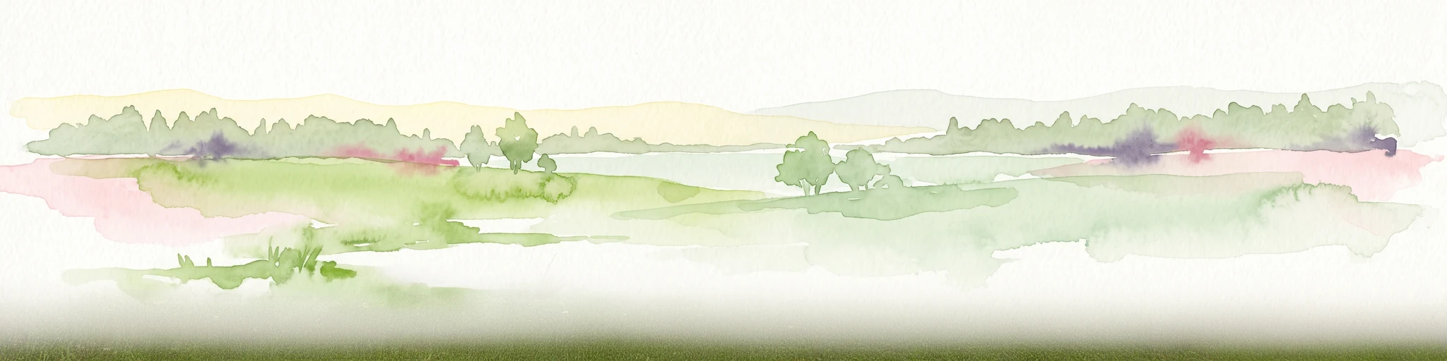
A wide watercolor painting showing a river flowing through a green meadow with trees and distant hills.
Protected areaHesse
About 5.9 km away#3 closest

North

Scheelhecke von Groß-Zimmern Protected Area, Hesse: A Wetland and Riverine Landscape Study

Key protected wetland features in the Reinheimer Hügelland

Scheelhecke von Groß-Zimmern protects an essential network of wet meadows and brook corridors in the Darmstadt-Dieburg district. Its geography encompasses a transition from open sedge-dominated floodplain to softwood forest, providing critical support for avian species and amphibians within the Natura 2000 Gersprenz network.

Area
0.046 km²
Established
1983
Relief
Upland
Climate
Temperate
Watercolor painting of a wide, low-horizon landscape featuring a line of green trees against a pale pink sky over a pale, sandy foreground.
Nature reserveHessen
About 9.6 km away#4 closest

East

Sandsteinbrüche am Burzelberg bei Frau-Nauses Protected Nature Reserve and Quarry Atlas

Odenwald mountain range, Hessen protected area

Examine the geography of Sandsteinbrüche am Burzelberg bei Frau-Nauses, a protected nature reserve in Hessen. This site features striking Buntsandstein quarry walls and rewilded forest edges, providing a specialized environment for cliff-nesting raptors and documenting local industrial history through its geological formations.

Area
0.195 km²
Established
1994
Relief
Upland
Climate
Temperate
A horizontal watercolor painting depicting a soft-focus landscape with rolling green hills, a marshy foreground with grasses, and light purple mountains in the distance.
Nature reserveHesse
About 11 km away#5 closest

North

Das große Hörmes bei Dieburg Nature Reserve: A Wetland Protected Area in Hesse

Mapped lowland wetland habitat in the Gersprenz district

This compact nature reserve in southern Hesse provides a essential sanctuary for wetland species, featuring a rare combination of reedbeds, sedge stands, and moist litter meadows. The area highlights the historical character of the Gersprenz lowlands through its protected hydrological network and open herbaceous habitat structure.

Area
0.136 km²
Established
1985
IUCN
IV
Watercolor painting of a rolling wetland landscape featuring green fields, soft hills in the background, and marshy foreground vegetation.
Nature reserveHessen
About 11 km away#6 closest

Northwest

Scheftheimer Wiesen Nature Reserve: Geographic Overview and Protected Landscape Mapping

Hessen wetland ecosystems and prehistoric heritage sites

Situated along the Ruthsenbach stream in Hessen, Scheftheimer Wiesen is a 166-hectare nature reserve known for its recovery of wet meadow habitats after decades of agricultural use. The area integrates natural terrain with cultural heritage, featuring reconstructed granite menhirs and historic burial mounds within a broader forest-framed environment near Darmstadt.

Area
1.661 km²
Established
1993
IUCN
IV
Relief
Lowland
Watercolor painting of a soft, hazy landscape featuring scattered trees, bushes, and rolling hills in shades of green and pink against a pale background.
Nature reserveHesse
About 12 km away#7 closest

North

Fohlenweide von Dieburg: Nature Reserve and Protected Landscape in Hesse, Germany

Mapping the wet meadow habitats and ecological boundaries of southern Hesse.

Located in the Darmstadt-Dieburg district, Fohlenweide von Dieburg is a refined example of a small-scale cultural landscape preserved for its high ecological value. The protected area features a unique mosaic of damp grasslands, forest margins, and riparian strips that support a range of wildlife. This site offers insight into regional conservation management in Central Europe.

Area
0.235 km²
Established
1989
IUCN
IV
Relief
Lowland
A soft watercolor painting of a flat, open landscape with scattered trees, rolling grasses, and muted green and pink tones.
Nature reserveHessen
About 12 km away#8 closest

West

Lerchenberg und Kernesbellen von Darmstadt-Eberstadt: Hessian Nature Reserve and Dune Atlas

Protected sand grassland and pine forest landscape mapping

Lerchenberg und Kernesbellen von Darmstadt-Eberstadt serves as a key inland dune reserve within the northern Upper Rhine Plain. This protected area features a unique, sun-warmed mosaic of sandy substrates, sparse calcareous forests, and historic orchard meadows. Analyze the site's ecological boundaries and its role as a critical habitat fragment within the broader network of regional protected landscapes.

Area
0.172 km²
Established
1995
IUCN
IV

Common questions about visiting, size, designation, and location context for Forstberg von Ueberau

Forstberg von Ueberau FAQs for park facts, access, geography, and protected area context

Find quick answers about Forstberg von Ueberau, including protected-area facts, park geography, trail and visitor context, and how the park fits into its surrounding country and regional landscape.
MoriAtlas Explorer

Continue Your Protected Areas Search Across the Global Atlas

Deepen your exploration by continuing the structured search for national parks and protected areas worldwide. Utilize the comprehensive filtering capabilities to compare different conservation landscapes and refine your understanding of global park geography. Discover more about the distribution and characteristics of protected natural areas.

Global natural geography