
Mori Atlas logo
Wildlife reserveFossil Ridge Wilderness

Examining the geological spine, alpine basins, and diverse mountain terrain of this Gunnison County wilderness.

Fossil Ridge Wilderness: A Comprehensive Geographic Profile of Colorado Protected Lands

Fossil Ridge Wilderness represents a distinct high-country protected area defined by its striking Paleozoic carbonate ridgelines and ancient marine fossil deposits. Situated in the rugged landscape of Gunnison County, this area captures the essence of Colorado Rocky Mountain geography, with elevations ranging from forested creek valleys near 8,880 feet to alpine summits exceeding 13,000 feet. The terrain features a complex mosaic of talus fields, subalpine timber, and open tundra that supports significant wildlife populations.

wilderness areaPaleozoic geologyfossil-bearing ridgecarbonate ridgesouthern Rocky Mountainsalpine terrain
A stylized digital illustration showing a mountain ridge with pink and purple rocky peaks, green grassy slopes, and scattered rocks in the foreground, set against a light blue sky with white clouds.

Fossil Ridge Wilderness

Wildlife reserve

Park overview

Structured park overview, official facts, and landscape profile for Fossil Ridge Wilderness

Fossil Ridge Wilderness park facts, protected area profile, and essential visitor context

Review the core facts for Fossil Ridge Wilderness, including designation, size, terrain, visitor scale, habitats, and operating context in one park-focused overview.

About Fossil Ridge Wilderness

Fossil Ridge Wilderness occupies a striking slice of west-central Colorado within the larger Gunnison National Forest system. Its center of gravity is Fossil Ridge itself, a long, exposed spine of Paleozoic carbonate rock that rises above the surrounding basins and drainages. The ridge and its adjacent peaks form a self-contained high-country unit of roughly 13,000 acres, surrounded by the broader national forest landscape.

The wilderness is built around strong topographic relief. Elevations climb from about 8,880 feet along Summerville Creek in the lower drainages to 13,254 feet at the summit of Henry Mountain, with Square Top Mountain also rising prominently along the same skyline. Between these extremes lie subalpine forests, open meadows, talus slopes, and broad alpine basins typical of the southern Rocky Mountains. The exposed carbonate bedrock and steep terrain give the area a rugged, open character even where vegetation is dense.

What sets Fossil Ridge apart from many other Colorado wilderness areas is its geological story. The carbonate formations that make up the ridge record environments from the Paleozoic era, when shallow epeiric seas periodically flooded the interior of the North American continent. Fossils preserved in these rocks offer a tangible record of those ancient marine ecosystems, and the wilderness is widely recognized as a place where paleontology and dramatic mountain scenery converge.

Today the wilderness is managed as part of the National Wilderness Preservation System under the U.S. Forest Service. It is valued not only for its unusual fossil exposures and scenic quality, but also as habitat for the elk, deer, mountain goats, and bighorn sheep that move across its ridges and basins. Visitors typically approach it as a backcountry destination for hiking, wildlife observation, and appreciation of the area's distinctive geology.

Quick facts and research context for Fossil Ridge Wilderness

Fossil Ridge Wilderness is located in Gunnison County, west-central Colorado, within the Gunnison National Forest, roughly 16 miles northeast of the city of Gunnison. Designated in 1993 and managed by the U.S. Forest Service, it covers about 13,992 acres and is classified as an IUCN Category Ib wilderness area. Its terrain spans from lower creek drainages around 8,880 feet up to alpine summits above 13,200 feet, including Henry Mountain, the highest point in the wilderness. The area is best known for its Paleozoic carbonate ridge exposures, which preserve fossils from ancient epeiric seas that once covered the region.

Protection and recognition

Examine documented terrestrial conservation metrics and official recognition records.

Fossil Ridge Wilderness Protection Status and Territorial Designation Facts

Fossil Ridge Wilderness encompasses documented terrestrial protection frameworks and administrative boundaries. Structured facts detail the registered conservation scope and international recognition status associated with the terrain.

Protection details

Protection scope
Terrestrial
Transboundary protection
No
Park context

Deeper park guide and search-rich context for Fossil Ridge Wilderness

Fossil Ridge Wilderness history, landscape, wildlife, and travel context

Explore Fossil Ridge Wilderness through its history, landscape character, ecosystems, wildlife, conservation priorities, cultural context, and seasonal travel timing in a structured park guide built for atlas discovery and search intent.

Why Fossil Ridge Wilderness stands out

Fossil Ridge Wilderness is best known for its namesake ridgeline of Paleozoic carbonate rocks, which contain fossils from shallow epeiric seas that covered the region hundreds of millions of years ago. These ancient marine fossil beds are unusually well exposed along the high, eroded ridge that gives the wilderness its name, and they represent the area's most distinctive geological signature. Beyond the paleontology, the wilderness is also recognized for its dramatic elevation gain, sweeping Rocky Mountain scenery, and populations of elk, deer, mountain goats, and bighorn sheep on steep alpine terrain.
A view along a rocky ridge with loose stones in the foreground, ascending a green slope towards two mountain peaks under a partly cloudy sky.
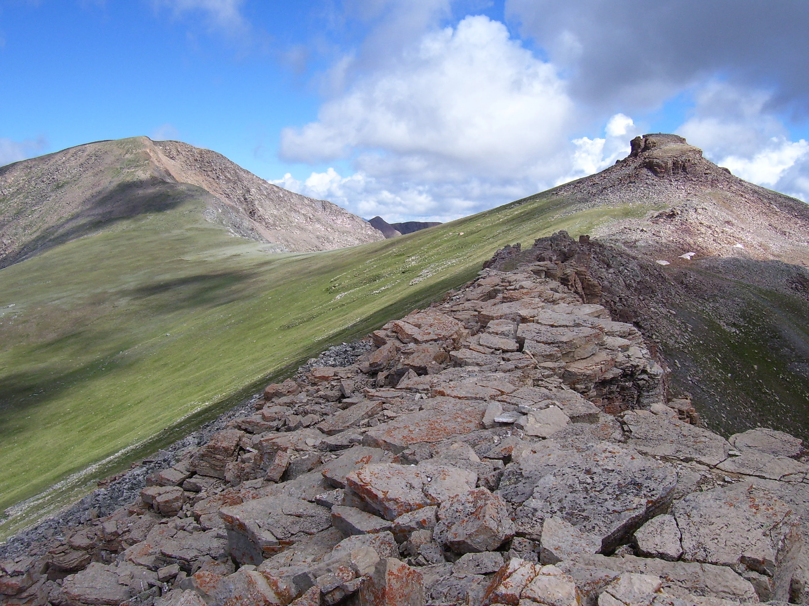
A rocky alpine ridge leads toward Henry Mountain and Square Top Mountain in Fossil Ridge Wilderness, Colorado.

Fossil Ridge Wilderness history and protected-area timeline

Fossil Ridge Wilderness was formally established in 1993 as part of the National Wilderness Preservation System, administered by the U.S. Forest Service. Its designation reflects a long-running recognition that the area's exposed Paleozoic carbonate ridge, with its abundant marine fossils, was a landscape of both scientific and scenic significance.

Although the wilderness itself is relatively young in administrative terms, the geological story embedded in its rocks stretches back hundreds of millions of years to the Paleozoic era. During that time, shallow epeiric seas repeatedly covered much of what is now Colorado, depositing carbonate sediments that would eventually be uplifted into the Rocky Mountains. Erosion over geologic time has stripped away softer overlying layers along Fossil Ridge, exposing the fossil-bearing carbonates that give the area its name and scientific identity.

Since its designation, the wilderness has been managed to preserve its largely undeveloped character, including its wildlife populations and its geological and paleontological values. Its inclusion within the Gunnison National Forest places it within a broader regional framework of public land conservation in the southern Rocky Mountains.

Fossil Ridge Wilderness landscape and geographic character

The landscape of Fossil Ridge Wilderness is dominated by a long, high ridge of exposed carbonate rock that runs through the heart of the area. This ridge forms a rugged spine above the surrounding drainage networks, with sharp relief and broken, pale outcrops that stand out against the darker forested slopes and meadows below it. The terrain is classic high-country Colorado, shaped by prolonged uplift, glacial and periglacial processes, and ongoing erosion.

Elevations stretch from roughly 8,880 feet at the bottom of Summerville Creek up to 13,254 feet at the top of Henry Mountain, while Square Top Mountain adds another prominent high point along the same ridge system. Between these extremes the wilderness contains a mix of steep mountain slopes, subalpine forest, open avalanche chutes, talus fields, and alpine basins. The combination of high elevation, exposed rock, and varied topography produces a landscape with strong visual contrasts between bare ridge tops, dark timber, and bright alpine tundra.

The drainage pattern around the ridge shapes how the wilderness feels on the ground, with creeks cutting down into the surrounding country and creating natural approach corridors. Because much of the terrain is steep and exposed, large areas of the wilderness read as open, airy, and sweeping, while forested sections and creek bottoms provide sheltered, denser cover. The result is a compact but visually rich stretch of Rocky Mountain wilderness.

Fossil Ridge Wilderness ecosystems, habitats, and plant life

Ecologically, Fossil Ridge Wilderness sits within the montane to alpine life zones of the southern Rocky Mountains. The lower elevations and sheltered creek valleys support coniferous forest typical of this part of Colorado, with evergreen stands dominated by species adapted to the region's cold winters, dry summers, and well-drained mountain soils. Mid-elevation slopes transition into subalpine forest, while the high ridges and the summits of Henry Mountain and Square Top Mountain rise into alpine terrain shaped by wind, short growing seasons, and thin soils.

Vegetation across the wilderness reflects both elevation and exposure. Steep, sunny south-facing slopes tend toward more open, grassy, and shrubby communities, while cooler north-facing slopes and drainages hold denser coniferous cover. Wet meadows and riparian vegetation along drainages such as Summerville Creek create small but important habitat pockets within an otherwise dry, high-elevation landscape. The exposed carbonate bedrock of the main ridge also affects local soils and plant communities, producing patchy, rocky ground-cover patterns that are visually distinct from surrounding forested terrain.

The wilderness lies within the broader ecological network of the Gunnison National Forest, which links Fossil Ridge to a wide range of habitat types across the southern Rockies. This regional context is important for species that move seasonally between summer alpine ranges and lower wintering grounds. While small in overall area, the wilderness contributes meaningful high-elevation habitat to the regional landscape, including terrain that connects forested slopes with alpine open space.

Fossil Ridge Wilderness wildlife and species highlights

Fossil Ridge Wilderness supports the kind of large-mammal fauna typical of Colorado's high-country wilderness areas. Elk are a key species, using a mix of forested slopes, meadows, and open alpine basins across the seasons. Mule deer are also widespread, navigating the steep terrain between lower drainages and higher summer range.

On the steeper, more rugged portions of the ridge, mountain goats take advantage of the cliff bands and rocky outcrops of the carbonate terrain, where retreat terrain and escape cover are abundant. Bighorn sheep are similarly associated with the exposed, broken ground and rocky slopes above treeline. The combination of these ungulates, along with their predators and smaller mammal communities, gives the wilderness a strong big-game wildlife character that complements its geological and scenic identity.

Birds typical of the southern Rocky Mountains are also present, including raptors that use the open ridge tops and forested songbird communities in the middle-elevation woodlands. Smaller mammals, such as marmots, pikas, and a variety of squirrels, occupy the talus and alpine zones, while riparian areas along creeks support additional bird and mammal activity. Together, these assemblages make the wilderness a meaningful area for wildlife observation within the broader Gunnison region.

Fossil Ridge Wilderness conservation status and protection priorities

Fossil Ridge Wilderness is protected primarily through its designation as a congressionally recognized wilderness area within the National Wilderness Preservation System. This status imposes a higher standard of management than ordinary national forest land, emphasizing the preservation of the area's natural, scenic, geological, and ecological values, and limiting road construction, mechanical equipment, and other forms of development. The U.S. Forest Service administers the wilderness as part of Gunnison National Forest.

From a conservation standpoint, the wilderness's importance lies in the combination of values it protects. Its Paleozoic carbonate ridge and associated marine fossil exposures represent a regionally significant geological and paleontological resource, and wilderness status provides a degree of long-term protection against activities that could damage those exposures. At the same time, the area preserves a connected block of high-elevation habitat that supports elk, deer, mountain goats, and bighorn sheep, all species sensitive to habitat fragmentation and human disturbance.

Because the wilderness sits within a much larger national forest management landscape, it also functions as a core protected area surrounded by lands managed for multiple uses. This positioning enhances its conservation role by providing relatively undisturbed summer range and movement corridors for wildlife, while its compact size means it relies heavily on the surrounding Gunnison National Forest for broader ecosystem function. The 1993 designation formalized recognition of these combined values as worthy of long-term preservation.

Fossil Ridge Wilderness cultural meaning and human context

Fossil Ridge Wilderness does not have a strongly documented cultural or human-history dimension beyond the broader context of public land conservation and recreational use in the Gunnison region. The area is part of a landscape that has historically supported ranching, mining, and outdoor recreation in west-central Colorado, and the town of Gunnison serves as the main gateway community. Within the wilderness itself, the most meaningful human story is scientific rather than cultural, focused on the geological interpretation of the fossil-bearing carbonate ridge that gives the place its name.

Top sights and standout views in Fossil Ridge Wilderness

Fossil Ridge Wilderness combines geological significance, classic Rocky Mountain scenery, and meaningful wildlife habitat in a relatively compact setting. The standout feature is the exposed Paleozoic carbonate ridge, where marine fossils from an ancient epeiric sea are preserved at unusually high elevation, offering a direct window into the deep history of the region.

Equally notable is the wilderness's dramatic elevation range, from around 8,880 feet in the creek bottoms to over 13,000 feet on the summits of Henry Mountain and Square Top Mountain. This vertical relief creates a rich mix of forested slopes, open alpine basins, and rugged cliff-and-talus terrain that supports elk, deer, mountain goats, and bighorn sheep.

Best time to visit Fossil Ridge Wilderness

Fossil Ridge Wilderness is best experienced in summer and early fall, when snow has melted off most of the higher ridges and access along creek bottoms and forest trails is generally more forgiving. Late July through September typically offers the most stable conditions for hiking the higher elevations, with wildflower bloom in the meadows and active wildlife movement across the alpine basins. Winter and early spring bring deep snowpack at high elevations, dramatic but more demanding conditions, and limited access to the upper ridge and summits. Shoulder seasons can be rewarding for solitude and wildlife viewing, but visitors should be prepared for highly changeable mountain weather.

Monthly climate preview

Track long term monthly precipitation and average temperature data for Fossil Ridge Wilderness

Fossil Ridge Wilderness Climate Normals and Long Term Temperature Patterns

Fossil Ridge Wilderness exhibits a measured annual temperature range from deep sub-zero winter minimums to moderate summer maximums alongside consistent daily precipitation normals. Reviewing the complete twelve-month climatology profile provides deeper analytical insight into multi-year meteorological trends across this protected area.
Annual mean4 °C
-9 °C17 °C
Jan-9°
Feb-7°
Mar-2°
Apr
May
Jun14°
Jul17°
Aug16°
Sep11°
Oct
Nov-3°
Dec-8°
Warmest month
July

17.2 °C

Coolest month
January

-8.8 °C

Wettest month
August

1.6 mm/day

Driest month
June

0.7 mm/day

Park location guide

Geography guide, regional context, and park location map for Fossil Ridge Wilderness

Fossil Ridge Wilderness park geography, regions, and map view in United States of America

Understand where Fossil Ridge Wilderness sits in United States of America through a broader geographic reading of the surrounding landscape, nearby location context, and its mapped position within the national park landscape.

How Fossil Ridge Wilderness fits into United States of America

The United States of America is a federal presidential republic and one of the world's largest countries by area and population. It consists of 50 states across a vast territory spanning multiple time zones, with its capital in Washington, D.C. and largest city in New York City. The nation has a diverse economy, influential political system, and significant cultural and military presence globally.

Wider geography shaping Fossil Ridge Wilderness in United States of America

The United States occupies a vast territory in North America, bordered by Canada to the north and Mexico to the south. The 48 contiguous states stretch from the Atlantic to the Pacific Ocean, while Alaska occupies the northwestern region and Hawaii is an archipelago in the Pacific. The country encompasses diverse terrain including the Rocky Mountains, Appalachian Mountains, Great Plains, and extensive river systems.

Map view of Fossil Ridge Wilderness

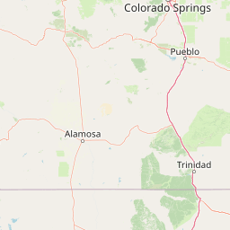
Use this park location map to pinpoint Fossil Ridge Wilderness in United States of America, understand its exact geographic position, and read its mapped placement within the surrounding landscape more clearly.

Pigeon | © OpenStreetMap contributors

Location context for Fossil Ridge Wilderness

ColoradoGunnison County

Visualizing high-altitude alpine terrain and ancient carbonate ridge formations

Fossil Ridge Wilderness Photos and Landscape Scenery Exploration

Examine detailed visual documentation of exposed Paleozoic rock formations, subalpine timber stands, and sweeping high-country terrain across the protected basin. Visual archives illustrate the dramatic vertical relief and geologic character defining this remote Colorado wilderness.

A view along a rocky ridge with loose stones in the foreground, ascending a green slope towards two mountain peaks under a partly cloudy sky.

Park atlas

Compare regional alpine terrain, protected landscapes, and high-country wilderness areas

Explore Other Parks Near Fossil Ridge Wilderness and Surrounding Rocky Mountain Protected Areas

Browse nearby national parks and protected areas sharing the high-elevation terrain, rugged mountain ridges, and subalpine forests characteristic of west-central Colorado. Expanding the geographic comparison reveals broader ecological patterns and interconnected wilderness corridors across the surrounding region.
Watercolor painting of a serene mountain landscape featuring rolling hills, coniferous trees, and a lake in the foreground, rendered in light pastel tones.
Protected landscapeColorado
About 16 km away#1 closest

Southeast

San Isabel National Forest: Geographic Overview and Protected Mountain Landscape Atlas

Central Colorado alpine terrain and designated wilderness areas

Spanning eleven counties in central Colorado, San Isabel National Forest serves as a cornerstone of the Southern Rocky Mountains. The forest landscape is dominated by the Sawatch and Sangre de Cristo ranges, offering a unique atlas of alpine tundra, dense coniferous forests, and high-altitude peaks that define the character of the region. This protected area provides a vital habitat and a vast, rugged environment characterized by volcanic formations like the Spanish Peaks and glacial geological features.

Area
4,533.42 km²
Established
1902
Relief
Mountain
Climate
Alpine
Watercolor painting of soft, layered mountain ranges behind green hills and patches of evergreen trees on a white background.
Protected landscapeColorado
About 42 km away#2 closest

South

Rio Grande National Forest: Atlas and Geographic Profile of a Southern Colorado Landscape

Watershed geography and Continental Divide terrain analysis.

Rio Grande National Forest represents an immense protected landscape encompassing diverse terrain from high desert steppe to rugged alpine peaks. This profile details the forest's hydrological significance as the source of the Rio Grande and its role as a massive ecological transition zone in the Mountain West. Examine the boundaries and mountain geography that define this critical protected area.

Area
7,500 km²
Established
1908
Relief
Mountain
Climate
Boreal
Protected areaColorado
About 44 km away#3 closest

Northwest

Raggeds Wilderness: Geographic Profile and Protected Area Mapping for the Elk Mountains

High altitude wilderness terrain in west-central Colorado

Raggeds Wilderness encompasses over 65,000 acres of protected high-country terrain in the Elk Mountains. This atlas record provides a detailed look at the park, covering its dramatic vertical transitions from deep forest drainages to jagged peaks and its function as a major node in the regional wilderness network.

Area
264.64 km²
Established
1980
IUCN
Ib
Relief
Mountain
A horizontal watercolor painting showing layers of pale green and soft pink mountain ridges behind a foreground of simple green and purple evergreen tree shapes.
Wildlife reserveColorado
About 48 km away#4 closest

North

Mount Massive Wilderness: A Protected Alpine Landscape in the Colorado Sawatch Range

High-altitude wilderness geography and Continental Divide terrain.

Mount Massive Wilderness represents a critical protected landscape in the central Colorado Rockies, encompassing glacially carved valleys, alpine tundra, and the second-highest peak in the state. This wilderness area provides a window into the rugged vertical relief and subalpine ecosystems that define the high-altitude geography surrounding Leadville, anchored by the iconic Sawatch Range and Continental Divide.

Area
123.6 km²
Established
1980
IUCN
Ib
Relief
Mountain
A horizontal watercolor illustration depicting soft layers of green rolling hills, a band of trees, and distant pinkish mountain peaks against a white background.
Protected landscapeColorado
About 51 km away#5 closest

West

Gunnison National Forest: Atlas and Geographic Overview of a Colorado Protected Landscape

Mapping deep wilderness areas and high mountain watersheds

Spanning over one million acres in western Colorado, this protected landscape features dramatic glaciated valleys, subalpine meadows, and iconic volcanic features. The forest anchors the Gunnison River headwaters and offers significant insights into the ecological structure of the Southern Rocky Mountains and its dense concentration of wilderness zones.

Area
6,766.89 km²
Established
1905
Relief
Mountain
Climate
Alpine
A soft watercolor illustration depicting a simplified, layered landscape of rolling hills and distant mountains in shades of light green, pale yellow, and soft pink.
Protected areaColorado
About 53 km away#6 closest

Northeast

Pike National Forest: Protected Mountain Landscapes and Regional Geography in Central Colorado

Granite peaks, montane forests, and diverse alpine terrain

Spanning from the rolling foothills of the Front Range to the high alpine summits of the Rocky Mountains, Pike National Forest is a significant protected area defined by its unique Pikes Peak granite bedrock and deep river-carved canyons. This analysis provides a structured look at its expansive wilderness boundaries, drainage basins, and the vertical transitions that characterize this vital central Colorado highland.

Area
4,478.27 km²
Established
1892
Relief
Mountain
Climate
Alpine
A soft watercolor painting of a mountain landscape with rolling green hills in the foreground and layered, pale purple peaks in the distance.
Wildlife reservePitkin County
About 57 km away#7 closest

North

Hunter-Fryingpan Wilderness: Mapped Protected Geography in the Central Rocky Mountains

High-altitude wilderness area in Pitkin County, Colorado

Hunter-Fryingpan Wilderness encompasses approximately 82,000 acres of rugged terrain near the continental divide. This protected area acts as a headwaters sanctuary for the Fryingpan River and Hunter Creek, defined by its steep granite ridges, subalpine meadows, and clusters of pristine alpine lakes. Understanding its geography reveals the stark, glaciated character of the central Colorado Rockies.

Area
331.95 km²
Established
1978
IUCN
Ib
Relief
Mountain
A horizontal watercolor painting depicting soft green rolling hills and distant mountains under a white sky.
Wildlife reserveColorado
About 65 km away#8 closest

Southwest

Powderhorn Wilderness: A High-Elevation Protected Landscape in the San Juan Mountains

Basaltic plateaus and vast alpine tundra in Colorado

Powderhorn Wilderness protects a distinct highland environment in southwestern Colorado. Characterized by dark basaltic caprocks and deep glacial cirques, this area serves as a critical headwaters system for the Gunnison River, supporting a complex transition from sagebrush steppe to subalpine forest and wind-swept tundra. The geography remains largely defined by its volcanic heritage and the primitive character of its remote plateau summits.

Area
251.1 km²
Established
1993
IUCN
Ib
Relief
Mountain

Common questions about visiting, size, designation, and location context for Fossil Ridge Wilderness

Fossil Ridge Wilderness FAQs for park facts, access, geography, and protected area context

Find quick answers about Fossil Ridge Wilderness, including protected-area facts, park geography, trail and visitor context, and how the park fits into its surrounding country and regional landscape.
MoriAtlas Explorer

Continue Your Protected Areas Search Across the Global Atlas

Deepen your exploration by continuing the structured search for national parks and protected areas worldwide. Utilize the comprehensive filtering capabilities to compare different conservation landscapes and refine your understanding of global park geography. Discover more about the distribution and characteristics of protected natural areas.

Global natural geography