

Mori Atlas logo
Nature reserveFranklin Harbor Conservation Park

A sheltered coastal nature reserve protecting diverse mangrove and samphire ecosystems within the Eyre Peninsula

Franklin Harbor Conservation Park: Coastal Protected Landscapes and Island Geography in South Australia

Franklin Harbor Conservation Park occupies a significant coastal position on the eastern edge of the Eyre Peninsula in South Australia. This protected area safeguards a unique assembly of mangrove woodlands, salt-tolerant samphire flats, and a series of harbor islands, including Entrance Island, which support specialized seabird and reptile habitats. The geography of the reserve bridges terrestrial scrubland and sheltered intertidal zones, offering a distinct example of integrated marine and coastal conservation environments.

coastal conservation parkmangrove habitatsamphire flatsEyre PeninsulaSouth Australiaisland reserve
A flat-style digital illustration depicting a mountain valley with a waterfall flowing into a winding river, surrounded by pine trees under a sunrise.

Franklin Harbor Conservation Park

Nature reserve

Park overview

Structured park overview, official facts, and landscape profile for Franklin Harbor Conservation Park

Franklin Harbor Conservation Park park facts, protected area profile, and essential visitor context

Review the core facts for Franklin Harbor Conservation Park, including designation, size, terrain, visitor scale, habitats, and operating context in one park-focused overview.

About Franklin Harbor Conservation Park

Franklin Harbor Conservation Park is a compact coastal reserve in South Australia that reflects the state's focus on preserving specific, biologically valuable habitats rather than large tracts of wilderness. It sits on the eastern shore of Eyre Peninsula near Cowell, an area defined by Spencer Gulf waters and sheltered harbor systems. The park encompasses a peninsula that encloses the southeastern side of Franklin Harbor and four islands within the harbor itself, including Entrance Island, giving the reserve both a mainland and an island character.

Established in 1976 under the South Australian National Parks and Wildlife Act, the conservation park has long been valued for the vegetation communities it shelters and the wildlife it supports. Its terrestrial habitats are closely tied to the marine and tidal environment of Franklin Harbor, making the boundary between land and sea ecologically significant. Since 2012, the park has been overlapped by the Franklin Harbor Marine Park, reinforcing its role within a broader marine and coastal conservation framework.

Classified as an IUCN Category Ia protected area, the strictest reserve category, Franklin Harbor Conservation Park is managed for the protection of its natural values rather than for intensive public use. Its position on Eyre Peninsula places it within a region known for agricultural land use and aquaculture, which makes the preservation of relatively undisturbed mangrove, samphire, and island ecosystems particularly important. The reserve is small in area but rich in habitat specificity, representing a focused effort to maintain ecological features that are otherwise scarce in South Australia.

Quick facts and research context for Franklin Harbor Conservation Park

Franklin Harbor Conservation Park is located on the east coast of Eyre Peninsula in South Australia, in the locality of Cowell about 5 kilometres south of the town centre. It was proclaimed on 22 January 1976 under the National Parks and Wildlife Act 1972 and is classified as an IUCN Category Ia protected area, the strict nature reserve category. The reserve covers 13.56 square kilometres of land on a peninsula and on four islands, including Entrance Island, within Franklin Harbor. The conservation park was also listed on the former Register of the National Estate in 1982 and has been overlapped by the Franklin Harbor Marine Park since 2012.

Protection and recognition

Documented protection scope and international recognition records for Franklin Harbor

Franklin Harbor Conservation Park Protection Status and Mapped Geography

Franklin Harbor Conservation Park maintains a mixed protection scope within its designated regional framework. Official conservation records aggregate administrative boundaries and management designations for comprehensive analysis.

Protection details

Protection scope
Mixed
Transboundary protection
No
Park context

Deeper park guide and search-rich context for Franklin Harbor Conservation Park

Franklin Harbor Conservation Park history, landscape, wildlife, and travel context

Explore Franklin Harbor Conservation Park through its history, landscape character, ecosystems, wildlife, conservation priorities, cultural context, and seasonal travel timing in a structured park guide built for atlas discovery and search intent.

Why Franklin Harbor Conservation Park stands out

Franklin Harbor Conservation Park is best known for its protection of mangrove and samphire flats, an association that is described as markedly depleted elsewhere in South Australia. The reserve's entrance islands are recognized for hosting death adders and for providing a safe roosting and feeding site for seabirds. Its combination of a sheltered harbour-side peninsula with offshore islands also makes it a notable example of an integrated coastal and marine conservation setting.
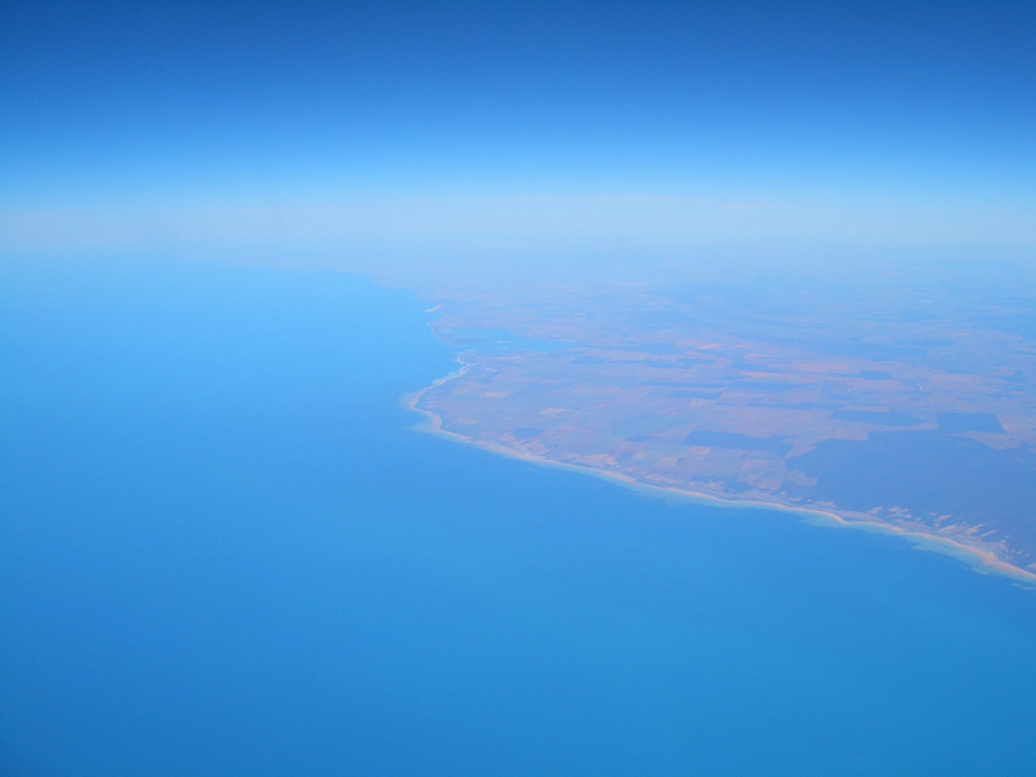
High altitude aerial view of the coastline where blue ocean water meets a tan and brown coastal landscape.
Aerial perspective of the coastline and lagoon at Franklin Harbor.

Franklin Harbor Conservation Park history and protected-area timeline

Franklin Harbor Conservation Park was proclaimed on 22 January 1976 under South Australia's National Parks and Wildlife Act 1972, formalizing protection for a stretch of peninsula and several harbor islands near Cowell. The reserve was established in an era when South Australia was actively expanding its system of conservation parks to protect representative and threatened habitats across the state.

In 1982, the conservation park was assessed as having significance for preserving mangrove and samphire flats, supporting a population of death adders on the entrance islands, and providing safe roosting and feeding habitat for seabirds. The same year, it was listed on the Register of the National Estate, a now-defunct Australian heritage register that recognized places of national environmental significance.

A more recent chapter in the park's history came in 2012, when it became overlapped by the Franklin Harbor Marine Park. This change reflected a growing emphasis on integrated coastal and marine management in South Australia and tied the conservation park more directly to broader efforts to protect the harbor environment.

Franklin Harbor Conservation Park landscape and geographic character

The landscape of Franklin Harbor Conservation Park is strongly coastal, shaped by its position on the sheltered eastern side of Eyre Peninsula and its relationship with Franklin Harbor. The park's largest land component is a peninsula enclosing the southeastern side of the harbor, providing a transition between open Spencer Gulf waters and the quieter, protected waters of the harbor itself.

The seaward side of the peninsula features a sandy beach backed by relatively minor areas of open scrubland. In contrast, the protected harbor-facing side of the peninsula and parts of two of the islands carry low woodland and shrubland vegetation adapted to tidal and saline conditions. Together, these elements give the reserve a varied shoreline profile within a small area, with sandy beach, scrubland, mangrove woodland, and samphire shrubland all present.

The four islands within the harbor, including Entrance Island, are an essential part of the reserve's physical character. Their position within the harbor mouth and inner waters adds a marine dimension to the park's landscape, blurring the traditional line between terrestrial reserve and open water habitat. The combination of peninsula, islands, and tidal flats creates a compact but structurally diverse coastal geography.

Franklin Harbor Conservation Park ecosystems, habitats, and plant life

Franklin Harbor Conservation Park protects a distinctive ecological association that is scarce in South Australia. The core natural value of the reserve is the combination of mangrove and samphire flats, two intertidal and supra-tidal vegetation communities that depend on the sheltered tidal conditions of Franklin Harbor. This vegetation association is described as markedly depleted across the broader South Australian coastline, making the park an important refuge for these communities.

The harbor-facing side of the peninsula and parts of the islands support a low woodland dominated by Avicennia marina, the grey mangrove or white mangrove, paired with samphire shrubland. These habitats are characteristic of quiet, sheltered marine shorelines and support the specialised ecological processes of tidal flats. The seaward side of the peninsula presents a contrasting environment, with sandy beach habitat and patches of open scrubland.

The flora of the scrubland areas is varied and includes native species such as Callitris, Santalum, Leucopogon, and Nitraria, alongside areas where boxthorn is dominant. This combination of marine-adjacent woodland, samphire flats, and coastal scrub gives the park a layered ecological profile in which marine, intertidal, and terrestrial influences converge within a small area.

Franklin Harbor Conservation Park wildlife and species highlights

Wildlife values are an important part of Franklin Harbor Conservation Park's identity, particularly on the entrance islands. The islands are recognised as habitat for a population of death adders, a venomous Australian snake that depends on relatively undisturbed coastal vegetation for cover and prey. Their presence indicates that the islands retain suitable refugia within an otherwise heavily used coastal landscape.

The islands and surrounding waters also serve as a safe roosting and feeding site for seabirds, supporting the broader role of the harbor as an important coastal bird area. The combination of mangroves, samphire flats, and open scrubland creates varied foraging and shelter conditions for different bird groups, from shorebirds using the tidal flats to seabirds working the harbor waters.

On the peninsula itself, the mosaic of mangrove woodland, samphire shrubland, and open scrubland provides habitat structure for reptiles, invertebrates, and small mammals typical of South Australian coastal environments. Although the reserve is small, the diversity of habitats means that its wildlife value extends beyond any single species group, supporting a functioning coastal ecosystem.

Franklin Harbor Conservation Park conservation status and protection priorities

Franklin Harbor Conservation Park is significant in conservation terms because it protects ecological features that have become scarce in South Australia. The mangrove and samphire flats within the reserve are recognised as an association that is markedly depleted across the state, making the park an important reference site for these habitats. By preserving both the flora and the associated fauna across a peninsula and several islands, the reserve maintains an intact example of a habitat type that has been lost or reduced elsewhere.

The park's IUCN Category Ia classification, the strict nature reserve category, signals a management approach focused on maintaining natural conditions rather than accommodating high levels of public use. Its inclusion in 1982 on the Register of the National Estate further recognised its national environmental significance during a period when such listings shaped Australian conservation policy.

The 2012 overlap with the Franklin Harbor Marine Park added a marine dimension to the conservation framework around the reserve, linking terrestrial habitat protection with broader marine park objectives. Together, these designations position the conservation park as a small but strategically important component of South Australia's coastal and marine protected area network on Eyre Peninsula.

Franklin Harbor Conservation Park cultural meaning and human context

Franklin Harbor Conservation Park sits within the locality of Cowell, a small coastal community on Eyre Peninsula historically associated with agriculture, fishing, and more recently aquaculture. The harbor itself has long been central to local identity and economy, with the conservation park forming part of a broader working coastal landscape.

Indigenous connections to the Eyre Peninsula coast, including the Cowell and Franklin Harbor area, are part of the deeper regional heritage, although the available source material does not detail specific traditional stories or land uses associated with the reserve itself. The park's protected status reflects broader South Australian recognition of the cultural and environmental importance of preserving representative coastal landscapes in areas with active human use.

Top sights and standout views in Franklin Harbor Conservation Park

Among the conservation park's standout qualities are its mangrove and samphire communities, which together form a habitat association that is markedly depleted elsewhere in South Australia. The reserve's inclusion of four islands, including Entrance Island, extends its ecological value into the marine environment and supports populations of seabirds and reptiles such as the death adder.

The overlap with the Franklin Harbor Marine Park since 2012 highlights the reserve's role within an integrated coastal and marine conservation system, while its IUCN Category Ia status emphasises the priority placed on preserving its natural condition.

Best time to visit Franklin Harbor Conservation Park

Franklin Harbor Conservation Park is a coastal reserve on Eyre Peninsula in South Australia, where conditions are shaped by a Mediterranean-style climate with mild, relatively wet winters and warm, dry summers. Spring and autumn generally offer comfortable temperatures for visiting the Cowell area, while summer can bring stronger heat and stronger marine winds along the exposed beach side of the peninsula. Winter conditions are milder but can be cooler and windier, particularly around the entrance islands.

Because the reserve is small and ecologically focused, rather than oriented around major visitor infrastructure, seasonal timing is less about park opening and more about landscape character. Migratory and coastal bird activity around the harbor islands and tidal flats can vary through the year, and the intertidal samphire and mangrove zones respond visibly to tidal cycles rather than to fixed calendar seasons.
Monthly climate preview

Long-term temperature ranges and monthly precipitation records across representative terrain

Franklin Harbor Conservation Park Climate Normals and Annual Weather Patterns

Historical data compiled from NASA POWER recordings illustrate the long-term annual temperature and precipitation rhythm across representative coordinates within Franklin Harbor Conservation Park. Analyzing twelve distinct monthly records provides a comprehensive baseline for evaluating regional environmental conditions and long-term climate normals.
Annual mean17 °C
10 °C23 °C
Jan23°
Feb23°
Mar21°
Apr18°
May14°
Jun11°
Jul10°
Aug11°
Sep14°
Oct16°
Nov19°
Dec21°
Warmest month
January

23.1 °C

Coolest month
July

10.3 °C

Wettest month
June

1.3 mm/day

Driest month
March

0.5 mm/day

Park location guide

Geography guide, regional context, and park location map for Franklin Harbor Conservation Park

Franklin Harbor Conservation Park park geography, regions, and map view in Australia

Understand where Franklin Harbor Conservation Park sits in Australia through a broader geographic reading of the surrounding landscape, nearby location context, and its mapped position within the national park landscape.

How Franklin Harbor Conservation Park fits into Australia

Australia is a constitutional monarchy and federal parliamentary democracy comprising six states and ten territories. With a population of nearly 28 million, it is one of the world's most urbanised countries, with most people concentrated on the eastern seaboard. The country has a high Human Development Index and is known for its cultural diversity, ancient Aboriginal heritage, and unique wildlife.

Wider geography shaping Franklin Harbor Conservation Park in Australia

Australia occupies the entire Australian continent, the island of Tasmania, and numerous smaller islands. It is the world's flattest and driest inhabited continent, featuring vast deserts in the interior (the Outback), tropical rainforests along the eastern coast, and a coastline bordering the Indian and Pacific Oceans.

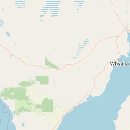
Map view of Franklin Harbor Conservation Park

Use this park location map to pinpoint Franklin Harbor Conservation Park in Australia, understand its exact geographic position, and read its mapped placement within the surrounding landscape more clearly.

Pigeon | © OpenStreetMap contributors

Location context for Franklin Harbor Conservation Park

South Australia
Recorded earthquake history

View the Recorded Earthquake History for Franklin Harbor Conservation Park

Access a structured archive of seismic events mapped to the surroundings of Franklin Harbor Conservation Park. This MoriAtlas dataset organizes historical data to assist in understanding the regional seismic context of the Eyre Peninsula coastal area.

Franklin Harbor Conservation Park Earthquakes

Catalogued events

5 events

Strongest magnitude

Magnitude 4.7

Most recent event

Nov 21, 2018

This history includes earthquakes recorded inside the park or within 50 km of its borders

Visualizing the coastal terrain, mangrove habitats, and marine environments of South Australia

Franklin Harbor Conservation Park Photos and Protected Landscape Scenery

Examinations of Franklin Harbor Conservation Park imagery reveal the complex topography of tidal flats, sandy beaches, and sheltered island ecosystems along the Eyre Peninsula. Visual exploration provides clear insight into rare mangrove associations and protected marine environments that define the conservation landscape.

High altitude aerial view of the coastline where blue ocean water meets a tan and brown coastal landscape.

Park atlas

Compare coastal reserves, marine overlaps, and neighboring conservation landscapes across South Australia

Other Parks Near Franklin Harbor Conservation Park and Surrounding Regional Protected Areas

Browsing other parks near Franklin Harbor Conservation Park reveals similar coastal ecosystems and tidal habitats found along the eastern Eyre Peninsula. Comparing these protected areas provides broader regional context for evaluating intertidal conservation networks and regional shorelines.
Protected landscapeSouth Australia
About 51 km away#1 closest

North

Ironstone Hill Conservation Park: Geography and Protected Land Map Overview

An essential protected landscape in the Eyre Peninsula of South Australia.

Ironstone Hill Conservation Park protects fragile sandy dune systems and dense mallee vegetation within an arid zone. This conservation area acts as a vital link in the regional natural network, neighboring both private reserves and active mineral-bearing ranges. The park provides an essential study of semi-arid terrain and rare species habitat in the heart of the Eyre Peninsula.

Area
196.5 km²
Established
2010
IUCN
VI
Relief
Upland
Wildlife reserveSouth Australia
About 54 km away#2 closest

Northwest

Heggaton Conservation Park: A Protected Wildlife Reserve on the Eyre Peninsula

Mapping the semi-arid mallee woodlands of South Australia

Heggaton Conservation Park is a key wildlife reserve in South Australia that safeguards extensive mallee forest and Melaleuca shrubland. This protected area provides an essential, relatively undisturbed habitat for Malleefowl and various rare plant species within the broader Eyre Peninsula landscape.

Area
64.76 km²
Established
1993
IUCN
VI
Relief
Lowland
Wildlife reserveSouth Australia
58 km away#3 closest

Southeast

Bird Islands Conservation Park: A Protected Coastal Landscape in South Australia

Key wildlife reserve on the Spencer Gulf coastline

Bird Islands Conservation Park represents a vital coastal habitat within South Australia. Covering islands and mainland sections near Wallaroo, the area integrates sand dunes, intertidal flats, and mangrove woodlands. This conservation site provides essential refuge for migratory shorebirds while maintaining a complex link between marine and terrestrial ecosystems on the Yorke Peninsula.

Area
3.69 km²
Established
1968
IUCN
VI
Relief
Lowland
Nature reserveSouth Australia
About 69 km away#4 closest

Northwest

Carappee Hill Conservation Park: Atlas and Geographic Protected Area Profile

Nature reserve geography and Eyre Peninsula landscape context

Carappee Hill Conservation Park covers 8.5 square kilometres of rocky, elevated terrain in the locality of Darke Peak. As a designated conservation area and IUCN Category III site, it serves as a critical refuge for native vegetation, providing a clear map of protected landform heritage in central South Australia.

Area
8.5 km²
Established
1973
IUCN
III
Relief
Upland
Wildlife reserveSouth Australia
71 km away#5 closest

Northwest

Darke Range Conservation Park: A Protected Woodland Sanctuary in South Australia

Geographic landscape and regional habitat exploration

Located near Darke Peak, this wildlife reserve safeguards threatened native peppermint gum woodland. The park functions as an ecologically significant pocket of intact vegetation, providing a window into the natural ridge terrain of the Eyre Peninsula that remains distinct from the surrounding rural land.

Area
6.93 km²
Established
1985
IUCN
VI
Relief
Mountain
A pale, abstract watercolor painting showing rolling green hills, trees, and a light sky against a white background.
Nature reserveSouth Australia
80 km away#6 closest

Northwest

Caralue Bluff Conservation Park: A Protected Nature Reserve on the Eyre Peninsula

Mapping regional landscape integrity in South Australia

Caralue Bluff Conservation Park encompasses a 21.5 square kilometre tract of land in South Australia, acting as a crucial element of the Eyre Peninsula landscape. Named for the nearby Caralue Bluff landform, this nature reserve safeguards essential bushland habitats within a highly developed rural setting. Analyze the park boundaries and terrain characteristics to better appreciate its function as a conserved natural refuge.

Area
21.57 km²
Established
1993
IUCN
VI
Scope
Terrestrial
Nature reserveSouth Australia
About 86 km away#7 closest

Southeast

Goose Island Conservation Park: Marine Nature Reserve Geography and Protected Island Boundaries

Spencer Gulf offshore refuge and seabird breeding habitat

Goose Island Conservation Park consists of a scattered ring of islands and rocky outcrops in the Spencer Gulf. This nature reserve provides a secluded, wind-swept environment that serves as a vital sanctuary for breeding black-faced cormorant populations and Australian sea lions. The area is defined by its marine-weathered terrain and offshore isolation, acting as a protected link in the broader coastal geography of South Australia.

Area
0.35 km²
Established
1972
IUCN
III
Visitors
300 annual
Wildlife reserveSouth Australia
100 km away#8 closest

West

Hincks Conservation Park: Protected Wildlife Reserve in South Australia

Mapping regional biodiversity and conservation landscapes

Hincks Conservation Park functions as a key protected area within the semi-arid coastal hinterland of the Eyre Peninsula. This reserve preserves an essential fragment of native vegetation against a surrounding backdrop of agricultural development. The site highlights the importance of managed land corridors in maintaining ecological connectivity across the central-eastern reaches of South Australia.

Area
8.78 km²
Established
1941
IUCN
VI
Relief
Lowland

Common questions about visiting, size, designation, and location context for Franklin Harbor Conservation Park

Franklin Harbor Conservation Park FAQs for park facts, access, geography, and protected area context

Find quick answers about Franklin Harbor Conservation Park, including protected-area facts, park geography, trail and visitor context, and how the park fits into its surrounding country and regional landscape.
MoriAtlas Explorer

Continue Your Protected Areas Search Across the Global Atlas

Deepen your exploration by continuing the structured search for national parks and protected areas worldwide. Utilize the comprehensive filtering capabilities to compare different conservation landscapes and refine your understanding of global park geography. Discover more about the distribution and characteristics of protected natural areas.

Global natural geography