
Mori Atlas logo
Nature reserveFranzosenwiesen/Rotes Wasser

Understanding the ecological geography of the Rotes Wasser stream and valley meadow corridor

Franzosenwiesen/Rotes Wasser Nature Reserve: Mapped Protected Landscapes in Hessen, Germany

(Naturschutzgebiet Franzosenwiesen/Rotes Wasser)

Franzosenwiesen/Rotes Wasser comprises a protected nature reserve in the Hessen region, encompassing an ecologically valuable corridor along the Rotes Wasser brook. The terrain is characterized by rolling lowland stream valleys and open wet meadow landscapes typical of the Burgwald foothills. This atlas entry examines the site boundaries and its role as a regional FFH habitat site within the Marburg-Biedenkopf district, providing a clear geographic overview of its riparian and meadow terrain.

nature reservewet meadowsbrook habitatriparian landscapeBurgwald foothillsHessian protected area
A flat-design, stylized digital illustration of a wetland area with tall grasses, birch trees, and a forest background reflecting in calm water.

Franzosenwiesen/Rotes Wasser

Nature reserve

Park overview

Structured park overview, official facts, and landscape profile for Franzosenwiesen/Rotes Wasser

Franzosenwiesen/Rotes Wasser park facts, protected area profile, and essential visitor context

Review the core facts for Franzosenwiesen/Rotes Wasser, including designation, size, terrain, visitor scale, habitats, and operating context in one park-focused overview.

About Franzosenwiesen/Rotes Wasser

Franzosenwiesen/Rotes Wasser is a small but ecologically focused nature reserve in the district of Marburg-Biedenkopf in Hesse, Germany. It sits in the transitional landscape between the rural communities of Rauschenberg and Wetter, where the lowland countryside is shaped by small stream valleys, agricultural fields, and patches of remnant meadow and woodland that belong to the wider Burgwald region northwest of Marburg.

The reserve takes its name from two distinct but connected landscape elements: the Franzosenwiesen, an area of open meadows, and the Rotes Wasser, the small brook whose valley runs through and alongside these meadows. The protected corridor extends southwest of the core settlement of Rosenthal and reaches toward Bracht, a district of Rauschenberg. The eastern part of the area is crossed by the state road L 3077, while the L 3087 runs along its northern edge, anchoring the reserve geographically between these two transport corridors.

Ecologically, the site's character is defined by the interplay between wet, traditionally used meadows and the riparian habitat of the stream itself. This combination creates conditions favorable to meadow flora, damp-ground vegetation, and the invertebrate and amphibian communities associated with small lowland brooks. The reserve is part of a broader network of small protected areas in the district, sitting near other nature reserves such as Nebeler Hintersprung, Diebskeller/Landgrafenborn, and the larger Christenberger Talgrund.

The protected status of the area is twofold. In addition to its designation as a Hessian Naturschutzgebiet, the Franzosenwiesen meadows and the downstream course of the Rotes Wasser toward Schönstadt are recognized under the European Union Habitats Directive as the FFH site Franzosenwiesen und Rotes Wasser. This layered protection reflects the area's role as a representative example of brook and wet meadow habitat in the Burgwald foothills and gives the modest reserve a significance well beyond its local footprint.

Quick facts and research context for Franzosenwiesen/Rotes Wasser

Franzogenwiesen/Rotes Wasser is a Hessian nature reserve within the Landkreis Marburg-Biedenkopf. The site lies between the towns of Rauschenberg and Wetter and extends along the Rotes Wasser stream. Its legal foundation is a regulation issued in December 1987. The protected area overlaps substantially with the EU Habitats Directive site of the same name.

Protection and recognition

Documented terrestrial conservation scope and official protected area records

Franzosenwiesen/Rotes Wasser Protection Status and Territorial Designation

Franzosenwiesen/Rotes Wasser maintains a recorded terrestrial conservation scope within established protected area registries. Structured documentation outlines the official management framework and baseline recognition data for this natural landscape.

Protection details

Protection scope
Terrestrial
Transboundary protection
No
WDPA ID
163141
Park context

Deeper park guide and search-rich context for Franzosenwiesen/Rotes Wasser

Franzosenwiesen/Rotes Wasser history, landscape, wildlife, and travel context

Explore Franzosenwiesen/Rotes Wasser through its history, landscape character, ecosystems, wildlife, conservation priorities, cultural context, and seasonal travel timing in a structured park guide built for atlas discovery and search intent.

Why Franzosenwiesen/Rotes Wasser stands out

The reserve is particularly noted for its wet meadow and lowland brook habitats along the Rotes Wasser, a small stream corridor that supports characteristic meadow, marsh, and riparian communities typical of the Burgwald foothills. Its combined status as a national nature reserve and an FFH site underlines its ecological value despite its modest size.
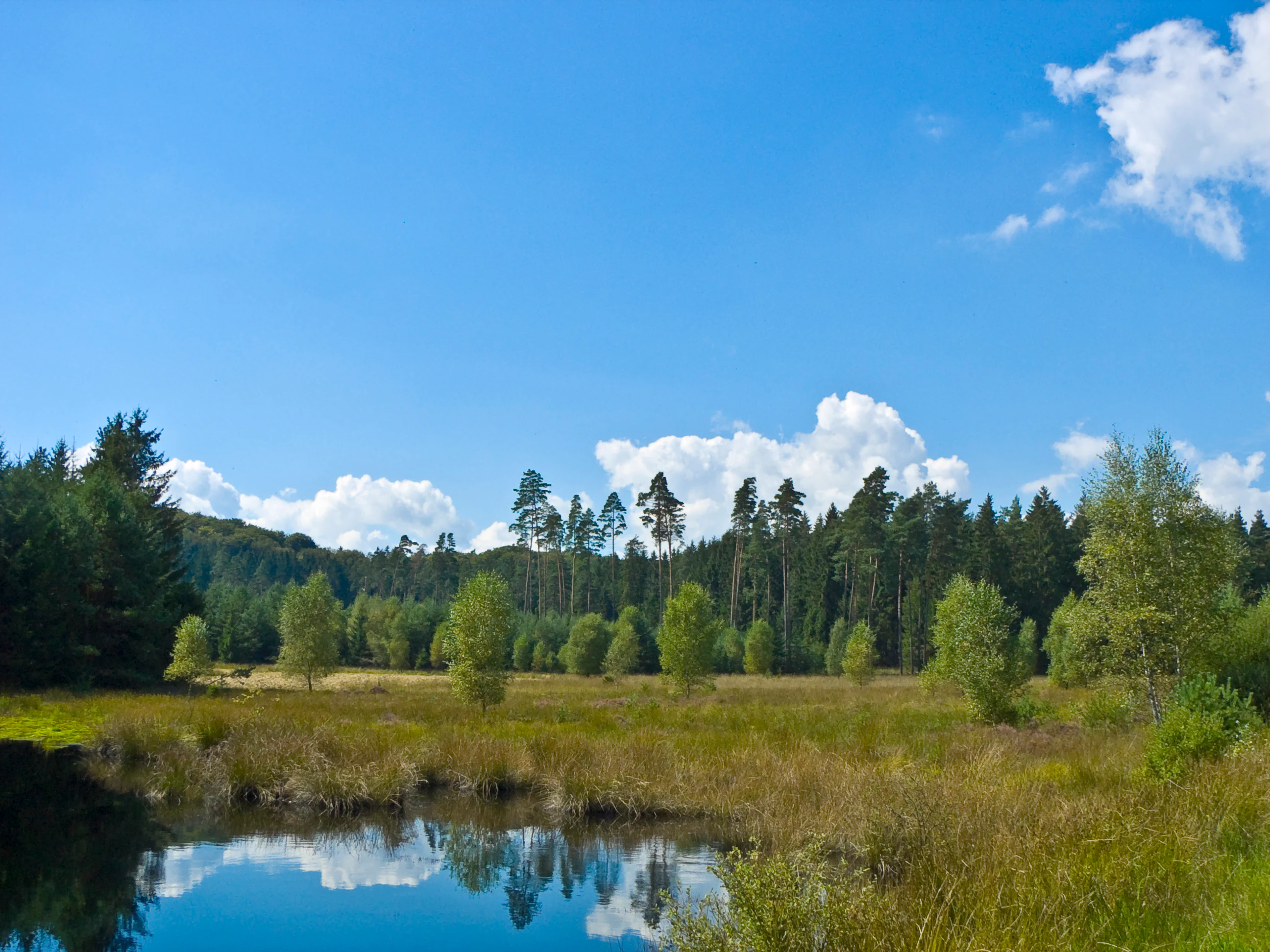
A peaceful bog landscape featuring a small, calm pond reflecting the sky in the foreground, with grassy wetland vegetation and a dense forest tree line in the background under a blue sky with scattered clouds.
A view of the wetland and forest environment at Franzosenwiesen.

Franzosenwiesen/Rotes Wasser history and protected-area timeline

The nature reserve Franzosenwiesen/Rotes Wasser was formally placed under protection in 1987, with the legal basis being the regulation issued by the state of Hesse on 1 December 1987, published in the Staatsanzeiger für das Land Hessen. Its official designation number within the Hessian nature reserve registry is 1534014.

In addition to its national nature reserve status, the area was later incorporated into the European network of protected habitats under the EU Flora-Fauna-Habitat Directive as the FFH site Franzosenwiesen und Rotes Wasser. This broader designation extends the protected footprint downstream along the Rotes Wasser toward Schönstadt, recognizing the ecological continuity between the meadow core and the lower reaches of the stream.

Franzosenwiesen/Rotes Wasser landscape and geographic character

The landscape of Franzogenwiesen/Rotes Wasser is shaped by a small stream valley typical of the foothills of the Burgwald. The reserve follows the Rotes Wasser, a minor watercourse that drains locally into the Ohm river system. The terrain here is gently rolling rather than mountainous, with low-gradient stream sections bordered by flat or slightly undulating meadow surfaces.

The Franzosenwiesen themselves form the open, grass-dominated core of the protected area, while the corridor of the Rotes Wasser adds a linear, riparian element along the valley floor. Patches of woodland, scattered shrubs, and transition zones between meadow and brook edge contribute to a varied small-scale landscape. Two state roads frame the area: the L 3077 cuts through the eastern section, and the L 3087 defines part of the northern boundary.

Franzosenwiesen/Rotes Wasser ecosystems, habitats, and plant life

Ecologically, the reserve represents a classic lowland wet meadow and brook habitat complex. The Franzosenwiesen harbor meadows that have traditionally been managed through mowing or grazing, maintaining open conditions favorable to herb-rich grassland communities. The Rotes Wasser, with its banks and small-scale fluctuations, supports riparian vegetation and damp-ground habitats that contrast with the drier agricultural land surrounding the reserve.

The overlap with the FFH site Franzogenwiesen und Rotes Wasser emphasizes the ecological value of these habitat types at the European level. The protected area functions as a refuge for meadow flora, stream-dependent vegetation, and the invertebrates, amphibians, and other small fauna that rely on the continuous transition between open wet meadow and flowing freshwater habitat.

Franzosenwiesen/Rotes Wasser wildlife and species highlights

While the source material does not detail specific species records, the wet meadow and riparian character of the reserve makes it a habitat for the typical fauna of small lowland brook valleys. The undisturbed banks and meanders of the Rotes Wasser, together with the open meadows of the Franzosenwiesen, provide conditions for amphibians, dragonflies, and other invertebrates tied to clean small watercourses, as well as for meadow-nesting birds and small mammals of the surrounding field-and-meadow mosaic.

Franzosenwiesen/Rotes Wasser conservation status and protection priorities

The conservation significance of Franzogenwiesen/Rotes Wasser rests on its dual designation. As a Hessian Naturschutzgebiet, it provides national-level protection for its meadow and brook habitats, while its inclusion in the EU Habitats Directive network as the FFH site Franzogenwiesen und Rotes Wasser extends this recognition to the European scale.

The reserve forms part of a broader network of small protected areas in the Landkreis Marburg-Biedenkopf, linking with neighboring reserves such as Nebeler Hintersprung, Diebskeller/Landgrafenborn, and Christenberger Talgrund. This network character helps maintain ecological connectivity in the Burgwald foothills, where agricultural pressure on meadows and small streams is otherwise high. The combination of strict nature protection and Habitats Directive status reflects the area's role as a representative and resilient example of lowland wet meadow and brook habitat in central Hesse.

Top sights and standout views in Franzosenwiesen/Rotes Wasser

The reserve's most distinctive feature is the seamless pairing of an open wet meadow landscape, the Franzosenwiesen, with the corridor of the Rotes Wasser brook. The dual status as both a Hessian Naturschutzgebiet and an EU FFH site gives this small area a meaningful conservation profile, and its position between the communities of Rauschenberg and Wetter anchors it firmly in the rural Burgwald foothills landscape of central Hesse.

Monthly climate preview

Long-term representative temperature and monthly precipitation patterns

Franzosenwiesen/Rotes Wasser Climate Normals and Annual Temperature Rhythm

Representative baseline coordinates trace measured monthly temperature variations alongside steady precipitation rates across the landscape. Examining the complete twelve-month normals dataset reveals deeper thermal trends across the protected area.
Annual mean8 °C
-1 °C18 °C
Jan-1°
Feb
Mar
Apr
May12°
Jun15°
Jul18°
Aug17°
Sep13°
Oct
Nov
Dec
Warmest month
July

17.6 °C

Coolest month
January

-1 °C

Wettest month
July

2.6 mm/day

Driest month
April

1.7 mm/day

Park location guide

Geography guide, regional context, and park location map for Franzosenwiesen/Rotes Wasser

Franzosenwiesen/Rotes Wasser park geography, regions, and map view in Germany

Understand where Franzosenwiesen/Rotes Wasser sits in Germany through a broader geographic reading of the surrounding landscape, nearby location context, and its mapped position within the national park landscape.

How Franzosenwiesen/Rotes Wasser fits into Germany

Germany is a federal republic in Western and Central Europe with a population of over 83 million across sixteen constituent states. It is Europe's largest economy by nominal GDP and a major global exporter and importer. The capital is Berlin, and the country borders Denmark, Poland, Czech Republic, Austria, Switzerland, France, Luxembourg, Belgium, and the Netherlands.

Wider geography shaping Franzosenwiesen/Rotes Wasser in Germany

Germany is located in Western and Central Europe, spanning 357,022 km². It borders Denmark to the north, Poland and the Czech Republic to the east, Austria and Switzerland to the south, and France, Luxembourg, Belgium, and the Netherlands to the west. The country has coastlines on the Baltic Sea and North Sea to the north, with the Alps located in the southern region.

Map view of Franzosenwiesen/Rotes Wasser

Use this park location map to pinpoint Franzosenwiesen/Rotes Wasser in Germany, understand its exact geographic position, and read its mapped placement within the surrounding landscape more clearly.

Pigeon | © OpenStreetMap contributors

Location context for Franzosenwiesen/Rotes Wasser

Hessen

Visualizing the lowland brook habitats and stream valley terrain of Hesse

Franzosenwiesen/Rotes Wasser Photos: Scenery, Wet Meadows, and Protected Landscapes

Photographic collections reveal the open wet meadow terrain and winding stream corridors that define Franzosenwiesen/Rotes Wasser. Visual documentation offers clear insight into the protected habitats and riparian landscapes of the Burgwald foothills.

A peaceful bog landscape featuring a small, calm pond reflecting the sky in the foreground, with grassy wetland vegetation and a dense forest tree line in the background under a blue sky with scattered clouds.

Park atlas

Compare nearby Hessian reserves and regional stream valley habitats

Parks Near Franzosenwiesen/Rotes Wasser and Surrounding Protected Landscapes

Browse other protected areas near Franzosenwiesen/Rotes Wasser to examine similar lowland stream valleys and wet meadow ecosystems. Expanding the geographic comparison provides broader context on regional conservation corridors across central Hesse.
A soft watercolor painting showing a panoramic view of a marshy valley with green coniferous forests in the midground and pale, soft-hued hills in the background.
Nature reserveHesse
About 3.4 km away#1 closest

West

Christenberger Talgrund: A Protected Nature Reserve in the Central Hessian Burgwald Landscape

Geography of a rare valley bog and stream corridor

Christenberger Talgrund is a protected nature reserve located at the edge of the Burgwald forest in Hesse. The site features a distinctive valley floor shaped by the Rodenbach, where historical peat accumulation has preserved transitional bog habitats, rare Sphagnum mosses, and specialized moisture-dependent invertebrate populations within a compact, forested setting.

Area
1.166 km²
Established
1987
IUCN
IV
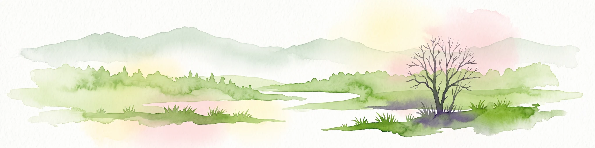
A watercolor painting depicting a soft-focus landscape with rolling green hills in the distance, a grassy foreground, and a single bare-branched tree on the right side.
Nature reserveHessen
About 4.3 km away#2 closest

East

Merzhäuser Teiche Nature Reserve: Geographic Atlas and Protected Landscape Overview

A dense wetland mosaic in the Burgwald region of Hessen.

Merzhäuser Teiche is a compact nature reserve situated on the edge of the Burgwald, Hesse's largest contiguous forest. Centered on three small ponds linked by the Kimmelbach, the area protects a transition zone of alder swamp, wet meadows, and nutrient-poor grassland. This site serves as a crucial habitat for waterbirds, amphibians, and rare butterflies within a characteristic central German landscape.

Area
0.201 km²
Established
1990
IUCN
IV
Relief
Lowland
A soft watercolor painting showing layered, gentle green hills and rolling terrain against a light, pale sky.
Nature reserveHessen
About 15 km away#3 closest

East

Kalkkuppen bei Winterscheid: Protected Geological Landscapes in the Gilserberg Heights

A detailed atlas view of this Hessen nature reserve

This nature reserve in the Schwalm-Eder-Kreis district protects four distinctive limestone hills built from Lower Muschelkalk. These outcrops stand as a geological anomaly within a region otherwise dominated by sandstone. The site serves as a vital component of the European Habitats Directive, offering a rare opportunity to study calcareous vegetation patterns and structural geology within the rolling terrain of northern Hesse.

Area
0.429 km²
Established
1986
IUCN
IV
Watercolor painting of a tranquil wetland scene with grassy banks, small pools of water, and rolling hills in the background.
Nature reserveHessen
About 18 km away#4 closest

Southwest

Kleine Lummersbach bei Cyriaxweimar Protected Nature Reserve and Hessian Landscape Geography

A diverse forest and grassland habitat within the Marburg-Biedenkopf district

Kleine Lummersbach bei Cyriaxweimar offers an exceptional case study in protected area geography. Formed by a blend of mature oak and beech forests, nutrient-poor meadows, and seasonal ponds, the reserve provides a critical refuge for protected amphibians and bats. Its varied terrain, spanning from dense woodland to open, grazed clearings, makes it a vital site for biodiversity conservation in central Germany.

Area
1.383 km²
Established
1997
IUCN
IV
Relief
Upland
Watercolor painting showing a landscape with hills, forest, and a body of water
National parkHesse
About 19 km away#5 closest

Northeast

Kellerwald-Edersee National Park: Hesse's Protected Landscape Exploration

Mapped boundaries and geographic context for this German national park.

Navigate the protected landscape of Kellerwald-Edersee National Park, a key national park situated in the German state of Hesse. This atlas entry focuses on its precise geographic definition, mapped terrain features, and the broader regional context it occupies within central Germany. Gain structured insights into the park's conservation significance and its place in the mapped landscape.

Area
76.88 km²
Established
2004
IUCN
II
Relief
Highland
Watercolor painting of green rolling hills and a calm, pale water surface under a soft, light-colored sky.
Protected landscapeHessen
About 21 km away#6 closest

Northeast

Naturpark Kellerwald-Edersee: Protected Landscape Geography and Map Context

Mapping the forest ridges and reservoir shores of northern Hessen

Examine the geographic foundation of Naturpark Kellerwald-Edersee, a sprawling protected area in northern Hessen. The landscape is characterized by its expansive ancient beech forests, deep valleys, and the Edersee reservoir. This entry provides a detailed look at the park's low mountain terrain, elevation ranges, and the ecological connectivity between its wooded ridges and surrounding river systems.

Area
595.25 km²
Established
2001
Relief
Mountain
Climate
Temperate
Nature reserveHessen
About 23 km away#7 closest

Southeast

Saurasen bei Schweinsberg Nature Reserve: Protected Geography and Floodplain Landscape

Ohm River basin protected area in central Hessen

Saurasen bei Schweinsberg is a compact, habitat-rich nature reserve located in the Ohm River lowland. The protected area features a unique hydrological mosaic of alder-ash woodland, sedge fens, and wet grasslands, serving as a sanctuary for diverse migratory birds and the threatened European tree frog. This site offers deep insights into the intersection of active river dynamics and traditional cultural landscapes in central Hessen.

Area
0.136 km²
Established
1985
Relief
Lowland
Climate
Temperate
A watercolor painting of soft, green rolling hills and clusters of trees set against a pale, light-washed sky on a white background.
Nature reserveHesse
About 24 km away#8 closest

East

Biedenbacher Teiche bei Florshain Nature Reserve, Hesse Protected Wetland Geography

A rare refuge of stream-fed ponds and meadows in northern Hesse

The Biedenbacher Teiche bei Florshain nature reserve protects a dense concentration of wetland microhabitats along the Biedenbach stream. Spanning ponds, sedge beds, and floodplain woodlands, this site offers a look into the vital ecological character of the Schwalm-Eder region. It remains an essential, undisturbed archive of local wetland flora and fauna within the larger, intensively cultivated Hessian agricultural landscape.

Area
0.035 km²
Established
1983
Relief
Lowland
Climate
Temperate

Common questions about visiting, size, designation, and location context for Franzosenwiesen/Rotes Wasser

Franzosenwiesen/Rotes Wasser FAQs for park facts, access, geography, and protected area context

Find quick answers about Franzosenwiesen/Rotes Wasser, including protected-area facts, park geography, trail and visitor context, and how the park fits into its surrounding country and regional landscape.
MoriAtlas Explorer

Continue Your Protected Areas Search Across the Global Atlas

Deepen your exploration by continuing the structured search for national parks and protected areas worldwide. Utilize the comprehensive filtering capabilities to compare different conservation landscapes and refine your understanding of global park geography. Discover more about the distribution and characteristics of protected natural areas.

Global natural geography