Mori Atlas logo
Wildlife reserveGarcia Wilderness

Examining the east-west ridge topography and oak forest terrain within San Luis Obispo County

Garcia Wilderness Protected Landscape and Santa Lucia Range Geographic Map Analysis

Garcia Wilderness stands as a significant protected area within the Santa Lucia Range of California. This wilderness preserves a distinct east-west ridge anchored by Garcia Mountain, creating a unique topographic transition between the Salinas and Santa Maria river basins. The area serves as a focal point for understanding the interplay between coastal chaparral slopes and higher-elevation oak woodlands along the central California coast.

wilderness areaSanta Lucia RangeLos Padres National Forestchaparraloak forestCalifornia coast

Garcia Wilderness

Wildlife reserve

Park overview

Structured park overview, official facts, and landscape profile for Garcia Wilderness

Garcia Wilderness park facts, protected area profile, and essential visitor context

Review the core facts for Garcia Wilderness, including designation, size, terrain, visitor scale, habitats, and operating context in one park-focused overview.

About Garcia Wilderness

Garcia Wilderness is a federally protected wilderness area situated in the southern part of San Luis Obispo County, California. Although small in absolute terms, it occupies an important position in the coastal mountain landscape of south-central California, where protected natural corridors are otherwise limited. As part of Los Padres National Forest, the wilderness is administered by the U.S. Forest Service.

The defining geographic feature is Garcia Mountain, a 3,146-foot peak that forms part of an east-west ridge in the Santa Lucia Range. This ridge orientation gives the wilderness a distinctive profile compared to many other California wilderness areas, which often follow north-south alignments. The protected lands stretch across the slopes and drainages on either side of this ridge, capturing a cross-section of habitats.

Vegetation in Garcia Wilderness reflects the transition from drier coastal environments into more sheltered, forested terrain. Lower elevations are dominated by chaparral shrublands and open grasslands, while upper slopes and sheltered draws support oak forests. The combination of these habitats in a single compact area is one of the wilderness's most distinctive qualities.

The drainages of Garcia Wilderness contribute to two of California's important river systems: the Salinas River to the north and the Santa Maria River to the south. This watershed role adds a hydrological dimension to the area's conservation value, helping maintain water quality and seasonal flow patterns for downstream landscapes.

Recreational use is intentionally low-impact, consistent with wilderness designation. Two campgrounds and three hiking trails, including the 11-mile Caldwell Mesa Trail, provide access to the area. Visitors typically come for solitude, hiking, and backcountry experience rather than developed amenities.

Quick facts and research context for Garcia Wilderness

Garcia Wilderness is a 14,100-acre congressionally designated wilderness in San Luis Obispo County, California. It lies within Los Padres National Forest and is managed by the U.S. Forest Service. The wilderness centers on Garcia Mountain, a 3,146-foot peak in the Santa Lucia Range.

It was established in 1992 under the Los Padres Condor Range and River Protection Act, alongside several other coastal California wilderness areas. Vegetation ranges from chaparral and grasslands to oak forests, and the terrain drains into both the Salinas River and the Santa Maria River.

Protection and recognition

Analysis of terrestrial protected area designation and management scope

Garcia Wilderness Protection Status and Documented Conservation Context

Records outline the documented terrestrial protection status and management scope established for Garcia Wilderness. Structured conservation data details official designation metrics and international recognition frameworks.

Protection details

Protection scope
Terrestrial
Transboundary protection
No
Park context

Deeper park guide and search-rich context for Garcia Wilderness

Garcia Wilderness history, landscape, wildlife, and travel context

Explore Garcia Wilderness through its history, landscape character, ecosystems, wildlife, conservation priorities, cultural context, and seasonal travel timing in a structured park guide built for atlas discovery and search intent.

Why Garcia Wilderness stands out

Garcia Wilderness is best known for preserving an east-west ridge of the Santa Lucia Range, including Garcia Mountain, within an otherwise heavily developed stretch of south-central California coastline. Its compact size concentrates a remarkable variety of vegetation, from chaparral slopes to oak forest. The area is also notable as one of several wildernesses created simultaneously by the 1992 Los Padres Condor Range and River Protection Act, a major federal conservation initiative for the region.

Garcia Wilderness history and protected-area timeline

Garcia Wilderness was established in 1992 by the U.S. Congress through the Los Padres Condor Range and River Protection Act, also known as Public Law 102-301. The act was designed to expand federal wilderness protection across southern and central California, focusing specifically on coastal range ecosystems and river systems of regional importance.

This single piece of legislation created several other wilderness areas in addition to Garcia, including Chumash, Machesna Mountain, Matilija, Sespe, and Silver Peak. By grouping these designations together, Congress aimed to strengthen ecological connectivity and landscape-scale protection in a part of California facing significant development pressure.

The wilderness was named for Garcia Mountain, the prominent peak whose east-west ridge forms the geographic backbone of the protected area. Since its establishment, Garcia Wilderness has remained under U.S. Forest Service management as part of Los Padres National Forest.

Garcia Wilderness landscape and geographic character

The landscape of Garcia Wilderness is defined primarily by an east-west ridge of the Santa Lucia Range, anchored by Garcia Mountain at 3,146 feet. This orientation is unusual within the broader California coastal ranges and gives the wilderness a clearly directional spine that shapes its slopes and drainages.

Terrain transitions from rolling, lower-elevation slopes to steeper ridges and more defined drainages as elevation increases. The result is a layered topography where small changes in elevation correspond with visible shifts in vegetation and exposure. The ridge's position between the Salinas and Santa Maria river basins also gives the wilderness strong topographic identity.

Because the area sits close to the Pacific coast, it experiences the moderating influences typical of California's coastal mountain environments, including marine fog and seasonal moisture that support more mesic vegetation than might otherwise be expected at these latitudes.

Garcia Wilderness ecosystems, habitats, and plant life

Ecologically, Garcia Wilderness captures a notable gradient between drier, shrub-dominated slopes and more sheltered forest communities. Open chaparral and grasslands occupy much of the lower and mid-elevation terrain, while oak forests establish in protected draws and on higher, more mesic slopes.

This juxtaposition of fuel types and vegetation structures gives the area ecological significance beyond its modest size, contributing to habitat diversity in a region where coastal development has reduced natural landscape continuity. The wilderness also helps maintain watershed function for both the Salinas and Santa Maria river systems, supporting downstream habitat quality.

Garcia Wilderness wildlife and species highlights

The wildlife profile of Garcia Wilderness reflects the habitat mosaic of chaparral, grassland, and oak forest typical of California's central coastal ranges. The area provides habitat for species associated with these environments, including deer, various small mammals, and birdlife drawn to oak woodlands and shrublands.

As part of Los Padres National Forest, the wilderness also contributes to broader habitat networks used by larger-ranging species across the central California coast. Its position near the boundary between the Salinas and Santa Maria basins makes it a useful refuge area within a heavily modified surrounding landscape.

Garcia Wilderness conservation status and protection priorities

Garcia Wilderness holds conservation significance as a protected anchor within the south-central California coastal landscape, an area where natural habitat has been significantly reduced by agriculture, ranching, and development. By preserving an entire ridge system along with its associated drainages, the wilderness supports both habitat and watershed functions.

Its establishment under the Los Padres Condor Range and River Protection Act of 1992 reflected a broader federal commitment to landscape-scale conservation in the region, grouping several wilderness designations together to strengthen ecological networks. The wilderness also contributes to condor and broader raptor conservation efforts that motivated the 1992 legislation.

Continued protection under the National Wilderness Preservation System limits road construction, motorized use, and most forms of development, ensuring that ecological processes within the area remain intact.

Garcia Wilderness cultural meaning and human context

The lands around Garcia Wilderness, including the wilderness itself, carry a long history of ranching and rural land use in the central California coastal ranges. Historical ranching sites such as Avenales Ranch in the area reflect the agricultural heritage of the region, a legacy that continues to shape how the surrounding landscape is perceived and managed today.

The wilderness also lies within the broader cultural landscape of the Chumash and other Indigenous peoples whose ancestral territories extended across the Santa Lucia Range. While the wilderness designation itself is a modern federal construct, the land it protects has deep prior human history.

Top sights and standout views in Garcia Wilderness

Garcia Wilderness stands out for the unusual east-west orientation of its ridge and the compact concentration of chaparral, grassland, and oak forest habitats within its boundaries. The presence of Garcia Mountain as a named focal peak gives the area a clear geographic identity.

Its establishment as part of a major 1992 federal wilderness package adds historical weight to the designation, linking it to broader conservation efforts along California's central coast.

Best time to visit Garcia Wilderness

As part of California's central coastal mountains, Garcia Wilderness is best experienced during the cooler and wetter months, when vegetation is greenest and temperatures are more comfortable for hiking. Late fall through spring typically offers the most pleasant conditions for traversing trails such as Caldwell Mesa.

Summer visits are possible but can be hot and dry, especially in lower chaparral zones. Because much of the vegetation is fire-adapted, visitors in late summer and fall should also be mindful of seasonal fire risk in southern California landscapes.

Monthly climate preview

Long-term representative point measurements of annual temperature and precipitation rhythm

Garcia Wilderness Climate Normals and Monthly Temperature Patterns

Representative coordinates document measured monthly averages ranging from cooler winter minimums to warm summer maximums alongside varying precipitation rates. Detailed multi-month records provide complete perspective on long-term climatological baselines across the protected area.
Annual mean16 °C
9 °C25 °C
Jan
Feb
Mar11°
Apr13°
May17°
Jun21°
Jul25°
Aug25°
Sep22°
Oct18°
Nov12°
Dec
Warmest month
July

24.8 °C

Coolest month
December

8.6 °C

Wettest month
February

2.9 mm/day

Driest month
August

0 mm/day

Park location guide

Geography guide, regional context, and park location map for Garcia Wilderness

Garcia Wilderness park geography, regions, and map view in United States of America

Understand where Garcia Wilderness sits in United States of America through a broader geographic reading of the surrounding landscape, nearby location context, and its mapped position within the national park landscape.

How Garcia Wilderness fits into United States of America

The United States of America is a federal presidential republic and one of the world's largest countries by area and population. It consists of 50 states across a vast territory spanning multiple time zones, with its capital in Washington, D.C. and largest city in New York City. The nation has a diverse economy, influential political system, and significant cultural and military presence globally.

Wider geography shaping Garcia Wilderness in United States of America

The United States occupies a vast territory in North America, bordered by Canada to the north and Mexico to the south. The 48 contiguous states stretch from the Atlantic to the Pacific Ocean, while Alaska occupies the northwestern region and Hawaii is an archipelago in the Pacific. The country encompasses diverse terrain including the Rocky Mountains, Appalachian Mountains, Great Plains, and extensive river systems.

Map view of Garcia Wilderness

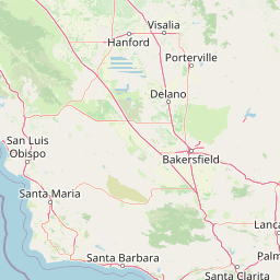
Use this park location map to pinpoint Garcia Wilderness in United States of America, understand its exact geographic position, and read its mapped placement within the surrounding landscape more clearly.

Pigeon | © OpenStreetMap contributors

Location context for Garcia Wilderness

San Luis Obispo County
Recorded earthquake history

Browse Recorded Earthquake History near the Garcia Wilderness

Review documented seismic events associated with the Garcia Wilderness landscape. MoriAtlas provides a clear, searchable record of historical earthquake data including epicentre proximity, magnitudes, and event depths for this part of the California coast.

Garcia Wilderness Earthquake History

Catalogued events

109 events

Strongest magnitude

Magnitude 4.4

Most recent event

Dec 12, 2025

This history includes earthquakes recorded inside the park or within 50 km of its borders

Park atlas

Compare adjacent coastal mountain ranges and connected regional wilderness landscapes.

Exploring Other Parks Near Garcia Wilderness and Surrounding Protected Areas

Browse nearby protected areas sharing similar coastal mountain terrain, oak woodlands, and chaparral ridges with Garcia Wilderness. Comparing adjacent conservation lands provides deeper geographic context for the central California mountain ecosystem.
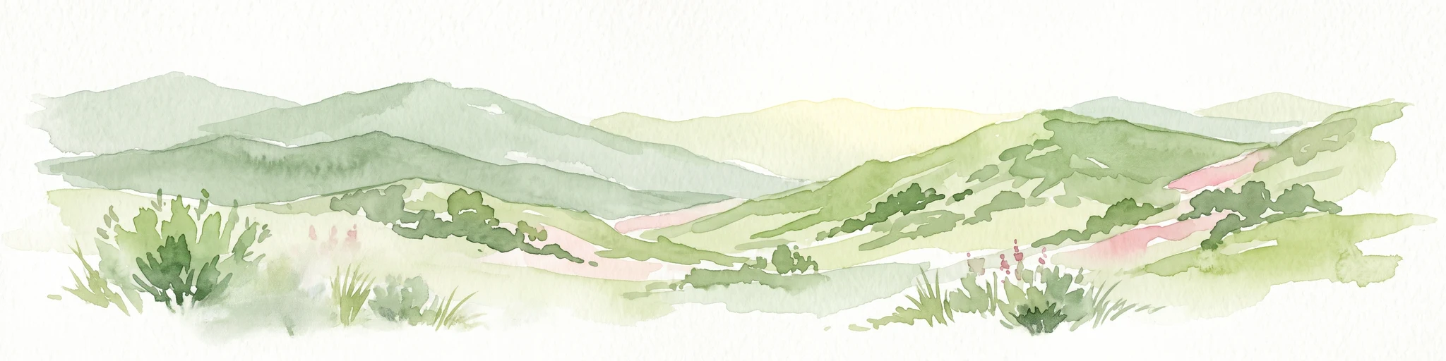
Watercolor painting of a mountain landscape with forested foothills and a valley in the foreground.
Protected landscapeCalifornia
Park boundaries overlap#1 closest

Southeast

Los Padres National Forest: Geography and Protected Landscape Map of Central California

Extensive wilderness corridors and high mountain ridges

Spanning from the Big Sur coastline to the interior ranges of the Santa Lucia and San Rafael mountains, Los Padres National Forest represents a significant protected area in California. The region contains deep gorges, forest-covered canyons, and high-altitude pine ridges that provide essential habitat and support major river headwaters.

Area
7,700 km²
Established
1936
Relief
Mountain
Climate
Mediterranean
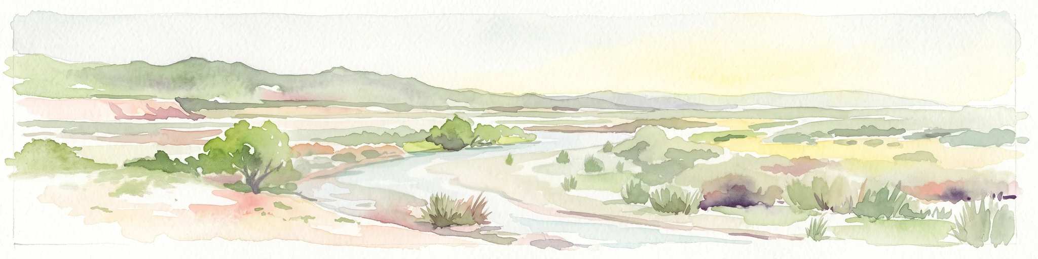
A horizontal watercolor painting depicting a wide, winding river flowing through a coastal valley with rolling hills in the background and sparse green vegetation in the foreground.
Marine protected areaCalifornia
27 km away#2 closest

Southwest

Chumash Heritage National Marine Sanctuary: California Marine Protected Area Atlas

Mapping coastal transition zones and submarine seafloor features

Spanning over 4,500 square miles off the Central Coast of California, the Chumash Heritage National Marine Sanctuary represents a critical ecological intersection between northern and southern marine species. The sanctuary includes dramatic underwater terrain like Arguello Canyon, Rodriguez Seamount, and the Santa Lucia Bank, creating a complex habitat that sustains kelp forests and diverse maritime resources.

Area
11,770 km²
Established
2024
IUCN
V
Relief
Mixed relief
A soft watercolor painting of a shoreline with gentle green hills and pale purple water against a white background.
Marine protected areaCalifornia
71 km away#3 closest

Northwest

Monterey Bay National Marine Sanctuary: California Marine Protected Area and Coastal Atlas

Mapping deep submarine canyons and expansive Pacific coastal ecosystems.

Monterey Bay National Marine Sanctuary represents one of the most biologically significant marine protected areas in the United States. Spanning 276 miles of California shoreline, the sanctuary encompasses varied aquatic terrain including towering kelp forests, rocky reefs, and the massive Monterey Submarine Canyon. This protected marine landscape serves as a crucial region for oceanic research and environmental conservation.

Area
15,780 km²
Established
1992
Relief
Mixed relief
Climate
Mediterranean
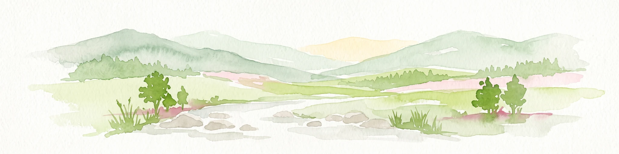
Watercolor painting of a mountain range with a winding stream, small trees, and grassy foreground on a white background.
Wildlife reserveCalifornia
About 108 km away#4 closest

Southeast

Matilija Wilderness: A High Elevation Protected Landscape in the Santa Ynez Mountains

Rugged canyon geography and critical California condor habitat

Spanning from deep canyon bottoms to the high rocky ridges of Monte Arido, Matilija Wilderness represents a significant protected unit within California. The area encompasses a dense network of riparian habitats along Matilija Creek, forming a vital ecological corridor for wildlife and preserving the rugged terrain of the southern Santa Ynez Mountains.

Area
118.2 km²
Established
1992
IUCN
Ib
Relief
Mountain
Marine protected areaCalifornia
110 km away#5 closest

South

Channel Islands National Marine Sanctuary Marine Protected Area Map and Atlas

Southern California marine habitat and island topography

Channel Islands National Marine Sanctuary protects 1,470 square miles of diverse marine environment near the California coast. This sanctuary guards vital kelp forests and deep seafloor ecosystems while preserving deep water archaeological sites and the biological legacy of the Northern Channel Islands.

Area
3,807 km²
Established
1980
IUCN
V
Relief
Lowland
National parkCalifornia
122 km away#6 closest

Southeast

Channel Islands National Park: A Protected Landscape within California's Geography

Explore its unique mapped terrain and protected area context.

Channel Islands National Park stands as a key protected area, providing critical insight into California's unique geographic features and natural landscapes. This entry focuses on the park's identity as a protected entity, detailing its mapped boundaries and the surrounding regional geography. It offers an atlas-level view, essential for understanding the park's contribution to the broader landscape context of the United States and its conservation importance.

Area
1,009.94 km²
Established
1980
IUCN
II
Visitors
323.2K annual
Watercolor painting of a panoramic mountain landscape with stylized pine trees and soft green meadows.
Protected landscapeCalifornia
135 km away#7 closest

Northeast

Sequoia National Forest: Protected Sierra Nevada Geography and Mountain Terrain

A vast protected landscape spanning 1.1 million acres in California

Spanning Tulare, Kern, and Fresno counties, Sequoia National Forest preserves iconic giant sequoia groves across multiple river watersheds. The terrain features vertical relief exceeding 11,000 feet, showcasing a range of ecosystems from chaparral slopes and coniferous forests to glacial cirques and granite spires located within the southern Sierra Nevada range.

Area
4,829.17 km²
Established
1908
Relief
Mountain
Climate
Mediterranean
A soft, painterly watercolor illustration depicting layered green mountain ridges and rolling foothills under a bright, open sky.
Protected landscapeCalifornia
141 km away#8 closest

Southeast

Angeles National Forest: Mapped Protected Landscapes and Geographic Terrain in California

Mountain wilderness and Mediterranean watershed geography

Spanning the San Gabriel and Sierra Pelona ranges, Angeles National Forest serves as a dramatic ecological transition zone. This analysis of its protected landscape focuses on the interaction between steep canyons, high peaks, and the distinct chaparral and conifer zones that shape California geography.

Area
2,652.26 km²
Established
1908
Relief
Mountain
Climate
Mediterranean

Common questions about visiting, size, designation, and location context for Garcia Wilderness

Garcia Wilderness FAQs for park facts, access, geography, and protected area context

Find quick answers about Garcia Wilderness, including protected-area facts, park geography, trail and visitor context, and how the park fits into its surrounding country and regional landscape.
MoriAtlas Explorer

Continue Your Protected Areas Search Across the Global Atlas

Deepen your exploration by continuing the structured search for national parks and protected areas worldwide. Utilize the comprehensive filtering capabilities to compare different conservation landscapes and refine your understanding of global park geography. Discover more about the distribution and characteristics of protected natural areas.

Global natural geography