
Mori Atlas logo
Wildlife reserveGates of the Mountains Wilderness

Examining the geological structure and historical wilderness corridors along the Missouri River.

Gates of the Mountains Wilderness: A Mapped Protected Landscape within Central Montana

Gates of the Mountains Wilderness serves as a premier protected area in central Montana, characterized by towering Madison Limestone cliffs and deeply carved river canyons. This wilderness corridor offers significant geographic insight into the Missouri River valley, documenting ancient thrust faults and the landscape history of the American West. The area provides a preserved look at rugged terrain, protected under federal wilderness statutes to maintain its natural, unmechanized state for ongoing scientific and geographic study.

wilderness areaMissouri River canyonlimestone cliffsLewis and Clark historynational forestriver corridor
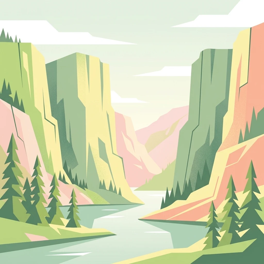
A flat-style digital illustration showing a river flowing between high, steep limestone canyon walls, flanked by coniferous trees under a pale sky.

Gates of the Mountains Wilderness

Wildlife reserve

Park overview

Structured park overview, official facts, and landscape profile for Gates of the Mountains Wilderness

Gates of the Mountains Wilderness park facts, protected area profile, and essential visitor context

Review the core facts for Gates of the Mountains Wilderness, including designation, size, terrain, visitor scale, habitats, and operating context in one park-focused overview.

About Gates of the Mountains Wilderness

The Gates of the Mountains Wilderness preserves a striking river-canyon landscape in central Montana, where the Missouri River has cut a deep passage through massive beds of Madison Limestone. Managed by the U.S. Forest Service within the Helena National Forest, the wilderness sits in Lewis and Clark County, with the nearest city being Helena, the state capital. Its boundaries follow a rugged corridor of cliffs, gulches, ridges, and forested slopes that together create a visually concentrated wilderness experience along the river.

Although relatively compact in area, the wilderness is unusually rich in character. The river corridor offers steep canyon scenery, while the uplands behind the limestone walls carry alternating ridges and valleys shaped by differences in rock resistance. Caves and folded limestone layers appear within the canyon, and the broader geology reflects the influence of major thrust faulting related to mountain-building events far older than the river itself. The Missouri is recognized here as a superposed or antecedent stream, meaning it maintained its course even as the surrounding landscape was uplifted around it.

Because it is a congressionally designated wilderness under the 1964 Wilderness Act, the area is managed to preserve its wild character. No motorized or mechanized vehicles, including bicycles, are permitted within its boundaries. There is no logging, no mining, and no permanent construction. Camping and fishing are allowed with permits, and hunting is permitted in season. The Meriwether Picnic site near the canyon is named in honor of Captain Meriwether Lewis, reflecting the deep connection between the landscape and the exploration of the American West.

Visitors come to the area for the combination of river scenery, geologic interest, solitude, and historical resonance. Boating tours pass between the cliffs, hikers explore side canyons and ridges, and those interested in fire ecology and history can trace the terrain associated with the Mann Gulch disaster. In every sense, the wilderness reads as a layered landscape, where natural history and human history are visibly carved into the same rock.

Quick facts and research context for Gates of the Mountains Wilderness

The Gates of the Mountains Wilderness is located in Lewis and Clark County, Montana, just north of the state capital Helena, and lies within the Helena National Forest. It is classified as an IUCN Category Ib wilderness area and has been formally protected since 1964 under the federal Wilderness Act.

The wilderness covers roughly 28,000 acres along a canyon section of the Missouri River. The cliffs lining the river are formed by Madison Limestone, a thick carbonate unit that defines the scenery of the canyon. The area offers hiking, camping, fishing, and seasonal hunting, while prohibiting motor vehicles, bicycles, logging, mining, and any kind of permanent construction.

Protection and recognition

Terrestrial conservation framework, management scope, and protected area designation details.

Gates of the Mountains Wilderness Protection Status and International Recognition

Terrestrial protection status and documented designation records outline the conservation framework for Gates of the Mountains Wilderness. Structured management scope facts establish the official territorial boundaries and administrative parameters for this protected landscape.

Protection details

Protection scope
Terrestrial
Transboundary protection
No
Park context

Deeper park guide and search-rich context for Gates of the Mountains Wilderness

Gates of the Mountains Wilderness history, landscape, wildlife, and travel context

Explore Gates of the Mountains Wilderness through its history, landscape character, ecosystems, wildlife, conservation priorities, cultural context, and seasonal travel timing in a structured park guide built for atlas discovery and search intent.

Why Gates of the Mountains Wilderness stands out

The wilderness is best known for the towering Madison Limestone cliffs that line the Missouri River in a narrow, deeply cut canyon, producing the dramatic "gates" that gave the area its name. This is the same canyon where Captain Meriwether Lewis wrote one of the most quoted passages of the Lewis and Clark journals, calling the cliffs the most remarkable he had seen on the expedition. The area is also strongly associated with the 1949 Mann Gulch fire, a tragedy that killed 13 smokejumpers and became a defining case study in wildfire behavior and wildland firefighting. The resulting literature, including Norman Maclean's book "Young Men and Fire," has tied the wilderness to the wider story of fire in the American West.
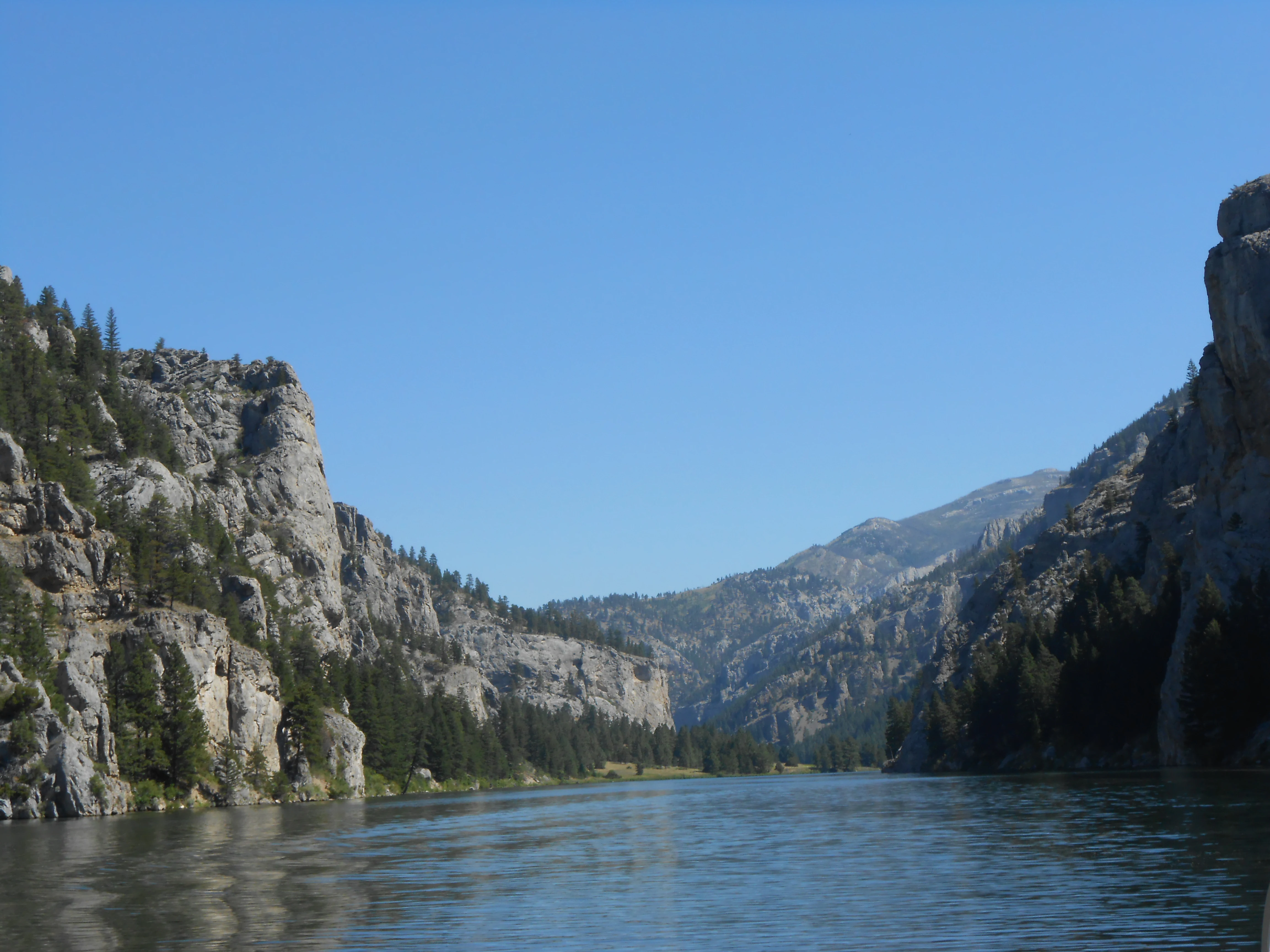
A wide view of a river flowing through a narrow canyon flanked by steep limestone cliffs and evergreen trees under a clear blue sky.
Limestone canyon walls rise above the Missouri River in the Gates of the Mountains Wilderness.

Gates of the Mountains Wilderness history and protected-area timeline

The cultural history of the Gates of the Mountains begins with the Lewis and Clark Expedition. On July 19, 1805, Captain Meriwether Lewis described the cliffs along the Missouri River in language that has remained famous: the cliffs rose perpendicularly from the water to a height of about 1,200 feet, and the river appeared to have forced its way through solid rock for the distance of nearly six miles. Lewis recorded that he named the place "the gates of the rocky mountains."

In 1918, the construction of Holter Dam upstream raised the water level of the Missouri River through the canyon by roughly 14 feet, creating Holter Lake and subtly altering the river's appearance through the gates. By the early twentieth century, conservationists had begun to recognize the area's scenic significance, and proposals were made to bring it into the national park system.

Montana senator Thomas J. Walsh raised the idea with National Park Service director Stephen Mather in 1922, citing Lewis and Clark's account of the canyon. After Mather visited, the National Park Service concluded that, while extraordinary, the area lacked sufficient national significance to warrant national park status and that local or state protection would be adequate. The proposal resurfaced in 1935 and again in the 1960s, each time with the same outcome: the area was judged suitable for a county park or a state park, but not a national park.

Instead, the area was given a different kind of protection. In 1964, the Wilderness Act was passed by Congress, and under its provisions the Gates of the Mountains was designated as wilderness. The land remained part of the Helena National Forest, administered by the U.S. Forest Service, but governed by the strict nondevelopment standards of federal wilderness. At that point, the previous designation of "Gates of the Mountains Wild Area" was replaced by the formal wilderness status it carries today.

The wilderness also carries a more recent and tragic chapter. In 1949, the Mann Gulch fire broke out within what is now the wilderness, ultimately claiming the lives of 13 firefighters, many of them smokejumpers. The event became one of the most studied disasters in American fire history and was the subject of Norman Maclean's posthumously published book "Young Men and Fire." The fire reshaped understanding of wildfire behavior and remains a defining event in the area's modern history.

Gates of the Mountains Wilderness landscape and geographic character

The defining feature of the Gates of the Mountains is the canyon itself. The Missouri River passes through a narrow corridor where pale gray Madison Limestone walls rise vertically from the water, producing the sense of enclosed passage that so impressed Lewis and Clark. At its southern entrance, the canyon reveals a striking geological boundary, where older Proterozoic shales have been pushed over younger limestone along the Eldorado thrust fault, evidence of the powerful mountain-building forces that shaped the region.

Within the canyon, the limestone has been folded and fractured, and erosion has opened caves and irregular layers across the cliff faces. Toward the north end, including at Mann Gulch and beyond, the terrain shifts into a pattern of alternating ridges and valleys, shaped by differences in how the younger rock layers resist erosion above the Madison Limestone. Throughout the canyon, the river itself tells a long geological story: it predates the uplift of the surrounding rock and has continued to cut downward as the landscape rose, making it a classic example of a superposed or antecedent stream.
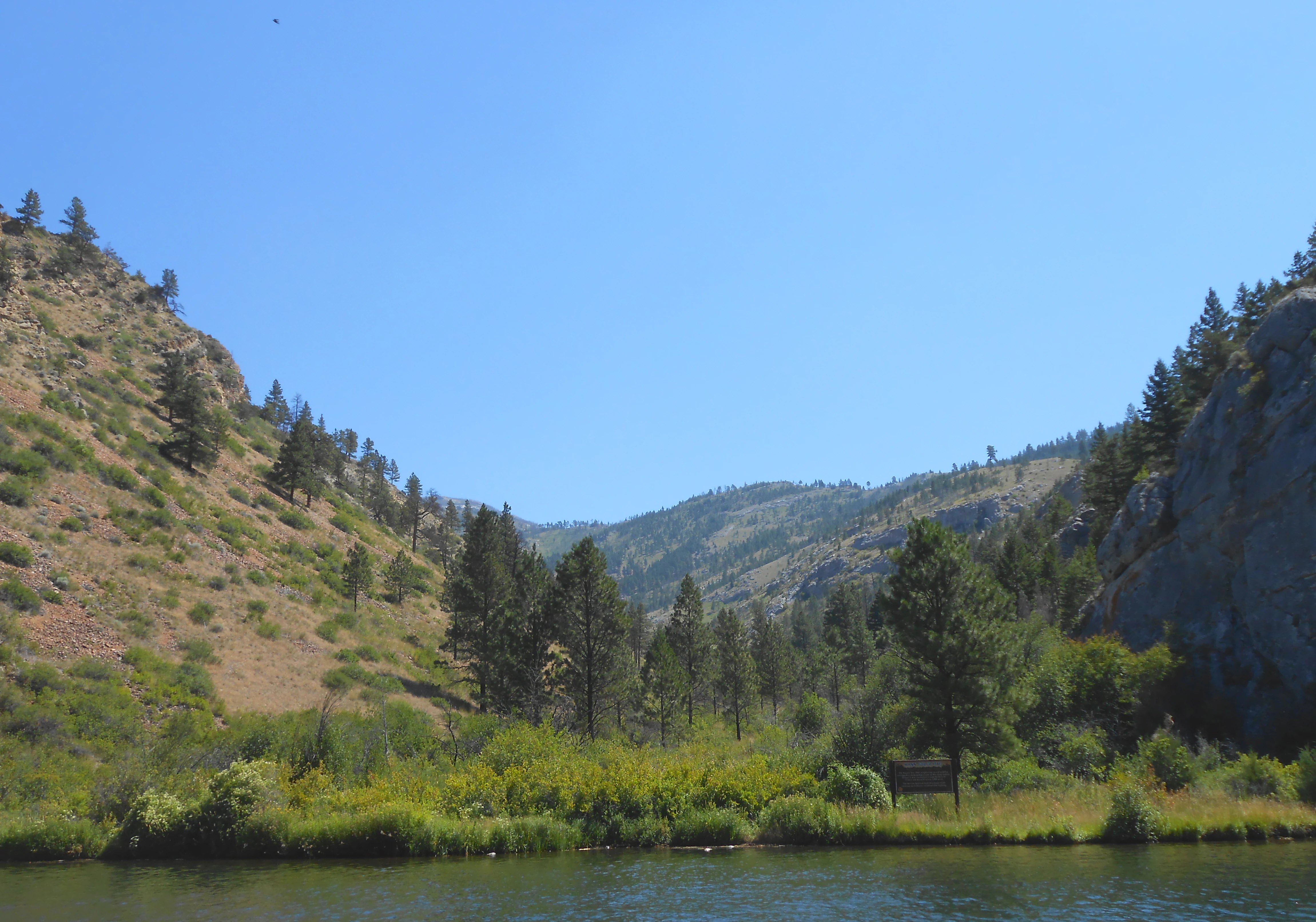
A valley with steep, rocky hillsides flanking a river, with sparse evergreen trees and grasses in the foreground.
A view of Mann Gulch within the Gates of the Mountains Wilderness.

Gates of the Mountains Wilderness ecosystems, habitats, and plant life

Vegetation in the wilderness reflects the transition between river canyon and upland environments typical of the northern Rocky Mountain front. Along the Missouri River corridor, the terrain is dry and rocky, supporting open slopes and scattered conifers adapted to thin soils on the limestone benches. As elevation and moisture conditions change away from the river, plant communities shift toward the mixed conifer forest characteristic of the Helena National Forest.

Ecologically, the wilderness provides a protected buffer along a free-flowing stretch of the Missouri River, along with habitat continuity across the canyons, gulches, and forested ridges. The combination of steep canyon walls, narrow river valley, and forested uplands creates varied microclimates that support wildlife adapted to both dry southern exposures and cooler, shaded slopes. Because the wilderness is closed to motor vehicles and mechanical uses, the area retains a relatively undisturbed acoustic and ecological environment compared with surrounding lands.
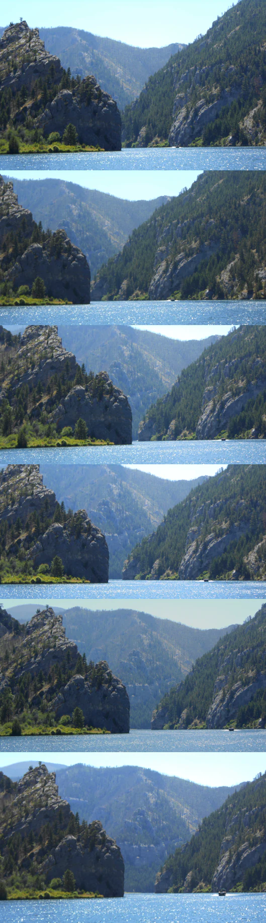
A vertical composite of six similar photographs showing a river flowing between steep limestone cliffs.
A sequence showing the perspective of approaching the limestone cliffs of the Gates of the Mountains along the Missouri River.

Gates of the Mountains Wilderness wildlife and species highlights

The canyon forests, cliffs, and river corridor of the Gates of the Mountains provide habitat for a typical range of central Montana wildlife. Mule deer and other ungulates move through the forested slopes and ridgelines, while smaller mammals find shelter in the rocky terrain and side gulches. Raptors use the cliff faces for nesting and hunting, and the river corridor itself draws waterfowl, shorebirds, and other species associated with the Missouri.

Beyond the ordinary year-round wildlife, the area is notable for the way its landscapes have shaped the history of human interaction with wildland fire in the West. The Mann Gulch fire of 1949 remains one of the most studied wildfire events in American history, and the terrain associated with it, including the steep slopes and dry fuels of the gulch, is still referenced in fire ecology and wildland firefighter training.

Gates of the Mountains Wilderness conservation status and protection priorities

The Gates of the Mountains Wilderness is significant from a conservation standpoint both for its scenery and for its protected status. Designated under the 1964 Wilderness Act, it represents an early federal decision to preserve a small but visually extraordinary stretch of the Missouri River canyon in a state of ecological and developmental wildness. Its IUCN Category Ib designation reflects the high level of protection it receives.

Within the wilderness, the Wilderness Act prohibits motorized and mechanized access, including bicycles, and bans logging, mining, and the construction of roads or permanent structures. These restrictions are intended to maintain the area's unaltered character and the natural processes that shape it. Seasonal hunting, permit-based camping, and fishing are allowed, preserving traditional recreational relationships with the land while keeping its ecological footprint low.

The wilderness also serves as a reference site in the broader history of American conservation. Its repeated examination by the National Park Service ultimately helped shape the conclusion that not every iconic landscape needed to become a national park; some could be more appropriately protected under wilderness or state-level categories. Today, it remains a small but intensively protected piece of Montana's natural heritage.

Gates of the Mountains Wilderness cultural meaning and human context

The Gates of the Mountains is one of the most culturally resonant natural landmarks in Montana, anchored above all by the journals of the Lewis and Clark Expedition. Lewis's 1805 description of the cliffs is one of the most quoted passages in American exploration writing, and the name he gave the canyon has endured as the defining label for both the river corridor and the surrounding wilderness.

In the twentieth century, the area became a touchstone in debates over how to classify and protect nationally significant landscapes. When the National Park Service reviewed the site in 1922, 1935, and again in the 1960s, its discussions helped clarify the distinctions between national parks, state parks, county parks, and wilderness areas. The decision to protect the Gates of the Mountains as wilderness rather than as a national park became part of the broader American conversation about differentiated conservation designations.

The modern cultural memory of the area is also shaped by wildfire history. The 1949 Mann Gulch fire, the deaths of the smokejumpers, and Norman Maclean's book "Young Men and Fire" have given the wilderness a powerful literary and investigative legacy, connecting the landscape to themes of risk, heroism, and the evolving science of wildland fire.

Top sights and standout views in Gates of the Mountains Wilderness

A canyon stretch of the Missouri River enclosed by sheer Madison Limestone cliffs rising hundreds of feet from the water.

The site where Captain Meriwether Lewis coined the name "gates of the rocky mountains" during the 1805 Lewis and Clark Expedition.

The Eldorado thrust fault, where ancient Proterozoic shales are pushed over much younger limestone at the southern mouth of the canyon.

The Mann Gulch fire site of 1949, a defining event in American wildland fire history and the subject of Norman Maclean's "Young Men and Fire."

Strict wilderness protection under the 1964 Wilderness Act, with no motor vehicles, no mechanized travel, and no logging or mining permitted.

Best time to visit Gates of the Mountains Wilderness

The character of the Gates of the Mountains varies considerably by season. Late spring and early summer bring high water on the Missouri River and the freshest green tones in the canyon vegetation, with cool conditions favorable to hiking and boating. Summer offers long daylight hours and stable weather for exploring the cliffs and side canyons, though afternoon thunderstorms are common in the surrounding mountains.

Fall brings cooler temperatures, fewer insects, and the gold and rust colors of the surrounding forest, making it a popular time for quieter hiking and photography. Winter can be cold, with snow at higher elevations, and visitors should expect limited services and more challenging travel, though the canyon retains a stark, deeply atmospheric quality in the cold months. In every season, the dramatic limestone cliffs remain the defining visual element of any visit.

Monthly climate preview

Long-term monthly temperature and precipitation data measured across the terrain

Gates of the Mountains Wilderness Climate Normals and Temperature Rhythms

Historical climate records for Gates of the Mountains Wilderness reveal a measured annual progression of average monthly temperatures and precipitation rates from NASA sampling points. Reviewing the complete twelve-month profile provides a detailed statistical breakdown of long-term weather patterns across the protected landscape.
Annual mean5 °C
-7 °C19 °C
Jan-7°
Feb-6°
Mar-1°
Apr
May
Jun14°
Jul19°
Aug18°
Sep12°
Oct
Nov-2°
Dec-6°
Warmest month
July

18.8 °C

Coolest month
January

-6.8 °C

Wettest month
June

2.8 mm/day

Driest month
January

1 mm/day

Park location guide

Geography guide, regional context, and park location map for Gates of the Mountains Wilderness

Gates of the Mountains Wilderness park geography, regions, and map view in United States of America

Understand where Gates of the Mountains Wilderness sits in United States of America through a broader geographic reading of the surrounding landscape, nearby location context, and its mapped position within the national park landscape.

How Gates of the Mountains Wilderness fits into United States of America

The United States of America is a federal presidential republic and one of the world's largest countries by area and population. It consists of 50 states across a vast territory spanning multiple time zones, with its capital in Washington, D.C. and largest city in New York City. The nation has a diverse economy, influential political system, and significant cultural and military presence globally.

Wider geography shaping Gates of the Mountains Wilderness in United States of America

The United States occupies a vast territory in North America, bordered by Canada to the north and Mexico to the south. The 48 contiguous states stretch from the Atlantic to the Pacific Ocean, while Alaska occupies the northwestern region and Hawaii is an archipelago in the Pacific. The country encompasses diverse terrain including the Rocky Mountains, Appalachian Mountains, Great Plains, and extensive river systems.

Map view of Gates of the Mountains Wilderness

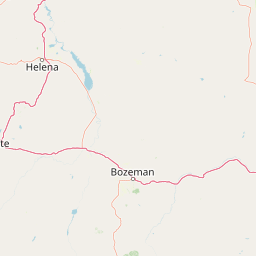
Use this park location map to pinpoint Gates of the Mountains Wilderness in United States of America, understand its exact geographic position, and read its mapped placement within the surrounding landscape more clearly.

Pigeon | © OpenStreetMap contributors

Location context for Gates of the Mountains Wilderness

Montana
Recorded earthquake history

Explore Historical Earthquake Records for Gates of the Mountains Wilderness

Access a structured catalogue of recorded seismic activity within the vicinity of the Gates of the Mountains Wilderness. Use MoriAtlas to trace historical events by magnitude and proximity to this unique Montana wilderness landscape.

Gates of the Mountains Wilderness Earthquakes

Catalogued events

61 events

Strongest magnitude

Magnitude 4.4

Most recent event

Apr 2, 2024

This history includes earthquakes recorded inside the park or within 50 km of its borders

Visualizing the dramatic river corridor and protected terrain of central Montana

Gates of the Mountains Wilderness Photos and Limestone Canyon Scenery

Visual documentation captures the soaring limestone cliffs and narrow river canyons defining the Gates of the Mountains Wilderness. Examining these protected landscapes reveals the rugged terrain and geological character shaping the regional ecosystem.

A wide view of a river flowing through a narrow canyon flanked by steep limestone cliffs and evergreen trees under a clear blue sky.

A wide, eye-level shot of a deep river canyon with steep, pale limestone rock faces rising from the water, dotted with coniferous trees under a cloudy sky.

A valley with steep, rocky hillsides flanking a river, with sparse evergreen trees and grasses in the foreground.

A vertical composite of six similar photographs showing a river flowing between steep limestone cliffs.

Park atlas

Discover adjacent conservation landscapes and regional protected terrain

Explore Protected Areas and Parks Near Gates of the Mountains Wilderness

Browse other parks and protected areas located near Gates of the Mountains Wilderness to examine broader regional geography and terrain patterns. Comparing adjacent conservation landscapes provides valuable context for understanding central Montana ecosystems and river corridors.
A watercolor painting depicting a soft, stylized mountain range and a river winding through a valley.
Protected landscapeMontana
Park boundaries overlap#1 closest

Northeast

Helena-Lewis and Clark National Forest: Geographic Overview and Protected Area Map

Montana wilderness spanning the Continental Divide

Spanning from the rolling eastern plains to the crest of the Northern Rockies, Helena-Lewis and Clark National Forest serves as a massive protected landscape in central Montana. This forest system protects eight unique mountain ranges and critical wilderness corridors, offering a comprehensive look at the ecological transition zones of the American Mountain West.

Area
11,000 km²
Established
1897
Relief
Mountain
Climate
Temperate
Protected areaMontana
75 km away#2 closest

West

Lolo National Forest: An Atlas of Protected Lands and Mountainous Terrain in Montana

Ecological transition zone of the northern Rocky Mountains

This protected area covers two million acres of diverse northern Rocky Mountain geography. Known for its massive western red cedars and transitional ecology, the forest features a complex network of ridgelines, glacial lake basins, and river corridors that serve as vital habitat across the Montana landscape.

Area
8,894.85 km²
Established
1906
Relief
Mountain
Climate
Temperate
Wildlife reserveMontana
139 km away#3 closest

South

Lee Metcalf Wilderness: Geographic Profile and Protected Landscape Boundaries in Montana

Mapping rugged alpine terrain across four distinct mountainous units

Located in southwestern Montana, the Lee Metcalf Wilderness serves as a cornerstone of ecological connectivity within the Greater Yellowstone Ecosystem. Spanning over 250,000 acres, this protected area features a unique fragmented geography consisting of the Bear Trap Canyon, Spanish Peaks, Taylor-Hilgard, and Monument Mountains units. The landscape is defined by its roadless mountain ridges, forested slopes, and deep river corridors, providing essential sanctuary for large mammal populations.

Area
1,029.07 km²
Established
1983
IUCN
Ib
Relief
Mountain
Wildlife reserveMontana
143 km away#4 closest

West

Rattlesnake Wilderness: Exploring the Protected Landscapes and Geography of Montana

Rugged alpine terrain and roadless mountain wilderness in the Northern Rockies.

Located in the Lolo National Forest of western Montana, Rattlesnake Wilderness protects an essential network of forested slopes, alpine ridges, and drainage headwaters. This roadless wildlife reserve provides an ecologically intact landscape that serves as a core component of the northern Rockies wilderness system, offering a clear view into the rugged relief of the Rattlesnake Mountains and their significant influence on local watersheds.

Area
133.45 km²
Established
1980
IUCN
Ib
Relief
Mountain
Wildlife reserveMontana
147 km away#5 closest

Northwest

Mission Mountains Wilderness: A Rugged Protected Area in the Montana Rocky Mountains

Glacial topography and high elevation alpine ecosystems

Mission Mountains Wilderness is a defining landmark in northwestern Montana, characterized by a steep and narrow mountain spine that rises abruptly above the Flathead Valley. The area protects a full spectrum of ecosystems, from dense coniferous forests to exposed talus slopes and alpine tundra. With its glacially carved cirques and deep U shaped valleys, this wilderness functions as a key component of a larger, jointly managed regional conservation landscape in the United States.

Area
298.97 km²
Established
1975
IUCN
Ib
Relief
Mountain
A watercolor painting of a serene landscape with coniferous trees, rolling hills, and soft-toned, layered mountains.
Protected landscapeMontana
About 153 km away#6 closest

West

Rattlesnake National Recreation Area: Geography and Protected Landscape Analysis

A mapped Northern Rockies gateway in western Montana

The recreation area encompasses 28,000 acres of forested mountain terrain, montane wetlands, and creek-carved valleys located just north of Missoula. This protected landscape is defined by its diverse trail network and significant ecological systems, including the rare Sphagnum bogs of Shoo Fly Meadows. The area provides essential habitat for grizzly bears, elk, and bull trout while framing a transition zone into the remote backcountry of the surrounding national forest.

Area
110 km²
Established
1980
Relief
Mountain
Scope
Terrestrial
National parkMontana
192 km away#7 closest

Northwest

Glacier National Park: A Montana National Park with Distinct Protected Landscape Geography

Explore its mapped boundaries and regional natural terrain.

Glacier National Park represents a significant national park entity within Montana, providing a unique lens for understanding protected landscapes and regional geography. As a key component of the US protected areas network, it offers valuable insights into mapped park boundaries and the surrounding natural terrain. This page serves as a gateway to exploring the specific geographic context and landscape identity of Glacier National Park.

Area
4,100.77 km²
Established
1910
IUCN
II
Visitors
2.9M annual
National parkWyoming
198 km away#8 closest

Southeast

Yellowstone National Park: US National Park Protected Landscape & Geographic Atlas

Explore mapped boundaries and regional natural landscape context.

Yellowstone National Park represents a significant protected landscape within Wyoming, designated as a US national park. This entry offers detailed insight into its geographic scope, mapped boundaries, and the unique natural terrain that defines it. Understand its role in regional geography and discover its protected-area identity through a structured atlas exploration, providing context for its conservation landscape.

Area
8,983.18 km²
Established
1872
IUCN
II
Visitors
4.7M annual

Common questions about visiting, size, designation, and location context for Gates of the Mountains Wilderness

Gates of the Mountains Wilderness FAQs for park facts, access, geography, and protected area context

Find quick answers about Gates of the Mountains Wilderness, including protected-area facts, park geography, trail and visitor context, and how the park fits into its surrounding country and regional landscape.
MoriAtlas Explorer

Continue Your Protected Areas Search Across the Global Atlas

Deepen your exploration by continuing the structured search for national parks and protected areas worldwide. Utilize the comprehensive filtering capabilities to compare different conservation landscapes and refine your understanding of global park geography. Discover more about the distribution and characteristics of protected natural areas.

Global natural geography