Mori Atlas logo
National parkGateway Arch National Park

Discover the protected landscape boundaries and regional context of Gateway Arch National Park.

Gateway Arch National Park: A Mapped National Park in Missouri's Geographic Atlas

Gateway Arch National Park stands as a unique protected area within the United States' national park system, situated in Missouri. This atlas-focused page highlights its specific geographic identity and mapped boundaries, offering a structured view for understanding its place in the regional landscape. Explore the factual context that defines Gateway Arch National Park as a distinct entity for geographic and park discovery.

Urban parkHistorical landmarkArchitectural landmarkCivil rights historyMississippi RiverNational Register of Historic Places

Gateway Arch National Park

National park

Park overview

Structured park overview, official facts, and landscape profile for Gateway Arch National Park

Gateway Arch National Park park facts, protected area profile, and essential visitor context

Review the core facts for Gateway Arch National Park, including designation, size, terrain, visitor scale, habitats, and operating context in one park-focused overview.

About Gateway Arch National Park

Gateway Arch National Park represents a unique type of protected area in the American national park system. Unlike most national parks that preserve natural landscapes, this park protects a significant cultural and historical site in the heart of an urban environment. The park consists of several interconnected components: the Gateway Arch itself, a museum facility spanning 140,000 square feet beneath the arch, the historic Old Courthouse building, and the surrounding riverfront park grounds. The memorial was developed through the efforts of St. Louis civic leader Luther Ely Smith, who proposed the idea in 1933 after noticing the deteriorated condition of the original platted area of St. Louis along the Mississippi River. The design competition to select the monument's form was held in 1947, with architect Eero Saarinen's catenary arch design winning over competitors including his father Eliel Saarinen. The site was controversially redesignated from a national memorial to a national park in 2018, with critics arguing that the change was made primarily to boost tourism rather than to conserve a natural area, and that it diluted the significance of the national park designation.

Quick facts and research context for Gateway Arch National Park

Gateway Arch National Park occupies a riverside location in downtown St. Louis, Missouri, near the original platted area of the city along the Mississippi River. The park commemorates three major historical themes: the Louisiana Purchase and subsequent westward expansion, the first civil government west of the Mississippi River, and the civil rights debate raised by the Dred Scott case. The Gateway Arch, designed by Finnish-American architect Eero Saarinen and structural engineer Hannskarl Bandel, was completed in 1965 at a cost of approximately $15 million. The site is maintained by the National Park Service and received over 1.1 million visitors in 2024.

Protection and recognition

Verifying the terrestrial management scope and historical designation data for the park.

Official Protected Area Designation and Status of Gateway Arch National Park

Gateway Arch National Park features a terrestrial protection status that reflects its official transition into the national park system in 2018. Analyzing documented management frameworks and historical designation data provides essential context regarding the legal and geographical conservation of the site.

Protection details

Protection scope
Terrestrial
Designated year
2018
Transboundary protection
No
Park context

Deeper park guide and search-rich context for Gateway Arch National Park

Gateway Arch National Park history, landscape, wildlife, and travel context

Explore Gateway Arch National Park through its history, landscape character, ecosystems, wildlife, conservation priorities, cultural context, and seasonal travel timing in a structured park guide built for atlas discovery and search intent.

Why Gateway Arch National Park stands out

Gateway Arch National Park is best known for the Gateway Arch itself, the tallest monument in the United States and one of the most recognizable architectural landmarks in America. The arch serves as a monument to westward expansion and stands as a symbolic gateway to the western United States. The park is also significant for the Old Courthouse, where the Dred Scott case was tried, making it an important site in American civil rights history. The site occupies the exact location where St. Louis was founded and where key events in early American history unfolded, including the Three Flags Day ceremony that formally completed the Louisiana Purchase transfer.

Gateway Arch National Park history and protected-area timeline

The history of Gateway Arch National Park begins in the early 1930s when St. Louis civic leader Luther Ely Smith conceived the idea of creating a memorial to Thomas Jefferson at the site of the original platted area of St. Louis. After pitching his idea in December 1933, Smith chaired the committee that selected the area and persuaded President Franklin Roosevelt in 1935 to make it a National Park Service unit. The original area was bounded by the Eads Bridge to the north, Poplar Street to the south, the Mississippi River to the east, and Third Street to the west. The Old Courthouse was added to the memorial boundary in 1940. The ambitious project required the demolition of 40 city blocks and 486 buildings, a plan that faced significant opposition. An election to approve a bond issue for the project was later revealed to be rigged. Construction of the Gateway Arch itself was delayed by World War II and the Korean War. Architect Eero Saarinen won the 1947 design competition, though officials initially thought the winner was his father Eliel. Saarinen died in September 1961, before the arch was completed. The arch was finished on October 28, 1965, and formally dedicated on May 25, 1968. In 2018, Congress redesignated the site as Gateway Arch National Park despite opposition from the National Park Service, which recommended calling it a national monument instead.

Gateway Arch National Park landscape and geographic character

Gateway Arch National Park is situated on the riverfront of St. Louis, Missouri, along the west bank of the Mississippi River. The landscape is primarily urban and designed, featuring the monumental Gateway Arch as its centerpiece, surrounded by structured park spaces, plazas, and landscaped areas. The park sits on ground that was once the original platted area of St. Louis, including the sites of the Battle of St. Louis during the American Revolutionary War and the location where the Three Flags Day ceremony transferred Louisiana from Spain to France to the United States in 1804. The Old Courthouse, the only portion of the memorial west of Interstate 44, sits with its distinctive dome similar to the U.S. Capitol dome. The park includes the Gateway Mall running between Market and Chestnut Streets, and the grounds extend over a section of Interstate 70 via the Park over the Highway project completed in 2014. The riverfront location provides views of the Mississippi River and connects to the Illinois riverfront via elevated walkways.

Gateway Arch National Park ecosystems, habitats, and plant life

As an urban cultural and historical site, Gateway Arch National Park does not contain significant natural habitats or ecosystems in the traditional sense. The park's value is primarily historical and architectural rather than ecological. However, recent renovations have added green space to the grounds, increasing from 1,800 trees to approximately 4,200 trees following the CityArchRiver renovation project completed in 2018. This includes an explorers garden for children and new landscaped areas totaling 7.5 acres. On the Illinois side, there is a new bird sanctuary. Prior to 2016, many ash trees were removed from the grounds to prevent damage from emerald ash borers. The park's nature offerings are best understood as urban green space and landscape design rather than protected natural habitats.

Gateway Arch National Park wildlife and species highlights

Wildlife presence at Gateway Arch National Park is limited due to its urban setting and primary function as a cultural monument. The site does not feature significant wildlife populations or habitat areas typical of more natural national parks. Some bird activity may be present in the landscaped areas and the bird sanctuary on the Illinois side of the river, but the park is not known for wildlife viewing or biodiversity. The park's significance lies in its historical and architectural features rather than in wildlife conservation or natural ecosystems.

Gateway Arch National Park conservation status and protection priorities

Gateway Arch National Park represents a unique conservation case within the National Park Service system. The site was listed on the National Register of Historic Places on October 15, 1966, recognizing its significant historical and architectural value. The conservation significance centers on preserving the Gateway Arch as an architectural masterpiece, the Old Courthouse as a historic building where pivotal civil rights cases were argued, and the memory of the founding era of St. Louis and American westward expansion. The 2018 redesignation as a national park rather than a national memorial has been controversial among conservation professionals who argue that the site lacks the natural resources typically protected in national parks. The National Park Service testified that the memorial is too small and limited in the range of resources it protects to warrant the national park designation. The conservation value lies primarily in maintaining the architectural integrity and historical significance of the structures and the commemorative purpose of the site.

Gateway Arch National Park cultural meaning and human context

Gateway Arch National Park is deeply embedded in American cultural and historical narratives. The park commemorates Thomas Jefferson's Louisiana Purchase, which doubled the size of the United States in 1803 and opened the western frontier for exploration and settlement. The site marks the starting point of the Lewis and Clark Expedition, one of the most important exploratory journeys in American history. The Old Courthouse connects to the Dred Scott case, one of the most infamous legal decisions in American history that helped fuel the Civil War. The park sits on land originally deeded by St. Louis founder Auguste Chouteau, and the surrounding area contains layers of history from the Revolutionary War through the Civil War. The Gateway Arch itself has become an enduring symbol of American ambition and westward expansion, appearing on the Missouri state quarter in 2003. The site represents a complex intersection of colonial history, westward expansion, and civil rights that continues to shape American identity.

Top sights and standout views in Gateway Arch National Park

Gateway Arch National Park's main highlight is the Gateway Arch itself, a 630-foot-tall steel catenary arch that stands as the tallest monument in the United States and one of the most recognizable American landmarks. Visitors can ride a unique tram system to the observation room at the top for panoramic views of St. Louis and the Mississippi River. The Old Courthouse, with its domed roof similar to the U.S. Capitol, is another significant highlight where the Dred Scott case was argued. The museum beneath the arch features exhibits on westward expansion and the arch's construction, including the documentary Monument to the Dream. The recent CityArchRiver renovation added 7.5 acres of green space, a new cobblestone plaza between the arch and the river, and improved connectivity to downtown St. Louis via the Park over the Highway structure.

Best time to visit Gateway Arch National Park

Gateway Arch National Park can be visited year-round, as the indoor museum and arch observation area operate in all seasons. The best time to visit depends on preferences: spring and fall offer pleasant weather for exploring the outdoor grounds and riverfront areas, while summer brings larger crowds but longer daylight hours for viewing the arch at sunset. Winter visits offer fewer visitors but cold temperatures in the outdoor areas. The museum and tram operate daily, though specific operating hours may vary by season. Visitors interested in avoiding crowds should consider weekday visits during non-peak tourist seasons. The arch's illuminated appearance at night offers a different perspective for evening visitors.

Monthly climate preview

Comparing long term temperature averages and seasonal precipitation cycles in Missouri

Gateway Arch National Park Monthly Climate Normals and Weather History

Historical records from a representative elevation of 152.79 meters reveal average monthly mean temperatures ranging from -1.38 °C up to 25.6 °C. Accessing the full monthly breakdown reveals detailed precipitation cycles and temperature boundaries for this Missouri landmark.
Annual mean13 °C
-1 °C26 °C
Jan-1°
Feb
Mar
Apr13°
May19°
Jun23°
Jul26°
Aug25°
Sep21°
Oct14°
Nov
Dec
Warmest month
July

25.6 °C

Coolest month
January

-1.4 °C

Wettest month
April

4 mm/day

Driest month
February

2.2 mm/day

Park location guide

Geography guide, regional context, and park location map for Gateway Arch National Park

Gateway Arch National Park park geography, regions, and map view in United States of America

Understand where Gateway Arch National Park sits in United States of America through a broader geographic reading of the surrounding landscape, nearby location context, and its mapped position within the national park landscape.

How Gateway Arch National Park fits into United States of America

The United States of America is a federal presidential republic and one of the world's largest countries by area and population. It consists of 50 states across a vast territory spanning multiple time zones, with its capital in Washington, D.C. and largest city in New York City. The nation has a diverse economy, influential political system, and significant cultural and military presence globally.

Wider geography shaping Gateway Arch National Park in United States of America

The United States occupies a vast territory in North America, bordered by Canada to the north and Mexico to the south. The 48 contiguous states stretch from the Atlantic to the Pacific Ocean, while Alaska occupies the northwestern region and Hawaii is an archipelago in the Pacific. The country encompasses diverse terrain including the Rocky Mountains, Appalachian Mountains, Great Plains, and extensive river systems.

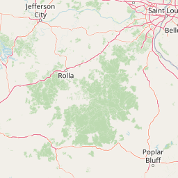
Map view of Gateway Arch National Park

Use this park location map to pinpoint Gateway Arch National Park in United States of America, understand its exact geographic position, and read its mapped placement within the surrounding landscape more clearly.

Pigeon | © OpenStreetMap contributors

Location context for Gateway Arch National Park

Missouri
Recorded earthquake history

Explore Historical Earthquake Records for Gateway Arch National Park

Review the comprehensive MoriAtlas catalogue of recorded seismic events associated with the area around Gateway Arch National Park. This resource offers data on historical magnitude and epicentre location, providing a clear geographic context for seismic activity near this national park.

Gateway Arch National Park Earthquake History

Catalogued events

3 events

Strongest magnitude

Magnitude 4

Most recent event

Aug 26, 1986

This history includes earthquakes recorded inside the park or within 50 km of its borders

Park atlas

Map the surrounding protected landscapes and national parks, expanding discovery across the broader Mississippi River region.

Discover Other National Parks and Protected Areas Surrounding Gateway Arch National Park

Users exploring Gateway Arch National Park can browse other national parks and protected areas located in its regional vicinity, including historical sites and diverse natural landscapes. Expanding discovery from this iconic urban park allows for direct comparison of different conservation approaches and geographic features across the wider Midwest.
National parkMissouri
93 km away#1 closest

Southwest

Mark Twain National Forest: Geography and Protected Area Atlas of Southern Missouri

Mapping the karst terrain and ancient ridges of the Ozark Highlands

Mark Twain National Forest represents a sprawling conservation area within the Missouri Ozark Highlands. Its geography is defined by volcanic mountain remnants, rocky glades, and significant river corridors like the Eleven Point National Scenic River. This record provides insight into the forest's complex mapped boundaries, seven designated wilderness areas, and the distinctive karst geology that characterizes this unique American landscape.

Area
6,037.3 km²
Established
1939
Relief
Upland
Climate
Temperate
Protected landscapeIllinois
96 km away#2 closest

Southeast

Shawnee National Forest: Exploring the Protected Landscapes of the Illinois Shawnee Hills

Mapped sandstone formations and glacial terrain in southern Illinois

Spanning nearly 289,000 hectares, Shawnee National Forest is the largest body of public land in Illinois. The area is defined by its dramatic sandstone bluffs, deep canyons, and seven designated wilderness areas that provide a rare rugged topography within the American Midwest. Explore the complex geography of this forest, from its glacial-sculpted river watersheds to its diverse hardwood habitats and historic reforestation sites.

Area
2,017.83 km²
Established
1933
Relief
Upland
Climate
Temperate
Wildlife reserveMissouri
130 km away#3 closest

South

Rockpile Mountain Wilderness: Mapping the Rugged Ridge Landscapes of the Southeastern Ozarks

A federally protected wilderness within Missouri's Mark Twain National Forest

Explore the distinct geography of Rockpile Mountain Wilderness, where a steep granite ridge runs from Little Grass Mountain toward the national forest boundary. This protected area features unique cultural history in the form of an Indigenous stone cairn and showcases the eroded, rocky character of the eastern Ozark highlands. Use this resource to understand the boundary and terrain of this significant wilderness tract.

Area
17.15 km²
Established
1980
IUCN
Ib
Relief
Mountain
Wildlife reserveMissouri
About 183 km away#4 closest

South

Mingo Wilderness: Missouri Protected Wildlife Reserve and Wetland Geography

Primitive bottomland forest and swamp landscape

Mingo Wilderness encompasses 8,000 acres of protected bottomland hardwood forest and cypress-tupelo swamp in southeastern Missouri. As a federally designated wilderness area embedded within a national wildlife refuge, it provides a quiet, primitive habitat characterized by slow-moving creek corridors and varied seasonal wetlands.

Area
32 km²
Established
1976
IUCN
Ib
Relief
Lowland
Wildlife reserveIllinois
185 km away#5 closest

Southeast

Lusk Creek Wilderness: An Atlas of Protected Sandstone Canyons and Forests in Southern Illinois

Mapping rugged wilderness terrain and forest ecological recovery.

Lusk Creek Wilderness serves as a key protected landscape in southern Illinois, featuring extensive sandstone canyon systems and dense hardwood woodland. This area offers a unique look at the geological and forested character of the Shawnee region, documented through its boundaries, elevation changes, and natural landmarks. Use this geographic entry to examine the rugged, roadless character of the state largest wilderness designation and its place within the wider regional drainage system.

Area
25.47 km²
Established
1990
IUCN
Ib
Relief
Upland
Wildlife reserveIllinois
191 km away#6 closest

Southeast

Garden of the Gods Wilderness: A Protected Sandstone Plateau in Southern Illinois

Explore geologic boundaries, sandstone hoodoos, and forested wilderness terrain

Garden of the Gods Wilderness represents a critical protected area within the Shawnee National Forest, notable for its unglaciated sandstone geography. This 3,318-acre wilderness offers an intimate view of ancient carboniferous rock formations, including prominent hoodoos and clifftop overlooks that provide expansive sightlines across the southern Illinois landscape.

Area
13.43 km²
Established
1990
Relief
Upland
Climate
Temperate
Wildlife reserveMissouri
221 km away#7 closest

Southwest

Irish Wilderness: Missouri Ozark Protected Area and Karst Landscape Atlas

Federally protected wilderness in the Eleven Point River landscape

Spanning the rugged terrain of the Missouri Ozarks, Irish Wilderness is a federally protected area known for its distinct karst geography. Visitors can study the network of caves, sinkholes, and springs that define the local environment, alongside historical remnants of frontier settlement. The area serves as a primary example of wilderness preservation within the Mark Twain National Forest, balancing sensitive cave ecosystems with forested ridge landscapes.

Area
65.87 km²
Established
1984
IUCN
Ib
Relief
Upland
Protected landscapeUnited States of America
250 km away#8 closest

Southeast

Land Between the Lakes National Recreation Area: Mapped Geography and Protected Landscapes

An inland peninsula preserved between two major river reservoirs.

Land Between the Lakes National Recreation Area occupies a distinct narrow land bridge between Kentucky Lake and Lake Barkley. This protected landscape contains a dense mix of forested ridges, stream valleys, and managed wildlife prairies. The area is integral to the lower Ohio River Valley geography, showcasing the results of long-term watershed management and large-scale ecological restoration within the United States.

Area
693.1 km²
Established
1963
Visitors
2M annual
Relief
Lowland

Common questions about visiting, size, designation, and location context for Gateway Arch National Park

Gateway Arch National Park FAQs for park facts, access, geography, and protected area context

Find quick answers about Gateway Arch National Park, including protected-area facts, park geography, trail and visitor context, and how the park fits into its surrounding country and regional landscape.
MoriAtlas Explorer

Continue Your Protected Areas Search Across the Global Atlas

Deepen your exploration by continuing the structured search for national parks and protected areas worldwide. Utilize the comprehensive filtering capabilities to compare different conservation landscapes and refine your understanding of global park geography. Discover more about the distribution and characteristics of protected natural areas.

Global natural geography