
Mori Atlas logo
Nature reserveGeschützter Wald von Madarounfa

A vital nature reserve in the Maradi Region preserving unique Sahel-Sudan transition woodland habitats.

Geschützter Wald von Madarounfa: Exploring the Protected Woodland Landscapes and Regional Geography

(Forêt classée de Madarounfa)

The Geschützter Wald von Madarounfa serves as a preserved island of Sahel-Sudan transition woodland within the agricultural landscape of Niger. This nature reserve, established in 1950, protects approximately 830 hectares of alluvial sandy soil that supports mature stands of acacia, tamarind, and other dryland tree species. The site is a key component of the regional natural heritage, reflecting the historical savanna mosaics that once characterized the Goulbi de Maradi river valley.

protected forestclassified forestSahel-Sudan transitiondryland woodlandacacia savannatamarind woodland
A digital illustration of a mountainous landscape with a river in the foreground, a waterfall cascading from a cliff, and dense forests surrounding the valley under a warm sky.

Geschützter Wald von Madarounfa

Nature reserve

Park overview

Structured park overview, official facts, and landscape profile for Protected Forest of Madarounfa

Protected Forest of Madarounfa park facts, protected area profile, and essential visitor context

Review the core facts for Protected Forest of Madarounfa, including designation, size, terrain, visitor scale, habitats, and operating context in one park-focused overview.

About Protected Forest of Madarounfa

The Protected Forest of Madarounfa, known locally by its French designation forêt classée de Madarounfa, is a compact classified forest reserve in the Maradi region of southwestern Niger. The reserve lies just north of the town of Madarounfa, occupying a broad valley that was historically shaped by the seasonal Goulbi de Maradi river system. With about 830 hectares of protected land, it is a relatively small site but an ecologically important one in a region where most original woodland has long since been cleared for agriculture and settlement.

The forest is a classic example of the woodland that once stretched across the Sahel-Sudan transition belt of West Africa, and it survives largely because it has been formally protected since 1950. Its sandy soils, deposited by old flooding events from the Goulbi de Maradi, support a tree cover that is denser and more diverse than the typical Sahelian thorn scrub to the north. The reserve contains a characteristic mix of useful and emblematic dryland tree species, including tamarind, Faidherbia albida, and several acacias.

The site also has cultural weight: in 2006, Niger's Ministry of Culture proposed the forest, together with nearby Madarounfa Lake and the Tombs of the 99 Saints, as a single UNESCO World Heritage Tentative List site. This nomination highlights how the forest is seen not just as a biological reserve but as part of a wider landscape of natural and spiritual importance in the Maradi region. For visitors and researchers, the Protected Forest of Madarounfa offers a glimpse of what much of this part of Niger may have looked like before large-scale agricultural expansion.

Quick facts and research context for Protected Forest of Madarounfa

The Protected Forest of Madarounfa is a classified woodland located in the Maradi region of southwestern Niger, immediately north of the town of Madarounfa. Covering roughly 830 hectares, it was set aside as a forêt classée in 1950, making it one of the older formal forest reserves in the country. The site lies in the Sahel-Sudan transition zone, with annual rainfall between 400 and 600 mm, and is bordered by the seasonal Goulbi de Maradi watercourse, with Madarounfa Lake about a kilometer to the south.

Protection and recognition

Explore terrestrial protection scope and documented conservation recognition data.

Geschützter Wald von Madarounfa Protection Status and Designated Area Record

Examine the verified terrestrial protection scope and administrative standing established for Geschützter Wald von Madarounfa. Review structured conservation records and official designation details maintained within the global protected area atlas.

Protection details

Protection scope
Terrestrial
Transboundary protection
No
Park context

Deeper park guide and search-rich context for Protected Forest of Madarounfa

Protected Forest of Madarounfa history, landscape, wildlife, and travel context

Explore Protected Forest of Madarounfa through its history, landscape character, ecosystems, wildlife, conservation priorities, cultural context, and seasonal travel timing in a structured park guide built for atlas discovery and search intent.

Why Protected Forest of Madarounfa stands out

The Protected Forest of Madarounfa is best known for preserving a rare, well-developed Sahel-Sudan transition woodland in an otherwise heavily cultivated part of southwestern Niger. The reserve is recognized for its stands of tamarind, Faidherbia albida, and several acacia species growing on sandy alluvial soils, a habitat combination that has been widely lost elsewhere in the region. It is also notable as part of the jointly nominated UNESCO Tentative List site that links the forest with the nearby Madarounfa Lake and the Tombs of the 99 Saints, giving the protected woodland a recognized cultural as well as ecological significance.
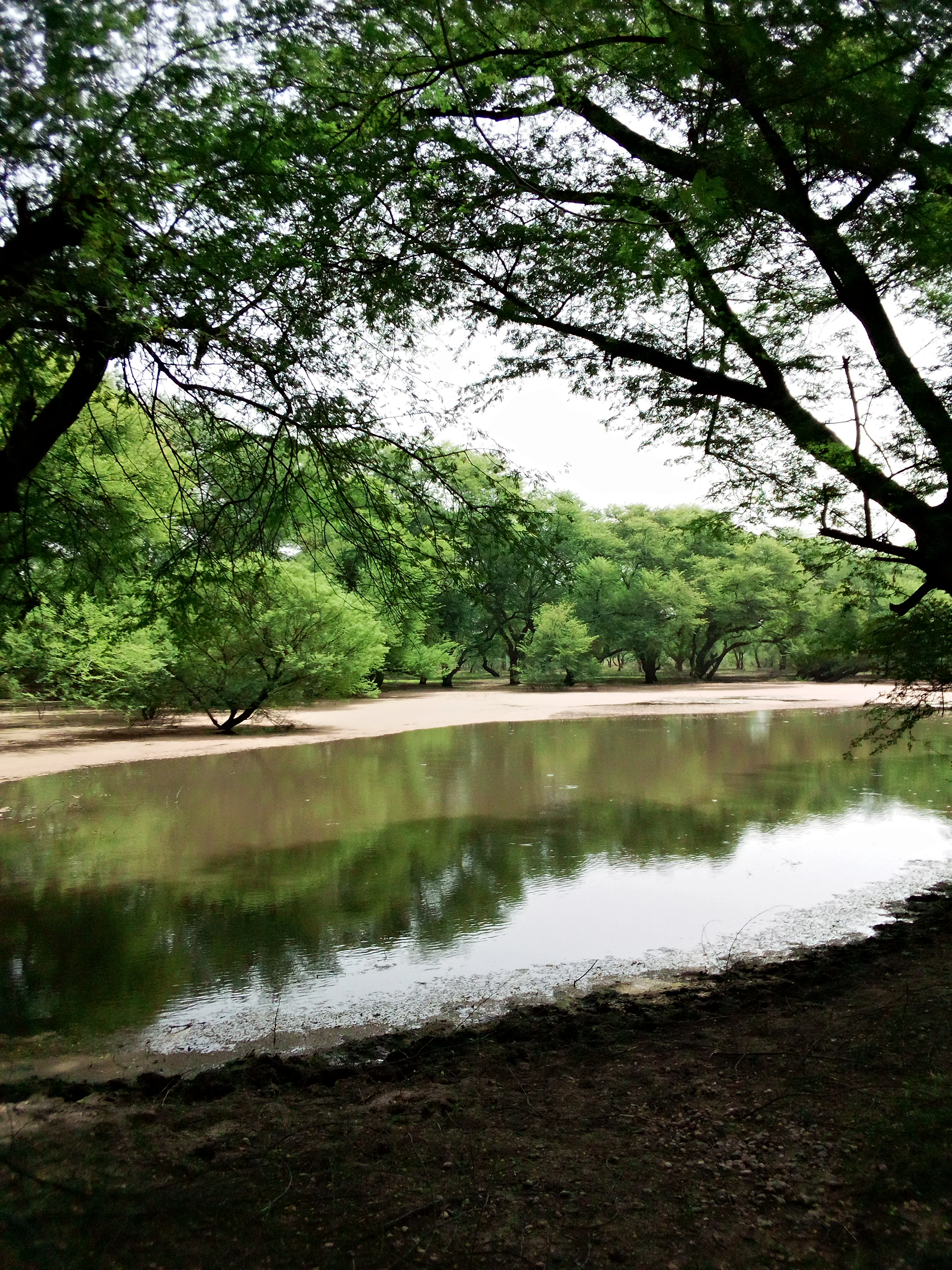
A still pond reflecting surrounding trees and a bright sky in a wooded savanna landscape.
A tranquil pond surrounded by trees in the Madarounfa Classified Forest.

Protected Forest of Madarounfa history and protected-area timeline

The Protected Forest of Madarounfa was formally placed under state protection in 1950, when it was designated as a forêt classée, or classified forest, under Niger's colonial-era forest protection framework. This designation made free grazing by livestock illegal within its boundaries, a regulation that has been central to maintaining the integrity of the woodland for decades.

Beyond its formal protection history, the site became part of a broader cultural initiative in the early twenty-first century. On 26 May 2006, Niger's Ministry of Culture proposed the forest together with the nearby Madarounfa Lake and the Tombs of the 99 Saints as a single entry on Niger's UNESCO World Heritage Tentative List. The nomination framed the area as a combined natural and cultural landscape of regional importance, drawing attention to the woodland's ecological value and its relationship with surrounding heritage sites.

The forest has also been the subject of technical inventory work, including a 1988 data-processing study of forest stands at Madarounfa and nearby protected woodlands by Niger's environment directorate in cooperation with the UN Food and Agriculture Organization.

Protected Forest of Madarounfa landscape and geographic character

The Protected Forest of Madarounfa occupies a low valley in the Maradi region, just north of the town of Madarounfa itself. Its terrain consists of sandy soils laid down in an old alluvial floodplain, a setting that has allowed a relatively dense tree cover to persist where surrounding areas are mostly open farmland. To the south of the reserve, roughly a kilometer away, lies the Madarounfa Lake, while the seasonal river Goulbi de Maradi passes along the forest's edge.

Topographically, the area is gently undulating rather than dramatic, with the woodland standing out as a prominent green patch against the more sparsely vegetated cultivated lands around it. The nearby villages of Angoual Mata to the east and Danja to the northeast sit amid this largely agricultural landscape, underscoring how the protected forest functions as an island of natural vegetation in a working rural environment.

Climatically, the reserve lies in the transition between the dry Sahel zone to the north and the wetter Sudan zone to the south, with annual rainfall typically between 400 and 600 mm. This intermediate position shapes its vegetation, producing a savanna-like woodland that is denser and more varied than Sahelian thorn scrub but less lush than the woodlands further south.

Protected Forest of Madarounfa ecosystems, habitats, and plant life

Ecologically, the Protected Forest of Madarounfa represents a well-preserved example of Sahel-Sudan transition woodland, a habitat type that has been heavily reduced across the region. The reserve's sandy alluvial soils support a savanna-like tree community in which individual species fulfill different ecological roles, from deep-rooted legumes that enrich the soil to broad-canopied trees that provide shade and food for wildlife.

The vegetation is dominated by a mix of characteristic dryland trees. Tamarind (Tamarindus indica) is one of the most recognizable presences, alongside Anabaum, or Faidherbia albida, which is well known for its role in improving soil fertility. The woodland also features the Senegal acacia (Acacia senegal), the Seyal acacia (Acacia seyal), and other species such as Anogeissus leiocarpa, Bauhinia rufescens, and Mitragyna inermis, which together create a multi-layered canopy structure typical of this transition zone.

Because grazing has been restricted within the reserve since 1950, the understory and tree regeneration have been able to persist in ways that are uncommon in the surrounding farmland-dominated landscape. The result is a relatively intact mosaic of dryland forest patches, acacia groves, and open spaces that together sustain a richer plant community than is usually found in this part of Niger.

Protected Forest of Madarounfa wildlife and species highlights

The Protected Forest of Madarounfa supports a varied bird community that reflects its position in the Sahel-Sudan transition, where northern dryland species mix with more southerly woodland birds. Water-associated species such as the gray heron, purple heron, cattle egret, little egret, striated heron, and hamerkop are associated with the seasonal pools and small water bodies found within the reserve.

More open-country and woodland species are also well represented. Regular sightings include the yellow-billed oxpecker, Senegal roller, African grey hornbill, red-billed hornbill, and violet-backed starling, all of which are characteristic of dry and semi-dry African woodlands. Smaller passerines such as the beautiful sunbird, yellow-crowned gonolek, and vitelline masked weaver add to the diversity of birdlife, while migratory visitors like the common redstart and yellow wagtail appear seasonally.

Other wildlife associated with the reserve includes ground-dwelling species such as the double-spurred francolin and northern white-faced owl, along with larger waterbirds like the knob-billed duck and white-faced whistling duck. The combination of water bodies, dense acacia stands, and open patches within the protected boundary creates the kind of habitat mosaic that allows such a broad range of bird species to coexist in a relatively small area.

Protected Forest of Madarounfa conservation status and protection priorities

The Protected Forest of Madarounfa has been under formal state protection since 1950, when it was classified as a forêt classée, Niger's long-standing category for legally protected forests. This classification legally prohibits free grazing of livestock within the reserve, a measure that has been central to keeping the woodland intact in a region where grazing pressure and fuelwood demand have transformed much of the surrounding landscape.

From a conservation perspective, the reserve is significant because it preserves a sizeable block of Sahel-Sudan transition woodland in an otherwise heavily cultivated landscape. By restricting grazing and other extractive uses, the protected status has allowed tree regeneration, understory development, and the persistence of mature individuals of species such as Faidherbia albida and tamarind that are increasingly rare elsewhere in the Maradi region.

In 2006, the forest was placed on Niger's UNESCO World Heritage Tentative List as part of a combined nomination that also includes Madarounfa Lake and the Tombs of the 99 Saints. While this nomination does not confer World Heritage status, it signals national-level recognition of the reserve's ecological and cultural importance and brings additional attention to its long-term protection needs, including managing the pressures from the surrounding agricultural communities and maintaining its habitats for the bird species that depend on them.

Protected Forest of Madarounfa cultural meaning and human context

The Protected Forest of Madarounfa is closely tied to the cultural landscape of the Maradi region. The nearby town of Madarounfa gives the reserve its name and is the administrative and economic center of the surrounding area, while villages such as Angoual Mata and Danja border the woodland and have long-standing relationships with its resources.

The reserve forms part of a broader heritage complex that includes the Tombs of the 99 Saints, an important local pilgrimage and commemorative site, and Madarounfa Lake, a focal point for local fishing and seasonal water use. The 2006 proposal to inscribe the forest, lake, and tombs together on Niger's UNESCO Tentative List reflects how these elements are seen locally as a unified cultural-natural landscape rather than as separate sites.

For communities in the area, the forest has historically been a source of timber, fuelwood, non-timber forest products, and seasonal grazing on its margins, though formal protection has restricted some of these uses. Its survival as a green landmark in a predominantly agricultural landscape also gives it an enduring identity value for residents of the Maradi region.

Top sights and standout views in Protected Forest of Madarounfa

The strongest highlights of the Protected Forest of Madarounfa include the unusual density and variety of its Sahel-Sudan transition woodland, the surviving presence of mature tamarind and Faidherbia albida trees, and the mosaic of seasonal pools and acacia groves that support a rich bird list. Its long protection history, dating to 1950, and its inclusion in Niger's UNESCO Tentative List as part of a combined natural and cultural site add a nationally recognized dimension to its ecological value.

Best time to visit Protected Forest of Madarounfa

The Protected Forest of Madarounfa lies in a dry tropical climate with a clear seasonal rhythm shaped by the brief rainy season and the longer dry season. The months immediately following the rains, roughly from late summer into early autumn, tend to be when the vegetation is greenest, water levels in Madarounfa Lake and seasonal pools are highest, and bird activity, including migratory species, is at its peak.

During the long dry season, the woodland takes on a more sparse, leafless character, but the structural features of the forest, including its mature tamarind and acacia stands, remain visible throughout the year. Cooler dry-season mornings and late afternoons tend to be the most comfortable periods for walking through the reserve, while midday heat can be intense at any time of year.
Monthly climate preview

Long-term representative monthly temperature and precipitation rhythm in the Maradi Region

Geschützter Wald von Madarounfa Climate Normals, Average Temperature, and Precipitation

Historical data points for Geschützter Wald von Madarounfa reveal distinct shifts in average temperature and precipitation across the recorded months. Reviewing the complete monthly profile provides deeper insight into long-term climate normals and regional weather patterns.
Annual mean28 °C
22 °C33 °C
Jan22°
Feb25°
Mar29°
Apr32°
May33°
Jun31°
Jul29°
Aug27°
Sep27°
Oct28°
Nov25°
Dec22°
Warmest month
May

32.9 °C

Coolest month
January

21.9 °C

Wettest month
August

6.4 mm/day

Driest month
January

0 mm/day

Park location guide

Geography guide, regional context, and park location map for Protected Forest of Madarounfa

Protected Forest of Madarounfa park geography, regions, and map view in Niger

Understand where Protected Forest of Madarounfa sits in Niger through a broader geographic reading of the surrounding landscape, nearby location context, and its mapped position within the national park landscape.

How Protected Forest of Madarounfa fits into Niger

Niger is a landlocked West African country spanning approximately 1.27 million km², making it the largest landlocked country in the region and the second-largest landlocked nation in Africa. Over 80% of its territory lies in the Sahara Desert, with the population concentrated in clusters in the southern and western regions. The country gained independence from France in 1960 and has experienced multiple coups, most recently in 2023.

Wider geography shaping Protected Forest of Madarounfa in Niger

Niger is located in West Africa and is landlocked, bordered by Libya (northeast), Chad (east), Nigeria (south), Benin and Burkina Faso (southwest), Mali (west), and Algeria (northwest). Over 80% of the country's land area lies in the Sahara Desert. The terrain is predominantly flat desert plains and sand dunes, with the Niger River flowing through the southwest corner near the capital Niamey.

Map view of Protected Forest of Madarounfa

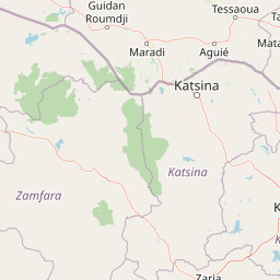
Use this park location map to pinpoint Protected Forest of Madarounfa in Niger, understand its exact geographic position, and read its mapped placement within the surrounding landscape more clearly.

Pigeon | © OpenStreetMap contributors

Location context for Protected Forest of Madarounfa

Maradi Region

Visual reference collection highlighting dryland woodland habitats, sandy alluvial terrain, and regional savanna vegetation.

Geschützter Wald von Madarounfa Photos and Protected Landscape Scenery

Photographic records illustrate the dense acacia stands and mature tamarind trees defining the protected Sahelian transition woodland. Visual exploration reveals the distinct topography and habitat structure distinguishing the classified reserve from surrounding agricultural terrain.

A still pond reflecting surrounding trees and a bright sky in a wooded savanna landscape.

Sparse woodland of mature trees with textured brown trunks and thin branches set against a dusty, overcast sky, with the forest floor covered in dry, light-colored sand.

Park atlas

Compare adjacent dryland reserves and regional conservation landscapes

Explore Protected Areas Near Geschützter Wald von Madarounfa

Browse other classified woodlands and protected environments located near Geschützter Wald von Madarounfa in the Maradi region. Examining these neighboring natural habitats provides a deeper understanding of Sahelian ecosystems and regional conservation networks.
A soft watercolor painting showing a winding river or lake flowing through a landscape with gentle green hills, clusters of trees, and a pale sky.
Nature reserveMaradi Region
About 3.8 km away#1 closest

South

Madarounfa Lake Nature Reserve: Geographic Overview of Niger's Premier Wetland

Seasonal wetlands and riparian habitats in Maradi Region

Madarounfa Lake functions as a pivotal natural feature in the Maradi Region, blending seasonal hydrological shifts with a distinct cultural identity. This protected area supports critical riparian woodland and waterbird populations, serving as an essential resource for the surrounding landscape. Its classification as a wetland of international importance highlights the environmental complexity of the Sahel-Sudanese transition zone.

Area
8.5 km²
Established
2019
Relief
Lowland
Scope
Terrestrial
Protected areaTahoua Region
About 206 km away#2 closest

Northwest

Mare de Tabalak Protected Area: Geography and Wetland Landscape in Tahoua, Niger

Mapping a unique Sahelian freshwater ecosystem and seasonal floodplains

Mare de Tabalak serves as one of the most ecologically significant wetlands in Niger. This protected area, characterized by its permanent freshwater lake and vast seasonal floodplains, sits at the intersection of the Ader Doutchi plateaus and the Tadrès sand dunes. The site acts as a major hub for migratory bird populations and supports essential regional pastoral and agricultural livelihoods within the Tahoua landscape.

Area
7 km²
Established
2005
Relief
Lowland
Climate
Arid
A horizontal watercolor painting depicting a soft green landscape with rolling hills in the background and marshy vegetation in the foreground.
Protected areaZinder
About 261 km away#3 closest

East

Guidimouni Lake Protected Area: Wetland Geography and Zinder Region Landscape Atlas

A Ramsar-designated freshwater and saline wetland system in the Sahel.

Guidimouni Lake is a significant endorheic wetland situated within the Zinder Region of Niger. This protected area consists of a long, narrow depression featuring a rare coexistence of fresh and saline water basins. Beyond its ecological role, the site provides a critical framework for understanding the interplay between Sahelian sand plains, local water-lily habitats, and the regional agro-pastoral economy.

Area
0.6 km²
Established
2019
Relief
Lowland
Climate
Subtropical
Wildlife reserveZinder
About 264 km away#4 closest

East

Mare de Lassouri Wildlife Reserve: Geographic Context and Sahel Wetland Mapping

Protecting vital aquatic habitats in the Zinder Region

Mare de Lassouri serves as a central hub for wetland conservation within the Zinder Region of Niger. This shallow freshwater basin offers a rich habitat mosaic where migratory waterbirds congregate amid bushy savanna, providing essential ecological value and sustaining local agricultural livelihoods in a resource-scarce Sahelian landscape.

Area
7.5 km²
Established
2005
Relief
Lowland
Climate
Arid
Protected areaTahoua Region
About 277 km away#5 closest

West

Mare de Dan Doutchi Protected Area: Mapping the Sahelian Wetlands of Tahoua Region

Permanent freshwater lake and Ramsar-listed ecological site

Situated in the Tahoua Region, Mare de Dan Doutchi acts as a rare permanent waterbody in the transition zone between the Sahel and the Sahara. This detailed profile covers the hydrological features of the basin, its role as a seasonal refuge for diverse bird species, and its importance to regional livelihoods within the Iullemmeden Basin context.

Area
382.5 km²
Established
1974
Relief
Lowland
Climate
Arid
National parkNigeria
About 296 km away#6 closest

South

Kamuku National Park: Nigeria's Protected Savanna Ecosystem and Inselberg Landscape

Explore mapped boundaries and regional geography.

Delve into Kamuku National Park, a significant protected savanna ecosystem in Nigeria, recognized for its unique geological features such as the Goron Dutse inselberg and the Dogon Ruwa Waterfalls. This page offers an atlas-level view of the park's landscape, detailing its protected area status, its role as elephant habitat, and its exceptional biodiversity, providing a comprehensive geographic context for exploration.

Area
1,120 km²
Established
1999
IUCN
II
Relief
Lowland
Wildlife reserveYobe
About 361 km away#7 closest

East

Nguru Lake Wildlife Reserve: Sahelian Wetland and Floodplain Geography

A protected freshwater ecosystem in Yobe, Nigeria

Nguru Lake serves as a vital hydrological anchor within the Hadejia-Nguru wetland system. This endorheic, shallow-water environment undergoes dramatic seasonal expansion, creating a rich mosaic of marshlands and mudflats. The site stands as a key protected area within the Chad Basin landscape, offering a unique look at Sahelian water ecology and floodplain dynamics.

Area
37 km²
Relief
Lowland
Climate
Tropical
Scope
Terrestrial
Protected areaDosso Region
About 367 km away#8 closest

West

Dallol Maouri Protected Area: Geographic Overview of Niger's Fossilized Wetland Valleys

Mapping seasonal pond systems and floodplain corridors in the Dosso Region

Dallol Maouri serves as a quintessential example of the ancient drainage systems found in the Iullemmeden Basin. As a Ramsar-listed protected area, it features a unique north to south orientation that fosters a rich transition between dryland Sahel and Sudanian savanna. The valley is defined by its seasonal mares, palm groves, and intricate network of koris tributaries that shape the geography of southwestern Niger.

Area
3,175.2 km²
Established
2004
Relief
Lowland
Climate
Subtropical

Common questions about visiting, size, designation, and location context for Protected Forest of Madarounfa

Protected Forest of Madarounfa FAQs for park facts, access, geography, and protected area context

Find quick answers about Protected Forest of Madarounfa, including protected-area facts, park geography, trail and visitor context, and how the park fits into its surrounding country and regional landscape.
MoriAtlas Explorer

Continue Your Protected Areas Search Across the Global Atlas

Deepen your exploration by continuing the structured search for national parks and protected areas worldwide. Utilize the comprehensive filtering capabilities to compare different conservation landscapes and refine your understanding of global park geography. Discover more about the distribution and characteristics of protected natural areas.

Global natural geography