
Mori Atlas logo
Protected landscapeGifford Pinchot National Forest

Tracing volcanic terrain, deep river valleys, and expansive old-growth forests across the Cascade Range

Gifford Pinchot National Forest: A Comprehensive Atlas of Washington's Volcanic Protected Landscapes

Gifford Pinchot National Forest stands as a significant protected landscape spanning southern Washington, stretching from the northern shadow of Mount Rainier to the Columbia River. This vast terrain is shaped by the active volcanic forces of the Cascade Range, encompassing iconic features such as Mount Adams and the Mount St. Helens National Volcanic Monument. The geography consists of a dense network of high-altitude wilderness areas, glaciated peaks, subalpine meadows, and major river systems that define this diverse regional landscape.

Cascade Rangevolcanic landscapesold-growth forestwilderness areasnational forestalpine meadows
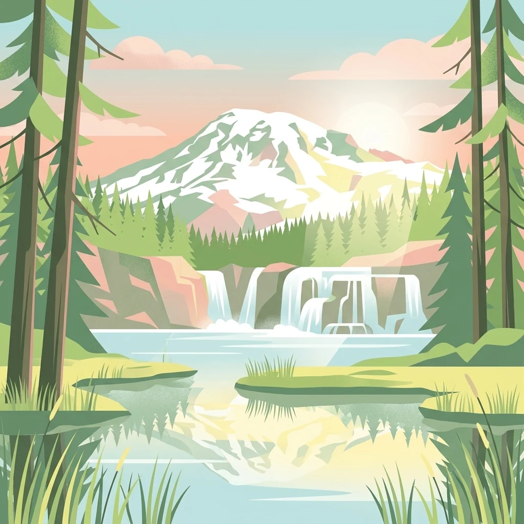
A digital illustration of a scenic park landscape featuring a prominent snow-capped mountain in the background, a multi-tiered waterfall cascading into a calm lake, and dense coniferous forests in the foreground.

Gifford Pinchot National Forest

Protected landscape

Park overview

Structured park overview, official facts, and landscape profile for Gifford Pinchot National Forest

Gifford Pinchot National Forest park facts, protected area profile, and essential visitor context

Review the core facts for Gifford Pinchot National Forest, including designation, size, terrain, visitor scale, habitats, and operating context in one park-focused overview.

About Gifford Pinchot National Forest

Gifford Pinchot National Forest is one of the signature landscapes of the Pacific Northwest, a sprawling Cascade Range forest that physically and culturally ties together three of Washington's most famous volcanoes. It occupies the western slopes of the South Cascades, bordered by Mount Rainier National Park to the north, Mount Adams to the east, Mount St. Helens to the west, and the Columbia River Gorge to the south. Across more than a million acres, it preserves a connected mosaic of old-growth Douglas-fir and western hemlock forests, high mountain meadows, glaciers, lava fields, and dozens of rivers and lakes.

The forest is managed by the U.S. Forest Service and is named for Gifford Pinchot, the first Chief of the Forest Service and a founding figure of American conservation policy. Pinchot's widow, Cornelia Bryce Pinchot, was among the speakers at the 1949 dedication ceremony at La Wis Wis Campground. The forest's modern identity is shaped both by its conservation pedigree and by active volcanic processes: the catastrophic 1980 eruption of Mount St. Helens led directly to the creation of the Mount St. Helens National Volcanic Monument in 1982, and Spirit Lake, the blast zone, and surrounding devastated landscapes remain defining features of the monument today.

Beyond its volcanoes, Gifford Pinchot is recognized for its wilderness system. Seven congressionally designated wilderness areas fall partly or wholly within its boundaries, ranging from the small Glacier View Wilderness to the much larger Goat Rocks, Indian Heaven, and William O. Douglas Wildernesses. These areas protect subalpine wildflower meadows, old-growth canopies, glacial cirques, and large predator habitat. Combined with lava tubes, cinder cones, and culturally important sites such as Layser Cave, the forest offers a layered story of geological violence, ecological recovery, and long human presence on the land.

Quick facts and research context for Gifford Pinchot National Forest

Located entirely within Washington State, Gifford Pinchot National Forest spans roughly 1.32 million acres across Skamania, Lewis, Yakima, Cowlitz, and Klickitat counties. It is administered by the U.S. Forest Service from a supervisor's office in Vancouver, Washington, with ranger districts in Randle, Amboy, and Trout Lake.

The forest was established in 1908 as Columbia National Forest and renamed in 1949 in honor of Gifford Pinchot, the first Chief of the U.S. Forest Service. It contains seven designated wilderness areas and the Mount St. Helens National Volcanic Monument, established by Congress in 1982. The forest's highest point is Mount Adams, the second-tallest volcano in Washington after Mount Rainier.

Protection and recognition

Examining the documented designation history and management framework of Gifford Pinchot National Forest

Gifford Pinchot National Forest Protection Status and 1982 Designation

Gifford Pinchot National Forest maintains an established protected area designation originating from 1982. Structured records aggregate official management context and conservation history for botanical and geographical analysis.

Protection details

Designated year
1982
Transboundary protection
No
Park context

Deeper park guide and search-rich context for Gifford Pinchot National Forest

Gifford Pinchot National Forest history, landscape, wildlife, and travel context

Explore Gifford Pinchot National Forest through its history, landscape character, ecosystems, wildlife, conservation priorities, cultural context, and seasonal travel timing in a structured park guide built for atlas discovery and search intent.

Why Gifford Pinchot National Forest stands out

Gifford Pinchot National Forest is best known for its dramatic Cascade Range scenery, which combines active and recently active volcanic terrain with extensive old-growth forests. The Mount St. Helens National Volcanic Monument and the towering Mount Adams anchor much of the forest's identity, while long-distance wilderness such as Goat Rocks, Indian Heaven, and William O. Douglas give it a strongly backcountry character. The forest is also known for its salmon-bearing rivers, including the Lewis, Cispus, Cowlitz, and White Salmon systems, and for the rare Wild and Scenic status of the White Salmon River. A long-running huckleberry harvesting program, large lake districts such as the Midway High Lakes, and the forest's deep connection to the Pacific Crest Trail further define its reputation.
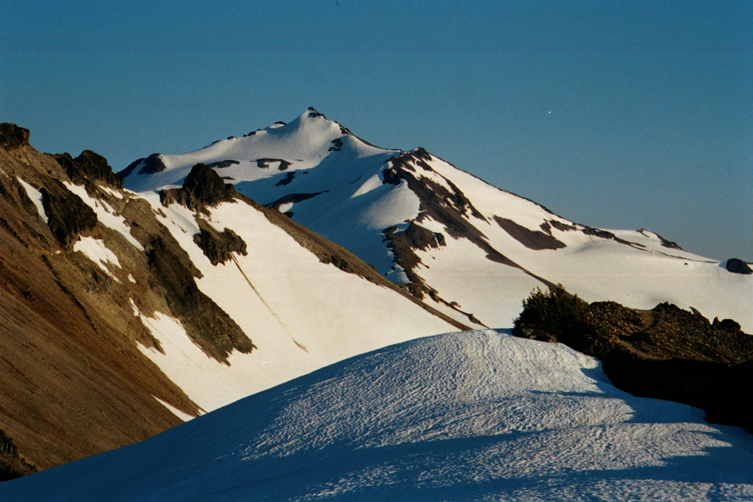
A snowy, craggy mountain peak rises against a clear blue sky, with a foreground covered in snow drifts and rocky slopes.
A view of Old Snowy Mountain from the Pacific Crest Trail in the Goat Rocks Wilderness.

Gifford Pinchot National Forest history and protected-area timeline

The origins of Gifford Pinchot National Forest go back to 1897, when portions of the present-day forest were included in the Mount Rainier Forest Reserve. On July 1, 1908, approximately 941,440 acres were formally set aside as the Columbia National Forest, making it one of the older national forests in the United States.

In 1855, the U.S. government had negotiated land cession treaties with tribes across the region. The Yakama tribe signed an agreement that moved them to a reservation while preserving off-reservation resource rights, including access to hunting grounds and huckleberry fields. That treaty relationship was challenged in 1916, when the Washington State Supreme Court ruled that Yakama members hunting off the reservation had to comply with state fish and game laws, a decision that fractured the original agreement and set up ongoing tensions over land use on the forest.

In 1949, the Columbia National Forest was officially renamed Gifford Pinchot National Forest at a dedication ceremony at La Wis Wis Campground on June 15. The renaming honored Gifford Pinchot, the first Chief of the U.S. Forest Service and a leading voice in the creation of the national forest system. His widow, Cornelia Bryce Pinchot, addressed the assembled audience.

In 1982, Congress established the Mount St. Helens National Volcanic Monument within the forest, following the devastating 1980 eruption that reshaped the mountain and its surroundings. The 1985 formation of the Gifford Pinchot Task Force brought an organized nonprofit voice to conservation advocacy for the forest, and subsequent decades saw continued congressional designations of wilderness areas and management responses to wildfire, including the 2024 Williams Mine fire, which burned more than 11,900 acres and prompted protected removal of historic Forest Service buildings such as the over-100-year-old Gotchen Creek Guard Station.

Gifford Pinchot National Forest landscape and geographic character

The landscape of Gifford Pinchot National Forest is overwhelmingly volcanic, shaped by the Cascade Range and a chain of stratovolcanoes and smaller volcanic features. The forest's terrain climbs from the deep Columbia River Gorge in the south to the glaciated flanks of Mount Adams, the highest point at 12,276 feet. Mount St. Helens dominates the western side, with an active crater still steaming within the National Volcanic Monument. Between these peaks, the forest drops into broad river valleys, forested ridges, and high plateaus.

The Goat Rocks, a rugged alpine area of sharp peaks, tarns, and meadows, mark a transition zone in the northern part of the forest. Subalpine meadows burst with wildflowers in summer, and the surrounding ridgelines carry the Pacific Crest Trail across its high route. To the south, the Indian Heaven Volcanic Field contributes a distinctive topography of cinder cones, small shield volcanoes, and dozens of lakes scattered across relatively gentle terrain.

Lava flows and volcanic features are visible throughout the forest, from the broad Big Lava Bed, one of the youngest and largest lava flows in the contiguous United States, to the Ape Caves lava tubes, Ice Caves, and other volcanic casts. River canyons such as the Lower Falls of the Lewis River cut deep into the volcanic bedrock, while reservoirs like Riffe Lake, Swift Reservoir, and Mayfield Reservoir shape parts of the Cowlitz and Lewis River valleys. The result is a landscape where fire, ice, and water have all left clear marks on what is otherwise a heavily forested terrain.
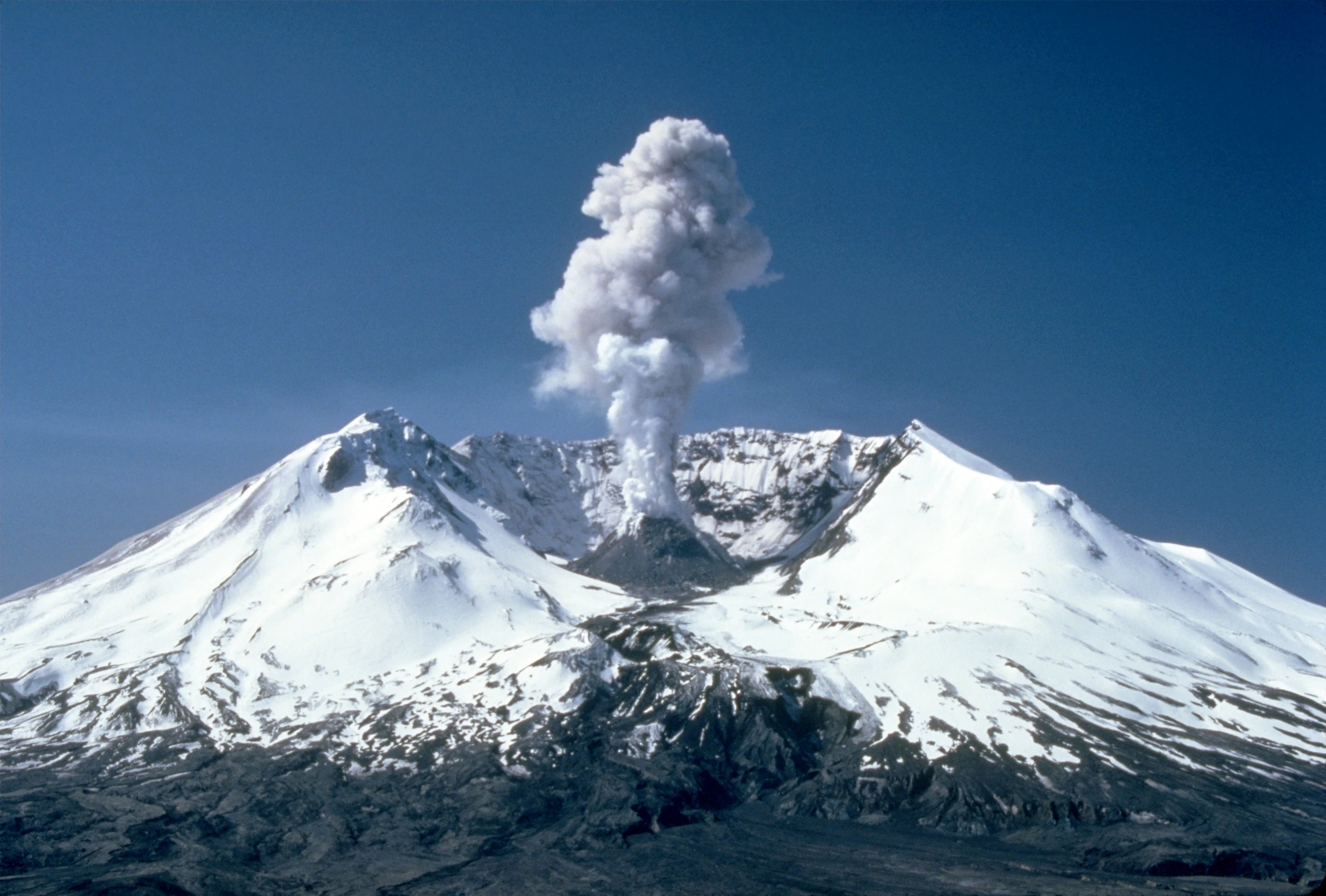
A view of the snow-covered peak of Mount St. Helens with a large plume of steam and ash rising from the crater against a clear blue sky.
A volcanic plume rising from the crater of Mount St. Helens, 1982.

Gifford Pinchot National Forest ecosystems, habitats, and plant life

Gifford Pinchot National Forest encompasses a wide elevation gradient, from low-elevation river canyons near the Columbia River up to glaciated peaks above 12,000 feet. This range supports a layered set of Pacific Northwest ecosystems. Lower and mid-elevation slopes are dominated by dense coniferous forests, with Douglas-fir, western hemlock, western red cedar, and other species typical of wet Cascade environments. A 1993 Forest Service study estimated roughly 198,000 acres of old growth across the forest, much of it protected within wilderness areas.

Above the forests, the forest climbs into parklike subalpine zones of mountain hemlock and subalpine fir, often interspersed with glacially carved meadows used heavily by elk and deer. Wetland complexes, high lakes, and glacial kettle ponds add important aquatic and semi-aquatic habitat. The Midway High Lakes Area on the flanks of Mount Adams, the Indian Heaven Wilderness lakes, and the lake basins around Goat Rocks are particularly distinctive, supporting cold-water fish populations and dense stands of huckleberry that themselves shape the forest's ecology through traditional Native American burning practices.

The river systems of the forest, including the Lewis, Cispus, Cowlitz, White Salmon, Little White Salmon, Wind, and Muddy Rivers, are central to its ecological identity. These rivers, fed by abundant Pacific Northwest rainfall and meltwater from Mount Adams glaciers, sustain salmon and trout populations and have been central to discussions about Wild and Scenic designation. The recommended additions of the Lewis, Cispus, Clear Fork, and Muddy Fork of the Cowlitz, along with thirteen rivers under further study, reflect the unusually rich river heritage protected within the forest.
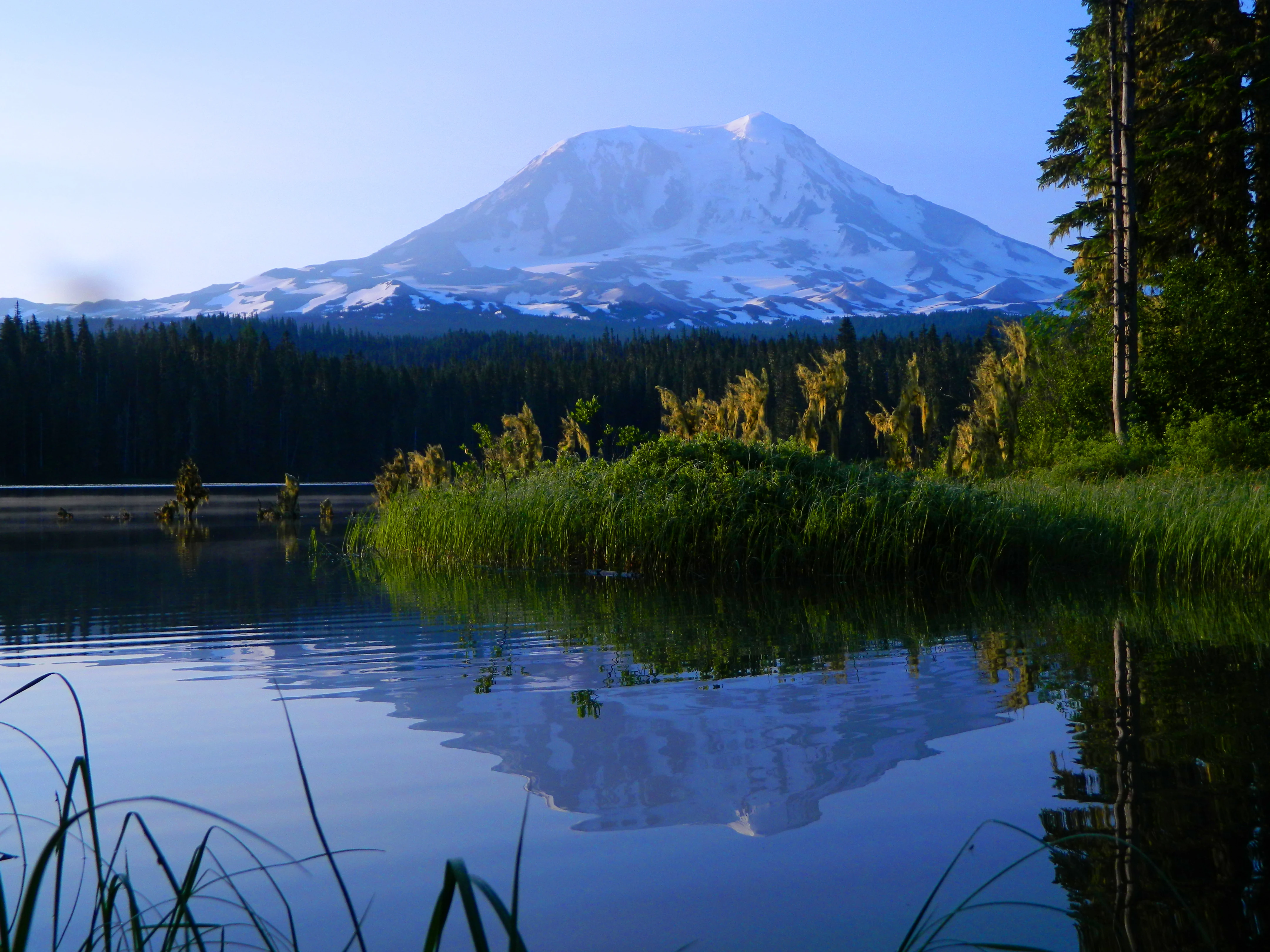
A snow capped volcanic mountain peak rising above a forest line, mirrored perfectly in the calm, dark water of a lake in the foreground.
Early morning light illuminates Mount Adams as it reflects in the calm waters of Takhlakh Lake.

Gifford Pinchot National Forest wildlife and species highlights

Gifford Pinchot National Forest supports a broad range of Cascade wildlife, including several large predators at the top of its food webs. Black bears are widespread across forested slopes, while mountain lions roam the more remote ridges, canyons, and wilderness areas. The U.S. Forest Service advises visitors to follow bear country and cougar country protocols, including careful management of trash and food in backcountry areas.

Elk and deer, particularly Roosevelt elk and black-tailed deer, thrive in the meadow and forest-edge habitats of the forest, and the high meadows near receding glaciers have been used for hunting for thousands of years. Small carnivores, raptors, and a wide variety of songbirds inhabit the old-growth canopy.

The Northern Spotted Owl, federally listed as threatened in 2012, is among the most sensitive species depending on the forest's older forest stands. The forest's rivers are especially important for anadromous fish: bull trout were listed as threatened in 1998, and chinook salmon, coho salmon, and steelhead were all listed as threatened in 2011. These fish runs, supported by healthy river gravels and cold water, are a defining wildlife feature of Gifford Pinchot's river corridors.
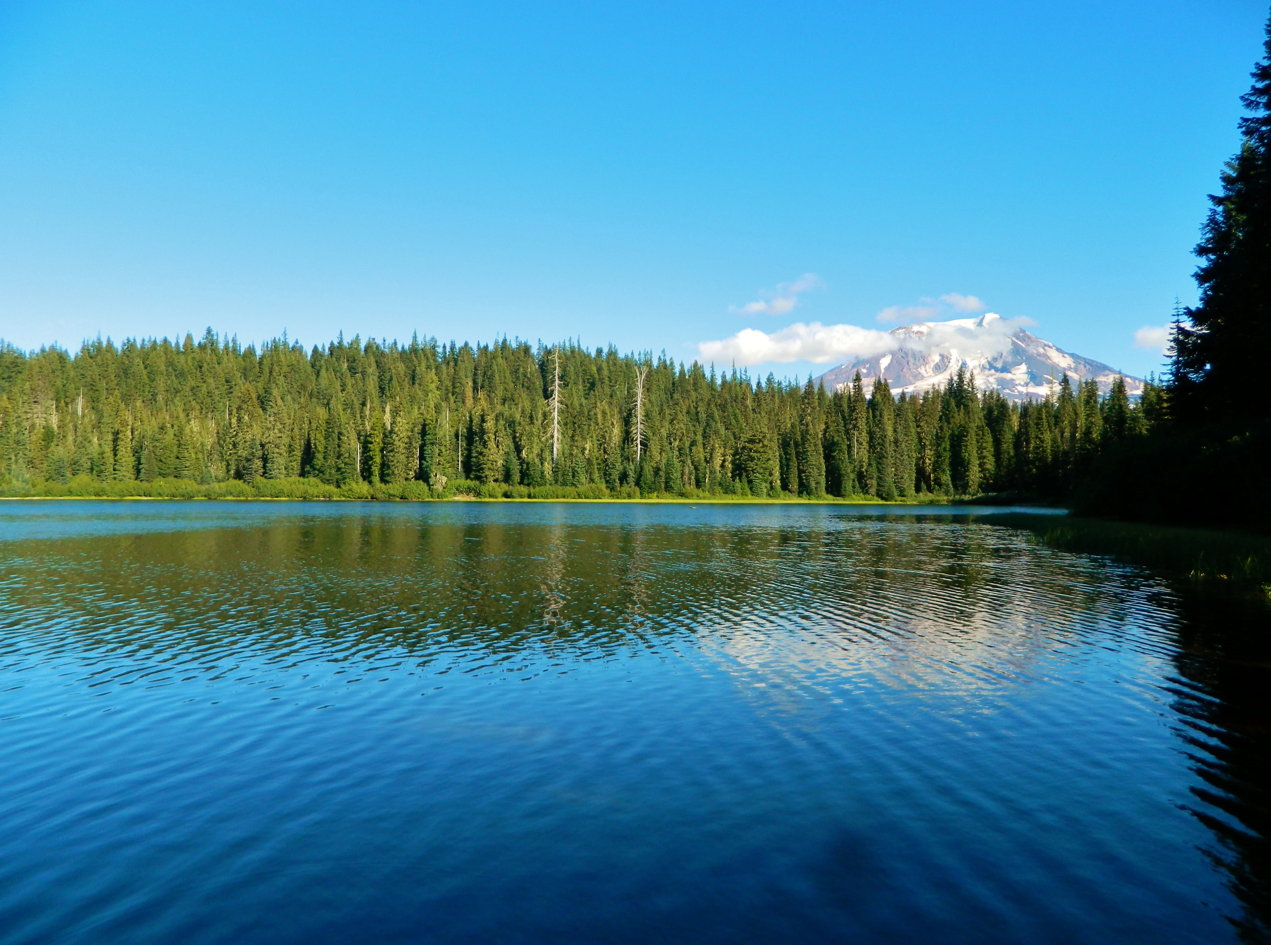
A clear blue lake in the foreground reflecting a distant, snow-covered volcanic peak behind a dense green forest of coniferous trees under a bright blue sky.
A view of Olallie Lake with a distant snow-capped mountain peak rising above the evergreen forest in Gifford Pinchot National Forest.

Gifford Pinchot National Forest conservation status and protection priorities

Gifford Pinchot National Forest is a cornerstone of federal forest conservation in Washington State. It is one of the older national forests in the United States and a key component of the broader Pacific Northwest forest system, with its conservation framework shaped directly by the legacy of Gifford Pinchot, the founding Chief of the U.S. Forest Service. The forest has been a focal point for early debates over sustained-yield forestry, wilderness preservation, and the balance between resource extraction and ecological protection.

Since 1964, Congressional action has established seven wilderness areas wholly or partly within the forest, including Glacier View, Goat Rocks, Indian Heaven, Mount Adams, Tatoosh, Trapper Creek, and William O. Douglas. The 1982 Mount St. Helens National Volcanic Monument added a distinct layer of protection, preserving a landscape of active volcanism and ecological recovery around one of the most studied eruptions of the modern era.

The forest is also critical habitat for threatened species, including Northern Spotted Owl, bull trout, chinook salmon, coho salmon, and steelhead, and is recognized for its substantial old-growth reserves. Culturally, the Sawtooth Berry Fields, designated in a 1932 handshake agreement between the Forest Service and Yakama Chief William Yallup, represent a rare formal recognition of tribal huckleberry rights. The 1985 formation of the Gifford Pinchot Task Force further institutionalized conservation advocacy for the forest, and ongoing management continues to grapple with wildfire risks, such as the 2024 Williams Mine fire, and with the challenge of balancing public access, tribal rights, wildlife protection, and forest health.

Gifford Pinchot National Forest cultural meaning and human context

Gifford Pinchot National Forest has been inhabited and used for at least 6,000 years, with Native peoples hunting in high meadows below receding glaciers and shaping the landscape through practices including targeted burning to support huckleberry production. Archaeological sites such as Layser Cave show continuous use extending thousands of years before the present, and more than 6,000 culturally modified trees have been identified across the forest, roughly 3,000 of which are now formally protected through Forest Service programs.

The 1855 Treaty of 1855 with the Yakama tribe established a complex legal and cultural framework for off-reservation resource use. Although later court rulings weakened these protections, the relationship between the forest and the Yakama and other tribes remains active, particularly around huckleberry harvesting. The Sawtooth Berry Fields, set aside through the 1932 handshake agreement between Forest Supervisor J.R. Bruckart and Yakama Chief William Yallup, are a rare woodland cultural reserve.

The forest also carries strong associations with American conservation history. Its 1949 renaming honored Gifford Pinchot and symbolized the institutionalization of the U.S. Forest Service. The Pinchot family legacy, including his widow Cornelia Bryce Pinchot, is part of the forest's identity, and the historic Gotchen Creek Guard Station, more than 100 years old, reflects a long tradition of ranger presence across the Cascades.
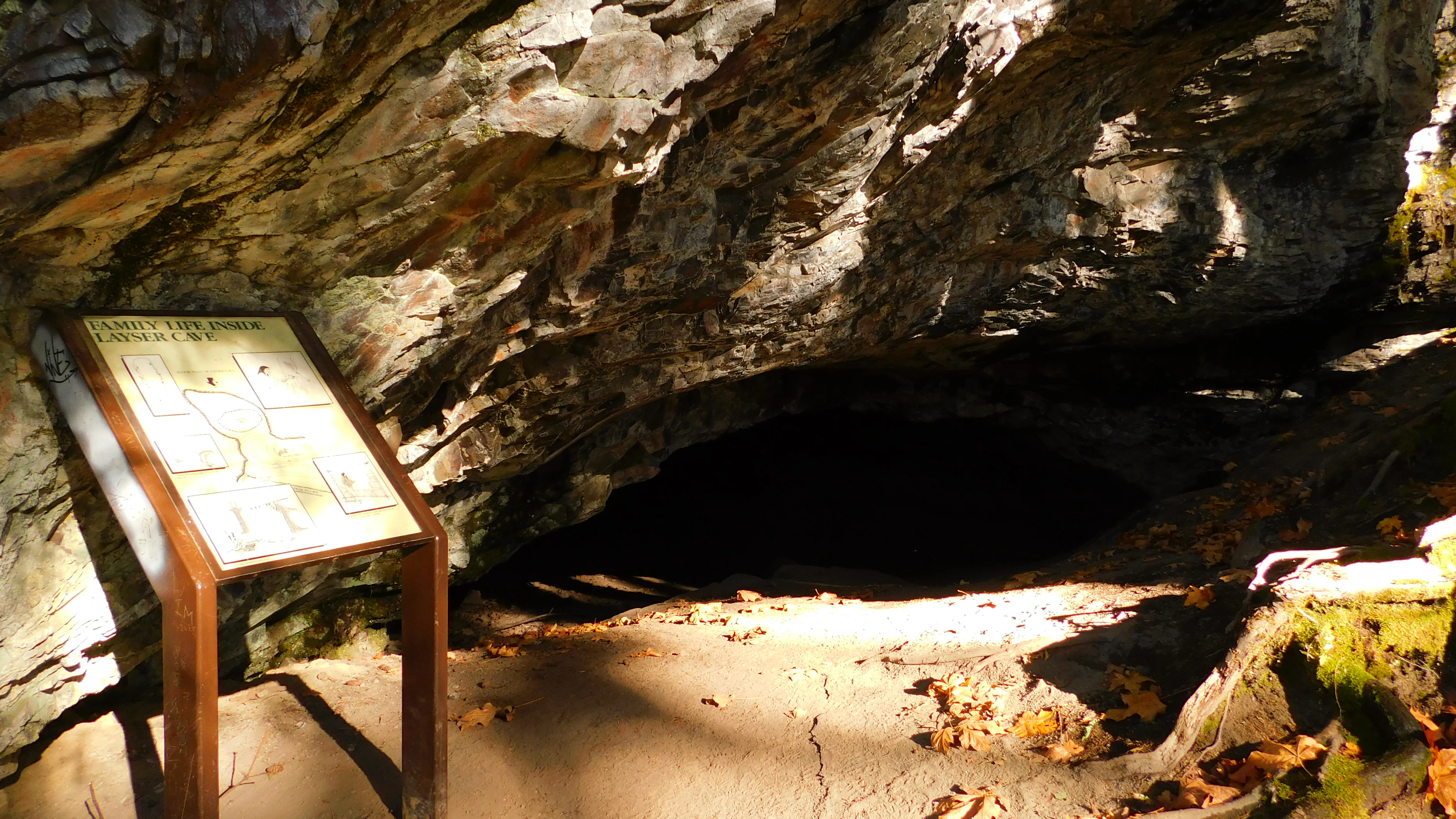
A weathered cave entrance is partially illuminated by sunlight, with a wooden interpretive sign standing in the foreground showing information about the archaeological site.
An informational sign placed outside the entrance of Layser Cave in Gifford Pinchot National Forest.

Top sights and standout views in Gifford Pinchot National Forest

Among the most distinctive features of Gifford Pinchot National Forest are the Mount St. Helens National Volcanic Monument, with its recovering blast zone and steaming crater, and the glaciated flanks of Mount Adams, the second-tallest volcano in Washington. The Goat Rocks Wilderness offers sharp alpine terrain along the Pacific Crest Trail, while the Indian Heaven Volcanic Field provides a rare concentration of cinder cones and lakes.

The forest's river network stands out for both ecological and scenic value, anchored by the Wild and Scenic White Salmon River and supplemented by major rivers such as the Lewis, Cispus, Cowlitz, Little White Salmon, Wind, and Muddy. Lake districts like the Midway High Lakes Area below Mount Adams and the Goose Lake area at Indian Heaven offer premier fishing, and the Ape Caves and Big Lava Bed showcase the volcanic origin of the broader landscape. The forest's old-growth reserves, its seven designated wilderness areas, and its deep tribal heritage make it one of the most varied protected landscapes in the Pacific Northwest.

Best time to visit Gifford Pinchot National Forest

Summer is the most broadly rewarding season to visit Gifford Pinchot National Forest, when mountain roads are typically open, high-country lakes and meadows are accessible, and snow has retreated from most hiking trails. The Pacific Northwest's relatively dry summers make this the prime window for backpacking, climbing, and visiting high lakes such as those in the Goat Rocks, Indian Heaven, and Midway High Lakes areas.

Late summer also brings the forest's well-known commercial huckleberry harvest, a key cultural and ecological event tied to the Sawtooth Berry Fields and broader huckleberry habitat. Spring and fall can be quieter and dramatically scenic, with rushing rivers and fall foliage in the lowland forests, though access to higher elevations may still be limited by snow. Winter brings heavy snowfall to the Cascades and transforms parts of the forest into a snow-based landscape, suited to snowplay, cross-country skiing, and visits to sites such as the Paradise area near Mount Rainier, though many high trails and roads close for the season.
Monthly climate preview

Long-term representative monthly temperature and precipitation rhythm

Gifford Pinchot National Forest Climate Normals and Annual Weather Patterns

Gifford Pinchot National Forest exhibits a measured annual cycle ranging from freezing winter minimums to warm summer maximums alongside varying monthly precipitation rates. Analyzing the complete twelve-month record reveals detailed baseline temperature bounds and moisture distributions across the protected landscape.
Annual mean7 °C
-1 °C16 °C
Jan-1°
Feb
Mar
Apr
May
Jun12°
Jul16°
Aug16°
Sep13°
Oct
Nov
Dec-1°
Warmest month
August

16.1 °C

Coolest month
December

-1.3 °C

Wettest month
December

10.4 mm/day

Driest month
July

0.7 mm/day

Park location guide

Geography guide, regional context, and park location map for Gifford Pinchot National Forest

Gifford Pinchot National Forest park geography, regions, and map view in United States of America

Understand where Gifford Pinchot National Forest sits in United States of America through a broader geographic reading of the surrounding landscape, nearby location context, and its mapped position within the national park landscape.

How Gifford Pinchot National Forest fits into United States of America

The United States of America is a federal presidential republic and one of the world's largest countries by area and population. It consists of 50 states across a vast territory spanning multiple time zones, with its capital in Washington, D.C. and largest city in New York City. The nation has a diverse economy, influential political system, and significant cultural and military presence globally.

Wider geography shaping Gifford Pinchot National Forest in United States of America

The United States occupies a vast territory in North America, bordered by Canada to the north and Mexico to the south. The 48 contiguous states stretch from the Atlantic to the Pacific Ocean, while Alaska occupies the northwestern region and Hawaii is an archipelago in the Pacific. The country encompasses diverse terrain including the Rocky Mountains, Appalachian Mountains, Great Plains, and extensive river systems.

Map view of Gifford Pinchot National Forest

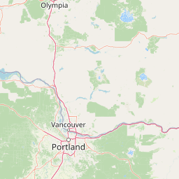
Use this park location map to pinpoint Gifford Pinchot National Forest in United States of America, understand its exact geographic position, and read its mapped placement within the surrounding landscape more clearly.

Pigeon | © OpenStreetMap contributors

Location context for Gifford Pinchot National Forest

Washington
Natural feature types

Explore the Geographic Landscapes of Gifford Pinchot National Forest

Navigate the full range of volcanic, alpine, and riverine features across Gifford Pinchot National Forest. MoriAtlas provides a structured atlas perspective on these natural landmarks to help identify the complex terrain defining this Washington wilderness.
Recorded earthquake history

Review the Seismic History and Earthquake Records of Gifford Pinchot National Forest

Investigate documented seismic events occurring in the vicinity of Gifford Pinchot National Forest. This MoriAtlas catalogue provides a structured, searchable overview of historic ground motion records, allowing for an in-depth look at regional data, magnitude trends, and epicentre proximities across the forest terrain.

Gifford Pinchot National Forest Earthquake History

Catalogued events

1,331 events

Strongest magnitude

Magnitude 6.8

Most recent event

Sep 5, 2026

This history includes earthquakes recorded inside the park or within 50 km of its borders

Visual reference guide for Cascade Range terrain, old-growth forests, and alpine habitats.

Gifford Pinchot National Forest Photos and Volcanic Landscape Scenery

Examine comprehensive visual documentation of Gifford Pinchot National Forest through detailed imagery of its volcanic terrain, glaciated peaks, and river valleys. These photographs provide essential geographic context for understanding the protected landscapes, old-growth reserves, and rugged alpine environments of the region.

A snowy, craggy mountain peak rises against a clear blue sky, with a foreground covered in snow drifts and rocky slopes.

A wide, multi-tiered waterfall cascading over dark basalt rock into a calm, turquoise plunge pool, framed by lush overhanging forest foliage.

A view of the snow-covered peak of Mount St. Helens with a large plume of steam and ash rising from the crater against a clear blue sky.

A snow capped volcanic mountain peak rising above a forest line, mirrored perfectly in the calm, dark water of a lake in the foreground.

A clear blue lake in the foreground reflecting a distant, snow-covered volcanic peak behind a dense green forest of coniferous trees under a bright blue sky.

A dirt hiking trail follows a rocky ridgeline toward a mountain summit, with two hikers walking along the path and a large, snow-covered volcanic peak visible in the background under a blue sky.

A weathered cave entrance is partially illuminated by sunlight, with a wooden interpretive sign standing in the foreground showing information about the archaeological site.

Park atlas

Compare surrounding Cascade Range landscapes and connected regional wilderness areas

Explore Protected Areas and Parks Near Gifford Pinchot National Forest

Trace regional park geography by comparing adjacent volcanic terrain, old-growth reserves, and protected river valleys. Broaden your exploration of Pacific Northwest conservation landscapes beyond Gifford Pinchot National Forest.
A watercolor painting showing a soft, stylized landscape of a green forested valley with distant rolling hills.
Wildlife reserveWashington
Park boundaries overlap#1 closest

South

Indian Heaven Wilderness: Volcanic Plateau Geography and Protected Cascade Landscapes

Volcanic peaks, high-elevation lakes, and expansive meadows in Washington.

Indian Heaven Wilderness encompasses a broad volcanic plateau in the southern Washington Cascades, famous for its dense concentration of lakes, ponds, and volcanic landforms. The area features a complex mosaic of cinder cones, shield volcanoes, and subalpine forests, offering a unique geographic perspective on the Pacific Northwest. Delve into the protected boundaries and mapped terrain of this significant wilderness area.

Area
84.1 km²
Established
1984
Visitors
8K annual
Relief
Mountain
Watercolor painting of a snow covered volcanic mountain peak in the distance behind a foreground of green meadow, wildflowers, and a winding river.
Wildlife reserveWashington
Park boundaries overlap#2 closest

East

Mount Adams Wilderness: Volcanic Terrain and Protected Landscapes in Washington State

Mapping the high altitude meadows and volcanic ridges

Spanning roughly 47,700 acres, Mount Adams Wilderness presents a unique geological mosaic of cinder cones, lava flows, and permanent snowfields. The area offers a profound look at Cascade Range geography, from its western forested valleys to its open alpine basins, serving as a critical protected landscape for understanding volcanic, glacial, and fluvial processes in the Pacific Northwest.

Area
193.07 km²
Established
1964
IUCN
Ib
Relief
Mountain
National parkWashington
Park boundaries overlap#3 closest

North

Mount Rainier National Park: A National Park in Washington with Distinct Mapped Boundaries

Explore its protected landscape and regional geography.

Mount Rainier National Park represents a core protected area within Washington State, offering rich opportunities for geographic discovery through its mapped boundaries and natural terrain. As a designated national park, it contributes significantly to the atlas of United States protected lands. This destination allows for detailed exploration of its landscape context, making it an essential point of reference for understanding regional geography and conservation areas.

Area
956.6 km²
Established
1899
IUCN
II
Visitors
1.6M annual
A watercolor painting of a mountain landscape with soft-colored rolling hills, a green forest line, and foreground vegetation on a white background.
Protected landscapeWashington
Park boundaries overlap#4 closest

North

Okanogan, Wenatchee National Forest: A Comprehensive Look at Washington's Protected Mountain Landscapes

Mapping ecological gradients and wilderness boundaries across the eastern Cascade Range

Spanning from the moist coniferous forests of the western Cascades to the arid plateaus of the Okanogan, this massive national forest protects an unmatched diversity of terrain. Explore the intricate geography of river-carved valleys, glacial cirques, and remote wilderness areas that characterize this critical environmental corridor in the Pacific Northwest.

Area
6,066.33 km²
Established
1911
Visitors
397K annual
Relief
Mountain
A watercolor painting showing a snowy mountain peak in the background rising above rolling green hills and pine forests in the foreground.
Protected landscapeOregon
0.5 km away#5 closest

South

Mount Hood National Forest: Atlas of Protected Landscapes and Volcanic Geography

Exploring the Cascade Range terrain and wilderness boundaries in Oregon.

Mount Hood National Forest encompasses a vast, rugged expanse of the Oregon Cascades, anchored by the iconic, glacier-clad Mount Hood. This protected landscape contains extensive old-growth forests, high-alpine lakes, and deep river canyons. Discover the geographic extent of these wilderness areas and mountain terrain within the MoriAtlas database of protected lands.

Area
4,318.17 km²
Established
1908
Visitors
4.4M annual
Relief
Mountain
Wildlife reserveOregon
0.7 km away#6 closest

South

Mark O. Hatfield Wilderness: An Atlas of Basalt Canyons and Cascade Mountain Terrain

Protected rugged wilderness located in Oregon

Spanning from the Columbia River Gorge to the slopes of Mount Hood, the Mark O. Hatfield Wilderness preserves an array of forest stands, hanging meadows, and steep ridgelines. The area serves as a critical geographic hub within the Cascade Range, offering detailed insight into the volcanic geology and drainage systems that shape this iconic portion of Oregon.

Area
266.37 km²
Established
1984
IUCN
Ib
Relief
Mountain
A watercolor painting showing a panoramic view of mountain peaks in the distance above green foothills and plains.
Protected landscapeWashington
9.7 km away#7 closest

North

Mount Baker, Snoqualmie National Forest: Mapped Geography and Protected Landscape Analysis

Exploratory atlas of Washington's primary Cascade Range wilderness

Delve into the structural geography of Mount Baker, Snoqualmie National Forest. This protected area corridor serves as a major ecological transition zone between the Puget Sound lowlands and the interior Cascades, characterized by extensive glaciers, wild river systems, and iconic stratovolcanoes that define the regional landscape of Washington state.

Area
6,978 km²
Established
1974
Relief
Mountain
Climate
Alpine
Protected landscapeOregon
22 km away#8 closest

South

Mount Hood National Recreation Area: Oregon Protected Landscape and Regional Geography

A three-unit recreational forest landscape in the Cascade Range.

Spanning over 34,000 acres, this protected landscape frames the lower volcanic slopes and forested drainages around Mount Hood. The area integrates river corridors, wilderness boundaries, and subalpine terrain, offering a clear view of the complex topography that defines the Cascade Range in northern Oregon.

Area
139.8 km²
Established
2009
Relief
Mountain
Climate
Temperate

Common questions about visiting, size, designation, and location context for Gifford Pinchot National Forest

Gifford Pinchot National Forest FAQs for park facts, access, geography, and protected area context

Find quick answers about Gifford Pinchot National Forest, including protected-area facts, park geography, trail and visitor context, and how the park fits into its surrounding country and regional landscape.
MoriAtlas Explorer

Continue Your Protected Areas Search Across the Global Atlas

Deepen your exploration by continuing the structured search for national parks and protected areas worldwide. Utilize the comprehensive filtering capabilities to compare different conservation landscapes and refine your understanding of global park geography. Discover more about the distribution and characteristics of protected natural areas.

Global natural geography