Mori Atlas logo
Nearby park discovery

Mapping regional protected areas and volcanic landscape clusters near the Cascade Range

National Forests and Protected Landscapes Near Gifford Pinchot National Forest in Washington

Identify protected lands and natural areas situated within the geographic proximity of Gifford Pinchot National Forest in southern Washington. This index provides a spatial perspective on regional park distribution, helping to trace landscape connections across the Cascade Range and volcanic terrain. Use this resource to examine the proximity and environmental context of surrounding protected areas without relying on road-based travel metrics.

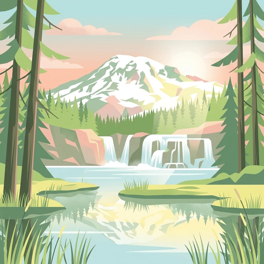
A digital illustration of a scenic park landscape featuring a prominent snow-capped mountain in the background, a multi-tiered waterfall cascading into a calm lake, and dense coniferous forests in the foreground.

A vast Cascade Range forest linking Mount Rainier, Mount Adams, Mount St. Helens, and the Columbia River.

Gifford Pinchot National Forest

Gifford Pinchot National Forest is a large protected forest in southern Washington State, managed by the U.S. Forest Service. It covers roughly 1.32 million acres along the western slopes of the Cascade Range, stretching from Mount Rainier National Park in the north to the Columbia River in the south. The forest is defined by deeply volcanic terrain, with Mount Adams as its highest point and the Mount St. Helens National Volcanic Monument sitting within its western boundary. The landscape combines expansive old-growth forests, glaciated alpine peaks, subalpine meadows, lava flows, and an extensive network of rivers and lakes. It is one of the older national forests in the United States, with roots going back to the Mount Rainier Forest Reserve of 1897 and the Columbia National Forest established in 1908. A 1949 renaming ceremony honored Gifford Pinchot, the first Chief of the U.S. Forest Service and a central figure in American conservation history. Today the forest is notable for its wilderness areas, volcanic scenery, salmon and trout habitat, and a long-running cultural connection to Native American tribes, particularly the Yakama. It also serves as a recreational landscape for hiking, fishing, backcountry camping, and through-hiking on the Pacific Crest Trail.

Location
United States of America
Park type
Protected landscape
Established
1908
Area
5,348 km²
Highest point
3,742 m
Gifford Pinchot National Forest Atlas
Regional park map

See the ranked park cluster in its geographic setting

Nearby parks around Gifford Pinchot National Forest

This regional map shows the same 20 nearby parks ranked below around Gifford Pinchot National Forest. Select a ranked marker to highlight that park’s boundary where boundary data is available.
Reference park: Gifford Pinchot National ForestRanked nearby parkSelected boundary: Gifford Pinchot National Forest20 nearby parks shown
20 nearby parks

Distance ranked comparison index of surrounding protected landscapes and regional park geography

Parks and Protected Areas Geographically Near Gifford Pinchot National Forest

Examine the ranked collection of nearby protected areas sharing geographic proximity with Gifford Pinchot National Forest based on direct boundary measurements. Compare surrounding park environments, regional spacing, and national conservation contexts across adjacent terrain.
A watercolor painting showing a soft, stylized landscape of a green forested valley with distant rolling hills.
Wildlife reserveWashington
Park boundaries overlap#1 closest

South

Indian Heaven Wilderness: Volcanic Plateau Geography and Protected Cascade Landscapes

Volcanic peaks, high-elevation lakes, and expansive meadows in Washington.

Indian Heaven Wilderness encompasses a broad volcanic plateau in the southern Washington Cascades, famous for its dense concentration of lakes, ponds, and volcanic landforms. The area features a complex mosaic of cinder cones, shield volcanoes, and subalpine forests, offering a unique geographic perspective on the Pacific Northwest. Delve into the protected boundaries and mapped terrain of this significant wilderness area.

Area
84.1 km²
Established
1984
Visitors
8K annual
Relief
Mountain
Watercolor painting of a snow covered volcanic mountain peak in the distance behind a foreground of green meadow, wildflowers, and a winding river.
Wildlife reserveWashington
Park boundaries overlap#2 closest

East

Mount Adams Wilderness: Volcanic Terrain and Protected Landscapes in Washington State

Mapping the high altitude meadows and volcanic ridges

Spanning roughly 47,700 acres, Mount Adams Wilderness presents a unique geological mosaic of cinder cones, lava flows, and permanent snowfields. The area offers a profound look at Cascade Range geography, from its western forested valleys to its open alpine basins, serving as a critical protected landscape for understanding volcanic, glacial, and fluvial processes in the Pacific Northwest.

Area
193.07 km²
Established
1964
IUCN
Ib
Relief
Mountain
National parkWashington
Park boundaries overlap#3 closest

North

Mount Rainier National Park: A National Park in Washington with Distinct Mapped Boundaries

Explore its protected landscape and regional geography.

Mount Rainier National Park represents a core protected area within Washington State, offering rich opportunities for geographic discovery through its mapped boundaries and natural terrain. As a designated national park, it contributes significantly to the atlas of United States protected lands. This destination allows for detailed exploration of its landscape context, making it an essential point of reference for understanding regional geography and conservation areas.

Area
956.6 km²
Established
1899
IUCN
II
Visitors
1.6M annual
A watercolor painting of a mountain landscape with soft-colored rolling hills, a green forest line, and foreground vegetation on a white background.
Protected landscapeWashington
Park boundaries overlap#4 closest

North

Okanogan, Wenatchee National Forest: A Comprehensive Look at Washington's Protected Mountain Landscapes

Mapping ecological gradients and wilderness boundaries across the eastern Cascade Range

Spanning from the moist coniferous forests of the western Cascades to the arid plateaus of the Okanogan, this massive national forest protects an unmatched diversity of terrain. Explore the intricate geography of river-carved valleys, glacial cirques, and remote wilderness areas that characterize this critical environmental corridor in the Pacific Northwest.

Area
6,066.33 km²
Established
1911
Visitors
397K annual
Relief
Mountain
A watercolor painting showing a snowy mountain peak in the background rising above rolling green hills and pine forests in the foreground.
Protected landscapeOregon
0.5 km away#5 closest

South

Mount Hood National Forest: Atlas of Protected Landscapes and Volcanic Geography

Exploring the Cascade Range terrain and wilderness boundaries in Oregon.

Mount Hood National Forest encompasses a vast, rugged expanse of the Oregon Cascades, anchored by the iconic, glacier-clad Mount Hood. This protected landscape contains extensive old-growth forests, high-alpine lakes, and deep river canyons. Discover the geographic extent of these wilderness areas and mountain terrain within the MoriAtlas database of protected lands.

Area
4,318.17 km²
Established
1908
Visitors
4.4M annual
Relief
Mountain
Wildlife reserveOregon
0.7 km away#6 closest

South

Mark O. Hatfield Wilderness: An Atlas of Basalt Canyons and Cascade Mountain Terrain

Protected rugged wilderness located in Oregon

Spanning from the Columbia River Gorge to the slopes of Mount Hood, the Mark O. Hatfield Wilderness preserves an array of forest stands, hanging meadows, and steep ridgelines. The area serves as a critical geographic hub within the Cascade Range, offering detailed insight into the volcanic geology and drainage systems that shape this iconic portion of Oregon.

Area
266.37 km²
Established
1984
IUCN
Ib
Relief
Mountain
A watercolor painting showing a panoramic view of mountain peaks in the distance above green foothills and plains.
Protected landscapeWashington
9.7 km away#7 closest

North

Mount Baker, Snoqualmie National Forest: Mapped Geography and Protected Landscape Analysis

Exploratory atlas of Washington's primary Cascade Range wilderness

Delve into the structural geography of Mount Baker, Snoqualmie National Forest. This protected area corridor serves as a major ecological transition zone between the Puget Sound lowlands and the interior Cascades, characterized by extensive glaciers, wild river systems, and iconic stratovolcanoes that define the regional landscape of Washington state.

Area
6,978 km²
Established
1974
Relief
Mountain
Climate
Alpine
Protected landscapeOregon
22 km away#8 closest

South

Mount Hood National Recreation Area: Oregon Protected Landscape and Regional Geography

A three-unit recreational forest landscape in the Cascade Range.

Spanning over 34,000 acres, this protected landscape frames the lower volcanic slopes and forested drainages around Mount Hood. The area integrates river corridors, wilderness boundaries, and subalpine terrain, offering a clear view of the complex topography that defines the Cascade Range in northern Oregon.

Area
139.8 km²
Established
2009
Relief
Mountain
Climate
Temperate
A watercolor painting showing a wide, panoramic view of a mountain range in the background, rolling green hills in the midground, and a small cluster of evergreen trees in the foreground against a white background.
Wildlife reserveOregon
26 km away#9 closest

South

Mount Hood Wilderness: Atlas of Volcanic Peaks and Glacial Geography in Oregon

High-altitude protected landscapes and forest ecosystems

This protected area captures the dramatic character of the Cascade Range through its signature volcanic terrain, ancient forests, and high-alpine ridges. Covering a vast vertical range, the wilderness offers a study in geologic forces, featuring active glaciers, deep basaltic canyons, and meadows that define the mountain's northern and western slopes.

Area
262 km²
Established
1964
IUCN
Ib
Visitors
10K annual
Wildlife reserveOregon
About 47 km away#10 closest

South

Roaring River Wilderness: Geography and Protected Area Atlas of Oregon

Ancient forest corridors and alpine lake landscapes

Roaring River Wilderness is a federally protected landscape in Oregon, defined by steep, tree-covered ridges and the vigorous Roaring River. This wilderness preserves a dense mosaic of old-growth conifers, high-elevation alpine lakes like Serene and Shellrock, and important salmon-spawning waters within the broader Mount Hood National Forest geography.

Area
148 km²
Established
2009
IUCN
Ib
Relief
Mountain
Protected landscapeOregon
73 km away#11 closest

South

Willamette National Forest: Geography and Protected Landscapes of the Central Oregon Cascades

Mapped terrain, old-growth forests, and protected wilderness boundaries.

Explore the expansive territory of Willamette National Forest, a primary protected area extending over 100 miles along Oregon's Cascade Range. This region features volcanic peaks exceeding 10,000 feet, extensive old-growth Douglas-fir stands, and a dense network of Wild and Scenic rivers, providing a detailed look at the geographic character and ecological heritage of the Pacific Northwest.

Area
6,790.75 km²
Established
1933
Visitors
1.7M annual
Relief
Mountain
A watercolor painting showing a panoramic view of rolling mountain ranges and dense evergreen forests with a soft, misty aesthetic.
Protected landscapeWashington
88 km away#12 closest

Northwest

Olympic National Forest: Atlas and Geographic Overview of Washington Protected Lands

Temperate rainforests, alpine ridges, and fjord shorelines

Olympic National Forest defines the outer reaches of the Olympic Mountains, featuring a massive expanse of old-growth conifers and high-precipitation temperate rainforests. This protected area connects diverse ecosystems ranging from the brackish waters of Hood Canal to rugged, snow-dusted subalpine ridges. Our detailed geographic mapping highlights the forest's role as a vital buffer and wilderness corridor within the broader Pacific Northwest landscape.

Area
2,541.89 km²
Established
1897
Relief
Mountain
Climate
Temperate
Wildlife reserveWashington
102 km away#13 closest

Northwest

Mount Skokomish Wilderness: Ridge Systems and Alpine Geography in Washington State

Exploration of a protected Olympic Peninsula mountain landscape.

Mount Skokomish Wilderness protects a dramatic stretch of the eastern Olympic Mountains defined by steep ridges and glacial basins. The area serves as a critical headwaters region and offers a dense display of peaks and old-growth forest transitions across its varied elevation profile, providing essential landscape context for the region.

Area
53.79 km²
Established
1984
IUCN
Ib
Relief
Mountain
National parkWashington
105 km away#14 closest

Northwest

Olympic National Park National Park: Geographic Atlas and Protected Landscape Discovery

Explore its unique Washington landscape and mapped protected areas.

Olympic National Park serves as a key protected area within Washington, offering rich opportunities for geographic exploration. This detail page provides essential context on its designation as a national park, its mapped boundaries, and its contribution to the regional geography. Understand the park's specific landscape character and its role within the atlas of protected lands, facilitating a structured approach to discovering its natural terrain and geographic significance.

Area
3,733.8 km²
Established
1938
IUCN
II
Visitors
3.7M annual
Watercolor painting of a coastal landscape with sandy dunes, beach grasses in the foreground, and a dense treeline in the background.
Protected landscapeOregon
108 km away#15 closest

Southwest

Siuslaw National Forest: Oregon Coast Range and Protected Landscape Geography

Coastal dunes, temperate rainforests, and river networks

Explore the mapped boundaries and natural geography of Siuslaw National Forest. This protected landscape highlights the ecological transition from Pacific shorelines to the high-elevation forests of the Oregon Coast Range, encompassing sand dune systems, salmon-supporting streams, and significant wilderness refuges.

Area
2,566.54 km²
Established
1908
Visitors
1M annual
Climate
Temperate
Wildlife reserveOregon
111 km away#16 closest

South

Middle Santiam Wilderness: Geographic Atlas and Protected Landscape Overview of the Oregon Cascades

Old-growth forest basins and volcanic landmarks in the Willamette National Forest.

Middle Santiam Wilderness represents a distinct segment of the central Oregon Cascades. The area is defined by its substantial old-growth coniferous forests, including 450-year-old Douglas-fir and western hemlock stands, alongside the striking 4,965-foot volcanic plug known as Chimney Peak. This map-focused record traces the river-cut valleys and high-ridge topography that shape this protected habitat.

Area
34.57 km²
Established
1984
IUCN
Ib
Relief
Mountain
Protected areaOregon
121 km away#17 closest

Southeast

Ochoco National Forest: Mapping the Rugged Canyons and High Desert of Central Oregon

A vast protected area defined by rimrock plateaus and pine-forest watersheds.

Located in the heart of the Ochoco Mountains, this protected landscape offers a study in ecological contrast. From its dense ponderosa pine groves to the exposed volcanic ridges of the high desert, the forest acts as a critical habitat corridor for mule deer and elk, while protecting the headwaters of the North Fork Crooked River within a diverse, multi-terrain framework.

Area
3,444.01 km²
Established
1911
Visitors
575K annual
Relief
Mountain
Watercolor painting of a rolling mountain landscape with coniferous trees in the foreground and a hazy range of hills in the background.
Wildlife reserveOregon
About 125 km away#18 closest

South

Menagerie Wilderness Wildlife Reserve: Oregon Cascade Range Geography and Rock Pinnacles

Protected Cascade mountain terrain and unique crag clusters

Situated in the central Cascade Range of Oregon, Menagerie Wilderness provides a compact, highly defined landscape of rising rock pinnacles and lush coniferous forest. This resource traces the unique topography and protected boundaries of this specialized wilderness area, offering insight into the geological features and forest ecosystems that distinguish it from surrounding mountainous terrain.

Area
20.37 km²
Established
1984
IUCN
Ib
Relief
Mountain
A soft watercolor painting of a landscape featuring the Twin Pillars volcanic rock formations in the distance, set against rolling green hills and pine forests.
Wildlife reserveOregon
129 km away#19 closest

Southeast

Mill Creek Wilderness: A Comprehensive Geographic Overview of Central Oregon Protected Land

Volcanic geology, canyon topography, and forest ecosystems in Oregon

Mill Creek Wilderness represents a significant protected unit within central Oregon, defined by its complex network of canyons and high-elevation plateaus. The area showcases a unique combination of old-growth ponderosa pine stands, lodgepole pine meadows, and striking volcanic plugs like the Twin Pillars. Its mapped terrain provides essential context for understanding the hydrology and geological evolution of the broader Ochoco mountain range.

Area
70.4 km²
Established
1984
IUCN
Ib
Relief
Mountain
A soft watercolor illustration depicting a range of layered mountain peaks with green slopes and snow-covered summits against a white background.
Wildlife reserveWashington
129 km away#20 closest

North

Glacier Peak Wilderness: Mapping the Volcanic and Glaciated Geography of Washington State

A detailed look at one of the most remote volcanic reserves in the Cascade Range.

Defined by the presence of an isolated stratovolcano and extensive glacial systems, Glacier Peak Wilderness represents a significant protected area within the Washington Cascades. This overview details the rugged landscape, from the deeply incised river valleys of the Chiwawa and Suiattle to the high-alpine rock and ice environment at the peak summit, providing essential geographic context for this roadless wilderness.

Area
2,290.75 km²
Established
1960
IUCN
Ib
Relief
Mountain
Distance methodology

Geographic measurements, not driving distances

How nearby park distances are calculated

Distances use park boundaries whenever the available geometry allows it. When one or both boundaries are missing, the mapped park locations provide a clearly labelled estimate. Every value represents straight-line geographic separation and does not use roads or routing.

Boundary distance

Calculated between the nearest points of both park boundaries.

Location-to-boundary estimate

Estimated from one mapped park location to the nearest boundary of the other park.

Mapped-location estimate

Estimated between the mapped locations of both parks.

MoriAtlas Explorer

Explore the Complex Volcanic Geography and Mapped Boundaries of Gifford Pinchot National Forest

Deepen your understanding of Gifford Pinchot National Forest by examining its unique volcanic terrain, wilderness areas, and river networks within the Washington Cascade Range. Through the MoriAtlas mapping platform, gain insight into the structural composition and geographic significance of this vast protected landscape and its regional context.