
Streams
Park geography
A comprehensive analysis of landscape features, forest cover, and elevation metrics
Gifford Pinchot National Forest Geographic Profile: Mapped Boundaries and Terrain Data
This geographic profile details the physical characteristics of Gifford Pinchot National Forest, including its 5347.95 km squared land area and diverse mountainous terrain. The data spans regional topography, temperate forest ecosystems, and aquatic features such as high-altitude lakes and wetlands within the Washington landscape.
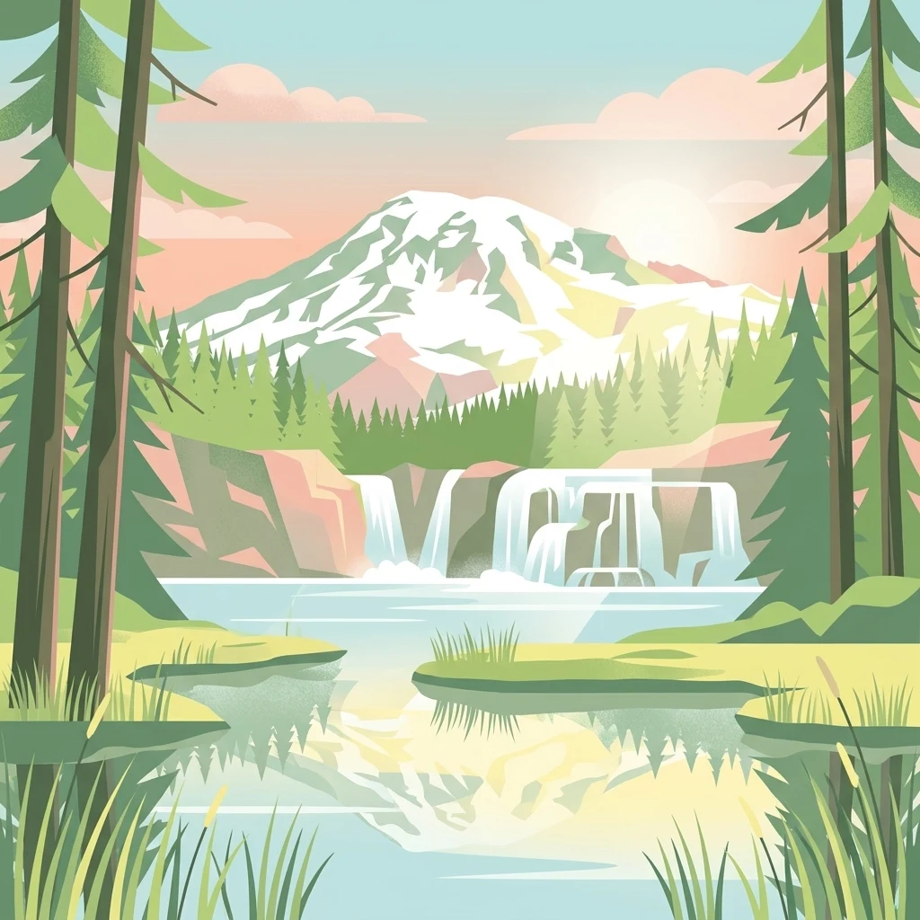
A vast Cascade Range forest linking Mount Rainier, Mount Adams, Mount St. Helens, and the Columbia River.
Gifford Pinchot National Forest
Gifford Pinchot National Forest is a large protected forest in southern Washington State, managed by the U.S. Forest Service. It covers roughly 1.32 million acres along the western slopes of the Cascade Range, stretching from Mount Rainier National Park in the north to the Columbia River in the south. The forest is defined by deeply volcanic terrain, with Mount Adams as its highest point and the Mount St. Helens National Volcanic Monument sitting within its western boundary. The landscape combines expansive old-growth forests, glaciated alpine peaks, subalpine meadows, lava flows, and an extensive network of rivers and lakes. It is one of the older national forests in the United States, with roots going back to the Mount Rainier Forest Reserve of 1897 and the Columbia National Forest established in 1908. A 1949 renaming ceremony honored Gifford Pinchot, the first Chief of the U.S. Forest Service and a central figure in American conservation history. Today the forest is notable for its wilderness areas, volcanic scenery, salmon and trout habitat, and a long-running cultural connection to Native American tribes, particularly the Yakama. It also serves as a recreational landscape for hiking, fishing, backcountry camping, and through-hiking on the Pacific Crest Trail.
- Location
- United States of America
- Park type
- Protected landscape
- Established
- 1908
- Area
- 5,348 km²
- Highest point
- 3,742 m
Location overview
United States of America and Washington Regional Distribution
Gifford Pinchot National Forest Location and Regional Geography
Gifford Pinchot National Forest is situated within the United States of America and the state of Washington. Administrative records outline country memberships and regional designations for spatial navigation.
- Countries
- United States of America
- Regions
- Washington
- Primary location
- Washington
- Geographic setting
- Inland
Boundary and coordinates
Mapped protected boundary geometry and derived spatial measurements
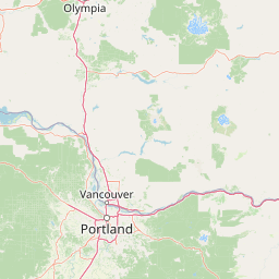
Gifford Pinchot National Forest Boundary Map and Spatial Extent
Interactive boundary mapping outlines the protected perimeter and spatial layout for geographic context. Derived measurements detail the total area and coordinate spans without survey-level precision.
- Boundary area
- 5,834.6 km²
- Boundary perimeter
- 1,349.9 km
- Northernmost point
- 46.8351° N
- Southernmost point
- 45.5567° N
- Easternmost point
- 120.8789° W
- Westernmost point
- 122.512° W
- Geographic centre
- 46.2579° N, 121.8577° W
- North–south span
- 142.1 km
- East–west span
- 126.1 km
Elevation and terrain
Mountain relief metrics and recorded natural water bodies
Gifford Pinchot National Forest Terrain and Elevation Summary
This elevation summary outlines the mountain terrain profile and highest recorded point within Gifford Pinchot National Forest. Individual feature cards detail names, classifications, and spatial relationships for recorded lakes and wetlands.
- Highest point
- 3,742 m
Selected named natural features
Peaks
West Point
1,173 m
Reservoirs
Packwood Lake
872 m
Lakes
Boot Lake
Peaks
Pedro's Pinnacle
Lakes
Lost Hat Lake
1,703 m
Environmental setting
Temperate mountain relief, major forest cover, and diverse water systems
Gifford Pinchot National Forest Environmental Settings and Landscape Classifications
Recorded landscape features, habitat types, and climate classifications provide structured insight into the physical setting of Gifford Pinchot National Forest. Connected categories link directly to related environmental records across the wider protected area atlas.
- Relief
- Mountain
- Climate
- Temperate
- Water
- Major water bodies
- Forest cover
- Mostly forested
- Seasonality
- Year-round
Landscape features
Mountains · Valleys · Cliffs · Canyon · Forest · Wetland · Lakes · Rivers · Waterfalls · Glacier · Volcano · Cave · Karst
Habitat types
Temperate coniferous forest · Montane forest · Alpine meadow · Wetland · Riverine habitat · Lacustrine habitat · Glacial habitat · Karst habitat
Park atlas
Compare surrounding Cascade Range landscapes and connected regional wilderness areas
Explore Protected Areas and Parks Near Gifford Pinchot National Forest
Trace regional park geography by comparing adjacent volcanic terrain, old-growth reserves, and protected river valleys. Broaden your exploration of Pacific Northwest conservation landscapes beyond Gifford Pinchot National Forest.
Wildlife reserveWashington
Park boundaries overlap#1 closest
South

Indian Heaven Wilderness: Volcanic Plateau Geography and Protected Cascade Landscapes
Volcanic peaks, high-elevation lakes, and expansive meadows in Washington.
Indian Heaven Wilderness encompasses a broad volcanic plateau in the southern Washington Cascades, famous for its dense concentration of lakes, ponds, and volcanic landforms. The area features a complex mosaic of cinder cones, shield volcanoes, and subalpine forests, offering a unique geographic perspective on the Pacific Northwest. Delve into the protected boundaries and mapped terrain of this significant wilderness area.
- Area
- 84.1 km²
- Established
- 1984
- Visitors
- 8K annual
- Relief
- Mountain
Wildlife reserveWashington
Park boundaries overlap#2 closest
East
Mount Adams Wilderness: Volcanic Terrain and Protected Landscapes in Washington State
Mapping the high altitude meadows and volcanic ridges
Spanning roughly 47,700 acres, Mount Adams Wilderness presents a unique geological mosaic of cinder cones, lava flows, and permanent snowfields. The area offers a profound look at Cascade Range geography, from its western forested valleys to its open alpine basins, serving as a critical protected landscape for understanding volcanic, glacial, and fluvial processes in the Pacific Northwest.
- Area
- 193.07 km²
- Established
- 1964
- IUCN
- Ib
- Relief
- Mountain
National parkWashington
Park boundaries overlap#3 closest
North
Mount Rainier National Park: A National Park in Washington with Distinct Mapped Boundaries
Explore its protected landscape and regional geography.
Mount Rainier National Park represents a core protected area within Washington State, offering rich opportunities for geographic discovery through its mapped boundaries and natural terrain. As a designated national park, it contributes significantly to the atlas of United States protected lands. This destination allows for detailed exploration of its landscape context, making it an essential point of reference for understanding regional geography and conservation areas.
- Area
- 956.6 km²
- Established
- 1899
- IUCN
- II
- Visitors
- 1.6M annual

Protected landscapeWashington
Park boundaries overlap#4 closest
North
Okanogan, Wenatchee National Forest: A Comprehensive Look at Washington's Protected Mountain Landscapes
Mapping ecological gradients and wilderness boundaries across the eastern Cascade Range
Spanning from the moist coniferous forests of the western Cascades to the arid plateaus of the Okanogan, this massive national forest protects an unmatched diversity of terrain. Explore the intricate geography of river-carved valleys, glacial cirques, and remote wilderness areas that characterize this critical environmental corridor in the Pacific Northwest.
- Area
- 6,066.33 km²
- Established
- 1911
- Visitors
- 397K annual
- Relief
- Mountain

Protected landscapeOregon
0.5 km away#5 closest
South
Mount Hood National Forest: Atlas of Protected Landscapes and Volcanic Geography
Exploring the Cascade Range terrain and wilderness boundaries in Oregon.
Mount Hood National Forest encompasses a vast, rugged expanse of the Oregon Cascades, anchored by the iconic, glacier-clad Mount Hood. This protected landscape contains extensive old-growth forests, high-alpine lakes, and deep river canyons. Discover the geographic extent of these wilderness areas and mountain terrain within the MoriAtlas database of protected lands.
- Area
- 4,318.17 km²
- Established
- 1908
- Visitors
- 4.4M annual
- Relief
- Mountain
Wildlife reserveOregon
0.7 km away#6 closest
South
Mark O. Hatfield Wilderness: An Atlas of Basalt Canyons and Cascade Mountain Terrain
Protected rugged wilderness located in Oregon
Spanning from the Columbia River Gorge to the slopes of Mount Hood, the Mark O. Hatfield Wilderness preserves an array of forest stands, hanging meadows, and steep ridgelines. The area serves as a critical geographic hub within the Cascade Range, offering detailed insight into the volcanic geology and drainage systems that shape this iconic portion of Oregon.
- Area
- 266.37 km²
- Established
- 1984
- IUCN
- Ib
- Relief
- Mountain

Protected landscapeWashington
9.7 km away#7 closest
North
Mount Baker, Snoqualmie National Forest: Mapped Geography and Protected Landscape Analysis
Exploratory atlas of Washington's primary Cascade Range wilderness
Delve into the structural geography of Mount Baker, Snoqualmie National Forest. This protected area corridor serves as a major ecological transition zone between the Puget Sound lowlands and the interior Cascades, characterized by extensive glaciers, wild river systems, and iconic stratovolcanoes that define the regional landscape of Washington state.
- Area
- 6,978 km²
- Established
- 1974
- Relief
- Mountain
- Climate
- Alpine
Protected landscapeOregon
22 km away#8 closest
South
Mount Hood National Recreation Area: Oregon Protected Landscape and Regional Geography
A three-unit recreational forest landscape in the Cascade Range.
Spanning over 34,000 acres, this protected landscape frames the lower volcanic slopes and forested drainages around Mount Hood. The area integrates river corridors, wilderness boundaries, and subalpine terrain, offering a clear view of the complex topography that defines the Cascade Range in northern Oregon.
- Area
- 139.8 km²
- Established
- 2009
- Relief
- Mountain
- Climate
- Temperate
MoriAtlas Explorer
Explore the Complex Volcanic Geography and Mapped Boundaries of Gifford Pinchot National Forest
Deepen your understanding of Gifford Pinchot National Forest by examining its unique volcanic terrain, wilderness areas, and river networks within the Washington Cascade Range. Through the MoriAtlas mapping platform, gain insight into the structural composition and geographic significance of this vast protected landscape and its regional context.
Browse next
Global natural geography
Explore related park routes
Explore MoriAtlas Global ParksBrowse All MoriAtlas ParksGlobal Park Map DiscoveryMoriAtlas: Browse All CountriesBrowse All MoriAtlas ContinentsNational Park Environment AtlasGrand Canyon National Park AtlasYellowstone National Park AtlasYosemite National Park Atlas and GeographySerengeti National Park AtlasGalápagos National Park Protected LandscapeBanff National Park Geography and AtlasKruger National Park Atlas EntryUluṟu-Kata Tjuṯa National Park AtlasExplore Uluru-Kata Tjuta National Park GeographyPlitvice Lakes National Park AtlasFiordland National Park Protected LandscapeGreat Smoky Mountains National Park AtlasAfghanistan National Parks and Protected AreasAlbania National Parks and Protected AreasAlgeria National Parks and Protected AreasAmerican Samoa National Parks and Protected AreasAndorra National Parks and Protected AreasAngola National Parks and Protected AreasAntarctica National Parks and Protected AreasAntigua and Barbuda Park List