
Mori Atlas logo
Nature reserveGillenbachtal

A dense urban-edge woodland encompassing traditional orchard meadows and rare humid-slope orchid habitats.

Gillenbachtal Nature Reserve: Mapped Protected Landscapes and Forest Gorge Geography in Rheinland-Pfalz

(Naturschutzgebiet Gillenbachtal)

Gillenbachtal functions as a protected nature reserve near Trier, representing a complex Wald-schlucht forest gorge defined by steep valley slopes, fallen timber, and exposed limestone rock. This landscape provides a vital ecological corridor where deciduous mixed forests meet traditional orchard meadows and nutrient-poor grasslands. By mapping the Gillenbach stream valley and its surrounding ridges, the area showcases a rare humid-slope orchid ecosystem that remains distinct from the typical dry limestone grasslands of the surrounding Rheinland-Pfalz region.

forest gorgedeciduous mixed forestorchid habitatcalcareous grasslandorchard meadowsstream valley
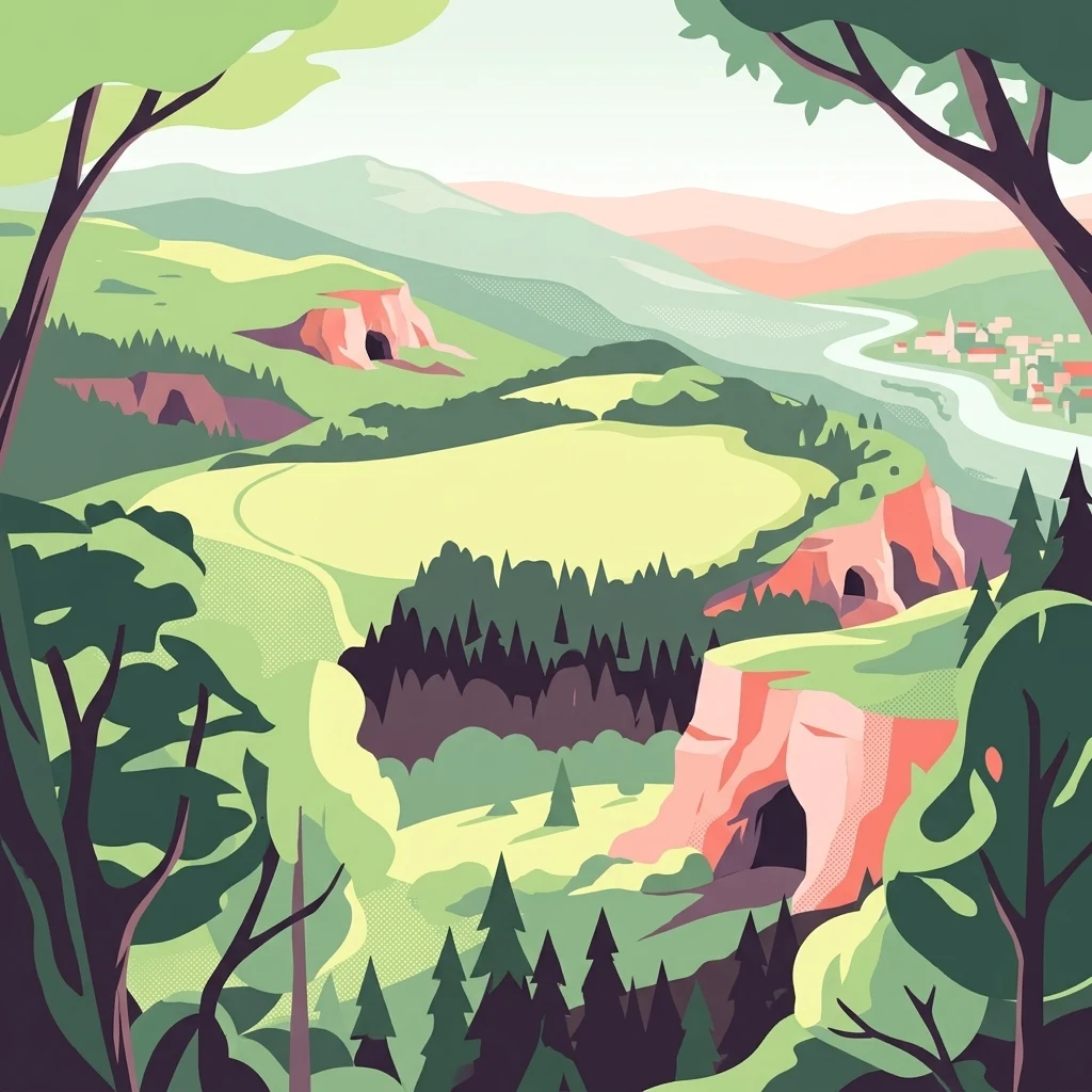
A flat-style digital illustration depicting a valley landscape with steep rocky cliffs containing cave openings, surrounded by dense forests and a winding river in the distance.

Gillenbachtal

Nature reserve

Park overview

Structured park overview, official facts, and landscape profile for Gillenbachtal

Gillenbachtal park facts, protected area profile, and essential visitor context

Review the core facts for Gillenbachtal, including designation, size, terrain, visitor scale, habitats, and operating context in one park-focused overview.

About Gillenbachtal

Gillenbachtal is a small but ecologically distinctive nature reserve lying just west of the city of Trier, where the surrounding countryside transitions from urban edge to upland forest. The reserve takes its name from the Gillenbach, a small stream whose headwaters once originated in this valley but which today usually runs dry except after heavy rainfall, as the original spring area was largely disrupted by road and motorway construction. The protected landscape therefore reads today less as a flowing watercourse and more as a wooded valley system defined by its slopes, soils, and biological communities.

The reserve's character is shaped by a pronounced valley topography. In many sections the landscape has the feel of a true Wald-schlucht, with steep sides, fallen timber, and rocks scoured by past water flow. This combination of terrain and forest structure has produced a habitat mosaic that includes old-growth attributes such as abundant standing and lying deadwood, which is strongly associated with rare and specialist woodland species. Cooler microclimatic conditions in the valley further distinguish the Gillenbachtal from the warmer surrounding countryside.

Ecologically, the reserve is unusually varied for its compact size. It protects a deciduous mixed forest rich in native tree species, together with traditional orchard meadows (Streuobstbestände) containing historical and local fruit varieties. Open habitats within the reserve include nutrient-poor oat-grass meadows, fragments of semi-dry grassland, and small calcareous mire communities dominated by small sedges. Secondary limestone cliff faces provide additional specialized habitats. Layered on top of these is the reserve's most celebrated feature: an orchid-rich zone on a humid slope, ecologically distinct from the region's more familiar dry calcareous orchid meadows.

Because orchid populations on this moist slope are sensitive to trampling, maintenance of the area is only carried out in winter during prolonged frost, when the ground is frozen solid enough to bear foot traffic without damage. This careful seasonal management reflects the fragile character of the reserve and is part of why it has earned formal protection. Today, Gillenbachtal functions both as a conservation site and as a quiet natural retreat very close to central Trier, offering a rare example of structurally complex, semi-natural woodland within easy reach of the city.

Quick facts and research context for Gillenbachtal

Gillenbachtal is a designated nature reserve in Rhineland-Palatinate, Germany, established in 1995 and administered by the City of Trier. The reserve covers roughly 38 square kilometers of land that includes the upper catchment and valley of the Gillenbach stream, extending from the urban edge of Trier's Pallien district down toward the Sirzenicher Bach. Its protected character centers on a steep-sloped forest gorge with abundant deadwood, traditional orchard meadows, dry grassland fragments, and a regionally distinctive humid orchid site on a mossy slope.

Protection and recognition

Examine official records, management context, and conservation designations for Gillenbachtal.

Gillenbachtal Protection Status and International Recognition Data

Gillenbachtal brings together documented protection status, management scope, and verified registry entries in a structured format. Researchers can evaluate official data records and international designations associated with this protected natural area.

Protection details

WDPA ID
163246
Park context

Deeper park guide and search-rich context for Gillenbachtal

Gillenbachtal history, landscape, wildlife, and travel context

Explore Gillenbachtal through its history, landscape character, ecosystems, wildlife, conservation priorities, cultural context, and seasonal travel timing in a structured park guide built for atlas discovery and search intent.

Why Gillenbachtal stands out

The reserve is best known for its humid-slope orchid area, which stands out because most orchid habitats in the surrounding region occur on dry limestone grassland, whereas the Gillenbachtal orchids grow in a moist, sloping woodland setting. It is also recognized for its structurally rich Wald-schlucht forest gorge ecology, with steep slopes, old and fallen trees, and exposed rock, combined with traditional orchard meadows planted with historic local fruit varieties.
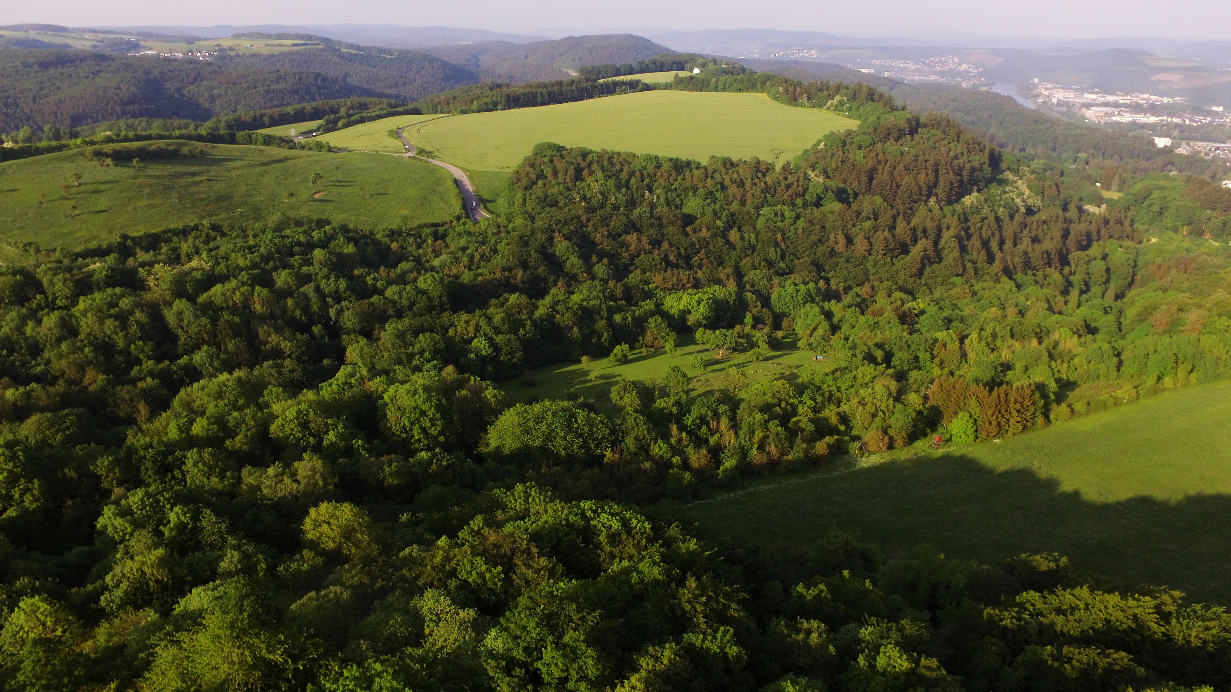
An aerial view showing a patchwork of lush green forest and open meadows under a clear sky, with rolling hills in the background.
Aerial view of the upper Gillenbachtal nature reserve with surrounding forests and meadows.

Gillenbachtal history and protected-area timeline

The Gillenbachtal was formally designated as a nature reserve in 1995, reflecting both its ecological value and its unusual combination of habitats near the city of Trier. Before receiving formal protection, the valley had already been used for many decades as a local recreation area. A former care home stood on the site where the Stadtwaldhotel is now located, and the surrounding woodland was laid out with paths and small bridges for residents and visitors to take walks.

Over time, the recreational infrastructure fell into disrepair, and the paths and bridges in today's reserve are largely ruined and overgrown. This former use, however, left a lasting mark on the landscape in the form of established orchard meadows and other semi-natural features that are now part of the reserve's protected character. The disruption of the Gillenbach's original headwaters by road and motorway construction also shaped the modern valley, leaving the stream essentially dry except after periods of heavy rainfall, with a seasonally dried waterfall still visible near the confluence with the Sirzenicher Bach.

Gillenbachtal landscape and geographic character

The Gillenbachtal landscape is defined by a narrow, sloping valley system just west of the city of Trier, descending from the ridge near the B 51 federal highway down toward the Sirzenicher Bach. In many places the reserve has the character of a Wald-schlucht, or forest gorge, with steep valley sides, masses of fallen and decaying timber, and rocky outcrops that show clear signs of past water erosion. A small seasonal waterfall near the lower end of the reserve, which typically dries up outside of wet periods, marks the confluence area where the Gillenbach meets the Sirzenicher Bach.

The valley's broader form combines these steep, sheltered lower slopes with open-lighter upper slopes and small clearings on the northern side facing the highway. Elevations and exposures create noticeable microclimatic differences across the reserve, with the valley bottom notably cooler than the surrounding hillsides. Exposed secondary limestone cliffs along parts of the valley add further structural variety, creating small cliff-face habitats interspersed within the broader woodland matrix.
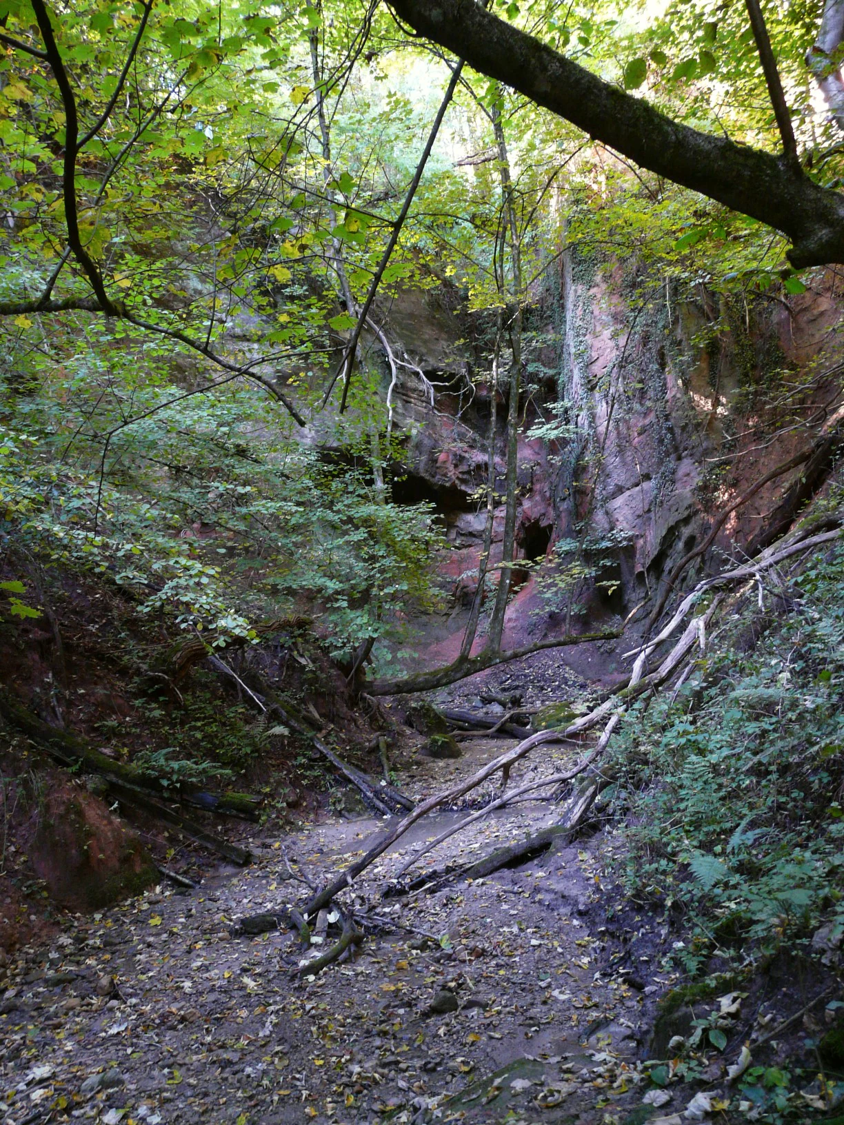
A view looking into a dry, rocky creek bed surrounded by steep, wooded slopes and exposed reddish rock formations in a forest.
The dry creek bed at the base of a wooded gorge in the Gillenbachtal nature reserve.

Gillenbachtal ecosystems, habitats, and plant life

The ecological character of Gillenbachtal rests on a compact but unusually rich mix of forest, orchard, grassland, mire, and cliff habitats. The dominant cover is a deciduous mixed forest of native broadleaf species structured to encourage high levels of old and dead wood, an attribute strongly associated with specialist woodland species such as certain fungi, lichens, saproxylic insects, and cavity-using birds. Interspersed with this closed woodland are traditional orchard meadows, planted with historical and local fruit varieties that contribute both to biodiversity and to the cultural character of the landscape.

Open-ground habitats add further ecological depth. The reserve includes nutrient-poor oat-grass meadows (Glatthaferwiesen), fragments of semi-dry grassland typical of warm limestone slopes, and a small calcareous community dominated by small sedges (Kalk-Kleinseggenried). Secondary steep limestone faces within the woodland provide yet another specialized habitat type. Climate within the valley is noticeably cooler than in the wider surroundings, which supports species that would not normally thrive in the warmer lowlands around Trier.

Gillenbachtal wildlife and species highlights

Wildlife in Gillenbachtal is shaped more by habitat structure than by the presence of large conspicuous fauna. The reserve's abundant old and dead wood supports a rich community of woodland species dependent on decaying timber, including specialist beetles and other saproxylic invertebrates, along with fungi and lichens associated with veteran trees. Cavity-nesting birds and other woodland bird species make use of mature trees and standing deadwood across the forested slopes.

The most distinctive faunal interest, however, lies in the reserve's flora-driven habitats, particularly the humid-slope orchid area, which supports a specialized community of wild orchids not found in the surrounding dry calcareous grasslands. Small woodland mammals, bats, and typical central European forest birdlife are expected to use the reserve, but the published record emphasizes orchid and habitat-level interest over charismatic large mammals.

Gillenbachtal conservation status and protection priorities

The conservation significance of Gillenbachtal lies in the way it concentrates a high diversity of habitat types within a small, urban-adjacent valley. Protection aims, as set out when the reserve was designated in 1995, focus on maintaining a species-rich deciduous mixed forest rich in old and dead wood, preserving traditional orchard meadows with historic local fruit varieties, and safeguarding open-ground communities including nutrient-poor meadows, semi-dry grassland fragments, calcareous sedge mire, and orchid habitats on a moist slope.

A particular conservation priority is the humid-slope orchid area, which differs ecologically from the drier limestone orchid sites more typical of the region. Because the soft, moist ground of this orchid zone is highly vulnerable to footfall damage, active management is restricted to winter periods with prolonged ground frost, when frozen soil supports the necessary maintenance work without harming fragile vegetation or soils. This careful seasonal regime reflects the reserve's role as a refuge for sensitive calcareous and orchid-rich habitats in an otherwise heavily shaped landscape.

Gillenbachtal cultural meaning and human context

The Gillenbachtal carries a light but distinctive cultural footprint, rooted in its nineteenth- and twentieth-century use as a recreational landscape for a care home that once stood in the area. Paths and small bridges built for that earlier use still trace through the valley, although they are now largely faded back into the forest. The traditional orchard meadows, planted with regional and historical fruit varieties, connect the reserve to older patterns of mixed land use in the Trier countryside and remain a defining element of its cultural landscape.

Top sights and standout views in Gillenbachtal

Gillenbachtal's strongest points of distinction are its forest-gorge topography with abundant old and dead wood, its humid-slope orchid community that is ecologically unlike the dry limestone orchid meadows elsewhere in the region, and its surviving traditional orchard meadows. The reserve's compact size and location on the edge of Trier make it a rare example of structurally rich, semi-natural woodland directly adjacent to a major German city, while its strict seasonal management protocols underline the fragility of its most valued habitats.

Best time to visit Gillenbachtal

Spring and early summer are the most rewarding times to experience Gillenbachtal, when woodland wildflowers and the reserve's distinctive orchids are in bloom and the valley's cooler microclimate contrasts sharply with the warmer surrounding countryside. Late spring also tends to be the time when the orchid-rich humid slope is most visually striking, although visitors are expected to remain on established paths to protect the soft, moisture-sensitive ground. Winter visits are generally quieter, but it is precisely during periods of sustained frost that the reserve's maintenance work is carried out, reflecting how the seasons shape both the ecology and management of the valley.

Monthly climate preview

Monthly temperature ranges and precipitation averages recorded at a representative elevation point

Gillenbachtal Climate Normals and Long-Term Temperature Patterns

Gillenbachtal exhibits a measured annual rhythm ranging from sub-zero winter minimums to warm summer maximums alongside steady daily precipitation normals. Reviewing the complete twelve-month dataset reveals detailed monthly averages and long-term climate trends for this Rheinland-Pfalz protected location.
Annual mean9 °C
0 °C18 °C
Jan
Feb
Mar
Apr
May12°
Jun16°
Jul18°
Aug18°
Sep14°
Oct
Nov
Dec
Warmest month
July

18.2 °C

Coolest month
January

-0.3 °C

Wettest month
December

2.5 mm/day

Driest month
April

1.6 mm/day

Park location guide

Geography guide, regional context, and park location map for Gillenbachtal

Gillenbachtal park geography, regions, and map view in Germany

Understand where Gillenbachtal sits in Germany through a broader geographic reading of the surrounding landscape, nearby location context, and its mapped position within the national park landscape.

How Gillenbachtal fits into Germany

Germany is a federal republic in Western and Central Europe with a population of over 83 million across sixteen constituent states. It is Europe's largest economy by nominal GDP and a major global exporter and importer. The capital is Berlin, and the country borders Denmark, Poland, Czech Republic, Austria, Switzerland, France, Luxembourg, Belgium, and the Netherlands.

Wider geography shaping Gillenbachtal in Germany

Germany is located in Western and Central Europe, spanning 357,022 km². It borders Denmark to the north, Poland and the Czech Republic to the east, Austria and Switzerland to the south, and France, Luxembourg, Belgium, and the Netherlands to the west. The country has coastlines on the Baltic Sea and North Sea to the north, with the Alps located in the southern region.

Map view of Gillenbachtal

Use this park location map to pinpoint Gillenbachtal in Germany, understand its exact geographic position, and read its mapped placement within the surrounding landscape more clearly.

Pigeon | © OpenStreetMap contributors

Location context for Gillenbachtal

Rheinland-Pfalz

Visual reference guide to forest gorges, steep valley terrain, and protected habitats

Gillenbachtal Photos and Landscape Scenery Explorer

Visual documentation captures the forest gorge terrain, deciduous mixed woodland, and specialized orchid habitats defining the Gillenbachtal protected reserve. Photographic records reveal the complex microclimates and steep valley topography characterizing this urban-edge natural environment.

An aerial view showing a patchwork of lush green forest and open meadows under a clear sky, with rolling hills in the background.

An aerial landscape view looking down over a dense, green deciduous forest and open meadow patches, with a sprawling city visible in the hazy distance under a bright sky.

A view looking into a dry, rocky creek bed surrounded by steep, wooded slopes and exposed reddish rock formations in a forest.

Park atlas

Compare adjacent forest reserves, stream valleys, and regional conservation areas.

Exploring Parks Near Gillenbachtal and Surrounding Protected Landscapes

Browsing parks near Gillenbachtal reveals connected woodland habitats and regional protected areas across Rhineland-Palatinate. Comparing these surrounding conservation landscapes provides deeper geographic context for local valley ecosystems and forest gorges.
Watercolor painting of a rolling green forest landscape with a winding path and soft, abstract hills in the background.
Nature reserveRhineland-Palatinate
About 5.5 km away#1 closest

Southeast

Mattheiser Wald Nature Reserve: A Protected Forest Landscape in Rhineland-Palatinate

Ecological mapping of urban forest and valley terrain

Mattheiser Wald represents a vital nature reserve and Natura 2000 site in the Trier region. The area is characterized by high-value oak and hornbeam woodland, abandoned military disturbance zones that host rare wildlife, and an intricate stream valley system. This atlas entry provides a detailed look at the reserve's topography and its status as a critical conservation landscape within an urban environment.

Area
4.47 km²
Established
2003
Relief
Upland
Climate
Temperate
Watercolor painting of a green, rolling hillside landscape with faint pink floral details in the foreground.
Nature reserveRheinland-Pfalz
About 10 km away#2 closest

Southwest

Perfeist bei Wasserliesch: Protected Grassland and Botanical Mapping in Rheinland-Pfalz

A regional sanctuary for rare orchids and calcareous meadow flora.

Perfeist bei Wasserliesch represents a significant protected area within the German Moselle landscape. Spanning 22 hectares of dry, sun-exposed calcareous soil on the Liescher Berg, the reserve offers a focused look at open grassland ecology. Its unique status as a botanical reference point highlights how small-scale protected land maintains rare plant species and fragile meadow habitats against the backdrop of the surrounding Moselle valley hill country.

Area
0.22 km²
Established
1986
Nature reserveRhineland-Palatinate
About 11 km away#3 closest

South

Wiltinger Saarbogen: Mapping the Natural Saar River Meander and Floodplain Habitats

A critical protected nature reserve in the Rhineland-Palatinate river landscape.

Wiltinger Saarbogen remains a rare, natural river arc within the Saar valley. This protected area offers a deep look into riverine geography, featuring a concentrated mosaic of gravel banks, reed-fringed wetlands, and riparian forests that stand in contrast to the engineered shipping canals of the region.

Area
1.67 km²
Established
1997
Watercolor illustration of a lush wetland landscape with reed beds, rolling green hills, and soft pastel colors.
Nature reserveRheinland-Pfalz
About 14 km away#4 closest

Northeast

Ried am Föhrenbach Nature Reserve: Geographic Overview and Protected Wetland Boundaries

Wetland mosaic and reedbed landscape in Rhineland-Palatinate

The Ried am Föhrenbach nature reserve in Rhineland-Palatinate encompasses a unique, elongated strip of wetland terrain along the Föhrenbach stream. Known for its extensive common reed stands and moist grassland, this protected area acts as a vital environmental buffer and habitat refuge within the regional landscape, set against the backdrop of the Moselle hill country and major transport infrastructure.

Area
0.465 km²
Established
1991
Relief
Lowland
Scope
Terrestrial
Watercolor painting of a rolling forested landscape with soft pink and yellow sky.
Protected areaGermany
About 15 km away#5 closest

Northeast

Meulenwald Protected Landscape: Topography and Geographic Context in the Eifel

A sandstone forest range and regional ecological landmark.

The Meulenwald offers a unique study in forest geography, spanning from the dense pine stands in the south to the varied shrubby clearings of the northern Heckenland. As a protected area near Trier, it showcases a remarkable botanical collection alongside a complex network of streams and ridges shaped by red sandstone, marking its status as a vital recreational and ecological anchor within Rhineland-Palatinate.

Nature reserveRheinland-Pfalz
About 18 km away#6 closest

Southwest

Langheck bei Nittel Nature Reserve: A Detailed Atlas of Protected Moselle Landscapes

Ecological geography and calcareous grassland habitat in Rheinland-Pfalz

Langheck bei Nittel is a significant nature reserve located in the Upper Moselle valley of Germany. The site protects a rare mosaic of calcareous dry grasslands, shrubbery, and forest edges that host a high concentration of orchid species. As a critical component of the regional biotope network, it offers insight into the conservation of warm-loving flora and the management of stony, nutrient-poor landscapes.

Area
0.42 km²
Established
1998
A soft watercolor painting of a landscape featuring a small river or pond in the center, flanked by green trees on the left and pink-flowered trees on the right, with low hills in the distance.
Nature reserveLuxembourg
About 18 km away#7 closest

Southwest

Naturschutzgebitt Kelsbaach Nature Reserve: A Geographical Overview of Luxembourg Landscapes

Dolomite rock formations and protected dry grassland ecosystems

Naturschutzgebitt Kelsbaach preserves a distinctive environmental gradient across the Moselle valley hillsides in Luxembourg. From exposed dolomite cliffs and arid plateau grasslands to the shaded Kelsbaach stream gorge, the reserve illustrates the complex interplay of regional geology and microclimate. This protected area offers a precise look at local biodiversity habitats and the lasting impact of historical land use on the natural terrain.

Area
0.755 km²
Established
1998
Relief
Upland
Climate
Temperate
Nature reserveSaarland
About 26 km away#8 closest

South

Steilhänge der Saar Nature Reserve: Mapped Protected Landscapes and River Valley Geography

Protected river slopes and forested terrain in Saarland

The Steilhänge der Saar nature reserve encompasses steep, wooded hillsides rising above the Saar river valley. This consolidated protected area features complex ecological gradients between rocky, sun-exposed upper slopes and shadowed tributary streams, serving as a critical habitat zone and a defining feature of the regional Saarland landscape.

Area
10.86 km²
Established
2017
IUCN
IV

Common questions about visiting, size, designation, and location context for Gillenbachtal

Gillenbachtal FAQs for park facts, access, geography, and protected area context

Find quick answers about Gillenbachtal, including protected-area facts, park geography, trail and visitor context, and how the park fits into its surrounding country and regional landscape.
MoriAtlas Explorer

Continue Your Protected Areas Search Across the Global Atlas

Deepen your exploration by continuing the structured search for national parks and protected areas worldwide. Utilize the comprehensive filtering capabilities to compare different conservation landscapes and refine your understanding of global park geography. Discover more about the distribution and characteristics of protected natural areas.

Global natural geography