Mori Atlas logo
National parkGlacier National Park

Explore the mapped boundaries and natural terrain of this significant protected landscape.

Glacier National Park: Montana's National Park Protected Area and Landscape Geography

Glacier National Park stands as a vital protected area within Montana, offering a significant focus for geographic and atlas-based exploration. This entry provides detailed context on its mapped boundaries, the surrounding natural terrain, and its role as a national park within the United States' protected lands system. Understand the geographic scope and landscape identity that define Glacier National Park for atlas discovery.

Rocky MountainsGlacial LandscapeWorld Heritage SiteInternational Peace ParkAlpine EnvironmentHistoric Hotels

Glacier National Park

National park

Park overview

Structured park overview, official facts, and landscape profile for Glacier National Park

Glacier National Park park facts, protected area profile, and essential visitor context

Review the core facts for Glacier National Park, including designation, size, terrain, visitor scale, habitats, and operating context in one park-focused overview.

About Glacier National Park

Glacier National Park represents one of the most significant wilderness areas in the United States, protecting a remarkable diversity of ecosystems from prairie grasslands to alpine tundra within a single landscape. The park serves as the crown jewel of the Crown of the Continent Ecosystem, a vast wilderness region that remains largely untouched and provides critical habitat for numerous species including grizzly bears, gray wolves, and mountain goats. The park's significance extends beyond its natural beauty to its geological importance, as the Lewis Overthrust displays some of the oldest sedimentary rocks on Earth, with fossils dating back approximately 1.4 billion years.

The establishment of Glacier National Park in 1910 followed decades of advocacy by conservationist George Bird Grinnell, who first explored the region in 1885 and spent two decades working to protect the land. The park's creation was also influenced by the Great Northern Railway, whose president Louis W. Hill saw the tourism potential of the region and helped lobby Congress for the park's designation. Today the park maintains almost all of its modern original native plant and animal species since European discovery, providing biologists with an essentially intact ecosystem for research and study.

Quick facts and research context for Glacier National Park

Glacier National Park is located in northwestern Montana along the Canadian border, spanning Flathead and Glacier counties. The park covers 1,013,322 acres (4,100.77 km2) and was established on May 11, 1910, making it one of the oldest national parks in the United States. The park contains over 700 lakes, though only 131 have been named, with Lake McDonald being the longest at 10 miles and the deepest at 464 feet. Six mountains in the park exceed 10,000 feet in elevation, with Mount Cleveland being the tallest at 10,466 feet. The park is managed by the National Park Service with headquarters in West Glacier, Montana.

Protection and recognition

Documenting terrestrial management scope and transboundary conservation status

Glacier National Park Protection Status and International Recognition

Glacier National Park maintains a designated terrestrial protection status that reflects its critical ecological value as a transboundary protected area. Official conservation frameworks record its global status as part of the Waterton Glacier International Peace Park UNESCO World Heritage designation.

International recognition

Protection details

Protection scope
Terrestrial
Transboundary protection
Yes
Park context

Deeper park guide and search-rich context for Glacier National Park

Glacier National Park history, landscape, wildlife, and travel context

Explore Glacier National Park through its history, landscape character, ecosystems, wildlife, conservation priorities, cultural context, and seasonal travel timing in a structured park guide built for atlas discovery and search intent.

Why Glacier National Park stands out

Glacier National Park is best known for its dramatic mountain landscapes carved by ancient glaciers, its iconic Going to the Sun Road that traverses the Continental Divide at Logan Pass, and its historic Swiss style lodges and chalets built by the Great Northern Railway in the early 1900s. The park is famous for its remaining glaciers though these have retreated dramatically from an estimated 150 glaciers over 25 acres in size in the mid 19th century to only 25 active glaciers by 2010. The mountain goat serves as the official park symbol and is commonly spotted on high rocky cliffs. The park is also renowned as part of the world's first International Peace Park with Waterton Lakes National Park in Canada.

Glacier National Park history and protected-area timeline

The region that became Glacier National Park was first inhabited by Native Americans, with the Blackfeet dominating the eastern regions and the Flathead (Salish) and Kootenai occupying the western areas. The Blackfeet considered the mountains of this area, especially Chief Mountain and the region at Two Medicine, as the Backbone of the World and frequented these areas during vision quests. In 1895 Chief White Calf of the Blackfeet authorized the sale of approximately 800,000 acres of mountain area to the U.S. government for $1.5 million, establishing the current boundary between the park and the reservation.

George Bird Grinnell first visited the region in 1885 and became so inspired by the scenery that he spent the next two decades working to establish a national park. His efforts, combined with those of the Boone and Crockett Club and Louis W. Hill president of the Great Northern Railway, led to the park's establishment in 1910 when President William Howard Taft signed the bill into law. The Great Northern Railway subsequently built numerous hotels and chalets throughout the park in the 1910s, constructing properties such as Many Glacier Hotel, Lake McDonald Lodge, and Sperry Chalet, all designed in Swiss alpine style. The Going to the Sun Road, completed in 1932, bisects the park and is recognized as a National Historic Civil Engineering Landmark.

Glacier National Park landscape and geographic character

Glacier National Park displays dramatic mountain terrain shaped by glacial action, featuring U shaped valleys, cirques, arêtes, and large outflow lakes radiating like fingers from the base of the highest peaks. The park encompasses parts of two sub ranges of the Rocky Mountains, the Lewis Range and the Livingston Range, with six mountains exceeding 10,000 feet in elevation. Chief Mountain, an isolated peak on the eastern boundary, rises 2,500 feet above the Great Plains as a dramatic example of the Lewis Overthrust. Triple Divide Peak sends waters toward the Pacific Ocean, Hudson Bay, and the Gulf of Mexico, making it effectively the apex of the North American continent. The park contains over 700 lakes, including the 10 mile long Lake McDonald, with many smaller tarns located in cirques formed by glacial erosion. Some lakes such as Avalanche Lake and Cracker Lake display an opaque turquoise color from suspended glacial silt.

Glacier National Park ecosystems, habitats, and plant life

Glacier National Park contains numerous ecosystems ranging from prairie to tundra, representing one of the most ecologically diverse protected areas in North America. The park is part of the larger Crown of the Continent Ecosystem, all of which remains primarily untouched wilderness of pristine quality. Over 1,132 plant species have been identified parkwide, with coniferous forests dominated by Engelmann spruce, Douglas fir, subalpine fir, limber pine, and western larch. The cedar hemlock groves along the Lake McDonald valley represent the easternmost examples of this Pacific climatic ecosystem. Above the forested valleys, alpine tundra conditions prevail with grasses and small plants surviving in a region with as little as three months without snow cover. Whitebark pine communities have been heavily damaged by blister rust, a non native fungus, with 30 percent of trees dead and over 70 percent of remaining trees infected.

Glacier National Park wildlife and species highlights

Glacier National Park is home to an impressive diversity of wildlife, with large mammals including American black bear, grizzly bear, bighorn sheep, elk, moose, mountain lion, and mountain goats inhabiting the park. The gray wolf, wolverine, and Canadian lynx also inhabit the park, with the grizzly bear and lynx listed as threatened species. Over 1,000 grizzlies live in the region as of 2021, more than triple the population estimates in 1975. The mountain goat serves as the official park symbol and is commonly observed on high rocky cliffs throughout the park. Over 260 species of birds have been recorded, including raptors such as bald eagle, golden eagle, peregrine falcon, and osprey. Twenty three species of fish reside in park waters, including the threatened bull trout which must be returned to the water if caught.

Glacier National Park conservation status and protection priorities

Glacier National Park holds significant conservation importance as a World Heritage Site, Biosphere Reserve, and component of the world's first International Peace Park with Waterton Lakes National Park in Canada. The park was designated as a Biosphere Reserve in 1976 and received World Heritage Site status in 1995 for meeting natural criteria related to exceptional natural beauty and geological significance. In 2017 the joint park received provisional Gold Tier designation as an International Dark Sky Park, the first transboundary dark sky park. A wilderness study submitted to Congress in 1974 identified 95 percent of the park as qualifying for wilderness designation, and 93 percent is currently managed as wilderness even though it has not been officially designated. The park maintains almost all of its original native plant and animal species since European discovery, providing a rare example of an intact ecosystem.

Glacier National Park cultural meaning and human context

The Glacier region was first inhabited by the Flathead (Salish), Kootenai, Shoshone, and Cheyenne tribes, with the Blackfeet living on the eastern slopes and the Great Plains immediately to the east. The Blackfeet Indian Reservation borders the park to the east while the Flathead Indian Reservation lies west and south of the park. When the Blackfeet Reservation was first established in 1855 by the Lame Bull Treaty, it included the eastern area of the current park up to the Continental Divide. The Blackfeet ceded the mountainous parts of their treaty lands in 1895 to the federal government, which became part of the park. While the forest reserve designation confirmed traditional usage rights of the Blackfeet, the national park enabling legislation did not mention guarantees to Native Americans, leading to ongoing discussions about traditional usage rights.

Top sights and standout views in Glacier National Park

Glacier National Park offers exceptional mountain scenery with over 700 lakes, 200 waterfalls, and peaks reaching above 10,000 feet. The Going to the Sun Road provides access to the heart of the park, crossing the Continental Divide at Logan Pass with views of dramatic glaciated valleys. Historic Swiss style hotels and chalets built by the Great Northern Railway in the 1910s remain operational, including Sperry Chalet, Granite Park Chalet, Many Glacier Hotel, and Lake McDonald Lodge. The park contains 350 buildings and structures listed on the National Register of Historic Places. Over 700 miles of hiking trails traverse the park, including 110 miles of the Continental Divide National Scenic Trail. The park protects critical habitat for grizzly bears, gray wolves, mountain goats, and bighorn sheep.

Best time to visit Glacier National Park

Glacier National Park can be visited throughout the year, though the summer months of June through September offer the most accessible conditions for hiking and sightseeing. The Going to the Sun Road is typically fully open from late May or early June through October, depending on snow conditions. The winter months offer opportunities for cross country skiing in lower altitude valleys, though snowmobiling is prohibited throughout the park. Summer daytime temperatures average 60 to 70 degrees Fahrenheit with nighttime lows in the 40s, while high country temperatures remain considerably cooler. Fall brings fewer crowds and spectacular autumn foliage, particularly in the aspen and cottonwood groves along lakes and streams. Spring and early summer feature abundant wildflowers and snowmelt fed waterfalls, though many backcountry areas remain inaccessible until early July due to snowpack.
Park guides

Explore structured reference materials and visitor insights for alpine terrain.

Focused Guidance and Published Resources for Exploring Glacier National Park

Targeted published guides provide structured answers regarding high-elevation terrain access and seasonal timing across protected mountain environments. Review specialized resource topics addressing the best time to visit and navigate alpine routes safely.
Monthly climate preview

Long term weather by month patterns and precipitation profiles in the Montana Rockies

Glacier National Park Climate and Monthly Temperature Averages

Long term climate normals for Glacier National Park reveal a stark annual rhythm, featuring mean temperatures that swing from below minus nine degrees Celsius in midwinter up to over fourteen degrees Celsius during peak summer. Analyzing monthly averages helps trace historical precipitation trends and temperature extremes recorded at the park's mid-elevation terrain.
Annual mean1 °C
-10 °C14 °C
Jan-9°
Feb-9°
Mar-5°
Apr
May
Jun10°
Jul14°
Aug14°
Sep
Oct
Nov-5°
Dec-10°
Warmest month
July

14.3 °C

Coolest month
December

-9.5 °C

Wettest month
June

3.9 mm/day

Driest month
August

1.4 mm/day

Park location guide

Geography guide, regional context, and park location map for Glacier National Park

Glacier National Park park geography, regions, and map view in United States of America

Understand where Glacier National Park sits in United States of America through a broader geographic reading of the surrounding landscape, nearby location context, and its mapped position within the national park landscape.

How Glacier National Park fits into United States of America

The United States of America is a federal presidential republic and one of the world's largest countries by area and population. It consists of 50 states across a vast territory spanning multiple time zones, with its capital in Washington, D.C. and largest city in New York City. The nation has a diverse economy, influential political system, and significant cultural and military presence globally.

Wider geography shaping Glacier National Park in United States of America

The United States occupies a vast territory in North America, bordered by Canada to the north and Mexico to the south. The 48 contiguous states stretch from the Atlantic to the Pacific Ocean, while Alaska occupies the northwestern region and Hawaii is an archipelago in the Pacific. The country encompasses diverse terrain including the Rocky Mountains, Appalachian Mountains, Great Plains, and extensive river systems.

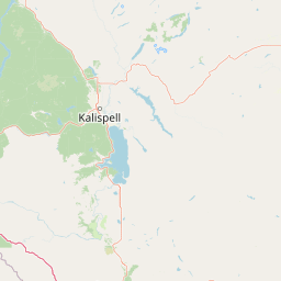
Map view of Glacier National Park

Use this park location map to pinpoint Glacier National Park in United States of America, understand its exact geographic position, and read its mapped placement within the surrounding landscape more clearly.

Pigeon | © OpenStreetMap contributors

Location context for Glacier National Park

Flathead CountyGlacier CountyMontana
Natural feature types

Explore the Natural Landmarks and Geographic Features of Glacier National Park

Access the complete collection of named natural landforms within Glacier National Park through MoriAtlas. This resource provides a structured look at the terrain, peaks, and lake systems that characterize this iconic protected landscape, supporting deeper geographic discovery for researchers and enthusiasts.
Recorded earthquake history

Review the Historical Earthquake Catalogue for Glacier National Park

Examine the documented seismic history associated with Glacier National Park. Explore this curated collection of recorded earthquakes to understand the regional seismic data and epicentre patterns identified in the area surrounding the park.

Glacier National Park Earthquake History

Catalogued events

44 events

Strongest magnitude

Magnitude 4.6

Most recent event

Jan 3, 2021

This history includes earthquakes recorded inside the park or within 50 km of its borders

Park atlas

Compare mountain terrain and protected landscapes around Glacier National Park, tracing regional conservation efforts.

Explore Other National Parks and Protected Areas Near Glacier National Park

Explore national parks and protected areas geographically near Glacier National Park, encompassing neighboring mountain ranges and the wider Crown of the Continent Ecosystem. This comparative view allows you to trace the spread of protected landscapes, understand regional conservation patterns, and continue your atlas-based discovery of significant natural sites.
Protected landscapeMontana
Park boundaries overlap#1 closest

Southeast

Helena-Lewis and Clark National Forest: Geographic Overview and Protected Area Map

Montana wilderness spanning the Continental Divide

Spanning from the rolling eastern plains to the crest of the Northern Rockies, Helena-Lewis and Clark National Forest serves as a massive protected landscape in central Montana. This forest system protects eight unique mountain ranges and critical wilderness corridors, offering a comprehensive look at the ecological transition zones of the American Mountain West.

Area
11,000 km²
Established
1897
Relief
Mountain
Climate
Temperate
National parkAlberta
Park boundaries overlap#2 closest

North

Waterton Lakes National Park: Alberta's Protected Landscape and Geographic Atlas

Explore mapped boundaries and regional terrain context.

Waterton Lakes National Park represents a vital protected area situated within the province of Alberta. This atlas view focuses on its mapped boundaries and the characteristic natural terrain, providing essential geographic context for understanding its significance. Discover its role as a national park and its placement within the regional geography of Western Canada, ideal for users seeking structured data on protected lands and landscape features.

Area
505 km²
Established
1895
IUCN
II
Visitors
475.8K annual
Protected landscapeMontana
16 km away#3 closest

Southwest

Kootenai National Forest: Geography and Protected Land Map for Northwestern Montana

Northern Rockies mountain ranges and watershed analysis.

Spanning over two million acres, Kootenai National Forest represents a critical protected landscape in the Northern Rockies. This atlas entry details the interplay between the Cabinet Mountains, regional river systems like the Kootenai and Clark Fork, and the dense conifer forests that define this uniquely wet corner of Montana.

Area
8,900 km²
Established
1907
Relief
Mountain
Climate
Temperate
Wildlife reserveMontana
65 km away#4 closest

South

Mission Mountains Wilderness: A Rugged Protected Area in the Montana Rocky Mountains

Glacial topography and high elevation alpine ecosystems

Mission Mountains Wilderness is a defining landmark in northwestern Montana, characterized by a steep and narrow mountain spine that rises abruptly above the Flathead Valley. The area protects a full spectrum of ecosystems, from dense coniferous forests to exposed talus slopes and alpine tundra. With its glacially carved cirques and deep U shaped valleys, this wilderness functions as a key component of a larger, jointly managed regional conservation landscape in the United States.

Area
298.97 km²
Established
1975
IUCN
Ib
Relief
Mountain
Protected areaMontana
76 km away#5 closest

South

Lolo National Forest: An Atlas of Protected Lands and Mountainous Terrain in Montana

Ecological transition zone of the northern Rocky Mountains

This protected area covers two million acres of diverse northern Rocky Mountain geography. Known for its massive western red cedars and transitional ecology, the forest features a complex network of ridgelines, glacial lake basins, and river corridors that serve as vital habitat across the Montana landscape.

Area
8,894.85 km²
Established
1906
Relief
Mountain
Climate
Temperate
Wildlife reserveMontana
128 km away#6 closest

South

Rattlesnake Wilderness: Exploring the Protected Landscapes and Geography of Montana

Rugged alpine terrain and roadless mountain wilderness in the Northern Rockies.

Located in the Lolo National Forest of western Montana, Rattlesnake Wilderness protects an essential network of forested slopes, alpine ridges, and drainage headwaters. This roadless wildlife reserve provides an ecologically intact landscape that serves as a core component of the northern Rockies wilderness system, offering a clear view into the rugged relief of the Rattlesnake Mountains and their significant influence on local watersheds.

Area
133.45 km²
Established
1980
IUCN
Ib
Relief
Mountain
Protected landscapeMontana
About 145 km away#7 closest

South

Rattlesnake National Recreation Area: Geography and Protected Landscape Analysis

A mapped Northern Rockies gateway in western Montana

The recreation area encompasses 28,000 acres of forested mountain terrain, montane wetlands, and creek-carved valleys located just north of Missoula. This protected landscape is defined by its diverse trail network and significant ecological systems, including the rare Sphagnum bogs of Shoo Fly Meadows. The area provides essential habitat for grizzly bears, elk, and bull trout while framing a transition zone into the remote backcountry of the surrounding national forest.

Area
110 km²
Established
1980
Relief
Mountain
Scope
Terrestrial
Protected landscapeIdaho
About 178 km away#8 closest

Southwest

Idaho Panhandle National Forests: Mapping the Inland Pacific Northwest Protected Landscapes

Geographic analysis of mountain ranges and river valley ecosystems

Spanning over 2.5 million acres, the Idaho Panhandle National Forests comprise a massive, interconnected network of mountain ranges, pristine lakes, and river corridors. This detailed look at the geography examines the structural backbone of the Selkirk, Cabinet, and Bitterroot ranges, highlighting the diverse ecological gradients and protected wilderness areas that characterize this significant portion of the inland Northwest.

Area
13,000 km²
Established
1912
Relief
Mountain
Climate
Temperate

Common questions about visiting, size, designation, and location context for Glacier National Park

Glacier National Park FAQs for park facts, access, geography, and protected area context

Find quick answers about Glacier National Park, including protected-area facts, park geography, trail and visitor context, and how the park fits into its surrounding country and regional landscape.
MoriAtlas Explorer

Continue Your Protected Areas Search Across the Global Atlas

Deepen your exploration by continuing the structured search for national parks and protected areas worldwide. Utilize the comprehensive filtering capabilities to compare different conservation landscapes and refine your understanding of global park geography. Discover more about the distribution and characteristics of protected natural areas.

Global natural geography