
Mori Atlas logo
Nature reserveGoldbergsee

Analyzing the ecological recovery, water-body geography, and renaturalized terrain of this Hesse reserve.

Goldbergsee Nature Reserve: A Mapped Exploration of Protected Landscapes in Schwalm-Eder-Kreis

Goldbergsee, situated in the northern foothills of the Knüllgebirge, represents a significant example of post-mining landscape renaturalization within the Schwalm-Eder-Kreis district. This nature reserve, featuring a former lignite pit transformed into a stable inland lake, serves as a critical habitat for migratory waterbirds and native vegetation. Through our geographic data, observe the lake's basin, its floating island structures, and the surrounding woodland terrain that defines its protected status.

nature reserveformer mining siterenaturalized lakewaterbirdsfloating islandslow mountain landscape
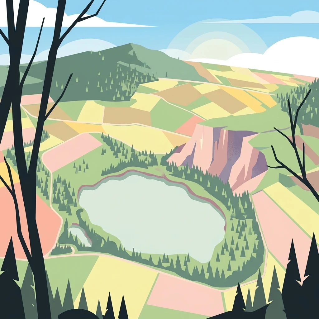
A digital illustration showing a high angle, wide view of a lake surrounded by forests, meadows, and rocky cliff faces, framed by dark stylized tree silhouettes in the foreground.

Goldbergsee

Nature reserve

Park overview

Structured park overview, official facts, and landscape profile for Goldbergsee (Ostheim)

Goldbergsee (Ostheim) park facts, protected area profile, and essential visitor context

Review the core facts for Goldbergsee (Ostheim), including designation, size, terrain, visitor scale, habitats, and operating context in one park-focused overview.

About Goldbergsee (Ostheim)

The Goldbergsee is a small inland lake in the Schwalm-Eder-Kreis district of northern Hesse, situated in the gently rolling northern outskirts of the Knüllgebirge low mountain range. It lies a short distance northeast of the roughly 385 meter Goldberg hill, between the Malsfeld villages of Mosheim and Ostheim and the neighbouring communities of Sipperhausen and Hombergshausen. The body of water itself spans about 600 meters in length and 380 meters in width, covers around 16.5 hectares, and reaches a maximum depth of about 20 meters, holding an estimated 1.8 million cubic meters of water.

What makes the Goldbergsee distinctive is its origin. The basin was excavated by PreussenElektra as the Ostheim open-cast lignite mine between 1972 and 1989, when around 7.3 million cubic meters of overburden were moved to extract nearly 2.4 million cubic meters of lignite bound for the Borken power plant. After the mine closed, the site was deliberately renaturalized rather than filled or built upon. Groundwater and hillside springs from the Goldberg rose into the abandoned pit, creating the present lake, and the surrounding land was reshaped into a mixture of natural habitats and small areas for continued agricultural use.

The lake is now the heart of a designated nature reserve of roughly 36 to 37 hectares, established in 1991 and formally completed with the end of renaturalization work in 1994. Within that protected zone, ecological succession has been allowed to proceed largely on its own, producing a mosaic of native plant communities along the shore, three floating islands on the water surface, and a habitat mosaic attractive to breeding, resting, and foraging waterbirds and other animals. A circular path of about 2.7 kilometers traces the perimeter of the reserve, and a discreet observation hut among bushes and trees at the southern edge near Sipperhausen, installed in 2000, supports low-impact wildlife observation and information sharing for visitors.

The Goldbergsee is also closely linked to a small neighbouring bathing lake, the Naturbadesee Ostheim, which lies just outside the protected zone and receives a constant inflow from the Goldbergsee via an overflow. From there, water continues through the Hohlgraben toward the Rhünda, creating the continuous water exchange that helps maintain the very high water quality recorded by the Hesse state environment institute. The result is a quiet, easy-to-explore protected area that illustrates how an industrial scar in the Hessian countryside can become a long-term refuge for native plants, waterbirds, and migratory species.

Quick facts and research context for Goldbergsee (Ostheim)

The Goldbergsee is a roughly 16.5 hectare lake in the Schwalm-Eder-Kreis district of northern Hesse, located about one kilometer northeast of the Goldberg summit in the northern Knüllgebirge foothills. The lake was formed in a former PreussenElektra lignite open-cast mine that operated from 1972 to 1989, and it was incorporated into the Goldbergsee nature reserve (NSG 163274) in 1991.

The reserve covers about 36 to 37 hectares and includes the lake itself, three floating islands, and a roughly 2.7 kilometer circular walking trail with a bird observation hut installed near Sipperhausen in the year 2000. The Hessische Landesanstalt für Umwelt rated the lake's water quality at the highest anthropogenic class, indicating it is essentially uncontaminated.

Protection and recognition

Documented conservation parameters and international recognition data

Goldbergsee Protection Status and Official Protected Area Records

Goldbergsee protection status details bring together documented management scope and official administrative records for the protected area. Structured datasets compile international recognition data alongside verified conservation metrics for comprehensive geographical analysis.

Protection details

WDPA ID
163274
Park context

Deeper park guide and search-rich context for Goldbergsee (Ostheim)

Goldbergsee (Ostheim) history, landscape, wildlife, and travel context

Explore Goldbergsee (Ostheim) through its history, landscape character, ecosystems, wildlife, conservation priorities, cultural context, and seasonal travel timing in a structured park guide built for atlas discovery and search intent.

Why Goldbergsee (Ostheim) stands out

The Goldbergsee is best known as a textbook example of post-mining landscape renaturalization in Hesse, where a former lignite open-cast pit has been allowed to flood and revert to a near-natural lake ecosystem. It is especially valued for its protected status, its three floating islands, and its role as a breeding and stopover site for waterbirds and migratory species. Visitors and naturalists are drawn to it for the combination of a quiet forested setting, very clean water, a clearly defined circular trail, and a dedicated observation hut at the southern edge of the reserve. Its identity is grounded less in dramatic scenery than in ecological recovery and easy wildlife observation.
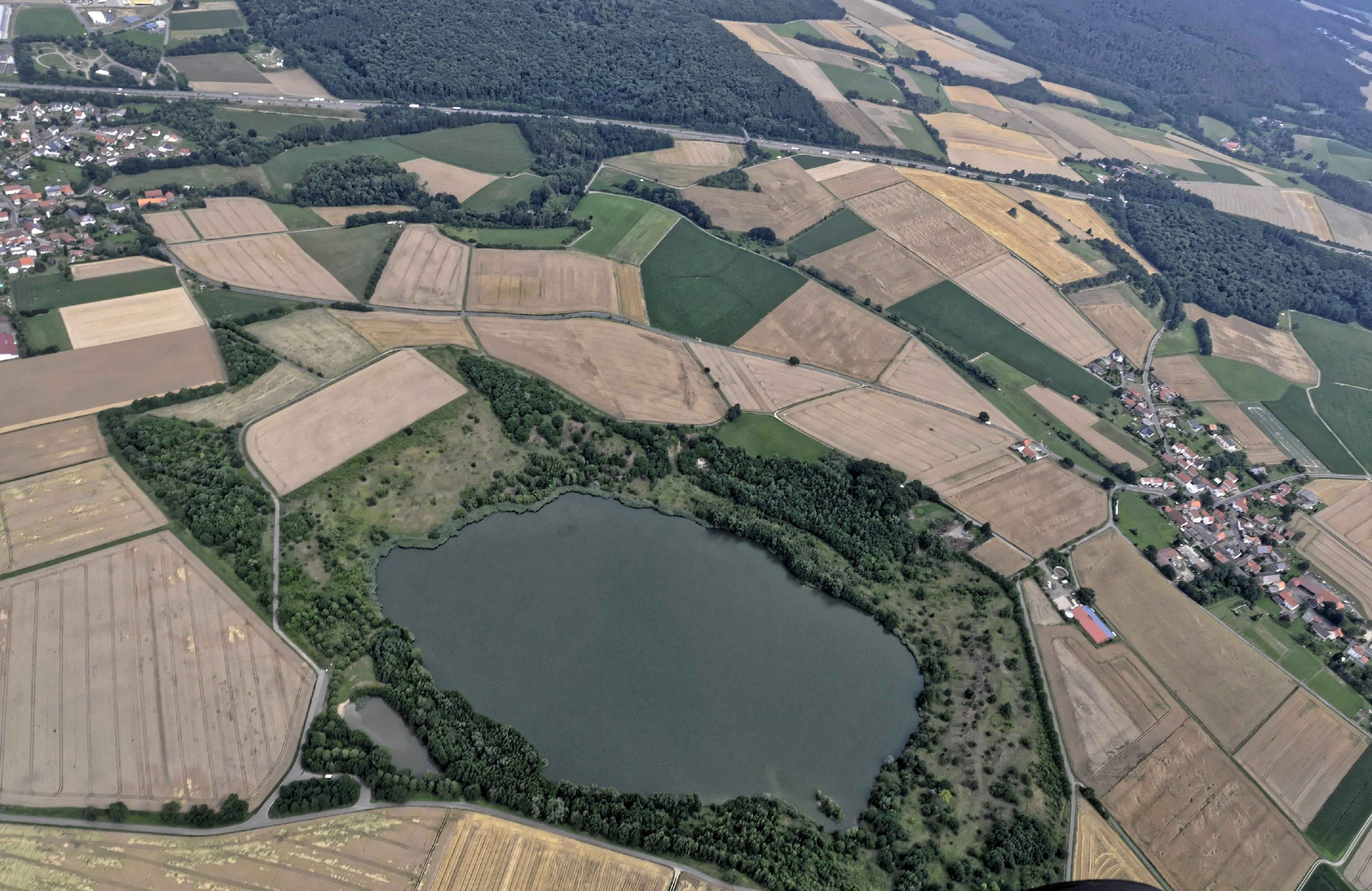
An aerial perspective of Goldbergsee, a circular lake surrounded by patches of forest and extensive agricultural fields, with residential areas visible at the edges.
Aerial view of Goldbergsee, showing the lake surrounded by agricultural fields and village infrastructure in Hesse, Germany.

Goldbergsee (Ostheim) history and protected-area timeline

Mining has a long history in the area between Ostheim and Sipperhausen. Small-scale coal extraction already took place here from 1840 to 1880 but was abandoned because of poor market demand. Major modern lignite extraction began in 1972, when PreussenElektra started work on the Ostheim open-cast mine. Over the next seventeen years, the operation moved roughly 7.3 million cubic meters of overburden to recover almost 2.4 million cubic meters of lignite, destined primarily for the Borken power plant. The mining covered a footprint of about 46 hectares.

Mining ended in 1989, after which the exhausted pit was deliberately converted into a lake and surrounding habitat. Renaturalization reshaped the contours of the site and allowed groundwater and hillside springs to refill the basin, while parts of the wider area were reconfigured for agricultural use. In 1991 the Oberen Naturschutzbehörde at the Regierungspräsidium Kassel formally designated the area as the Goldbergsee nature reserve, with reference number 163274, covering around 36 to 37 hectares. The renaturalization programme concluded in 1994, leaving the area to develop largely through natural succession.

Since then the reserve has been managed as an essentially self-regulating protected landscape. In the year 2000 a small observation hut with information panels was built into the bushes near Sipperhausen at the southern edge of the reserve, providing a discreet vantage point for monitoring waterbirds and other wildlife. The site has also become an example cited in broader Hessian discussions of how former open-cast mines can be restored to ecologically valuable conditions.

Goldbergsee (Ostheim) landscape and geographic character

The Goldbergsee is set in the gently rolling northern foothills of the Knüllgebirge, a low mountain area often described regionally as the Homberger Hochland. Its immediate landmark is the Goldberg hill to the southwest, whose summit sits around 385 meters above sea level and whose slopes feed both the lake's groundwater and the surface streams of the area.

The basin itself is broad and moderately shallow by inland lake standards: about 600 meters long, 380 meters wide, up to 20 meters deep, and encircled by a shoreline of roughly 1.5 kilometers. The water level is sustained by underground springs and hillside seepage from the Goldberg, giving the lake a calm, clear, non-turbid appearance. Three small floating islands sit on the water, adding visible structure to an otherwise open surface, and the surrounding reserve frames the lake with mixed native woodland, shrubs, and successional vegetation.

The wider topography is shaped by two small streams: the Rhünda flows eastward through the valley to the south of the Goldberg, while its tributary, the Hohlgraben, runs to the west. The basin sits between these drainage lines rather than within either of them, giving the lake a sheltered, basin-like position in the local relief. Around its perimeter, the landscape passes from open water through reed- and shrub-dominated margins into young forest and small patches of traditional land use, making for a compact and visually varied setting.

Goldbergsee (Ostheim) ecosystems, habitats, and plant life

Ecologically, the Goldbergsee is a textbook example of a man-made lake that has been left to develop under natural succession. Because the mining-era basin was allowed to fill through natural groundwater and hillside springs, and because visitors are largely kept to the marked perimeter trail, the shoreline and water have developed a complex mosaic of native plant communities without intensive intervention.

A characteristic feature is the presence of three floating islands, which are uncommon in inland German lakes and add structural diversity to the water surface. These islands, together with the reeds, shrubs, and marginal vegetation that have established around the edges, support a layered habitat ranging from open water to wet woodland. The reserve's plant cover reflects recolonization by typical Central European species, with native associations establishing themselves in the absence of regular management.

Water quality is exceptionally high for a former mining site. The Hesse state environment institute classified the lake at the top anthropogenic water-quality grade, reflecting the continual exchange with the neighbouring Naturbadesee Ostheim and onward toward the Rhünda via the Hohlgraben. This exchange keeps nutrient and sediment loads low and supports a relatively clear, oxygen-rich lake environment.

Goldbergsee (Ostheim) wildlife and species highlights

The lake and its reserve are most valued from a wildlife perspective as a refuge for waterbirds and migratory species. Many waterfowl and migratory birds use the Goldbergsee as a breeding site, a stopover during migration, and a feeding area, taking advantage of the calm water, the floating islands, and the sheltered shoreline vegetation. The reserve's protected status and limited public access keep disturbance low, which is particularly important for sensitive breeding and resting birds.

Beyond birds, the mosaic of open water, reeds, shrubs, and young woodland supports a typical range of native fauna associated with small Hessian lowland lakes. Amphibians, insects, and small mammals make use of the wet margins, while the surrounding bushes and tree growth provide cover for songbirds and other woodland species. The observation hut on the southern perimeter of the reserve is positioned specifically with waterbirds and other visible wildlife in mind, and it is widely used by visitors interested in informal wildlife observation.

The combination of high water quality, structural variety, and minimal active management means the Goldbergsee acts as a small but stable node in the broader ecological network of the Schwalm-Eder-Kreis, complementing the surrounding riverine habitats of the Rhünda and the other protected areas in the district.

Goldbergsee (Ostheim) conservation status and protection priorities

The Goldbergsee's conservation significance rests on three intertwined points: its origin as a restored open-cast mine, its protected status, and the ecological value of the succession that has been allowed to develop on site.

Legally, the lake sits within the Goldbergsee nature reserve, designated in 1991 by the Oberen Naturschutzbehörde at the Regierungspräsidium Kassel under reference number 163274. The reserve covers about 36 to 37 hectares and includes the lake, its shoreline, and the surrounding land, establishing it as a formally protected landscape within the Schwalm-Eder-Kreis district. Renaturalization work concluded in 1994, and since then the area has essentially been left to self-organize, producing native plant communities and habitat structure without intensive management intervention.

From an ecological standpoint, the lake also demonstrates how former industrial sites can be converted into ecologically valuable assets. Its very high water quality rating, its floating islands, and its role as habitat for waterbirds and migratory species show that restored mining pits, properly handled, can contribute meaningfully to regional biodiversity networks. The neighbouring Naturbadesee Ostheim and the linked Hohlgraben to the Rhünda extend the conservation value beyond the formal reserve boundary by maintaining continuous water exchange and connecting the lake to wider riverine habitats.

Goldbergsee (Ostheim) cultural meaning and human context

The Goldbergsee sits in a part of northern Hesse with a layered human history. Coal has been extracted in the area between Ostheim and Sipperhausen on two distinct timescales: small-scale workings operated between 1840 and 1880 but ceased because of weak demand, and a much larger industrial-scale operation took place between 1972 and 1989. The abandoned village site of Goningshausen lies on the southwestern shore of the lake, marking that the present nature reserve overlays a landscape with older settlement history that has since vanished.

For local communities today, the most important cultural associations are recreational rather than industrial. The neighbouring Naturbadesee Ostheim and the 2.7 kilometer perimeter path around the reserve are part of the everyday outdoor life of Ostheim, Sipperhausen, and surrounding villages. The observation hut at the southern edge of the reserve, installed in the year 2000 and integrated into the bushes, reflects a deliberate local effort to share the natural value of the site with residents and visitors in a low-key, non-intrusive way.

Top sights and standout views in Goldbergsee (Ostheim)

The standout features of the Goldbergsee are its successional ecology, its formal protection status, and the unusually clean water for a lake of its industrial origin. Three floating islands, a near-natural mosaic of native vegetation, and a 2.7 kilometer perimeter trail with a discreet observation hut create a compact, easy-to-explore reserve where the surrounding woodland, water surface, and shoreline habitats can be compared at close range.

Equally notable is the lake's role as a breeding and resting site for waterbirds and migratory species, supported by continuous water exchange with the neighbouring Naturbadesee Ostheim and onward toward the Rhünda. Together, these features make the Goldbergsee a small but ecologically valuable node in the network of protected areas of the Schwalm-Eder-Kreis.

Best time to visit Goldbergsee (Ostheim)

The Goldbergsee is an essentially evergreen destination. Its shoreline vegetation, waterbirds, and floating islands are present year-round, and the circular path remains usable in all seasons. Spring and early summer tend to bring the most active bird presence, as breeding waterfowl and returning migrants make use of the lake's sheltered margins. Autumn is typically rich in migratory species passing through, while winter highlights the lake's open water character and the structural contrast between ice-free sections, floating islands, and surrounding woodland.

Because the lake sits in a low-mountain area and the path can be exposed in places, visitors expecting mild, dry conditions will generally find late spring through early autumn the most comfortable window for walking the full 2.7 kilometer perimeter route and using the observation hut near Sipperhausen.

Monthly climate preview

Long-term representative averages and weather by month for Goldbergsee

Goldbergsee Climate Normals: Annual Temperature and Precipitation Rhythm

Goldbergsee records measured long-term monthly averages detailing the annual temperature progression and precipitation rhythm at a representative coordinate. Reviewing the complete twelve-month profile provides deeper insight into historical climate patterns across the protected landscape.
Annual mean9 °C
-1 °C19 °C
Jan-1°
Feb
Mar
Apr
May12°
Jun16°
Jul19°
Aug18°
Sep14°
Oct
Nov
Dec
Warmest month
July

18.6 °C

Coolest month
January

-0.8 °C

Wettest month
July

2.5 mm/day

Driest month
April

1.4 mm/day

Park location guide

Geography guide, regional context, and park location map for Goldbergsee (Ostheim)

Goldbergsee (Ostheim) park geography, regions, and map view in Germany

Understand where Goldbergsee (Ostheim) sits in Germany through a broader geographic reading of the surrounding landscape, nearby location context, and its mapped position within the national park landscape.

How Goldbergsee (Ostheim) fits into Germany

Germany is a federal republic in Western and Central Europe with a population of over 83 million across sixteen constituent states. It is Europe's largest economy by nominal GDP and a major global exporter and importer. The capital is Berlin, and the country borders Denmark, Poland, Czech Republic, Austria, Switzerland, France, Luxembourg, Belgium, and the Netherlands.

Wider geography shaping Goldbergsee (Ostheim) in Germany

Germany is located in Western and Central Europe, spanning 357,022 km². It borders Denmark to the north, Poland and the Czech Republic to the east, Austria and Switzerland to the south, and France, Luxembourg, Belgium, and the Netherlands to the west. The country has coastlines on the Baltic Sea and North Sea to the north, with the Alps located in the southern region.

Map view of Goldbergsee (Ostheim)

Use this park location map to pinpoint Goldbergsee (Ostheim) in Germany, understand its exact geographic position, and read its mapped placement within the surrounding landscape more clearly.

Pigeon | © OpenStreetMap contributors

Location context for Goldbergsee (Ostheim)

Schwalm-Eder-Kreis

Explore the terrain, floating islands, and waterbird habitats of Goldbergsee

Goldbergsee Photos and Landscape Scenery: Visualizing Northern Hesse Protected Areas

Visual records capture the renaturalized lake basin, surrounding woodland margins, and floating islands of Goldbergsee. Studying these protected area views reveals the ecological recovery and landscape character of the northern Hesse reserve.

An aerial perspective of Goldbergsee, a circular lake surrounded by patches of forest and extensive agricultural fields, with residential areas visible at the edges.

A calm lake reflecting a clear blue sky, bordered by leafy trees and a grassy bank with a small wooden structure.

Park atlas

Compare regional nature reserves and connected lowland habitats across northern Hesse

Explore Other Parks Near Goldbergsee and Surrounding Protected Landscapes

Continue exploring protected areas near Goldbergsee to discover related nature reserves and regional wetland habitats. Comparing these surrounding landscapes provides deeper context for local wildlife corridors and lowland ecological recovery.
A wide watercolor illustration showing a pale sky above a line of green trees and a foreground of pink and green grassy meadows.
Nature reserveSchwalm-Eder-Kreis
About 3 km away#1 closest

Southwest

Mosenberg bei Homberg Nature Reserve: Mapped Protected Landscape and Regional Geography

Nature reserve terrain in the Schwalm-Eder-Kreis district of northern Hesse

Spanning 64 hectares, Mosenberg bei Homberg preserves a diverse mixture of traditional agricultural landscapes including open grasslands and wood-pastures. The area provides a critical habitat for specialized birds, defined by its steep basalt scree and proximity to the Klingelbach stream. This site offers a clear example of how historic coppice woodland systems maintain significant biodiversity across the northern Hesse region.

Area
0.646 km²
Established
1986
Relief
Upland
Climate
Temperate
A watercolor painting showing a soft, stylized landscape of green hills, a winding stream, and coniferous forest sections under a pale sky.
Nature reserveHesse
About 5.6 km away#2 closest

South

Eichelskopf Nature Reserve: Protected Geological and Historical Landscapes in Hesse

Regional conservation profile and mapped boundaries in Schwalm-Eder.

Examine the conservation history of Eichelskopf, a key nature reserve in the Schwalm-Eder district of Hesse. Established in 1927, this site remains a vital point of interest for understanding the evolution of species protection and geological heritage management in central Germany.

Area
0.027 km²
Established
1927
Scope
Terrestrial
A horizontal watercolor painting depicting a soft-toned, rolling landscape with green meadows, distant tree lines, and a light-filled sky.
Nature reserveHesse
About 9.5 km away#3 closest

South

Roßbachtal bei Völkershain Nature Reserve: Geography and Protected Valley Landscapes

Stream-fed meadow and forest habitats in Hesse

Located in the Schwalm-Eder-Kreis, Roßbachtal bei Völkershain encompasses a linear valley environment within the Knüllgebirge. The reserve tracks the Roßbach stream as it moves toward the Breitenbach, featuring a protected alignment of meadows and slopes that serves as a focused habitat management area in central Germany.

Area
1.141 km²
Established
1988
IUCN
IV
A soft, panoramic watercolor painting depicting a green floodplain with a winding river, scattered trees, and rolling hills in the distance.
Nature reserveSchwalm-Eder-Kreis
About 11 km away#4 closest

East

Fuldatal bei Konnefeld: Protected Floodplain and Wetland Geography in Schwalm-Eder-Kreis

An essential river valley habitat and nature reserve in northern Hesse

Fuldatal bei Konnefeld is a compact, high-value nature reserve situated along the Fulda river valley. The landscape is defined by its old river oxbows, soft-wood forest galleries, and species-rich hay meadows. This resource provides a focused geographic overview of its protected status as a Natura 2000 site and its function as a vital wildlife corridor.

Area
0.169 km²
Established
1989
IUCN
IV
Relief
Lowland
A watercolor painting showing a tranquil lake shore with soft green vegetation and distant muted hills.
Nature reserveSchwalm-Eder-Kreis
About 14 km away#5 closest

West

Borkener See Nature Reserve: Geographic Overview of a Reclaimed Wetland and Bird Sanctuary

A protected landscape featuring oligotrophic lake waters in Schwalm-Eder-Kreis.

Borkener See serves as a focal point for understanding the reclamation of mining landscapes in northern Germany. As an officially protected nature reserve, it provides a stable habitat for migratory bird species, with deep water basins and carefully managed wetland buffers defining its physical and ecological presence in the Westhessische Senke.

Area
3.5 km²
Established
1990
Relief
Lowland
Climate
Temperate
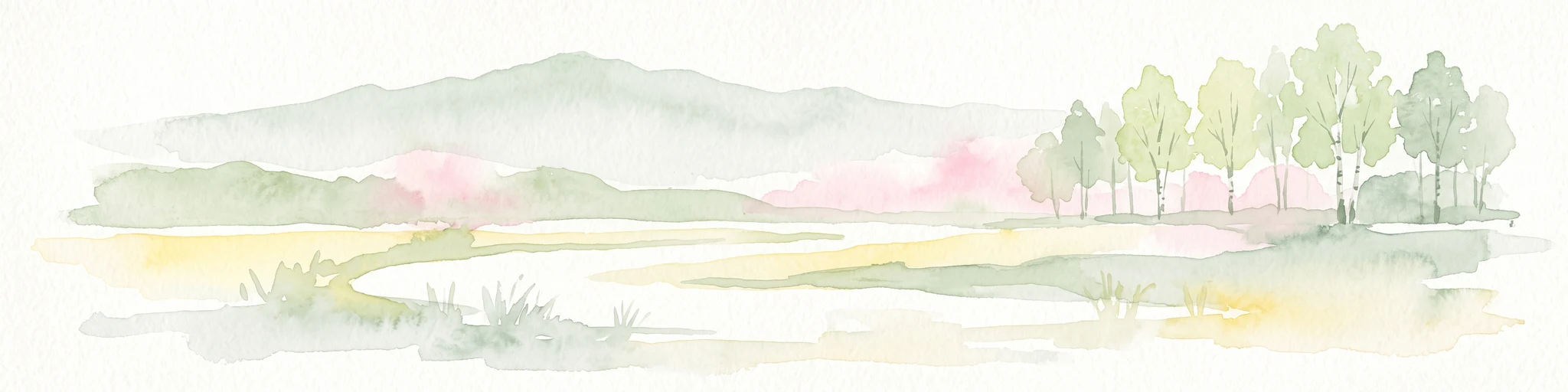
A watercolor illustration showing a winding river flowing through a grassy field, with a cluster of green trees on the right and soft pink and gray hills in the background.
Nature reserveGermany
About 14 km away#6 closest

East

Kiesgrube bei Baumbach Nature Reserve: River Meander and Wetland Geography in Germany

A preserved riparian landscape and bird habitat in northern Hesse

Located along the middle Fulda, this nature reserve represents an engineered success story where a former quarry transformed into a vital wetland ecosystem. Its shallow lake margins, willow thickets, and floodplain forests create a critical protected area for local waterbird populations, serving as an essential node within the Auenverbund Fulda floodplain conservation network.

Area
0.23 km²
Established
1995
Relief
Lowland
Climate
Temperate
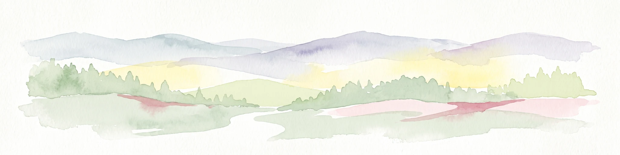
A watercolor painting showing a wide, panoramic view of soft, rolling hills with patches of forest, rendered in muted pastel colors.
Protected landscapeHesse
About 17 km away#7 closest

South

Naturpark Knüll: Geography, Basalt Formations, and Protected Areas of Northern Hesse

An expansive cultural landscape defined by volcanic ridges and riverine habitats

Naturpark Knüll offers a deep look into the geological and structural diversity of the Knüllgebirge. By mapping the transitions between bunter sandstone, basalt hilltops, and fertile floodplains, this resource highlights the region's role in biodiversity conservation and sustainable land management across the Schwalm-Eder and Hersfeld-Rotenburg districts.

Area
832.58 km²
Established
2021
Relief
Mountain
Climate
Temperate
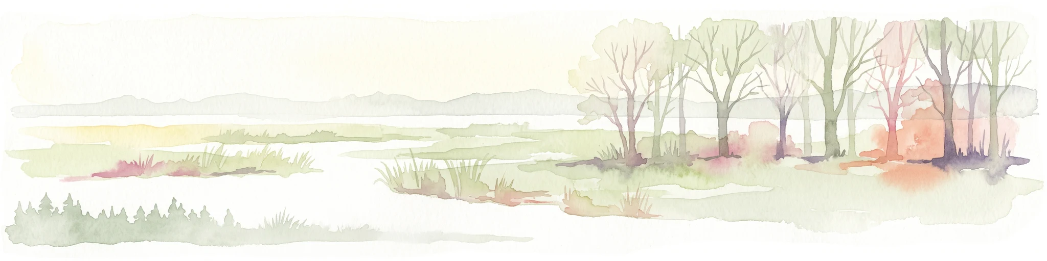
A pale, panoramic watercolor painting of a wetland landscape with a row of trees on the right side and low hills in the distance.
Nature reserveLandkreis Hersfeld-Rotenburg
About 18 km away#8 closest

Southeast

Im Sand bei Rotenburg Nature Reserve: Mapping the Fulda River Floodplain and Wetland Mosaic

A structured floodplain refuge in Landkreis Hersfeld Rotenburg

Located in the low-lying reaches of the Fulda River, Im Sand bei Rotenburg represents a significant shift from industrial land use to a protected, structurally rich riverine mosaic. The area features a complex of water-filled pits, reedbeds, and alluvial forest patches that serve as a crucial migratory stopover for diverse waterbird populations in northeastern Hesse.

Area
0.102 km²
Established
1997
IUCN
IV
Relief
Lowland

Common questions about visiting, size, designation, and location context for Goldbergsee (Ostheim)

Goldbergsee (Ostheim) FAQs for park facts, access, geography, and protected area context

Find quick answers about Goldbergsee (Ostheim), including protected-area facts, park geography, trail and visitor context, and how the park fits into its surrounding country and regional landscape.
MoriAtlas Explorer

Continue Your Protected Areas Search Across the Global Atlas

Deepen your exploration by continuing the structured search for national parks and protected areas worldwide. Utilize the comprehensive filtering capabilities to compare different conservation landscapes and refine your understanding of global park geography. Discover more about the distribution and characteristics of protected natural areas.

Global natural geography