
Mori Atlas logo
Nature reserveMosenberg bei Homberg

Mapped protected boundaries and ecological terrain within the Schwalm-Eder-Kreis district

Mosenberg bei Homberg Nature Reserve: A Detailed Geographic and Landscape Atlas Profile

(Naturschutzgebiet Mosenberg bei Homberg)

Mosenberg bei Homberg represents a key protected area in northern Hesse, characterized by a complex mosaic of nutrient-poor grasslands and light oak-hornbeam forests on basalt rubble slopes. This nature reserve, co-designated as an EU Habitats Directive site, showcases the interplay between historic land use and current conservation management. The site features steep transitions from open meadow to woodland, providing essential breeding habitats for bird species adapted to warm-dry slope environments.

nature reserveNaturschutzgebietFFH siteNatura 2000dry grasslandMagerrasen
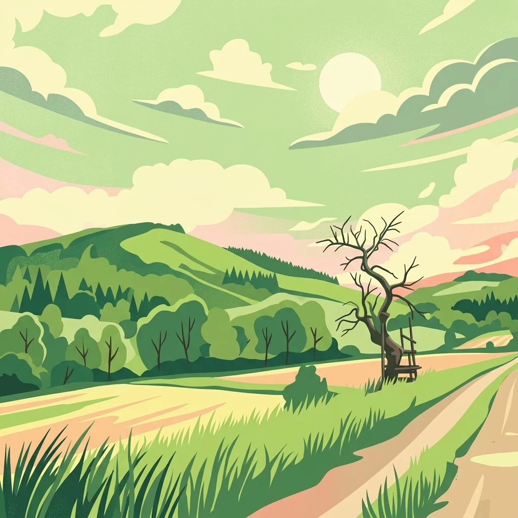
A digital illustration showing a green landscape with rolling hills, a dirt path, and a leafless tree with a wooden structure hanging from it under a cloudy sky.

Mosenberg bei Homberg

Nature reserve

Park overview

Structured park overview, official facts, and landscape profile for Mosenberg bei Homberg

Mosenberg bei Homberg park facts, protected area profile, and essential visitor context

Review the core facts for Mosenberg bei Homberg, including designation, size, terrain, visitor scale, habitats, and operating context in one park-focused overview.

About Mosenberg bei Homberg

Mosenberg bei Homberg is a compact yet ecologically rich nature reserve in the rolling landscape of northern Hesse, where traditional rural land use has produced a mosaic of habitats now protected under both German and European law. Covering roughly 64 hectares across two separate parcels, the reserve sits on the southwestern and western flanks of the Mosenberg, a basalt-based hill whose slopes harbor one of the more distinctive combinations of dry grassland and ancient-feeling deciduous forest in the Schwalm-Eder district.

The landscape character of the site is defined by the interplay of geology, slope, and centuries of human land management. The basalt scree that tumbles down toward the valley below the ruined Sauerburg supports a light, open oak-hornbeam forest with a notable proportion of high-quality hardwoods such as oak, hornbeam, and other deciduous species. This woodland carries an unusually large amount of standing and fallen deadwood, providing habitat for fungi, saproxylic insects, woodpeckers, and other organisms dependent on decaying wood.

Above and around these wooded slopes, the reserve preserves open and semi-open habitats that survive from the region's historic farming systems. Partly scrubbed-over lean grasslands (Magerrasen), extensive meadows, and scattered field copses coexist with relicts of former coppice woodland (Niederwald) and wood-pasture (Hutewald) management. Together these habitats form a finely grained ecological mosaic on slopes often too steep, thin-soiled, or marginal for modern intensive agriculture.

The reserve is also valued for the cultural-ecological continuity it represents. Sheep grazing, mowing with aftermath grazing, and traditional forestry practices are not merely remnants here; they are considered active tools for keeping the open grasslands open and for maintaining the structure of the woodland. In this sense, Mosenberg bei Homberg functions both as a nature conservation site and as a living example of the historical cultural landscape of the upper Efze river catchment.

Quick facts and research context for Mosenberg bei Homberg

Mosenberg bei Homberg is a nature reserve (Naturschutzgebiet) located on the territory of the town of Homberg (Efze) in the Schwalm-Eder district of northern Hesse, Germany. The protected area has been legally designated since 1986 under the code 1634015 and coincides in extent with the EU FFH site 4922-301 of the same name.

The reserve lies on the southwestern and western slopes of the Mosenberg, a hill that rises to roughly 437 meters above sea level, and includes forest associated with the basalt scree around the ruined Sauerburg. Its setting north-east of the Homberg town center places it at the interface between settlement, road infrastructure, and the traditional agricultural landscape of the upper Efze valley.

Protection and recognition

Documented terrestrial protection history and Natura 2000 recognition details

Mosenberg bei Homberg Protection Status and International Recognition

Terrestrial protection status for Mosenberg bei Homberg establishes a recorded designation year of 1986 within official databases. International recognition sources link the protected area to documented Natura 2000 listings and structured conservation records.

International recognition

Protection details

Protection scope
Terrestrial
Designated year
1986
Transboundary protection
No
WDPA ID
164698
Park context

Deeper park guide and search-rich context for Mosenberg bei Homberg

Mosenberg bei Homberg history, landscape, wildlife, and travel context

Explore Mosenberg bei Homberg through its history, landscape character, ecosystems, wildlife, conservation priorities, cultural context, and seasonal travel timing in a structured park guide built for atlas discovery and search intent.

Why Mosenberg bei Homberg stands out

The reserve is best known for its species-rich, light oak-hornbeam forest with abundant deadwood on basalt scree, and for its mosaic of nutrient-poor grasslands shaped by historic sheep grazing and wood-pasture use. It is also recognized as a breeding and foraging habitat for characteristic birds of warm-dry slope environments, notably red-backed shrike, black woodpecker, and peregrine falcon.
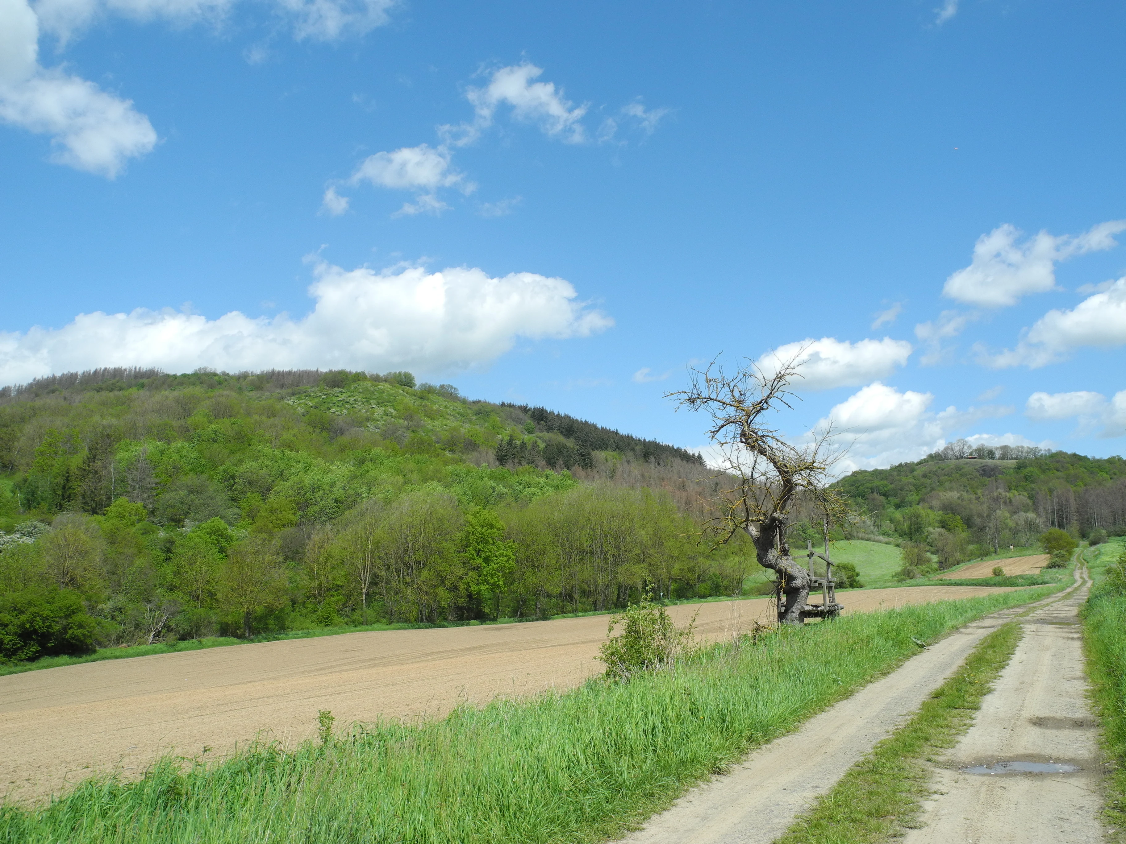
A dirt path runs alongside a brown plowed field towards a forested hill, with a solitary dead tree standing near the path and a blue sky with clouds above.
View of the Mosenberg nature reserve showing a dirt path, a plowed field, a dead tree, and forested slopes under a blue sky.

Mosenberg bei Homberg history and protected-area timeline

The area around the Mosenberg has a long history shaped by settlement, hilltop fortification, and traditional land use. The slopes bear the Sauerburg, a ruined castle site that anchors both the name and the cultural identity of the hill. For centuries, the surrounding woodland slopes were managed as coppice (Niederwald) and wood-pasture (Waldweide or Hutewald), while the drier, sun-exposed grasslands were grazed by sheep or mown in rotation. These systems gradually produced the species-rich vegetation patterns still visible today.

Formal nature conservation arrived in 1986, when the area was placed under legal protection as a Naturschutzgebiet under the designation number 1634015 by the responsible Hessian authorities. The protected area was later recognized at the European level as part of the Natura 2000 network, becoming FFH site 4922-301 "Mosenberg bei Homberg," and the two designations were made spatially identical.

A formal management plan was prepared by the Regierungspräsidium Kassel in May 2011, addressing the protection and development of the site's grassland and woodland habitats. This plan formalized ongoing measures such as sheep grazing, mowing regimes, hay-transfer seeding, and the maintenance of the characteristic oak-hornbeam forest structure, marking a shift from passive protection to active, targeted conservation management.

Mosenberg bei Homberg landscape and geographic character

The reserve occupies the lower and middle slopes of the Mosenberg and the basalt scree leading down from the Sauerburg. The relief is moderately sloping to locally steep, with thin, stony soils derived from basalt weathered material. These edaphic conditions, combined with the south-west to west exposure, create drier and warmer microclimates than the surrounding plateau and valley.

At its eastern edge, the hill rises to the summit of the Mosenberg at about 437 meters above sea level. Below the summit, the basalt rubble slopes descend into a mixture of open grassland, scrub patches, and gradually denser woodland. The distinctive feature of the slope is the transition, over relatively short distances, from open lean grassland to closed oak-hornbeam forest, producing sharp habitat edges that are themselves valuable for many species.

A small stream, the Klingelbach, runs along the southern margin of the reserve as a right-hand tributary of the Efze. Combined with the nearby Landesstraße L 3224 along the southeastern edge, the site is bordered by both hydrological and infrastructure features that frame its landscape setting between natural valley and settled countryside.

Mosenberg bei Homberg ecosystems, habitats, and plant life

Ecologically, Mosenberg bei Homberg is defined by warm-dry, semi-open habitats that have become rare in much of central Germany. The vegetation mosaic includes nutrient-poor grasslands (Magerrasen) in various stages of succession, from open, grazed turf to thicket with colonizing shrubs. Embedded within this grassland matrix are small patches of extensive meadows and field copses, while along the basalt slopes the vegetation shifts into light oak-hornbeam woodland rich in noble hardwoods.

The woodland itself is structurally distinctive. Because it evolved under coppice and wood-pasture systems rather than modern high-forestry practice, it is comparatively open, multi-layered, and rich in old, gnarled trees. Standing and fallen deadwood is abundant, supporting communities of fungi and invertebrates specialized on decaying wood. The combination of open soils, exposed rock, and varied microhabitats gives the slope a particularly high habitat diversity over a small area.

The site's classification as an FFH area reflects the presence of habitat types of European interest, particularly the open dry grasslands and the orchis- and hornbeam-rich deciduous forest communities of the basalt slopes. These habitats not only host notable flora, they also underpin the site's value for breeding birds and invertebrates that depend on structurally rich, extensively used landscapes.

Mosenberg bei Homberg wildlife and species highlights

The wildlife profile of Mosenberg bei Homberg is closely tied to the structure of its habitats. The reserve is explicitly recognized for its breeding and foraging bird communities, which include the red-backed shrike as a breeding species, and black woodpecker and peregrine falcon as regular visitors searching for food. Red-backed shrike, in particular, is associated with the warm, partly open slopes with scattered shrubs and trees that the reserve provides in abundance.

Black woodpecker benefits from the high volume of deadwood and old trees in the oak-hornbeam forest, using them both for foraging and for cavity creation that other species later reuse. Peregrine falcon presence, even as a foraging guest rather than a confirmed breeder, indicates that the open slopes and adjacent cliff-like or rocky terrain around the Sauerburg provide hunting opportunities and possibly nesting ledges.

Beyond birds, the mosaic of dry grassland, scrub, and deadwood-rich woodland supports a rich invertebrate fauna characteristic of traditional cultural landscapes, including pollinators, grasshoppers, and saproxylic beetles associated with decaying wood. Small mammals typical of woodland edges and dry grasslands, as well as common reptiles that use warm, stony slopes, also find suitable habitat here, although the available documentation emphasizes the site's bird conservation value above all.

Mosenberg bei Homberg conservation status and protection priorities

Conservation significance at Mosenberg bei Homberg rests on the spatial coincidence of two formal protection regimes: the German Naturschutzgebiet designation under code 1634015 since 1986, and the European Natura 2000 designation as FFH site 4922-301. This double designation means the site is managed to maintain both nationally valued habitats and habitat types and species of Community interest under the EU Habitats Directive.

The conservation strategy combines preservation with active management. The lean grasslands on the southern and western slopes are maintained and developed through targeted sheep grazing and mowing-pasture regimes, supplemented by measures such as hay-transfer seeding to reinforce characteristic species. The oak-hornbeam forests on the basalt scree of the Sauerburg slopes are maintained in their historical, structurally rich form, retaining features such as open canopy, deadwood, and a high proportion of noble hardwoods.

The management plan published in 2011 by the Regierungspräsidium Kassel systematized these measures and tied them explicitly to the conservation goals of the FFH designation. In this framework, Mosenberg bei Homberg is not viewed as a static relic but as a working cultural landscape whose biodiversity depends on the continuation of adapted, low-intensity land use.

Mosenberg bei Homberg cultural meaning and human context

The cultural context of Mosenberg bei Homberg is inseparable from its ecological value. The mosaic of grassland, coppice relicts, and wood-pasture woodland is a direct product of centuries of rural land use in the Efze valley, where steep basalt slopes were never intensively farmed. The presence of the Sauerburg, a ruined castle perched above the reserve, ties the landscape to broader patterns of medieval settlement, fortification, and territorial control in northern Hesse.

Traditional practices such as sheep herding, rotational mowing, and selective woodland cutting for fuel wood and grazing are not merely historical curiosities; they remain embedded in the reserve's current conservation strategy. The site thus serves as a tangible reminder that many of the most biodiverse habitats in central Europe are cultural landscapes, maintained by the interaction of people, livestock, and terrain over long periods.

Recognition of this dual natural-cultural value is reflected in the management approach, which frames grazing, mowing, and selective forestry as cultural practices that simultaneously sustain local identity, rural livelihoods, and habitat quality.

Top sights and standout views in Mosenberg bei Homberg

A standout feature of Mosenberg bei Homberg is the sharp ecological transition across a short distance, from open lean grassland on the lower slopes to a light, deadwood-rich oak-hornbeam forest on the basalt scree. This structural complexity, compressed into a relatively small area, gives the site an unusually high habitat density for its size.

The reserve's formal significance is reinforced by the overlap of national and European protection frameworks, while its practical significance lies in the way historic grazing and coppice practices continue to shape biodiversity outcomes today. Few sites of comparable size combine such a clear demonstration of warm-dry slope habitats, traditional land use, and conservation planning in a single, coherent landscape.

Best time to visit Mosenberg bei Homberg

As a small, low-elevation reserve without major seasonal infrastructure, Mosenberg bei Homberg is principally a site for quiet, off-season nature observation. Late spring and early summer are typically the most rewarding time to experience the lean grasslands, when grasses and wildflowers are in full growth, shrub-nesting birds such as the red-backed shrike are establishing territories, and insect activity on the warm slopes is at its peak.

Autumn can also be attractive for visitors interested in woodland character, as the oak-hornbeam forest on the basalt slopes takes on warm leaf colors and fruiting structures become more visible, while the deadwood component of the forest remains evident year-round. Winter visits offer clearer views across the open slopes and the silhouette of the Mosenberg hill and Sauerburg ruins against the surrounding agricultural landscape, though weather-dependent accessibility along minor rural roads may be a constraint outside the main seasons.

Monthly climate preview

Track representative temperature ranges and monthly precipitation patterns across the year

Mosenberg bei Homberg Climate Normals and Long-Term Weather by Month

Historical data records monthly temperature variations from sub-zero winter minimums to peak summer maximums alongside steady precipitation rates. Detailed monthly normals provide complete context for understanding the broader environmental profile of this regional protected area.
Annual mean9 °C
-1 °C19 °C
Jan-1°
Feb
Mar
Apr
May12°
Jun16°
Jul19°
Aug18°
Sep14°
Oct
Nov
Dec
Warmest month
July

18.6 °C

Coolest month
January

-0.8 °C

Wettest month
July

2.5 mm/day

Driest month
April

1.4 mm/day

Park location guide

Geography guide, regional context, and park location map for Mosenberg bei Homberg

Mosenberg bei Homberg park geography, regions, and map view in Germany

Understand where Mosenberg bei Homberg sits in Germany through a broader geographic reading of the surrounding landscape, nearby location context, and its mapped position within the national park landscape.

How Mosenberg bei Homberg fits into Germany

Germany is a federal republic in Western and Central Europe with a population of over 83 million across sixteen constituent states. It is Europe's largest economy by nominal GDP and a major global exporter and importer. The capital is Berlin, and the country borders Denmark, Poland, Czech Republic, Austria, Switzerland, France, Luxembourg, Belgium, and the Netherlands.

Wider geography shaping Mosenberg bei Homberg in Germany

Germany is located in Western and Central Europe, spanning 357,022 km². It borders Denmark to the north, Poland and the Czech Republic to the east, Austria and Switzerland to the south, and France, Luxembourg, Belgium, and the Netherlands to the west. The country has coastlines on the Baltic Sea and North Sea to the north, with the Alps located in the southern region.

Map view of Mosenberg bei Homberg

Use this park location map to pinpoint Mosenberg bei Homberg in Germany, understand its exact geographic position, and read its mapped placement within the surrounding landscape more clearly.

Pigeon | © OpenStreetMap contributors

Location context for Mosenberg bei Homberg

Schwalm-Eder-Kreis
Recorded earthquake history

Browse the Historical Earthquake Catalogue for Mosenberg bei Homberg

Review the documented history of seismic events identified near Mosenberg bei Homberg. This MoriAtlas catalogue provides a structured view of historical earthquake records to support ongoing geographic exploration and mapping of the Schwalm-Eder-Kreis region.

Mosenberg bei Homberg Earthquake History

Catalogued events

1 event

Strongest magnitude

Magnitude 3.4

Most recent event

Jan 29, 1982

This history includes earthquakes recorded inside the park or within 50 km of its borders

Visual exploration of basalt slopes, oak and hornbeam forests, and rare grassland habitats

Mosenberg bei Homberg Photos and Protected Area Landscape Scenery

Visual records illustrate the rugged terrain and distinct habitat transitions across the protected basalt slopes of Mosenberg bei Homberg. Detailed photography reveals the unique structural character of the oak and hornbeam woodlands and dry grasslands that define the regional ecosystem.

A dirt path runs alongside a brown plowed field towards a forested hill, with a solitary dead tree standing near the path and a blue sky with clouds above.

Park atlas

Compare regional nature reserves and connected habitats across northern Hesse

Parks Near Mosenberg bei Homberg And Surrounding Protected Landscapes

Browse other parks and protected areas near Mosenberg bei Homberg to analyze regional terrain, oak-hornbeam forests, and dry grassland habitats. Extending the geographic comparison reveals broader ecological patterns across the surrounding district and local valley landscapes.
A horizontal watercolor painting of a serene lake bordered by a shoreline with trees and distant rolling hills against a soft background.
Nature reserveSchwalm-Eder-Kreis
About 3 km away#1 closest

Northeast

Goldbergsee Nature Reserve and Mapped Protected Landscapes in Schwalm-Eder-Kreis

Ecological transition and inland water-body geography.

Goldbergsee stands as a prime case study of industrial renaturalization in northern Hesse. This protected nature reserve, characterized by its clear spring-fed water and successional woodland habitat, offers a window into how former open-cast mining sites evolve into ecologically balanced water bodies within the Schwalm-Eder-Kreis mountain foothills.

Established
1991
A watercolor painting showing a soft, stylized landscape of green hills, a winding stream, and coniferous forest sections under a pale sky.
Nature reserveHesse
About 3.7 km away#2 closest

Southeast

Eichelskopf Nature Reserve: Protected Geological and Historical Landscapes in Hesse

Regional conservation profile and mapped boundaries in Schwalm-Eder.

Examine the conservation history of Eichelskopf, a key nature reserve in the Schwalm-Eder district of Hesse. Established in 1927, this site remains a vital point of interest for understanding the evolution of species protection and geological heritage management in central Germany.

Area
0.027 km²
Established
1927
Scope
Terrestrial
A horizontal watercolor painting depicting a soft-toned, rolling landscape with green meadows, distant tree lines, and a light-filled sky.
Nature reserveHesse
8.6 km away#3 closest

Southeast

Roßbachtal bei Völkershain Nature Reserve: Geography and Protected Valley Landscapes

Stream-fed meadow and forest habitats in Hesse

Located in the Schwalm-Eder-Kreis, Roßbachtal bei Völkershain encompasses a linear valley environment within the Knüllgebirge. The reserve tracks the Roßbach stream as it moves toward the Breitenbach, featuring a protected alignment of meadows and slopes that serves as a focused habitat management area in central Germany.

Area
1.141 km²
Established
1988
IUCN
IV
A watercolor painting showing a tranquil lake shore with soft green vegetation and distant muted hills.
Nature reserveSchwalm-Eder-Kreis
9.1 km away#4 closest

West

Borkener See Nature Reserve: Geographic Overview of a Reclaimed Wetland and Bird Sanctuary

A protected landscape featuring oligotrophic lake waters in Schwalm-Eder-Kreis.

Borkener See serves as a focal point for understanding the reclamation of mining landscapes in northern Germany. As an officially protected nature reserve, it provides a stable habitat for migratory bird species, with deep water basins and carefully managed wetland buffers defining its physical and ecological presence in the Westhessische Senke.

Area
3.5 km²
Established
1990
Relief
Lowland
Climate
Temperate
A soft, panoramic watercolor painting depicting a green floodplain with a winding river, scattered trees, and rolling hills in the distance.
Nature reserveSchwalm-Eder-Kreis
13 km away#5 closest

East

Fuldatal bei Konnefeld: Protected Floodplain and Wetland Geography in Schwalm-Eder-Kreis

An essential river valley habitat and nature reserve in northern Hesse

Fuldatal bei Konnefeld is a compact, high-value nature reserve situated along the Fulda river valley. The landscape is defined by its old river oxbows, soft-wood forest galleries, and species-rich hay meadows. This resource provides a focused geographic overview of its protected status as a Natura 2000 site and its function as a vital wildlife corridor.

Area
0.169 km²
Established
1989
IUCN
IV
Relief
Lowland
A watercolor painting showing a wide, panoramic view of soft, rolling hills with patches of forest, rendered in muted pastel colors.
Protected landscapeHesse
About 15 km away#6 closest

South

Naturpark Knüll: Geography, Basalt Formations, and Protected Areas of Northern Hesse

An expansive cultural landscape defined by volcanic ridges and riverine habitats

Naturpark Knüll offers a deep look into the geological and structural diversity of the Knüllgebirge. By mapping the transitions between bunter sandstone, basalt hilltops, and fertile floodplains, this resource highlights the region's role in biodiversity conservation and sustainable land management across the Schwalm-Eder and Hersfeld-Rotenburg districts.

Area
832.58 km²
Established
2021
Relief
Mountain
Climate
Temperate
A watercolor illustration showing a winding river flowing through a grassy field, with a cluster of green trees on the right and soft pink and gray hills in the background.
Nature reserveGermany
About 16 km away#7 closest

East

Kiesgrube bei Baumbach Nature Reserve: River Meander and Wetland Geography in Germany

A preserved riparian landscape and bird habitat in northern Hesse

Located along the middle Fulda, this nature reserve represents an engineered success story where a former quarry transformed into a vital wetland ecosystem. Its shallow lake margins, willow thickets, and floodplain forests create a critical protected area for local waterbird populations, serving as an essential node within the Auenverbund Fulda floodplain conservation network.

Area
0.23 km²
Established
1995
Relief
Lowland
Climate
Temperate
A minimalist watercolor painting of rolling hills and a stream, using soft greens, purples, and pale yellows on a white background.
Protected landscapeHesse
About 19 km away#8 closest

Northwest

Naturpark Habichtswald: Protected Landscape and Basalt Terrain Atlas in Northern Hesse

Exploration of forested ridges and medieval castle ruins.

Explore the geographic identity of Naturpark Habichtswald, a prominent protected landscape in northern Hesse. This record covers the park's volcanic basalt hills, broad wooded ridges, and the diverse historical ruins that define its unique topographic character across the Habichtswälder Bergland.

Area
474.28 km²
Established
1962
Relief
Mountain
Climate
Temperate

Common questions about visiting, size, designation, and location context for Mosenberg bei Homberg

Mosenberg bei Homberg FAQs for park facts, access, geography, and protected area context

Find quick answers about Mosenberg bei Homberg, including protected-area facts, park geography, trail and visitor context, and how the park fits into its surrounding country and regional landscape.
MoriAtlas Explorer

Continue Your Protected Areas Search Across the Global Atlas

Deepen your exploration by continuing the structured search for national parks and protected areas worldwide. Utilize the comprehensive filtering capabilities to compare different conservation landscapes and refine your understanding of global park geography. Discover more about the distribution and characteristics of protected natural areas.

Global natural geography