
Mori Atlas logo
Regional parkParc naturel régional du Golfe du Morbihan

Understanding the mapped marine boundaries and tidal landscapes of this French regional park

Parc naturel régional du Golfe du Morbihan: A Detailed Geographic and Coastal Park Atlas

Parc naturel régional du Golfe du Morbihan represents a significant protected coastal landscape in the Bretagne region of France. This atlas entry details the geography of the sheltered gulf, encompassing a mosaic of inhabited islands, shallow seagrass meadows, tidal flats, and historic oyster farming communities. The park integrates extensive marine spaces with inland communes, creating a complex maritime environment that serves as an essential habitat for diverse species including the native seahorse.

coastal parkmarine parkgulfislandsBrittanyMorbihan
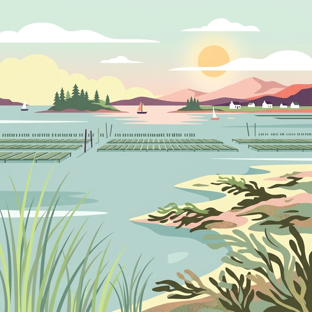
A peaceful vector-style illustration of a coastal gulf scene at sunrise, featuring calm water, small islands with pine trees, distant hills, sailboats, and structured rectangular oyster farming racks in the water, with marshy vegetation in the foreground.

Parc naturel régional du Golfe du Morbihan

Regional park

Park overview

Structured park overview, official facts, and landscape profile for Golfe du Morbihan Regional Natural Park

Golfe du Morbihan Regional Natural Park park facts, protected area profile, and essential visitor context

Review the core facts for Golfe du Morbihan Regional Natural Park, including designation, size, terrain, visitor scale, habitats, and operating context in one park-focused overview.

About Golfe du Morbihan Regional Natural Park

The Golfe du Morbihan Regional Natural Park is a French regional natural park that brings together a network of communes around the Gulf of Morbihan, a sheltered arm of the sea on the coast of southern Brittany. Created in 2014, it represents an effort to coordinate the protection, planning, and promotion of a territory where land and sea are functionally inseparable. The park's perimeter is designed to capture not just the shoreline but also the inland communes and island communities whose identity is intrinsically tied to the gulf.

The territory reflects the classic geography of southern Morbihan: a deeply indented coastline forming the gulf, a scattering of small inhabited and uninhabited islands, estuarine and tidal flats, and an inland zone of agricultural countryside, woodlands, and small market towns. Vannes, historically the principal town of the gulf, sits centrally within the park's influence. Surrounding communes such as Arzon, Sarzeau, Saint-Gildas-de-Rhuys, Locmariaquer, Auray, and others represent the diversity of the area, blending active fishing and oyster-farming communities with inland rural landscapes.

Beyond its scenic character, the park is a place of active economic and cultural life. Oyster cultivation, sailing, fishing, seasonal tourism, and agriculture all coexist within its boundaries. The park's mission is to reconcile these uses with the preservation of the gulf's ecological value, hydrological patterns, and cultural heritage. It does so under the broader framework of France's regional natural parks, which emphasize sustainable development and territorial coherence rather than strict nature reserve-style exclusion.

The park plays an institutional role as well. It is managed as a syndicat mixte, bringing together regional, departmental, and municipal authorities, and it is classified under IUCN Category V for protected landscapes and seascapes. Its territory includes both terrestrial and marine components, and its governance recognizes that ecological management in this environment must operate across the waterline.

Quick facts and research context for Golfe du Morbihan Regional Natural Park

Located in the Morbihan department in Brittany, northwestern France, the park is built around the Gulf of Morbihan, a shallow inland sea opening onto the Atlantic. It covers about 64,200 hectares of land across 35 communes and roughly 17,000 hectares of associated marine area.

Classified as IUCN Category V (protected landscape or seascape), it is administered as a mixed syndicat under the Federation of Regional Natural Parks of France. Its territory blends cultivated coastal countryside, salt-influenced ecosystems, traditional oyster-farming zones, and inhabited islands, with Vannes serving as the principal nearby city.

Protection and recognition

Examine documented protection scope, administrative details, and official recognition records.

Parc naturel régional du Golfe du Morbihan Protection Status and Designated Area Record

Parc naturel régional du Golfe du Morbihan protection status brings together verified management records and administrative registry entries. Protected area designation details outline the foundational conservation framework and structural scope.

Protection details

WDPA ID
555561955
Park context

Deeper park guide and search-rich context for Golfe du Morbihan Regional Natural Park

Golfe du Morbihan Regional Natural Park history, landscape, wildlife, and travel context

Explore Golfe du Morbihan Regional Natural Park through its history, landscape character, ecosystems, wildlife, conservation priorities, cultural context, and seasonal travel timing in a structured park guide built for atlas discovery and search intent.

Why Golfe du Morbihan Regional Natural Park stands out

The park is best known for its protected seascape centered on the Gulf of Morbihan, one of the most distinctive coastal inlets in Brittany. Small islands, sheltered bays, oyster-farming villages, and historic port communities shape a tightly woven maritime landscape. It is also recognized for the Hippocampus genus: the park's logo features a lined seahorse, drawn from one of the seahorse species living among soft substrates and seagrass meadows in the gulf. The combination of seahorse habitat, traditional oyster cultivation (visible for instance around the Île-d'Arz), and a working coastal heritage gives the park a clearly identifiable identity.
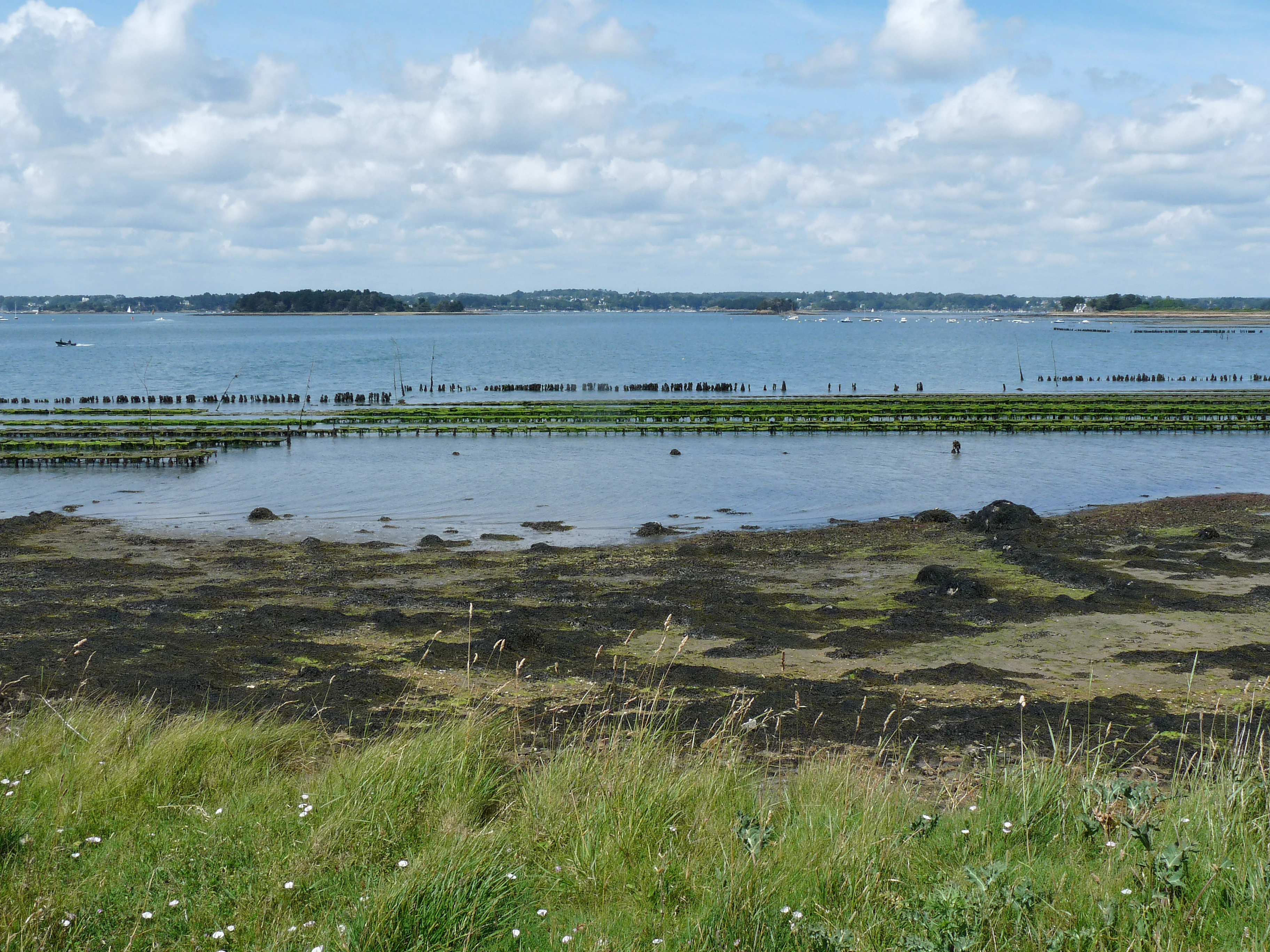
A wide view of coastal waters featuring rows of oyster farming racks emerging from the low tide, with grassy shoreline in the foreground and a distant island under a partly cloudy sky.
Oyster farming tables stretching across the shallow waters near the coast of Ile d'Arz in the Gulf of Morbihan.

Golfe du Morbihan Regional Natural Park history and protected-area timeline

The process leading to the creation of the park began in 1994, with the regional council of Brittany deliberating in favor of the project in 1999. Over the following years, the proposal was shaped through local debate, planning efforts, and political negotiation between the communes surrounding the gulf.

The park was officially created by decree on 2 October 2014, signed by Prime Minister Manuel Valls and the Minister of Ecology, Ségolène Royal, the day before. At its establishment, it became the 50th regional natural park in France, a symbolic milestone for the national network. Thirty communes originally adhered to the park's charter.

The park has since been extended through two formal waves. In December 2018, four additional communes were integrated into its perimeter. In December 2022, two further communes were incorporated, bringing the total number of communes in the park to 35. Over the same period, the park's presence in regional media and planning discussions consolidated it as an established institution in the governance of the gulf and its surroundings.

Golfe du Morbihan Regional Natural Park landscape and geographic character

The landscape of the park is defined by its setting around a sheltered gulf. The Gulf of Morbihan itself is a shallow tidal sea with a complex shoreline of peninsulas, bays, inlets, and outlets to the open Atlantic. Within the gulf lie numerous islands, including the Île-d'Arz, recognizable in the imagery of the region for its traditional oyster-farming operations.

Along the coast, low cliffs, beaches, tidal flats, marshes, and ancient salt-working areas shape a rhythm of land and sea. Inland, the terrain transitions into gently rolling countryside, mixed agricultural land, woodland patches, and small river valleys feeding into the gulf system. The result is a mosaic where no single dominant landscape dominates; instead, the character emerges from the continuous interplay between marine, coastal, and rural environments.

Golfe du Morbihan Regional Natural Park ecosystems, habitats, and plant life

The park supports a notably rich ecological transition zone between marine and terrestrial systems. Shallow tidal waters, interspersed seagrass beds (known locally as zostères), and rocky or soft substrates create conditions suitable for diverse marine life. The seagrass meadows in particular are ecologically significant, providing habitat for small organisms and supporting sensitive species such as seahorses.

On land, the park's habitats include coastal marshes, reed beds, hedgerow-rich agricultural countryside, woodland patches, and cliff-side vegetation along the gulf's edge. The interaction between freshwater streams, tidal influence, and long-established human management has produced semi-natural habitats of high biodiversity value. This blend of marine, wetland, and rural habitat types is central to the park's ecological identity.

Golfe du Morbihan Regional Natural Park wildlife and species highlights

The park's wildlife character is closely tied to its coastal and marine habitats. The Gulf of Morbihan hosts seahorse populations, including the two species referenced in connection with the park's logo, found among rocky substrates and seagrass beds at relatively shallow depths.

Beyond these emblematic species, the tidal flats, mudflats, reed beds, and estuary mouths support rich populations of wading birds, waterfowl, and marine invertebrates. Inland, the mosaic of small woodlands, hedgerows, and farmland supports common Breton terrestrial fauna. The wildlife value of the park lies primarily in the continuity and quality of its coastal and marine habitats rather than in any single charismatic species.

Golfe du Morbihan Regional Natural Park conservation status and protection priorities

From a conservation perspective, the park's significance lies in its integrated approach to coastal management. By including both terrestrial communes and marine space within a single management entity, it acknowledges that ecological processes in the gulf cannot be protected by land-based reserves alone.

The presence of seagrass meadows, oyster-farming zones, island habitats, and tidal wetlands reflects a working coastal environment whose continued ecological function depends on careful planning. The park's IUCN Category V status underlines its recognition as a protected landscape and seascape rather than a strict nature reserve, balancing conservation with sustainable human activity.

Golfe du Morbihan Regional Natural Park cultural meaning and human context

The gulf and its surroundings carry a strong Breton maritime heritage. Coastal communes have longstanding traditions of oyster cultivation, fishing, and navigation, while the islands of the gulf preserve distinctive small-community ways of life. Place names and local culture reflect the region's Breton linguistic background, with the park itself known in Breton as « Park ar Mor Bihan ».

Vannes, the principal nearby city, anchors the territory historically and culturally, connecting inland Brittany to the coastal gulf. The park's charter and structure encourage the preservation of these cultural patterns alongside environmental management, recognizing that the landscape and the communities within it have shaped one another over centuries.

Top sights and standout views in Golfe du Morbihan Regional Natural Park

A protected coastal-seascape park built around the Gulf of Morbihan, integrating inland communes, inhabited islands, and a substantial area of marine space. Notable for its Breton maritime heritage, traditional oyster-farming communities, and biologically important seagrass meadows that sustain emblematic species such as seahorses. The park's gradual territorial expansion and its status as the 50th regional natural park of France reflect its established role in regional environmental governance.

Best time to visit Golfe du Morbihan Regional Natural Park

The park's character shifts meaningfully with the seasons. Late spring and summer bring active oyster-farming activity, lively port communities, and favorable conditions for boat-based exploration of the gulf and its islands. Autumn often offers quieter landscapes, migratory bird presence along the tidal flats, and softer atmospheric conditions over the water.

Winter brings reduced activity but highlights the park's ecological rhythms, with strong tidal patterns, exposed mudflats, and frost-touched coastal scenery. Each season rewards different interests: marine wildlife in warmer months, birdlife and landscape mood in cooler ones.
Monthly climate preview

Long-term monthly temperature averages and precipitation measurements for Bretagne conservation lands

Parc naturel régional du Golfe du Morbihan Climate Normals and Temperature Patterns

Representative coordinate records show measured monthly temperature ranges and precipitation rhythms across the protected landscape. Examining the complete twelve-month climatology dataset clarifies long-term environmental patterns for this regional park.
Annual mean12 °C
7 °C19 °C
Jan
Feb
Mar
Apr11°
May14°
Jun17°
Jul19°
Aug19°
Sep17°
Oct14°
Nov10°
Dec
Warmest month
August

19.3 °C

Coolest month
January

6.6 °C

Wettest month
December

2.9 mm/day

Driest month
July

1.3 mm/day

Park location guide

Geography guide, regional context, and park location map for Golfe du Morbihan Regional Natural Park

Golfe du Morbihan Regional Natural Park park geography, regions, and map view in France

Understand where Golfe du Morbihan Regional Natural Park sits in France through a broader geographic reading of the surrounding landscape, nearby location context, and its mapped position within the national park landscape.

How Golfe du Morbihan Regional Natural Park fits into France

France is a unitary semi-presidential republic and one of the world's largest economies. It borders Belgium, Luxembourg, Germany, Switzerland, Italy, Monaco, Andorra, and Spain, with a maritime border to the United Kingdom. The country is known for its cultural influence, art, cuisine, and political history spanning centuries.

Wider geography shaping Golfe du Morbihan Regional Natural Park in France

France is located in Western Europe. Metropolitan France extends from the Rhine to the Atlantic Ocean and from the Mediterranean Sea to the English Channel and North Sea. The country borders Belgium, Luxembourg, Germany, Switzerland, Italy, Monaco, Andorra, Spain, and has a maritime border with the United Kingdom.

Map view of Golfe du Morbihan Regional Natural Park

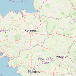
Use this park location map to pinpoint Golfe du Morbihan Regional Natural Park in France, understand its exact geographic position, and read its mapped placement within the surrounding landscape more clearly.

Pigeon | © OpenStreetMap contributors

Location context for Golfe du Morbihan Regional Natural Park

Bretagne
Recorded earthquake history

Examine Recorded Earthquake History Near Parc naturel régional du Golfe du Morbihan

Navigate to the MoriAtlas collection of historical earthquake records associated with the geography of Parc naturel régional du Golfe du Morbihan. Review event metadata including magnitude, depth, and epicentre proximity for a clearer understanding of local seismic history.

Parc naturel régional du Golfe du Morbihan Earthquake History

Catalogued events

43 events

Strongest magnitude

Magnitude 4.6

Most recent event

Nov 21, 2013

This history includes earthquakes recorded inside the park or within 50 km of its borders

Explore sheltered gulf shores, island habitats, and coastal marine environments through field photography.

Visualizing Parc naturel régional du Golfe du Morbihan: Landscape, Scenery, and Protected Area Photography

Visual records capture the intricate marine geography, tidal flats, and maritime heritage defining Parc naturel régional du Golfe du Morbihan. Photographic documentation reveals the complex relationship between sheltered waters, islands, and protected coastal ecosystems.

A wide view of coastal waters featuring rows of oyster farming racks emerging from the low tide, with grassy shoreline in the foreground and a distant island under a partly cloudy sky.

Park atlas

Compare adjacent regional landscapes and coastal reserves across Brittany

Other Parks and Protected Areas Near Parc naturel régional du Golfe du Morbihan

Browsing other parks near Parc naturel régional du Golfe du Morbihan reveals connected coastal reserves and marine environments throughout the surrounding region. Extending beyond a single protected area allows visitors to examine broader regional geography and evaluate neighboring conservation landscapes.
Nature reserveLoire-Atlantique
About 8.3 km away#1 closest

Southeast

Réserve naturelle régionale de l'étang du pont de fer: Protected Wetlands of Loire-Atlantique

Coastal freshwater pond, wooded buffers, and wetland connectivity.

This regional nature reserve encompasses a sizeable freshwater pond and surrounding marshes, serving as a vital link in the chain of wetlands between the Vilaine estuary and the Guérande region. Its distinctive landscape, defined by floating sedge islets and dense alder woodland, supports a high density of avifauna and rare plant species. As a key component of the protected terrain in Loire-Atlantique, the reserve offers insight into coastal wetland ecosystems and their function as biodiversity corridors in western France.

Area
0.626 km²
Established
2008
IUCN
IV
Relief
Lowland
A soft watercolor illustration depicting a serene wetland scene with a calm body of water, grassy marshland, and distant rolling hills under a pale sky.
Nature reservePays de la Loire
About 26 km away#2 closest

Southeast

Réserve naturelle régionale du marais de Brière: Protected Wetland Geography in Western France

A vital conservation mosaic of reedbeds, canals, and flooded meadows.

Located in the Pays de la Loire region, this protected area preserves the distinctive Grande Brière marshland landscape. The reserve manages a complex network of channels, islands, and damp meadows, providing essential habitat for migratory waterbirds and wetland wildlife. It represents a significant effort to maintain the ecological integrity of inland marsh complexes through structured regional conservation.

Area
8.36 km²
Established
2012
IUCN
IV
Nature reserveBretagne
About 29 km away#3 closest

Northeast

Réserve naturelle régionale des landes de Monteneuf: Geographic Landscape and Protected Area

Atlantic heathland mosaic and Neolithic heritage sites in Bretagne

The Réserve naturelle régionale des landes de Monteneuf serves as a vital refuge for Atlantic heathland habitats within the Bretagne region of France. Situated on thin, acidic schist soils, the area displays a textured mosaic of dry and humid moorland patches, small ponds, and prominent megalithic alignments. This protected territory offers a unique look at how historical land use maintains an open heathland ecosystem amidst a changing rural landscape.

Area
1.255 km²
Established
2013
IUCN
IV
Relief
Lowland
A soft watercolor painting showing a green landscape with a small pond in the foreground and rolling hills in the background under a pastel sky.
Nature reserveMorbihan
About 37 km away#4 closest

West

Réserve naturelle régionale des étangs du Petit et du Grand Loc'h: Wetland Landscape Atlas

Coastal protected area in Morbihan, Brittany

Located along the Atlantic coast near Guidel, this regional nature reserve protects a vital corridor of freshwater ponds, wet meadows, and reclaimed polders. The area is defined by its complex hydrology and serves as a key refuge for wintering and migratory bird populations within the Morbihan landscape, showcasing the intersection of maritime and terrestrial environments.

Area
1.18 km²
Established
2008
IUCN
IV
Relief
Lowland
A horizontal watercolor painting depicting a soft coastal scene with green grassy shores; distant hills; and a calm expanse of water.
Nature reservePays de la Loire
About 47 km away#5 closest

Southeast

Réserve naturelle régionale de la pointe Saint-Gildas: Coastal Geography and Protected Map

Regional Nature Reserve in Pays de la Loire, France

The Réserve naturelle régionale de la pointe Saint-Gildas represents a significant protected coastal headland. Located in Loire-Atlantique, the site encompasses 11.5 hectares of land where freshwater estuarine influences converge with Atlantic saltwater, providing a unique focus for regional geographic and landscape conservation studies.

Area
0.115 km²
Established
2014
IUCN
IV
Relief
Lowland
A watercolor painting showing a soft, stylized landscape of green hills, marshy fields, and patches of pink wildflowers or heathland against a white background.
Nature reserveBretagne
About 63 km away#6 closest

Northwest

Réserve naturelle régionale des landes et marais de Glomel: Protected Bog and Heathland Atlas

A rare inland wetland refuge within the Bretagne Montagnes Noires

Explore the geographic mosaic of the Réserve naturelle régionale des landes et marais de Glomel, a protected area in Bretagne comprising dual sites of peat bogs, wet heaths, and marshy meadows. This atlas entry details the internal terrain, including the Grazius stream network and the historic canal environment, essential for understanding the habitat distribution and conservation of this distinct inland landscape.

Area
1.078 km²
Established
2008
IUCN
IV
Relief
Upland
Watercolor painting of a coastal polder landscape with green grassy mounds, light yellow flat areas, and soft purple hills in the distance.
Nature reservePays de la Loire
About 69 km away#7 closest

Southeast

Réserve naturelle régionale du polder de Sébastopol: Coastal Wetland and Polder Geography

Protected coastal landscape on the Île de Noirmoutier.

This 133-hectare nature reserve in the Pays de la Loire region encompasses a distinctive 19th-century drainage landscape. The area features a long, narrow geometry of brackish ponds and salt-influenced terrain that provides essential stopover and breeding habitats for coastal waterbirds along the Vendée shoreline.

Area
1.33 km²
Established
2008
IUCN
IV
Nature reserveFinistère
72 km away#8 closest

Northwest

Vallée de l'Aulne Nature Reserve: A Detailed Mapping of Finistère River Valley Geography

Protected riparian landscapes, watershed ecology, and regional basin boundaries

The Vallée de l'Aulne serves as a central artery for the natural landscapes of western France. Spanning from inland Brittany toward the Atlantic, this protected reserve encompasses riverine corridors, bocage terrain, and tidal estuary zones. Use this detailed profile to examine the geographic distribution of protected habitats, river basin features, and the integrated environmental protections that define this key Finistère landscape.

Area
35.64 km²
Established
2014
Relief
Lowland
Climate
Temperate

Common questions about visiting, size, designation, and location context for Golfe du Morbihan Regional Natural Park

Golfe du Morbihan Regional Natural Park FAQs for park facts, access, geography, and protected area context

Find quick answers about Golfe du Morbihan Regional Natural Park, including protected-area facts, park geography, trail and visitor context, and how the park fits into its surrounding country and regional landscape.
MoriAtlas Explorer

Continue Your Protected Areas Search Across the Global Atlas

Deepen your exploration by continuing the structured search for national parks and protected areas worldwide. Utilize the comprehensive filtering capabilities to compare different conservation landscapes and refine your understanding of global park geography. Discover more about the distribution and characteristics of protected natural areas.

Global natural geography