Mori Atlas logo
Park earthquake history

Review recorded event magnitudes, focal depths, and epicentre distances in the park vicinity.

Historical Earthquake Records and Seismic Activity Catalogue for Graham-Laurier Provincial Park

This catalogue provides a structured view of historical earthquake events recorded near the boundaries of Graham-Laurier Provincial Park in British Columbia. Each entry details the timing, magnitude, and precise epicentre distance from the park, sourcing information from established geological record sets to support geographic research and regional seismic context. These findings offer an objective look at documented earth movement within the greater Peace River landscape.

Related tags

boreal forestremote wildernessMuskwa-KechikaBritish ColumbiaPeace River region

A remote northern British Columbia wilderness anchored by Christina Falls

Graham-Laurier Provincial Park

Graham-Laurier Provincial Park is a large, remote wilderness protected area in the Peace River region of northeastern British Columbia, Canada. Covering roughly 100,000 hectares of northern boreal terrain, the park sits within the broader Muskwa-Kechika Management Area, one of the largest intact natural landscapes in North America. The park is defined by its isolation, undeveloped character, and its role as a refuge for wildlife in an otherwise resource-active region of the province. Access is limited and rugged, with the park reached primarily through the Halfway/Graham Forest Service Road and a network of trails suitable for both motorized and non-motorized users. The signature feature is Christina Falls, accessible via the Christina Falls trail, which is a focal point for the small number of visitors who make the journey each year. Hunting is the dominant recreational activity, reflecting the park's role as a working wilderness within a landscape shaped by both conservation and resource interests.

Location
Canada
Park type
State or regional park
Established
1999
Area
999.8 km²
Explore Graham-Laurier Provincial Park Geography

Compare Graham-Laurier Provincial Park dates, depths, and distances

Explore historical earthquake records near Graham-Laurier Provincial Park

The Graham-Laurier Provincial Park catalogue associates reported epicentres with its remote British Columbia boreal territory by calculated distance, not through its forests, valleys, or Muskwa-Kechika setting. Dates, magnitudes, depths, localities, sources, and park-distance values enable historical comparison without implying boundary occurrence, wilderness effects, current danger, or recurrence.

Sort by
Magnitude
Location

This page describes catalogued earthquakes associated with the park by epicentre location and distance. It does not establish causation, assess current danger, or predict future earthquakes.

No earthquake records match the current filters

Park atlas

Continue from a mountain park of forest, rivers and waterfalls to a separate profile

Discover another protected area after Graham-Laurier’s earthquake catalogue

Graham-Laurier Provincial Park’s earthquake section ends with an invitation to browse another protected place; the Canadian source park spans 999.82 km² of mountains, forest, major rivers and waterfalls, while the next destination has its own facts and evidence. Appearance here conveys no shared provincial designation, landscape, closeness, seismic record, hazard assessment or risk.
State or regional parkBritish Columbia
43 km away#1 closest

North

Redfern-Keily Provincial Park: A Deep Dive into Muskwa Ranges Protected Geography

Remote Glacial Landscapes and Northern Wilderness Terrain

Redfern-Keily Provincial Park encompasses a significant stretch of remote wilderness in the Muskwa Ranges of northeastern British Columbia. Anchored by the eight-kilometer Redfern Lake and surrounding glaciers like the Ithaca and Achaean, the area serves as a primary example of intact boreal and subalpine geography. The terrain offers a rugged look at high-elevation ecosystems and glacial history within the Muskwa-Kechika Management Area.

Area
807.12 km²
Established
1999
IUCN
II
Relief
Mountain
State or regional parkBritish Columbia
About 46 km away#2 closest

Northeast

Pink Mountain Provincial Park: Regional Geography and Protected Alpine Landscapes

Muskwa Foothills terrain and scientific conservation history.

Situated in the eastern foothills of the Rocky Mountains, Pink Mountain Provincial Park is defined by its transition from forested valleys to high-altitude tundra. This protected area stands as a unique ecological corridor, preserving major Mesozoic fossil sites and providing a habitat for diverse northern wildlife species that thrive in the cold-adapted vegetation of the Muskwa Foothills.

Area
0.98 km²
Established
1999
IUCN
II
Relief
Mountain
State or regional parkBritish Columbia
About 93 km away#3 closest

North

Prophet River Hot Springs Provincial Park: Protected Landscape and Geothermal Geography

Remote backcountry wilderness in northeastern British Columbia

Prophet River Hot Springs Provincial Park is a specialized protected area known for its unique tufa mounds and geothermal features. Set against the mountainous backdrop of the Muskwa Ranges, this backcountry destination offers a compelling study of boreal and subalpine geography, accessible only by hiking or horseback through undisturbed wilderness corridors.

Area
1.84 km²
Established
1999
IUCN
II
Relief
Mountain
State or regional parkBritish Columbia
110 km away#4 closest

Northwest

Kwadacha Wilderness Provincial Park: Geographic Boundaries and Regional Protected Area Context

Untouched mountain wilderness in northern British Columbia

Kwadacha Wilderness Provincial Park provides a rare, roadless mountain experience within the northeastern interior of British Columbia. Characterized by high-relief alpine ridges, dense boreal forests, and challenging river systems, the park represents an essential wilderness corridor that remains free from human infrastructure and standard road access, prioritizing ecological integrity over recreation.

Area
1,302.79 km²
Established
1973
IUCN
Ib
Relief
Mountain
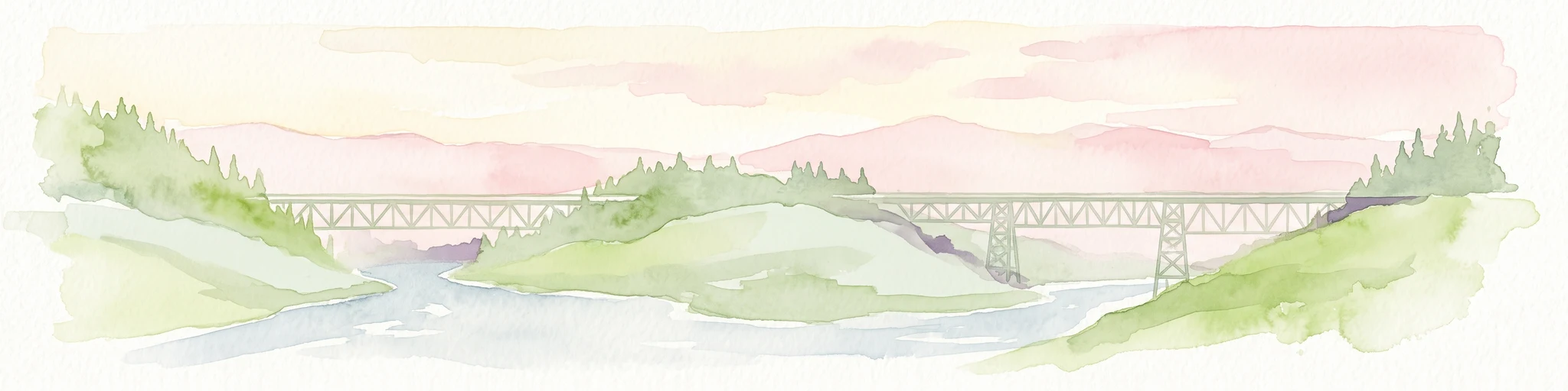
Watercolor painting of a long truss bridge spanning a river winding through a valley with hills and trees in the background.
State or regional parkBritish Columbia
About 155 km away#5 closest

East

Kiskatinaw Provincial Park: A Protected Landscape Along the Historic Alaska Highway

Geography and heritage in the Peace River region of British Columbia

Kiskatinaw Provincial Park encompasses a distinctive horseshoe meander of the Kiskatinaw River, creating a deep gorge carved into the terrain of northeastern British Columbia. This protected area serves as a focal point for understanding both the river geomorphology of the Peace River Country and the engineering history of the original Alaska Highway, exemplified by the iconic 1942 wooden trestle bridge.

Area
0.58 km²
Established
1962
IUCN
II
Relief
Upland
State or regional parkBritish Columbia
About 167 km away#6 closest

Northwest

Finlay-Russel Provincial Park and Protected Area: Mapping Northern British Columbia Wilderness

A remote river corridor in the Muskwa-Kechika Management Area.

Located in northern British Columbia, Finlay-Russel Provincial Park and Protected Area preserves an essential 85-kilometre river corridor along the Finlay River. This expansive wilderness territory serves as an integral part of the Muskwa-Kechika Management Area, showcasing deep boreal forest landscapes and rugged river valley terrain far from established road networks.

Area
1,092.05 km²
Established
2001
IUCN
II
Access
Remote access
State or regional parkBritish Columbia
About 231 km away#7 closest

Northwest

Dune Za Keyih Provincial Park and Protected Area: Watershed and Terrain Geography

Remote wilderness landscape in northern British Columbia

Dune Za Keyih Provincial Park and Protected Area protects the largest unlogged watershed in British Columbia. Situated within the Muskwa-Kechika Management Area, this remote wilderness is defined by the geological structures of the Rocky Mountain Trench, providing a continuous corridor of undisturbed mountain forest, riparian zones, and highland terrain.

Area
3,468.33 km²
Established
2001
IUCN
Ib
Relief
Mountain
State or regional parkBritish Columbia
About 266 km away#8 closest

North

Jackpine Remnant Provincial Park: Protected Boreal Landscape and Regional Map Context

Conservation and terrain data for the Fort Nelson region

Jackpine Remnant Provincial Park provides a critical study in northern conservation geography. Located in the Fort Nelson area of British Columbia, this 148-hectare site protects a rare stand of jack pine trees. Its mapped boundaries and boreal forest terrain offer a focused look at small-scale protected landscapes and their significance within the broader regional ecosystem of the Canadian north.

Area
1.48 km²
Established
2001
IUCN
II
Relief
Lowland
MoriAtlas Explorer

Continue Your Geographic Exploration of Graham-Laurier Provincial Park

Delve deeper into the mapped boundaries and natural terrain features of Graham-Laurier Provincial Park. Use the MoriAtlas dataset to understand how this remote boreal refuge connects to the broader Muskwa-Kechika ecosystem and the rugged landscape of northern British Columbia.