

Mori Atlas logo
Nature reserveGrambker Feldmarksee

A uniquely restored quarry landscape with protected reedbeds and diverse aquatic habitats

Grambker Feldmarksee Nature Reserve and Protected Wetland Geography in Bremen, Germany

Grambker Feldmarksee stands as a significant protected nature reserve within the Bremen region, representing a former motorway quarry lake that has matured into a vital aquatic ecosystem. The site features a distinct ring of woodland, extensive reed zones, and engineered shallow-water margins that support diverse bird populations. Its status as an EU-protected bird habitat and FFH site highlights its ecological value within the surrounding northern German urbanized terrain.

nature reservelakequarry lakegroundwater-fed lakereedbedwaterbirds
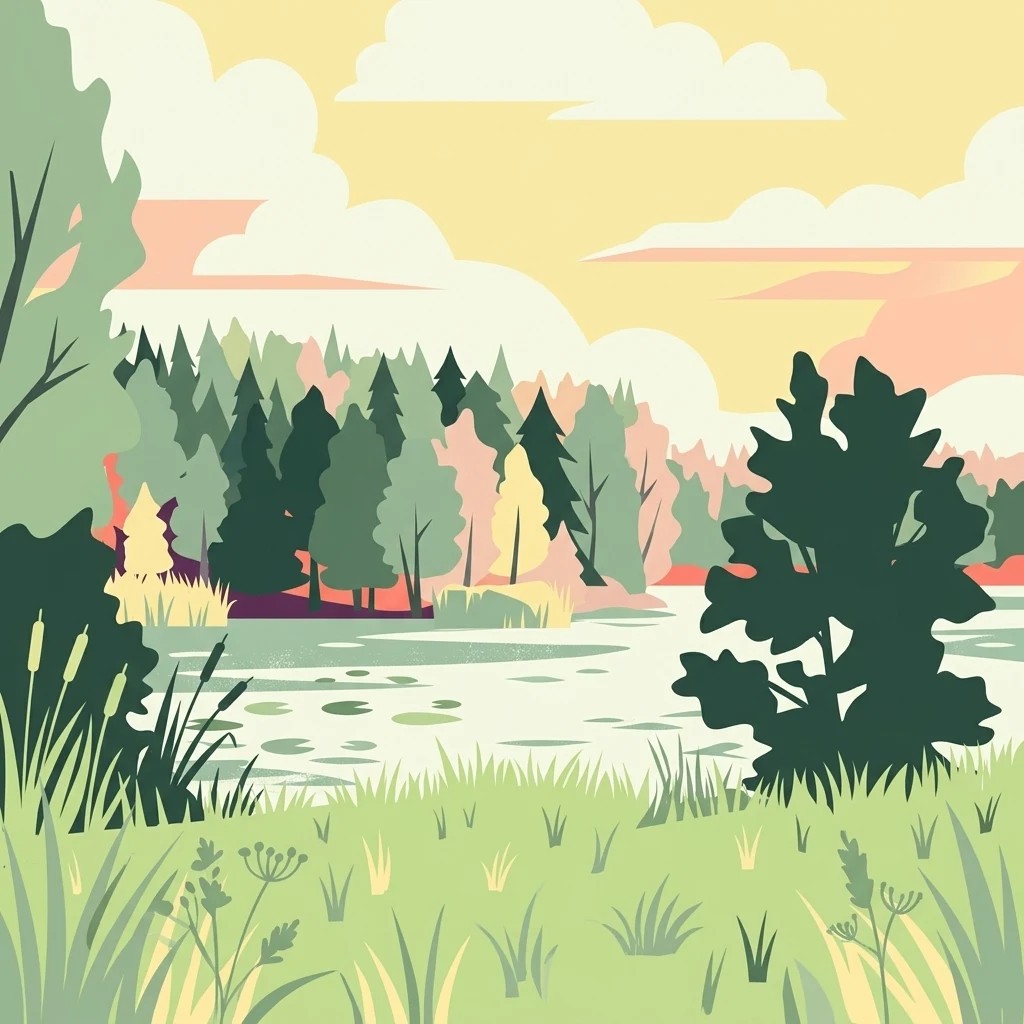
A flat-style vector illustration of a quiet lake surrounded by a dense forest and grassy banks under a warm, soft-toned sky.

Grambker Feldmarksee

Nature reserve

Park overview

Structured park overview, official facts, and landscape profile for Grambker Feldmarksee

Grambker Feldmarksee park facts, protected area profile, and essential visitor context

Review the core facts for Grambker Feldmarksee, including designation, size, terrain, visitor scale, habitats, and operating context in one park-focused overview.

About Grambker Feldmarksee

Grambker Feldmarksee is one of the more distinctive small protected lake sites in the Free Hanseatic City of Bremen. Although it originated as an engineered borrow pit during 1970s motorway construction, the lake has matured into a recognized nature reserve within the city's own municipal territory. Visitors and local naturalists value it as a quiet, tree-encircled waterbody that nonetheless shows a clearly layered ecological structure: an open water zone populated by submerged aquatic plants, a soft reed fringe, surrounding shrub and woodland cover, and artificial shallow-water margins that were deliberately created to enhance habitat diversity.

In administrative terms the lake and its protected surroundings belong to the Burglesum district and specifically the locality of Burg-Grambke. The waterbody sits at the edge of the built-up city, next to the A27 motorway, which provides a sharp boundary on the western side, while the Ruschweidengraben and the historic Maschinenfleet waterway frame the reserve on the north and east. Beyond these boundaries lies the wider Blockland landscape, a large open countryside area west of Bremen's core that has long been characterized by meadows, wet grassland, and traditional fleet drainage channels. The Grambker Feldmarksee reserve is therefore not an isolated pocket of nature but an ecological node within a larger, still-recognizable rural landscape.

The protected area covers around 22.6 hectares, fully aligned with the boundaries of both the lake and its fringing habitats, and overlaps entirely with a corresponding FFH site under the European Habitats Directive. It is also part of the EU bird protection area known as Blockland. This layered protection is important to the site's character: it means the area contributes both to the conservation of specific habitat types and to the maintenance of habitats used by vulnerable or migratory bird species in northwest Germany. Within Bremen there are only a handful of comparable sites that carry this combined designation, and Grambker Feldmarksee stands out as one of the city's strongest examples of a small lake that has acquired serious conservation significance.

Quick facts and research context for Grambker Feldmarksee

Grambker Feldmarksee lies in the Bremen district of Burglesum, in the locality of Burg-Grambke, near the A27 motorway. It is a former quarry lake, dug between 1971 and 1973 during motorway construction, and has been a designated nature reserve since 1 July 2009. The protected area covers about 22.6 hectares, is identical to a corresponding FFH (Habitats Directive) site, and lies within the EU bird protection area Blockland. The lake itself is small but relatively deep, fed by slightly saline groundwater influenced by the Lilienthal salt dome.

Protection and recognition

Documented terrestrial protection scope, management framework, and Natura 2000 listings

Grambker Feldmarksee Protection Status and International Recognition Data

Grambker Feldmarksee maintains a recorded terrestrial protection scope alongside imported Natura 2000 designations. Official records catalog the verified recognition sources and regulatory framework governing the protected landscape.

International recognition

Protection details

Protection scope
Terrestrial
Transboundary protection
No
Park context

Deeper park guide and search-rich context for Grambker Feldmarksee

Grambker Feldmarksee history, landscape, wildlife, and travel context

Explore Grambker Feldmarksee through its history, landscape character, ecosystems, wildlife, conservation priorities, cultural context, and seasonal travel timing in a structured park guide built for atlas discovery and search intent.

Why Grambker Feldmarksee stands out

Grambker Feldmarksee is best known as a reclaimed quarry lake that has been transformed into an ecologically rich protected wetland on the outskirts of Bremen. It is recognized for its combination of groundwater-influenced water chemistry, a complete fringe of mature woodland, a continuous reedbelt, and deliberately created shallow-water zones that together support characteristic waterbirds and aquatic vegetation. Its double status as both a German nature reserve and an EU-protected FFH and bird protection area site gives it a layered conservation identity beyond its modest size.
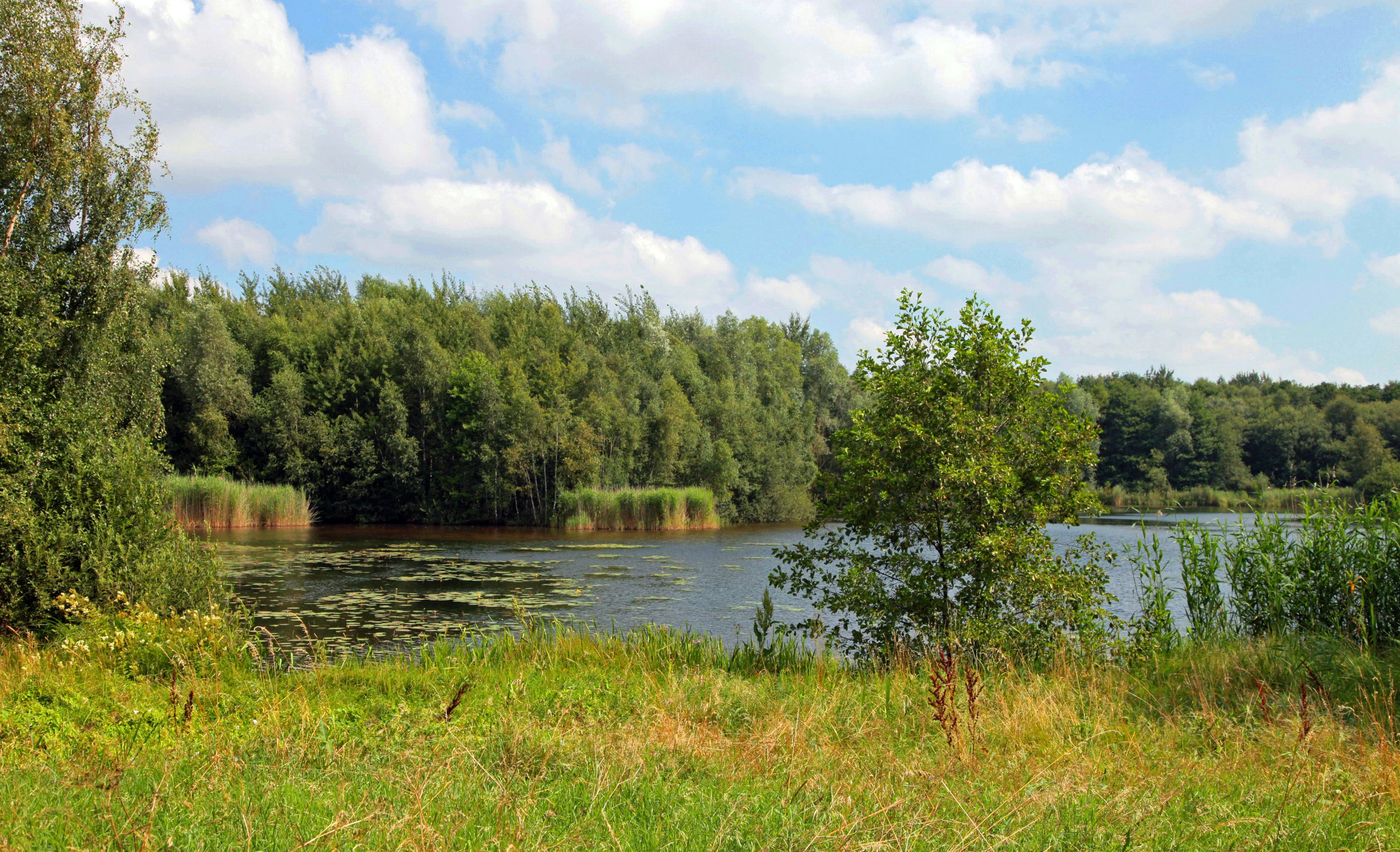
A peaceful lake in a nature reserve, surrounded by grassy banks and a dense line of trees under a cloudy sky.
The Grambker Feldmarksee lake surrounded by dense riparian vegetation.

Grambker Feldmarksee history and protected-area timeline

The origins of Grambker Feldmarksee are anthropogenic rather than natural. Between 1971 and 1973, during the construction of the A27 motorway, large quantities of sand and other materials were excavated in what is now the Burg-Grambke area, and the resulting pit gradually filled with water to form the lake. For its first years the site was essentially a by-product of infrastructure development rather than a planned landscape feature. Yet its immediate surroundings, made up of remaining agricultural field areas, or Feldmark, gave the lake its present name.

In the late 1980s, as part of compensatory measures for the later construction of the A281 motorway, an additional 2,500 square meters of shallow-water habitat was created along the northern shore. This was an early and deliberate step toward giving the lake a stronger ecological function rather than letting it remain simply a water-filled excavation.

Before its formal designation, the lake was already recognized for its ecological value: it was placed under landscape protection and was designated as a bird protection area. Formal nature reserve status followed on 1 July 2009, when it was officially declared the Naturschutzgebiet Grambker Feldmarksee. The reserve area was simultaneously aligned with an EU Habitats Directive (FFH) site and recognized as part of the broader Blockland EU bird protection area, consolidating its conservation role at municipal, federal, and European levels.

Grambker Feldmarksee landscape and geographic character

The landscape of Grambker Feldmarksee is dominated by a relatively compact, deep lake set in a shallow basin and completely encircled by trees. The shoreline transitions through a continuous sequence of wooded fringe, then reed belt, then open water, producing a clear zonation typical of mature lowland lake margins in northern Germany. The surrounding terrain is flat, shaped by the same glacial and post-glacial processes that formed the wider Bremen lowlands, but locally the area retains a slightly sheltered, almost enclosed character because of the dense tree ring around the water.

To the west the lake is bordered directly by the A27 motorway, whose embankments form a hard urban boundary, while to the east runs the Maschinenfleet, one of the historic drainage channels of the Blockland. To the northwest lies the Ruschweidengraben, a smaller grassy watercourse. Together these features give the reserve a defined polygonal shape that reads as a green island wedged between major infrastructure and traditional agricultural countryside. The artificially created shallow-water zone along the northern shore broadens this landscape by adding muddy and partially flooded margins that contrast with the deeper central basin.

Grambker Feldmarksee ecosystems, habitats, and plant life

Ecologically, Grambker Feldmarksee is a mesotrophic, groundwater-fed lake with slightly brackish characteristics because of the influence of the Lilienthal salt dome underground. The relatively stable water chemistry and the absence of strong nutrient enrichment have allowed characteristic submerged vegetation to establish, including pondweed species from the Laichkräuter group and stonewort algae (Armleuchteralgen), both of which are typical indicators of clear, moderately productive fresh to slightly brackish water in northwestern Germany.

Around the open water, the lake is wrapped in a continuous ring of shrubs and trees, behind which lies a broad reedbelt (Röhricht). This combination of woodland, reedbed, and lightly saline open water creates a layered habitat mosaic within a very small area. In 1988 and 1989, the deliberate construction of a 2,500-square-meter shallow-water zone on the northern shore further increased habitat diversity by providing warm, well-lit margins for amphibians, invertebrates, and young fish, as well as feeding areas for wading birds. The full reserve area corresponds to a European FFH site, which recognizes the habitat types present as worthy of protection at EU level.

Grambker Feldmarksee wildlife and species highlights

The lake is primarily significant for waterbirds, which is consistent with its earlier designation as a Vogelschutzgebiet and its current inclusion in the Blockland EU bird protection area. Characteristic species recorded at the site include the Great Crested Grebe (Haubentaucher), the Tufted Duck (Reiherente), and the Common Pochard (Tafelente), all of which depend on relatively undisturbed standing water with good submerged vegetation for feeding and breeding. The reed fringe and surrounding woodland add structural diversity that can support reedbed passerines and other small bird species typical of lake margins in the region.

The shallow-water zone along the northern shore expands the wildlife value of the lake by providing additional habitat for amphibians and aquatic invertebrates, which in turn support the food web on which waterbirds depend. Although the fauna of the lake is not described in the source as exceptionally rich or unique, the combination of slightly saline groundwater, mesotrophic water quality, and habitat zonation makes the site a reliable refuge for waterbird populations in the immediate Bremenburg area.

Grambker Feldmarksee conservation status and protection priorities

Grambker Feldmarksee carries one of the most layered conservation designations of any small lake in Bremen. Since 1 July 2009 it has been formally protected as the Naturschutzgebiet Grambker Feldmarksee, and its boundaries coincide exactly with a European FFH site under the Habitats Directive. It also forms part of the larger EU bird protection area Blockland, recognizing its role in maintaining habitats for protected and migratory bird species in northwest Germany. Together, these three levels of designation give the lake legal protection against damaging change and obligate authorities to manage the area for biodiversity rather than purely for amenity.

The surrounding landscape adds to this significance. Most of the reserve is encircled by the larger Landschaftsschutzgebiet Blockland - Burgdammer Wiesen, a protected countryside zone that buffers the lake from urban expansion and agricultural intensification. Within the lake itself, the mesotrophic water status and the stable, slightly saline groundwater regime are themselves conservation-relevant conditions: they support a submerged plant community of pondweeds and stoneworts that would not persist under stronger nutrient pollution. The deliberate 1988-1989 creation of a 2,500-square-meter shallow-water zone as compensation for the A281 motorway illustrates the active, management-driven approach that has shaped the lake into a functional nature reserve rather than a passive leftover.

Grambker Feldmarksee cultural meaning and human context

The name Grambker Feldmarksee reflects the local cultural and historical landscape pattern of northwestern Germany. The term Feldmark refers to the open farmland and field areas traditionally belonging to a village, in this case Burg-Grambke, a small locality that is now administratively part of Bremen. The lake's name therefore embeds the idea that what is now a protected wetland was once simply part of the surrounding agricultural land, modified first by motorway construction and then by deliberate restoration.

The wider region carries an older drainage and land-use heritage. Fleets such as the Maschinenfleet, and small drainage ditches like the Ruschweidengraben, are part of the long-standing water management tradition of the Blockland, an area that has been shaped for centuries by farmers working to keep water levels in balance with agricultural use. The reserved location next to the A27 motorway, and the fact that the lake itself was created during a major infrastructure project, also situates the site within a more recent narrative of how Bremen has integrated modern transport infrastructure with the preservation of ecological pockets within the city territory.

Top sights and standout views in Grambker Feldmarksee

Grambker Feldmarksee combines the unlikely roles of former motorway borrow pit and formally protected nature reserve within a single compact site. Its highlights include a fully tree-fringed shoreline, a continuous reedbelt, an artificial shallow-water zone built for habitat compensation, slightly saline groundwater fed by the Lilienthal salt dome, and a submerged flora of pondweeds and stonewort algae. The reserve carries the rare combination of German Naturschutzgebiet status, full alignment with an FFH site, and inclusion within the Blockland EU bird protection area, making it one of the most systematically protected small lake sites in Bremen's territory.

Best time to visit Grambker Feldmarksee

As a small lake and nature reserve in northern Germany's mild, Atlantic-influenced climate, Grambker Feldmarksee can be visited in any season, but the character of the experience varies noticeably through the year. Spring and early summer are typically the most rewarding periods for waterbird observation, when grebes and diving ducks are most active on the water and the reedbelt is at its fullest. Summer brings the densest vegetation and the highest diversity of singing wetland birds along the reed edges, while autumn passage can draw migratory waterfowl to the lake, complementing the breeding species present during the warmer months. In winter the open water remains a calm, reflective surface framed by leafless woodland, giving the reserve a quieter, more contemplative atmosphere.


Monthly climate preview

Measured monthly temperature ranges and precipitation averages for Grambker Feldmarksee

Grambker Feldmarksee Climate Normals and Long Term Temperature Patterns

Grambker Feldmarksee exhibits a measured annual temperature and precipitation rhythm spanning long term baseline averages from NASA power climatology data. Reviewing the complete twelve month profile provides deeper insight into monthly temperature variations and precipitation distribution across the protected area.
Annual mean9 °C
1 °C18 °C
Jan
Feb
Mar
Apr
May13°
Jun16°
Jul18°
Aug18°
Sep14°
Oct10°
Nov
Dec
Warmest month
July

18 °C

Coolest month
January

1 °C

Wettest month
July

2.5 mm/day

Driest month
April

1.4 mm/day

Park location guide

Geography guide, regional context, and park location map for Grambker Feldmarksee

Grambker Feldmarksee park geography, regions, and map view in Germany

Understand where Grambker Feldmarksee sits in Germany through a broader geographic reading of the surrounding landscape, nearby location context, and its mapped position within the national park landscape.

How Grambker Feldmarksee fits into Germany

Germany is a federal republic in Western and Central Europe with a population of over 83 million across sixteen constituent states. It is Europe's largest economy by nominal GDP and a major global exporter and importer. The capital is Berlin, and the country borders Denmark, Poland, Czech Republic, Austria, Switzerland, France, Luxembourg, Belgium, and the Netherlands.

Wider geography shaping Grambker Feldmarksee in Germany

Germany is located in Western and Central Europe, spanning 357,022 km². It borders Denmark to the north, Poland and the Czech Republic to the east, Austria and Switzerland to the south, and France, Luxembourg, Belgium, and the Netherlands to the west. The country has coastlines on the Baltic Sea and North Sea to the north, with the Alps located in the southern region.

Map view of Grambker Feldmarksee

Use this park location map to pinpoint Grambker Feldmarksee in Germany, understand its exact geographic position, and read its mapped placement within the surrounding landscape more clearly.

Pigeon | © OpenStreetMap contributors

Location context for Grambker Feldmarksee

Bremen
Recorded earthquake history

Review the Historical Earthquake Catalogue for Grambker Feldmarksee

Continue your geographic exploration by reviewing the recorded seismic history associated with the Grambker Feldmarksee nature reserve. MoriAtlas provides a clear, historical catalogue of event data for those interested in the seismic context of this protected landscape in Bremen.

Grambker Feldmarksee Earthquake Records

Catalogued events

1 event

Strongest magnitude

Magnitude 4

Most recent event

Jul 15, 2005

This history includes earthquakes recorded inside the park or within 50 km of its borders

Explore protected wetland habitats, lake margins, and regional terrain views

Grambker Feldmarksee Photos and Landscape Scenery Visual Guide

Visual documentation of Grambker Feldmarksee reveals the unique landscape character of this protected wetland and surrounding lowland terrain. Examining these detailed park images provides clear insight into aquatic habitats, reedbeds, and shoreline ecology.

A peaceful lake in a nature reserve, surrounded by grassy banks and a dense line of trees under a cloudy sky.

Park atlas

Compare regional wetland reserves and connected nature habitats in northwestern Germany.

Parks Near Grambker Feldmarksee and Surrounding Protected Landscapes

Browsing other parks near Grambker Feldmarksee reveals similar lowland reserves and urban wetland habitats across the surrounding region. Comparing these protected areas provides broader geographic context on regional conservation corridors and lowland lake ecosystems.
Nature reserveBremen
1 km away#1 closest

East

Untere Wümme Nature Reserve: Riverine Biodiversity and Protected Tidal Landscapes in Bremen

Protected floodplain geography and tidal river habitats.

This nature reserve protects the meandering lower course of the Wümme river, showcasing one of northern Germany's few freshwater tidal systems. Spanning reedbeds, willow forests, and open mudflats, the reserve forms a vital corridor for migratory fish and waterfowl, reflecting a complex mosaic of protected riverine ecosystems and historic meadow landscapes.

Area
1.485 km²
Established
1991
Relief
Lowland
Climate
Temperate
Nature reserveBremen
About 3 km away#2 closest

Northwest

Ruschdahlmoor Nature Reserve: Deep Peatlands and Protected Wetland Geography in Bremen

Geological subsidence sinkhole and urban protected landscape

Ruschdahlmoor stands as a unique nature reserve in Bremen, Germany, distinguished by a peat-forming wetland developed inside a sinkhole over the Lesum salt dome. This protected area supports tall herb meadows, reed-fringed ponds, and rare peat-depth records, offering a dense, ecologically rich landscape context that remains a vital part of the city's natural geography.

Area
0.048 km²
Established
1991
IUCN
IV
Relief
Lowland
Nature reserveBremen
About 3.2 km away#3 closest

West

Dunger See Nature Reserve: Mapped Protected Wetland and Landscape Geography in Bremen

A structured geographic look at the Werderland bird protection habitat.

Dunger See is a compact, ecologically diverse nature reserve in Bremen, shaped by intentional land management to provide critical nesting and wintering grounds for wildfowl. This protected area stands out for its indented shoreline, artificial island clusters, and surrounding woodland buffers that contrast with the open agricultural terrain of the wider Werderland landscape.

Area
0.33 km²
Established
1990
Relief
Lowland
Climate
Temperate
A watercolor painting showing a soft, panoramic view of a flat wetland area with green trees, a solitary tree in the middle, and industrial silos faintly visible in the background.
Nature reserveBremen
About 5.9 km away#4 closest

South

Hochwasserschutzpolder zwischen Senator-Apelt-Straße und Neustädter Hafen: Bremen Protected Lands

A vital wetland reserve integrating flood management and avian biodiversity in the port district.

Located within the port district of Bremen, the Hochwasserschutzpolder zwischen Senator-Apelt-Straße und Neustädter Hafen is a notable protected area that balances essential flood-control infrastructure with rich ecological functions. The reserve sustains a variety of wetland bird populations across its reed-lined waters and alluvial woodlands, providing a critical haven for wildlife amidst the surrounding industrial and urban development of the Lower Weser region.

Area
0.847 km²
Established
2014
IUCN
IV
Nature reserveBremen
About 7.8 km away#5 closest

Northwest

Hammersbecker Wiesen: Protected Nature Reserve and Meadow Landscape in Bremen

Ecological mosaic of wet meadows and stream valley terrain

Hammersbecker Wiesen encompasses 25.8 hectares of ecologically significant wet grassland and hedgerow habitats in Bremen. This nature reserve provides an essential refuge for diverse plant species and local amphibians within an urban-adjacent setting, illustrating the preserved character of traditional northern German meadow systems.

Area
0.258 km²
Established
1986
Nature reserveBremen
8.2 km away#6 closest

Southeast

Kuhgrabensee Nature Reserve: Mapped Geography and Protected Areas in Bremen

An ecologically vital lake and bird sanctuary in Northwest Germany

Kuhgrabensee serves as a prime example of landscape restoration within Bremen, featuring a groundwater-fed lake with notable saline influences. This protected area supports a diverse array of pioneer plants and wildlife across its reed-lined shores and shallow-water habitats, providing a quiet corridor for ecological observation and study in the heart of the local landscape.

Area
0.296 km²
Established
1987
Relief
Lowland
Climate
Temperate
A watercolor painting showing a serene landscape with calm water, small islands of trees, and rolling hills in the background.
Nature reserveBremen
About 8.5 km away#7 closest

Southeast

Am Stadtwaldsee (Uni-Wildnis) Nature Reserve: Geographic Atlas and Park Map Context

Protected secondary habitat landscape in Bremen, Germany

Located in Bremen, the Am Stadtwaldsee (Uni-Wildnis) nature reserve offers a compelling study of secondary ecological succession. The area features a dense concentration of ponds and wooded ground shaped by historical sand mining. Explore the mapped boundaries of this eleven-hectare refuge to understand its role in urban biodiversity and regional landscape conservation.

Area
0.114 km²
Established
1991
IUCN
IV
Nature reserveBremen
About 9 km away#8 closest

South

Ochtumniederung bei Brokhuchting: Wetland Nature Reserve and Floodplain Geography

A core conservation area within the Bremen Niedervieland

This protected area stands as a primary example of large-scale river floodplain restoration in the Bremen region. The landscape includes a dense network of canals, reedbeds, and seasonal flood zones that provide critical shelter for waterfowl and waders. Through careful environmental management, this site integrates natural riverine terrain with the surrounding industrial and urban framework of northwestern Germany, offering a distinct study of managed wetland ecosystems.

Area
3.75 km²
Established
1998
Relief
Lowland
Climate
Temperate

Common questions about visiting, size, designation, and location context for Grambker Feldmarksee

Grambker Feldmarksee FAQs for park facts, access, geography, and protected area context

Find quick answers about Grambker Feldmarksee, including protected-area facts, park geography, trail and visitor context, and how the park fits into its surrounding country and regional landscape.
MoriAtlas Explorer

Continue Your Protected Areas Search Across the Global Atlas

Deepen your exploration by continuing the structured search for national parks and protected areas worldwide. Utilize the comprehensive filtering capabilities to compare different conservation landscapes and refine your understanding of global park geography. Discover more about the distribution and characteristics of protected natural areas.

Global natural geography

