
Mori Atlas logo
Wildlife reserveGrand Bay National Estuarine Research Reserve

Mapping the ecological mosaic of marshes, pine savannas, and Gulf of Mexico estuarine waters

Grand Bay National Estuarine Research Reserve: Protected Coastal Landscapes in Mississippi

The Grand Bay National Estuarine Research Reserve encompasses a vast protected corridor along the southeastern Mississippi coast. This diverse landscape integrates saltwater marshes, maritime pine forests, and fire-maintained pine savannas into a single, highly productive estuarine system. It serves as a vital nursery for Gulf of Mexico marine life and demonstrates the complex interplay between coastal bay waters and inland botanical diversity.

estuarine reservesaltwater marshcoastal baypine savannamaritime pine forestpitcher plant bogs
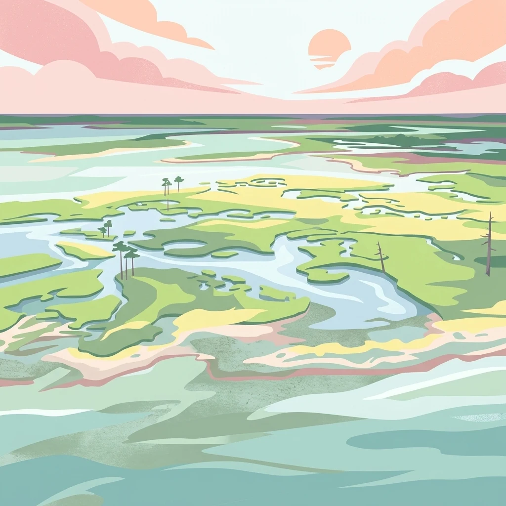
An aerial illustration of a marshy estuary landscape under a soft pastel sky, showing winding channels of water weaving through green coastal plains with sparse trees.

Grand Bay National Estuarine Research Reserve

Wildlife reserve

Park overview

Structured park overview, official facts, and landscape profile for Grand Bay National Estuarine Research Reserve

Grand Bay National Estuarine Research Reserve park facts, protected area profile, and essential visitor context

Review the core facts for Grand Bay National Estuarine Research Reserve, including designation, size, terrain, visitor scale, habitats, and operating context in one park-focused overview.

About Grand Bay National Estuarine Research Reserve

Grand Bay National Estuarine Research Reserve protects a substantial slice of the Mississippi Gulf Coast where terrestrial and marine ecosystems meet. Established in 1999, the reserve is situated in southeastern Mississippi, near Pascagoula, where the coastal bay waters of the Mississippi Sound lap against a complex shoreline shaped by salt marsh, maritime forest, and pine savanna. Its size and habitat diversity make it one of the more ecologically significant estuarine reserves in the northern Gulf of Mexico.

The reserve is notable for the sheer productivity of its estuarine waters. Coastal bays, salt marshes, oyster reefs, and seagrass beds combine to create nursery habitat for many of the Gulf's commercially and recreationally important marine species, a role that places the reserve at the intersection of conservation and regional fisheries. This productivity is matched on the land side by a striking ecological range that includes maritime pine forest, longleaf pine savanna, and seepage areas that support pitcher plant bogs, an unusually rich combination for a coastal reserve.

Grand Bay also functions as a working landscape for conservation research and management. Through its partnership with the Grand Bay Savannah Conservation Partnership, it participates in a coordinated prescribed burn program designed to maintain the fire-dependent pine savannas and adjacent woodlands. Government agencies at the local and state level, along with the oil and gas industry operating in the region, support this management approach, reflecting the reserve's integration into the broader coastal economy of southeastern Mississippi. Education and public engagement are delivered through the Grand Bay Coastal Resources Center, which also serves the adjacent Grand Bay National Wildlife Refuge and stands as the public face of the reserve's research, education, and visitor programs.

Quick facts and research context for Grand Bay National Estuarine Research Reserve

The Grand Bay National Estuarine Research Reserve is a coastal estuarine reserve located in Mississippi, United States, near the city of Pascagoula along the Gulf of Mexico. Established in 1999, it is administered as part of the National Estuarine Research Reserve System and is classified as an IUCN Category IV protected area focused on habitat and species management.

The reserve encompasses a mosaic of coastal bay waters, saltwater marshes, maritime pine forest, pine savanna, and pitcher plant bogs, alongside oyster reefs and seagrass habitats. It functions as both a regional research site and a public-access coastal reserve, sharing its interpretive and educational facilities with the neighboring Grand Bay National Wildlife Refuge through the Grand Bay Coastal Resources Center completed in 2009.

Protection and recognition

Examine documented protection scope, management frameworks, and official recognition records

Grand Bay National Estuarine Research Reserve Protection Status and Governance Data

Grand Bay National Estuarine Research Reserve maintains a mixed protection scope governed by structured conservation frameworks and administrative standards. Official designation details and recognition records outline the regulatory environment surrounding this protected estuarine landscape.

Protection details

Protection scope
Mixed
Transboundary protection
No
Park context

Deeper park guide and search-rich context for Grand Bay National Estuarine Research Reserve

Grand Bay National Estuarine Research Reserve history, landscape, wildlife, and travel context

Explore Grand Bay National Estuarine Research Reserve through its history, landscape character, ecosystems, wildlife, conservation priorities, cultural context, and seasonal travel timing in a structured park guide built for atlas discovery and search intent.

Why Grand Bay National Estuarine Research Reserve stands out

Grand Bay is best known for its large, biologically productive Gulf Coast estuarine system, where coastal bays, saltwater marshes, and submerged habitats come together to support an unusually rich concentration of marine life. The reserve's mosaic of estuarine waters, oyster reefs, and seagrass beds serves as nursery habitat for some of the Gulf of Mexico's most important commercial and recreational species. Equally distinctive is the combination of upland and wetland habitats within a single reserve: maritime pine forest, fire-maintained pine savanna, and pitcher plant bogs sit alongside expansive marshes and open bay waters. This unusual ecological pairing of coastal wetlands and pine savanna habitats, supported by an active prescribed fire program, is a defining feature of Grand Bay's identity in the regional conservation landscape.
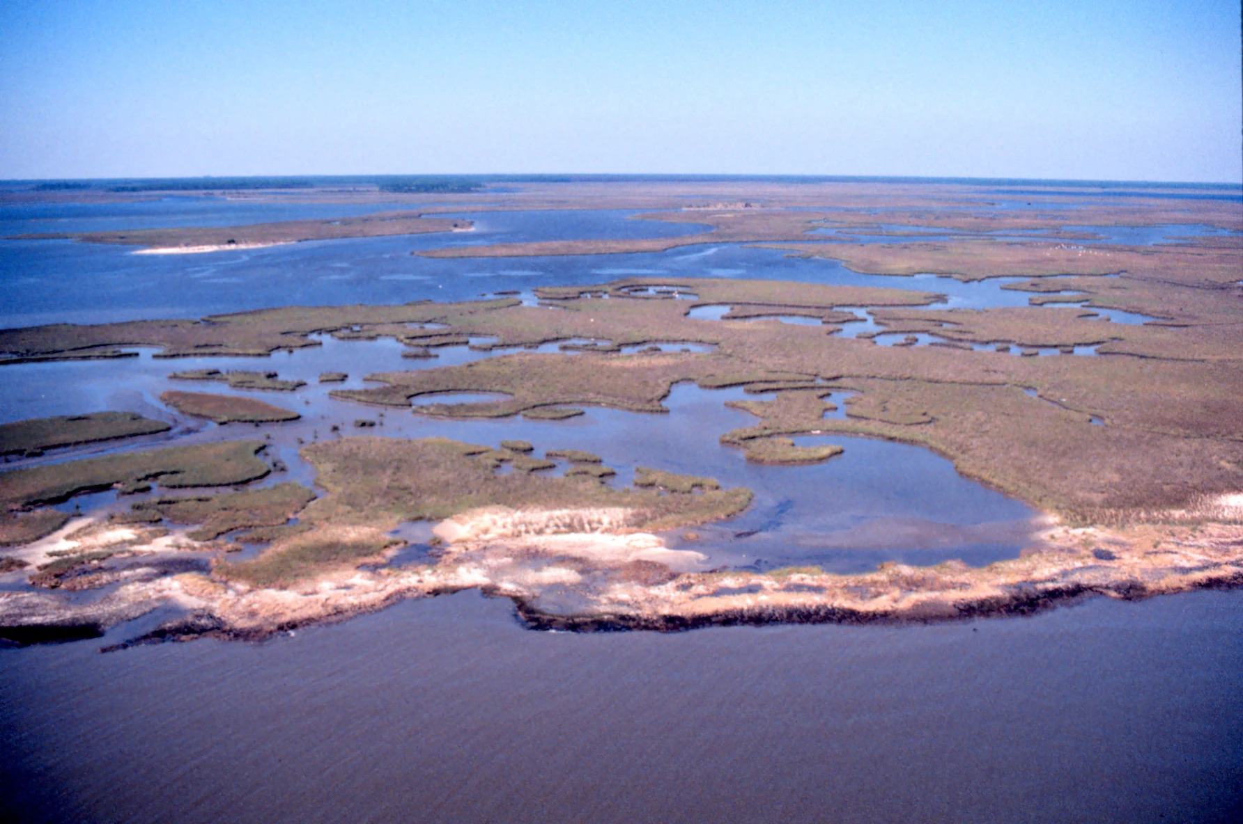
An aerial photograph of a vast, flat coastal marshland with meandering waterways and sandy shorelines under a clear blue sky.
An aerial view of the saltwater marsh ecosystem at Grand Bay National Estuarine Research Reserve.

Grand Bay National Estuarine Research Reserve history and protected-area timeline

The Grand Bay National Estuarine Research Reserve was formally established in 1999, extending the long-running tradition of recognizing the ecological significance of the Grand Bay area along the Mississippi Gulf Coast. Its designation brought the diverse coastal habitats of this stretch of the Mississippi Sound into the National Estuarine Research Reserve System, placing local research, monitoring, and education efforts within a national framework.

Following its designation, the reserve developed a coordinated management approach that emphasized the role of fire in maintaining its upland pine savanna and adjacent fire-dependent woodlands. The Grand Bay Savannah Conservation Partnership brought together local and state agencies with industry partners in the oil and gas sector to support a broad prescribed burn program across the region. This collaborative approach situated the reserve as both a research site and a working landscape for landscape-scale fire management.

In 2009, the reserve and the neighboring Grand Bay National Wildlife Refuge jointly opened the Grand Bay Coastal Resources Center. Completed in that year, the Center functions as the administrative, educational, and visitor hub for both protected areas. Its interpretive exhibits, classrooms, laboratories, and dormitory have since supported ongoing research, environmental education, and public engagement programs, marking a significant step in the institutional development of the reserve.

Grand Bay National Estuarine Research Reserve landscape and geographic character

The landscape of the Grand Bay National Estuarine Research Reserve is defined by the meeting of marine waters and coastal land. Along the eastern margin of the Mississippi Sound, the reserve encompasses open coastal bay waters and an eroding shoreline punctuated by tidal channels, including the Rigolets area visible in aerial views. Saltwater marshes form an extensive transitional band where the bay meets the uplands, shaping the rhythm of tides across the reserve and creating the soft, sinuous edge that is characteristic of this stretch of the Gulf Coast.

Behind the marshes, the land rises into a varied coastal upland mosaic. Maritime pine forest occupies sandy ridges and higher ground, while broad expanses of pine savanna, shaped by centuries of fire, give the inland portion of the reserve an open, park-like character. Pitcher plant bogs occur in wetter pockets and seepage zones, introducing an unusual botanical texture into a mostly coastal setting. This combination of bay, marsh, pine, savanna, and bog creates a sharply layered landscape where water, fire, and vegetation interact across relatively short distances.

The reserve's shoreline is dynamic and visibly shaped by ongoing coastal processes. Erosion along certain portions of the bay margin has been documented through aerial imagery and is an active concern within the reserve's management context. Inland, the boundaries of the reserve interface with industrial and energy infrastructure that is closely tied to the regional economy, adding an additional layer to the geography of the site and highlighting the role of large-scale land use in shaping the surrounding terrain.

Grand Bay National Estuarine Research Reserve ecosystems, habitats, and plant life

Ecologically, Grand Bay functions as a high-productivity transition zone between the marine waters of the Gulf of Mexico and the coastal uplands of southeastern Mississippi. Saltwater marshes dominate the estuarine side of the reserve, providing the structural and biological foundation of the system. These marshes are deeply connected to oyster reefs and seagrass beds in the bay, which together create a tightly linked estuarine ecosystem that supports fish, invertebrates, and the broader food web of the Mississippi Sound.

On the landward side, the reserve protects a sequence of fire-maintained coastal plant communities. Maritime pine forest occupies the higher, sandier sites, while open pine savanna habitat extends across much of the upland area. Within this mosaic, seepage conditions create pockets suitable for pitcher plant bogs, a habitat type more commonly associated with the longleaf pine flatwoods further inland. The combination of pine savanna and pitcher plant bogs within an estuarine reserve gives Grand Bay an unusually complete coastal-to-upland ecological gradient.

Habitat diversity of this scale is closely tied to the broader ecological character of the northern Gulf of Mexico. The reserve's combination of submerged aquatic habitats, emergent marshes, forested uplands, and fire-maintained savannas supports a wide range of resident and migratory species. The management of these systems, particularly through fire, helps sustain the open character of the savanna and the hydrological conditions required by bog and marsh communities.

Grand Bay National Estuarine Research Reserve wildlife and species highlights

Wildlife at Grand Bay reflects the productivity of its estuarine waters and the diversity of its upland habitats. The bay, marshes, oyster reefs, and seagrass beds provide nursery habitat for many of the Gulf of Mexico's most important recreational and commercial marine species, giving the reserve a central role in supporting regional fisheries. Blue crab, shrimp, speckled trout, and red fish are among the species that depend on Grand Bay during early life stages.

The reserve's protected status also supports several rare or endangered plant and animal species found within the estuarine and upland habitats. These occurrences contribute to the conservation significance of the site and are among the key reasons for the reserve's designation. Migratory and resident birdlife is closely linked to the diverse habitat mosaic, from open water and marsh to pine savanna and forested uplands, while the invertebrate communities of the marsh and oyster reefs underpin the broader estuarine food web.

The combination of aquatic and terrestrial habitats creates overlapping wildlife communities that use different portions of the reserve at different times of year. Upland game species are part of this mosaic as well, and the reserve supports controlled hunting within its management framework, alongside fishing, boating, and wildlife observation as visitor activities.

Grand Bay National Estuarine Research Reserve conservation status and protection priorities

Grand Bay National Estuarine Research Reserve plays a significant role in conserving one of the more productive estuarine ecosystems in the northern Gulf of Mexico. Its protected status provides formal recognition and management of habitats that support rare and endangered species, sustain commercial fisheries, and maintain ecological processes across the Mississippi Sound. The reserve functions both as a habitat refuge and as a long-term research site for understanding coastal estuarine dynamics.

A central conservation strategy at Grand Bay is the use of prescribed fire to maintain pine savanna and adjacent fire-dependent woodlands. Through the Grand Bay Savannah Conservation Partnership, the reserve coordinates with local and state agencies and industry partners, including oil and gas companies operating in adjacent lands, to plan and implement broad-scale prescribed burns. This cross-boundary approach extends fire management beyond the strict reserve boundary and supports landscape-scale conservation outcomes in southeastern Mississippi.

The reserve also contributes to conservation through its role within the National Estuarine Research Reserve System, which connects local research and monitoring efforts with national priorities. Shared facilities with the Grand Bay National Wildlife Refuge, anchored by the Grand Bay Coastal Resources Center completed in 2009, support research, monitoring, environmental education, and habitat management in a coordinated way. Protection of archaeological sites within the reserve adds a heritage dimension to its conservation mission, recognizing the long history of human use of this coastal landscape alongside its natural values.

Grand Bay National Estuarine Research Reserve cultural meaning and human context

The Grand Bay landscape carries a long history of human presence on the Mississippi Gulf Coast. Archaeological sites are documented within the boundaries of the reserve, reflecting the area's significance to the broader cultural and historical record of the region. The preservation of these sites within a working estuarine reserve highlights the connection between natural and cultural heritage in coastal Mississippi.

Locally, the reserve is closely tied to the regional identity of the Pascagoula area and the broader Gulf Coast economy. The reserve's educational programs, public access opportunities, and shared facilities with the Grand Bay National Wildlife Refuge contribute to a regional sense of place that links coastal communities, traditional uses of the land and water, and contemporary conservation practice. Maintenance of long-standing land uses, including controlled hunting, fishing, and other outdoor recreation, reflects an ongoing cultural relationship with the landscape shaped by working coastal communities and the surrounding industries.

Top sights and standout views in Grand Bay National Estuarine Research Reserve

A defining feature of Grand Bay is the close integration of research, education, and active habitat management within a single reserve. The Grand Bay Coastal Resources Center links the reserve and the adjacent Grand Bay National Wildlife Refuge, providing laboratories, classrooms, interpretive exhibits, and a dormitory that support both internal programs and visiting researchers and students.

Equally important is the reserve's landscape-scale prescribed fire program, coordinated through the Grand Bay Savannah Conservation Partnership. This program sustains pine savanna habitat, supports regional fire management partnerships with state agencies and industry, and demonstrates how conservation can be embedded within a working coastal landscape. Combined with the reserve's high estuarine productivity and habitat diversity, these features make Grand Bay a notable example of integrated coastal conservation in the Gulf of Mexico.

Best time to visit Grand Bay National Estuarine Research Reserve

The character of a visit to Grand Bay shifts with the seasons in ways that reflect both the coastal weather of the Gulf of Mexico and the ecological rhythms of the reserve. Cooler months along the Mississippi Gulf Coast generally offer milder temperatures and are well suited to hiking, paddling, and exploring the marsh and pine savanna landscapes, while also providing strong conditions for observing wintering and migratory birdlife across the range of habitats.

Warmer seasons bring lush marsh conditions, active estuarine productivity, and extended opportunities for boating, fishing, and photography. Late winter and early spring are often particularly associated with the prescribed burning season in the pine savanna portions of the reserve, during which managed fire plays a visible and ecologically important role across the landscape. Visitors interested in wildflowers, bog species, and the reserve's distinctive coastal upland habitats may find periods of mild weather especially rewarding, while summer brings heat and humidity typical of the Gulf Coast region.
Monthly climate preview

Long-term representative temperature and precipitation patterns across the reserve

Grand Bay National Estuarine Research Reserve Climate Normals and Weather by Month

Grand Bay National Estuarine Research Reserve exhibits a measured annual thermal rhythm ranging from winter minimums below freezing to summer averages exceeding 28 degrees Celsius, paired with year-round precipitation. Reviewing the complete twelve-month climate profile reveals detailed monthly fluctuations in temperature and rainfall for this protected coastal coordinate.
Annual mean21 °C
12 °C28 °C
Jan12°
Feb13°
Mar16°
Apr20°
May24°
Jun27°
Jul28°
Aug28°
Sep26°
Oct22°
Nov16°
Dec13°
Warmest month
July

28.3 °C

Coolest month
January

11.7 °C

Wettest month
July

6.2 mm/day

Driest month
October

3.2 mm/day

Park location guide

Geography guide, regional context, and park location map for Grand Bay National Estuarine Research Reserve

Grand Bay National Estuarine Research Reserve park geography, regions, and map view in United States of America

Understand where Grand Bay National Estuarine Research Reserve sits in United States of America through a broader geographic reading of the surrounding landscape, nearby location context, and its mapped position within the national park landscape.

How Grand Bay National Estuarine Research Reserve fits into United States of America

The United States of America is a federal presidential republic and one of the world's largest countries by area and population. It consists of 50 states across a vast territory spanning multiple time zones, with its capital in Washington, D.C. and largest city in New York City. The nation has a diverse economy, influential political system, and significant cultural and military presence globally.

Wider geography shaping Grand Bay National Estuarine Research Reserve in United States of America

The United States occupies a vast territory in North America, bordered by Canada to the north and Mexico to the south. The 48 contiguous states stretch from the Atlantic to the Pacific Ocean, while Alaska occupies the northwestern region and Hawaii is an archipelago in the Pacific. The country encompasses diverse terrain including the Rocky Mountains, Appalachian Mountains, Great Plains, and extensive river systems.

Map view of Grand Bay National Estuarine Research Reserve

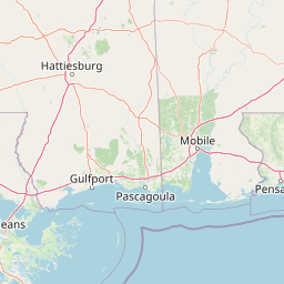
Use this park location map to pinpoint Grand Bay National Estuarine Research Reserve in United States of America, understand its exact geographic position, and read its mapped placement within the surrounding landscape more clearly.

Pigeon | © OpenStreetMap contributors

Location context for Grand Bay National Estuarine Research Reserve

Mississippi

Visual reference of coastal bay waters, tidal marshes, and fire-maintained pine savannas.

Grand Bay National Estuarine Research Reserve Photos and Protected Landscape Scenery

Visual documentation of Grand Bay National Estuarine Research Reserve reveals the intricate transition between marine waters, saltwater marshes, and upland pine savannas. Photographic records provide clear insight into the protected terrain, coastal habitats, and ecological character of the Mississippi Sound.

An aerial photograph of a vast, flat coastal marshland with meandering waterways and sandy shorelines under a clear blue sky.

Park atlas

Compare adjacent coastal habitats, saltwater marshes, and neighboring protected landscapes.

Parks Near Grand Bay National Estuarine Research Reserve and Regional Protected Areas

Browsing other protected areas near Grand Bay National Estuarine Research Reserve reveals connected coastal wetlands and regional wildlife habitats along the Gulf Coast. Evaluating adjacent reserves provides broader geographic context for comparing estuarine ecosystems and maritime pine savannas.
A watercolor illustration of a coastal landscape with a sandy shoreline, soft green dunes, and a gentle pink horizon against a white background.
Protected landscapeFlorida
About 19 km away#1 closest

East

Gulf Islands National Seashore: Mapped Landscapes and Protected Coastal Geography

Coastal terrain across Florida, Alabama, and Mississippi.

Spanning diverse units across the Gulf Coast, Gulf Islands National Seashore preserves dynamic barrier islands and mainland reserves. This geographic profile traces the quartz-sand beaches, maritime ecosystems, and historic defense networks that form this protected landscape, providing context on its unique geologic and environmental evolution.

Area
548.179 km²
Established
1971
IUCN
V
Visitors
8.3M annual
Protected landscapeMississippi
About 247 km away#2 closest

Northwest

Homochitto National Forest: Mapping the Protected Landscapes of Southwestern Mississippi

Regional forest geography and landscape documentation.

Investigate the unique landscape of Homochitto National Forest, an extensive protected area in Mississippi defined by its loess-country topography and managed pine forests. This entry provides essential mapping context and geographic data for those examining the role of this forest within the broader Southeastern United States ecological network and its CCC-rooted heritage.

Area
776.34 km²
Established
1936
Relief
Upland
Scope
Terrestrial
Protected landscapeMississippi
About 315 km away#3 closest

North

Tombigbee National Forest: Geographic Atlas and Protected Landscape Overview

Mapping the forest terrain and regional watershed in Mississippi

Tombigbee National Forest represents a complex protected landscape divided into two non-contiguous sections across northeastern Mississippi. From the pine-and-hardwood ridges of its northern unit to the reservoir-anchored southern portion, the forest offers a detailed case study in regional topography and watershed management within the southeastern United States.

Area
271.16 km²
Established
1959
Relief
Upland
Climate
Subtropical
Watercolor painting of a meandering river flowing through a green marshland with rolling hills in the background under a pale sky.
Nature reserveFlorida
About 344 km away#4 closest

East

Apalachicola National Estuarine Research Reserve: Florida Protected Estuary and Coastal Geography

Exploring the tidal marshes and benthic habitats of Florida's Gulf Coast.

Apalachicola National Estuarine Research Reserve offers a deep look into the coastal geography of the Florida panhandle. As a protected area, it manages the complex intersection of estuarine food chains, commercial fishing zones, and vital wetland habitats, utilizing advanced GIS capabilities to map the bay's submerged reefs and tidal channels.

Relief
Lowland
Climate
Subtropical
Scope
Marine
Water
Water-dominated
Protected landscapeMacon County
About 355 km away#5 closest

Northeast

Tuskegee National Forest: A Protected Landscape in Macon County, Alabama

Mapped geography and forest terrain in the American South

Tuskegee National Forest represents a concentrated pocket of protected land in Macon County, Alabama. As the smallest national forest in the country, it provides a dense network of trails and stream terraces that demonstrate how compact forests sustain regional biodiversity and outdoor recreation.

Area
45.54 km²
Established
1959
Relief
Upland
Climate
Subtropical
Protected landscapeAlabama
About 364 km away#6 closest

Northeast

Talladega National Forest: Geography and Protected Appalachian Forest Maps

Mapping Alabama high country and southern Appalachian forest recovery

Talladega National Forest is a primary protected landscape in Alabama, offering a detailed look at the transition from central pine-oak ridges to northeastern mixed mesophytic hardwood slopes. This forest manages a diverse range of terrain, including the highest peaks in the state, and represents a major achievement in regional ecological restoration across hundreds of thousands of acres of federally protected land.

Area
1,588.66 km²
Established
1936
Relief
Mixed relief
Climate
Temperate
Watercolor painting of a green landscape featuring rolling hills, small clusters of trees, and a calm water feature in the foreground.
Protected landscapeMississippi
About 409 km away#7 closest

North

Holly Springs National Forest: Geographic Context and Protected Landscape Boundaries

Northern Mississippi forest topography and ecological restoration geography.

Holly Springs National Forest occupies the rolling hills of north central Mississippi, where federal land tracts form a complex mosaic with private holdings. This protected area features diverse forest types including loblolly and shortleaf pine uplands alongside bottomland hardwood swamps. It serves as an essential watershed region, hosting multiple reservoirs like Chewalla Lake and Puskus Lake while protecting the headwaters of the Wolf River.

Area
629.94 km²
Established
1936
Relief
Upland
Climate
Subtropical
Protected landscapeAlabama
About 411 km away#8 closest

North

William B. Bankhead National Forest: Cumberland Plateau Landscapes and Geography

Protected river gorges and forested ridges in northwestern Alabama

Covering extensive tracts across Lawrence, Winston, and Franklin counties, William B. Bankhead National Forest anchors the regional geography of the Cumberland Plateau. This atlas entry provides a detailed look at the forest's stream-carved terrain, limestone geology, and its central role in preserving the riparian corridors of the Sipsey Fork and its surrounding protected wilderness.

Area
733.4 km²
Established
1918
Relief
Upland
Scope
Terrestrial

Common questions about visiting, size, designation, and location context for Grand Bay National Estuarine Research Reserve

Grand Bay National Estuarine Research Reserve FAQs for park facts, access, geography, and protected area context

Find quick answers about Grand Bay National Estuarine Research Reserve, including protected-area facts, park geography, trail and visitor context, and how the park fits into its surrounding country and regional landscape.
MoriAtlas Explorer

Continue Your Protected Areas Search Across the Global Atlas

Deepen your exploration by continuing the structured search for national parks and protected areas worldwide. Utilize the comprehensive filtering capabilities to compare different conservation landscapes and refine your understanding of global park geography. Discover more about the distribution and characteristics of protected natural areas.

Global natural geography