
Visit Planning
Choosing when to visit Grand Canyon National Park: the short answer
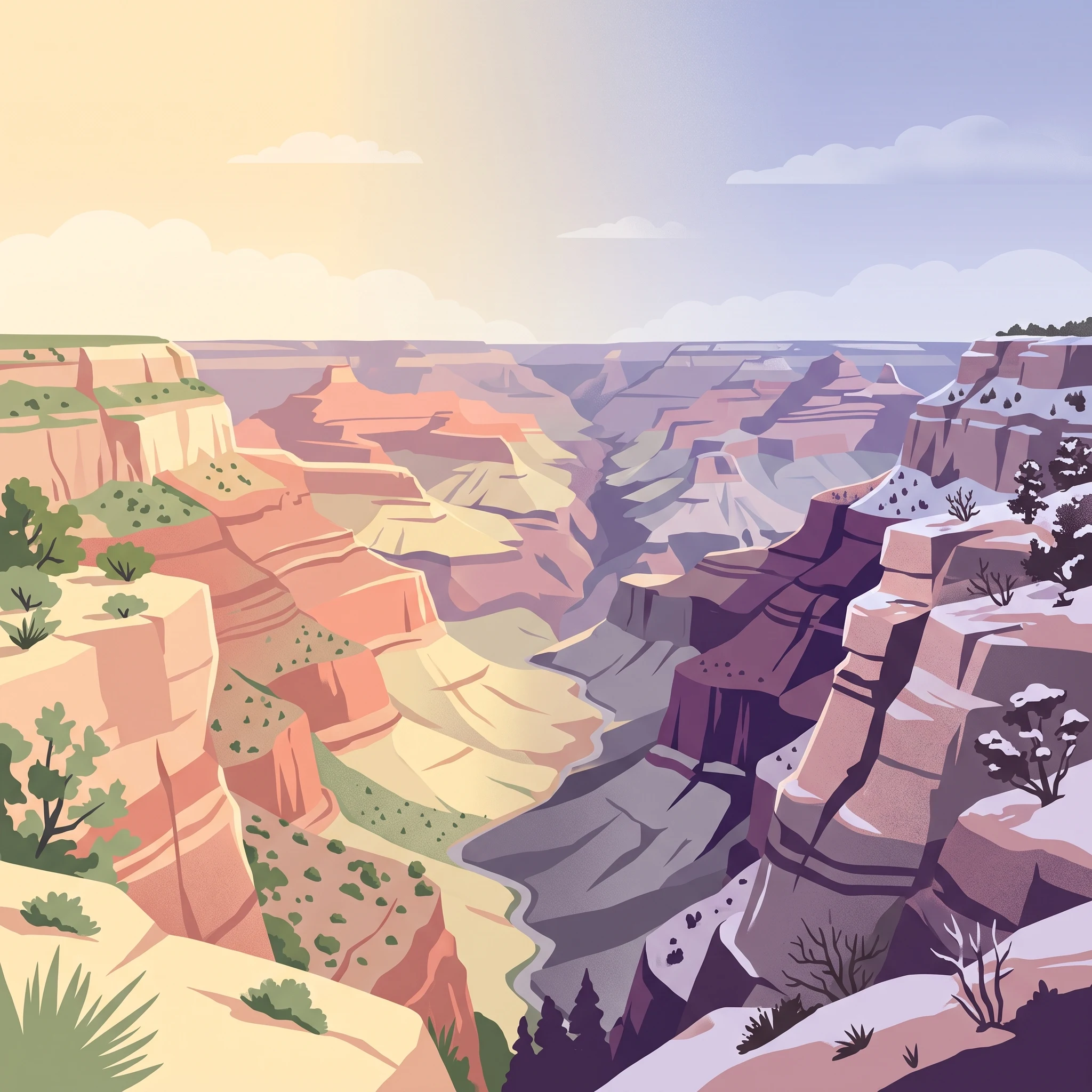
Determining the best time to visit Grand Canyon National Park requires balancing two primary, often competing factors: the desire for full park access and the necessity of managing temperature extremes. Because the park features significant elevation changes,ranging from the high-altitude rims to the depths of the inner canyon,conditions at the top can be drastically different from those at the river level. There is no single universal window for a visit, as the ideal timing depends entirely on whether your priority is traversing the North Rim, exploring the more popular South Rim, or undertaking challenging canyon-floor hikes.
The Impact of Elevation on Your Visit
Understanding the elevation gradient is critical to choosing your dates. The rims typically sit at high altitudes, leading to colder temperatures and occasional snow during winter and early spring. Conversely, the canyon floor often experiences intense, sustained heat during the summer months. These vertical climatic zones mean that even on a single day, a visitor might encounter near-freezing conditions at the rim while facing extreme, life-threatening heat at the bottom. The seasonal interplay of these temperatures dictates when certain activities become feasible or comfortable. For those aiming to visit both the North and South Rims, the window is narrower, as the North Rim is generally accessible only during the warmer months, typically from mid-spring until the first major snowfall of autumn.
Balancing Weather and Accessibility
The annual cycle of the park is defined by these environmental shifts. Spring and autumn offer the most moderate, comfortable temperature ranges for those interested in hiking or long days of sightseeing, providing a reprieve from the extreme summer heat and the winter chill. However, these periods also correspond with popular travel times. Winter presents a quieter atmosphere and a unique, snow-dusted landscape, yet it necessitates careful planning regarding road access and facility availability. Summer is marked by peak heat, particularly within the gorge, and higher visitor densities. When planning your trip, consider how your tolerance for these temperature fluctuations and your interest in specific park areas will interact with the calendar. Rather than seeking a single 'perfect' month, focus on aligning your travel dates with the specific type of environment and access level you are prepared to navigate. Always verify the current status of roads, facilities, and trail conditions through official park channels, as regional weather patterns can shift the typical timeline of seasonal transitions from year to year.
Seasonal Planning
Best months for visiting Grand Canyon National Park
Spring and Autumn: The Moderate Hiking Windows
For most visitors, the months of April and May, as well as September and October, represent the most balanced periods for a visit. During these intervals, the park experiences moderate temperature profiles that contrast sharply with the extreme heat of the mid-summer months. April begins with mean temperatures around 9.86°C, quickly warming into May with a mean of 15.45°C. September follows a similar pattern, offering a cooling-off period from the summer peaks with a mean of 19.04°C, which drops to 11.83°C by October. These windows are particularly advantageous for those planning to explore the trail networks descending from the rims, as the reduced heat stress at higher elevations makes extended outdoor activity more manageable. Travelers should note that while these periods are thermally comfortable at the rim, significant temperature shifts persist between the canyon floor and the surface.
Summer: High Heat and Full Accessibility
June, July, and August constitute the period of highest thermal intensity, with mean temperatures climbing above 21°C and reaching as high as 24.42°C in July. These months are characterized by the longest daylight hours of the year,peaking at 14.41 hours in June,which provides more time for sightseeing but increases exposure to solar radiation. The primary trade-off during this season is managing heat safety while taking advantage of the full operational availability of both the North and South Rims. While summer is a high-traffic time for park infrastructure, it is also the period when the North Rim is consistently accessible for visitors who prefer to avoid the higher-density areas of the South Rim. Hikers during this time must prioritize hydration and time-of-day planning, as the canyon floor experiences significantly more intense heat than the elevated rim regions.
Winter: Quiet Vistas and Operational Limitations
Visiting between November and March offers a distinct experience defined by significantly lower temperatures and the shortest days of the year, with daylight dropping to 9.59 hours in December. January and February are the coldest months, with mean temperatures hovering near the freezing point and average daily minimums plunging below -9°C. This period is ideal for those who prioritize solitude and appreciate the dramatic contrast of snow against the canyon's red rock strata. However, the compromise for this atmospheric experience is limited access. The North Rim is generally closed to vehicle traffic during the winter, and snow or ice can create hazardous conditions on rim-side trails. Visitors opting for these months should prioritize flexibility, as winter weather patterns are less predictable and often dictate which sections of the park can be safely navigated.
Annual Climate Overview
Grand Canyon Weather and Climate Patterns by Month
Navigating Annual Temperature Fluctuations
The annual temperature profile is defined by significant variability, shaped by the park's elevation and the arid environment of the surrounding plateau. Winters are marked by cold, sub-freezing nights, with average minimums often dipping toward -11°C in December and January. These months present a stark contrast to the core of the summer season, when average maximums consistently climb above 35°C in June and July. This dramatic swing of nearly 50 degrees Celsius across the year reflects the high-desert climate that characterizes much of the protected area. Visitors should note that these figures represent long-term climate normals rather than daily weather forecasts, and conditions can shift rapidly within a single 24-hour period due to the rugged topography.
Patterns in Precipitation and Humidity
Precipitation in this high-altitude region follows a distinctly seasonal rhythm, with moisture levels varying as the calendar turns. While the area generally maintains a dry profile, there is a measurable increase in precipitation during the mid-summer months,specifically July and August,when daily averages reach their annual peaks of 1.32 mm and 1.58 mm, respectively. This period often coincides with shifts in regional atmospheric moisture. Conversely, the spring months of April and May are among the driest, often recording precipitation averages below 0.5 mm per day. Humidity levels track inversely with temperature; during the heat of June, the air is at its most arid, with humidity dropping to an average of 25%. This low humidity can mask the intensity of the solar radiation, a factor that is important for those sensitive to high heat and dry conditions.
Variability in Daylight and Wind
Daylight hours fluctuate significantly throughout the year, impacting the available time for daylight activities. The peak of summer, particularly around June, offers the longest days with over 14 hours of potential light. In contrast, the shortest days occur in December, when daylight dips below 10 hours. This seasonal contraction of daylight is a crucial planning factor, as it limits the time available for sustained outings during the winter months compared to the expansive windows of the summer solstice.
Wind patterns also exhibit notable changes, with an increase in average wind speeds during the spring transition. April emerges as a notably breezy month, with average wind speeds reaching 4.33 m/s, before settling into more moderate patterns as the summer heat takes hold. These wind variations are often felt most intensely on exposed ridgelines and rim viewpoints, where the absence of dense vegetative cover provides little shelter from prevailing air currents. While these normals describe the broader annual trends, they do not account for local microclimates or specific weather events that may influence actual conditions on any given day. Readers should consult official, localized weather reports prior to their visit to account for these inherent environmental fluctuations.
Seasonal Analysis
Understanding Grand Canyon seasonal weather patterns and transitions
Defining the Grand Canyon annual climate rhythm
Rather than adhering to a strict four-season calendar, the Grand Canyon environment is defined by its distinct temperature thresholds and the shifting influence of regional moisture patterns. Because the park spans vast differences in elevation, from the high-altitude rims to the depth of the inner canyon, the annual rhythm is best understood as a transition between periods of significant thermal stress and periods of moderate, though unpredictable, meteorological conditions.
The cold-dominant period: December through March
Winter at the Grand Canyon is primarily defined by its low temperatures, with mean monthly averages lingering near the freezing point. January and December exhibit the most pronounced cold, featuring high frequencies of overnight lows well below zero. This phase is characterized by a lack of significant precipitation but a higher likelihood of snow, which can persist on the canyon rims, particularly at the higher elevations of the North Rim. Visitors during this period should anticipate that temperatures at the rim do not reflect the conditions deeper in the canyon, where, despite the depth, temperatures can remain chilled, though often warmer than the rim edge. Daylight remains at its shortest annual minimum during these months, limiting the time available for extended exploration.
The dry, warming transition: April through June
As daylight hours increase throughout the spring, the park enters a notable drying phase. April and May represent a critical transition where daytime maximums begin a steady climb, effectively ending the consistent sub-freezing morning temperatures of winter. This period is marked by the lowest relative humidity of the year, particularly in June, which sees moisture levels plummet. Environmental conditions during this time are dominated by rising thermal intensity. Hikers and visitors should observe that while the rim temperatures might feel comfortable, the internal canyon experiences an additive effect from heat trapped by the canyon walls. This phase is not a wet season; it is a period of accelerating desiccation where wind speeds often rise, contributing to a high-fire-danger environment that persists until the arrival of seasonal moisture shifts.
The summer moisture phase: July through September
July marks the shift toward the park's warmest annual phase, characterized by sustained high daytime maximums that frequently exceed the year's thermal peaks. This window is also the most significant in terms of precipitation frequency, as the park experiences an uptick in moisture brought by regional weather patterns. August and September continue this warmth, though the intensity begins to taper as daylight hours shorten. While these months are technically the wettest, they are not defined by prolonged rainfall; instead, they are subject to intermittent, high-intensity events. Humidity levels during this period are higher than in the preceding spring months, providing a subtle but noticeable shift in the air's quality, though it remains a hot, exposed environment for any visitor venturing away from the rims.
The cooling autumn window: October and November
Autumn acts as a compressed mirror to the spring transition. By October, the extreme thermal stress of summer recedes rapidly as average temperatures drop significantly. This period is defined by stabilization; the erratic heat of summer gives way to more temperate, manageable days, although overnight temperatures again approach the freezing threshold. It is a period of transition toward winter, where the landscape enters a phase of gradual cooling, signaling that the window for high-elevation access is drawing to a close as the seasonal clock resets.
Seasonal Experiences
What Visiting Grand Canyon National Park is Like Through the Year
Experiences Driven by Seasonal Climate Patterns
Visiting the Grand Canyon is an exercise in managing the park's dramatic vertical and seasonal shifts. The experience of the park changes significantly based on the time of year, primarily due to the relationship between air temperature and the massive elevation changes between the rims and the inner canyon floor. While the rim-level vistas remain accessible for much of the year, the viability of deep-canyon activities is often tethered to the temperature normals observed in different seasons.
Walking and Hiking Through the Thermal Gradient
Activities like descending the Bright Angel or South Kaibab trails are heavily influenced by the seasonal temperature averages. During the spring months of April and May, when average maximum temperatures begin to rise from the mid-20s toward 30°C, the inner canyon can become significantly warmer than the rim, creating a stark thermal gradient that hikers must navigate. This period offers longer daylight hours,approaching 14 hours by late spring,allowing for more time to complete long descents. However, visitors must account for the rapid increase in temperature as they move away from the cooler, forested rim environments.
By July and August, when mean temperatures are at their highest and the average daily maximum exceeds 34°C, strenuous activity deep within the canyon requires high vigilance regarding heat exposure. The increased humidity levels observed during these mid-summer months, often accompanied by local weather patterns, can alter the standard experience of the arid landscape. Visitors planning to hike during these high-heat windows are encouraged to check official daily warnings and consider the reality that the most difficult portion of any hike is the ascent back to the rim at the end of the day.
Rim-Level Exploration and Vistas
For those focusing on rim-based experiences, such as traversing the Trail of Time or visiting viewpoints like Mather Point or Desert View, the experience is less impacted by extreme thermal stress than the inner canyon. Winter months, characterized by mean temperatures near freezing and shorter daylight hours of roughly 9.5 to 10 hours, provide a quiet, contemplative atmosphere for these walks. While the experience is vastly different from the high-summer season, it allows for a focus on the geological layers without the high-temperature constraints of the shoulder and summer seasons. It is essential for visitors during these colder periods to verify that they have appropriate gear, as trails near the rim can be prone to icy conditions depending on the preceding weather patterns.
Operational Considerations for Seasonal Access
Landscape-based experiences at the North Rim, such as those at Cape Royal or Point Imperial, are seasonally limited by the park's operational schedule. This northern region, at a higher elevation than the South Rim, experiences conditions that necessitate closures, typically extending through the winter and into late spring. Visitors whose preferred experience includes the distinct coniferous landscape of the North Rim should align their planning with the windows where in-park facilities are active, as these represent the only times these specific vistas are realistically reachable. Always consult current National Park Service bulletins for confirmed opening dates, as these are subject to annual adjustments based on environmental factors rather than fixed calendar dates.
Travel Planning by Interest
Choosing the best visiting period for your hiking and sightseeing goals
Selecting windows for canyon hiking and thermal management
For visitors prioritizing strenuous canyon activities, the primary challenge is the significant thermal gradient between the rim and the river. Hiking feasibility is highest when air temperatures at the bottom of the canyon remain manageable for sustained physical effort. The months of April, May, and September offer the most reliable window for these pursuits, as mean temperatures across the park shift from 9.86°C in April to 15.45°C in May, and back to 19.04°C by September. During these periods, maximum temperatures at the surface provide a buffer against the far higher heat experienced once descending below the rim. Mid-summer, particularly July and August, presents a severe limitation for serious hiking; when mean maximum temperatures climb toward 36.79°C and humidity levels rise to 42.71% in August, the internal canyon temperatures frequently exceed safety thresholds for physical exertion.
Balancing daylight duration with heat exposure
Daylight is a critical variable for those seeking to maximize time on trails or photography without the risks associated with heat stress. June offers the peak of daylight availability at 14.41 hours, providing long windows for exploration. However, this high-daylight period coincides with the most intense solar exposure and the onset of the summer heat. Travelers who want extended daylight hours but require moderate temperatures often find the late spring transition in May a superior trade-off compared to the mid-summer peak. In May, daylight reaches 13.92 hours, nearly matching June, while the mean maximum temperature remains lower at 30.92°C compared to the 35.5°C average in June. By early autumn, daylight hours contract to 12.19 hours in September, which may restrict the scope of longer, full-day hikes.
Timing for consistent panoramic viewing and clear conditions
Visitors whose primary goal is panoramic sightseeing and photography across the rims should consider the shoulder months of April and October. These periods avoid the humidity spikes of late summer,which can introduce atmospheric haze,while also avoiding the extreme precipitation variability and potential for low-visibility days seen in late winter. April serves as an efficient choice for those who prefer longer daylight (12.94 hours) and rising temperatures that begin to melt high-elevation frost. Conversely, October provides a cooling, stable environment with a mean temperature of 11.83°C, often resulting in crisper air clarity compared to the warmer months. While winter can offer singular, high-contrast photographic opportunities, the limited daylight hours (9.59 hours in December) and colder conditions may restrict the time available to visit multiple viewpoints or observe the changing light at dawn and dusk across the canyon depths.
Operational Planning
Seasonal access and park operations for trip planning
Navigating North Rim and South Rim accessibility
The most significant logistical divide for planning your visit is the operational difference between the South and North Rims. While the two rims are separated by a relatively short distance as the crow flies, they are distinct entities regarding seasonal access. The South Rim serves as the primary gateway for the majority of park visitors and is managed for year-round access. Conversely, the North Rim operates on a strictly seasonal cycle due to its higher average elevation and exposure to winter weather conditions. Historically, access roads and in-park facilities on the North Rim are typically open during the summer months, while the area remains largely inaccessible by vehicle during the winter. You must verify current road status, facility opening schedules, and potential early-season or late-season closures directly through the official National Park Service website before finalizing your travel dates.
Seasonal shuttle and internal transit operations
Within the South Rim, visitor experience is often dictated by the availability of the park’s shuttle system. This internal network is designed to reduce congestion at popular trailheads and viewpoints, such as those along the West Rim Drive. Frequency and reach of these shuttles fluctuate throughout the year, with expanded service levels typically coinciding with peak visitation months to accommodate higher volume. During quieter periods, route availability may be reduced. Because shuttle schedules, route maps, and operating hours are subject to adjustment based on staffing and demand, always consult the latest park bulletins prior to your arrival to ensure your desired viewpoints or trailheads are serviced during your stay.
Planning for remote area access and permits
Travel beyond the established rim-village infrastructure requires careful, advance preparation. Areas such as the Havasupai Indian Reservation, located outside the national park boundaries, operate under entirely separate administrative rules and often require specific permits that must be secured well in advance. For those planning to descend into the canyon, whether for day hiking or overnight stays at locations like Phantom Ranch, logistical requirements regarding permits and water access points are critical. Remember that the canyon's deep, vertical topography means that infrastructure and trail conditions can change rapidly following weather events. Never assume that a trail or service is open simply because it falls within a particular season. Always confirm current permit availability, reservation requirements, and trail-specific notices via the relevant tribal or federal authorities to ensure your plans are consistent with current park operations.
Safety and Preparation
Seasonal Weather, Safety, and Trip Preparation for Grand Canyon
Managing Thermal Exposure and Elevation Risks
Preparing for a visit requires acknowledging the significant vertical relief of the landscape. Because temperatures can shift dramatically between the rim and the inner canyon, relying on a single weather forecast for a primary lodge or visitor center often misrepresents the conditions encountered during activities like hiking or rim-side exploration. Even during months with moderate rim temperatures, the inner gorge often retains significantly higher heat, creating a thermal gradient that requires visitors to assess the specific elevation of their planned route. Proactive preparation involves monitoring multi-elevation forecasts and official park alerts, as long-term climate normals suggest persistent, non-linear temperature fluctuations that can surprise unprepared travelers.
Seasonal Clothing and Gear Considerations
Packing strategies should focus on versatility rather than anticipating static weather. During transition months, such as April or October, conditions can swing from freezing morning temperatures to warm afternoons, necessitating layered clothing that can be adjusted rapidly. While summer visitors often prioritize lightweight, breathable fabrics to manage high daytime maximums, those traveling in winter must prepare for sub-freezing lows and the possibility of snow or ice, even if the primary roads appear clear. Specialized traction devices or sturdy footwear with adequate grip are practical considerations when trails show signs of winter accumulation, though travelers should always verify current trail conditions through official park communications before departure.
Navigating Seasonal Daylight and Activity Timing
Daylight availability serves as a critical planning factor, particularly for those attempting longer excursions or complex itineraries. In late autumn and winter, the restricted hours of sunlight limit the time available for safe navigation, effectively condensing the window for strenuous activity. Conversely, the longer days of late spring and early summer provide expanded opportunities for exploration, but these hours also correlate with higher heat risk during peak sun exposure. When planning the timing of a visit, consider the practical limits of your endurance against the available light. Regardless of the season, maintaining a margin for error in your itinerary is standard practice for a landscape where terrain and altitude intensify the physical demands of any activity.
Verifying Conditions and Official Guidance
Operational and safety status updates are essential to responsible trip planning. Because weather events, road closures, and water service interruptions can occur without long-term warning, checking the National Park Service's live alerts and incident reports is the only way to obtain reliable information for your specific dates. Relying on seasonal generalizations for access to specific trails, shuttle routes, or campgrounds can lead to logistical difficulties; verify the current status of all park facilities, especially if your travel dates fall near the beginning or end of the standard operating seasons for the North or South Rims.
Trip synthesis
How to evaluate your optimal time to visit
Deciding when to visit Grand Canyon National Park requires reconciling your personal recreational goals with the park's dramatic vertical climate zones and operational reality. Because the canyon is not a single environment but a vast, elevation-driven landscape, there is no single month or season that satisfies every traveler's requirements. Your decision should center on whether your priority is challenging, high-intensity canyon exploration or serene, rim-level sightseeing.
Prioritizing weather for your activity levels
If your primary goal is hiking deep into the canyon, you must align your travel dates with the moderate temperature windows of mid-spring and early autumn. During these periods, you can navigate the significant thermal gradient between the rim and the river floor without contending with the extreme high-heat risks that characterize June, July, and August. Conversely, if you are visiting primarily for panoramic sightseeing and landscape photography, the late autumn and winter months offer the benefit of lower humidity and greater air clarity, provided you are prepared for sub-freezing morning temperatures and potential seasonal snow at the rim.
Balancing accessibility with environmental comfort
Your choice of timing is also heavily influenced by your interest in the North Rim versus the South Rim. Access to the North Rim is defined by seasonal facility operations, which are far more restricted than the year-round activity at the South Rim. If you wish to experience the quieter, higher-elevation vistas of the North Rim, you are constrained to the summer and early autumn window. If you prioritize maximum flexibility, the South Rim remains the primary choice, though it requires managing higher visitor volumes and adjusting your schedule to avoid peak-heat hours during the summer. Regardless of when you choose to travel, recognize that the canyon’s weather is not static. A warm, clear day can be followed by rapid temperature shifts, especially as you descend into the gorge. Always view seasonal normals as indicators of patterns rather than guaranteed conditions for your specific dates. Before final booking, check official National Park Service resources for the most current information regarding trail closures, facility hours, and weather alerts, as these operational variables will ultimately dictate the feasibility of your planned activities on the ground.