

Mori Atlas logo
Nature reserveGrass Tree Conservation Park

Understanding the mapped boundaries and natural woodland terrain of this coastal conservation landscape.

Grass Tree Conservation Park: A Protected Nature Reserve in South Australia's Limestone Coast

Grass Tree Conservation Park serves as a critical nature reserve in South Australia, protecting a defined stand of Xanthorrhoea grass trees within the Limestone Coast region. The park preserves distinct vegetation associations, ranging from brown stringybark low woodland to pink gum open forest, all situated across a terrain of undulating sandy dunes. By maintaining these native vegetation communities, the reserve acts as an essential component of the regional conservation network near the West Naracoorte Range.

grass treesLimestone Coastlow woodlandopen forestcalcarenite dunesnative vegetation reserve

Grass Tree Conservation Park

Nature reserve

Park overview

Structured park overview, official facts, and landscape profile for Grass Tree Conservation Park

Grass Tree Conservation Park park facts, protected area profile, and essential visitor context

Review the core facts for Grass Tree Conservation Park, including designation, size, terrain, visitor scale, habitats, and operating context in one park-focused overview.

About Grass Tree Conservation Park

Grass Tree Conservation Park is a small but ecologically focused protected area in South Australia's Limestone Coast region, located in the gazetted locality of Cadgee roughly 17 kilometres north of Naracoorte. Covering just 16 hectares within the Hundred of Hynam, the park sits on the southern side of Boddingtons West Road on land that has never been cleared for agriculture, giving it unusual conservation value for its size.

The reserve was proclaimed on 17 August 1972 under the National Parks and Wildlife Act 1972, with its specific purpose being the protection of a stand of grass trees, the Xanthorrhoea australis plants for which the park is named. Despite the land's intact status, historical grazing by domestic livestock appears to have disturbed the understorey of the open forest areas and encouraged the establishment of introduced grasses and pasture weeds such as Cape weed.

The park is jointly classified as an IUCN Category III protected area, recognising it as a natural monument or feature of significance. Its management falls under South Australia's Department for Environment and Water, and as of the early 1990s it was described as receiving very little visitor use, with no visitor facilities other than 5-metre-wide boundary access tracks along its western, southern, and eastern edges. The park's role is therefore primarily protective, safeguarding a representative pocket of native Limestone Coast vegetation rather than serving as a recreational destination.

Quick facts and research context for Grass Tree Conservation Park

Grass Tree Conservation Park is located in the Limestone Coast region of South Australia, in the locality of Cadgee approximately 17 kilometres north of Naracoorte. It occupies 16 hectares of crown land within the Hundred of Hynam, on the southern side of Boddingtons West Road, and was proclaimed on 17 August 1972 under the National Parks and Wildlife Act 1972.

The reserve is managed by the Department for Environment and Water and is classified as an IUCN Category III protected area in recognition of its natural monument value. It protects a distinctive assemblage of three vegetation associations on calcarenite-derived sandy soils, including a low woodland of brown stringybark, open forest of pink gum, and a smaller area of South Australian blue gum, all associated with stands of grass trees.

Protection and recognition

Examine documented terrestrial protection parameters and boundary records.

Grass Tree Conservation Park Protection Status and Administrative Scope

Grass Tree Conservation Park maintains a documented terrestrial protection status with structured administrative parameters. Official designation records outline the scope of environmental management and regional conservation frameworks.

Protection details

Protection scope
Terrestrial
Transboundary protection
No
Park context

Deeper park guide and search-rich context for Grass Tree Conservation Park

Grass Tree Conservation Park history, landscape, wildlife, and travel context

Explore Grass Tree Conservation Park through its history, landscape character, ecosystems, wildlife, conservation priorities, cultural context, and seasonal travel timing in a structured park guide built for atlas discovery and search intent.

Why Grass Tree Conservation Park stands out

Grass Tree Conservation Park is known for protecting a defined stand of grass trees within an otherwise largely cleared agricultural landscape on South Australia's Limestone Coast. The park's defining feature is this population of Xanthorrhoea australis, which forms a characteristic understorey component across multiple native vegetation types on the reserve. The park also stands out as a representative example of the Naracoorte Environmental Association, where calcarenite dune ridges are overlain by mobile sands supporting low woodland and open forest communities of brown stringybark, pink gum, and South Australian blue gum.

Grass Tree Conservation Park history and protected-area timeline

Grass Tree Conservation Park was established by proclamation on 17 August 1972 under South Australia's National Parks and Wildlife Act 1972. Its creation was driven by a specific conservation objective: the protection of a stand of grass trees on crown land in the Hundred of Hynam that had not previously been cleared for agriculture.

Although the land had escaped clearing, the understorey of its open forest areas shows evidence of historical disturbance, with the presence of introduced grasses and pasture weeds suggesting that domestic livestock once grazed within the area. By 1992, official descriptions recorded very little visitor use at the park, and no formal visitor facilities had been developed beyond boundary access tracks along several edges of the reserve.

Grass Tree Conservation Park landscape and geographic character

The landscape of Grass Tree Conservation Park is shaped by the geology of the Naracoorte Environmental Association, a setting characterised by calcarenite dune ridges overlain by dunes and sheets of mobile sand. This produces a terrain of gently undulating sandy ground that reflects the broader dune systems of the West Naracoorte Range on the Limestone Coast.

The park's soils are predominantly deep, acid, bleached sands with a yellow-grey B horizon, with smaller areas of shallower alkaline sandy soils of a reddish colour. A stony limestone rise runs through the central part of the reserve, while the southern and eastern sections carry the deeper sandy substrates that support the most open woodland communities. The boundary access tracks on the western, southern, and eastern sides intersect this subdued dune topography.

Grass Tree Conservation Park ecosystems, habitats, and plant life

Ecologically, Grass Tree Conservation Park protects a narrow but representative slice of Limestone Coast native vegetation arranged across three recognised vegetation associations. The dominant community is a low woodland of brown stringybark associated with the sandy soils of the stranded dune systems of the West Naracoorte Range, where the understorey reflects the park's grazing history through the presence of introduced grasses and pasture species.

A second association occupies the central stony limestone rise, comprising open forest to low open forest of pink gum with an understorey generally made up of introduced grasses and weed species such as Cape weed. The third association, found in the south-east of the park, is a small area of open forest dominated by South Australian blue gum, with an understorey that includes grass trees, Austral bracken, and rice flower, representing the most botanically intact plant community on the reserve.

Grass Tree Conservation Park conservation status and protection priorities

Grass Tree Conservation Park derives its conservation significance from its role as a protected refuge for native grass trees and associated Limestone Coast vegetation in an agricultural landscape. Its IUCN Category III designation recognises it as a natural monument or feature, a classification typically applied to areas where specific natural elements such as distinctive plant communities or geological features are the primary conservation focus.

The reserve's value is enhanced by the fact that its crown land was never cleared for agriculture, preserving an intact soil profile and the structural framework of native woodland and forest even where historical grazing has influenced the understorey composition. By maintaining the three recognised vegetation associations, including brown stringybark low woodland, pink gum open forest, and South Australian blue gum open forest with its grass tree understorey, the park contributes to the broader network of small reserves that sustain native plant diversity across the south-east of South Australia.

Top sights and standout views in Grass Tree Conservation Park

A 16-hectare protected reserve dedicated to safeguarding a stand of grass trees on the Limestone Coast of South Australia, proclaimed in 1972 under the National Parks and Wildlife Act 1972 and classified as an IUCN Category III natural monument or feature.

The park protects three distinct vegetation associations, brown stringybark low woodland, pink gum open forest, and South Australian blue gum open forest, with an understorey of grass trees, Austral bracken, and rice flower in its most intact south-eastern section.
Monthly climate preview

Long-term representative measurements outlining annual temperature ranges and monthly precipitation patterns

Grass Tree Conservation Park Climate Normals, Average Temperature and Precipitation

Representative coordinate records outline how average monthly temperatures and precipitation totals shift across the year at Grass Tree Conservation Park. Examining the complete twelve-month climatology provides deeper analytical context for long-term environmental patterns.
Annual mean15 °C
9 °C21 °C
Jan21°
Feb21°
Mar19°
Apr15°
May12°
Jun10°
Jul
Aug
Sep11°
Oct14°
Nov17°
Dec19°
Warmest month
January

21.4 °C

Coolest month
July

8.9 °C

Wettest month
June

2.4 mm/day

Driest month
February

0.6 mm/day

Park location guide

Geography guide, regional context, and park location map for Grass Tree Conservation Park

Grass Tree Conservation Park park geography, regions, and map view in Australia

Understand where Grass Tree Conservation Park sits in Australia through a broader geographic reading of the surrounding landscape, nearby location context, and its mapped position within the national park landscape.

How Grass Tree Conservation Park fits into Australia

Australia is a constitutional monarchy and federal parliamentary democracy comprising six states and ten territories. With a population of nearly 28 million, it is one of the world's most urbanised countries, with most people concentrated on the eastern seaboard. The country has a high Human Development Index and is known for its cultural diversity, ancient Aboriginal heritage, and unique wildlife.

Wider geography shaping Grass Tree Conservation Park in Australia

Australia occupies the entire Australian continent, the island of Tasmania, and numerous smaller islands. It is the world's flattest and driest inhabited continent, featuring vast deserts in the interior (the Outback), tropical rainforests along the eastern coast, and a coastline bordering the Indian and Pacific Oceans.

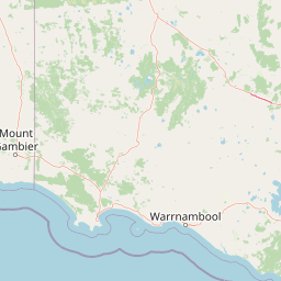
Map view of Grass Tree Conservation Park

Use this park location map to pinpoint Grass Tree Conservation Park in Australia, understand its exact geographic position, and read its mapped placement within the surrounding landscape more clearly.

Pigeon | © OpenStreetMap contributors

Location context for Grass Tree Conservation Park

South Australia
Park atlas

Compare regional conservation areas and nearby South Australian native reserves.

Parks Near Grass Tree Conservation Park and Surrounding Protected Landscapes

Browse protected areas and native vegetation reserves located near Grass Tree Conservation Park in the Limestone Coast region. Comparing adjacent terrain and woodland habitats provides broader geographic context for South Australia conservation networks.
Nature reserveSouth Australia
About 23 km away#1 closest

West

Fairview Conservation Park: Protected Nature Reserve and Limestone Coast Geography

Mapped wetlands, sandy ridges, and woodlands in southeastern South Australia

Explore the geographic framework of Fairview Conservation Park, a nature reserve in South Australia's Limestone Coast. The protected area features a unique intersection of semi-permanent lagoons, periodically inundated flats, and varied woodland vegetation including blue gum and manna gum, offering a clear window into the regional geological and ecological character of the area.

Area
13.94 km²
Established
1960
IUCN
Ia
Relief
Lowland
National parkSouth Australia
About 24 km away#2 closest

South

Naracoorte Caves National Park: Detailed Map and Protected Landscape Context in South Australia

Explore its unique protected geography and natural terrain.

Naracoorte Caves National Park represents a vital protected area within the diverse geography of South Australia. This entry provides an atlas-driven perspective, highlighting its identity as a national park, its mapped landscapes, and its regional significance. Engage with structured information detailing the park's protected status and geographic features, offering a clear view of its contribution to South Australia's natural heritage.

Area
6.6 km²
Established
2001
IUCN
II
Visitors
90.8K annual
Nature reserveSouth Australia
About 24 km away#3 closest

Northeast

Geegeela Conservation Park: Mapped Geography and Protected Area Data

Ecological restoration and woodland habitat in South Australia

Geegeela Conservation Park stands as a significant nature reserve within the Limestone Coast of South Australia. Covering over eight square kilometres, this area protects a regenerating mosaic of desert banksia heath and stringybark woodland, offering a critical refuge for local bird species and nationally endangered fauna within the surrounding rural landscape.

Area
8.58 km²
Established
2005
IUCN
III
Relief
Lowland
National parkAustralia
About 29 km away#4 closest

Northeast

Little Desert National Park: Victoria's Semi-Arid National Park and Protected Landscape

Explore mapped boundaries and unique mallee heathland ecosystems.

Delve into the protected landscape of Little Desert National Park, a significant national park covering over 1,300 square kilometers of Victoria's semi-arid western region. This area is characterized by its deep sandy soils, mallee heathlands, and diverse wildlife, including important populations of native birds. Understanding its geographic setting and mapped boundaries provides crucial insight into Australia's conservation efforts and the preservation of unique desert ecosystems.

Area
1,326.47 km²
Established
1988
IUCN
II
Visitors
50K annual
Nature reserveSouth Australia
About 32 km away#5 closest

South

Hacks Lagoon Conservation Park: Wetland Landscape and Protected Area Geography

A vital Ramsar wetland site in the South Australia Limestone Coast region

Hacks Lagoon Conservation Park provides a protected freshwater sanctuary amidst the rural plains of South Australia. This nature reserve sustains a diverse wetland habitat, encompassing open water, marshes, and seasonally flooded zones that support critical waterbird populations within an internationally recognized ecological system.

Area
2.02 km²
Established
1967
IUCN
IV
Relief
Lowland
Wildlife reserveSouth Australia
About 32 km away#6 closest

South

Big Heath Conservation Park: Mapping Protected Landscapes in South Australia

A strict nature reserve of woodland and wetland mosaics.

Big Heath Conservation Park represents a significant protected area in the Limestone Coast region of South Australia. The terrain is characterized by a gently undulating plain where subtle variations in elevation and soil composition create a distinct patchwork of eucalypt woodlands, sandy heath, and seasonal depressions linked to regional hydrological drainage systems.

Area
24.72 km²
Established
1964
IUCN
Ia
Relief
Lowland
Nature reserveSouth Australia
About 45 km away#7 closest

South

Glen Roy Conservation Park: Geography and Protected Landscape Atlas

Nature reserve terrain in south-east South Australia

Glen Roy Conservation Park stands as a significant protected remnant in south-eastern South Australia, encompassing a diverse array of calcarenite dune ridges, bleached sand dunes, and seasonal interdunal swamps. The park area is managed for its ecological variety, featuring distinct vegetation associations ranging from brown stringybark open forest to river red gum woodland and closed heathland.

Area
5.44 km²
Established
1970
IUCN
III
Relief
Lowland
Wildlife reserveSouth Australia
About 46 km away#8 closest

Northeast

Custon Conservation Park: Protected Wildlife Reserve and Woodland Landscape in South Australia

Geographic atlas of protected native grassy woodlands and local biodiversity reserves

Custon Conservation Park represents a vital protected land parcel within South Australia, focused on the conservation of endangered Grey-box Grassy Woodland. The site acts as a specialized wildlife reserve where native vegetation associations are preserved through integrated ecological strategies. This detail page offers insight into the park boundaries and regional environmental context of this significant Limestone Coast protected area.

Area
0.64 km²
Established
2007
IUCN
III
Relief
Lowland

Common questions about visiting, size, designation, and location context for Grass Tree Conservation Park

Grass Tree Conservation Park FAQs for park facts, access, geography, and protected area context

Find quick answers about Grass Tree Conservation Park, including protected-area facts, park geography, trail and visitor context, and how the park fits into its surrounding country and regional landscape.
MoriAtlas Explorer

Continue Your Protected Areas Search Across the Global Atlas

Deepen your exploration by continuing the structured search for national parks and protected areas worldwide. Utilize the comprehensive filtering capabilities to compare different conservation landscapes and refine your understanding of global park geography. Discover more about the distribution and characteristics of protected natural areas.

Global natural geography