
Streams
Park geography
Detailed analysis of terrain, mountain peaks, and spatial dimensions
Comprehensive Geographic Profile and Mapped Boundaries of Grassland National Park
Trace the spatial characteristics of Grassland National Park through its recorded mountain landscape and expansive grassland habitat. This geographic overview highlights the physical dimensions, boundary spans, and specific natural features including high-altitude peaks and mountain passes found across the region in South Africa.
Related tags
National ParkGrassland EcosystemEastern CapeWitteberg MountainsMontane Habitat
South African mountain grassland protected area in the Eastern Cape Highlands
Grassland National Park
Grassland National Park is a newly established protected area in the Eastern Cape province of South Africa, situated along the southwestern border of the country adjacent to Lesotho within the Witteberge mountain range. The park was officially established in October 2025 through a collaborative partnership between South African National Parks (SANParks) and the World Wide Fund for Nature South Africa (WWF-SA), representing a significant addition to South Africa's protected area network. Covering approximately 102 square kilometers, the park specifically targets the conservation of grassveld vegetation communities that have historically been under-represented in South Africa's protected area estate. The park's location in the Eastern Cape Highlands places it within a region of remarkable topographic diversity, where the Witteberge mountain range creates a dramatic backdrop of rolling high-altitude grasslands and steep escarpment terrain.
- Location
- South Africa
- Park type
- National park
- Established
- 2025
- Area
- 102.3 km²
Location overview
Provincial placement within the Eastern Cape and transboundary context
Geographic Positioning of Grassland National Park in South Africa
Grassland National Park is located within the Eastern Cape region of South Africa. The protected landscape maintains a documented transboundary status across administrative borders.
- Countries
- South Africa
- Regions
- Eastern Cape
- Primary location
- Eastern Cape
- Geographic setting
- Transboundary · Inland
Boundary and coordinates
Exploring the 102.25 square kilometer spatial extent and coordinate limits
Geographic Boundaries and Spatial Mapping of Grassland National Park
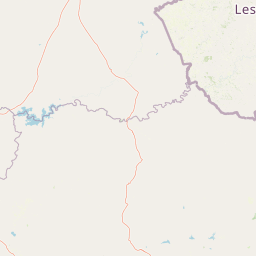
Interactive boundary geometry offers a clear visual outline of the Grassland National Park landscape within its regional geography. Associated spatial profiles detail the estimated land area, geographic center, and coordinate limits.
- Boundary area
- 2,128.8 km²
- Boundary perimeter
- 558.7 km
- Northernmost point
- 30.3459° S
- Southernmost point
- 31.1865° S
- Easternmost point
- 28.3623° E
- Westernmost point
- 27.3426° E
- Geographic centre
- 30.7742° S, 27.935° E
- North–south span
- 93.2 km
- East–west span
- 97.6 km
Terrain and natural features
Mountain classification and recorded features within boundaries
Grassland National Park Terrain and Named Natural Features
Grassland National Park features a mountain relief classification encompassing multiple named streams, peaks, passes, and waterfalls. Linked feature cards supply names, types, and spatial relationships for recorded landscape elements.
Selected named natural features
Peaks
Avoca Peak
2,760 m
Streams
Kwa Sijora
Peaks
Scobell's Kop
Mountain saddles
Tsatsane Pass
Streams
Bell River
Environmental setting
Analysis of recorded habitat types, relief variations, and seasonal patterns
Environmental Classifications and Terrain Profile of Grassland National Park
Recorded landscape features, habitat types, and relief attributes serve as complementary metrics for reading the physical setting of Grassland National Park. Stored classifications connect directly to broader atlas destinations to provide systematic context for the protected terrain.
- Relief
- Mountain
- Water
- Minor water
- Forest cover
- No forest cover
- Seasonality
- Seasonal
Landscape features
Mountains · Grassland
Habitat types
Grassland
Park atlas
Map the Regional Park Geography and Protected Landscapes of South Africa's Eastern Cape
Discover Related National Parks and Protected Areas Near Grassland National Park
Browse other national parks and protected areas in South Africa's Eastern Cape Highlands, extending the geographic context from Grassland National Park to adjacent montane grassveld ecosystems and diverse protected landscapes. Compare conservation efforts and regional variations in terrain and habitat across the Witteberge mountain range and surrounding highland environments through this focused atlas view.
Protected areaQuthing District
About 11 km away#1 closest
North

Lake Letsie Protected Area and Highland Wetland Geography in Quthing District
Mapping a unique Afroalpine reservoir and its surrounding catchment
Situated in the Quthing District of Lesotho, Lake Letsie is an essential protected landscape characterized by its shallow freshwater basin and high-altitude wetland habitat. This site provides critical insights into Afromontane biodiversity, regional water management, and the ecological impact of transboundary environmental factors on highland terrain.
- Area
- 4.34 km²
- Established
- 2001
- Relief
- Mountain
- Climate
- Alpine
National parkQacha's Nek District
82 km away#2 closest
Northeast
Sehlabathebe National Park: Mapped Protected Landscape in Lesotho's Maloti Mountains
Explore high-altitude terrain, waterfalls, and ancient rock art sites.
Sehlabathebe National Park stands as a protected national park within the rugged Maloti Mountains of Lesotho's Qacha's Nek District. This destination is vital for understanding the geographic context of protected areas, featuring dramatic cliffs, iconic waterfalls like Tsoelikana, and numerous rock art sites that speak to its cultural and historical significance. Its high-altitude Afro-Alpine and sub-alpine ecosystems offer unique landscape characteristics and support notable biodiversity, making it a key point of interest for atlas-driven exploration of natural and protected terrains.
- Area
- 69.5 km²
- Established
- 1969
- IUCN
- IV
- Relief
- Mountain
Protected areaKwaZulu-Natal
91 km away#3 closest
Northeast

Maloti-Drakensberg Park Geography: Mountain Escarpments and Alpine Plateau Exploration
A transboundary protected landscape spanning South Africa and Lesotho
Spanning the core of the Drakensberg mountain system, Maloti-Drakensberg Park provides a unique window into high-altitude biodiversity and geological drama. The protected area features basalt cliffs, rolling valleys, and an extensive plateau, forming a critical ecological and cultural corridor. This atlas entry covers the topographic features and spatial distribution of one of southern Africa's most significant protected landscapes.
- Area
- 2,493.13 km²
- Established
- 2001
- Relief
- Mountain
- Climate
- Alpine

Protected areaKwaZulu-Natal
91 km away#4 closest
Northeast
uKhahlamba-Drakensberg Park: Protected Mountain Landscapes and Escarpment Geography in South Africa
Exploring the basalt cliffs and alpine plateau of KwaZulu-Natal.
uKhahlamba-Drakensberg Park encompasses an expansive protected region where the Drakensberg escarpment rises sharply from the foothills of KwaZulu-Natal. This atlas record details the park landscape, including its transition from sandstone terraces to high-altitude basalt, its extensive river gorges, and the concentration of archaeological cave sites. Use this resource to understand the geographic scale of this transboundary conservation area.
- Area
- 2,429.13 km²
- Relief
- Mountain
- Climate
- Temperate
- Access
- Access unknown
Nature reserveKwaZulu-Natal
101 km away#5 closest
Northeast
Ntsikeni Nature Reserve: High-Elevation Wetland Geography and Protected Landscape Atlas
A remote Drakensberg foothills wetland and montane grassland reserve.
Ntsikeni Nature Reserve is recognized as the largest and one of the highest wetlands in South Africa. Located in the KwaZulu-Natal province, this protected area features a unique, misty plateau landscape that sustains diverse orchid flora and essential headwater ecosystems. Use these geographic maps to examine the terrain, park boundaries, and the ecological transition between rolling foothills and the Drakensberg escarpment.
- Area
- 92.87 km²
- Established
- 1978
- Relief
- Upland
- Climate
- Temperate
Nature reserveKwaZulu-Natal
About 102 km away#6 closest
East
Mount Currie Nature Reserve: A Detailed Geographic Atlas of KwaZulu-Natal Mountains
High-altitude wetlands and protected Drakensberg foothills
Mount Currie Nature Reserve encompasses a rugged expanse of Drakensberg foothills characterized by sharp dolerite cliffs and expansive central wetland systems. This protected area acts as a crucial ecological intersection, bridging montane grassland and Afromontane forest patches while providing a sanctuary for diverse avian life and significant cultural heritage sites.
- Area
- 17.77 km²
- Established
- 1980
- IUCN
- IV
- Relief
- Mountain
Nature reserveKwaZulu-Natal
About 114 km away#7 closest
Northeast
Coleford Nature Reserve: Protected Grasslands and Wetlands in KwaZulu-Natal
Tracing the landscape of a key Drakensberg foothill reserve
The Coleford Nature Reserve represents a critical protected area in the Southern Drakensberg, featuring threatened Drakensberg Foothill Moist Grassland. Its landscape is defined by the Ngwagwane River valley and diverse wetland systems, providing essential habitat for endangered bird species. This reserve functions as a gateway to the broader montane geography of the southwestern KwaZulu-Natal region.
- Area
- 12.72 km²
- Established
- 1948
- IUCN
- IV
- Relief
- Highland
Natural monumentMaseru District
About 126 km away#8 closest
North
Thaba Bosiu Natural Monument: Mapping the Plateau Geography in Maseru District
A fortified sandstone landscape with deep cultural roots
Thaba Bosiu remains one of the most recognizable geographic landmarks in Lesotho, featuring a flat-topped sandstone summit surrounded by sheer cliffs. This natural monument provides a unique window into the regional terrain, tracing the intersection of river valley systems, basalt formations, and historical mountain refuge sites that define the Maseru District.
- Area
- 2 km²
- Established
- 1967
- Relief
- Mountain
- Access
- Easy access
MoriAtlas Explorer
Continue Exploring Grassland National Park's Protected Landscape and Geographic Context
Deepen your understanding of Grassland National Park by examining its specific protected area characteristics and its position within the Eastern Cape's regional geography. Explore the mapped terrain and landscape context that define this significant national park. This focus on geographic identity and atlas placement provides a structured way to appreciate the park's natural value.
Browse next
Global natural geography
Explore related park routes
Explore MoriAtlas Global ParksBrowse All MoriAtlas ParksGlobal Park Map DiscoveryMoriAtlas: Browse All CountriesBrowse All MoriAtlas ContinentsNational Park Environment AtlasGrand Canyon National Park AtlasYellowstone National Park AtlasYosemite National Park Atlas and GeographySerengeti National Park AtlasGalápagos National Park Protected LandscapeBanff National Park Geography and AtlasKruger National Park Atlas EntryUluṟu-Kata Tjuṯa National Park AtlasExplore Uluru-Kata Tjuta National Park GeographyPlitvice Lakes National Park AtlasFiordland National Park Protected LandscapeGreat Smoky Mountains National Park AtlasAfghanistan National Parks and Protected AreasAlbania National Parks and Protected AreasAlgeria National Parks and Protected AreasAmerican Samoa National Parks and Protected AreasAndorra National Parks and Protected AreasAngola National Parks and Protected AreasAntarctica National Parks and Protected AreasAntigua and Barbuda Park List