

Mori Atlas logo
Nature reserveGreat Fish River Nature Reserve

Examining the consolidated protected boundaries and dissected cliff geography of this expansive South African wilderness region.

Great Fish River Nature Reserve: A Detailed Atlas of River Valley Landscapes and Eastern Cape Terrain

The Great Fish River Nature Reserve serves as a significant protected land entity in South Africa, encompassing over 45,000 hectares of diverse river-valley systems. Formed through the consolidation of three historical reserves, the territory features a complex topography of sharp cliffs, fragmented ridges, and deep kloofs. Visitors can trace the primary drainage patterns carved by the Great Fish River, which anchors the dense subtropical thicket and unique ecological character of this prominent Eastern Cape conservation site.

nature reserveriver valleysubtropical thicketEastern CapeGreat Fish Rivercliff scenery

Great Fish River Nature Reserve

Nature reserve

Park overview

Structured park overview, official facts, and landscape profile for Great Fish River Nature Reserve

Great Fish River Nature Reserve park facts, protected area profile, and essential visitor context

Review the core facts for Great Fish River Nature Reserve, including designation, size, terrain, visitor scale, habitats, and operating context in one park-focused overview.

About Great Fish River Nature Reserve

Great Fish River Nature Reserve is one of the larger inland reserves in South Africa's Eastern Cape Province, formed through the consolidation of three historical nature reserves into a single, continuously managed landscape. The reserve stretches across the valleys and ridges associated with the Great Fish River, a significant watercourse in the region that gives the protected area its name. Its location near Grahamstown places it within a network of Eastern Cape reserves that share ecological and conservation goals.

The reserve's identity is closely tied to its varied topography. Elevation changes of several hundred meters across the property shape the experience of the landscape, which is defined by steep cliffs along the river, dissected valleys, and broken ridgelines between catchment basins. This kind of relief creates a patchwork of microhabitats that supports both dense thicket on the lower slopes and more open vegetation on higher ground.

Vegetationally, the reserve is dominated by Great Fish subtropical thicket, a dense, evergreen, and semi-succulent shrubland that is characteristic of river valleys in this part of the Eastern Cape. The Great Fish River itself threads through the property, not only providing a scenic centerpiece but also shaping soil moisture, microclimate, and habitat distribution across the reserve.

The circular route connecting the three former reserves is a defining structural feature of the protected area, both in terms of management and visitor experience. By linking Andries Vosloo Kudu Reserve, Double Drift Nature Reserve, and Sam Knott Nature Reserve into a single entity, the greater reserve achieves a scale and continuity that none of the original protected areas possessed on their own. This combined system reflects a broader approach in the region toward building larger, more ecologically coherent protected landscapes.

Quick facts and research context for Great Fish River Nature Reserve

Great Fish River Nature Reserve is located in the Eastern Cape Province of South Africa and lies along the Great Fish River, near the town of Grahamstown. Established in 1994, it was formed from the merger of three earlier reserves: Andries Vosloo Kudu Reserve, Double Drift Nature Reserve, and Sam Knott Nature Reserve. The combined area spans roughly 45,000 hectares and is managed by Eastern Cape Parks. The landscape is dominated by Great Fish subtropical thicket vegetation and features steep river cliffs, dissected ridges, and elevation ranging from about 95 to 561 meters above sea level.

Protection and recognition

Examine the official terrestrial conservation scope and designated protection framework.

Great Fish River Nature Reserve Protection Status and Governance Data

Great Fish River Nature Reserve maintains a documented terrestrial protection status within the regional conservation network. Structured facts outline the recorded administrative framework and management scope governing the reserve.

Protection details

Protection scope
Terrestrial
Transboundary protection
No
Park context

Deeper park guide and search-rich context for Great Fish River Nature Reserve

Great Fish River Nature Reserve history, landscape, wildlife, and travel context

Explore Great Fish River Nature Reserve through its history, landscape character, ecosystems, wildlife, conservation priorities, cultural context, and seasonal travel timing in a structured park guide built for atlas discovery and search intent.

Why Great Fish River Nature Reserve stands out

Great Fish River Nature Reserve is best known for its dramatic river-valley scenery, with sharp cliffs dropping down to the Great Fish River and broken ridges separating the reserve's various basins. It also stands out as a consolidated reserve, built from three older protected areas joined into a single management unit connected by a circular route. The dominance of Great Fish subtropical thicket vegetation gives the reserve a distinctive ecological character typical of the region's valley bushveld.
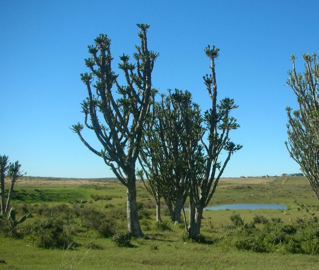
A group of tall, candelabra-like Euphorbia trees standing in a grassy, open landscape under a clear blue sky, with a small pond visible in the distance.
Euphorbia trees in the landscape of the Great Fish River Nature Reserve.

Great Fish River Nature Reserve history and protected-area timeline

The Great Fish River Nature Reserve was officially established in 1994 through the consolidation of three previously separate reserves managed within the Eastern Cape: Andries Vosloo Kudu Reserve, Double Drift Nature Reserve, and Sam Knott Nature Reserve. Each of these predecessor reserves had its own identity and history as a standalone protected area.

Bringing them together under a single management framework marked a shift toward larger, more unified conservation units in the region. The merger was designed to improve habitat continuity along the Great Fish River valley and to streamline management under Eastern Cape Parks, the governing body responsible for the reserve today.

The circular route linking the three component reserves reflects this consolidated approach, replacing the older model of isolated, smaller reserves with a more integrated landscape.

Great Fish River Nature Reserve landscape and geographic character

The landscape of Great Fish River Nature Reserve is shaped primarily by the Great Fish River and its valley system. Elevation across the property ranges from roughly 95 meters to over 560 meters above sea level, producing a distinctly broken topography. Steep cliffs drop down from elevated terrain toward the river, and the basins on either side are separated by fragmented ridges rather than smooth, continuous slopes.

These deep river valleys and cliffs create a visually dramatic environment, with views over the watercourse and a strong sense of enclosure within the smaller kloofs and side valleys. The dissected character of the terrain means that the reserve feels like a series of connected but distinct landscape compartments, each with its own slope aspect, soil condition, and vegetation pattern.

Such varied relief, combined with the presence of the river, has a strong influence on the rest of the reserve's ecology, contributing to the dense thicket cover and habitat diversity that characterize the protected area.

Great Fish River Nature Reserve ecosystems, habitats, and plant life

The defining ecological feature of Great Fish River Nature Reserve is its broad cover of Great Fish subtropical thicket. This vegetation type is a dense, evergreen, and largely closed shrubland dominated by woody species adapted to the warm, semi-arid valley climate of the Eastern Cape. It forms the backbone of the reserve's natural character, blanketing much of the lower and middle elevation zones.

The reserve's broken topography, with cliffs, ridges, and basins, supports variation in this thicket pattern. Steeper, rockier slopes, deeper valleys near the river, and higher ridges each carry subtly different vegetation expressions, while the river corridor itself introduces a moister, more linear habitat alongside the dense bushland.

By combining three older reserves, the greater reserve also creates more continuous habitat along the Great Fish River valley, reducing fragmentation that existed when these areas were managed separately. This continuity is ecologically meaningful for species that depend on large, connected tracts of thicket.

Great Fish River Nature Reserve conservation status and protection priorities

Great Fish River Nature Reserve represents an important example of reserve consolidation in the Eastern Cape, with three historic protected areas joined into a single 45,000-hectare system under the management of Eastern Cape Parks. By unifying Andries Vosloo Kudu Reserve, Double Drift Nature Reserve, and Sam Knott Nature Reserve, the reserve increases the effective size and connectivity of habitat along the Great Fish River valley.

The dominance of Great Fish subtropical thicket, a regionally significant vegetation type, gives the reserve particular conservation value. Protecting large, unbroken stands of this thicket is central to the reserve's role, as fragmented or degraded thicket loses much of its ecological function. The river corridor that runs through the property adds a further conservation dimension, linking habitats and supporting ecological processes along the Great Fish River.

Top sights and standout views in Great Fish River Nature Reserve

Three former reserves merged into a single large protected area linked by a circular route, and a striking river-valley landscape where sharp cliffs and fragmented ridges frame the Great Fish River. The reserve's extensive cover of Great Fish subtropical thicket gives it a distinctive ecological identity closely tied to the Eastern Cape's valley systems. Its proximity to Grahamstown and its scale within the regional network under Eastern Cape Parks make it a notable component of conservation in the province.

Best time to visit Great Fish River Nature Reserve

The Great Fish River valley climate of the Eastern Cape generally rewards visits in the milder, drier months, when cooler temperatures and clearer conditions make the reserve's river valleys, cliffs, and thicket more comfortable to explore. During warmer, wetter periods, the dense subtropical thicket can become particularly lush and visually impressive, though thicker vegetation may obscure views and make walking conditions more demanding. Seasonal variation in rainfall, temperature, and vegetation cover shapes both the scenery and the practical character of any visit to the reserve.
Monthly climate preview

Long-term temperature and precipitation records measured across the protected landscape

Great Fish River Nature Reserve Climate Normals and Annual Weather Patterns

Representative coordinate records show monthly mean temperatures shifting between twelve and twenty-two degrees Celsius alongside distinct precipitation variations across the year. Reviewing the complete twelve-month climatology profile provides deeper insight into measured long-term averages for the reserve.
Annual mean18 °C
13 °C22 °C
Jan22°
Feb22°
Mar21°
Apr18°
May16°
Jun13°
Jul13°
Aug14°
Sep16°
Oct18°
Nov19°
Dec21°
Warmest month
February

22.1 °C

Coolest month
July

12.9 °C

Wettest month
January

4 mm/day

Driest month
June

0.8 mm/day

Park location guide

Geography guide, regional context, and park location map for Great Fish River Nature Reserve

Great Fish River Nature Reserve park geography, regions, and map view in South Africa

Understand where Great Fish River Nature Reserve sits in South Africa through a broader geographic reading of the surrounding landscape, nearby location context, and its mapped position within the national park landscape.

How Great Fish River Nature Reserve fits into South Africa

South Africa is the southernmost country in Africa, spanning 1.22 million km² with a population of over 63 million. The country operates with three capital cities, Pretoria (executive), Cape Town (legislative), and Bloemfontein (judicial), and is renowned for its biodiversity, national parks, and multicultural society.

Wider geography shaping Great Fish River Nature Reserve in South Africa

South Africa occupies the southernmost region of Africa, with coastline along both the Atlantic Ocean to the west and the Indian Ocean to the east. The interior features elevated plateaus including the Highveld, with the Drakensberg escarpment marking the eastern highlands. The country shares borders with Namibia, Botswana, Zimbabwe, Mozambique, Eswatini, and Lesotho.

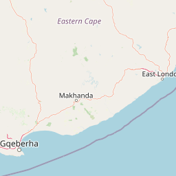
Map view of Great Fish River Nature Reserve

Use this park location map to pinpoint Great Fish River Nature Reserve in South Africa, understand its exact geographic position, and read its mapped placement within the surrounding landscape more clearly.

Pigeon | © OpenStreetMap contributors

Location context for Great Fish River Nature Reserve

Eastern Cape

Visualizing the river valley terrain, subtropical thicket, and cliff formations of South Africa

Great Fish River Nature Reserve Photos and Landscape Scenery

Visual records capture the dramatic river valley scenery, steep cliffs, and broken ridges that define Great Fish River Nature Reserve. Examining photographic views of the protected landscape reveals the dense subtropical thicket vegetation and varied topography unique to the Eastern Cape.

A group of tall, candelabra-like Euphorbia trees standing in a grassy, open landscape under a clear blue sky, with a small pond visible in the distance.

Park atlas

Compare regional valley topography, subtropical thicket, and adjacent conservation areas.

Exploring Parks Near Great Fish River Nature Reserve and Surrounding Protected Landscapes

Browse other protected areas and reserves located within the surrounding Eastern Cape region. Continuing the geographic comparison reveals broader regional terrain patterns and connected conservation networks.
Nature reserveEastern Cape Province
About 45 km away#1 closest

Northwest

Mpofu Nature Reserve: Mapping the Ecological Diversity of the Amatole Mountains

Protected escarpment terrain and South African biome transitions

Located in the Eastern Cape, Mpofu Nature Reserve is a significant protected landscape known for the meeting of Grassland, Forest, and Albany Thicket biomes. The terrain ranges from low valley floors to high escarpment plateaus, providing a complex habitat for diverse mammals and endemic flora in a malaria-free setting.

Area
75 km²
Established
1985
Relief
Mountain
Climate
Subtropical
National parkEastern Cape
About 82 km away#2 closest

Southwest

Addo Elephant National Park: South African National Park with Diverse Protected Landscapes

Explore its geographic context and unique Big Seven megafauna habitats.

Addo Elephant National Park is a crucial protected landscape within South Africa's Eastern Cape, covering approximately 1,640 square kilometers of varied terrain including karoo plains, coastal dunes, and marine protected areas. Its identity is deeply tied to the successful recovery of elephant populations and its distinction as the only African national park where all Big Seven megafauna can be observed in their natural surroundings. Discover the park's geographic spread, landscape diversity, and its role as a premier conservation area.

Area
1,640 km²
Established
1931
IUCN
II
Visitors
305.5K annual
Nature reserveEastern Cape
About 94 km away#3 closest

North

Tsolwana Nature Reserve: Geographic Profile and Protected Landscape Boundaries

Eastern Cape, South Africa Mountain and Karoo Transition

Tsolwana Nature Reserve protects a 8,500 hectare landscape on the Winterberg slopes. This region serves as a vital ecological bridge, blending semi-arid Karoo vegetation with high-altitude grasslands. Explore the map to understand the intersection of river corridors, mountain ridgelines, and plains habitat that define this South African reserve.

Area
85 km²
Established
1979
Wildlife reserveEastern Cape
About 94 km away#4 closest

Southwest

Shamwari Game Reserve: An Atlas View of Restored Bushveld and Conservation Landscapes

Examining protected terrain within South Africa's Eastern Cape

Shamwari Game Reserve occupies approximately 250 square kilometers of restored Eastern Cape terrain. As a focal point of the Indalo Protected Environment, the reserve provides a structured habitat for diverse wildlife species and represents a significant case study in regional land reclamation and conservation mapping.

Area
250 km²
Established
1992
Relief
Upland
Scope
Terrestrial
Wildlife reserveEastern Cape
About 117 km away#5 closest

East

Inkwenkwezi Private Game Reserve: Wildlife Reserve and Regional Landscape Geography

A protected multi-biome territory in South Africa's Eastern Cape region

Inkwenkwezi Private Game Reserve represents a critical study in compressed ecological diversity. Within its 4,500-hectare boundary, the property demonstrates the transition between coastal Wild Coast influences and inland forests. This overview details the reserve's unique biome convergence and its place within the broader protected geography of the Eastern Cape, providing insight into the land use and wildlife habitat structure.

Area
45 km²
Established
1983
Access
Access unknown
Scope
Terrestrial
National parkEastern Cape
About 148 km away#6 closest

Northwest

Mountain Zebra National Park: A National Park within Eastern Cape's Geography

Explore its mapped protected boundaries and regional landscape context.

Mountain Zebra National Park serves as a key protected area within South Africa's Eastern Cape region. This page offers an atlas-driven perspective, detailing the park's geographic scope and mapped boundaries. Understand its role as a national park and its contribution to the regional landscape context, providing structured data for those interested in protected land distribution and natural terrain.

Area
284 km²
Established
1937
IUCN
II
Visitors
31.2K annual
Nature reserveEastern Cape
About 208 km away#7 closest

East

Dwesa Nature Reserve and Wild Coast Protected Landscapes in Eastern Cape

Coastal forest, marine protection, and rugged river valley topography

Dwesa Nature Reserve protects a distinctive interface between land and sea, featuring shaded indigenous forests that descend into a series of open coves and cliffs along the Indian Ocean. This geographic study reveals how varied habitats from woodland to estuary are preserved within a single unit in South Africa, providing significant insights into regional biodiversity and coastal land management.

Area
54.5 km²
Established
1975
Relief
Lowland
Access
Access unknown
National parkEastern Cape
About 217 km away#8 closest

West

Camdeboo National Park: Protected Landscape Atlas and Eastern Cape Geographic Context

Discover the mapped geography and protected area identity of this Eastern Cape national park.

Camdeboo National Park represents a key protected landscape within the Eastern Cape province of South Africa. This entry provides essential details for understanding its protected-area status, geographic footprint, and its role within the regional atlas. Examine its mapped boundaries and explore the unique natural terrain it encompasses, gaining specific insight into its protected landscape characteristics.

Area
194.05 km²
Established
2005
Relief
Mountain
Climate
Arid

Common questions about visiting, size, designation, and location context for Great Fish River Nature Reserve

Great Fish River Nature Reserve FAQs for park facts, access, geography, and protected area context

Find quick answers about Great Fish River Nature Reserve, including protected-area facts, park geography, trail and visitor context, and how the park fits into its surrounding country and regional landscape.
MoriAtlas Explorer

Continue Your Protected Areas Search Across the Global Atlas

Deepen your exploration by continuing the structured search for national parks and protected areas worldwide. Utilize the comprehensive filtering capabilities to compare different conservation landscapes and refine your understanding of global park geography. Discover more about the distribution and characteristics of protected natural areas.

Global natural geography