Mori Atlas logo
National parkGreat Smoky Mountains National Park

Discover mapped boundaries, diverse terrain, and the unique geography of this Tennessee national park.

Great Smoky Mountains National Park: A Protected Landscape Atlas and Geographic Exploration

Great Smoky Mountains National Park represents a significant protected landscape in Tennessee, renowned for its sprawling mountainous terrain and exceptional biodiversity. As a cornerstone of the U.S. protected area atlas, this national park offers a unique opportunity to explore its complex geography, from ancient temperate rainforests to high-elevation spruce-fir forests. Understanding its mapped boundaries and rich ecological context provides crucial insight into the region's natural heritage and its importance within North America's protected lands.

mountainswaterfallsold-growth forestbiodiversity hotspotUNESCO World Heritage Sitehiking trails

Great Smoky Mountains National Park

National park

Park overview

Structured park overview, official facts, and landscape profile for Great Smoky Mountains National Park

Great Smoky Mountains National Park park facts, protected area profile, and essential visitor context

Review the core facts for Great Smoky Mountains National Park, including designation, size, terrain, visitor scale, habitats, and operating context in one park-focused overview.

About Great Smoky Mountains National Park

Great Smoky Mountains National Park represents one of the most significant conservation achievements in American history and stands as a testament to the power of public-private partnership in protecting natural heritage. The park preserves a landscape of extraordinary ecological complexity and cultural significance, where ancient geological processes have shaped dramatic mountain terrain and millennia of biological evolution have produced a richness of life found nowhere else in the temperate world. The mountains themselves are composed primarily of Precambrian metamorphic rocks, formed over a billion years ago from the accumulation of marine sediments and igneous material, with younger Paleozoic sedimentary rocks appearing in the foothills and limestone-rich coves. The park's position at the crossroads of northern and southern ecological provinces, combined with the dramatic elevation gradient spanning nearly 6,000 feet, creates a tapestry of distinct ecological zones that support an unparalleled diversity of plant and animal life. The human story of the Smokies is equally compelling, spanning thousands of years of Cherokee habitation, frontier settlement, industrial logging, and ultimately the conservation movement that led to the park's creation. The park's significance extends beyond its borders, anchoring a major tourism industry that generates an estimated $2.5 billion annually for the regional economy while inspiring millions of visitors to connect with the natural world.

Quick facts and research context for Great Smoky Mountains National Park

Great Smoky Mountains National Park spans 522,419 acres along the Tennessee-North Carolina border, with elevations ranging from approximately 875 feet to 6,643 feet at Kuwohi. The park contains 16 mountains exceeding 6,000 feet, known as Southern Sixers, and protects over 2,900 miles of streams and more than 100 waterfalls. It is home to approximately 19,000 known species of organisms, with scientists estimating as many as 100,000 species may be present, making it the most biologically diverse national park in the United States. The park features four historic districts preserving early European-American settlements and Cherokee heritage sites. The Appalachian Trail traverses 71.6 miles through the park, following the crest of the mountains along the state line.

Protection and recognition

Documented terrestrial conservation status and international designations since 1983

Great Smoky Mountains National Park Protection Status and UNESCO Recognition

Official terrestrial protection framework details and designation history for Great Smoky Mountains National Park establish its placement in global conservation databases. Documented records track the established terrestrial scope alongside its notable 1983 international designation as a UNESCO World Heritage site.

International recognition

Protection details

Protection scope
Terrestrial
Designated year
1983
Transboundary protection
No
Park context

Deeper park guide and search-rich context for Great Smoky Mountains National Park

Great Smoky Mountains National Park history, landscape, wildlife, and travel context

Explore Great Smoky Mountains National Park through its history, landscape character, ecosystems, wildlife, conservation priorities, cultural context, and seasonal travel timing in a structured park guide built for atlas discovery and search intent.

Why Great Smoky Mountains National Park stands out

The Great Smoky Mountains are best known for their distinctive blue mist, caused by volatile compounds released from the vegetation in the warm, humid climate, which gives the range its name and creates the ethereal atmosphere that inspired the Cherokee name Shaconage, meaning place of blue smoke. The park is internationally recognized for its extraordinary biological diversity, supporting more species of plants than any other national park in North America, including over 1,500 flowering plant species and 101 native tree species. The ancient cove hardwood forests contain some of the largest tracts of old-growth temperate forest remaining in North America. The park is also famous for its spectacular waterfall systems, with Ramsey Cascades dropping 100 feet and Rainbow Falls plunging 80 feet in single drops. The preserved historic districts, particularly Cades Cove with its rolling meadows framed by mountain silhouettes and collection of 19th-century log structures, offer visitors a window into the lives of early Appalachian settlers.

Great Smoky Mountains National Park history and protected-area timeline

The human history of the Great Smoky Mountains extends back at least 14,000 years, with Native Americans hunting in the region since the Archaic period. The Cherokee people began migrating into the area in the latter 17th century, establishing the Great Smoky Mountains at the center of their territory and calling the range Shaconage, meaning place of blue smoke. European settlers arrived in the mid-18th century, establishing frontier outposts and eventually permanent communities in the valleys and coves throughout the range. The area saw conflict during the American Revolutionary War and the Civil War, with communities divided in their allegiances. By the early 20th century, extensive logging operations had removed two-thirds of the virgin forests from the Smokies, sparking a conservation movement led by local citizens, automobile clubs, and influential advocates including travel writer Horace Kephart and photographer George Masa. The creation of the park required unprecedented cooperation between federal, state, and local governments, along with a $5 million contribution from John D. Rockefeller Jr., and the displacement of thousands of residents from their mountain homesteads. The park was officially established by Congress on June 15, 1934, and formally dedicated by President Franklin D. Roosevelt at Newfound Gap in 1940, becoming the first national park with land purchased using federal funds.

Great Smoky Mountains National Park landscape and geographic character

The Great Smoky Mountains rise as a complex mass of elongated ridges and deep valleys running roughly east to west along the Tennessee-North Carolina border. The range is part of the Blue Ridge Mountains, a subrange of the Appalachian Mountains, and represents some of the highest elevations in eastern North America. The topography is characterized by steep, heavily forested slopes descending into narrow valleys known as coves, with the most prominent being Cades Cove, a broad flat plain surrounded by mountain ridges that represents one of the most accessible and visited areas in the park. The elevation gradient from approximately 875 feet to 6,643 feet at Kuwohi creates dramatic changes in terrain, vegetation, and climate across relatively short distances. The mountains contain over 2,900 miles of streams, with water flowing generally northward from the high ridges into the Tennessee River watershed. More than 100 waterfalls are scattered throughout the park, with Ramsey Cascades being the tallest at 100 feet and Rainbow Falls the highest single-drop waterfall at 80 feet. The landscape also includes several notable balds, rare patches of grassland or heath where trees are unexpectedly absent, particularly at higher elevations.

Great Smoky Mountains National Park ecosystems, habitats, and plant life

The ecological diversity of Great Smoky Mountains National Park is unmatched by any other protected area in the United States, with the park serving as a critical refuge for species that were displaced during the last glacial period and have found suitable ecological niches in this temperate rainforest environment. The forests cover approximately 95 percent of the park and are organized into distinct zones based on elevation and moisture conditions. The cove hardwood forests in the stream valleys and lower mountain slopes represent one of the most diverse forest types in North America, with over 130 tree species in the canopy, including yellow birch, tulip tree, sugar maple, and eastern hemlock. The northern hardwood forests on higher slopes are dominated by yellow birch and American beech, while the spruce-fir forest at the highest elevations, typically above 5,500 feet, consists primarily of red spruce and Fraser fir, a relict of the ice ages. The park contains an estimated 20 to 25 percent old-growth forest, one of the largest blocks of deciduous temperate old-growth forest remaining in North America. Over 1,500 species of flowering plants grow in the park, more than in any other national park in North America, including 35 orchid species and 58 members of the lily family.

Great Smoky Mountains National Park wildlife and species highlights

Great Smoky Mountains National Park supports an extraordinary diversity of wildlife, with 65 species of mammals, over 240 species of birds, 67 species of fish, 40 species of reptiles, and 43 species of amphibians documented within its boundaries. The American black bear is the most iconic resident, with an estimated 1,900 individuals in the park representing the densest black bear population east of the Mississippi River. The park is known as the Salamander Capital of the World, home to five of the world's nine families of salamanders, including up to 31 species with several found nowhere else on Earth, such as the red-cheeked salamander and the imitator salamander. Bird diversity is remarkable due to the presence of multiple forest types, with nearly 120 species using the park as a breeding ground, including 52 neotropical migrants. The park supports populations of elk, reintroduced beginning in 2001, most abundantly in the Cataloochee area, as well as white-tailed deer, bobcat, beaver, and numerous bat species including the endangered Indiana bat. Brook trout are the only trout native to the park's waters, while introduced rainbow and brown trout now dominate lower elevation streams.

Great Smoky Mountains National Park conservation status and protection priorities

Great Smoky Mountains National Park represents one of the most important conservation areas in North America, recognized internationally for its outstanding ecological value and biodiversity significance. The park was designated a UNESCO World Heritage Site in 1983, recognizing its exceptional natural values including the Appalachian temperate rainforest ecosystem, outstanding geological features, and remarkable biological diversity. As an International Biosphere Reserve certified in 1988, the park serves as a living laboratory for scientific research and environmental education. The park's conservation significance stems from its role as a refugium for species that survived the last glacial period and the preservation of old-growth forest communities that predate European settlement. However, the park faces significant environmental challenges, including air pollution from nearby development that historically made it the most polluted national park in the United States, though air quality has improved substantially since the passage of the Clean Air Act. Invasive species such as the balsam wooly adelgid have devastated Fraser fir populations at higher elevations, and the park must manage the impacts of its extraordinary visitation while preserving its natural and cultural resources.

Great Smoky Mountains National Park cultural meaning and human context

The Great Smoky Mountains hold profound cultural significance for multiple communities, with the Cherokee people considering this landscape central to their ancestral territory for centuries before European contact. The Cherokee called the range Shaconage, meaning place of blue smoke, and established numerous settlements in the river valleys surrounding the mountains, with the village of Oconaluftee representing the only known permanent Cherokee village within the present park boundaries. The forced removal of most Cherokee in 1838 along the Trail of Tears led to the creation of the Qualla Boundary, home to the Eastern Band of Cherokee Indians, whose reservation borders the park to the south. European-American settlement began in the late 18th century, with communities establishing themselves in the coves and valleys, building farms, churches, mills, and schools that shaped the cultural landscape preserved today in historic districts at Cades Cove, Elkmont, Cataloochee, Roaring Fork, and Oconaluftee. The park preserves over 80 historic structures, including log cabins, barns, churches, and mills that provide tangible connections to the lives of early Appalachian settlers whose descendants were displaced to create the national park.

Top sights and standout views in Great Smoky Mountains National Park

The Great Smoky Mountains National Park offers visitors an unparalleled combination of natural beauty, ecological diversity, and cultural heritage. The iconic Cades Cove provides a scenic loop drive through a cleared valley surrounded by mountain ridges, with numerous preserved historic buildings including log cabins, barns, and churches that showcase 19th-century Appalachian life. Kuwohi, the highest point in Tennessee and along the entire Appalachian Trail, features an observation tower offering 360-degree views across three states on clear days. The park contains more than 850 miles of hiking trails, including 71.6 miles of the Appalachian Trail, with destinations ranging from the dramatic Alum Cave Trail to Mount Le Conte to the cascading waters of Grotto Falls and Laurel Falls. The synchronous fireflies at Elkmont in late May and early June represent one of the most remarkable natural light displays in North America, drawing thousands of visitors to witness the synchronized flashing of Photinus carolinus.

Best time to visit Great Smoky Mountains National Park

The Great Smoky Mountains National Park offers distinct seasonal experiences throughout the year, though the park's popularity means that crowds can be significant during peak periods. Spring brings spectacular wildflower displays, with rhododendrons, mountain laurel, and flame azalea blooming in succession from lower to higher elevations, while the cooler temperatures at higher elevations make this a comfortable time for hiking. Summer offers the warmest conditions for backcountry exploration, though afternoon thunderstorms are common, and the park's high elevation provides welcome relief from valley heat. Fall foliage in the Smokies is legendary, with the northern hardwood forests displaying brilliant oranges, reds, and yellows, typically peaking in mid-October at higher elevations and later in the lower elevations. Winter brings fewer crowds and the opportunity to experience snow-dusted mountain landscapes, though high-elevation roads and trails may be closed, and the climate varies dramatically from valley to summit. The park experiences heavy precipitation throughout the year, with annual amounts ranging from 50 to 80 inches, and heavy winter snowfall at higher elevations.

Park guides

Targeted resources for planning your exploration of the Appalachian region

Great Smoky Mountains National Park Focused Guides and Visitor Insights

Selected published guides provide structured answers to specific questions about protected mountain terrain and ecological diversity. Readers can examine detailed timing insights to understand seasonal weather shifts and access patterns across the high ridges.
When to visit Great Smoky Mountains National Park: Best months and seasonal trade-offs
Visitor timing guide

When to visit Great Smoky Mountains National Park: Best months and seasonal trade-offs

Determine your trip timing based on mountain climate patterns, crowd levels, and specific seasonal natural highlights across the Appalachian landscape.

Great Smoky Mountains National Park experiences significant variation in climate due to its wide range of elevations, with temperatures fluctuating markedly between the valley floors and the higher mountain peaks. This guide evaluates these conditions using historical climate normals to help travelers align their visit with specific seasonal phenomena, such as the famous synchronous fireflies in late spring or the vibrant fall foliage. By breaking down precipitation trends, daylight hours, and temperature shifts throughout the year, this overview enables a clearer understanding of how environmental factors influence the park experience across different seasons. Because the park remains the most visited in the United States, timing your trip is essential for managing crowds and accessing popular areas like Cades Cove or the high-elevation trails. This information provides a baseline for planning based on long-term weather patterns and typical seasonal access, but travelers must always verify current conditions, road closures, and permit requirements directly with park authorities before departure. The provided analysis serves as a foundation for navigating the trade-offs between various times of year, ensuring that your expectations for weather and park accessibility are grounded in the realities of the Appalachian temperate rainforest.

When to visit
Monthly climate preview

Trace thirty-year temperature variations and average monthly precipitation at the park coordinates.

Great Smoky Mountains National Park Climate Normals and Average Temperatures

Long term meteorological measurements at a representative elevation of 865 meters reveal mean monthly temperatures ranging from near freezing up to 22 degrees Celsius alongside steady year-round precipitation. Comparing the complete twelve-month cycle provides deeper insight into historic minimums, maximums, and daily rainfall averages across the Appalachian landscape.
Annual mean12 °C
1 °C22 °C
Jan
Feb
Mar
Apr12°
May16°
Jun20°
Jul22°
Aug22°
Sep18°
Oct13°
Nov
Dec
Warmest month
July

22.1 °C

Coolest month
January

1 °C

Wettest month
February

4.2 mm/day

Driest month
October

2.8 mm/day

Park location guide

Geography guide, regional context, and park location map for Great Smoky Mountains National Park

Great Smoky Mountains National Park park geography, regions, and map view in United States of America

Understand where Great Smoky Mountains National Park sits in United States of America through a broader geographic reading of the surrounding landscape, nearby location context, and its mapped position within the national park landscape.

How Great Smoky Mountains National Park fits into United States of America

The United States of America is a federal presidential republic and one of the world's largest countries by area and population. It consists of 50 states across a vast territory spanning multiple time zones, with its capital in Washington, D.C. and largest city in New York City. The nation has a diverse economy, influential political system, and significant cultural and military presence globally.

Wider geography shaping Great Smoky Mountains National Park in United States of America

The United States occupies a vast territory in North America, bordered by Canada to the north and Mexico to the south. The 48 contiguous states stretch from the Atlantic to the Pacific Ocean, while Alaska occupies the northwestern region and Hawaii is an archipelago in the Pacific. The country encompasses diverse terrain including the Rocky Mountains, Appalachian Mountains, Great Plains, and extensive river systems.

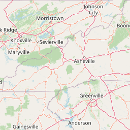
Map view of Great Smoky Mountains National Park

Use this park location map to pinpoint Great Smoky Mountains National Park in United States of America, understand its exact geographic position, and read its mapped placement within the surrounding landscape more clearly.

Pigeon | © OpenStreetMap contributors

Location context for Great Smoky Mountains National Park

North CarolinaSevier CountySwain CountyTennessee
Natural feature types

Examine the Named Natural Features across Great Smoky Mountains National Park

Gain a deeper understanding of the park geography by browsing the collection of named landforms, riparian systems, and forest features in MoriAtlas. This structured index provides context on the diverse natural entities that characterize the protected landscape of Great Smoky Mountains National Park.
Recorded earthquake history

Explore Historical Earthquake Records Near Great Smoky Mountains National Park

Access a comprehensive catalogue of recorded seismic events associated with the geography of the park. MoriAtlas provides historical data including magnitudes and epicentre proximity, allowing you to trace the seismic history of the surrounding Appalachian landscape.

Great Smoky Mountains Earthquake History

Catalogued events

43 events

Strongest magnitude

Magnitude 4.7

Most recent event

May 10, 2025

This history includes earthquakes recorded inside the park or within 50 km of its borders

Park atlas

Compare the diverse mountain landscapes and protected-area geography of the wider Appalachian region.

Discover Nearby National Parks and Protected Areas Beyond Great Smoky Mountains National Park

After exploring Great Smoky Mountains National Park, delve into other national parks and protected areas across the surrounding Appalachian region. Browse diverse mountain landscapes, trace connected forest ecosystems, and compare the distinct conservation efforts shaping this geographically rich terrain.
Protected landscapeNorth Carolina
Park boundaries overlap#1 closest

Southeast

Pisgah National Forest: Protected Appalachian Mountain Geography and Regional Mapping

An extensive mountain forest in western North Carolina

Pisgah National Forest represents a major protected landscape in the southern Appalachian Mountains of North Carolina. Its diverse terrain includes high peaks above 6,000 feet, dense hardwood forests, and deep river gorges. Recognized as a historic center for professional forestry, the area protects extensive watersheds and wilderness zones, offering a detailed case study in Appalachian geography, conservation science, and rugged mountain topography.

Area
2,075.06 km²
Established
1916
Relief
Mountain
Climate
Temperate
Protected landscapeNorth Carolina
0.1 km away#2 closest

South

Nantahala National Forest: Geographic Overview of Protected Appalachian Mountain Landscapes

Mapping deep river gorges and temperate rainforests in North Carolina

The Nantahala National Forest represents a significant conservation achievement, encompassing diverse southern Appalachian mountain terrain. The landscape features deep river gorges, ancient old-growth forests, and extensive networks of waterfalls. This overview provides mapped context on its vast wilderness areas, including Joyce Kilmer-Slickrock, and the long-distance trail corridors that traverse this temperate rainforest region.

Area
2,150 km²
Established
1920
Relief
Mountain
Climate
Temperate
Wildlife reserveNorth Carolina
3.1 km away#3 closest

Southwest

Joyce Kilmer-Slickrock Wilderness: Mapped Topography and Protected Forest Boundaries

Old-growth Appalachian wilderness in North Carolina

Analyze the dramatic valley-and-ridge geography of the Joyce Kilmer-Slickrock Wilderness. This protected area, encompassing the rare Joyce Kilmer Memorial Forest, serves as a vital reference for eastern forest conservation, featuring ancient hardwood groves and sweeping mountain vistas across the Unicoi range.

Area
70 km²
Established
1975
IUCN
Ib
Relief
Mountain
Wildlife reserveNorth Carolina
23 km away#4 closest

Southeast

Middle Prong Wilderness: High-Elevation Appalachian Forest and Watershed Geography

Rugged ridges and headwaters in the Pisgah National Forest

Middle Prong Wilderness encompasses nearly 7,900 acres of protected southern Appalachian terrain. This rugged landscape, ranging from deep valley floors to wind-swept high-elevation ridges, serves as a vital protected corridor adjacent to Shining Rock Wilderness, showcasing a complex mosaic of hardwood and spruce-fir forest ecosystems within the Blue Ridge Mountains.

Area
32 km²
Established
1984
IUCN
Ib
Relief
Mountain
Wildlife reserveTennessee
50 km away#5 closest

West

Gee Creek Wilderness: Geographic Atlas of an Appalachian Forested Wildlife Reserve

Protected mountain terrain in the Tennessee foothills

Gee Creek Wilderness is a federally protected area in southeastern Tennessee characterized by its small, roadless footprint and rich Appalachian forest composition. The reserve showcases the dramatic intersection of forested ridgelines and stream-carved valleys, providing a concentrated look at the ecological character of the Cherokee National Forest's lower Appalachian zone.

Area
10.09 km²
Established
1975
IUCN
Ib
Relief
Upland
Wildlife reserveUnited States of America
55 km away#6 closest

Southeast

Ellicott Rock Wilderness: Geographic and Historic Protected Landscape Overview

A rare tri-state wilderness in the Southern Appalachian Mountains

Discover the mapped terrain of Ellicott Rock Wilderness, a protected area defined by its steep river gorges, dense cove forests, and unique position at the tripoint of three U.S. states. This wilderness area preserves the Chattooga River corridor and historic survey landmarks within the southern Blue Ridge Mountains, offering deep insight into the regional geography of the American southeast.

Area
33.48 km²
Established
1975
IUCN
Ib
Relief
Mountain
Protected landscapeSouth Carolina
57 km away#7 closest

Southeast

Sumter National Forest: Mapping Protected Landscapes and Terrain in South Carolina

Bridging Piedmont forests and Appalachian mountain foothills

Sumter National Forest offers a study in geographic contrast, as its three districts span the transition from South Carolina Piedmont ridges to the rugged spurs of the Blue Ridge Mountains. This protected area features the Chattooga Wild and Scenic River corridor, expansive hardwood-conifer mosaics, and complex mountain watersheds. The forest provides a window into regional land restoration, where reclaimed farmland and mountain ridges now form a continuous network of protected natural terrain.

Area
1,500.98 km²
Established
1936
Relief
Mixed relief
Climate
Temperate
Wildlife reserveGeorgia
79 km away#8 closest

South

Raven Cliffs Wilderness: Exploring the Appalachian Ridges and Protected Forest Landscapes

High-elevation wilderness area in northern Georgia.

Spanning steep ridges and narrow valleys, Raven Cliffs Wilderness represents a significant protected area within the Chattahoochee National Forest. The landscape transitions from high, exposed ridgelines to dense hardwood forest, offering a compact yet varied study in Appalachian mountain geography.

Area
36.89 km²
Established
1986
IUCN
Ib
Relief
Mountain

Common questions about visiting, size, designation, and location context for Great Smoky Mountains National Park

Great Smoky Mountains National Park FAQs for park facts, access, geography, and protected area context

Find quick answers about Great Smoky Mountains National Park, including protected-area facts, park geography, trail and visitor context, and how the park fits into its surrounding country and regional landscape.
MoriAtlas Explorer

Continue Your Protected Areas Search Across the Global Atlas

Deepen your exploration by continuing the structured search for national parks and protected areas worldwide. Utilize the comprehensive filtering capabilities to compare different conservation landscapes and refine your understanding of global park geography. Discover more about the distribution and characteristics of protected natural areas.

Global natural geography