
Why Groot Winterhoek Wilderness Area stands out
Groot Winterhoek is best known for its rugged Cape Fold sandstone peaks, high-elevation fynbos plateaus, and pristine mountain rivers and rockpools that characterise the upper catchments of the Winterhoek range. The protected zone is recognised for the exceptional conservation value of its fynbos, particularly its protea-rich and endemic shrub communities, and for the unusually high proportion of natural habitat that remains around it. It is also valued as a working example of mountain wilderness protection within the greater Cape Fold Belt, a UNESCO-relevant landscape system.
Groot Winterhoek Wilderness Area history and protected-area timeline
The Winterhoek mountains have a long human history stretching back thousands of years. San communities whose descendants include the modern Khoisan peoples once moved seasonally through the range, leaving behind a substantial record of rock art that has been documented across multiple sites in the mountains, with some of the imagery estimated at roughly 6,000 years old.
During the colonial and early settler periods, the valleys surrounding the range, including the Tulbagh basin to the south, became agricultural and pastoral landscapes. Towns such as Tulbagh, Saron, and Porterville settled around the base of the mountains, while the rugged interior remained comparatively unused for farming, partly because of the steep terrain and sandstone soils. This limited historical development of the high mountains is one reason a large share of the range remained in a natural state.
The formal conservation period began when the wilderness area was brought under CapeNature management as part of the Western Cape's protected-area network. Recognising the area's intact fynbos, water-catchment importance, and wilderness values, authorities consolidated a contiguous protected block of around 30,000 hectares around the core of the range. This formal protection built on the area's longstanding role as a de facto refuge for indigenous fynbos, wildlife such as klipspringer and Cape leopard, and culturally significant rock art landscapes, securing those values against fragmentation and land-use change.
Groot Winterhoek Wilderness Area landscape and geographic character
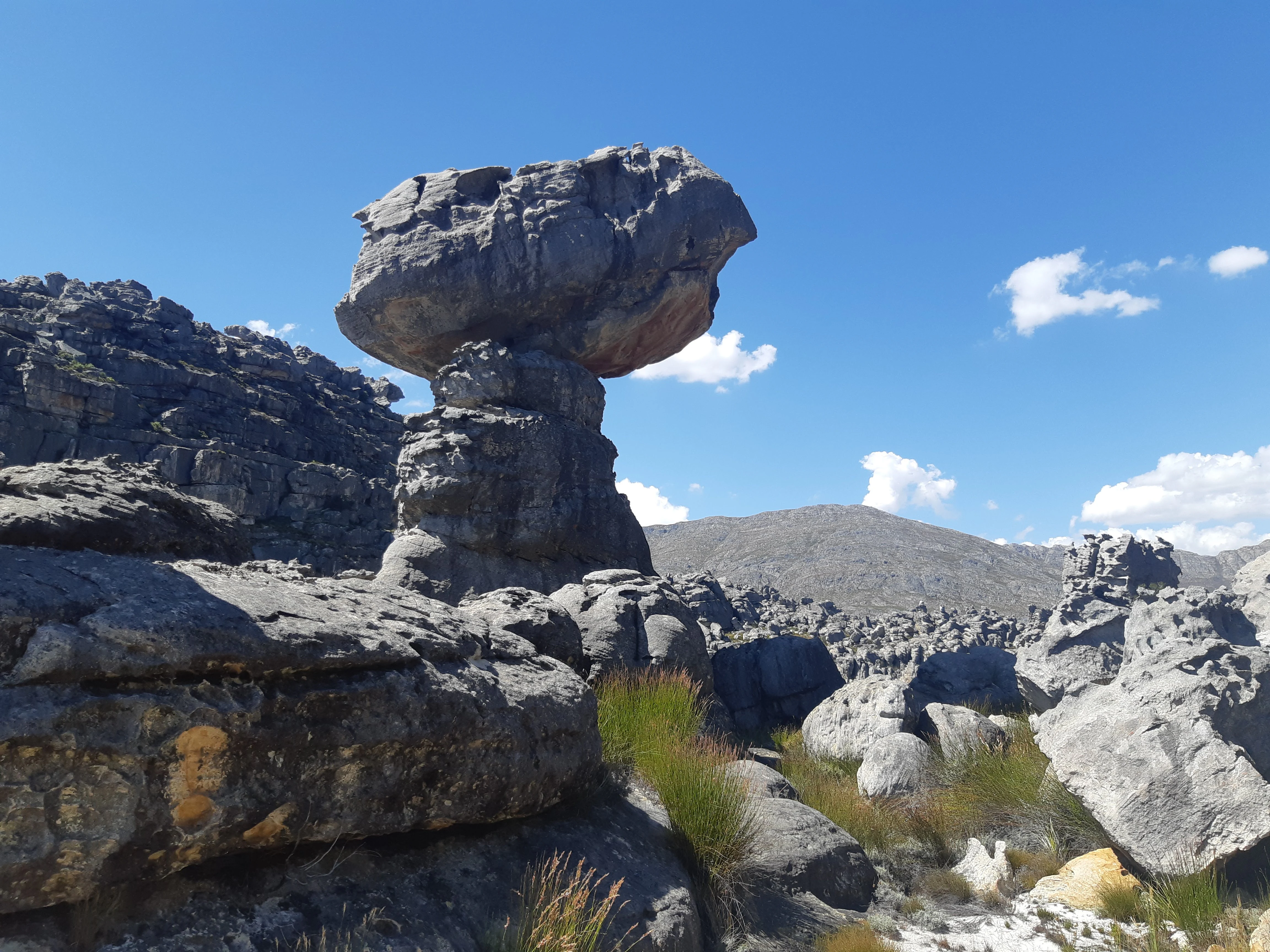
The landscape of Groot Winterhoek is a textbook expression of the Cape Fold Belt. The underlying Table Mountain sandstone was uplifted and folded during the late Paleozoic era, producing a series of parallel ridges and intervening valleys that, over hundreds of millions of years, have been eroded into a deeply dissected mountain terrain. Within the wilderness area this geology shows up as steep, layered cliffs, broken rocky outcrops, sharp ridgelines, and broad upper plateaus that drop suddenly into narrow river gorges.
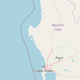
The highest point in the surrounding range, Groot Winterhoek peak, reaches roughly 2,077 metres and sits just north of Tulbagh. From these summits the land falls away through a stepped series of slopes, benches, and valleys before giving way to lower-lying farmland and renosterveld around the towns of Porterville and Saron to the west. The northern half of the mountains includes an elevated plateau that is accessed via the Dasklip Pass, a notable feature both as a geological transition and as the historic route linking the valley communities with the interior highlands.
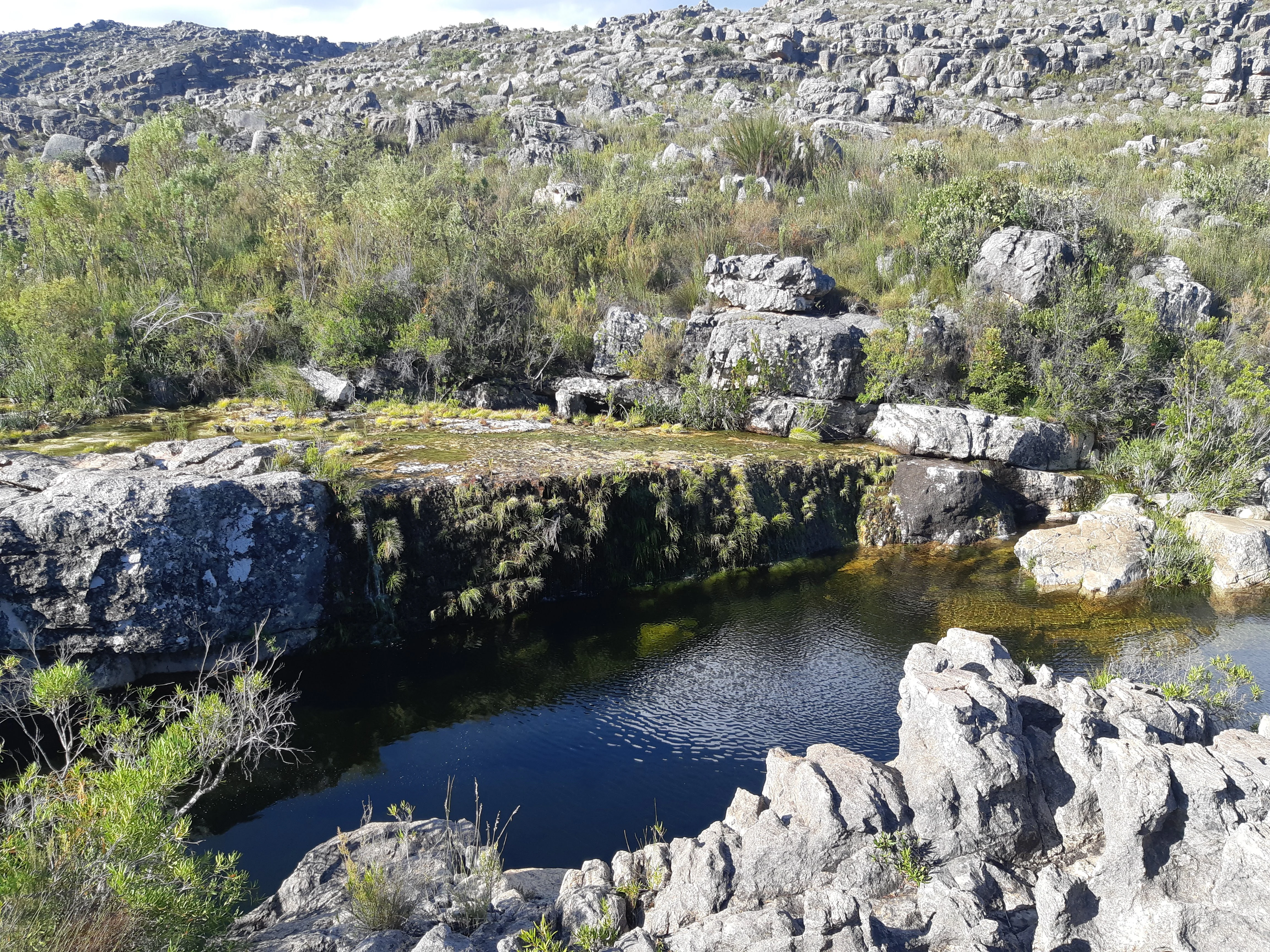
Throughout the reserve, water shapes the visual character of the terrain. Winter rainfall feeds seasonal streams and runs along the sandstone bed, collecting in rockpools and dropping over rock ledges as waterfalls during the wetter months. These pools and falls, combined with the variation between exposed rocky crests and sheltered valley vegetation, give the wilderness a landscape rhythm of bright, open ridges alternating with dark, moist kloofs.
Groot Winterhoek Wilderness Area ecosystems, habitats, and plant life
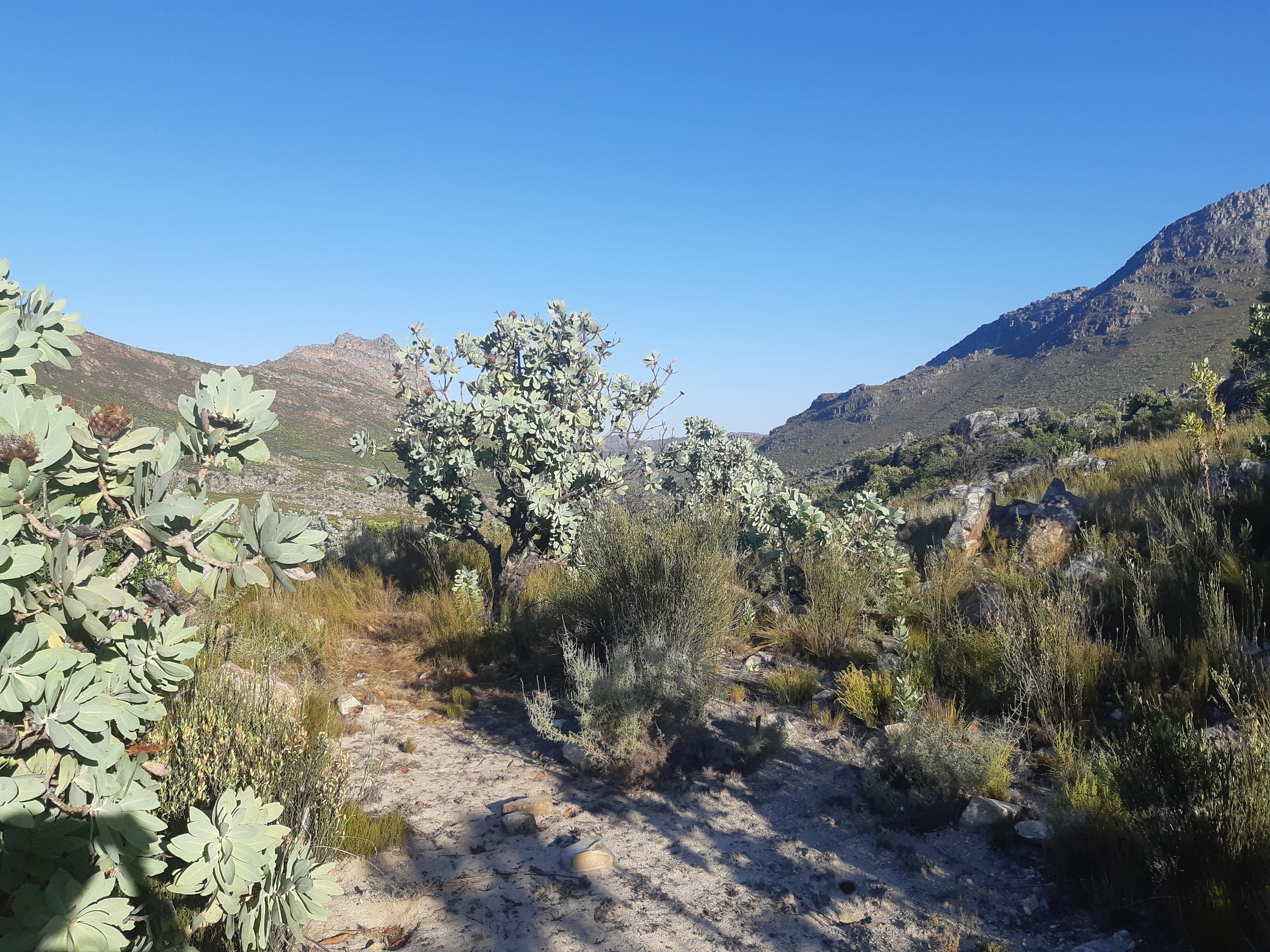
The Groot Winterhoek Wilderness Area sits within South Africa's portion of the Cape Floristic Region, recognised globally as one of the most botanically diverse temperate zones on Earth. The reserve is overwhelmingly a fynbos environment, shaped by nutrient-poor sandstone soils, Mediterranean-climate winter rainfall, and frequent fires, all of which favour the characteristic fine-leaved shrubs and graminoids of the biome.
Proteas are central to the wilderness's botanical identity, growing in a range of forms from low ground covers to small trees. They are joined by ericas, restios, and a wide suite of aromatic shrubs including Agathosma species and Aspalathus linearis, the plant associated with rooibos and harvested in the broader region. The transition between fynbos types across elevation and aspect is part of what gives the reserve high botanical significance, with plant communities shifting between valley, slope, and plateau conditions over relatively short distances.
The reserve also plays a meaningful role in upper-catchment conservation. Plant cover, soil depth, and unbroken slopes across the sandstone plateau help regulate the flow and quality of water running off the range into the surrounding valleys. By keeping this mountain block free of cultivation or large-scale development, the wilderness supports both endemic flora and the broader hydrological system that sustains the lowland towns and farmland ringing the mountains.
Groot Winterhoek Wilderness Area wildlife and species highlights
Groot Winterhoek supports a mammal community typical of the Western Cape's mountain wildernesses, with species adapted to rocky terrain, fynbos cover, and the seasonal rhythm of winter rainfall and dry summers. Klipspringer move through the rocky crags and ridges, while grey rhebok and grysbok make use of denser fynbos and grassy clearings, particularly on the upper plateau and along sheltered slopes.
Larger carnivores are also present. Cape mountain leopard occurrences have been documented in the range, alongside caracal and African wild cat. Smaller carnivores and generalist mammals such as mongoose species and genets round out the predator and mesopredator community. The presence of apex and mesopredators is broadly seen as a signal of relatively intact habitat, since these species require large, well-connected landscapes to persist.
Among invertebrates, Black Mound Termites are noted as a common and ecologically important presence in the area, contributing to soil turnover and nutrient cycling in fynbos landscapes. Birdlife in fynbos mountain habitats typically includes ground-niving and shrub-loving species, although the rocky ridges and forested kloofs also offer habitat for raptors. While specific bird records are not extensive in the source material, the habitat profile suggests a rich and seasonally variable bird community typical of the Cape Fold mountains.
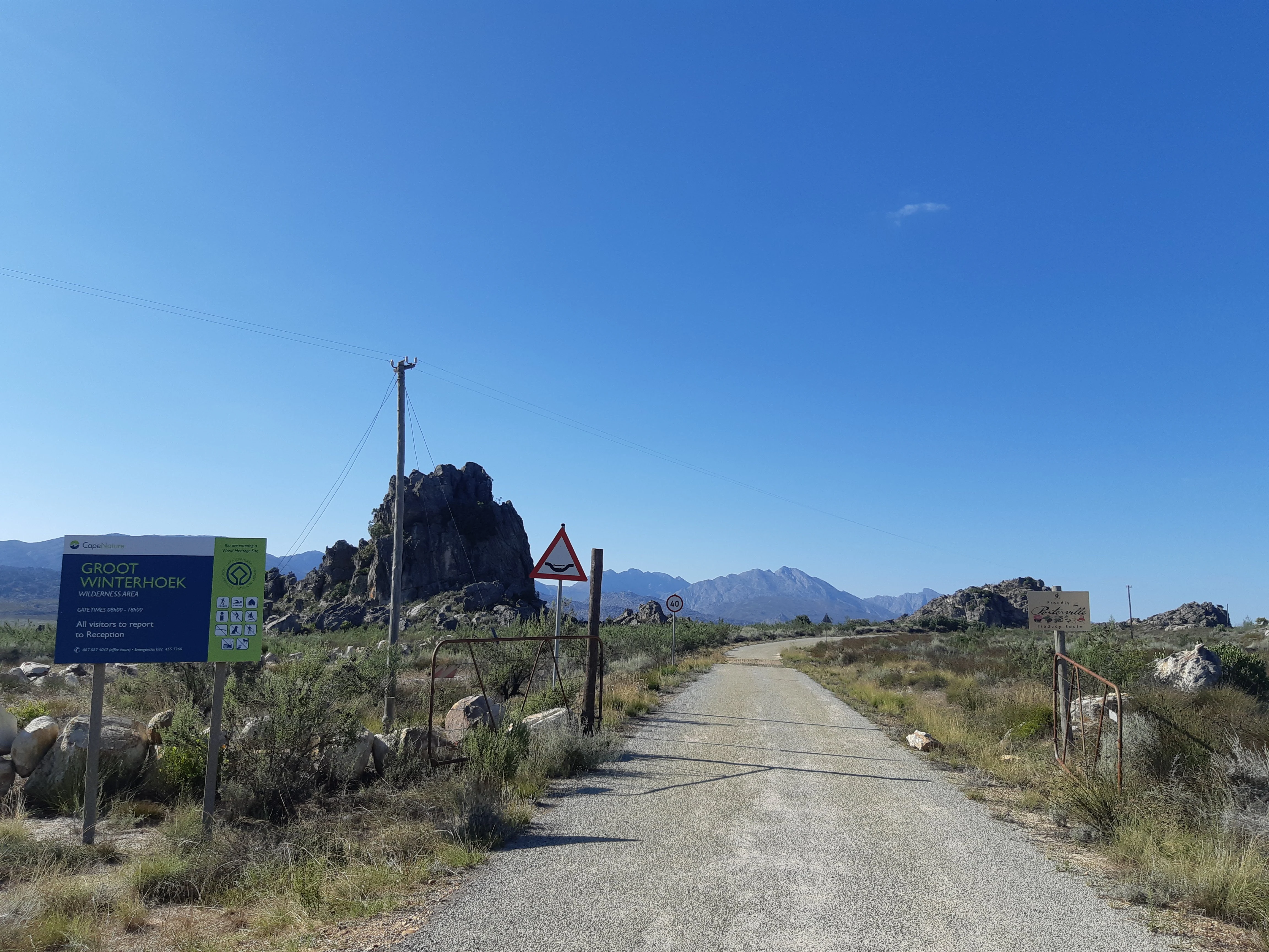
Groot Winterhoek Wilderness Area conservation status and protection priorities
Conservation significance is at the heart of Groot Winterhoek Wilderness Area's identity. The surrounding mountain range remains in a remarkably natural state: roughly 83% of the broader Winterhoek range is classified as still being in a natural condition, and around 72% of the range enjoys some form of formal protection. The wilderness area itself is the core of this protection, holding a contiguous 30,000-hectare block under CapeNature management.
From a biodiversity perspective, the reserve safeguards representative fynbos vegetation across elevation and aspect gradients, including commercially important and endemic-rich plant groups such as proteas, ericas, and rooibos relatives. Because fynbos ecosystems depend on periodic fire, intact catchments, and undisturbed soils, the wilderness's protected status is essential to maintaining the ecological processes that sustain this flora.
On a landscape scale, the reserve is part of the larger Cape Fold Belt conservation network, contributing to connectivity between protected mountain blocks in the Western Cape. Its role in protecting upper-catchment water resources is significant as well, as the streams that rise in the Winterhoek plateau feed downstream agricultural and human communities. The combination of biodiversity, water-source protection, and wilderness character is what defines the conservation value of Groot Winterhoek.
Groot Winterhoek Wilderness Area cultural meaning and human context
The Winterhoek mountains have been inhabited, travelled through, and culturally marked for millennia. The most visible evidence is San rock art scattered across the range, with examples preserved on rock faces throughout the mountains and dated to as far back as 6,000 years. These sites connect the present-day wilderness to the long precolonial human history of southern Africa's interior mountain landscapes.
In the more recent historical period, the valleys below the range became home to established farming communities and towns such as Tulbagh, Saron, and Porterville. Each of these towns developed its own culture and identity inside the bowl-shaped geography of the Cape interior, with the mountains serving as both backdrop and resource. The relatively limited development of the high mountains themselves has left the cultural and ecological layers of the landscape unusually intact compared with more accessible ranges.
Today, Groot Winterhoek's cultural value is recognised through both heritage and conservation frameworks. The presence of ancient rock art alongside intact fynbos and wilderness settings gives the area a layered significance, where protection of biodiversity and protection of indigenous heritage reinforce one another in the same mountain block.
Top sights and standout views in Groot Winterhoek Wilderness Area
Key features that distinguish Groot Winterhoek Wilderness Area include its position as one of the larger contiguous Cape Fold Belt wilderness blocks in the Western Cape, its sandstone-built peaks and plateaus reaching above 2,000 metres, and its network of seasonal waterfalls and rockpools set in deep mountain kloofs. The reserve's fynbos, particularly its protea- and Agathosma-rich slopes, anchors its botanical importance, while San rock art sites scattered through the range give it strong cultural weight.
Best time to visit Groot Winterhoek Wilderness Area
As a Mediterranean-climate mountain wilderness, Groot Winterhoek is primarily shaped by the contrast between wet winters and dry summers typical of the Western Cape. Winter and early spring bring the highest rainfall, which fills the rockpools, swells the streams into flowing waterfalls, and greens up the fynbos, creating the most visually dramatic conditions for hiking, but trails can also be wet and cool at higher elevations.
Late spring shifts the landscape toward peak wildflower displays in fynbos, often making it one of the more rewarding times for botanical interest, provided fire regimes have allowed the vegetation to recover. Summer tends to be drier and warmer, with clearer skies and easier walking conditions on the lower slopes, although the upper plateau can still be exposed to intense sun and temperature swings. Visitors interested in a balance of mild weather, good water flow, and active fynbos growth often aim for the shoulder seasons between late spring and early autumn.