
Mori Atlas logo
Protected areaGuidimouni Lake

A permanent endorheic basin supporting critical waterbird habitats and diverse aquatic ecosystems.

Guidimouni Lake Protected Area: Exploring the Sahelian Wetland Geography of Zinder, Niger

Guidimouni Lake functions as a vital wetland within the Chad Basin, characterized by an elongated endorheic depression that connects Sahelian sand plains with surrounding terrain. This protected area in Zinder serves as a essential hub for biodiversity, hosting significant fish populations and a persistent Nile crocodile community. Its geography offers a complex mosaic of fresh and saline basins, reed beds, and wooded fringes that define the local environmental context of southeastern Niger.

Sahel wetlandendorheic lakeRamsar sitefreshwater and saline basinswaterbird habitatfish breeding grounds
A digital illustration showing a calm lake surrounded by grassy reeds and high rocky cliffs under a soft sunset sky, with a small boat anchored in the foreground.

Guidimouni Lake

Protected area

Park overview

Structured park overview, official facts, and landscape profile for Guidimouni Lake

Guidimouni Lake park facts, protected area profile, and essential visitor context

Review the core facts for Guidimouni Lake, including designation, size, terrain, visitor scale, habitats, and operating context in one park-focused overview.

About Guidimouni Lake

Guidimouni Lake is a permanent inland wetland in the commune of Guidimouni, in Damagaram Takaya department, Zinder Region, southeastern Niger. It sits in a southwest-to-northeast endorheic depression roughly three kilometres long and around 700 metres wide, with the open water covering about 60 hectares and reaching a maximum depth of about three metres. The basin is framed by gently undulating sandy plains between 390 and 395 metres above sea level, with hills rising to about 590 metres in the surrounding landscape. The National Road N1 runs along the northern shore, making the lake a geographic landmark as well as an ecological one.

Although the lake lies squarely in the Sahel zone, where mean annual rainfall is only about 300 to 400 millimetres, it is one of the wetter pockets of Niger. The rainy season runs from mid-June to mid-October and the dry season from mid-October to mid-June, with two months of cooling Harmattan winds within the dry phase. This seasonal rhythm underpins both the lake's hydrology and the cycles of fishing, agriculture and transhumant pastoralism that depend on it. The lake's two main basins, one fresh and one saline, are fed by the surface spring Gouzgourou and by several groundwater aquifers, and the entire system is closed, with no surface outflow.

The lake is encircled by trees and shrubs, including ageing stands of true date palm, African baobab, dum palm and white raisin trees. Aquatic vegetation dominated by reed beds and water lilies provides important spawning and refuge habitat. The water is only lightly turbid and its general quality is good, with pH values of about 7.88 in the freshwater basin and 8.78 in the saline basin, both slightly alkaline. The lake's waters supply drinking water to local communities and livestock, and its fertile surroundings support cultivation of watermelons, onions, cabbage, potatoes, tomatoes, garlic, carrots and peppers.

Quick facts and research context for Guidimouni Lake

Guidimouni Lake is a permanent lake in the Sahel zone of southeastern Niger, situated at roughly 390 metres above sea level within the Chad Basin. The lake covers about 60 hectares, reaches a maximum depth of around three metres and contains two main basins, one fresh and one saline. It is fed by the surface spring Gouzgourou and several groundwater aquifers, and has no outflow.

The site was declared a Ramsar Wetland of International Importance in December 2019, with the protected designation extending across roughly 338 hectares. The lake is a leading fishery site in the Zinder Region and has supported traditional soda or natron extraction since the 1970s, making it both an ecological refuge and a long-standing economic resource.

Protection and recognition

Terrestrial conservation framework and recorded recognition timeline

Guidimouni Lake Protection Status and Official Designation History

Guidimouni Lake maintains a documented terrestrial protection status established in 2019 without imported international recognition sources. Official designation records outline the management scope and structural history for this protected landscape.

Protection details

Protection scope
Terrestrial
Designated year
2019
Transboundary protection
No
Park context

Deeper park guide and search-rich context for Guidimouni Lake

Guidimouni Lake history, landscape, wildlife, and travel context

Explore Guidimouni Lake through its history, landscape character, ecosystems, wildlife, conservation priorities, cultural context, and seasonal travel timing in a structured park guide built for atlas discovery and search intent.

Why Guidimouni Lake stands out

Guidimouni Lake is best known as one of the most important permanent wetlands in the Zinder Region and as a key Ramsar-listed site in southern Niger. Its mix of fresh and saline basins within a single endorheic depression, combined with a reed and water-lily fringe, creates habitats for cichlids, catfish, lungfish and Nile perch, as well as for the Nile crocodile and a wide community of waterbirds. The site is also known for its pioneering Nile crocodile reintroduction programme, begun in 1994, which has produced an established population of several hundred animals. Together with the nearby Mare de Lassouri, it anchors a network of seasonally vital waterbird habitats in one of the wetter microzones of the Nigerien Sahel.
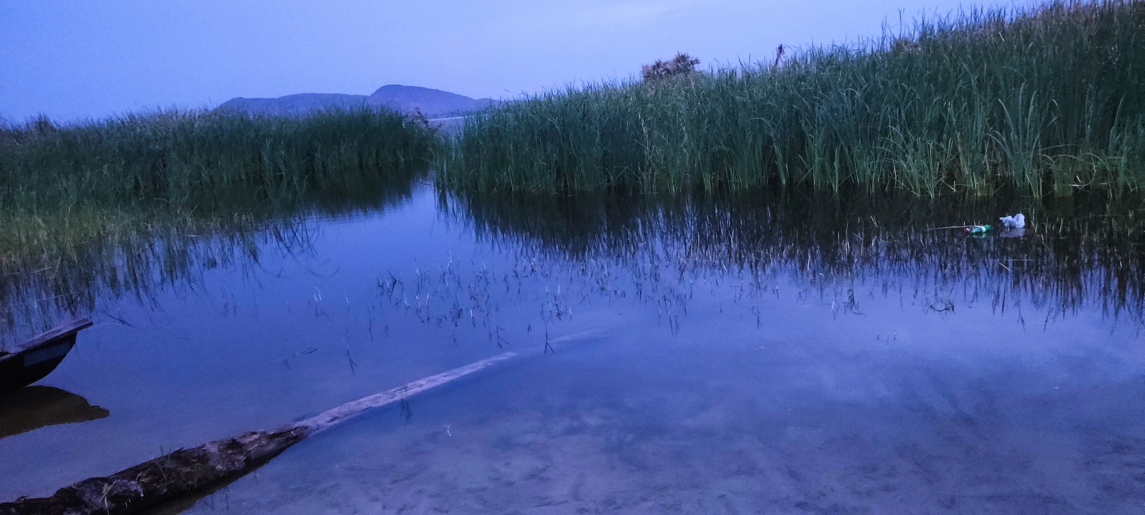
A wide shot of Guidimouni Lake during twilight showing calm water, dense patches of reeds, and a distant low mountain range on the horizon.
A twilight view across the wetlands of Guidimouni Lake, featuring reeds and a small traditional boat.

Guidimouni Lake history and protected-area timeline

The wetlands of the Guidimouni basin have been used by local communities for generations, but the lake's history as a managed ecological and economic site began to take shape in the 1970s. In that decade, six or seven fish species were introduced and a fishing cooperative was established, marking the beginning of a more structured use of the basin's resources. Soda, or natron, has been extracted from the site since the same period.

From 1994 onward, the lake gained a new ecological role as the setting for a Nile crocodile reintroduction programme. By 2017 the population had grown to roughly 300 individuals, establishing Guidimouni as one of the more notable sites for crocodile recovery in the Sahel.

The lake's modern conservation identity was cemented on 18 December 2019, when it was designated a Wetland of International Importance under the Ramsar Convention, with the protected area covering approximately 338 hectares. This status reflected both the lake's biodiversity and its documented value for fisheries, water supply and traditional livelihoods.

Guidimouni Lake landscape and geographic character

The landscape around Guidimouni Lake is shaped by its position in the Chad Basin within the southern Niger Sahel. The lake itself fills a long, narrow, southwest-to-northeast endorheic depression about three kilometres in length and around 700 metres wide. On its edges, gently undulating sandy plains lie between 390 and 395 metres above sea level, giving way to hills reaching up to roughly 590 metres in the wider surroundings.

Together, these elements form a subtle but ecologically important mosaic of open water, reed and water-lily beds, sandy shorelines and wooded fringe habitats. The National Road N1 traces the northern shore, placing the lake directly within the visible geography of the region. The basin's enclosed character, with no outflow, supports the coexistence of fresh and saline water within a single small system.

Guidimouni Lake ecosystems, habitats, and plant life

The lake functions as a permanent aquatic refuge within an otherwise semi-arid Sahel landscape. Its two basins, one fresh and one saline, are flanked by reed beds and water lilies that shelter spawning fish and invertebrates. Surrounding vegetation includes a mix of native trees such as date palm, baobab, dum palm, desert date and white raisin, alongside introduced species like neem, red eucalyptus and Prosopis juliflora.

Annual grasses such as Cenchrus biflorus, Eragrostis tremula and several Aristida species occupy the open sandy ground, while invasive cattail (Typha domingensis) and, in smaller amounts, tiger lotus (Nymphaea lotus) affect the aquatic margins. These habitat patterns combine to create a compact but ecologically rich wetland mosaic that draws both resident and migratory birds and supports a broad fish community.

Guidimouni Lake wildlife and species highlights

Guidimouni Lake harbours a diverse fish fauna that includes Nile tilapia, Zille's tilapia, African catfish, West African lungfish, African sharptooth catfish, Nile perch, African bonytongue and other native species, many spawning within the reed and water-lily beds. Mammals recorded in and around the wetland include the golden jackal, patas monkey, Cape hare and striped ground squirrel, together with three monitor lizard species and the white-throated monitor.

The most charismatic wildlife story at Guidimouni is the reintroduction of the Nile crocodile, begun in 1994, with a population of roughly 300 individuals counted by 2017.

The site is also a major hub for waterbirds, combining resident and migratory species. White storks, fulvous whistling ducks and white-faced whistling ducks are highlighted as particularly significant, while dozens of additional species have been recorded, including African jacana, shoveler, mallard, garganey, great, grey, black-headed and purple herons, cattle, squacco and little egrets, black-crowned night heron, sacred ibis, glossy ibis, knob-billed duck, ruff, black-tailed godwit, black-winged stilt, common snipe, common moorhen, lesser moorhen, grey-headed and Senegal kingfishers, red-billed hornbill, blue-naped mousebird, white-throated bee-eater, little tern, little grebe, black kite, pallid harrier, tawny pipit, yellow wagtail, crested lark, northern red bishop, quelea and village indigo bird. This mix makes the lake one of the most bird-rich permanent wetlands in the Zinder Region.

Guidimouni Lake conservation status and protection priorities

Guidimouni Lake was officially designated a Wetland of International Importance in December 2019, under the Ramsar Convention, with the protected area covering roughly 338 hectares. Its Ramsar recognition sits alongside long-running efforts to manage fish stocks and restore crocodiles, both of which have shaped the modern ecological character of the site.

From a conservation standpoint, the lake is significant because it remains a permanent water body, with mixed fresh and saline conditions, in one of the wetter microclimates of the Nigerien Sahel. It supports resident and migratory waterbirds, reestablished crocodiles, and a diverse fish fauna, making it an anchor for biodiversity in the surrounding semi-arid landscape. At the same time, over-use by the local population, alongside irregular rainfall and temperature extremes, are recognised as the main threats to water quality and biodiversity, and sustainable management of fishing, livestock watering and natron extraction remains a central conservation concern.

Guidimouni Lake cultural meaning and human context

The lake is deeply embedded in the rural life of the Guidimouni commune. It supports a fishing cooperative with roots in the 1970s and serves as a watering point for both resident livestock and transhumant herders moving through the Zinder Region. The surrounding fertile soils sustain mixed crop cultivation, while traditional natron or soda extraction has been practised at the site for decades. National Road N1 along the northern shore reflects the lake's longstanding role as a geographic and social landmark for the surrounding communities.

Top sights and standout views in Guidimouni Lake

The strongest features of Guidimouni Lake are its twin fresh and saline basins within an endorheic Sahel depression, its Ramsar designation in 2019, and its reintroduction of the Nile crocodile, which has produced a thriving population of about 300 animals. Add to this an unusually rich bird list, a productive fishery, traditional natron extraction and a strategic position beside the N1 national road, and the lake emerges as one of the most distinctive compact wetlands in Niger.

Best time to visit Guidimouni Lake

The character of a visit to Guidimouni Lake is shaped by the local version of the Sahel climate. The rainy season runs from mid-June to mid-October, when the lake and its reed beds are most vibrant and waterbird activity peaks. The dry season, from mid-October to mid-June, brings clearer skies, lower water levels and two months of cooling Harmattan winds, offering a quieter and more open atmosphere. Migratory waterbirds are typically most visible around the transitions between these seasons.

Monthly climate preview

Long-term temperature ranges and precipitation rhythm for Zinder coordinates

Guidimouni Lake Climate Normals and Annual Weather Patterns by Month

Representative coordinate records show measured monthly temperature variations alongside multi-year precipitation normals across the year. Reviewing the complete twelve-month sequence provides deeper insight into long-term environmental patterns for this protected location.
Annual mean28 °C
21 °C33 °C
Jan21°
Feb24°
Mar28°
Apr32°
May33°
Jun32°
Jul30°
Aug27°
Sep28°
Oct28°
Nov25°
Dec22°
Warmest month
May

33.4 °C

Coolest month
January

20.9 °C

Wettest month
August

5.6 mm/day

Driest month
January

0 mm/day

Park location guide

Geography guide, regional context, and park location map for Guidimouni Lake

Guidimouni Lake park geography, regions, and map view in Niger

Understand where Guidimouni Lake sits in Niger through a broader geographic reading of the surrounding landscape, nearby location context, and its mapped position within the national park landscape.

How Guidimouni Lake fits into Niger

Niger is a landlocked West African country spanning approximately 1.27 million km², making it the largest landlocked country in the region and the second-largest landlocked nation in Africa. Over 80% of its territory lies in the Sahara Desert, with the population concentrated in clusters in the southern and western regions. The country gained independence from France in 1960 and has experienced multiple coups, most recently in 2023.

Wider geography shaping Guidimouni Lake in Niger

Niger is located in West Africa and is landlocked, bordered by Libya (northeast), Chad (east), Nigeria (south), Benin and Burkina Faso (southwest), Mali (west), and Algeria (northwest). Over 80% of the country's land area lies in the Sahara Desert. The terrain is predominantly flat desert plains and sand dunes, with the Niger River flowing through the southwest corner near the capital Niamey.

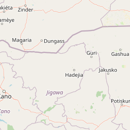
Map view of Guidimouni Lake

Use this park location map to pinpoint Guidimouni Lake in Niger, understand its exact geographic position, and read its mapped placement within the surrounding landscape more clearly.

Pigeon | © OpenStreetMap contributors

Location context for Guidimouni Lake

Zinder

Explore protected area views, endorheic basin terrain, and wetland scenery.

Guidimouni Lake Photos and Landscapes: Visual Guide to the Sahel Wetland Environment

Visual documentation captures the unique topography and diverse habitats defining Guidimouni Lake within the Chad Basin. Detailed photography reveals the intricate mix of open water, sandy shorelines, and reed beds that shape this protected Sahel wetland ecosystem.

A wide shot of Guidimouni Lake during twilight showing calm water, dense patches of reeds, and a distant low mountain range on the horizon.

Park atlas

Compare regional wetlands, endorheic depressions, and connected Sahel habitats.

Other Parks Near Guidimouni Lake and Regional Protected Landscapes

Browse protected areas near Guidimouni Lake to compare regional wetland networks, sandy plains, and wildlife habitats across the Chad Basin. Examining adjacent reserves expands geographic understanding of conservation zones throughout the southern Niger Sahel.
Wildlife reserveZinder
About 33 km away#1 closest

North

Mare de Lassouri Wildlife Reserve: Geographic Context and Sahel Wetland Mapping

Protecting vital aquatic habitats in the Zinder Region

Mare de Lassouri serves as a central hub for wetland conservation within the Zinder Region of Niger. This shallow freshwater basin offers a rich habitat mosaic where migratory waterbirds congregate amid bushy savanna, providing essential ecological value and sustaining local agricultural livelihoods in a resource-scarce Sahelian landscape.

Area
7.5 km²
Established
2005
Relief
Lowland
Climate
Arid
Wildlife reserveYobe
About 138 km away#2 closest

Southeast

Nguru Lake Wildlife Reserve: Sahelian Wetland and Floodplain Geography

A protected freshwater ecosystem in Yobe, Nigeria

Nguru Lake serves as a vital hydrological anchor within the Hadejia-Nguru wetland system. This endorheic, shallow-water environment undergoes dramatic seasonal expansion, creating a rich mosaic of marshlands and mudflats. The site stands as a key protected area within the Chad Basin landscape, offering a unique look at Sahelian water ecology and floodplain dynamics.

Area
37 km²
Relief
Lowland
Climate
Tropical
Scope
Terrestrial
A soft, horizontal watercolor painting showing a green and tan landscape of trees and hills with a reflecting body of water in the foreground, set against a white background.
Nature reserveMaradi Region
About 261 km away#3 closest

West

Geschützter Wald von Madarounfa: Protected Woodland and Nature Reserve in the Maradi Region

Mapping the Sahel-Sudan transition landscapes of Niger.

Located in the Maradi Region, this nature reserve protects a rare mosaic of dryland vegetation, including acacia and tamarind groves on alluvial soils. The woodland functions as a critical environmental anchor within the surrounding agricultural plains, offering a window into the natural history of the Goulbi de Maradi river valley.

Area
8.3 km²
Established
1950
Relief
Lowland
Climate
Subtropical
A soft watercolor painting showing a winding river or lake flowing through a landscape with gentle green hills, clusters of trees, and a pale sky.
Nature reserveMaradi Region
About 263 km away#4 closest

West

Madarounfa Lake Nature Reserve: Geographic Overview of Niger's Premier Wetland

Seasonal wetlands and riparian habitats in Maradi Region

Madarounfa Lake functions as a pivotal natural feature in the Maradi Region, blending seasonal hydrological shifts with a distinct cultural identity. This protected area supports critical riparian woodland and waterbird populations, serving as an essential resource for the surrounding landscape. Its classification as a wetland of international importance highlights the environmental complexity of the Sahel-Sudanese transition zone.

Area
8.5 km²
Established
2019
Relief
Lowland
Scope
Terrestrial
Protected areaTahoua Region
About 391 km away#5 closest

West

Mare de Tabalak Protected Area: Geography and Wetland Landscape in Tahoua, Niger

Mapping a unique Sahelian freshwater ecosystem and seasonal floodplains

Mare de Tabalak serves as one of the most ecologically significant wetlands in Niger. This protected area, characterized by its permanent freshwater lake and vast seasonal floodplains, sits at the intersection of the Ader Doutchi plateaus and the Tadrès sand dunes. The site acts as a major hub for migratory bird populations and supports essential regional pastoral and agricultural livelihoods within the Tahoua landscape.

Area
7 km²
Established
2005
Relief
Lowland
Climate
Arid
Nature reserveNiger
About 395 km away#6 closest

North

Aïr and Ténéré National Nature Reserve: Protected Landscape Atlas in Niger's Sahara

Discover unique Sahelian ecosystems isolated within the desert.

Delve into the Aïr and Ténéré National Nature Reserve, a monumental protected area in northern Niger. This reserve is celebrated for its extraordinary geographic setting, acting as an island of Sahelian life within the expansive Sahara Desert. Examine its mapped boundaries, the striking contrast between its blue marble mountains and the Ténéré desert, and its critical role in preserving unique desert flora and fauna. The reserve's vast scale and ecological distinctiveness make it a key destination for understanding protected land geography and Saharan conservation.

Area
64,560 km²
Established
1988
IUCN
IV
Relief
Mountain
National parkNigeria
About 450 km away#7 closest

South

Yankari National Park: A Protected National Park within Nigeria's Geographic Atlas

Explore the mapped terrain and protected landscape of Yankari National Park.

Yankari National Park, designated as a national park within Nigeria, offers a distinct focus for atlas-driven exploration of protected landscapes. This resource provides a detailed perspective on the park's geographic identity, its mapped boundaries, and its significance within Nigeria's wider network of natural areas. Engage with structured information that highlights the park's place in the regional geography and its value as a mapped natural landscape.

National parkNigeria
About 465 km away#8 closest

Southwest

Kamuku National Park: Nigeria's Protected Savanna Ecosystem and Inselberg Landscape

Explore mapped boundaries and regional geography.

Delve into Kamuku National Park, a significant protected savanna ecosystem in Nigeria, recognized for its unique geological features such as the Goron Dutse inselberg and the Dogon Ruwa Waterfalls. This page offers an atlas-level view of the park's landscape, detailing its protected area status, its role as elephant habitat, and its exceptional biodiversity, providing a comprehensive geographic context for exploration.

Area
1,120 km²
Established
1999
IUCN
II
Relief
Lowland

Common questions about visiting, size, designation, and location context for Guidimouni Lake

Guidimouni Lake FAQs for park facts, access, geography, and protected area context

Find quick answers about Guidimouni Lake, including protected-area facts, park geography, trail and visitor context, and how the park fits into its surrounding country and regional landscape.
MoriAtlas Explorer

Continue Your Protected Areas Search Across the Global Atlas

Deepen your exploration by continuing the structured search for national parks and protected areas worldwide. Utilize the comprehensive filtering capabilities to compare different conservation landscapes and refine your understanding of global park geography. Discover more about the distribution and characteristics of protected natural areas.

Global natural geography