
Mori Atlas logo
Protected landscapeGunnison National Forest

Tracing the high alpine basins, river headwaters, and dense forest terrain across the Southern Rocky Mountains

Gunnison National Forest: A Comprehensive Geographic Profile of a Major Colorado Protected Landscape

Gunnison National Forest encompasses an expansive 1.67 million acres of mountainous terrain in western Colorado. This protected landscape stretches from semi-arid sagebrush foothills to jagged alpine ridgelines exceeding thirteen thousand feet. The region contains seven designated wilderness areas and acts as a primary watershed for the Gunnison River, serving as a cornerstone of the state's rugged Western Slope geography.

national forestRocky Mountainsalpine wildernessaspen forestswilderness areasGunnison River watershed
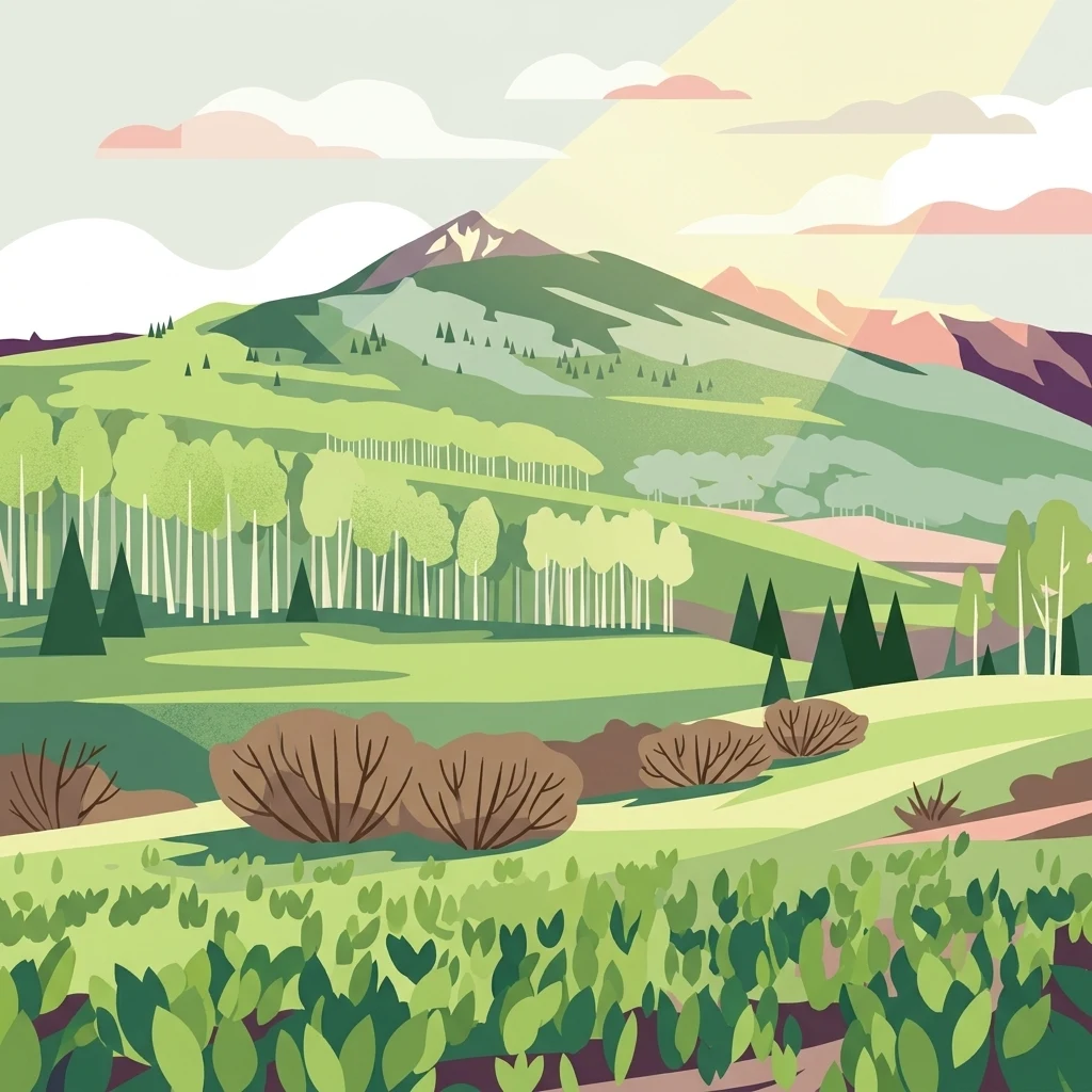
A stylized flat vector illustration of a green mountain valley with aspen groves, conifer trees, and sunlight streaming from behind the peaks.

Gunnison National Forest

Protected landscape

Park overview

Structured park overview, official facts, and landscape profile for Gunnison National Forest

Gunnison National Forest park facts, protected area profile, and essential visitor context

Review the core facts for Gunnison National Forest, including designation, size, terrain, visitor scale, habitats, and operating context in one park-focused overview.

About Gunnison National Forest

Gunnison National Forest is one of the largest and most ecologically varied national forests in Colorado, occupying a central role in the Southern Rocky Mountain landscape. It stretches across more than fifteen hundred square miles of mountains, valleys, plateaus, and high passes, all sitting within the greater Colorado Plateau-Rocky Mountain transition zone. The forest's terrain rises steadily from the sagebrush foothills along the Gunnison River basin up through thick belts of ponderosa pine, Douglas fir, and aspen, eventually reaching subalpine spruce-fir forests and bare alpine summits that exceed twelve and thirteen thousand feet.

Geologically, the forest showcases much of what makes the region distinctive: tilted sedimentary layers, glacial cirques and U-shaped valleys, broad volcanic uplands, and the deep gorge of the Black Canyon's upper reaches. The headwaters of the Gunnison River rise within these mountains, giving the area not only scenic significance but also critical value as a watershed that feeds downstream agriculture, drinking water systems, and the famous Black Canyon of the Gunnison National Park.

Beyond its scenery, Gunnison National Forest holds significant cultural and historical weight. The forest itself was first protected in 1905 as the Cochetopa Forest Reserve, one of the early reserves created during the presidency of Theodore Roosevelt and named after John W. Gunnison, a U.S. Army officer whose 1853 expedition surveyed a route through the Western interior. Mining-era ghost towns, old railroad grades, and historic ranching enclaves continue to dot the forest, offering glimpses into the layered human history of the region.

Today, the forest is jointly administered with the neighboring Grand Mesa and Uncompahgre National Forests under the GMUG umbrella, with offices in Delta and ranger districts in Gunnison and Paonia. Together, the wilderness areas, recreational corridors, and wild backcountry make Gunnison NF a cornerstone of outdoor experience in Colorado's high country.

Quick facts and research context for Gunnison National Forest

Gunnison National Forest is located in the western part of Colorado and spans about 1,672,136 acres across Gunnison, Saguache, Hinsdale, Delta, and Montrose counties. Established on June 13, 1905, originally as the Cochetopa Forest Reserve under President Theodore Roosevelt, it is administered today by the U.S. Forest Service as part of the Grand Mesa, Uncompahgre, and Gunnison National Forests, a combined administrative unit commonly abbreviated GMUG.

The forest borders the White River National Forest to the north, Grand Mesa and Uncompahgre National Forests to the west, San Isabel National Forest to the east, and Rio Grande National Forest to the south. Within its boundaries lie seven congressionally designated wilderness areas, including shared portions of the iconic Maroon Bells-Snowmass Wilderness and Collegiate Peaks Wilderness.

Protection and recognition

Documented terrestrial protection scope and management parameters for Gunnison National Forest.

Gunnison National Forest Protection Status and Terrestrial Conservation Data

Gunnison National Forest maintains a documented terrestrial protection scope within its designated conservation boundaries. Researchers and visitors can review verified management parameters and official administrative records for this protected landscape.

Protection details

Protection scope
Terrestrial
Transboundary protection
No
Park context

Deeper park guide and search-rich context for Gunnison National Forest

Gunnison National Forest history, landscape, wildlife, and travel context

Explore Gunnison National Forest through its history, landscape character, ecosystems, wildlife, conservation priorities, cultural context, and seasonal travel timing in a structured park guide built for atlas discovery and search intent.

Why Gunnison National Forest stands out

Gunnison National Forest is best known for the sheer diversity of its mountain terrain, which shifts from high sage steppe and aspen-covered slopes to dense spruce-fir forests and dramatic alpine ridges above timberline. It contains or shares seven wilderness areas, one of the densest concentrations of designated wilderness in the lower 48 states, including the Maroon Bells-Snowmass Wilderness and Collegiate Peaks Wilderness, both celebrated for their rugged scenery and ecological value. The forest also stands out for its role as the upper watershed of the Gunnison River, which carves the famous Black Canyon downstream. Long-distance trails, ghost mining towns, remote alpine basins, and big-game habitat further reinforce its reputation as a defining landscape of Colorado's Western Slope.
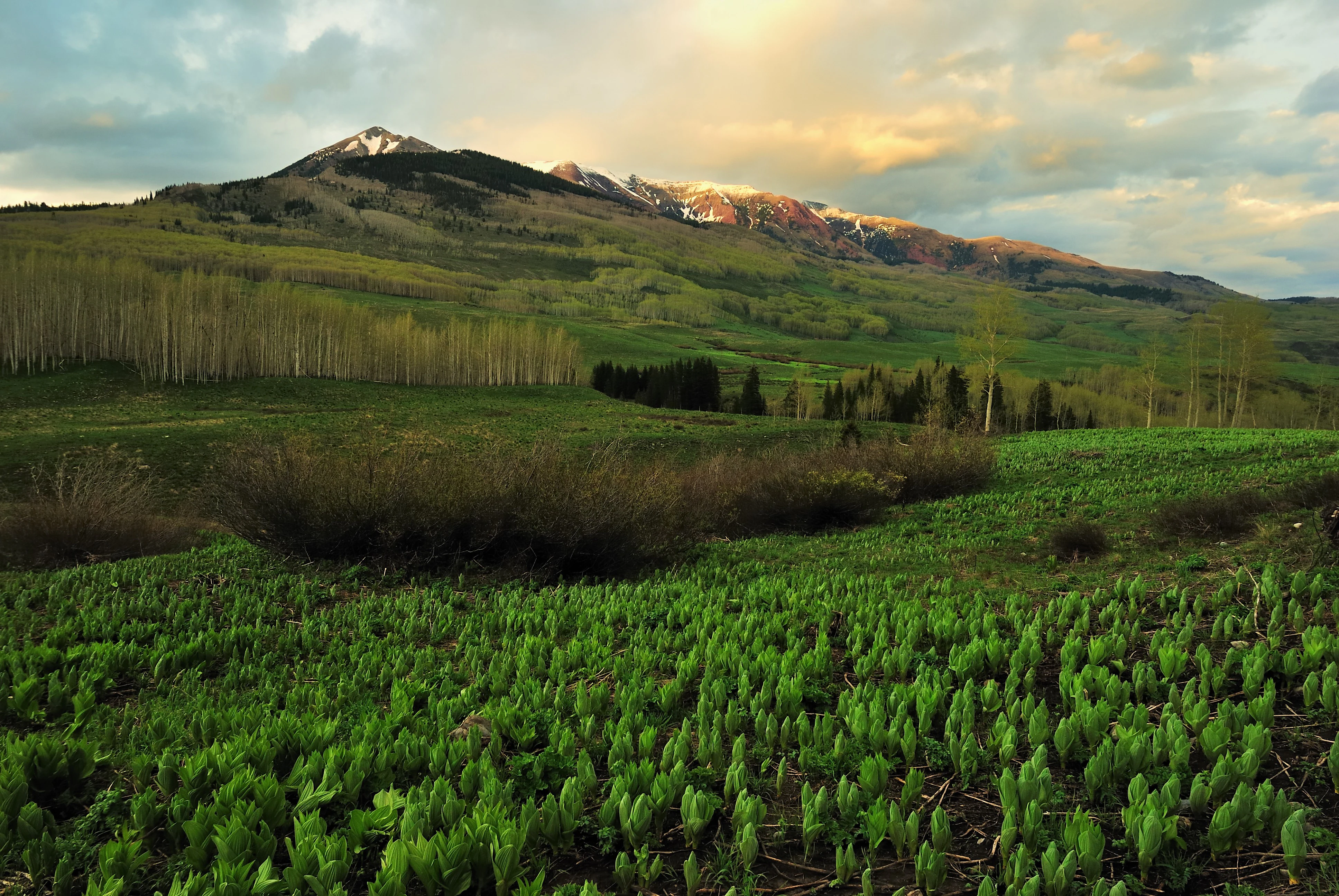
A landscape view of green meadows in the foreground leading to a slope of aspen trees and distant snow-dusted mountain peaks under a sunset sky.
A scenic view of the landscape near Copper Lake Trail in Gunnison National Forest.

Gunnison National Forest history and protected-area timeline

Gunnison National Forest traces its origins to June 13, 1905, when President Theodore Roosevelt established what was then known as the Cochetopa Forest Reserve. This early designation placed the mountainous lands of western Colorado under federal protection as part of a broader early-20th-century conservation movement that reshaped how the United States managed its public lands. The creation of the reserve came at a time when unregulated grazing, logging, and mining were visibly degrading watersheds across the West.

The forest's name honors John W. Gunnison, an Army officer appointed in 1853 to survey a possible transcontinental railroad route along the 38th parallel. His expedition crossed the mountains and valleys of what is today western Colorado, mapping terrain and engaging with Ute communities, before Gunnison was killed by members of a Pahvant band in Utah in October 1853. His name lived on in the Gunnison River, the city of Gunnison, and eventually the federal forest that protects the surrounding watershed.

Over the following decades, the reserve evolved into a national forest under the U.S. Forest Service, absorbing former reserve lands and reorganized boundaries. Mining activity in the late 19th and early 20th centuries left a strong imprint on the area, with abandoned towns, mill sites, and access roads still visible in remote basins. In the modern era, the forest has been administered jointly with Grand Mesa and Uncompahgre National Forests, a consolidation that strengthened regional planning while preserving local ranger-district presence in Gunnison and Paonia.

Gunnison National Forest landscape and geographic character

The landscape of Gunnison National Forest is defined by the dramatic topography of Colorado's Western Slope. From west to east, the terrain rises from semi-arid valleys of sagebrush and juniper into thick montane forests, then breaks into rugged subalpine and alpine zones along the Continental Divide's eastern flank. The result is a single forest that encompasses an unusually wide vertical range, often several thousand feet between valley floors and the highest ridges.

The forest contains classic Rocky Mountain landforms, including glacial cirques, moraines, broad U-shaped valleys, exposed granite knolls, and soaring ridgelines. Volcanic features also appear, especially in the more southerly portions, where ancient flows and tuff deposits shape the geology. The headwaters of the Gunnison River gather in high alpine meadows before plunging downstream, eventually carving the famous Black Canyon of the Gunnison.

Long, forested ridges like the West Elks, Fossil Ridge, and the ragged peaks shared with the Maroon Bells-Snowmass area give the forest its visually distinctive silhouette. In summer, wildflower-filled basins and aspen groves dominate the middle elevations, while winter transforms the same terrain into a snow-covered playground of steep slopes, hidden bowls, and broad cross-country ski terrain.

Gunnison National Forest ecosystems, habitats, and plant life

Ecologically, Gunnison National Forest reflects the layered vegetation zones typical of the Southern Rockies. Lower elevations support dry forests of piñon, juniper, and ponderosa pine, which give way higher up to mixed conifer stands of Douglas fir, lodgepole pine, and aspen. Above roughly 11,000 feet, dense spruce-fir forests, subalpine meadows, and tundra-like alpine zones take over, supporting communities adapted to short growing seasons and long, snowy winters.

The forest also functions as a critical wildlife corridor. Its elevated basins and remote ridges offer summer range for elk and mule deer, while lower valleys provide important winter habitat. Dense forests and cliff bands harbor species like mountain lions and black bears, and the area's extensive aspen stands support one of the most important breeding habitats in the southern Rockies for a wide range of songbirds and raptors.

Riparian systems along the Gunnison River and its numerous tributaries add further ecological variety, producing lush green ribbons of willow, alder, and cottonwood amid otherwise dry slopes. Wetlands, beaver meadows, and high-altitude fens are scattered throughout the wilderness areas, contributing to the forest's watershed role and serving as reservoirs of biodiversity.

Gunnison National Forest wildlife and species highlights

Wildlife in Gunnison National Forest is notably rich, reflecting the forest's combination of elevation range, varied habitat, and proximity to large blocks of protected wilderness. Elk are among the most visible large mammals, and the West Elk and surrounding wilderness areas are well known for their seasonal herds, which draw hunters, wildlife watchers, and photographers from across the country. Mule deer are also common, especially in the middle-elevation sage and oak ecotones.

Predators and scavengers thrive in the forest's deep cover. Black bears range widely through berry-rich aspen groves, while mountain lions prowl the steep canyons and rocky breaks. Coyotes, bobcats, and red foxes are present across the lower terrain, and the forest supports occasional wolverine and lynx detections in its most isolated high-country wilderness. Beaver activity shapes many of the smaller drainages, creating wet meadows that benefit everything from amphibians to moose.

Birdlife is equally diverse. The forest hosts breeding raptors such as golden eagles, red-tailed hawks, and great horned owls, while montane and aspen zones shelter warblers, nuthatches, and woodpeckers. Sage-dependent species like sage thrashers and Brewer's sparrows use the lower-elevation shrublands. Cutthroat and brook trout populate the cold streams, and the river corridors attract herons, ospreys, and kingfishers, completing an unusually varied fauna for a single national forest.

Gunnison National Forest conservation status and protection priorities

As a protected national forest under the U.S. Forest Service, Gunnison NF plays a central role in conserving the ecological integrity of Colorado's Western Slope. Its 1.67 million acres include seven designated wilderness areas in or adjacent to the forest, anchoring one of the densest wilderness networks in the contiguous United States. These wilderness designations, including the Maroon Bells-Snowmass, Collegiate Peaks, La Garita, West Elk, Fossil Ridge, Raggeds, and Powderhorn areas, formally limit roads, mechanical equipment, and most development, protecting watersheds and large predator habitat at landscape scale.

Beyond wilderness, the forest's value lies in its watershed function. Much of the upper Gunnison River originates here, feeding downstream reservoirs and ultimately the Black Canyon of the Gunnison. Forest managers work to balance recreation, grazing, timber, and wildlife needs, restoring aspen stands, reducing wildfire risk in dry ponderosa zones, and maintaining habitat connectivity between wilderness strongholds. Restoration efforts frequently focus on native trout streams, riparian recovery, and limiting the spread of invasive plants in fragile alpine basins.

In a broader sense, Gunnison National Forest represents a long-term investment in keeping large portions of the Southern Rockies ecologically intact. As climate stress, drought, and intensifying recreation challenge mountain landscapes across the West, the forest's protected core areas and intact watersheds are increasingly viewed as critical for both biodiversity and downstream human communities.

Gunnison National Forest cultural meaning and human context

The cultural landscape around Gunnison National Forest reflects centuries of human use overlaid by the comparatively short but intense history of the American West. Long before federal protection, the area's valleys and mountains were home to Ute and other Indigenous peoples whose seasonal migrations followed game, plants, and weather patterns across what is now the Western Slope. Their presence is still acknowledged in place names and oral histories across the region.

In the 19th century, the area became central to the great Western surveys. John W. Gunnison's 1853 expedition, despite ending in tragedy, opened the region to outside knowledge and settlement. Mining booms soon followed, leaving behind ghost towns, stamp mills, and ditch systems that still mark the forest. Ranching communities established in the late 1800s remain a cultural backbone of the area, with cattle allotments, hay meadows, and small civic centers like Gunnison, Crested Butte, Lake City, and Paonia giving the region much of its modern identity.

The forest also has a strong outdoor recreation culture, shaped by skiers, climbers, hikers, and outfitters who have built a year-round economy around high-country adventure. Crested Butte in particular is internationally known for skiing, mountain biking, and wildflower festivals, weaving national forest lands into the everyday life of nearby communities.

Top sights and standout views in Gunnison National Forest

Gunnison National Forest concentrates some of Colorado's most iconic mountain scenery within a single connected land base. Its seven wilderness areas, including shared borders of the Maroon Bells-Snowmass and Collegiate Peaks Wilderness, give it a wilderness density matched by few other forests in the lower 48. Long-distance trails, big-game herds, and headwaters of the Gunnison River reinforce its ecological significance.

Highlights include the West Elk Wilderness with its remote peaks and isolated basins, the La Garita Wilderness and its broad volcanic uplands, the rugged Fossil Ridge Wilderness, and the dramatic Raggeds Wilderness shared with the White River National Forest. Old mining-era routes, historic ranching valleys, and the high-alpine setting near Crested Butte round out a forest that combines ecological richness with deep human history.

Best time to visit Gunnison National Forest

Summer and early fall are widely regarded as the prime seasons for exploring Gunnison National Forest, when snow has receded from most trails and high mountain passes and wildflower meadows are at their peak. Mid to late summer offers the most reliable access to alpine lakes, wilderness loops, and high-elevation scenic drives. Fall brings outstanding aspen color across the middle elevations, especially in drainages around Crested Butte and the West Elks.

Winter transforms the forest into a snow-oriented landscape, with Crested Butte Mountain Resort and surrounding backcountry offering skiing and snowboarding, while lower-elevation trails near Gunnison and Paonia remain accessible for cross-country skiing and snowshoeing. Spring is typically the wettest and least predictable season, with lingering snow at high elevations and muddy conditions below, but it can be a quiet, atmospheric time for those seeking solitude before the busy summer months arrive.
Monthly climate preview

Long-term temperature and precipitation records across representative coordinate elevations

Gunnison National Forest Climate Normals and Measured Weather by Month

Gunnison National Forest exhibits recorded monthly mean temperatures ranging from negative subzero minimums to positive maximum averages alongside stable daily precipitation values. Reviewing the complete twelve-month climate profile reveals broader thermal patterns and long-term meteorological shifts across the protected landscape.
Annual mean5 °C
-7 °C18 °C
Jan-7°
Feb-5°
Mar-1°
Apr
May
Jun15°
Jul18°
Aug17°
Sep12°
Oct
Nov-1°
Dec-6°
Warmest month
July

18.1 °C

Coolest month
January

-6.9 °C

Wettest month
August

1.5 mm/day

Driest month
June

0.7 mm/day

Park location guide

Geography guide, regional context, and park location map for Gunnison National Forest

Gunnison National Forest park geography, regions, and map view in United States of America

Understand where Gunnison National Forest sits in United States of America through a broader geographic reading of the surrounding landscape, nearby location context, and its mapped position within the national park landscape.

How Gunnison National Forest fits into United States of America

The United States of America is a federal presidential republic and one of the world's largest countries by area and population. It consists of 50 states across a vast territory spanning multiple time zones, with its capital in Washington, D.C. and largest city in New York City. The nation has a diverse economy, influential political system, and significant cultural and military presence globally.

Wider geography shaping Gunnison National Forest in United States of America

The United States occupies a vast territory in North America, bordered by Canada to the north and Mexico to the south. The 48 contiguous states stretch from the Atlantic to the Pacific Ocean, while Alaska occupies the northwestern region and Hawaii is an archipelago in the Pacific. The country encompasses diverse terrain including the Rocky Mountains, Appalachian Mountains, Great Plains, and extensive river systems.

Map view of Gunnison National Forest

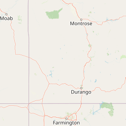
Use this park location map to pinpoint Gunnison National Forest in United States of America, understand its exact geographic position, and read its mapped placement within the surrounding landscape more clearly.

Pigeon | © OpenStreetMap contributors

Location context for Gunnison National Forest

Colorado

Visual exploration of mountain terrain, wilderness areas, and high alpine habitats

Gunnison National Forest Photos and Landscape Scenery

Visual documentation captures the dramatic vertical range and rugged terrain of Gunnison National Forest across diverse protected habitats. Examining high-elevation photography and protected-area landscapes reveals the distinctive ecological character of the Southern Rocky Mountains.

A landscape view of green meadows in the foreground leading to a slope of aspen trees and distant snow-dusted mountain peaks under a sunset sky.

Park atlas

Compare adjacent Rocky Mountain wilderness areas, shared watersheds, and regional protected terrain.

Explore Parks Near Gunnison National Forest and Surrounding Protected Mountain Landscapes

Browsing other protected areas near Gunnison National Forest reveals a broader network of high alpine basins and rugged mountain watersheds across the Western Slope. Comparing these connected landscapes provides valuable regional context for understanding the wider ecology of the Southern Rocky Mountains.
Protected areaColorado
About 21 km away#1 closest

North

Raggeds Wilderness: Geographic Profile and Protected Area Mapping for the Elk Mountains

High altitude wilderness terrain in west-central Colorado

Raggeds Wilderness encompasses over 65,000 acres of protected high-country terrain in the Elk Mountains. This atlas record provides a detailed look at the park, covering its dramatic vertical transitions from deep forest drainages to jagged peaks and its function as a major node in the regional wilderness network.

Area
264.64 km²
Established
1980
IUCN
Ib
Relief
Mountain
A minimalist watercolor illustration showing soft green hills, purple mountains in the background, and a reflective water body in the foreground.
Protected areaColorado
About 29 km away#2 closest

South

Curecanti National Recreation Area: Mapped Geography and Protected Landscapes of Western Colorado

River-based recreation and volcanic canyon terrain

Curecanti National Recreation Area stretches across Gunnison and Montrose counties, serving as a primary water-based protected landscape in Colorado. The area preserves the geologic transitions from the broad expanse of Blue Mesa Reservoir to the granite-walled canyons of Morrow Point and Crystal, offering a deep look into the regional geography and historical infrastructure of the Gunnison basin.

Area
174.4 km²
Established
1965
Visitors
807.1K annual
Relief
Mountain
National parkMontrose County
About 39 km away#3 closest

West

Black Canyon of the Gunnison National Park: Protected Area Geography and Mapped Landscape

Explore the natural terrain and protected boundaries in Montrose County.

Black Canyon of the Gunnison National Park is a national park defined by its profound geological features and its status as a protected landscape. Located within Montrose County, it offers a distinct geographic profile for atlas-based exploration. Users can understand the park's mapped boundaries, its relation to the surrounding regional geography, and the unique natural terrain that defines this protected area, contributing to a structured discovery of its natural landscape identity.

Area
124.4 km²
Established
1999
IUCN
II
Visitors
357.1K annual
A soft watercolor illustration depicting a flat-topped mountain landscape with a line of trees and a foreground meadow.
Protected landscapeColorado
About 48 km away#4 closest

Northwest

Grand Mesa National Forest: A Comprehensive Atlas of Colorado High-Plateau Geography

Mapping the basalt-capped flat-top mountain terrain

Grand Mesa National Forest stands as a primary protected landscape within the Colorado Rockies, characterized by its signature basalt-capped plateau. This forest unit serves as a vital geographic landmark, offering unique insights into high-altitude mountain terrain, subalpine water systems, and historical forest conservation. Learn about the boundaries and physical landscape features that define this massive elevated tableland above the surrounding dry valleys.

Area
1,402.46 km²
Established
1892
Relief
Highland
Climate
Alpine
A wide watercolor illustration depicting a gentle landscape with green hills, scattered trees, and a pale sky with pink and purple hues.
Wildlife reserveGunnison County
About 51 km away#5 closest

East

Fossil Ridge Wilderness: Mapped Geography and Protected Landscapes in Gunnison County

High-altitude ridges, Paleozoic geology, and alpine wilderness character.

Fossil Ridge Wilderness sits as a compact but geographically rich protected area within the Gunnison National Forest. This site offers an detailed look at high-elevation Rocky Mountain terrain, characterized by exposed carbonate rock, deep drainage corridors, and dramatic vertical relief that serves as essential habitat for bighorn sheep and mountain goats.

Area
56.62 km²
Established
1993
IUCN
Ib
Relief
Mountain
A horizontal watercolor painting depicting soft green rolling hills and distant mountains under a white sky.
Wildlife reserveColorado
About 52 km away#6 closest

South

Powderhorn Wilderness: A High-Elevation Protected Landscape in the San Juan Mountains

Basaltic plateaus and vast alpine tundra in Colorado

Powderhorn Wilderness protects a distinct highland environment in southwestern Colorado. Characterized by dark basaltic caprocks and deep glacial cirques, this area serves as a critical headwaters system for the Gunnison River, supporting a complex transition from sagebrush steppe to subalpine forest and wind-swept tundra. The geography remains largely defined by its volcanic heritage and the primitive character of its remote plateau summits.

Area
251.1 km²
Established
1993
IUCN
Ib
Relief
Mountain
Watercolor painting of a serene mountain landscape featuring rolling hills, coniferous trees, and a lake in the foreground, rendered in light pastel tones.
Protected landscapeColorado
About 63 km away#7 closest

East

San Isabel National Forest: Geographic Overview and Protected Mountain Landscape Atlas

Central Colorado alpine terrain and designated wilderness areas

Spanning eleven counties in central Colorado, San Isabel National Forest serves as a cornerstone of the Southern Rocky Mountains. The forest landscape is dominated by the Sawatch and Sangre de Cristo ranges, offering a unique atlas of alpine tundra, dense coniferous forests, and high-altitude peaks that define the character of the region. This protected area provides a vital habitat and a vast, rugged environment characterized by volcanic formations like the Spanish Peaks and glacial geological features.

Area
4,533.42 km²
Established
1902
Relief
Mountain
Climate
Alpine
A horizontal watercolor painting showing layers of pale green and soft pink mountain ridges behind a foreground of simple green and purple evergreen tree shapes.
Wildlife reserveColorado
About 73 km away#8 closest

Northeast

Mount Massive Wilderness: A Protected Alpine Landscape in the Colorado Sawatch Range

High-altitude wilderness geography and Continental Divide terrain.

Mount Massive Wilderness represents a critical protected landscape in the central Colorado Rockies, encompassing glacially carved valleys, alpine tundra, and the second-highest peak in the state. This wilderness area provides a window into the rugged vertical relief and subalpine ecosystems that define the high-altitude geography surrounding Leadville, anchored by the iconic Sawatch Range and Continental Divide.

Area
123.6 km²
Established
1980
IUCN
Ib
Relief
Mountain

Common questions about visiting, size, designation, and location context for Gunnison National Forest

Gunnison National Forest FAQs for park facts, access, geography, and protected area context

Find quick answers about Gunnison National Forest, including protected-area facts, park geography, trail and visitor context, and how the park fits into its surrounding country and regional landscape.
MoriAtlas Explorer

Continue Your Protected Areas Search Across the Global Atlas

Deepen your exploration by continuing the structured search for national parks and protected areas worldwide. Utilize the comprehensive filtering capabilities to compare different conservation landscapes and refine your understanding of global park geography. Discover more about the distribution and characteristics of protected natural areas.

Global natural geography