
Planning Fundamentals
When to Visit Hattah-Kulkyne National Park for the Best Conditions
For most visitors, the best time to visit Hattah-Kulkyne National Park is during the cooler months, specifically between May and September. This window provides the most manageable conditions for exploring the park, as the intense heat characteristic of the Mallee district during the summer months is replaced by mild, often crisp weather. By planning your trip during this period, you avoid the extreme temperature peaks that frequently exceed 40 degrees Celsius, which can make walking tracks and outdoor exploration physically demanding and potentially hazardous.
Balancing Temperature and Activity
The primary trade-off for any visit to this park is the significant fluctuation between seasonal extremes. While the mid-year months offer high-quality hiking conditions, they also bring the coldest nighttime temperatures. The shift from summer highs to winter lows is stark, and your choice of when to visit depends largely on how you prioritize comfort. If your primary goal is to hike the sandy tracks or explore the lake systems, the period from May to September is the most supported choice. During these months, the daytime mean temperatures range from roughly 10 to 14 degrees Celsius, a stark contrast to the intense heat found in the region during January and December.
The Influence of Landscape and Hydrology
Beyond simple temperature, your timing dictates the character of the environment you will encounter. The Hattah Lakes are dynamic, and their visual appeal is tied to the local precipitation patterns and the hydrological cycle of the Murray River basin. Because the park acts as an arid refuge, its semi-arid climate means rainfall is generally low year-round. However, visiting during the cooler months allows you to witness the landscape without the parched, shimmering quality that defines the peak of the dry summer season. The cooler, slightly more stable air during the winter and early spring months helps preserve the unique quality of the mallee woodland, making long-distance viewing and bird watching more rewarding. Understanding these factors helps you distinguish between a trip focused on active exploration and one designed to experience the raw, semi-arid beauty of the Australian interior during its most temperate phase.
Seasonal Planning
Best Months for Visiting Hattah-Kulkyne National Park
Balancing Comfort and Environmental Exposure
The most effective window for visiting Hattah-Kulkyne National Park spans from May through September. This five-month period provides the most consistent relief from the intense heat characteristic of the Mallee region. During these cooler months, daytime maximum temperatures typically range from 21 to 26 degrees Celsius, offering a safer and more comfortable climate for activities like hiking and birdwatching. While winter nights in this environment can dip toward freezing, the trade-off is a daytime environment where the risk of heat stress is significantly reduced compared to the summer months.
The Transitional Value of Spring and Autumn
If your priority is birdwatching or experiencing the park during a transition phase, the shoulder periods of April and October present unique trade-offs. April functions as a bridge between the extreme summer heat and the onset of cooler winter days, with average maximums around 32 degrees Celsius. By October, temperatures begin to rise again as the region shifts toward summer, with averages climbing back into the mid-30s. These months are suitable for visitors prepared for fluctuating conditions who want to avoid the coldest winter nights while also steering clear of the peak heat of December and January, where temperatures frequently exceed 40 degrees Celsius.
Considerations for Summer Planning
The summer months, extending from November through March, bring the most significant environmental challenges to the park. With average daytime maximums often rising above 38 degrees and peaking near 44 degrees in January, this period is generally best suited for travellers who are experienced in arid environments and prioritize specific wildlife encounters over strenuous outdoor exertion. During this time, the lakes in the park may recede significantly, shifting the landscape toward a drier, more minimalist aesthetic. Visitors during these months should anticipate high solar exposure, increased humidity fluctuations, and the necessity to plan activities during the cooler, earlier hours of the day.
Summary of Seasonal Priorities
To help structure your trip timing, consider these primary trade-offs based on climate patterns:
- May to September: The priority is comfort and safety for hiking and exploration. The trade-off is colder overnight temperatures and shorter daylight hours.
- April and October: The priority is moderate daytime conditions. The trade-off is unpredictable temperature swings and higher heat levels than the deep winter months.
- November to March: The priority is observing the stark, arid character of the Mallee in its most intense state. The trade-off is extreme heat and limited safe hours for outdoor activity.
Annual Climate Overview
Understanding Monthly Weather Patterns in Hattah-Kulkyne National Park
Navigating the Temperature Spectrum in the Mallee
The climate of Hattah-Kulkyne National Park is defined by extreme seasonal volatility, typical of the arid Mallee region of northwestern Victoria. Visitors should anticipate a clear divergence between the intense heat of summer and the stark, cooler conditions of winter. During the peak of summer in January and December, mean daily maximum temperatures consistently exceed 40 degrees Celsius. These periods are characterized by high thermal stress, as the sparse mallee eucalypt canopy offers limited shade against the harsh sun. Conversely, mid-year months like June and July present a dramatic shift, with average minimums dropping toward 0.6 degrees Celsius. This range necessitates significant preparation, as the environment does not offer the moderate, temperate climate found in coastal or alpine parts of Australia.
The Relationship Between Humidity, Wind, and Aridity
The park's humidity levels follow a predictable inverse relationship with temperature. During the hottest months of January and February, relative humidity often dips below 40 percent, reflecting the desiccating, arid nature of the landscape. This dryness amplifies the sensation of heat and increases the risk of dehydration for anyone hiking across the park's exposed red-dirt plains. In contrast, the cooler, wetter months from June to August see humidity levels rise significantly, often peaking near 75 percent. While this creates a more comfortable feel for physical exertion, it also marks the period when ground moisture is highest, influencing the status of the Hattah Lakes system. Wind speeds also fluctuate, with slightly higher averages recorded during the warmer months, often contributing to the movement of dust across the park's open woodland spaces.
Seasonal Daylight and Solar Exposure
Daylight duration in Hattah-Kulkyne ranges from approximately 9.7 hours in the depths of winter to over 14 hours during the summer solstice. While longer daylight hours in November and December might seem beneficial for exploration, the extreme temperatures during those periods often render midday activity dangerous or unfeasible. Visitors looking to maximize safe time outdoors should weigh the shorter, cool days of June and July against the longer, high-heat days of the year's end. The seasonal change is not merely a matter of sun exposure, but a fundamental shift in the park's ambient energy; the intense solar radiation of the austral summer is the primary factor shaping the park's accessibility and environmental safety profile.
Understanding Climate Normals vs. Local Conditions
It is essential to recognize that these climate normals, based on long-term historical records, provide a high-level baseline for the region rather than a guarantee of specific weather during your visit. The semi-arid environment can experience unpredictable fluctuations, and current weather conditions may vary significantly from these historical averages. Because the park features diverse micro-habitats, ranging from dry, elevated mallee ridges to lower-lying lake beds, conditions on the ground can shift depending on your specific location within the 48,000-hectare area. Always treat these figures as indicators of the expected seasonal rhythm, not as local forecasts, and verify live conditions with official state resources before planning any extended outdoor activity.
Seasonal dynamics
Annual Weather Phases and Seasonal Transitions in Hattah-Kulkyne National Park
The Arid Heat Phase (November to March)
This period defines the peak of the park's semi-arid cycle, characterized by intense heat and low moisture. During these months, daytime maximum temperatures frequently exceed 38 degrees Celsius, often climbing higher as the summer progresses through January and February. This is not a time of high rainfall, and the relative humidity remains at its lowest, creating a parched landscape where the red earth of the Mallee district dominates the visual experience. Visitors should anticipate high-intensity sun and sustained warmth that persists well into the evenings. Because the Hattah Lakes act as a dynamic wetland system, their water levels during this phase depend entirely on previous inflows, often receding to reveal dry salt pans as the heat accelerates evaporation. This phase is defined by its atmospheric intensity, where mid-day outdoor exertion becomes physically demanding and potentially hazardous due to heat exposure.
The Transitional Cooling Phase (April and October)
These months serve as the essential, yet distinct, bookends to the intense heat period. April marks a significant shift as average maximum temperatures drop from the mid-thirties seen in March down toward the mid-twenties, and nights become noticeably crisp. Similarly, October acts as the hinge between the cool season and the return of summer, where daytime temperatures begin to climb back toward the mid-thirties. These transitions are not uniform; they are marked by greater daily temperature volatility, where the difference between a cool morning and a warm afternoon is at its most pronounced. For visitors, these months offer a shorter window of moderate daytime temperatures that facilitate easier movement through the mallee woodlands, although they lack the consistency of the deep winter period.
The Cool Climate Phase (May to September)
This period offers the most stable environmental conditions for exploring the park. Starting in May, daytime maximums descend below 27 degrees Celsius, reaching their lowest point in July, when temperatures hover near 21 degrees. Nights are cool to cold, frequently dropping toward the freezing point, which provides a stark contrast to the scorching summer cycle. This phase is the peak of the park's atmospheric humidity, which, while still relatively low compared to coastal regions, is at its annual zenith. The combination of shorter daylight hours and lower solar intensity makes this the most suitable window for covering long distances on foot. The landscape remains dry, but the absence of extreme heat allows for a more varied exploration of the mallee ecosystems without the persistent need to manage heat-related fatigue. This is the period where the park's semi-arid character feels most manageable, creating an accessible environment for wildlife observation, particularly for bird species that frequent the lake edges during these milder months.
Seasonal Experiences
Annual Landscape Transitions and Visitor Activities in Hattah-Kulkyne National Park
Navigating the Dynamic Lake Systems
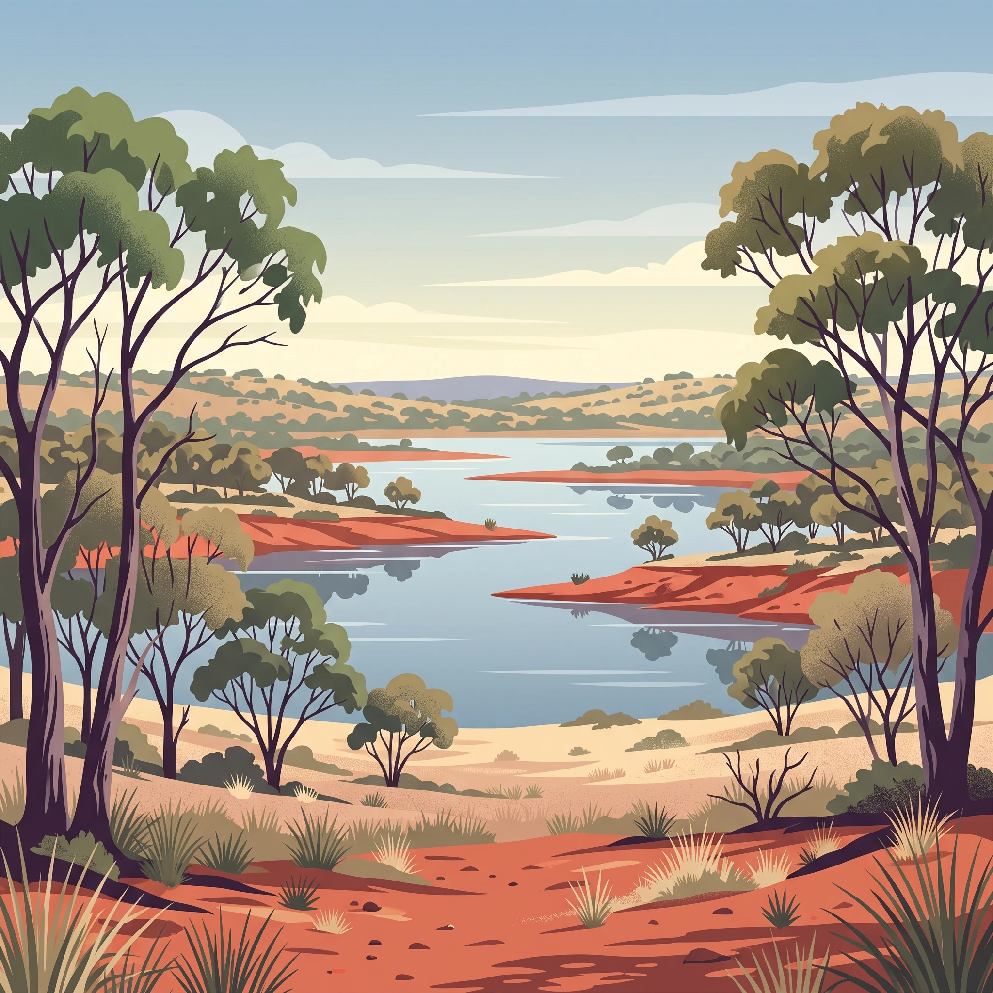
The Hattah Lakes are the central feature of the park, and their physical state depends heavily on the timing of your visit. Because the area acts as a vital wetland system, the visual and experiential character of these lakes shifts from productive, water-filled basins to dry salt pans as the seasons progress. During cooler months, when evaporative rates are generally lower, the water levels remain more stable, providing the signature blue-grey landscape contrast against the red mallee soil. As the climate shifts toward the hot, arid summer months, these lake beds often recede or dry out completely. Visitors seeking to experience the lakes as functional, bird-filled wetlands should prioritize periods during the cooler months, while those interested in the raw, geological study of the basin floors may find the dry phases more revealing.
Wildlife Observation and Malleefowl Habitats
The park is a critical refuge for threatened bird species, most notably the malleefowl, the black-eared miner, and the mallee emu-wren. The activity levels of these birds are linked to seasonal environmental conditions, particularly temperature. During the high-heat months, wildlife tends to be less active during the middle of the day, retreating into the dense mallee woodlands to conserve energy. Birdwatching is most productive during the cooler morning and evening hours, regardless of the season, but the cooler months of the year offer a significantly wider window for comfortable observation. During the late winter and spring, temperatures are more conducive to extended periods of walking through the scrub to locate these elusive species, as the thermal stress on both the visitor and the wildlife is considerably reduced compared to the summer months.
Hiking in the Mallee Woodlands
The red-dirt tracks that weave through the eucalypt woodlands offer a distinct walking experience that defines a visit to the region. The suitability of these trails is governed by thermal limits. Because the park is situated in an arid, semi-arid environment, exposed walking routes can become hazardous during the hotter phases of the year, when maximum temperatures often exceed the threshold for safe, sustained physical exertion. From May to September, the lower daytime temperatures make these trails accessible for longer durations, allowing visitors to explore the inland areas of the park without the necessity of returning to sheltered areas by mid-morning. If you are planning a visit to explore the internal walking network, focus on the cooler seasonal window to ensure your activity is supported by manageable ambient heat levels. Always remember that the landscape remains inherently dry regardless of the month, and any trail activity requires carrying sufficient water and monitoring current conditions, as seasonal averages do not account for daily weather volatility or extreme heat events.
Visitor Priorities
Selecting the Best Time to Visit Hattah-Kulkyne National Park Based on Your Goals
Balancing Walking Comfort and Thermal Stress
For travellers whose primary objective is exploring the park's extensive network of walking tracks, the most critical factor is managing the extreme thermal environment of the Mallee district. The period from May through September offers the only reliable window for sustained daytime activity. During these months, average maximum temperatures remain within a range that permits walking without the high risk of heat-related exhaustion associated with the summer months. While mid-winter temperatures in June and July can drop to near-freezing levels during the night and early morning, the daytime maximums around 21 degrees Celsius create a comfortable atmosphere for active movement. The trade-off for this physical comfort is the need to prepare for significant temperature fluctuations throughout a single day, as the drop from afternoon warmth to near-zero overnight lows is extreme.
Targeting the Drier Periods for Landscape Visibility
If your goal is to experience the park’s unique landscape, particularly the salt pans and the varied states of the Hattah Lakes, timing your visit to align with drier climatic conditions is essential. Precipitation is consistently low year-round, yet the evaporation rates vary significantly based on the season. Late autumn and early winter, specifically April and May, often provide the clearest conditions for viewing the contrast between the vibrant red earth and the sky. By contrast, the summer months bring not only intense heat, with maximums often exceeding 40 degrees Celsius in January and February, but also a persistent dryness that can cause the wetland systems to retreat. Visitors prioritising photography or landscape observation during these hotter months must contend with heat haze and the logistical challenge of operating in an environment where the mid-day sun is physically oppressive and visibility can be affected by the sheer intensity of the light.
Maximizing Daylight for Wildlife Observation
Wildlife enthusiasts, particularly those interested in spotting the park's threatened malleefowl or other specialized mallee species, often face a difficult tension between daylight availability and ambient temperature. Daylight hours are longest in the summer months, peaking at over 14 hours in December and January, which theoretically offers more time for field observations. However, the extreme heat during this period drives much of the wildlife into shade or nocturnal patterns to avoid the harsh environment. Consequently, the shoulder months of September and October, or even March, offer a better compromise. These periods provide enough daylight to allow for extended exploration while the temperatures remain sufficiently moderate to ensure that birds and other fauna remain active during more of the day. Choosing these months requires accepting that you have fewer total daylight hours than in mid-summer, but the trade-off is a higher probability of successful sightings as wildlife activity is not suppressed by extreme thermal stress.
Access and Planning
Seasonal Access and Practical Trip Planning for Hattah-Kulkyne National Park
Accessing Hattah-Kulkyne National Park requires planning that accounts for its remote Mallee location and the realities of semi-arid environmental management. While the park is generally open to the public throughout the year, access can be significantly influenced by local road conditions, rainfall events that affect the lake systems, and fire danger ratings during the peak heat periods. Because infrastructure and trail availability can fluctuate based on maintenance requirements or ecological restoration projects, you must check the official Parks Victoria website for current park alerts, road closures, or service notifications before finalizing your travel dates.
Travel by Vehicle and Road Considerations
Most visitors reach the park by car from Melbourne using the M79 and A79 highways, passing through regional hubs like Ouyen. While the main access roads leading to the park boundaries are typically well-maintained, the internal network of tracks often consists of red earth and sand that can become hazardous or impassable following localized downpours. It is essential to treat these tracks as variable; they are not highways and may require high-clearance vehicles or four-wheel drive capabilities, especially if you intend to venture into more remote sections of the park. Always verify the status of these internal routes with park authorities, particularly if you are planning to visit during the shoulder months when unpredictable weather patterns can transition from dry to wet quickly.
Regional Transit and Connections
For those relying on public transport, the V/line network connects Melbourne to nearby towns like Mildura, Ouyen, and Robinvale through a combination of rail and coach services. It is important to note that public transport does not reach deep into the national park itself. Once you arrive in a nearby regional town, you will need to arrange private transport or a vehicle rental to reach the park entrance. If you are travelling by coach, be mindful that services between major cities and regional centers can experience high demand, particularly during the summer and peak holiday periods. You should confirm the current capacity and booking requirements for these services well in advance, as ticket availability is not guaranteed.
Planning for Infrastructure and Facilities
Visitor facilities within the park, including designated camping areas and specific walking tracks, are managed according to changing park conditions. While some sites are designed for long-term use, authorities may restrict access to protect sensitive habitats or during periods of high fire risk. There are no permanent staffed visitor centers providing real-time tour services within the immediate park boundary, so independent planning is necessary. Always review official guidelines regarding permits, camping reservations, and fire restrictions before you depart. These regulations are subject to change and are the only definitive source for what is permitted at the time of your visit.
Safety and Preparation
Weather, Safety, and Essential Seasonal Preparation for Hattah-Kulkyne
Navigating Environmental Extremes in the Mallee
The semi-arid nature of this environment requires proactive preparation regardless of your chosen season. The most critical factor for visitors to understand is the high variability in daily temperatures. Even during the cooler months, the diurnal temperature range can be significant. Daytime heat can rise quickly, and nights often drop to near-freezing temperatures, especially from May through August. Preparing for this volatility is more effective than planning for a single weather state. You should monitor current local forecasts, as seasonal averages for the Mallee district are not precise predictors for any individual visit.
Preparing for Thermal and Arid Conditions
The primary environmental challenge in the warmer months, particularly from November through March, is prolonged exposure to high temperatures. During this period, the maximum temperatures frequently exceed 40 degrees Celsius. Preparation for these months necessitates a focus on self-sufficiency, as the park features vast, open woodlands with limited shade. Visitors should prioritize light, breathable clothing that provides maximum coverage against intense solar radiation. Because the relative humidity is consistently low during the hotter months, dehydration can occur faster than expected. Always carry more water than you anticipate needing for your specific activity level and intended route.
Seasonal Gear and Daily Planning
Your equipment choices should adapt to the park's cyclical landscape. During the cooler winter months, the mornings are crisp and cold, necessitating layered clothing that can be removed as the day warms up. High-quality, durable footwear is essential year-round, as the terrain is characterized by loose red sand and uneven, scrubby vegetation.
Daylight duration fluctuates substantially across the year, ranging from approximately 9.7 hours in June to over 14 hours in December. This difference dictates how much ground you can cover safely. In the winter months, shorter days mean you must start your hikes early to ensure you return before sunset. Conversely, the long summer days extend your potential hours for activity, but they also overlap with the hottest part of the afternoon, which is often the period of highest risk for heat-related stress.
Monitoring Alerts and Local Conditions
Before you depart, you must consult official park authority websites for the most current information. These sources provide the only accurate data regarding fire danger ratings, park-wide closures, road conditions, or unexpected environmental alerts that may occur. Never rely solely on broad regional weather forecasts or long-term climate normals to judge the safety of a specific trail or campground. Always inform someone of your intended route and your expected return time, as the remoteness of the Mallee woodlands can make assistance difficult to coordinate if you are unprepared.
Final Planning
How to Choose the Right Time for Your Hattah-Kulkyne National Park Visit
Evaluating Your Personal Priorities for a Hattah-Kulkyne Trip
Choosing the best time for your visit requires a clear assessment of your physical tolerance for heat and your specific goals for the trip. If your primary objective is exploring the network of walking trails across the red-earth landscape or observing the park's diverse birdlife, scheduling your arrival between May and September is essential. During these cooler months, the daytime temperatures remain manageable, allowing for sustained outdoor activity without the exhaustion associated with the summer heat. This period represents a clear trade-off: you gain the ability to hike comfortably but must accept shorter daylight hours and cooler overnight temperatures, which necessitates careful packing and preparation.
Balancing Climatic Realities with Travel Expectations
For those interested in the hydrological dynamics of the Hattah Lakes, note that the visual character of the wetlands is a result of long-term climate patterns rather than predictable seasonal rainfall. The decision to visit should be based on your readiness to adapt to the park's semi-arid environment. If you plan to travel during the hotter months from November through March, you are choosing a time when the landscape is at its most intense and arid. While these months offer significantly longer days, they also demand a strict adherence to safety protocols regarding heat exposure and dehydration. Most visitors find that the trade-off of extreme heat is rarely worth it unless there is a specific, non-strenuous objective that does not require long periods of physical exertion during peak afternoon hours.
Making Your Final Decision
Ultimately, there is no single best time to visit that guarantees a perfect experience, as the environment is inherently variable. The most effective strategy is to compare your preferred activities against the established climatic normals. If you seek stability in your schedule and comfort during exercise, focus on the shoulder and cool-weather months. If you are indifferent to heat and prioritize long daylight hours for photography or observation, the transitional months of April or October can offer a middle ground between extreme thermal stress and the depths of winter. Always remember that climate normals serve as a historical guide rather than a precise weather forecast. Before you finalize your travel dates, verify the most current park alerts, road conditions, and local fire risk warnings, as these real-time operational factors often dictate the viability of your trip regardless of the time of year.