Why Hattah-Kulkyne National Park stands out
Hattah-Kulkyne is best known for its unique combination of mallee woodland ecosystems and seasonal wetland habitats that create a striking contrast between red-dirt landscapes and glassy lake surfaces. The park protects one of the most significant mallee bird habitats in Victoria, supporting populations of three threatened species: the malleefowl, black-eared miner, and mallee emu-wren. The Hattah Lakes themselves are a defining feature, transforming from productive wetlands during the wet season to completely dry salt pans during the prolonged dry season, creating a dynamic and visually dramatic landscape. The area represents one of the few remaining intact mallee ecosystems in southeastern Australia and serves as a critical corridor for wildlife movement through the arid interior.
Hattah-Kulkyne National Park history and protected-area timeline
The protection of Hattah-Kulkyne has roots in the early twentieth-century conservation movement in Victoria. In 1915, a sanctuary was established specifically to protect the natural beauty and ecological values of the Hattah lakes system, recognizing the area's significance as a wetland and its appeal as a scenic landscape. The formal establishment of Hattah Lakes National Park followed on June 7, 1960, marking an important milestone in the regional conservation effort. The park's creation was significantly influenced by the advocacy of Les Chandler, an ornithologist who was instrumental in documenting the area's birdlife and promoting its protection. Together with Reverend Clarrie Lang, Chandler founded the Sunraysia Field Naturalists' Club in 1949, which later became the Sunraysia Naturalists' Research Trust. This organization campaigned for the declaration of the Hattah-Kulkyne area as a national park, achieving partial success in 1960 and ultimately seeing the park greatly expanded in 1980 when the Kulkyne State Forest was incorporated into the protected area, creating the Hattah-Kulkyne National Park as it exists today.
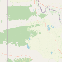
Hattah-Kulkyne National Park landscape and geographic character
The landscape of Hattah-Kulkyne National Park is defined by the interplay between semi-arid mallee woodlands and seasonal wetland systems set against the characteristic red soils of the Victorian Mallee. The terrain is generally flat to gently undulating, with elevations varying only slightly across the park's extensive area. The mallee vegetation creates a distinctive scenery of multi-stemmed eucalypts rising from red sandy ground, with the canopy typically remaining relatively low due to the challenging dry conditions. During the wet season, the Hattah Lakes fill with water, creating mirror-still surfaces that reflect the surrounding mallee woodland and transform the landscape dramatically. During the dry season, these same lakes become completely dry, with their beds exposed as salt-crusted pans that starkly illustrate the region's climatic extremes. Several major high-tension power lines traverse the park, creating cleared corridors that contrast with the otherwise continuous vegetation. The park's position adjacent to the Murray River places it within one of Australia's most important river systems, though the park itself lies above the river's floodplain.
Hattah-Kulkyne National Park ecosystems, habitats, and plant life
Hattah-Kulkyne supports a complex of interconnected ecosystems that make it one of Victoria's most important conservation areas for semi-arid biodiversity. The mallee woodlands represent the dominant vegetation type, supporting a diverse understory of shrubs, grasses, and flowering plants that have evolved to cope with prolonged drought and low nutrient soils. The wetland system, particularly the Hattah Lakes chain, provides critical habitat for waterbirds and supports ecological processes that are absent from the surrounding agricultural landscape. The park's designation as part of the Murray-Sunset, Hattah and Annuello Important Bird Area by BirdLife International recognizes its global significance for the conservation of mallee-dependent bird species. The dynamic hydrological cycle of the lakes, alternating between periods of abundant water and complete dryness, creates a unique ecological condition that supports both aquatic and terrestrial species and maintains the ecological integrity of the wetland system.
Hattah-Kulkyne National Park wildlife and species highlights
The wildlife of Hattah-Kulkyne is notable for its diversity of bird species, with over 200 species recorded within the park boundaries. The mallee woodlands provide essential habitat for several bird species of conservation concern, most notably the malleefowl, black-eared miner, and mallee emu-wren, all of which are threatened and depend on intact mallee ecosystems for their survival. The malleefowl is particularly significant as one of Australia's ground-nesting megapodes, building large mound nests that it tends with remarkable thermal regulation. The wetlands support populations of waterbirds including ducks, swans, herons, and ibises, particularly during the wet season when the lakes provide abundant feeding and breeding habitat. Reptiles including various skinks, dragons, and snakes are present in the mallee, while mammals such as kangaroos, wallabies, and smaller marsupials inhabit the woodland areas. The park's position within a larger network of connected mallee reserves allows for wildlife movement across the landscape.
Hattah-Kulkyne National Park conservation status and protection priorities
Hattah-Kulkyne National Park holds significant conservation value at both national and international levels. The designation of the Hattah-Kulkyne Lakes as a Ramsar Wetland on December 15, 1982, recognized the international importance of the wetland system under the Ramsar Convention, obligations that commits Australia to the wise use and conservation of these aquatic habitats. The park's inclusion in the Important Bird Area network further underscores its global significance for bird conservation, specifically for the threatened mallee bird species that depend on the protected habitat. The park forms part of the Victorian Mallee Parks, a collaborative management network that includes Murray-Sunset National Park, Wyperfeld National Park, Lake Albacutya Park, and Murray-Kulkyne Park, working together to maintain ecological connectivity across the fragmented agricultural landscape of the Mallee region. Conservation challenges include managing the impacts of altered fire regimes, invasive species, and the pressures arising from the surrounding agricultural land use.
Hattah-Kulkyne National Park cultural meaning and human context
The Hattah-Kulkyne area has been associated with Aboriginal communities for thousands of years, though the specific Traditional Owner groups and their connection to the land are not extensively documented in the available source material. The landscape would have provided resources for Indigenous peoples including access to the lake systems for water, fish, and waterfowl, as well as the mallee woodlands for food and materials. The modern history of the area reflects European settlement patterns in the Mallee region, with the development of agriculture and the subsequent recognition of the need to protect significant natural areas. The advocacy of early naturalists like Les Chandler and the formation of community organizations such as the Sunraysia Field Naturalists' Club represent an important phase in the region's environmental awareness that contributed to the establishment of the protected area.
Top sights and standout views in Hattah-Kulkyne National Park
The Hattah Lakes themselves are the undoubted highlight of any visit to Hattah-Kulkyne, with Lake Hattah being the largest and most visually impressive of the wetland chain. The contrast between the red mallee woodlands and the blue-grey waters when the lakes are full creates a memorable landscape scene. The birdlife, particularly the chance to observe malleefowl in their natural habitat, represents a major draw for nature enthusiasts and ornithologists. The network of walking tracks and camping areas, particularly those used for school groups, provides opportunities to experience the mallee landscape at ground level. The Ramsar-listed wetlands offer insight into the ecological importance of the park beyond its role as a protected woodland area. The sense of remoteness and the feeling of being in a distinctive semi-arid Australian landscape that differs fundamentally from the wetter, more heavily vegetated parts of Victoria is perhaps the park's most enduring quality.
Best time to visit Hattah-Kulkyne National Park
The best time to visit Hattah-Kulkyne depends significantly on rainfall patterns and the corresponding water levels in the Hattah Lakes. The winter months from June to August typically offer mild daytime temperatures and the best chance of encountering the lakes filled with water, as this is the wet season in the Mallee region. Spring can also be rewarding, with wildflower displays in the mallee understory and pleasant temperatures. However, the dry season from late summer through autumn often sees the lakes completely dry, which while offering a different landscape experience, may be less visually appealing for some visitors. Summer temperatures can be extreme, frequently exceeding 40 degrees Celsius, making outdoor activity uncomfortable. Visitors interested in birdwatching should be aware that the wet season attracts the greatest diversity and abundance of waterbirds, while the dry season concentrates wildlife around the remaining water sources.