

Mori Atlas logo
Nature reserveHayters Hill Nature Reserve

A vital subtropical forest remnant nestled within the rolling hinterlands of the Northern Rivers region

Hayters Hill Nature Reserve: Mapping the Protected Big Scrub Rainforest Fragments of New South Wales

Hayters Hill Nature Reserve serves as a critical geographic marker for the remnants of the historic Big Scrub, a once vast lowland subtropical rainforest in northern New South Wales. This protected enclave on elevated coastal terrain preserves a fragment of the original forest canopy that dominated the landscape before large scale agricultural clearing. As a significant ecological reference point, the reserve highlights the persistence of subtropical vegetation within a modified coastal hinterland.

subtropical rainforestlowland rainforestforest remnantNorthern RiversNew South Walesprotected nature reserve

Hayters Hill Nature Reserve

Nature reserve

Park overview

Structured park overview, official facts, and landscape profile for Hayters Hill Nature Reserve

Hayters Hill Nature Reserve park facts, protected area profile, and essential visitor context

Review the core facts for Hayters Hill Nature Reserve, including designation, size, terrain, visitor scale, habitats, and operating context in one park-focused overview.

About Hayters Hill Nature Reserve

Hayters Hill Nature Reserve is a compact protected area located in the Northern Rivers region of New South Wales, on the far north coast of eastern Australia. Although the reserve itself covers only a few hectares, its significance lies in what it represents: a surviving fragment of the Big Scrub, one of the largest expanses of lowland subtropical rainforest that once flourished in the region.

The reserve sits on elevated terrain roughly five kilometres southwest of Byron Bay, placing it within a coastal hinterland known for its mild climate, high rainfall, and lush vegetation. This setting supported the development of the subtropical rainforests that characterised the Big Scrub before widespread agricultural clearing transformed the landscape in the late nineteenth century.

Today, Hayters Hill is one of several small reserves scattered across the Northern Rivers that collectively protect remnants of the original Big Scrub rainforest. Together with neighbouring reserves, it helps maintain a network of habitat patches that preserve elements of the region's distinctive subtropical flora and rainforest structure. Despite its modest size, the reserve offers a window into the ecological character of a forest community that has otherwise been almost entirely lost from the wider landscape.

Quick facts and research context for Hayters Hill Nature Reserve

Hayters Hill Nature Reserve is a very small nature reserve covering roughly eight hectares in the Northern Rivers region of New South Wales, near Byron Bay. It is managed by the NSW National Parks and Wildlife Service and is classified as an IUCN Category IV area, recognising its role in habitat and species management.

The reserve protects a rainforest remnant belonging to the broader Big Scrub ecosystem, a lowland subtropical rainforest system that once covered tens of thousands of hectares across the region before being almost entirely cleared for farming. Hayters Hill sits on traditional country of the Arakwal people.

Protection and recognition

Documented terrestrial protection scope and international recognition records

Hayters Hill Nature Reserve Protection Status and Official Designation Data

Hayters Hill Nature Reserve maintains a documented terrestrial protection scope within its designated natural boundary. Official records outline administrative designation history and international recognition frameworks where verified.

Protection details

Protection scope
Terrestrial
Transboundary protection
No
Park context

Deeper park guide and search-rich context for Hayters Hill Nature Reserve

Hayters Hill Nature Reserve history, landscape, wildlife, and travel context

Explore Hayters Hill Nature Reserve through its history, landscape character, ecosystems, wildlife, conservation priorities, cultural context, and seasonal travel timing in a structured park guide built for atlas discovery and search intent.

Why Hayters Hill Nature Reserve stands out

Hayters Hill Nature Reserve is best known for protecting a small but ecologically meaningful remnant of lowland subtropical rainforest from the historic Big Scrub of northern New South Wales. The reserve stands out as a living fragment of a once massive forest landscape, now reduced to scattered pockets across the Northern Rivers region.
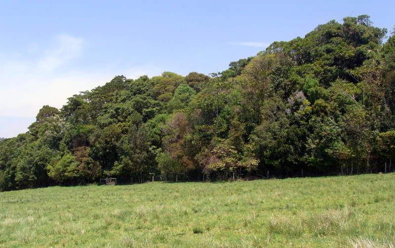
A line of dense subtropical rainforest trees rising above a foreground of open green pasture.
Subtropical rainforest remnant bordering a grassy pasture at Hayters Hill Nature Reserve.

Hayters Hill Nature Reserve history and protected-area timeline

Hayters Hill Nature Reserve was formally gazetted in January 1989, decades after the original Big Scrub rainforests had been cleared. The protection of the reserve reflects a more modern recognition of the ecological value of the surviving rainforest fragments in the Northern Rivers region of New South Wales.

The Big Scrub itself was once an extensive lowland subtropical rainforest covering roughly 75,000 hectares across the region. During the late nineteenth century, this forest was largely cleared to make way for agriculture, particularly dairy farming and other land uses associated with European settlement. As a result, the original forest was reduced to a small number of isolated remnants scattered across the landscape.

The establishment of Hayters Hill, alongside other small reserves conserving similar rainforest communities, represents a conservation response aimed at preserving what remains of this historically significant forest system and the biodiversity it supports.

Hayters Hill Nature Reserve landscape and geographic character

The reserve occupies a small area of elevated land within the gently rolling coastal hinterland of the Northern Rivers region. Its setting on higher ground relative to the surrounding terrain provides slightly different soil and drainage conditions from the flatter lowlands, an important factor in the development and persistence of the rainforest vegetation found there.

The broader landscape around Hayters Hill has been extensively modified by agriculture, but the reserve retains a patch of closed forest canopy characteristic of the subtropical rainforests that once dominated the region. The terrain itself is modest in scale, with the reserve forming a small forested island within a largely cleared rural and coastal environment near Byron Bay.

Hayters Hill Nature Reserve ecosystems, habitats, and plant life

Hayters Hill Nature Reserve protects a remnant of lowland subtropical rainforest, an ecosystem type that once dominated the Northern Rivers region of New South Wales. The Big Scrub rainforests to which this reserve belongs are recognised for their rich plant diversity, complex canopy structure, and adaptation to the warm, humid coastal climate of the far north coast.

The reserved forest continues to display structural features typical of subtropical rainforest, including a closed upper canopy, dense understorey layers, and a humid microclimate beneath the trees. Even as a small fragment, the reserve offers insight into the ecological character of the original Big Scrub forests and their role in the regional landscape.

Hayters Hill Nature Reserve conservation status and protection priorities

The conservation significance of Hayters Hill Nature Reserve lies in its role as a surviving fragment of the Big Scrub lowland subtropical rainforest, an ecosystem that was almost entirely lost to land clearing during the late nineteenth century. With the original forest reduced to scattered remnants, small reserves like Hayters Hill have become important refuges for the plant communities and ecological processes associated with this once extensive forest system.

The reserve is classified as an IUCN Category IV protected area, recognising its focus on habitat and species management. Along with neighbouring reserves such as Andrew Johnston Big Scrub, Victoria Park, Davis Scrub, Boatharbour, and Wilsons Peak, Hayters Hill forms part of a broader conservation network that seeks to maintain functional examples of Big Scrub rainforest across the Northern Rivers landscape.

Hayters Hill Nature Reserve cultural meaning and human context

Hayters Hill Nature Reserve is situated on traditional country of the Arakwal people, the Indigenous custodians of the land around what is now Byron Bay and the surrounding Northern Rivers region. The Arakwal are part of the broader Bundjalung cultural landscape of northeastern New South Wales, an area with deep and continuing Indigenous heritage that long predates European settlement and the later clearing of the Big Scrub rainforests.

Top sights and standout views in Hayters Hill Nature Reserve

A surviving fragment of the once vast lowland subtropical Big Scrub rainforest.

Part of a network of small reserves across the Northern Rivers protecting remnants of the Big Scrub ecosystem.

Located on elevated ground near Byron Bay within a historically forested coastal hinterland.

Recognised through its IUCN Category IV status as an area focused on habitat and species management.

An important ecological reference point for understanding the subtropical rainforests that once covered the region.

Monthly climate preview

Long term temperature and monthly precipitation averages for New South Wales

Hayters Hill Nature Reserve Climate Normals and Annual Weather Patterns

Representative coordinate measurements reveal the annual temperature range and monthly precipitation distribution across Hayters Hill Nature Reserve from 1991 to 2020. Detailed month by month climate normals provide deeper analytical context for studying long term regional patterns at this location.
Annual mean21 °C
18 °C25 °C
Jan25°
Feb25°
Mar24°
Apr23°
May21°
Jun19°
Jul18°
Aug18°
Sep20°
Oct21°
Nov22°
Dec24°
Warmest month
February

24.8 °C

Coolest month
July

17.8 °C

Wettest month
February

5.9 mm/day

Driest month
September

1.3 mm/day

Park location guide

Geography guide, regional context, and park location map for Hayters Hill Nature Reserve

Hayters Hill Nature Reserve park geography, regions, and map view in Australia

Understand where Hayters Hill Nature Reserve sits in Australia through a broader geographic reading of the surrounding landscape, nearby location context, and its mapped position within the national park landscape.

How Hayters Hill Nature Reserve fits into Australia

Australia is a constitutional monarchy and federal parliamentary democracy comprising six states and ten territories. With a population of nearly 28 million, it is one of the world's most urbanised countries, with most people concentrated on the eastern seaboard. The country has a high Human Development Index and is known for its cultural diversity, ancient Aboriginal heritage, and unique wildlife.

Wider geography shaping Hayters Hill Nature Reserve in Australia

Australia occupies the entire Australian continent, the island of Tasmania, and numerous smaller islands. It is the world's flattest and driest inhabited continent, featuring vast deserts in the interior (the Outback), tropical rainforests along the eastern coast, and a coastline bordering the Indian and Pacific Oceans.

Map view of Hayters Hill Nature Reserve

Use this park location map to pinpoint Hayters Hill Nature Reserve in Australia, understand its exact geographic position, and read its mapped placement within the surrounding landscape more clearly.

Pigeon | © OpenStreetMap contributors

Location context for Hayters Hill Nature Reserve

New South Wales

Visual exploration of subtropical rainforest habitats and protected terrain in New South Wales.

Hayters Hill Nature Reserve Photos and Landscape Scenery

Visual records reveal the enclosed forest canopy and elevated terrain defining Hayters Hill Nature Reserve within the Northern Rivers region. Examining these protected area photographs provides clear insight into surviving subtropical rainforest fragments from the historic Big Scrub.

A line of dense subtropical rainforest trees rising above a foreground of open green pasture.

Park atlas

Compare nearby forest remnants and regional protected landscapes across the Northern Rivers.

Other Parks and Protected Areas Near Hayters Hill Nature Reserve

Browse neighbouring protected areas and forest reserves situated across the coastal hinterland surrounding Hayters Hill Nature Reserve. Extending the geographic comparison reveals how surviving subtropical rainforest fragments connect within the broader regional ecosystem.
National parkNew South Wales
About 2 km away#1 closest

East

Arakwal National Park: National Park Protected Landscape in New South Wales

Explore mapped boundaries and regional geography.

Arakwal National Park stands as a protected national park, offering insights into its distinct landscape and geographic setting within New South Wales. This resource provides detailed information focused on the park's mapped boundaries and its role as a conservation landscape. Users can explore the regional geography and understand the specific protected-area context that defines Arakwal National Park, contributing to a broader atlas understanding.

Area
1.99 km²
Established
2001
IUCN
II
Relief
Lowland
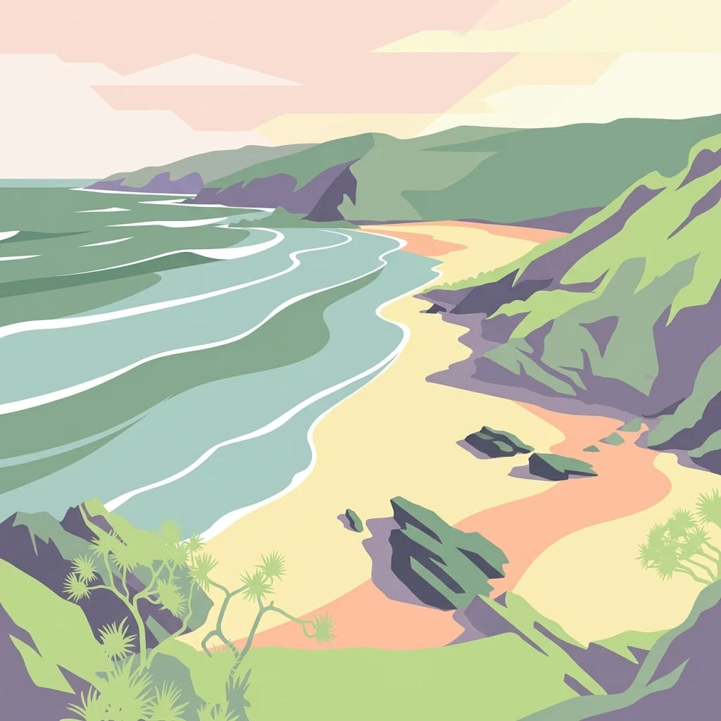
A stylized illustration showing a sandy beach meeting the ocean, flanked by grassy green hills and cliffs under a soft-colored sky.
Nature reserveNew South Wales
About 6 km away#2 closest

Southeast

Broken Head Nature Reserve: Littoral Rainforest and Coastal Geography of New South Wales

Coastal terrain and protected headland mapped landscapes

Located in the Northern Rivers region of New South Wales, Broken Head Nature Reserve offers a concentrated view of coastal ecological zones. The protected area features a unique combination of littoral rainforest, sandstone formations, and beach ecosystems. This geography provides insight into regional conservation and the historical landscape of the far north coast of Australia.

Area
0.98 km²
IUCN
Ia
Relief
Lowland
Climate
Subtropical
Nature reserveNew South Wales
About 7.4 km away#3 closest

North

Tyagarah Nature Reserve: A Protected Coastal Landscape Atlas in Northern New South Wales

Coastal dunes, endangered ecosystems, and whale migration geography.

Located along the Pacific coast of New South Wales, Tyagarah Nature Reserve features seven kilometers of undeveloped beach backed by a mosaic of stable dunes and wetland habitats. The area provides a critical sanctuary for numerous threatened plant species and serves as a premier vantage point for tracking migrating humpback whales from the shore. This site represents a convergence of Indigenous cultural history and vital coastal conservation landscapes in the Byron Shire.

Area
8.75 km²
Relief
Lowland
Climate
Subtropical
Scope
Terrestrial
Nature reserveNew South Wales
About 7.8 km away#4 closest

Northeast

Nguthungulli Julian Rocks Nature Reserve: Atlas of Coastal Protected Marine Landscapes

Geographic overview of basalt islands and Tasman Sea marine environments.

Nguthungulli Julian Rocks Nature Reserve represents a rare convergence of marine geography off the coast of New South Wales. These two rocky islets provide a dense, structured habitat where warm and cool currents meet. The reserve acts as a focal point for understanding regional coastal conservation, Indigenous cultural heritage, and the intricate, submerged basalt formations that define this significant Australian protected area.

Area
40.47 km²
Established
1961
IUCN
Ia
Relief
Lowland
Marine protected areaNew South Wales
About 9.3 km away#5 closest

East

Cape Byron Marine Park: Protected Marine Geography and Coastal Landscapes in New South Wales

Subtropical marine sanctuary and reef biodiversity atlas

Spanning from the Brunswick River to Lennox Head, Cape Byron Marine Park serves as a vital protected area on the Australian east coast. Analyze its coastal geography, including tidal estuaries, sandy surf beaches, and significant submerged reef structures that support a convergence of subtropical and temperate marine life.

Area
220 km²
Established
2002
Relief
Lowland
Climate
Subtropical
Nature reserveNew South Wales
About 15 km away#6 closest

North

Brunswick Heads Nature Reserve: Protected Littoral Rainforest and Coastal Geography

Northern Rivers coastal terrain and protected ecosystem mapping

Spanning 221 hectares, Brunswick Heads Nature Reserve protects one of the few remaining littoral rainforest stands in New South Wales. The reserve features a dense, sheltered rainforest interior that contrasts with open sandy beaches and tidal estuarine flats, creating a high-density habitat mosaic for rare plants and threatened shorebird populations.

Area
2.21 km²
Established
1979
IUCN
IV
Relief
Lowland
Nature reserveNew South Wales
About 16 km away#7 closest

West

Andrew Johnston Big Scrub Nature Reserve: Mapped Protected Landscapes in New South Wales

Botanical significance within the Northern Rivers volcanic terrain

Andrew Johnston Big Scrub Nature Reserve serves as a primary example of remnant subtropical lowland rainforest in Australia. This protected area offers insight into the region's volcanic geography and high-rainfall forest ecosystems, providing a critical refuge for biodiversity on fertile basaltic soils within the broader New South Wales landscape.

Area
0.21 km²
Established
1993
IUCN
IV
Relief
Upland
National parkNew South Wales
About 19 km away#8 closest

Northwest

Goonengerry National Park: New South Wales Protected Landscape and Geography

Discover mapped boundaries and regional context.

Goonengerry National Park is a designated national park in New South Wales, Australia, offering valuable insights for geographic exploration. This entry provides a structured view of its protected area status, focusing on its mapped boundaries and landscape context. Users can explore how Goonengerry National Park fits into the regional geography of New South Wales, enhancing understanding of protected lands within the Australian atlas.

Area
4 km²
Established
1999
IUCN
II
Relief
Upland

Common questions about visiting, size, designation, and location context for Hayters Hill Nature Reserve

Hayters Hill Nature Reserve FAQs for park facts, access, geography, and protected area context

Find quick answers about Hayters Hill Nature Reserve, including protected-area facts, park geography, trail and visitor context, and how the park fits into its surrounding country and regional landscape.
MoriAtlas Explorer

Continue Your Protected Areas Search Across the Global Atlas

Deepen your exploration by continuing the structured search for national parks and protected areas worldwide. Utilize the comprehensive filtering capabilities to compare different conservation landscapes and refine your understanding of global park geography. Discover more about the distribution and characteristics of protected natural areas.

Global natural geography