
Mori Atlas logo
Protected landscapeHelena-Lewis and Clark National Forest

Traversing the ecological divide from eastern grass steppe to rugged Rocky Mountain peaks

Helena-Lewis and Clark National Forest: A Vast Protected Landscape in Central Montana

Helena-Lewis and Clark National Forest spans nearly 3 million acres across Montana, bridging the gap between the Great Plains foothills and the Continental Divide of the Northern Rockies. This expansive protected area encompasses eight distinct mountain ranges and major wilderness complexes, including the Gates of the Mountains and the Scapegoat Wilderness. Its geography reflects a complex transition of terrain, where dry sagebrush landscapes yield to dense coniferous forests and alpine ridges along the divide.

national forestmontanarocky mountainscontinental dividewildernessconiferous forest
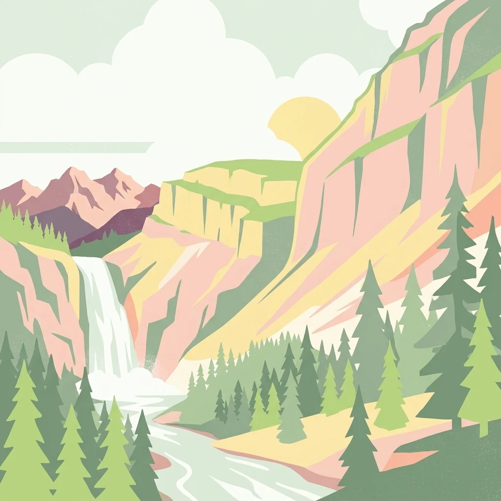
A digital illustration of a mountainous landscape with a tall waterfall cascading into a river, surrounded by evergreen trees, with stylized cliffs and a setting sun in the background.

Helena-Lewis and Clark National Forest

Protected landscape

Park overview

Structured park overview, official facts, and landscape profile for Helena-Lewis and Clark National Forest

Helena-Lewis and Clark National Forest park facts, protected area profile, and essential visitor context

Review the core facts for Helena-Lewis and Clark National Forest, including designation, size, terrain, visitor scale, habitats, and operating context in one park-focused overview.

About Helena-Lewis and Clark National Forest

Helena-Lewis and Clark National Forest is a sprawling multi-unit National Forest in west-central Montana that today represents the merged administrative identity of the former Helena National Forest and the Lewis and Clark National Forest. Carved into seven distinct geographic sections by valleys, mountain ranges, and private lands, it stretches from the Big Belt and Elkhorn Mountains in the south to the remote reaches of the Rocky Mountain Front in the north, where it borders Glacier National Park. With roughly 2.8 million acres of federally designated forest land under the U.S. Forest Service, it ranks among the largest and most ecologically varied national forests in the Northern Rockies.

The forest's defining character is its east-to-west environmental transition. The eastern Jefferson Division is a drier country of native grasslands, sagebrush flats, and island pockets of ponderosa and lodgepole pine, where cattle grazing leases and timber harvests have long shaped land management. Moving westward, the Rocky Mountain Division climbs into denser stands of Douglas fir, spruce, and larch, reaching elevations near 9,362 feet at Rocky Mountain Peak. This gradient allows the forest to support unusually diverse ecological communities within a single administrative unit, ranging from prairie-edge species in the lower foothills to grizzly bear habitat and alpine wildlife along the Continental Divide.

Culturally, the forest is layered with deep history. Before it was reserved by the federal government, the landscape was used for thousands of years by Native American peoples, and seasonal winter camps of the Blackfeet, Sioux, Cheyenne, Flathead, and Crow nations once dotted the territory. The Lewis and Clark Expedition crossed these lands in 1804 to 1806, and the forest's name commemorates that journey. In the late 19th century, federal policy shifted to reservation and ceding of traditional lands, most notably through the 1896 treaty with the Blackfeet, and the original Lewis and Clarke Forest Reserve was established on February 22, 1897, as one of the earliest formally protected forest reserves in the United States. The forest's modern footprint was built through successive mergers of earlier reserves, including the Flathead Forest Reserve, Little Belt, Crazy Mountain, Elkhorn, Jefferson, and parts of Absaroka National Forests, culminating in administrative consolidation of the Helena and Lewis and Clark units in 2014.

Today the forest functions as both a working landscape and a conservation landscape. Its wilderness areas are managed primarily for ecological preservation, while other sections continue to support grazing, timber, recreation, and rural community economies. A network of nearly 1,500 miles of trails, 29 vehicle-accessible campgrounds, two ski areas, and more than 1,600 miles of rivers and streams makes it a major recreational anchor in central Montana, while places like the Badger-Two Medicine area reflect ongoing contestations between energy development, motor access, preservation, and tribal cultural protection.

Quick facts and research context for Helena-Lewis and Clark National Forest

Helena-Lewis and Clark National Forest spans roughly 2.8 million acres in west-central Montana, making it one of the older and larger National Forest units in the northern Rockies. It was first established as the Lewis and Clarke Forest Reserve on February 22, 1897, and has since grown through the consolidation of several earlier reserves, including Jefferson, Absaroka, and Elkhorn National Forests. The forest is divided between an eastern Jefferson Division of grasslands and pine stands and a western Rocky Mountain Division that includes wilderness preserves along the Continental Divide.

The forest lies across thirteen counties, with headquarters in Great Falls, Montana for the Lewis and Clark side and in Helena for the Helena side; the two units consolidated administration in 2014. Elevations run from about 4,500 feet in lower foothill country to roughly 9,362 feet at Rocky Mountain Peak, with eight named mountain ranges within its boundaries. Major wilderness areas include the Gates of the Mountains, Scapegoat, and connections to the Bob Marshall Wilderness complex.

Protection and recognition

Documented management scope and conservation status records

Helena-Lewis and Clark National Forest Protection Status and Terrestrial Scope

Helena-Lewis and Clark National Forest encompasses a defined terrestrial protection scope within its managed boundaries. Structured conservation records outline the documented framework and administrative parameters governing this protected area.

Protection details

Protection scope
Terrestrial
Transboundary protection
No
Park context

Deeper park guide and search-rich context for Helena-Lewis and Clark National Forest

Helena-Lewis and Clark National Forest history, landscape, wildlife, and travel context

Explore Helena-Lewis and Clark National Forest through its history, landscape character, ecosystems, wildlife, conservation priorities, cultural context, and seasonal travel timing in a structured park guide built for atlas discovery and search intent.

Why Helena-Lewis and Clark National Forest stands out

Helena-Lewis and Clark National Forest is best known for the way it captures the full ecological gradient of central Montana, from dry ponderosa pine foothills and grass-shrub steppe in the east to alpine coniferous forest and designated wilderness along the Continental Divide. The forest includes several iconic wilderness landscapes such as the Gates of the Mountains Wilderness and the Scapegoat Wilderness, the latter linked to the larger Bob Marshall Wilderness complex. The forest is also known for its wildlife richness, holding resident populations of grizzly bears and gray wolves in the western ranges, along with elk, bighorn sheep, mountain goats, moose, and mountain lions. Its rivers and streams, particularly the Smith River, are recognized for native westslope cutthroat trout and productive fly fishing, while the Badger-Two Medicine area is celebrated for both its scenic roadless character and its deep cultural importance to the Blackfeet Nation.
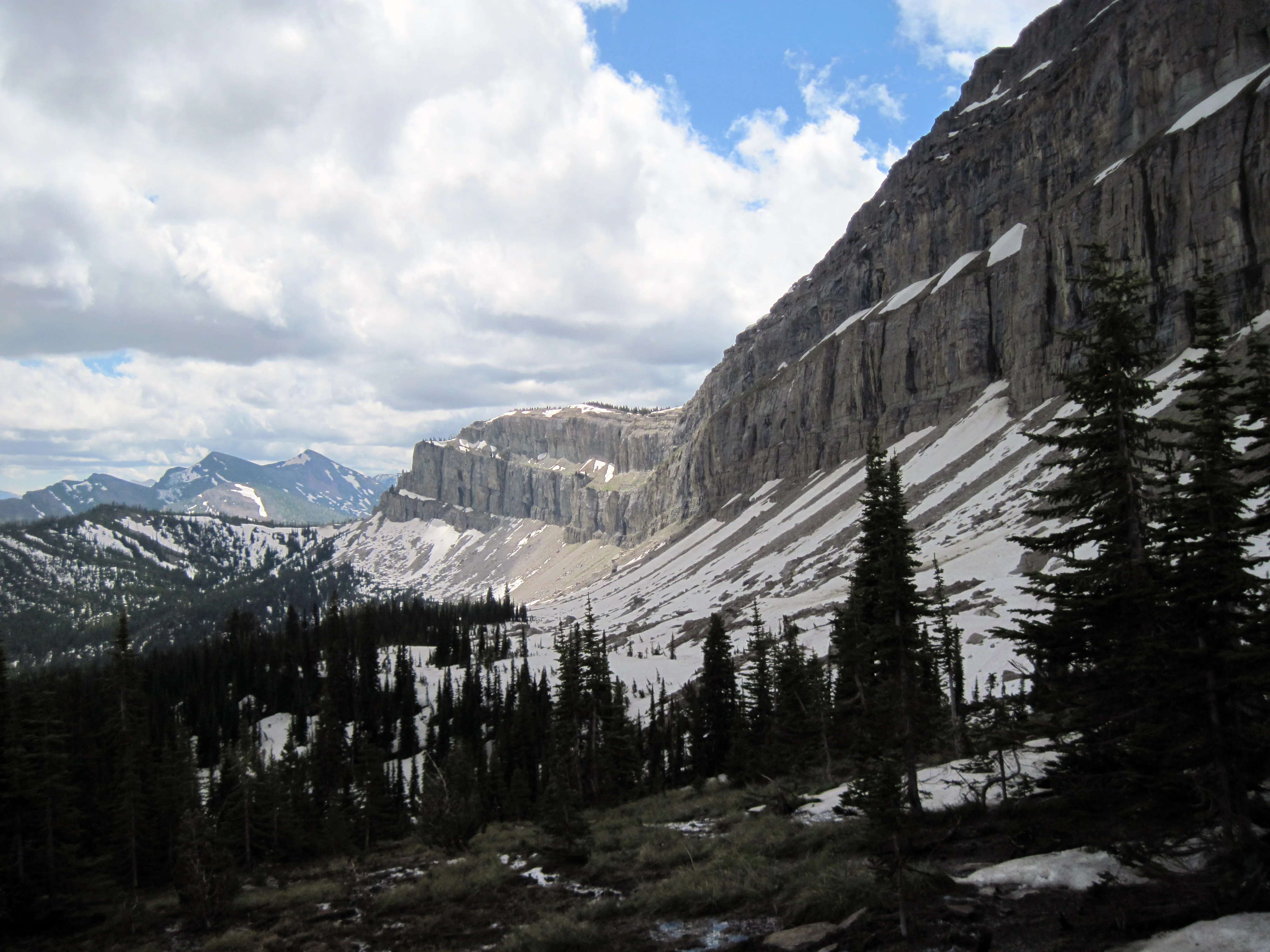
A wide, mountainous landscape featuring a long, massive limestone cliff face known as the Chinese Wall, with patches of snow on the slopes and surrounding coniferous forest under a cloudy sky.
A scenic view of the iconic Chinese Wall in the Helena-Lewis and Clark National Forest.

Helena-Lewis and Clark National Forest history and protected-area timeline

The landscape that is now Helena-Lewis and Clark National Forest was inhabited by various Native American cultures for at least 8,000 to 10,000 years before European American contact. Members of the Blackfeet, Sioux, Cheyenne, Flathead, and Crow nations used different parts of the territory for hunting, seasonal travel, and winter camps, taking advantage of forest cover for shelter during cold months. When the Lewis and Clark Expedition passed through between 1804 and 1806, the expedition encountered a landscape that was already well known to Indigenous peoples as a working seasonal environment.

In the late 19th century, the federal government pursued a policy of removing Native nations onto reservations and opening western lands to settlement. The Blackfeet Indian Reservation was established by the Treaty of 1896 to the east of the present forest and Glacier National Park, requiring the Blackfeet to cede vast areas of territory. On February 22, 1897, the Lewis and Clarke Forest Reserve was created under the United States General Land Office, becoming one of the oldest forest reserves in the country. The forest territory was later transferred to the U.S. Forest Service in 1906 and formally designated as a National Forest.

The modern shape of the forest emerged through a long series of mergers and reorganizations. The Flathead Forest Reserve was added in 1903, and the name spelling was changed from Lewis and Clarke to Lewis and Clark in 1907. Reserves such as the Little Belt, Crazy Mountain, Elkhorn, Snowy Mountains, Little Rockies, and Highwood Mountains were progressively combined into Jefferson National Forest and other units, and large portions of those lands were eventually folded back into the Lewis and Clark system. Parts of Absaroka National Forest were added in 1945. In 2014, the Helena and Lewis and Clark National Forests consolidated their administrations into the present-day Helena-Lewis and Clark National Forest. The forest's history also includes the 1949 Mann Gulch fire, a major wildland fire event that killed 13 firefighters and was later memorialized in Norman Maclean's book Young Men and Fire and in the folk song Cold Missouri Waters.

Helena-Lewis and Clark National Forest landscape and geographic character

Helena-Lewis and Clark National Forest covers a strikingly varied terrain shaped by the meeting of the Rocky Mountain Front with the eastern plains. Elevations span from around 4,500 feet in the foothill valleys to 9,362 feet at Rocky Mountain Peak, with the Rocky Mountains in this region generally staying below 10,000 feet. The landscape is broken into eight principal mountain ranges, including the Big Belt, Little Belt, Judith, Big Snowy, Little Snowy, Crazy, Castle, Highwood, and Elkhorn Mountains, plus the northern Rocky Mountain Front itself.

The forest's eastern sections are defined by grass and sagebrush steppe, with scattered island pockets of lodgepole and ponderosa pine rising out of open lowlands. The Big Belt Mountains rise in these eastern sections and contain the Gates of the Mountains Wilderness, whose narrow Missouri River corridor still resembles the setting the Lewis and Clark Expedition experienced. The southern part of the forest includes the Elkhorn Mountains, while the central Crazy Mountains offer particularly remote, rugged terrain favored for solitude.

The western Rocky Mountain Division is a markedly different environment, dominated by dense coniferous forest of spruce, fir, and pine. Here the Continental Divide traces a major spine through the forest, framing the Scapegoat Wilderness and connecting to the larger Bob Marshall Wilderness complex. Many lakes, higher-elevation streams, and forested ridges define this zone, and the snowpack can linger for up to ten months of the year along the highest divide country.
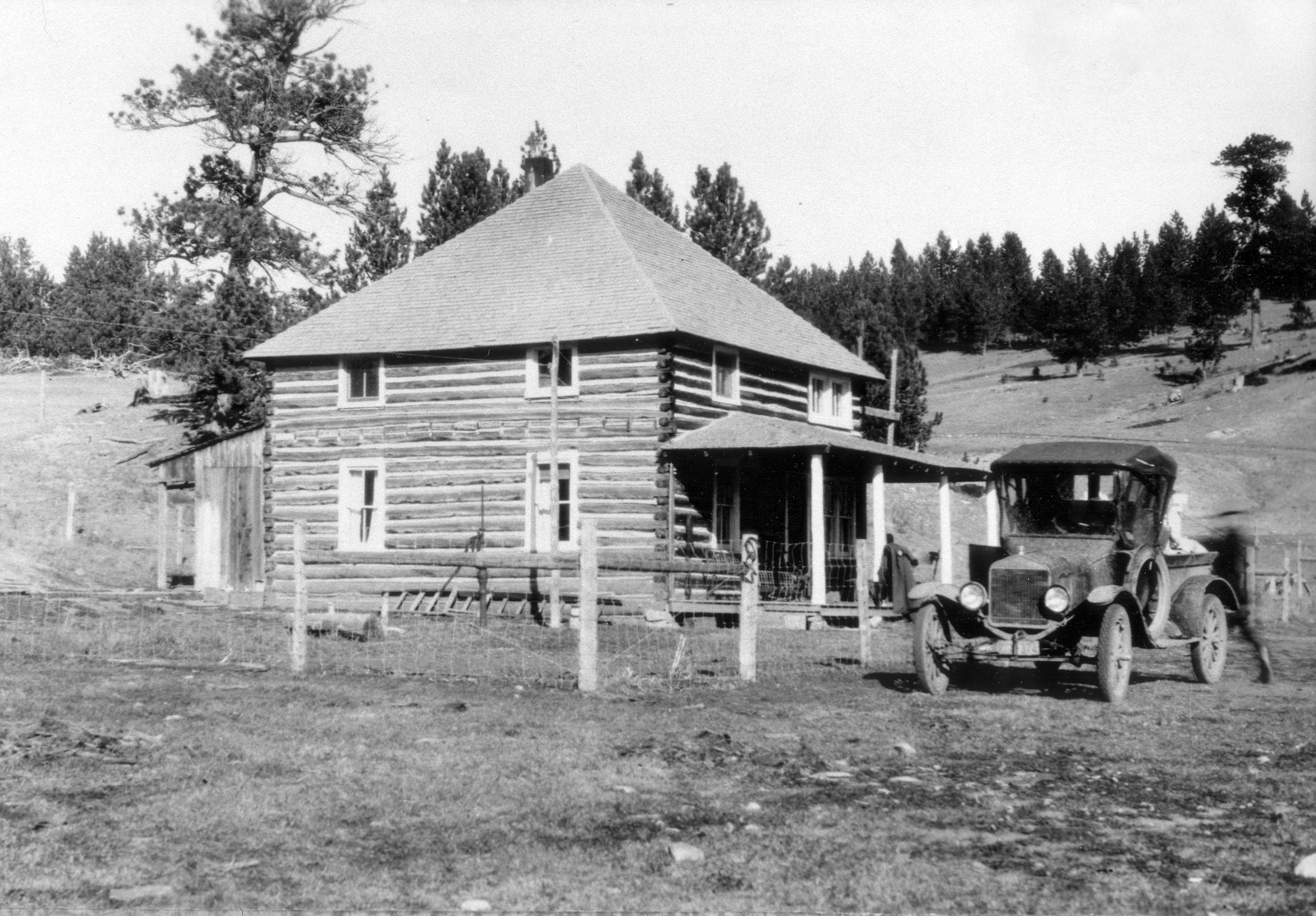
A black and white archival photograph of a two-story log cabin with a pyramid roof and a front porch, with a vintage automobile parked in front on a dirt landscape.
Historic Judith Station, a 1905 ranger station in the Helena-Lewis and Clark National Forest, seen here around 1920.

Helena-Lewis and Clark National Forest ecosystems, habitats, and plant life

Helena-Lewis and Clark National Forest spans the ecological transition from semi-arid northern grasslands to montane and subalpine coniferous forest, a gradient that gives it unusually high habitat diversity for a single National Forest unit. The drier Jefferson Division is anchored by ponderosa and lodgepole pine stands set within expansive grasslands and sagebrush shrublands, a vegetation pattern that reflects lower precipitation and a more continental climate. Soils and vegetation here favor species adapted to fire, drought, and seasonal grazing.

The wetter Rocky Mountain Division supports denser stands of Douglas fir, Engelmann spruce, subalpine fir, and larch, with more continuous canopy cover and a richer moss-and-needle understory. Higher elevations give way to subalpine and alpine zones near the Continental Divide, where growing seasons are short and snow lingers much of the year. Riparian systems weave through both divisions, with willow thickets, beaver meadows, and gallery forests along streams that ultimately feed the Missouri River basin. Native westslope cutthroat trout persist in cold, clean headwater streams, symbolizing the forest's role in protecting freshwater biodiversity in central Montana.
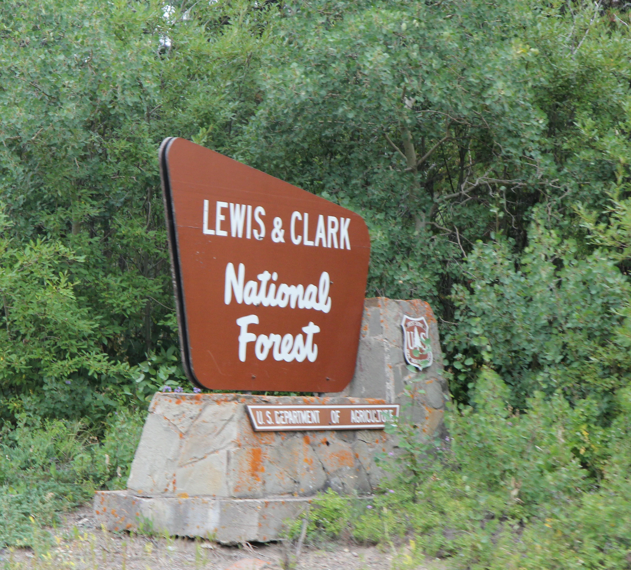
A brown, trapezoidal National Forest entrance sign with the text Lewis and Clark National Forest, mounted on a stone base, with dense green trees in the background.
A brown National Forest entrance sign for the Lewis and Clark National Forest.

Helena-Lewis and Clark National Forest wildlife and species highlights

Wildlife is one of Helena-Lewis and Clark National Forest's strongest identity markers, particularly in the western Rocky Mountain Division. The Scapegoat Wilderness and surrounding Bob Marshall complex support a sustained population of grizzly bears, along with gray wolves, making this one of the most important intact carnivore strongholds in the lower 48. Other large predators, including mountain lions, wolverines, Canada lynx, and bobcats, are present especially near the Continental Divide, where forested cover and rugged terrain offer security.

Large herbivores are widely distributed. Elk, moose, mule deer, and white-tailed deer are common across much of the forest, while bighorn sheep and mountain goats concentrate in the higher rocky ranges. Black bears are numerous throughout, and pronghorn appear in the more open eastern sections. Smaller mammals such as beavers, muskrats, mink, river otters, and coyotes occupy streamside and foothill habitats, with the rare Columbian white-tailed deer present in upstream reaches.

Birdlife is increasingly visible across the forest. Bald eagles, peregrine falcons, red-tailed hawks, and various grouse species are recovering or expanding in response to protections for waterways and nesting habitat. Lakes and rivers in the western sections are particularly rich in water-associated species, reinforcing the forest's identity as a stronghold for both terrestrial and aquatic wildlife in the northern Rockies.
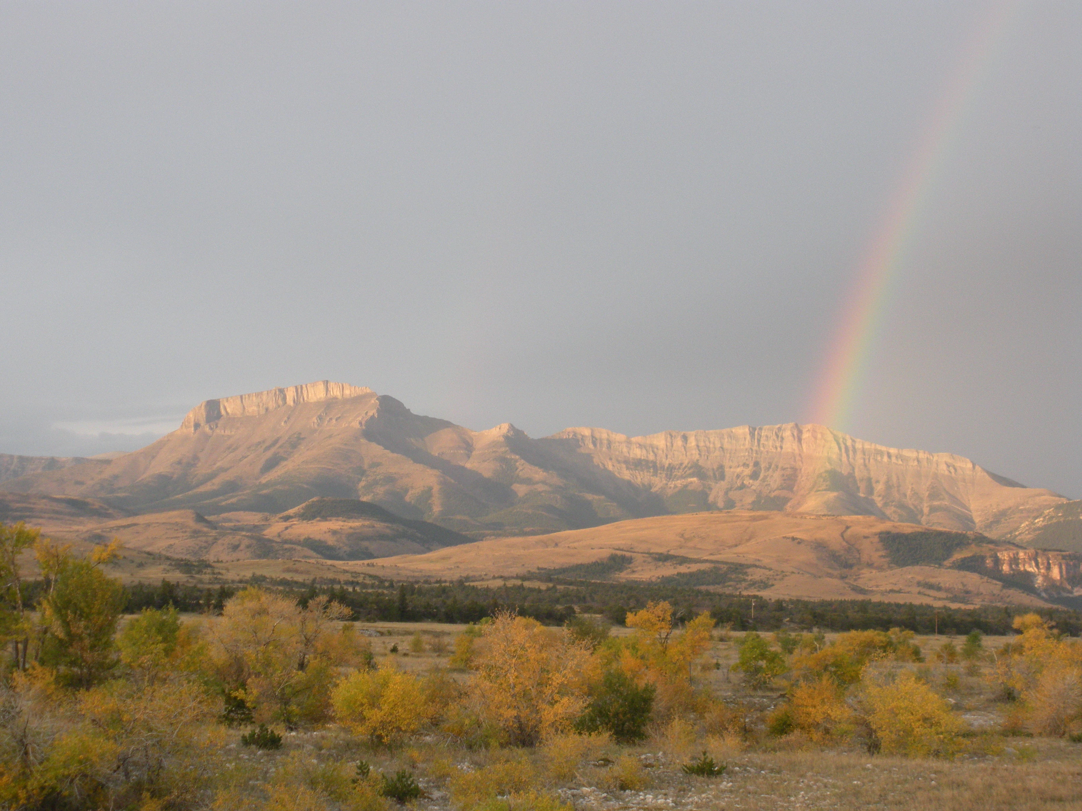
A wide landscape view of Ear Mountain with a rainbow stretching down toward the cliffs under a cloudy sky.
A rainbow appearing over Ear Mountain in the Helena-Lewis and Clark National Forest.

Helena-Lewis and Clark National Forest conservation status and protection priorities

Helena-Lewis and Clark National Forest holds significant conservation value because it preserves one of the largest intact blocks of public land along the Rocky Mountain Front, including designated wilderness that buffers the southern edge of Glacier National Park. Its wilderness areas, such as the Gates of the Mountains and Scapegoat Wilderness, protect watersheds, native trout populations, and habitat for wide-ranging species like grizzly bears and gray wolves that require large, roadless landscapes. The western sections contain some of the best remaining native westslope cutthroat trout habitat in the region, making the forest a focal point for cold-water conservation.

Conservation work extends beyond wildlife to the protection of cultural landscapes. The Badger-Two Medicine area, roughly 200 square miles adjacent to the Blackfeet Reservation and Glacier National Park, is sacred to the Blackfeet and is the subject of ongoing efforts to keep it roadless and free from oil and gas drilling. Approximately 93,000 acres in this area have been recognized as eligible for the National Register of Historic Places as a traditional cultural district, and additional advocacy continues to expand that recognition. The U.S. Forest Service has restricted motorized travel on hundreds of miles of trails here, although court rulings have occasionally reopened limited access.

The forest also embodies the broader tension between multiple-use management and preservation. Parts of the Jefferson Division continue to support cattle leases and timber harvest, while wilderness sections are managed primarily for ecological values. Events such as the 1949 Mann Gulch fire and the 2017 Alice Creek Fire, which burned roughly 29,000 acres and crossed the Continental Divide, illustrate the forest's role in fire ecology and the importance of managing fire as both a natural process and a contemporary risk to watersheds and communities.

Helena-Lewis and Clark National Forest cultural meaning and human context

Helena-Lewis and Clark National Forest is layered with Indigenous and frontier-era cultural history. For thousands of years, members of the Blackfeet, Sioux, Cheyenne, Flathead, and Crow nations used the diverse terrain of the forest for hunting, seasonal travel, and winter shelter, with different tribal groups occupying different ecological zones of what is now the forest footprint. The Lewis and Clark Expedition of 1804 to 1806 then carried the forest into the broader narrative of American exploration and westward expansion, and the National Forest's name reflects that legacy.

The 19th century brought profound disruption to these traditional relationships. Treaties, including the 1896 agreement with the Blackfeet, confined Native nations to reservations and opened their ancestral lands to Euro-American settlement, logging, and grazing. The 1897 creation of the Lewis and Clarke Forest Reserve marked a turning point in federal land policy, framing the landscape as a public resource rather than tribal territory. Today, the Badger-Two Medicine area stands as a place where Indigenous stewardship, conservation, and tribal sovereignty remain actively negotiated, and where the Blackfeet Nation continues to assert treaty-based rights to hunt, fish, and gather wood in the forest.
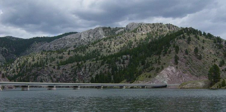
A long concrete bridge stretches across a wide river, backed by a large, tree-covered mountain slope under a cloudy sky.
The York-Trout Creek Bridge spanning a section of the Missouri River within the Helena-Lewis and Clark National Forest.

Top sights and standout views in Helena-Lewis and Clark National Forest

Among the most distinctive features of Helena-Lewis and Clark National Forest are the Gates of the Mountains Wilderness along the Missouri River, the Scapegoat Wilderness as part of the Bob Marshall Wilderness complex, and the sweeping Rocky Mountain Front where the Rockies rise abruptly from the prairie. The forest's eight mountain ranges, varied elevation from 4,500 to over 9,300 feet, and dual identity as both a working multiple-use landscape and a major wilderness stronghold make it unusually rich for a single National Forest unit.

Best time to visit Helena-Lewis and Clark National Forest

Summertime is the most accessible season across most of Helena-Lewis and Clark National Forest, when average daytime highs sit in the 70s Fahrenheit and the network of nearly 1,500 miles of trails, rivers, and campgrounds is fully open. Higher elevations along the Continental Divide are cooler and wilder, with snow lingering well into the warmer months. Winter brings heavy snow, particularly in the western divisions, opening the forest to snowmobiling and cross-country skiing but limiting ground access in the backcountry. Visitors sensitive to extremes should note that the more exposed eastern sections can be especially cold in winter, while the western mountains carry snowpack for many months of the year.
Monthly climate preview

Long-term temperature ranges and monthly precipitation patterns across representative terrain

Helena-Lewis and Clark National Forest Climate Normals and Weather by Month

Representative coordinates record an annual temperature spread spanning sub-zero winter minimums and warm summer peaks alongside distinct monthly precipitation variations. Examining the complete twelve-month profile provides a structured breakdown of long-term climatic averages across the protected landscape.
Annual mean5 °C
-7 °C18 °C
Jan-7°
Feb-6°
Mar-1°
Apr
May
Jun14°
Jul18°
Aug18°
Sep12°
Oct
Nov-2°
Dec-7°
Warmest month
July

18.4 °C

Coolest month
January

-6.9 °C

Wettest month
June

3 mm/day

Driest month
December

1.1 mm/day

Park location guide

Geography guide, regional context, and park location map for Helena-Lewis and Clark National Forest

Helena-Lewis and Clark National Forest park geography, regions, and map view in United States of America

Understand where Helena-Lewis and Clark National Forest sits in United States of America through a broader geographic reading of the surrounding landscape, nearby location context, and its mapped position within the national park landscape.

How Helena-Lewis and Clark National Forest fits into United States of America

The United States of America is a federal presidential republic and one of the world's largest countries by area and population. It consists of 50 states across a vast territory spanning multiple time zones, with its capital in Washington, D.C. and largest city in New York City. The nation has a diverse economy, influential political system, and significant cultural and military presence globally.

Wider geography shaping Helena-Lewis and Clark National Forest in United States of America

The United States occupies a vast territory in North America, bordered by Canada to the north and Mexico to the south. The 48 contiguous states stretch from the Atlantic to the Pacific Ocean, while Alaska occupies the northwestern region and Hawaii is an archipelago in the Pacific. The country encompasses diverse terrain including the Rocky Mountains, Appalachian Mountains, Great Plains, and extensive river systems.

Map view of Helena-Lewis and Clark National Forest

Use this park location map to pinpoint Helena-Lewis and Clark National Forest in United States of America, understand its exact geographic position, and read its mapped placement within the surrounding landscape more clearly.

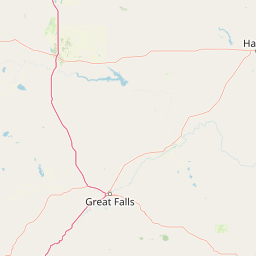
Pigeon | © OpenStreetMap contributors

Location context for Helena-Lewis and Clark National Forest

Montana
Recorded earthquake history

Explore Historical Earthquake Records for Helena-Lewis and Clark National Forest

Investigate the documented seismic history of the lands surrounding Helena-Lewis and Clark National Forest. Through the MoriAtlas collection, view historical event data including magnitude, epicentre locations, and proximity to this diverse Montana wilderness area.

Helena-Lewis and Clark National Forest Earthquake History

Catalogued events

276 events

Strongest magnitude

Magnitude 5.8

Most recent event

Aug 28, 2026

This history includes earthquakes recorded inside the park or within 50 km of its borders

Examine the rugged mountain ranges, alpine wilderness, and diverse habitats of Montana.

Helena-Lewis and Clark National Forest Photos: Landscape and Scenery Visual Explorer

Visual records capture the striking ecological gradient of Helena-Lewis and Clark National Forest, spanning from dry eastern grasslands to dense coniferous ranges along the Continental Divide. Photographic archives reveal the varied terrain, high-elevation ridges, and protected wilderness environments that define this expansive regional landscape.

A wide, mountainous landscape featuring a long, massive limestone cliff face known as the Chinese Wall, with patches of snow on the slopes and surrounding coniferous forest under a cloudy sky.

A waterfall flows down between sheer dark rocky cliffs into a turbulent stream with a large log in the foreground.

A black and white archival photograph of a two-story log cabin with a pyramid roof and a front porch, with a vintage automobile parked in front on a dirt landscape.

A brown, trapezoidal National Forest entrance sign with the text Lewis and Clark National Forest, mounted on a stone base, with dense green trees in the background.

A wide landscape view of Ear Mountain with a rainbow stretching down toward the cliffs under a cloudy sky.

Black and white historical photograph of a person on horseback leading a pack mule through a mountain meadow at the base of a tall, vertical rock cliff.

A long concrete bridge stretches across a wide river, backed by a large, tree-covered mountain slope under a cloudy sky.

Park atlas

Compare regional mountain ranges, wilderness complexes, and adjacent forest reserves.

Parks Near Helena-Lewis and Clark National Forest and Surrounding Protected Areas

Browse other parks and protected areas located near Helena-Lewis and Clark National Forest to evaluate regional terrain variations across Montana. Comparing adjacent mountain ranges and wilderness complexes provides a clearer picture of the wider Northern Rockies ecosystem.
Watercolor painting of a light-colored landscape featuring a river meandering through green trees and soft hills against a hazy background.
Wildlife reserveMontana
Park boundaries overlap#1 closest

Southwest

Gates of the Mountains Wilderness: Montana Protected Landscape and Geographic Overview

Explore Missouri River canyon boundaries and local terrain

Gain insight into the geological drama of Gates of the Mountains Wilderness, a protected reserve in Montana. This atlas entry focuses on the limestone canyon walls and historic river corridors that define the regional geography, offering a structured look at its protected boundaries and terrain.

Area
115.59 km²
Established
1964
IUCN
Ib
Relief
Mountain
National parkMontana
Park boundaries overlap#2 closest

Northwest

Glacier National Park: A Montana National Park with Distinct Protected Landscape Geography

Explore its mapped boundaries and regional natural terrain.

Glacier National Park represents a significant national park entity within Montana, providing a unique lens for understanding protected landscapes and regional geography. As a key component of the US protected areas network, it offers valuable insights into mapped park boundaries and the surrounding natural terrain. This page serves as a gateway to exploring the specific geographic context and landscape identity of Glacier National Park.

Area
4,100.77 km²
Established
1910
IUCN
II
Visitors
2.9M annual
Protected areaMontana
Park boundaries overlap#3 closest

West

Lolo National Forest: An Atlas of Protected Lands and Mountainous Terrain in Montana

Ecological transition zone of the northern Rocky Mountains

This protected area covers two million acres of diverse northern Rocky Mountain geography. Known for its massive western red cedars and transitional ecology, the forest features a complex network of ridgelines, glacial lake basins, and river corridors that serve as vital habitat across the Montana landscape.

Area
8,894.85 km²
Established
1906
Relief
Mountain
Climate
Temperate
Wildlife reserveMontana
50 km away#4 closest

West

Mission Mountains Wilderness: A Rugged Protected Area in the Montana Rocky Mountains

Glacial topography and high elevation alpine ecosystems

Mission Mountains Wilderness is a defining landmark in northwestern Montana, characterized by a steep and narrow mountain spine that rises abruptly above the Flathead Valley. The area protects a full spectrum of ecosystems, from dense coniferous forests to exposed talus slopes and alpine tundra. With its glacially carved cirques and deep U shaped valleys, this wilderness functions as a key component of a larger, jointly managed regional conservation landscape in the United States.

Area
298.97 km²
Established
1975
IUCN
Ib
Relief
Mountain
Wildlife reserveMontana
64 km away#5 closest

West

Rattlesnake Wilderness: Exploring the Protected Landscapes and Geography of Montana

Rugged alpine terrain and roadless mountain wilderness in the Northern Rockies.

Located in the Lolo National Forest of western Montana, Rattlesnake Wilderness protects an essential network of forested slopes, alpine ridges, and drainage headwaters. This roadless wildlife reserve provides an ecologically intact landscape that serves as a core component of the northern Rockies wilderness system, offering a clear view into the rugged relief of the Rattlesnake Mountains and their significant influence on local watersheds.

Area
133.45 km²
Established
1980
IUCN
Ib
Relief
Mountain
Wildlife reserveMontana
66 km away#6 closest

South

Lee Metcalf Wilderness: Geographic Profile and Protected Landscape Boundaries in Montana

Mapping rugged alpine terrain across four distinct mountainous units

Located in southwestern Montana, the Lee Metcalf Wilderness serves as a cornerstone of ecological connectivity within the Greater Yellowstone Ecosystem. Spanning over 250,000 acres, this protected area features a unique fragmented geography consisting of the Bear Trap Canyon, Spanish Peaks, Taylor-Hilgard, and Monument Mountains units. The landscape is defined by its roadless mountain ridges, forested slopes, and deep river corridors, providing essential sanctuary for large mammal populations.

Area
1,029.07 km²
Established
1983
IUCN
Ib
Relief
Mountain
National parkAlberta
72 km away#7 closest

Northwest

Waterton Lakes National Park: Alberta's Protected Landscape and Geographic Atlas

Explore mapped boundaries and regional terrain context.

Waterton Lakes National Park represents a vital protected area situated within the province of Alberta. This atlas view focuses on its mapped boundaries and the characteristic natural terrain, providing essential geographic context for understanding its significance. Discover its role as a national park and its placement within the regional geography of Western Canada, ideal for users seeking structured data on protected lands and landscape features.

Area
505 km²
Established
1895
IUCN
II
Visitors
475.8K annual
A watercolor painting of a serene landscape with coniferous trees, rolling hills, and soft-toned, layered mountains.
Protected landscapeMontana
About 76 km away#8 closest

West

Rattlesnake National Recreation Area: Geography and Protected Landscape Analysis

A mapped Northern Rockies gateway in western Montana

The recreation area encompasses 28,000 acres of forested mountain terrain, montane wetlands, and creek-carved valleys located just north of Missoula. This protected landscape is defined by its diverse trail network and significant ecological systems, including the rare Sphagnum bogs of Shoo Fly Meadows. The area provides essential habitat for grizzly bears, elk, and bull trout while framing a transition zone into the remote backcountry of the surrounding national forest.

Area
110 km²
Established
1980
Relief
Mountain
Scope
Terrestrial

Common questions about visiting, size, designation, and location context for Helena-Lewis and Clark National Forest

Helena-Lewis and Clark National Forest FAQs for park facts, access, geography, and protected area context

Find quick answers about Helena-Lewis and Clark National Forest, including protected-area facts, park geography, trail and visitor context, and how the park fits into its surrounding country and regional landscape.
MoriAtlas Explorer

Continue Your Protected Areas Search Across the Global Atlas

Deepen your exploration by continuing the structured search for national parks and protected areas worldwide. Utilize the comprehensive filtering capabilities to compare different conservation landscapes and refine your understanding of global park geography. Discover more about the distribution and characteristics of protected natural areas.

Global natural geography