Mori Atlas logo
Wildlife reserveHogwash Bend Conservation Park

Discover the mapped landscape of river red gum forests and mallee woodland feeding grounds

Hogwash Bend Conservation Park: A Critical Protected Wildlife Reserve in South Australia

Hogwash Bend Conservation Park sits along the Murray River in the Riverland region, providing a specialized protected habitat for the vulnerable eastern Regent Parrot. The reserve links riparian river red gum forests with semi-arid mallee woodlands, creating a vital mosaic of nesting and feeding terrain. This geographic corridor plays a significant role in local conservation by securing essential environmental resources for threatened native species across both sides of the river.

river red gum forestMurray River habitatmallee woodlandRegent Parrot breeding reservevulnerable species habitatRiverland conservation

Hogwash Bend Conservation Park

Wildlife reserve

Park overview

Structured park overview, official facts, and landscape profile for Hogwash Bend Conservation Park

Hogwash Bend Conservation Park park facts, protected area profile, and essential visitor context

Review the core facts for Hogwash Bend Conservation Park, including designation, size, terrain, visitor scale, habitats, and operating context in one park-focused overview.

About Hogwash Bend Conservation Park

Hogwash Bend Conservation Park sits in the Riverland region of eastern South Australia, where the Murray River forms the broad floodplain landscapes that have shaped both the natural environment and the human history of the area. The park is positioned close to the small Riverland town of Cadell and takes its name from Hogwash Bend, a bend in the southern side of the Murray River that the protected land partly follows.

The reserve is composed of three separate parcels of land distributed across two localities. On the southern side of the Murray, within the Hundred of Cadell, the park includes Sections 275 and 412 along with an allotment in Cadell itself. On the northern side of the river, within the Hundred of Stuart at Taylorville, lies Section 88. Despite this split arrangement, the park functions as a single conservation unit focused on the river's ecological corridor and the adjacent woodland environment that supports breeding wildlife.

The land that makes up today's conservation park was purchased jointly by the Australian and South Australian governments to address the habitat needs of the eastern subspecies of the Regent Parrot. This subspecies breeds in the hollow-bearing river red gums of the Murray River floodplain and feeds in nearby mallee woodland, a habitat relationship that requires nesting and feeding areas to lie within a relatively short distance of each other. By securing a block of red gum forest in immediate reach of mallee feeding habitat, the park directly responds to that ecological requirement.

Beyond its very specific role for Regent Parrots, the park also provides habitat for other native species of conservation concern, and contributes to the broader network of reserves and natural lands along the Murray River. Its establishment in 2012 added a focused, species-driven reserve to the Riverland's protected-area landscape.

Quick facts and research context for Hogwash Bend Conservation Park

Hogwash Bend Conservation Park is a South Australian protected area classified as an IUCN Category III reserve, recognising it as a natural monument or feature. It was proclaimed on 6 September 2012 under the National Parks and Wildlife Act 1972 and is managed by the state's Department for Environment and Water.

The park consists of three land parcels, two on the southern side of the Murray River near Cadell and one on the northern side at Taylorville. It covers roughly 4 square kilometres. Although small, the reserve was assembled through joint Australian and South Australian government purchase to conserve habitat for the eastern Regent Parrot and other threatened native species.

Protection and recognition

Documented terrestrial protection scope and official recognition details

Hogwash Bend Conservation Park Protection Status and International Recognition

Terrestrial protection status and designation history define the conservation framework established for Hogwash Bend Conservation Park. International recognition sources remain unrecorded while management parameters outline the preserved natural terrain.

Protection details

Protection scope
Terrestrial
Transboundary protection
No
Park context

Deeper park guide and search-rich context for Hogwash Bend Conservation Park

Hogwash Bend Conservation Park history, landscape, wildlife, and travel context

Explore Hogwash Bend Conservation Park through its history, landscape character, ecosystems, wildlife, conservation priorities, cultural context, and seasonal travel timing in a structured park guide built for atlas discovery and search intent.

Why Hogwash Bend Conservation Park stands out

Hogwash Bend Conservation Park is best known as a dedicated breeding-habitat reserve for the eastern Regent Parrot, a vulnerable subspecies whose nesting colonies along the Murray River are among the most important conservation assets of the South Australian Riverland. The park protects mature river red gum trees that provide natural nesting hollows, while its proximity to mallee woodland supplies the feeding grounds the parrots depend on during breeding. Beyond the parrot, the reserve is recognised for bringing together several habitat types, including riverfront red gum forest and dryland mallee, within a compact conservation footprint. This combination of nesting and feeding habitat within close range gives the park an outsized conservation significance relative to its small area.

Hogwash Bend Conservation Park history and protected-area timeline

The land that forms Hogwash Bend Conservation Park was acquired by the Australian and South Australian governments before the formal proclamation of the park, as part of a deliberate effort to protect habitat for the eastern Regent Parrot, a subspecies vulnerable under national environment law. The purchase brought together parcels on both sides of the Murray River that together supported the nesting and feeding needs of breeding parrots.

On 6 September 2012, the conservation park was officially proclaimed under South Australia's National Parks and Wildlife Act 1972, formalising its protection status and establishing it as a dedicated reserve for vulnerable native wildlife. Its creation reflected earlier parliamentary discussion of the site's conservation value, including remarks in the South Australian House of Assembly by the then Minister for Environment and Conservation, Paul Caica, who described the property's mix of mature river red gums, Regent Parrot nesting habitat, and adjacent mallee woodland as essential to the species' breeding success.

Since its proclamation, the park has been managed by the South Australian Department for Environment and Water as part of the state's network of reserves along the Murray River corridor.

Hogwash Bend Conservation Park landscape and geographic character

Hogwash Bend Conservation Park lies along a bend of the Murray River in the Riverland, a region characterised by broad floodplains, river red gum forests, and expanses of semi-arid woodland stretching away from the riverbanks. The park's southern parcels follow the river corridor near the locality of Cadell, while its northern parcel sits across the river at Taylorville in the Hundred of Stuart.

The most prominent landform within the reserve is the river red gum forest of the Murray floodplain, with tall mature trees growing in the riparian zone along Hogwash Bend and adjacent river flats. Above and beyond the red gum floodplain, the surrounding country transitions into mallee woodland, a distinctive Australian dryland vegetation pattern dominated by multi-stemmed eucalypts of the mallee group, which creates a contrasting landscape of low, dense tree cover over sandy or loamy soils.

The park's compact area ties together these two landscape types, riverfront gum forest on one hand and adjacent mallee on the other, producing a small but ecologically rich cross-section of the Riverland's characteristic terrain.

Hogwash Bend Conservation Park ecosystems, habitats, and plant life

The natural environment of Hogwash Bend Conservation Park is shaped by the meeting of two contrasting habitat systems typical of the southern Murray-Darling Basin: mature river red gum forest along the floodplain and mallee woodland on the adjacent dryland. Together, these habitats create a compact ecological gradient that supports both river-dependent and dryland species within a small footprint.

River red gums dominate the riverine sections of the park, providing the tall trunks and natural hollows that make the floodplain valuable for hollow-nesting birds and arboreal mammals. The mallee communities on the surrounding land offer a different but complementary habitat, with low, multi-stemmed eucalypts, an understorey of shrubs adapted to dry conditions, and open ground that supports ground-foraging wildlife.

This combination of habitats is central to the park's conservation purpose, because the eastern Regent Parrot depends on both environments in close proximity: it nests in hollows along the Murray River and feeds in the mallee woodland nearby. The reserve's vegetation patterns are therefore not incidental but a deliberate reason for its existence.

Hogwash Bend Conservation Park wildlife and species highlights

The wildlife of Hogwash Bend Conservation Park revolves around species that depend on either the riverfront red gum habitat, the nearby mallee woodland, or both. The park's most significant animal is the eastern Regent Parrot, a subspecies listed as vulnerable under Australia's Environment Protection and Biodiversity Conservation Act 1999. The reserve was acquired specifically to protect nesting habitat for this parrot within flying distance of its feeding grounds.

A range of other native species have also been recorded in or noted for the park, reflecting the diversity of habitats it contains. These include the brush-tailed possum, which uses tree hollows in the red gum forest; the darter, a fish-eating bird associated with the river itself; the little friarbird, a nectar-feeding woodland bird; Gilbert's Whistler, a shy songbird of drier woodlands; the Australian bustard, a large ground-dwelling bird of open country; and the carpet python, a reptile that inhabits both forest and woodland environments.

The presence of these species underlines how a small reserve, by straddling river and mallee, can host a more varied animal community than its size alone would suggest.

Hogwash Bend Conservation Park conservation status and protection priorities

Hogwash Bend Conservation Park exists primarily as a targeted habitat-protection initiative rather than a broad landscape-scale reserve. Its central conservation purpose is to secure nesting habitat for the eastern Regent Parrot, a vulnerable subspecies whose breeding success depends on the presence of mature river red gums with suitable hollows within a short distance of mallee woodland feeding areas. Securing a block of land that combines both habitat types, and doing so quickly enough to influence the parrot's breeding cycle, was the rationale for the joint Australian and South Australian government purchase of the land.

Beyond the Regent Parrot, the park contributes to conservation of several other native species, including the brush-tailed possum, darter, little friarbird, Gilbert's Whistler, Australian bustard, and carpet python. This broader habitat value is an important secondary benefit of an acquisition designed primarily for one species.

The reserve's IUCN Category III classification, recognising it as a natural monument or feature, reflects the focus on a specific natural element, in this case a defined stretch of Murray River habitat of particular importance to vulnerable wildlife. Its proclamation under South Australia's National Parks and Wildlife Act 1972 and ongoing management by the Department for Environment and Water give the protection a permanent, institutional basis.

Top sights and standout views in Hogwash Bend Conservation Park

Hogwash Bend Conservation Park's standout quality is the way it concentrates high-value wildlife habitat into a very small area. In just a few square kilometres, the reserve brings together mature river red gum forest with adjacent mallee woodland, the two habitat types that together sustain breeding populations of the vulnerable eastern Regent Parrot.

The park also illustrates how a single, well-targeted land purchase can secure habitat for multiple threatened species at once, including birds, mammals, and reptiles that share the same river and woodland mosaic. Its location on both sides of the Murray River adds a cross-river dimension that reinforces its role as a bridge between riparian and dryland habitats in the Riverland.
Monthly climate preview

Long-term monthly temperature and precipitation rhythm for South Australia

Hogwash Bend Conservation Park Climate Normals and Annual Temperature Patterns

Hogwash Bend Conservation Park records measured monthly temperature variations alongside steady baseline precipitation levels across the representative coordinate. Exploring the comprehensive twelve-month climate profile reveals deeper historical averages and detailed seasonal shifts.
Annual mean18 °C
10 °C26 °C
Jan26°
Feb26°
Mar22°
Apr18°
May14°
Jun11°
Jul10°
Aug11°
Sep14°
Oct18°
Nov21°
Dec24°
Warmest month
January

26.2 °C

Coolest month
July

10.1 °C

Wettest month
September

1 mm/day

Driest month
March

0.4 mm/day

Park location guide

Geography guide, regional context, and park location map for Hogwash Bend Conservation Park

Hogwash Bend Conservation Park park geography, regions, and map view in Australia

Understand where Hogwash Bend Conservation Park sits in Australia through a broader geographic reading of the surrounding landscape, nearby location context, and its mapped position within the national park landscape.

How Hogwash Bend Conservation Park fits into Australia

Australia is a constitutional monarchy and federal parliamentary democracy comprising six states and ten territories. With a population of nearly 28 million, it is one of the world's most urbanised countries, with most people concentrated on the eastern seaboard. The country has a high Human Development Index and is known for its cultural diversity, ancient Aboriginal heritage, and unique wildlife.

Wider geography shaping Hogwash Bend Conservation Park in Australia

Australia occupies the entire Australian continent, the island of Tasmania, and numerous smaller islands. It is the world's flattest and driest inhabited continent, featuring vast deserts in the interior (the Outback), tropical rainforests along the eastern coast, and a coastline bordering the Indian and Pacific Oceans.

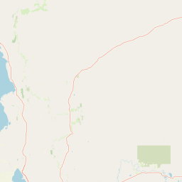
Map view of Hogwash Bend Conservation Park

Use this park location map to pinpoint Hogwash Bend Conservation Park in Australia, understand its exact geographic position, and read its mapped placement within the surrounding landscape more clearly.

Pigeon | © OpenStreetMap contributors

Location context for Hogwash Bend Conservation Park

South Australia
Park atlas

Discover related river corridor reserves and connected habitats across the Riverland region

Explore Parks Near Hogwash Bend Conservation Park and Surrounding Protected Landscapes

Browsing other protected areas near Hogwash Bend Conservation Park reveals broader regional patterns in river red gum floodplains and mallee woodland. Comparing adjacent reserves helps trace the continuity of riparian wildlife habitats across the Murray River corridor.
Wildlife reserveSouth Australia
About 36 km away#1 closest

Northeast

Taylorville Station Wildlife Reserve: Mallee Woodland Map and Regional Geography

Protected mallee landscapes in the Murray-Mallee, South Australia.

Taylorville Station provides a critical refuge for mallee-dependent species within its 92 square kilometres of semi-arid woodland. As a cornerstone of the Riverland Biosphere Reserve, this protected area in South Australia offers a unique look at the ecological significance of the Murray-Mallee region's persistent eucalypt vegetation and habitat management frameworks.

Area
92.6 km²
Established
2005
IUCN
IV
Visitors
2.7K annual
A horizontal watercolor illustration of a sparse woodland landscape with low shrubs and trees against a pale, soft-colored background.
Wildlife reserveSouth Australia
About 44 km away#2 closest

Southwest

Brookfield Conservation Park Wildlife Reserve and Murray-Mallee Landscape Context

South Australia regional protected area geography

Brookfield Conservation Park is a focused wildlife reserve situated in the semi-arid interior of South Australia. The area features a distinct mix of open mallee woodland and shrublands, serving as a sanctuary for the endangered southern hairy-nosed wombat. Beyond its conservation value, the terrain retains historical evidence of past charcoal production and pastoral land use, offering a layered view of ecological and industrial history.

Established
1978
IUCN
III
Relief
Lowland
Scope
Terrestrial
National parkSouth Australia
About 50 km away#3 closest

Southeast

Murray River National Park: Protected Wetland Ecosystems in South Australia

Explore South Australia's unique river red gum floodplains.

Murray River National Park is a significant protected area in South Australia, renowned for its expansive wetland and floodplain environments situated along the Murray River. This national park preserves crucial habitats within the Murray-Darling Basin, characterized by river red gum woodlands, permanent water bodies, and dynamic seasonal floodplains. Its detailed maps and geographic context offer deep insights into one of Australia's most important riverine conservation landscapes.

Area
148.79 km²
Established
1991
IUCN
VI
Relief
Lowland
Wildlife reserveSouth Australia
About 60 km away#4 closest

Southwest

Yookamurra Sanctuary: A Wildlife Reserve within the Murraylands Geography of South Australia

Mapped protected landscape and arid-zone conservation terrain

Yookamurra Sanctuary acts as a protected island of native vegetation within the heavily modified agricultural landscape of South Australia. Defined by its gently undulating terrain and calcrete-influenced mallee woodlands, this reserve provides a essential habitat for arid-zone fauna. The sanctuary offers a focused look at how private conservation maintains biodiversity in the transitional zone between the Mount Lofty Ranges and the Murray River.

Area
50.55 km²
IUCN
IV
Relief
Lowland
Climate
Mediterranean
State or regional parkSouth Australia
About 73 km away#5 closest

East

Cooltong Conservation Park: Geography and Protected Mallee Woodland in South Australia

A regional conservation area defined by dune and shale flat topography

Cooltong Conservation Park is a protected state area in South Australia's Riverland. It features 37 square kilometres of mallee shrubland shaped by undulating dunes and shale flats. This conservation landscape is a recognized stronghold for birdlife, particularly the iconic Malleefowl, offering an authentic look at Australia's inland semi-arid terrain and its ecological connectivity.

Area
37.1 km²
Established
1993
IUCN
VI
Relief
Lowland
Nature reserveSouth Australia
About 74 km away#6 closest

Northeast

Calperum Station Nature Reserve: Mallee Landscapes and Riverland Wetlands in South Australia

Detailed geographic overview of a major Australian nature reserve.

Spanning over 2,300 square kilometers, Calperum Station preserves a vital stretch of mallee woodland and Murray River floodplain. This nature reserve serves as an international site for wetland conservation and provides a crucial stronghold for threatened bird species. The mapped area highlights the intersection of dryland dune-field ecology and riparian corridors, offering insight into large-scale habitat restoration.

Area
2,386 km²
Established
1993
Relief
Lowland
Climate
Arid
Protected areaSouth Australia
About 78 km away#7 closest

Southeast

Kapunda Island Conservation Park: Atlas and Geographic Context of a Murray River Reserve

A protected sand-bar island in the South Australian Riverland

Located in the Murray River near Loxton, Kapunda Island Conservation Park serves as an important example of a riverine island environment. This protected area provides essential habitat, featuring river red gum woodland and lignum understorey that support local waterbird populations and regional biodiversity patterns.

Area
0.01 km²
Established
1968
IUCN
III
Relief
Lowland
Watercolor painting of a rolling, hilly landscape with sparse trees against a pale, soft-toned sky.
Nature reserveSouth Australia
About 93 km away#8 closest

Southwest

Kaiserstuhl Conservation Park: Protected Nature Reserve in the Barossa Ranges

Mapping the forest ridges and hill country of South Australia

Kaiserstuhl Conservation Park preserves a distinctive segment of forested ridge and valley terrain within the Mount Crawford Forest. Situated near the Heysen Trail in South Australia, this nature reserve focuses on the protection of its 600-metre namesake peak, providing a clear geographic landmark within the eastern Barossa Ranges.

Area
4.35 km²
Established
1979
IUCN
III
Visitors
7.5K annual

Common questions about visiting, size, designation, and location context for Hogwash Bend Conservation Park

Hogwash Bend Conservation Park FAQs for park facts, access, geography, and protected area context

Find quick answers about Hogwash Bend Conservation Park, including protected-area facts, park geography, trail and visitor context, and how the park fits into its surrounding country and regional landscape.
MoriAtlas Explorer

Continue Your Protected Areas Search Across the Global Atlas

Deepen your exploration by continuing the structured search for national parks and protected areas worldwide. Utilize the comprehensive filtering capabilities to compare different conservation landscapes and refine your understanding of global park geography. Discover more about the distribution and characteristics of protected natural areas.

Global natural geography