
Mori Atlas logo
Nature reserveHollerland

A low-lying cultural landscape defined by medieval drainage networks and rare inland saline habitats

Hollerland Nature Reserve: Exploring the Historic Marshland Landscapes of Bremen, Germany

(Naturschutzgebiet Westliches Hollerland (Leher Feld))

Hollerland represents a significant protected nature reserve within the city-state of Bremen, preserving a historic marshland fragment cultivated by settlers since the twelfth century. The terrain is characterized by a dense, 90-kilometer-long network of drainage ditches that wind through damp meadows, creating vital conditions for diverse meadow birds and dragonfly communities. Beyond its cultural heritage, the reserve features the unique Pannlake, an inland saline spring that supports brackish-water flora typically found in coastal environments.

wetland nature reservewet grasslandmeadow birdsdragonfly habitatamphibiansinland saline spring
Digital vector illustration of a valley featuring a large cliffside waterfall, a winding river, and surrounding evergreen forests.

Hollerland

Nature reserve

Park overview

Structured park overview, official facts, and landscape profile for Westliches Hollerland

Westliches Hollerland park facts, protected area profile, and essential visitor context

Review the core facts for Westliches Hollerland, including designation, size, terrain, visitor scale, habitats, and operating context in one park-focused overview.

About Westliches Hollerland

Westliches Hollerland occupies a flat, low-lying stretch of countryside within the city limits of Bremen, sandwiched between expanding suburbs and the surviving rural margins of the Wümme river floodplain. Although suburban Bremen grew rapidly outward from the 1960s onward, this western fragment of the older Hollerland cultural landscape was spared from large-scale development through a long-running campaign by local conservationists and residents.

The reserve is shaped by centuries of human intervention. Medieval settlers from the Netherlands drained and cultivated the original marshland, creating a finely patterned mosaic of meadows, ditches, lanes, and small woodlands. That ditchescape, around 90 kilometers of carefully maintained channels, remains the structural backbone of the area and the reason it continues to function as high-quality habitat for wetland species.

Ecologically, the area blends wet grassland, reedbeds, scattered woodland fragments, small ponds, and the unusual saline Pannlake, allowing coastal-style vegetation and salt-tolerant plants to occur far from the sea. Its location at the edge of Bremen, its ecological richness, and the strong citizen-led fight to keep it undeveloped together define its modern identity as both a living agricultural landscape and a strictly protected nature reserve.

Quick facts and research context for Westliches Hollerland

Located in the Horn-Lehe district of Bremen, the Westliches Hollerland nature reserve covers 293 hectares and forms the third-largest protected area within the city-state. It is bordered roughly by Kuhgrabenweg, Lehesterdeich, Hollergrund, and the A 27 motorway, and adjoins the Untere Wümme nature reserve to the north.

The protected area was formally designated on 3 April 1985 with an expansion in 1991, and in 2004 it was placed under the EU Fauna-Flora-Habitats Directive. Internationally it is classified as an IUCN Category IV Habitat/Species Management Area. The reserve is managed as a wet-grassland landscape, with traditional mowing and grazing practices maintained alongside its historic drainage system.

Protection and recognition

Documented terrestrial boundaries, management scope, and Natura 2000 records

Hollerland Protection Status and Official International Recognition

Hollerland maintains a documented terrestrial protection status supported by official Natura 2000 designation records. Readers can review recorded administrative boundaries and international recognition sources for this protected area.

International recognition

Protection details

Protection scope
Terrestrial
Transboundary protection
No
Park context

Deeper park guide and search-rich context for Westliches Hollerland

Westliches Hollerland history, landscape, wildlife, and travel context

Explore Westliches Hollerland through its history, landscape character, ecosystems, wildlife, conservation priorities, cultural context, and seasonal travel timing in a structured park guide built for atlas discovery and search intent.

Why Westliches Hollerland stands out

Westliches Hollerland is best known for being one of the most important meadow-bird breeding and resting areas in the Bremen region, set within an unusually well-preserved wet cultural landscape. Dense networks of drainage ditches, shallow depressions, and small open waters create habitat for curlews, lapwings, redshanks, snipe, amphibians, and an unusually rich dragonfly community that includes roughly 26 recorded species. The reserve also stands out for the Pannlake, a small inland saline spring rooted in the Lilienthal salt dome, which supports coastal-like vegetation such as strawberry clover, sea rush, and brackish reedbeds far inland. Together, these ecological and cultural features give the area a distinctive character within northern Germany's protected-area network.
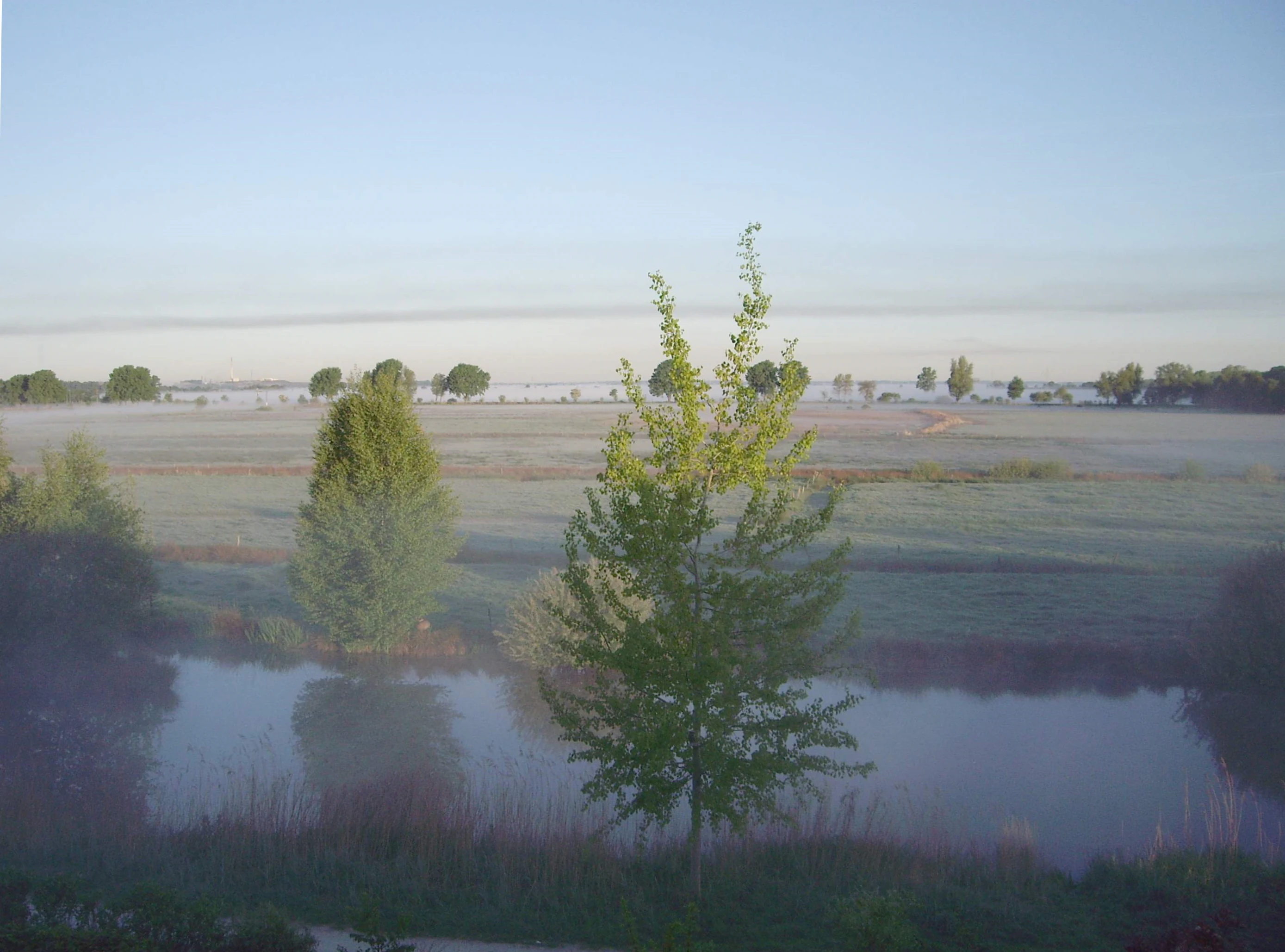
A hazy, misty morning view of a flat, grassy wetland landscape with a small pond in the foreground and sparse trees in the distance.
Early morning mist covering the flat wetlands of Hollerland.

Westliches Hollerland history and protected-area timeline

The history of the Hollerland begins in 1106, when six settlers from Utrecht arrived in Bremen during the reign of King Heinrich IV. Led by a priest named Heinrich, they negotiated with Archbishop Friedrich I to drain and cultivate the surrounding marshy wasteland. Under their contract, each settler paid an annual penny per hide and surrendered a tithe of the yield, while gaining the unusual privilege of the so-called Hollerrecht, which allowed them to settle their own civil disputes without interference from outside judges. The settlement was first called Hollandria, or Nova terra, around 1188.

The area was governed first by the Welfs, then by the Archbishop of Bremen from 1219, and became a rural municipality of Bremen in the early thirteenth century. By the fourteenth century it was administered as a Goh, a regional judicial district, with its court meeting at the Uppe Angst site in Rockwinkel. In 1598 the Hollerland was merged administratively with the neighboring Blockland; the 1741 Second Stade Compromise shifted parts of the combined region to Hanoverian authority, but Bremen regained full sovereignty after the 1803 Reichsdeputationshauptschluss.

The modern protection story began in the 1960s, when the Neue Heim development company acquired large tracts of the area for a planned satellite city of around 50,000 residents called the Hollerstadt. After years of protests led from 1978 onward by the Bürgerinitiative für die Erhaltung des Hollerlandes, founded by Gerold Janssen, Pastor Friedrich Bode, and Dieter Stratmann, the plans were eventually abandoned. In 1985, more than three-quarters of the western Hollerland was formally designated as a nature reserve, with an extension in 1991. In 2004, after more than twenty-five years of political struggle, the 293-hectare reserve was finally placed under the European Union Fauna-Flora-Habitats Directive, cementing its long-term protection.

Westliches Hollerland landscape and geographic character

The Westliches Hollerland is an exceptionally flat, low-lying landscape shaped almost entirely by water management. The terrain consists of a fine mosaic of damp meadows, narrow ditches, scattered reedbeds, small woodland patches, and gently undulating sinks and ponds. Roads and lanes such as Kuhgrabenweg, Lehesterdeich, and Hollergrund frame the reserve, while the A 27 motorway forms a hard boundary to the south.

The dominant feature is the historic ditch network, roughly 90 kilometers in total length, originally cut by medieval settlers to drain the marshland and still actively maintained today. These channels give the landscape its characteristic linear, comb-like appearance and create the hydrological conditions on which nearly all of the area's ecological value depends.

A particularly unusual feature is the Pannlake, a small inland saline spring connected to the Lilienthal salt dome underground. Its brackish water supports a community of salt-tolerant plants and vegetation types otherwise associated with coastal North Sea habitats, creating an ecological anomaly deep inside the Bremen countryside.

Westliches Hollerland ecosystems, habitats, and plant life

The nature reserve functions primarily as an extensively managed, wet grassland landscape, in which traditional mowing and grazing interact with an artificial but ecologically essential ditch system. More than forty plant species from Germany's Red List of threatened species have been recorded here, including strawberry clover, sea rush, and stands of sea club-rush that give the Pannlake a coastal feel far from the sea.

The habitat mosaic supports several distinct vegetation communities: wet meadows, reedbeds, brackish-water vegetation around the saline spring, and small relict woodlands such as the Hollerwald. Together these create transitional zones between open water, marsh, pasture, and scrub that are increasingly rare in an intensively used region like northwestern Germany.

Westliches Hollerland wildlife and species highlights

Westliches Hollerland is recognized as one of the most valuable breeding grounds for meadow birds in the Bremen region. Curlews, snipe, lapwings, and redshanks nest in the wet grasslands, while the area also serves as a significant resting stopover for migratory waterfowl moving along the North Sea flyway.

The dense network of ditches, pools, and shallow depressions supports a rich amphibian population and an exceptionally important insect fauna. Roughly 26 dragonfly species have been recorded, including the green hawker, which is closely tied to the water-soldier plant abundant in the reserve's ditches. Among the fishes living in the channels are threatened species such as moderlieschen, weatherfish, and European mudminnow, all of which are nationally rare in Germany.

The Pannlake adds another layer of biological interest: its saline-brackish conditions support a specialized flora and fauna more typical of coastal salt marshes, giving the reserve an unusually broad ecological spectrum within a small area.

Westliches Hollerland conservation status and protection priorities

The Westliches Hollerland is protected for its combination of surviving cultural landscape, hydrological heritage, and threatened wetland biodiversity. Its conservation value rests on the unusually intact relationship between the medieval drainage system and the species-rich wet grassland, reedbed, and brackish habitats that depend on it.

Following its 1985 designation and 1991 extension as a nature reserve under Bremen law, the area received European-level protection in 2004 when it was placed under the EU Habitats Directive (Fauna-Flora-Habitats Directive). This higher international status marked the end of a more than 25-year political struggle and tied the long-term management of the reserve to European nature conservation obligations.

The reserve also embodies an unusual model of citizen-led conservation. The Bürgerinitiative für die Erhaltung des Hollerlandes not only campaigned for its legal protection but also influenced on-the-ground management decisions, including the 1989 Hollerland compromise that drew the final boundary between developable land and protected meadow and woodland.

Westliches Hollerland cultural meaning and human context

The cultural identity of the Hollerland is rooted in the medieval Dutch colonization of the Bremen marshes, known as the Hollerkolonisation. Beginning in the early twelfth century, settlers from Utrecht introduced distinctive techniques of land reclamation, field layout, and self-governance that left a durable imprint on the region's landscape and institutions.

The settlers' privileges, codified in the so-called Hollerrecht, gave them unusual autonomy over their own legal affairs and shaped the region's medieval judicial history, including the centuries-old Gohgericht that met at the Uppe Angst meeting site in Rockwinkel. Today's place names, field patterns, and parish divisions across Horn-Lehe, Oberneuland, Borgfeld, and Osterholz still reflect this medieval territorial structure.

The late-twentieth-century fight to save the Westliches Hollerland from urban development added a second, modern layer of cultural meaning. The campaign by Gerold Janssen and the citizen initiative became a defining story for Bremen's environmental movement, and the eventual designation of the reserve is also remembered as a milestone in the city's postwar planning history.

Top sights and standout views in Westliches Hollerland

The reserve's standout qualities are its exceptionally dense, historically rooted ditch network; its status as one of the most important meadow-bird breeding and migration sites in the Bremen region; its unusually rich dragonfly and amphibian fauna, including 26 recorded dragonfly species; and the inland saline Pannlake, whose brackish water supports coastal-like vegetation far from the sea.

The area also stands out for being protected at both regional and European levels, combining local nature reserve status under Bremen law with EU Habitats Directive coverage secured in 2004.

Best time to visit Westliches Hollerland

Late spring and early summer are the most rewarding seasons for visiting Westliches Hollerland, when the wet meadows host breeding meadow birds and the ditches and ponds reach high levels of amphibian and dragonfly activity. Early mornings in this period are particularly distinctive, when fog often hangs over the flat meadows and the birdlife of the area is most vocal.

In autumn the meadows take on a quieter character, while migratory waterfowl use the pastures and ditches as a staging area. Winter visits are possible but are more about open landscape, frost, and stillness than about active wildlife observation.


Monthly climate preview

Long-term representative point measurements across monthly temperature and precipitation cycles

Hollerland Climate Normals, Annual Temperature and Precipitation Rhythm

Representative point records for Hollerland outline measured monthly temperature swings and precipitation rates derived from multi-year climatology averages. Reviewing the complete twelve-month profile provides deeper context for annual meteorological patterns across the protected landscape.
Annual mean9 °C
1 °C18 °C
Jan
Feb
Mar
Apr
May13°
Jun16°
Jul18°
Aug18°
Sep14°
Oct10°
Nov
Dec
Warmest month
July

18 °C

Coolest month
January

1 °C

Wettest month
July

2.5 mm/day

Driest month
April

1.4 mm/day

Park location guide

Geography guide, regional context, and park location map for Westliches Hollerland

Westliches Hollerland park geography, regions, and map view in Germany

Understand where Westliches Hollerland sits in Germany through a broader geographic reading of the surrounding landscape, nearby location context, and its mapped position within the national park landscape.

How Westliches Hollerland fits into Germany

Germany is a federal republic in Western and Central Europe with a population of over 83 million across sixteen constituent states. It is Europe's largest economy by nominal GDP and a major global exporter and importer. The capital is Berlin, and the country borders Denmark, Poland, Czech Republic, Austria, Switzerland, France, Luxembourg, Belgium, and the Netherlands.

Wider geography shaping Westliches Hollerland in Germany

Germany is located in Western and Central Europe, spanning 357,022 km². It borders Denmark to the north, Poland and the Czech Republic to the east, Austria and Switzerland to the south, and France, Luxembourg, Belgium, and the Netherlands to the west. The country has coastlines on the Baltic Sea and North Sea to the north, with the Alps located in the southern region.

Map view of Westliches Hollerland

Use this park location map to pinpoint Westliches Hollerland in Germany, understand its exact geographic position, and read its mapped placement within the surrounding landscape more clearly.

Pigeon | © OpenStreetMap contributors

Location context for Westliches Hollerland

Bremen
Recorded earthquake history

Review the Hollerland Earthquake History and Recorded Regional Seismic Catalogue

Access a structured collection of historical seismic events associated by location with the Hollerland nature reserve. This catalogue provides direct insight into recorded magnitudes and event depths, helping enthusiasts analyze historical seismic patterns within the Bremen landscape through the MoriAtlas data framework.

Hollerland Earthquake History

Catalogued events

3 events

Strongest magnitude

Magnitude 4.5

Most recent event

Jul 15, 2005

This history includes earthquakes recorded inside the park or within 50 km of its borders

Visualizing the marshland terrain, drainage networks, and wet grassland habitats

Hollerland Photos and Protected Landscape Scenery

Visual documentation of Hollerland reveals the intricate drainage ditch networks and flat marshland terrain that define this regional nature reserve. Examining these protected area photographs provides clear insight into the wet grassland habitats, seasonal ponds, and historical cultural landscapes preserved in northwestern Germany.

A hazy, misty morning view of a flat, grassy wetland landscape with a small pond in the foreground and sparse trees in the distance.

Park atlas

Compare surrounding lowland reserves and connected marshland landscapes in northwestern Germany.

Parks Near Hollerland, Exploring Related Protected Areas and Regional Wetlands

Browse other protected areas near Hollerland to examine similar wet grasslands, drainage networks, and regional lowland habitats. Comparing adjacent nature reserves reveals broader ecological patterns across the surrounding Bremen countryside and northern Germany.
Nature reserveBremen
0 km away#1 closest

West

Kuhgrabensee Nature Reserve: Mapped Geography and Protected Areas in Bremen

An ecologically vital lake and bird sanctuary in Northwest Germany

Kuhgrabensee serves as a prime example of landscape restoration within Bremen, featuring a groundwater-fed lake with notable saline influences. This protected area supports a diverse array of pioneer plants and wildlife across its reed-lined shores and shallow-water habitats, providing a quiet corridor for ecological observation and study in the heart of the local landscape.

Area
0.296 km²
Established
1987
Relief
Lowland
Climate
Temperate
Nature reserveBremen
0.1 km away#2 closest

Northwest

Untere Wümme Nature Reserve: Riverine Biodiversity and Protected Tidal Landscapes in Bremen

Protected floodplain geography and tidal river habitats.

This nature reserve protects the meandering lower course of the Wümme river, showcasing one of northern Germany's few freshwater tidal systems. Spanning reedbeds, willow forests, and open mudflats, the reserve forms a vital corridor for migratory fish and waterfowl, reflecting a complex mosaic of protected riverine ecosystems and historic meadow landscapes.

Area
1.485 km²
Established
1991
Relief
Lowland
Climate
Temperate
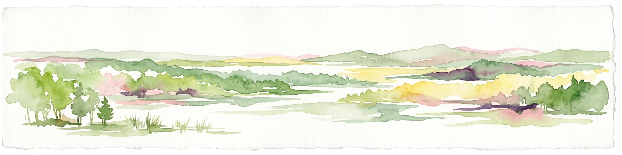
A watercolor painting showing a serene landscape with calm water, small islands of trees, and rolling hills in the background.
Nature reserveBremen
About 0.9 km away#3 closest

West

Am Stadtwaldsee (Uni-Wildnis) Nature Reserve: Geographic Atlas and Park Map Context

Protected secondary habitat landscape in Bremen, Germany

Located in Bremen, the Am Stadtwaldsee (Uni-Wildnis) nature reserve offers a compelling study of secondary ecological succession. The area features a dense concentration of ponds and wooded ground shaped by historical sand mining. Explore the mapped boundaries of this eleven-hectare refuge to understand its role in urban biodiversity and regional landscape conservation.

Area
0.114 km²
Established
1991
IUCN
IV
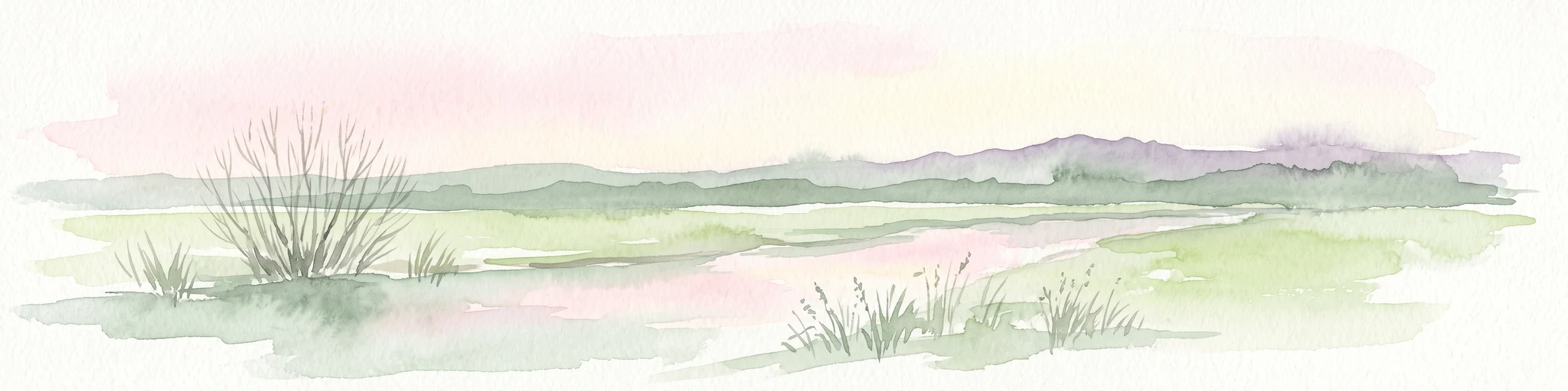
A pale, soft-toned watercolor illustration of a calm river meandering through open, green marshy meadows with distant rolling hills under a soft pink sky.
Nature reserveBremen
1.4 km away#4 closest

East

Borgfelder Wümmewiesen: Protected Wetland and Floodplain Geography in Bremen

An expansive 688-hectare nature reserve with river-fed grasslands.

Borgfelder Wümmewiesen offers a look at one of the largest protected nature reserves in the Bremen region. The landscape is characterized by its flat, open terrain and regular water dynamics that frame a rich mosaic of wet meadows, reedbeds, and ponds, providing essential habitat for breeding and migratory bird species along the Wümme river corridor.

Area
6.88 km²
Established
1987
Relief
Lowland
Climate
Temperate
Nature reserveLandkreis Osterholz
About 6.9 km away#5 closest

North

Westliche Hälfte des Langen Moores Nature Reserve in Landkreis Osterholz

A protected mosaic of highmoor peatland geography

Examine the distinct ecological features of Westliche Hälfte des Langen Moores, a protected nature reserve in Landkreis Osterholz. This site offers a compact look at highmoor regeneration and the diverse plant communities found within the historic Teufelsmoor cultural landscape of northern Germany.

Area
0.11 km²
Established
1984
IUCN
IV
Nature reserveBremen
About 7.3 km away#6 closest

South

Vogelschutzgebiet Arsten-Habenhausen: Mapping the Protected Weser Floodplain Habitat

A historic urban nature reserve located in Bremen

Located in the Habenhausen district of Bremen, Vogelschutzgebiet Arsten-Habenhausen is a significant protected area focused on river floodplain maintenance. The site provides a concentrated view of floodplain woodland and reedbed vegetation, illustrating how small, long-established nature reserves contribute to the regional geography of the Weser river corridor in Germany.

Area
0.01 km²
Established
1950
IUCN
IV
Relief
Lowland
Watercolor painting of a wide, rolling landscape with green trees, golden fields, and soft hills in the background.
Protected areaGermany
8.3 km away#7 closest

Southeast

Krietes Wald (Im Holze) Protected Area: Landscape and Geographic Atlas Summary

A critical urban forest node in the Bremen region of Germany.

Krietes Wald (Im Holze) serves as a significant nature reserve characterized by its mature beech and oak-hornbeam woodland. Spanning a narrow, protected corridor in eastern Bremen, the site provides dense habitat value within an industrial landscape. It stands as a regional reference for saproxylic insect conservation and structural forest development within the federal republic of Germany.

Area
0.083 km²
Established
2015
Relief
Lowland
Climate
Temperate
A watercolor painting showing a soft, panoramic view of a flat wetland area with green trees, a solitary tree in the middle, and industrial silos faintly visible in the background.
Nature reserveBremen
About 8.3 km away#8 closest

West

Hochwasserschutzpolder zwischen Senator-Apelt-Straße und Neustädter Hafen: Bremen Protected Lands

A vital wetland reserve integrating flood management and avian biodiversity in the port district.

Located within the port district of Bremen, the Hochwasserschutzpolder zwischen Senator-Apelt-Straße und Neustädter Hafen is a notable protected area that balances essential flood-control infrastructure with rich ecological functions. The reserve sustains a variety of wetland bird populations across its reed-lined waters and alluvial woodlands, providing a critical haven for wildlife amidst the surrounding industrial and urban development of the Lower Weser region.

Area
0.847 km²
Established
2014
IUCN
IV

Common questions about visiting, size, designation, and location context for Westliches Hollerland

Westliches Hollerland FAQs for park facts, access, geography, and protected area context

Find quick answers about Westliches Hollerland, including protected-area facts, park geography, trail and visitor context, and how the park fits into its surrounding country and regional landscape.
MoriAtlas Explorer

Continue Your Protected Areas Search Across the Global Atlas

Deepen your exploration by continuing the structured search for national parks and protected areas worldwide. Utilize the comprehensive filtering capabilities to compare different conservation landscapes and refine your understanding of global park geography. Discover more about the distribution and characteristics of protected natural areas.

Global natural geography