
Mori Atlas logo
Protected landscapeHolly Springs National Forest

Examining the pine-covered ridges, bottomland hardwood swamps, and watershed geography of this restored forest.

Holly Springs National Forest: A Mapped Exploration of Northern Mississippi Protected Landscapes

Holly Springs National Forest serves as a prominent example of ecological restoration in the north central hills of Mississippi. This federal protected area spans roughly 155,000 acres, showcasing a landscape transformed from eroded agricultural land into a thriving mosaic of loblolly pine, shortleaf pine, and hardwood forests. The forest encompasses a diverse range of terrain, from high pine-clad ridges to saturated bottomland swamps along the Wolf River, creating a unique geographic profile for regional conservation.

national forestu.s. forest servicereforestationpine forestloblolly pineshortleaf pine
A stylized vector illustration of a forested lake scene with tall trees, cypress-like knees, and rocky cliffs in the distance under a pale sky.

Holly Springs National Forest

Protected landscape

Park overview

Structured park overview, official facts, and landscape profile for Holly Springs National Forest

Holly Springs National Forest park facts, protected area profile, and essential visitor context

Review the core facts for Holly Springs National Forest, including designation, size, terrain, visitor scale, habitats, and operating context in one park-focused overview.

About Holly Springs National Forest

Holly Springs National Forest is a U.S. Forest Service landscape in the north central hills of Mississippi, a region shaped historically by agriculture, erosion, and the subsequent effort to reclaim degraded land through forestry. The Holly Springs Ranger District controls about 155,661 acres of federal land within a broader proclamation zone of roughly 690,000 acres that also contains private farms, woodlots, and small communities. This intermixed ownership pattern is one of the defining structural characteristics of the forest and influences everything from wildlife habitat to recreation access.

The forest's physical identity is a mix of pine-covered ridges, mixed upland hardwood stands, and low-lying bottomland environments. The uplands were planted largely to loblolly pine, chosen for its ability to thrive in depleted soils, and supplemented by shortleaf pine and upland hardwoods. In the wetter lowlands and along streams such as the Wolf River, the forest transitions into bottomland hardwood swamps, providing a strong habitat contrast within a relatively compact landscape. Baker's Pond, near the northern tip of the forest, marks the headwaters of the Wolf River, which flows northward and westward before joining the Mississippi River at Memphis.

Recreation is woven through the forest at multiple sites. Chewalla Lake, Puskus Lake, and Lake Tillatoba provide reservoirs with campgrounds, picnic areas, swimming beaches, or combinations of these amenities. The Baker's Pond Hiking Trail and North Cypress Non-Motorized Trail offer additional hiking opportunities, and the Forest Service has worked with the Wolf River Conservancy since 1999 to expand trail access around the river's source. Within the broader administrative structure of the U.S. Forest Service in Mississippi, Holly Springs National Forest is grouped with Bienville, De Soto, and Homochitto under the umbrella name National Forests in Mississippi, though on the ground it functions through the Holly Springs Ranger District headquartered in Oxford.

Together, the forest's restoration history, ecological diversity, and patterned land ownership make it a meaningful example of twentieth-century conservation in the southeastern United States.

Quick facts and research context for Holly Springs National Forest

Holly Springs National Forest was proclaimed and established by the U.S. Forest Service on June 15, 1936, during the tenure of USDA Chief Forester Ferdinand A. Silcox. Its federally administered lands total about 155,661 acres (roughly 243 square miles), embedded within a much larger proclamation zone of nearly 690,000 combined federal and private acres. The forest lies in northern Mississippi and spans parts of Benton, Lafayette, Marshall, Yalobusha, Tippah, and Union counties, with its largest tract southeast of Holly Springs along U.S. Highway 78 and a separate southern unit in Yalobusha County.

The forest is managed by the Holly Springs Ranger District, headquartered in Oxford, Mississippi, and administered alongside three other Mississippi national forests under the collective name National Forests in Mississippi. It is a working pine-and-hardwood forest with recreation features that include Chewalla Lake, Puskus Lake, Lake Tillatoba, Baker's Pond, and several marked hiking trails.

Protection and recognition

Documented terrestrial protection scope and conservation management parameters

Holly Springs National Forest Protection Status and Terrestrial Conservation Data

Terrestrial protection status for Holly Springs National Forest outlines the established management scope and conservation parameters. Official administrative records document the baseline protected area framework without external international recognition sources.

Protection details

Protection scope
Terrestrial
Transboundary protection
No
Park context

Deeper park guide and search-rich context for Holly Springs National Forest

Holly Springs National Forest history, landscape, wildlife, and travel context

Explore Holly Springs National Forest through its history, landscape character, ecosystems, wildlife, conservation priorities, cultural context, and seasonal travel timing in a structured park guide built for atlas discovery and search intent.

Why Holly Springs National Forest stands out

Holly Springs National Forest is best known as a striking example of large-scale ecological restoration in the Deep South. Its rolling hills, once stripped of cover and farming viability, were replanted primarily in loblolly and shortleaf pine, producing the characteristic pine-dominated landscape that defines much of the modern forest. The Civilian Conservation Corps plantings remain a foundational chapter of the area's identity. The forest is also recognized for its unusual checkerboard land pattern, with federal tracts of pine and hardwood interspersed among roughly 530,000 acres of private farms and woodlots. Beyond its pine uplands, the area contains bottomland hardwood swamps along streams such as the Wolf River, whose headwaters originate within the forest. Recreation resources including Chewalla Lake, Puskus Lake, and Lake Tillatoba further distinguish it as a versatile outdoor destination in northern Mississippi.
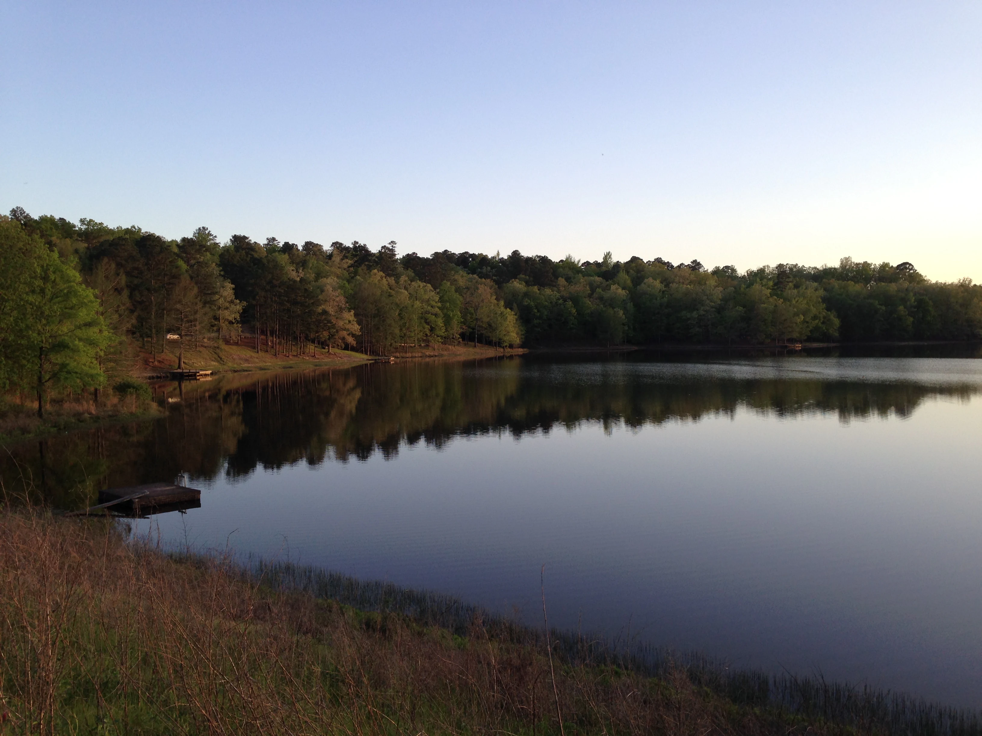
A wide, calm lake surrounded by a dense forest under a soft, clear sky at dusk.
A serene view of Puskus Lake at sunset within Holly Springs National Forest.

Holly Springs National Forest history and protected-area timeline

Holly Springs National Forest was established by the U.S. Forest Service on June 15, 1936, under the leadership of USDA Chief Forester Ferdinand A. Silcox. In the same year, it was combined administratively with the Bienville, De Soto, and Homochitto national forests under the collective title National Forests in Mississippi, establishing the multi-unit management arrangement that continues today.

By the time of its creation, much of the land within the forest's eventual boundaries had already been abandoned as farmland. Decades of cultivation had stripped hillside soils and left large areas prone to severe erosion. The Civilian Conservation Corps responded by planting loblolly pine across the rolling hills, taking advantage of the species' tolerance for poor soils, ease of establishment, and heavy needle litter that helped slow further erosion. These early plantings, supplemented by shortleaf pine and upland hardwoods, formed the foundation of the present-day forest cover and shaped much of the local timber identity of the region.

In 1983, the Reagan administration proposed auctioning off the entire Holly Springs National Forest to private bidders as part of a federal asset management initiative. The proposal generated significant attention, but the plan was ultimately largely abandoned, and the forest remained under Forest Service stewardship. In more recent decades, beginning in 1999, the Forest Service has partnered with the Wolf River Conservancy to expand hiking trail development around Baker's Pond and the headwaters of the Wolf River, marking a continuing evolution of the forest's public role beyond timber management.

Holly Springs National Forest landscape and geographic character

Holly Springs National Forest occupies part of the north central hills of Mississippi, a region of rolling topography shaped by long agricultural use and post-Depression reforestation. The forest is divided into two main sections. The larger section lies southeast of the city of Holly Springs and straddles U.S. Highway 78, while a separate tract of roughly 20,776 acres sits about 40 miles to the southwest in Yalobusha County, between Coffeeville and Oakland, near Interstate 55. Together these sections span portions of Benton, Lafayette, Marshall, Yalobusha, Tippah, and Union counties.

The terrain is defined by the contrast between pine-clad uplands and hardwood-dominated lowlands. The hillsides carry extensive plantations of loblolly pine from the Civilian Conservation Corps era, alongside naturally regenerating shortleaf pine and upland hardwoods. In valley bottoms and along the Wolf River corridor, the landscape shifts into bottomland hardwood swamp, with standing water, mixed hardwood canopy, and slow-moving channels like Tubby Creek. The presence of lakes including Chewalla Lake, Puskus Lake, and Lake Tillatoba, plus small impoundments such as Baker's Pond, adds additional water-based scenery to the broader forest setting.

Holly Springs National Forest ecosystems, habitats, and plant life

Ecologically, Holly Springs National Forest sits at the meeting point of pine uplands and hardwood lowlands, a habitat transition typical of north central Mississippi but here reinforced by deliberate reforestation. The loblolly pine plantations of the uplands are interspersed with shortleaf pine and upland hardwoods, creating a varied canopy structure across the hills. The original choice of loblolly pine was both practical and ecological: it tolerated eroded soils, established readily, and contributed heavy needle litter that helped stabilize the land.

In the lower portions of the forest, particularly where Tubby Creek meets the Wolf River near Ashland, the vegetation shifts into bottomland hardwood swamp, with species adapted to periodic flooding and saturated soils. This swamp habitat, contained within a largely pine-dominated forest, gives the area exceptional ecological diversity for its size. The forest also functions as the headwaters of the Wolf River, with Baker's Pond marking the river's source and supporting wetland and riparian habitats that connect northward into West Tennessee.

The intermixed pattern of federal forest land and surrounding private farms and woodlots further shapes ecological conditions. The roughly 530,000 acres of private land within the proclamation zone create edge habitats, openings, and a mosaic of cover types that complements the more contiguous federal tracts.

Holly Springs National Forest wildlife and species highlights

Holly Springs National Forest supports wildlife communities representative of both upland pine and bottomland hardwood environments in the upper South. Pine-dominated ridges provide habitat for species associated with southern pine forests, while the bottomland hardwood swamps along the Wolf River and Tubby Creek support wetland-dependent wildlife. The forest's combination of open pine stands, regenerating forest, hardwood bottomlands, and aquatic habitats around its lakes and ponds creates conditions for a broad mix of resident species.

The presence of headwater wetlands at Baker's Pond and along the upper Wolf River adds particular value for amphibians, aquatic species, and other wetland-associated wildlife. The surrounding agricultural and private forest matrix further contributes to habitat diversity, supporting game species, songbirds, and other common Mississippi woodland fauna. While the source material emphasizes habitat patterns rather than species inventories, the forest's ecological structure points to a typical and reasonably rich wildlife profile for the region.

Holly Springs National Forest conservation status and protection priorities

Holly Springs National Forest stands as a major conservation success story of the mid-twentieth century in Mississippi. Its establishment in 1936 followed decades of agricultural abandonment and erosion across the north central hills, and its subsequent reforestation through the Civilian Conservation Corps marked one of the more ambitious land recovery efforts in the region. The heavy use of loblolly pine in that effort was explicitly designed to stabilize damaged soils while reestablishing forest cover.

The forest continues to serve conservation purposes through its protection of pine uplands, hardwood bottoms, and the headwaters of the Wolf River. Its proximity to and partnership with the Wolf River Conservancy, formalized beginning in 1999, extends its conservation role into downstream watershed protection in both Mississippi and Tennessee. The fact that the forest survived the 1983 federal proposal to auction it off underscores its recognized conservation and public value, and its grouping with other Mississippi national forests under coordinated Forest Service management has helped maintain its long-term protected status.

Holly Springs National Forest cultural meaning and human context

Holly Springs National Forest is closely tied to the agricultural and rural character of northern Mississippi. The land it occupies was once actively farmed, and the cycles of cultivation, abandonment, and subsequent reforestation define a regional history shared by many communities in this part of the state. Counties including Benton, Marshall, Tippah, Union, Lafayette, and Yalobusha each contribute to the forest's identity, with nearby cities such as Holly Springs, Oxford, Ashland, and Tupelo framing the cultural geography around it.

The Civilian Conservation Corps era represents an important cultural chapter, with Depression-era crews reshaping the landscape through reforestation work that has endured for nearly a century. Today, partnerships with conservation organizations such as the Wolf River Conservancy connect the forest to broader regional watershed stewardship traditions. While the forest does not carry strong associations with specific indigenous cultural sites in the available source material, its rural Southern context remains central to its cultural setting.

Top sights and standout views in Holly Springs National Forest

Holly Springs National Forest's strongest points of distinction are its origin as a landscape reborn from eroded farmland, its enormous scale of loblolly pine reforestation, and its unusual patchworked land ownership pattern. The forest's bottomland hardwood swamps, particularly along the Wolf River near Ashland, offer one of the more ecologically distinctive lowland environments in the region and serve as headwaters for a river that ultimately joins the Mississippi.

Recreation sites including Chewalla Lake, Puskus Lake, Lake Tillatoba, and Baker's Pond provide accessible outdoor experiences, while hiking opportunities at Baker's Pond and the North Cypress Non-Motorized Trail add variety. The forest's administrative grouping with Mississippi's other national forests and its longstanding connection to the communities of northern Mississippi further shape its role within the state's conservation and outdoor heritage.

Best time to visit Holly Springs National Forest

Northern Mississippi experiences mild winters and warm, humid summers, conditions that shape visits to Holly Springs National Forest across the year. Spring and fall are generally the most comfortable periods for hiking and exploring the forest's upland trails, when temperatures are moderate and the mix of pine and hardwood foliage is at its most visually varied. Fall in particular can bring clear skies, cooler air, and pleasant conditions around the recreation lakes.

Summer remains attractive for lake-based recreation such as swimming and picnicking at Chewalla Lake, Puskus Lake, and Lake Tillatoba, though visitors should expect warm temperatures and high humidity typical of the region. Winter visits tend to be quieter and cooler, with reduced foliage cover making the rolling terrain and mixed forest pattern easier to observe from roads and trails. Because specific operational details such as campsite hours or facility schedules are not covered in the source material, visitors should consult the U.S. Forest Service's Mississippi National Forests resources for current access information.
Monthly climate preview

Long-term temperature and precipitation patterns across representative coordinates

Holly Springs National Forest Climate Normals and Monthly Weather Records

Holly Springs National Forest exhibits a measured annual climate rhythm with average monthly temperatures spanning from cool winter minimums to warm summer maximums alongside steady precipitation. Examining the complete twelve-month record provides detailed monthly averages for tracking long-term temperature ranges and precipitation totals across the protected landscape.
Annual mean16 °C
4 °C28 °C
Jan
Feb
Mar11°
Apr16°
May21°
Jun25°
Jul28°
Aug27°
Sep24°
Oct17°
Nov10°
Dec
Warmest month
July

27.6 °C

Coolest month
January

4.3 °C

Wettest month
April

4.9 mm/day

Driest month
September

3.1 mm/day

Park location guide

Geography guide, regional context, and park location map for Holly Springs National Forest

Holly Springs National Forest park geography, regions, and map view in United States of America

Understand where Holly Springs National Forest sits in United States of America through a broader geographic reading of the surrounding landscape, nearby location context, and its mapped position within the national park landscape.

How Holly Springs National Forest fits into United States of America

The United States of America is a federal presidential republic and one of the world's largest countries by area and population. It consists of 50 states across a vast territory spanning multiple time zones, with its capital in Washington, D.C. and largest city in New York City. The nation has a diverse economy, influential political system, and significant cultural and military presence globally.

Wider geography shaping Holly Springs National Forest in United States of America

The United States occupies a vast territory in North America, bordered by Canada to the north and Mexico to the south. The 48 contiguous states stretch from the Atlantic to the Pacific Ocean, while Alaska occupies the northwestern region and Hawaii is an archipelago in the Pacific. The country encompasses diverse terrain including the Rocky Mountains, Appalachian Mountains, Great Plains, and extensive river systems.

Map view of Holly Springs National Forest

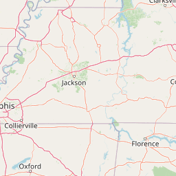
Use this park location map to pinpoint Holly Springs National Forest in United States of America, understand its exact geographic position, and read its mapped placement within the surrounding landscape more clearly.

Pigeon | © OpenStreetMap contributors

Location context for Holly Springs National Forest

Mississippi
Recorded earthquake history

Explore the Historical Earthquake Records for Holly Springs National Forest

Review documented seismic activity near the forest through a structured historical catalogue. Explore recorded events by date, magnitude, and location to understand the seismic context of the north central hills in Mississippi with this MoriAtlas resource.

Holly Springs National Forest Earthquake History

Catalogued events

2 events

Strongest magnitude

Magnitude 3.4

Most recent event

May 10, 2008

This history includes earthquakes recorded inside the park or within 50 km of its borders

Explore protected area photography highlighting pine ridges, bottomland swamps, and rolling hills.

Holly Springs National Forest Photos and Scenery: Visualizing the Restored Pine Landscapes

Visual documentation captures the varied terrain of Holly Springs National Forest, featuring restored pine uplands and hardwood-dominated lowlands. Photographic records help researchers examine ecological recovery patterns, watershed environments, and forest habitats across northern Mississippi.

A wide, calm lake surrounded by a dense forest under a soft, clear sky at dusk.

A wide view of a flooded forest with tall tree trunks emerging from the dark, still water of a swamp.

Park atlas

Compare nearby national forests and regional protected areas across northern Mississippi.

Exploring Parks Near Holly Springs National Forest and Surrounding Protected Landscapes

Browse other parks and protected areas sharing the surrounding regional geography of northern Mississippi. Expanding the search helps compare similar working forests, pine uplands, and watershed landscapes.
Protected landscapeMississippi
41 km away#1 closest

South

Tombigbee National Forest: Geographic Atlas and Protected Landscape Overview

Mapping the forest terrain and regional watershed in Mississippi

Tombigbee National Forest represents a complex protected landscape divided into two non-contiguous sections across northeastern Mississippi. From the pine-and-hardwood ridges of its northern unit to the reservoir-anchored southern portion, the forest offers a detailed case study in regional topography and watershed management within the southeastern United States.

Area
271.16 km²
Established
1959
Relief
Upland
Climate
Subtropical
Protected landscapeAlabama
129 km away#2 closest

East

William B. Bankhead National Forest: Cumberland Plateau Landscapes and Geography

Protected river gorges and forested ridges in northwestern Alabama

Covering extensive tracts across Lawrence, Winston, and Franklin counties, William B. Bankhead National Forest anchors the regional geography of the Cumberland Plateau. This atlas entry provides a detailed look at the forest's stream-carved terrain, limestone geology, and its central role in preserving the riparian corridors of the Sipsey Fork and its surrounding protected wilderness.

Area
733.4 km²
Established
1918
Relief
Upland
Scope
Terrestrial
A watercolor painting showing a stylized landscape with rolling green hills, a band of trees, and a pale pink lake surface under a soft morning sky.
Protected landscapeUnited States of America
184 km away#3 closest

North

Land Between the Lakes National Recreation Area: Mapped Geography and Protected Landscapes

An inland peninsula preserved between two major river reservoirs.

Land Between the Lakes National Recreation Area occupies a distinct narrow land bridge between Kentucky Lake and Lake Barkley. This protected landscape contains a dense mix of forested ridges, stream valleys, and managed wildlife prairies. The area is integral to the lower Ohio River Valley geography, showcasing the results of long-term watershed management and large-scale ecological restoration within the United States.

Area
693.1 km²
Established
1963
Visitors
2M annual
Relief
Lowland
National parkMissouri
234 km away#4 closest

Northwest

Mark Twain National Forest: Geography and Protected Area Atlas of Southern Missouri

Mapping the karst terrain and ancient ridges of the Ozark Highlands

Mark Twain National Forest represents a sprawling conservation area within the Missouri Ozark Highlands. Its geography is defined by volcanic mountain remnants, rocky glades, and significant river corridors like the Eleven Point National Scenic River. This record provides insight into the forest's complex mapped boundaries, seven designated wilderness areas, and the distinctive karst geology that characterizes this unique American landscape.

Area
6,037.3 km²
Established
1939
Relief
Upland
Climate
Temperate
Watercolor painting of a wide, rolling landscape featuring layered sandstone bluffs and green forested hills against a light background.
Protected landscapeIllinois
243 km away#5 closest

North

Shawnee National Forest: Exploring the Protected Landscapes of the Illinois Shawnee Hills

Mapped sandstone formations and glacial terrain in southern Illinois

Spanning nearly 289,000 hectares, Shawnee National Forest is the largest body of public land in Illinois. The area is defined by its dramatic sandstone bluffs, deep canyons, and seven designated wilderness areas that provide a rare rugged topography within the American Midwest. Explore the complex geography of this forest, from its glacial-sculpted river watersheds to its diverse hardwood habitats and historic reforestation sites.

Area
2,017.83 km²
Established
1933
Relief
Upland
Climate
Temperate
Wildlife reserveMissouri
About 246 km away#6 closest

North

Mingo Wilderness: Missouri Protected Wildlife Reserve and Wetland Geography

Primitive bottomland forest and swamp landscape

Mingo Wilderness encompasses 8,000 acres of protected bottomland hardwood forest and cypress-tupelo swamp in southeastern Missouri. As a federally designated wilderness area embedded within a national wildlife refuge, it provides a quiet, primitive habitat characterized by slow-moving creek corridors and varied seasonal wetlands.

Area
32 km²
Established
1976
IUCN
Ib
Relief
Lowland
Protected landscapeMississippi
248 km away#7 closest

Southwest

Homochitto National Forest: Mapping the Protected Landscapes of Southwestern Mississippi

Regional forest geography and landscape documentation.

Investigate the unique landscape of Homochitto National Forest, an extensive protected area in Mississippi defined by its loess-country topography and managed pine forests. This entry provides essential mapping context and geographic data for those examining the role of this forest within the broader Southeastern United States ecological network and its CCC-rooted heritage.

Area
776.34 km²
Established
1936
Relief
Upland
Scope
Terrestrial
A soft watercolor illustration featuring rolling green hills, a winding stream, and a forested treeline against a pale sky.
Wildlife reserveMissouri
261 km away#8 closest

Northwest

Irish Wilderness: Missouri Ozark Protected Area and Karst Landscape Atlas

Federally protected wilderness in the Eleven Point River landscape

Spanning the rugged terrain of the Missouri Ozarks, Irish Wilderness is a federally protected area known for its distinct karst geography. Visitors can study the network of caves, sinkholes, and springs that define the local environment, alongside historical remnants of frontier settlement. The area serves as a primary example of wilderness preservation within the Mark Twain National Forest, balancing sensitive cave ecosystems with forested ridge landscapes.

Area
65.87 km²
Established
1984
IUCN
Ib
Relief
Upland

Common questions about visiting, size, designation, and location context for Holly Springs National Forest

Holly Springs National Forest FAQs for park facts, access, geography, and protected area context

Find quick answers about Holly Springs National Forest, including protected-area facts, park geography, trail and visitor context, and how the park fits into its surrounding country and regional landscape.
MoriAtlas Explorer

Continue Your Protected Areas Search Across the Global Atlas

Deepen your exploration by continuing the structured search for national parks and protected areas worldwide. Utilize the comprehensive filtering capabilities to compare different conservation landscapes and refine your understanding of global park geography. Discover more about the distribution and characteristics of protected natural areas.

Global natural geography